GEOTECHNICAL REPORT B-1942
|
|
|
- Bennett Doyle
- 6 years ago
- Views:
Transcription


1 GEOTECHNICAL REPORT TUSCARORA BRIDGE REPLACEMENT B-1942 E.A March 2011 MATERIALS DIVISION
2 STATE OF NEVADA DEPARTMENT OF TRANSPORTATION MATERIALS DIVISION GEOTECHNICAL SECTION GEOTECHNICAL REPORT TUSCARORA BRIDGE REPLACEMENT B-1942 March 2011 E.A ELKO COUNTY, NEVADA Prepared by: Dana Boomhower, P.E. Senior Materials Engineer - Geotechnical Reviewed by: Jeff Palmer, Ph.D., P.E. Principal Geotechnical Engineer Reviewed by: J. Mark Salazar, P.E. Chief Geotechnical Engineer Approved by: Reid Kaiser, P.E. Chief Materials Engineer ii
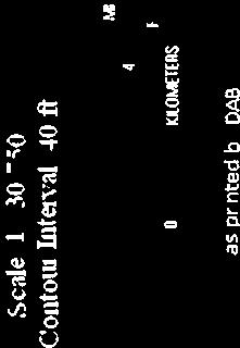
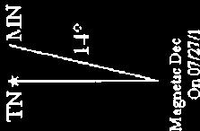
3 TABLE OF CONTENTS INTRODUCTION...1 General...1 Purpose and Scope...1 PROJECT DESCRIPTION...2 GEOLOGIC CONDITIONS and SEISMICITY...2 FIELD INVESTIGATION...3 LABORATORY ANALYSIS...4 DISCUSSION...4 RECOMMENDATIONS...5 Excavation...5 Foundations...5 Settlement...5 REFERENCES...6 APPENDICES APPENDIX A... Project Location Area Map... Borehole Location Sheets APPENDIX B... Boring Log Key... Boring Logs APPENDIX C... Soil Particle Size Distribution Sheets (Gradation Curves)... Test Result Summary Sheets iii
")
4 INTRODUCTION General This report has been prepared for the planned replacement structure on Altosc Road approximately six miles east of Tuscarora, Nevada. Structure B-1942 will convey traffic between Tuscarora and State Route 226 in Elko County (See Photo 1). Photo 1. Looking southwest toward Tuscarora The current structure is planned to be replaced with a prefabricated concrete arch structure. For a more detailed description, see the contract plans. A site plan for the project is presented as the Project Location Area Map in Appendix A. Purpose and Scope The purpose of this report is to provide information regarding the subsurface soil conditions at the proposed project site. This report also provides geotechnical design recommendations for the structure foundations proposed for this project. The scope of this report consists primarily of geotechnical investigation, analysis, and recommendations for both design and construction. The investigation included gathering 1


5 information obtained from previous subsurface explorations, soil sampling, and analysis of field and laboratory testing data. This report includes boring logs and summaries of test results from both the field investigations and laboratory testing. These may be found in appendices B and C, respectively. PROJECT DESCRIPTION The project site is located on Altosc Road approximately four miles east-northeast of Tuscarora, Nevada. Altosc Road is an unpaved road that runs west-southwest to eastnortheast at the location of the proposed structure. The current structure to be replaced was designed as a simple span, over the south fork of the Owyhee River. Preliminary discussion has indicated the proposed structure will be designed using a prefabricated concrete arch, and will include barrier rails. GEOLOGIC CONDITIONS and SEISMICITY The site is founded primarily in older alluvial deposits (Qa) 1. These deposits are generally dark brown to black clayey sands and gravels (See Photos 2 and 3). This area lies at an elevation of approximately 5700 feet and slopes gently downward to the northnorth east. Structure B-1942 is located approximately 1.5 miles west of State Route 226, 50 miles northwest of Elko. Groundwater was found in both boreholes (TB-1 and TB-2) at a depth of approximately 6.0. This is near the elevation of the river surface, and therefore, might fluctuate with rising or falling water levels. Photos 2 and 3. Soil samples 2

6 Seismic Coefficients are provided in the table below 2. The coefficients provided are from the NDOT Structural Design Policies and Practices Manual, and are slightly more conservative than those found in the AASHTO Manual. Peak Ground Acceleration (PGA) Coefficient Short-Period Spectral Acceleration Coefficient (S s ) Long-Period Spectral Acceleration Coefficient (S l ) The following seismic parameters are recommended: Site Class = C F pga = 1.2 F a = 1.2 F v = 1.7 FIELD INVESTIGATION The Geotechnical Section conducted subsurface investigation at the proposed project site in August 20. Subsurface soil conditions were explored in the investigation by drilling two boreholes placed near the existing structure (See Photo 4). Photo 4. Drill rig setting up on borehole TB-1, looking west. 3
7 The approximate location of each borehole is shown on the Borehole Location sheet in Appendix A. The two boreholes, TB-1 and TB-2 were drilled to depths of 36.0 feet and 51.5 feet, respectively. The surface elevations were obtained for the borehole locations by surveying from a known elevation point. Drilling was accomplished with a Diedrich D-120 drill rig equipped for soil sampling, using 6-inch hollow stem auger. Soil samples and standard penetration resistance values (N-Values) were obtained utilizing the Standard Penetration Test () procedure as set forth in AASHTO test number T206. The N 60 correction factor for drill unit #82 at the time of exploration was Larger samples were obtained with a California Modified Sampler (CMS), using the procedure as set forth in ASTM test number D The uncorrected blow counts are shown on the boring logs in Appendix B. All soil samples were classified, both visually and using laboratory data, using the Unified Soil Classification System (USCS) described in ASTM test number D LABORATORY ANALYSIS Laboratory tests were performed on the samples collected from the boreholes. The testing program consisted of sieve analyses, moisture and unit weight, and Atterberg limits. The results of this testing program show that the soils consist primarily of clayey sands and gravels. The one dry unit weight obtained from boring TB-1 was pounds per cubic foot (pcf) for sample B (well-graded gravel with sand). Further information is presented in the summaries of test results in Appendix C. DISCUSSION Borehole TB-1 was drilled on the northeast side of structure B-1942, and borehole TB-2 was drilled on the southwest side of the structure. Following the field investigation and laboratory testing, the soils were identified as primarily poorly- to well-graded silty and clayey sands and gravels. Liquefaction is unlikely to occur due to soil plasticity and density, as well as low seismic accelerations experienced in the region. 4
8 RECOMMENDATIONS Excavation All excavation shall be performed in accordance with the NDOT 2001 Standard Specifications for Road and Bridge Construction 3. All permanent slopes should be constructed to lie at a maximum of 2:1 (Horiz:Vert) slope. The contractor shall be responsible for all necessary shoring for any excavation and/or construction. For temporary shoring, soils should be classified as OSHA Type C 4. Variable site conditions include the possibility of encountering very soft soils, boulders, or other adverse soil conditions. Foundations The medium-dense to dense soils are well suited for spread footings for the bridge structure. Spread footings for the structure and any retaining walls placed in embankments and native soil have a factored geotechnical resistance of 4000 psf (4 ksf). This is based on a three-foot spread footing, 30 feet long. A new external stability analysis must be performed if the proposed structure either reduces the footing or raises the anticipated loading. The NDOT Hydraulics Section stated that the use of a concrete bottom in the proposed structure design eliminates any concern over scour. Settlement The estimated settlement of the structure abutments is less than 0.5, with differential settlement estimated around half of the total settlement (0.25 ) under an applied load of 4 ksf on a 3 foot by 30 foot spread footing. Settlement is determined in the LRFD design process in the Service Load calculations by setting the desired settlement limits and determining foundation that meets that requirement. Most of the anticipated settlement should occur during construction due to the granular soils at the site. 5
9 REFERENCES 1. Geologic Map of Nevada, Map 57; Nevada Bureau of Mines and Geology, NDOT Structures Manual - Structural Design Policies and Practices, Standard Specifications for Road and Bridge Construction, State of Nevada Department of Transportation, Part 1926, Subpart P, Appendix A. 6
10 APPENDIX A Project Location Area Map Borehole Location Sheets
11
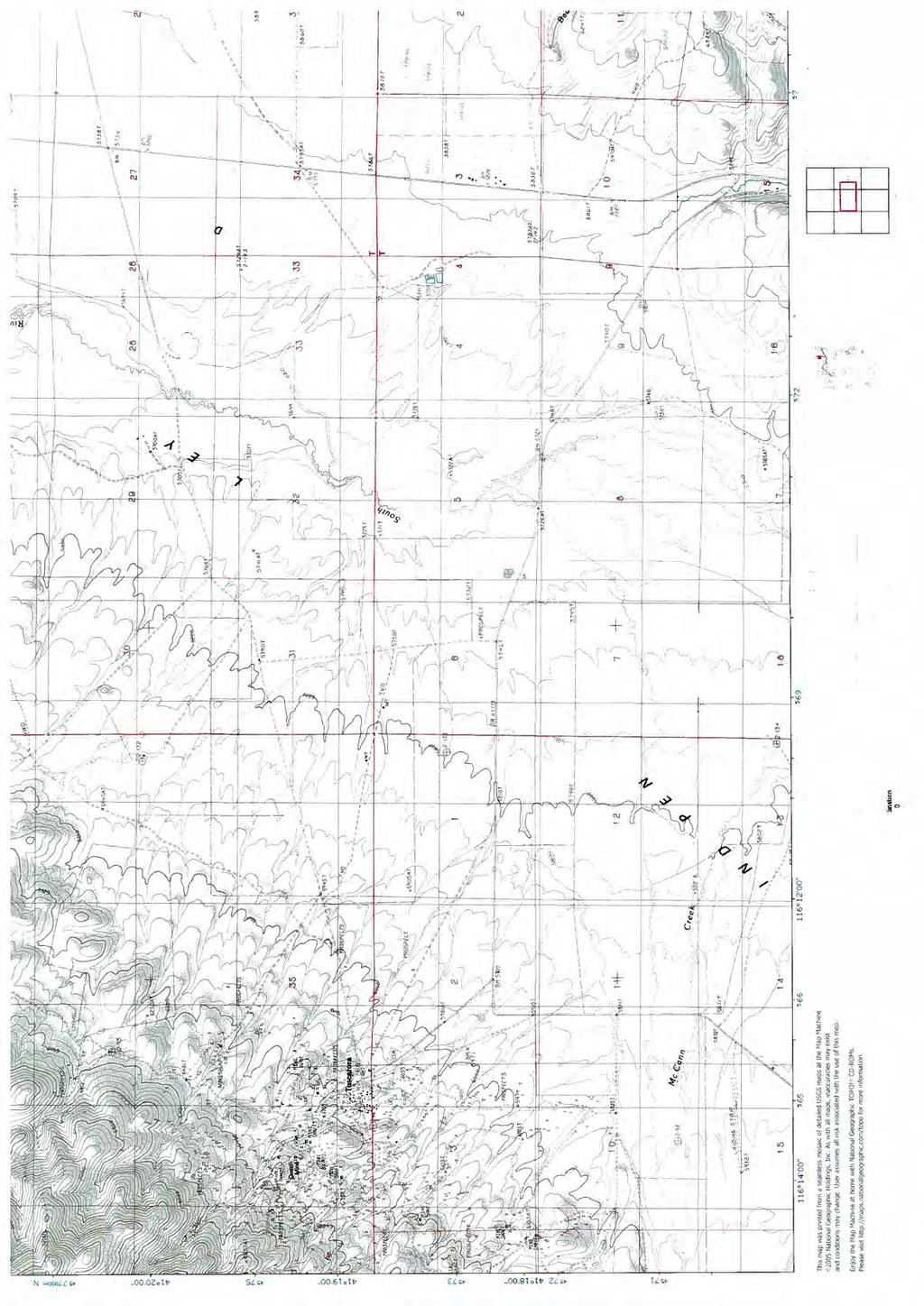


12
13 APPENDIX B Boring Log Key Boring Logs
14 KEY TO BORING LOGS PARTICLE SIZE LIMITS CLAY SILT SAND GRAVEL COBBLES BOULDERS FINE MEDIUM COARSE FINE COARSE.002 mm 0 # 3/4 inch 3 inch 12 inch USCS GROUP GW GP GM GC SW SP SM SC ML CL OL MH CH OH CS PT TYPICAL SOIL DESCRIPTION Well graded gravels, gravel-sand mixtures, little or no fines Poorly graded gravels, gravel-sand mixtures, little or no fines Silty gravels, poorly graded gravel-sand-silt mixtures Clayey gravels, poorly graded gravel-sand-clay mixtures Well graded sands, gravelly sands, little or no fines Poorly graded sands, gravelly sands, little or no fines Silty sands, poorly graded sand-silt mixtures Clayey sands, poorly graded sand-clay mixtures Inorganic silts and very fine sands, rock flour, silty or clayey fine sands with slight plasticity Inorganic clays of low to medium plasticity, gravelly clays, sandy clays, silty clays, lean clays Organic silts and organic silt-clays of low plasticity Inorganic silts, micaceous or diatomaceous fine sandy or silty soils, elastic silts Inorganic clays of high plasticity, fat clays Organic clays of medium to high plasticity Claystone/Siltstone Peat and other highly organic soils MOISTURE CONDITION CRITERIA SOIL CEMENTATION CRITERIA Description Criteria Description Criteria Dry Absence of moisture, dusty, Weak Crumbles or breaks with handling or little dry to touch. finger pressure. Moist Damp, no visible free water. Moderate Crumbles or breaks with considerable Wet Visible free water, usually below finger pressure. groundwater table. Strong Won t break or crumble w/finger pressure. Groundwater Elevation Symbols STANDARD PENETRATION CLASSIFICATION * Blow counts on Calif. Modified GRANULAR SOIL CLAYEY SOIL Sampler (N CMS ) can be converted BLOWS/FT DENSITY BLOWS/FT CONSISTENCY to N by: 0-4 VERY LOOSE 0 1 VERY SOFT (N CMS )(0.62) = N 5 - LOOSE 2-4 SOFT MEDIUM DENSE 5-8 MEDIUM STIFF Blow counts from Automatic or DENSE 9-15 STIFF Safety Hammer can be converted OVER 50 VERY DENSE VERY STIFF to Standard N 60 by: *Standard Penetration Test (N) 140 lb hammer HARD (N AUTOMATIC )(1.30) =N inch free-fall on 2 inch O.D. x 1.4 inch I.D. sampler OVER 60 VERY HARD (N SAFETY )(1.17) =N 60 TEST ABBREVIATIONS SAMPLER NOTATION CD CONSOLIDATED DRAINED O ORGANIC CONTENT CMS CALIF. MODIFIED SAMPLER CH CHEMICAL (CORROSIVENESS) OC CONSOLIDATION CPT CONE PENETRATION CM COMPACTION PI PLASTICITY INDEX CS CONTINUOUS SAMPLER CU CONSOLIDATED UNDRAINED RQD ROCK QUALITY DESIGNATION CSS CALIFORNIA SPLIT SPOON D DISPERSIVE SOILS RV R-VALUE P PUSHED (NOT DRIVEN) DS DIRECT SHEAR S SIEVE ANALYSIS PB PITCHER BARREL E EXPANSIVE SOIL SL SHRINKAGE LIMIT RC ROCK CORE G SPECIFIC GRAVITY U UNCONFINED COMPRESSION SH SHELBY TUBE H HYDROMETER UU UNCONSOLIDATED UNDRAINED STANDARD PENETRATION TEST HC HYDRO-COLLAPSE UW UNIT WEIGHT TP TEST PIT K PERMEABILITY W MOISTURE CONTENT - I.D.= inch - I.D.=3.228 inch with tube; 3.50 inch w/o tube SOIL COLOR DESIGNATIONS ARE FROM THE MUNSELL SOIL COLOR CHART. EXAMPLE: (7.5 YR 5/3) BROWN - NXB I.D.= inch LAST MODIFIED: October 11, I.D.= inch
15 EXPLORATION LOG START DATE 8// END DATE 8// JOB DESCRIPTION B-1942 Tuscarora Bridge LOCATION Altosc Rd. 1.5 miles west of SR 226 BORING TB-1 E.A. # GROUNDWATER LEVEL (ft) DATE DEPTH ft ELEV. ft GROUND ELEV. 8// HAMMER DROP SYSTEM Automatic N/A N/A 0.0 STATION OFFSET ENGINEER EQUIPMENT OPERATOR DRILLING METHOD BACKFILLED "M" ' Left Boomhower Diedrich D-120 Rigsby 6" H.S.A. Yes DATE SHEET 1 OF ELEV. (ft) DEPTH (ft) BLOW COUNT SAMPLE 6 inch NO. TYPE Increments Last 1 foot Percent Recov'd LAB TESTS USCS Group MATERIAL DESCRIPTION SANDY GRAVEL Dry, grayish brown REMARKS Bulk 2.0' - 4.5' A B C D E CMS SW SC GW GP GC GP GM WELL GRADED SAND with CLAY and GRAVEL Dark grayish brown, dry to damp, loose WELL GRADED GRAVEL with SAND Dark brown, wet, medium dense POORLY GRADED GRAVEL with CLAY and SAND Dark brown, wet, medium dense POORLY GRADED GRAVEL with SILT and SAND Dark brown to black, wet, medium dense WELL GRADED SAND with SILT and GRAVEL Dark brown to black, wet, dense (B) Free water. (D) Rock in sampler shoe F SW SM G WELL GRADED SAND with SILTY CLAY and GRAVEL Dark brown to black, wet, dense NV_DOT TUSCARORA.GPJ NV_DOT.GDT 3/14/ H SW SC WELL GRADED SAND with SILTY CLAY and GRAVEL Dark brown wet, medium dense
16 EXPLORATION LOG START DATE 8// END DATE 8// JOB DESCRIPTION B-1942 Tuscarora Bridge LOCATION Altosc Rd. 1.5 miles west of SR 226 BORING TB-1 E.A. # GROUNDWATER LEVEL (ft) DATE DEPTH ft ELEV. ft GROUND ELEV. 8// HAMMER DROP SYSTEM Automatic N/A N/A 0.0 STATION OFFSET ENGINEER EQUIPMENT OPERATOR DRILLING METHOD BACKFILLED "M" ' Left Boomhower Diedrich D-120 Rigsby 6" H.S.A. Yes DATE SHEET 2 OF ELEV. (ft) DEPTH (ft) BLOW COUNT SAMPLE 6 inch NO. TYPE Increments Last 1 foot Percent Recov'd LAB TESTS USCS Group MATERIAL DESCRIPTION REMARKS Soil plugged auger. Hole reopened with difficulty. GP GC I POORLY GRADED GRAVEL with CLAY and SAND Medium yellow brown, wet, dense B.O.H NV_DOT TUSCARORA.GPJ NV_DOT.GDT 3/14/
17 EXPLORATION LOG START DATE 8/11/ END DATE 8/11/ JOB DESCRIPTION B-1942 Tuscarora Bridge LOCATION Altosc Rd. 1.5 miles west of SR 226 BORING TB-2 E.A. # GROUNDWATER LEVEL (ft) DATE DEPTH ft ELEV. ft GROUND ELEV. 8/11/ HAMMER DROP SYSTEM Automatic N/A N/A 0.0 STATION OFFSET ENGINEER EQUIPMENT OPERATOR DRILLING METHOD BACKFILLED "M" ' Right Boomhower Diedrich D-120 Rigsby 6" H.S.A. Yes DATE SHEET 1 OF ELEV. (ft) DEPTH (ft) BLOW COUNT SAMPLE 6 inch NO. TYPE Increments Last 1 foot Percent Recov'd LAB TESTS USCS Group MATERIAL DESCRIPTION SANDY GRAVEL Dry, grayish brown REMARKS Bulk 2.0' - 4.5' A SW SC 7.75 WELL GRADED SAND with CLAY and GRAVEL Dark grayish brown, dry to damp, loose (A) Sampler 5.5'. Water level 5.9' B SP SM POORLY GRADED SAND with SILT and GRAVEL Dark greenish gray to black, wet, dense C SC CLAYEY SAND with GRAVEL Greenish gray, wet, medium dense D WELL GRADED SAND with SILT and GRAVEL Greenish gray to black, wet, dense NV_DOT TUSCARORA.GPJ NV_DOT.GDT 3/14/ E SW SM WELL GRADED SAND with SILTY CLAY and GRAVEL Dark greenish gray to black, wet, very dense
18 EXPLORATION LOG START DATE 8/11/ END DATE 8/11/ JOB DESCRIPTION B-1942 Tuscarora Bridge LOCATION Altosc Rd. 1.5 miles west of SR 226 BORING TB-2 E.A. # GROUNDWATER LEVEL (ft) DATE DEPTH ft ELEV. ft GROUND ELEV. 8/11/ HAMMER DROP SYSTEM Automatic N/A N/A 0.0 STATION OFFSET ENGINEER EQUIPMENT OPERATOR DRILLING METHOD BACKFILLED "M" ' Right Boomhower Diedrich D-120 Rigsby 6" H.S.A. Yes DATE SHEET 2 OF ELEV. (ft) SAMPLE BLOW COUNT DEPTH 6 inch Last (ft) NO. TYPE Increments 1 foot 19 F Percent Recov'd 95 LAB TESTS USCS Group SW SM MATERIAL DESCRIPTION WELL GRADED SAND with SILT and GRAVEL Greenish gray to black, wet, dense to very dense REMARKS G GP GC POORLY GRADED GRAVEL with CLAY and SAND Greenish gray to black, wet, very dense H SP SC POORLY GRADED SAND with CLAY and GRAVEL Greenish gray to black, wet, dense (H) Sample disturbed & saturated I GW GC WELL GRADED GRAVEL with CLAY and SAND Greenish gray to black, wet, dense J GP GC POORLY GRADED GRAVEL with CLAY and SAND Greenish gray to black, wet, dense B.O.H. NV_DOT TUSCARORA.GPJ NV_DOT.GDT 3/14/
19 APPENDIX C Soil Particle Size Distribution Sheets Test Result Summary Sheets
20 Particle Size Distribution Report 0 6 in. 3 in. 2 in. 1½ in. 1 in. ¾ in. ½ in. 3/8 in. # #20 #30 0 #60 #0 # PERCENT FINER GRAIN SIZE - mm. +3" % GRAVEL % SAND % SILT % CLAY USCS AASHTO PL LL CL A-7-6(13) GC A-2-6(0) SIEVE PERCENT FINER SIEVE PERCENT FINER Material Description inches number sandy lean clay 1.5" " /4" /2" /8" clayey gravel with sand D 60 D 30 D GRAIN SIZE COEFFICIENTS NEVADA DEPARTMENT OF TRANSPORTATION # #16 0 #50 # C c C u Source of Sample: TB-1 Depth: ' Sample Number: BULK 1 Source of Sample: TB-1 Depth: ' Sample Number: A Source of Sample: TB-1 Depth: ' Sample Number: B1 Client: Project: Project No.: D. Boomhower Tuscarora Bridge EA 73561, FL REMARKS: Figure
21 Particle Size Distribution Report 0 6 in. 3 in. 2 in. 1½ in. 1 in. ¾ in. ½ in. 3/8 in. # #20 #30 0 #60 #0 # PERCENT FINER GRAIN SIZE - mm. +3" % GRAVEL % SAND % SILT % CLAY USCS AASHTO PL LL GW A-2-6(0) SIEVE PERCENT FINER SIEVE PERCENT FINER Material Description inches number well-graded gravel with sand 1.5" " /4" /2" /8" D 60 D 30 D GRAIN SIZE COEFFICIENTS NEVADA DEPARTMENT OF TRANSPORTATION # #16 0 #50 # C c C u Source of Sample: TB-1 Depth: ' Sample Number: B2 Source of Sample: TB-1 Depth: ' Sample Number: C Source of Sample: TB-1 Depth: ' Sample Number: D Client: Project: Project No.: D. Boomhower Tuscarora Bridge EA 73561, FL REMARKS: Figure
22 Particle Size Distribution Report 0 6 in. 3 in. 2 in. 1½ in. 1 in. ¾ in. ½ in. 3/8 in. # #20 #30 0 #60 #0 # PERCENT FINER GRAIN SIZE - mm. +3" % GRAVEL % SAND % SILT % CLAY USCS AASHTO PL LL SW-SM A-1-a SW-SC A-2-4(0) SIEVE PERCENT FINER SIEVE PERCENT FINER Material Description inches number well-graded sand with silt and gravel 1" /4" /2" /8" D 60 D 30 D GRAIN SIZE COEFFICIENTS NEVADA DEPARTMENT OF TRANSPORTATION # #16 0 #50 # C c C u Source of Sample: TB-1 Depth: ' Sample Number: E Source of Sample: TB-1 Depth: ' Sample Number: F Source of Sample: TB-1 Depth: ' Sample Number: G Client: Project: Project No.: D. Boomhower Tuscarora Bridge EA 73561, FL well-graded sand with siltyclay and gravel REMARKS: Figure
23 Particle Size Distribution Report 0 6 in. 3 in. 2 in. 1½ in. 1 in. ¾ in. ½ in. 3/8 in. # #20 #30 0 #60 #0 # PERCENT FINER GRAIN SIZE - mm. +3" % GRAVEL % SAND % SILT % CLAY USCS AASHTO PL LL SIEVE PERCENT FINER SIEVE PERCENT FINER Material Description inches number 1" 3/4" 1/2" 3/8" D 60 D 30 D GRAIN SIZE COEFFICIENTS # #16 0 #50 # C c C u Source of Sample: TB-1 Depth: ' Sample Number: H Source of Sample: TB-1 Depth: ' Sample Number: I REMARKS: NEVADA DEPARTMENT OF TRANSPORTATION Client: Project: D. Boomhower Tuscarora Bridge Project No.: EA 73561, FL-8- Figure
24 Particle Size Distribution Report 0 6 in. 3 in. 2 in. 1½ in. 1 in. ¾ in. ½ in. 3/8 in. # #20 #30 0 #60 #0 # PERCENT FINER GRAIN SIZE - mm. +3" % GRAVEL % SAND % SILT % CLAY USCS AASHTO PL LL GC A-6(3) SP-SM A-1-a NP 21 SIEVE PERCENT FINER SIEVE PERCENT FINER Material Description inches number clayey gravel with sand 1.5" " /4" /2" /8" D 60 D 30 D GRAIN SIZE COEFFICIENTS NEVADA DEPARTMENT OF TRANSPORTATION # #16 0 #50 # C c C u Source of Sample: TB-2 Depth: ' Sample Number: BULK 1 Source of Sample: TB-2 Depth: ' Sample Number: A Source of Sample: TB-2 Depth: ' Sample Number: B Client: Project: Project No.: D. Boomhower Tuscarora Bridge EA 73561, FL poorly graded sand with silt and gravel REMARKS: Figure
25 Particle Size Distribution Report 0 6 in. 3 in. 2 in. 1½ in. 1 in. ¾ in. ½ in. 3/8 in. # #20 #30 0 #60 #0 # PERCENT FINER GRAIN SIZE - mm. +3" % GRAVEL % SAND % SILT % CLAY USCS AASHTO PL LL SC A-2-7(0) SW-SM A-1-a SW-SC A-1-a SIEVE PERCENT FINER SIEVE PERCENT FINER Material Description inches number clayey sand with gravel 1.5" 0.0 1" /4" /2" /8" D 60 D 30 D GRAIN SIZE COEFFICIENTS NEVADA DEPARTMENT OF TRANSPORTATION # #16 0 #50 # C c C u Source of Sample: TB-2 Depth: ' Sample Number: C Source of Sample: TB-2 Depth: ' Sample Number: D Source of Sample: TB-2 Depth: ' Sample Number: E Client: Project: Project No.: D. Boomhower Tuscarora Bridge EA 73561, FL well-graded sand with silt and gravel well-graded sand with siltyclay and gravel REMARKS: Figure
26 Particle Size Distribution Report 0 6 in. 3 in. 2 in. 1½ in. 1 in. ¾ in. ½ in. 3/8 in. # #20 #30 0 #60 #0 # PERCENT FINER GRAIN SIZE - mm. +3" % GRAVEL % SAND % SILT % CLAY USCS AASHTO PL LL SW-SM A-1-a GP-GC A-2-6(0) SIEVE PERCENT FINER SIEVE PERCENT FINER Material Description inches number well-graded sand with silt and gravel 1.5" " poorly graded gravel with clay and sand 3/4" /2" /8" D 60 D 30 D GRAIN SIZE COEFFICIENTS NEVADA DEPARTMENT OF TRANSPORTATION # #16 0 #50 # C c C u Source of Sample: TB-2 Depth: ' Sample Number: F Source of Sample: TB-2 Depth: ' Sample Number: G Source of Sample: TB-2 Depth: ' Sample Number: H Client: Project: Project No.: D. Boomhower Tuscarora Bridge EA 73561, FL REMARKS: Figure
27 Particle Size Distribution Report 0 6 in. 3 in. 2 in. 1½ in. 1 in. ¾ in. ½ in. 3/8 in. # #20 #30 0 #60 #0 # PERCENT FINER GRAIN SIZE - mm. +3" % GRAVEL % SAND % SILT % CLAY USCS AASHTO PL LL GW-GC A-2-6(0) GP-GC A-2-6(0) SIEVE PERCENT FINER SIEVE PERCENT FINER Material Description inches number well-graded gravel with clay and sand 1.5" " poorly graded gravel with clay and sand 3/4" /2" /8" D 60 D 30 D GRAIN SIZE COEFFICIENTS # #16 0 #50 # C c C u Source of Sample: TB-2 Depth: ' Sample Number: I Source of Sample: TB-2 Depth: ' Sample Number: J REMARKS: NEVADA DEPARTMENT OF TRANSPORTATION Client: Project: D. Boomhower Tuscarora Bridge Project No.: EA 73561, FL-8- Figure
28 EA/Cont # Job Description Tuscarora Bridge Boring No. TB - 1 Elevation (ft) Station "M" Date 08//20 SAMPLE SAMP- N DRY % STRENGTH TEST SAMPLE DEPTH LER BLOWS SOIL W% UW PASS LL PL PI TEST Φ C Φ C COMMENTS NO. (ft) TYPE per ft. GROUP pcf % % % TYPE deg. psi deg. psi Peak Residual BULK BULK CL RV = 16 A B CMS bag 24 GC B CMS GW C D E SW-SM F G SW-SC H I SUMMARY OF RESULTS N.D.O.T. GEOTECHNI CAL SECTI ON CMS = California Modified Sampler 2.42" ID U = Unconfined Compressive H = Hydrometer CM = Compaction = Standard Penetration 1.38" ID UU = Unconsolidated Undrained S = Sieve E = Swell/Pressure on Expansive Soils CS = Continuous Sample 3.23" ID CD = Consolidated Drained G = Specific Gravity SL = Shrinkage Limit RC = Rock Core CU = Consolidated Undrained PI = Plasticity Index UW= Unit Weight PB = Pitcher Barrel DS = Direct Shear LL = Liquid Limit W = Moisture Content CSS = Calif. Split Spoon 2.42" ID Φ = Friction PL = Plastic Limit K = Permeability CPT = Cone Penetration Test C = Cohesion NP = Non-Plastic O = Organic Content TP = Test Pit N = No. of blows per ft., sampler OC = Consolidation D = Dispersive P = Pushed, not driven Ch = Chemical RQD = Rock Quality Designation R = Refusal N = Field N = (N css )(0.62) RV = R - Value X = X-Ray Defraction Sh = Shelby Tube 2.87" ID MD = Moisture Density HCpot = Hydro-Collapse Potential * = Average of subsamples
29 EA/Cont # Job Description Tuscarora Bridge Boring No. TB - 2 Elevation (ft) Station "M" ,.5' Rt. Date 08/11/20 SAMPLE SAMP- N DRY % STRENGTH TEST SAMPLE DEPTH LER BLOWS SOIL W% UW PASS LL PL PI TEST Φ C Φ C COMMENTS NO. (ft) TYPE per ft. GROUP pcf % % % TYPE deg. psi deg. psi Peak Residual BULK BULK GC RV = 21 A B SP-SM NP NP C SC D SW-SM E SW-SC F SW-SM G GP-GC H SUMMARY OF RESULTS N.D.O.T. GEOTECHNI CAL SECTI ON I GW-GC J GP-GC CMS = California Modified Sampler 2.42" ID U = Unconfined Compressive H = Hydrometer CM = Compaction = Standard Penetration 1.38" ID UU = Unconsolidated Undrained S = Sieve E = Swell/Pressure on Expansive Soils CS = Continuous Sample 3.23" ID CD = Consolidated Drained G = Specific Gravity SL = Shrinkage Limit RC = Rock Core CU = Consolidated Undrained PI = Plasticity Index UW= Unit Weight PB = Pitcher Barrel DS = Direct Shear LL = Liquid Limit W = Moisture Content CSS = Calif. Split Spoon 2.42" ID Φ = Friction PL = Plastic Limit K = Permeability CPT = Cone Penetration Test C = Cohesion NP = Non-Plastic O = Organic Content TP = Test Pit N = No. of blows per ft., sampler OC = Consolidation D = Dispersive P = Pushed, not driven Ch = Chemical RQD = Rock Quality Designation R = Refusal N = Field N = (N css )(0.62) RV = R - Value X = X-Ray Defraction Sh = Shelby Tube 2.87" ID MD = Moisture Density HCpot = Hydro-Collapse Potential * = Average of subsamples
GEOTECHNICAL INVESTIGATION I-15 SIGN BRIDGES LAS VEGAS EA JANUARY
 GEOTECHNICAL INVESTIGATION I-15 SIGN BRIDGES LAS VEGAS EA 73171 JANUARY 06 MATERIALS DIVISION STATE OF NEVADA DEPARTMENT OF TRANSPORTATION MATERIALS DIVISION GEOTECHNICAL SECTION GEOTECHNICAL REPORT I-15
GEOTECHNICAL REPORT US 93 WILDLIFE UNDERCROSSINGS North of Wells, Nevada E.A July 2009
 GEOTECHNICAL REPORT US 93 WILDLIFE UNDERCROSSINGS North of Wells, Nevada E.A. 73523 July 2009 MATERIALS DIVISION STATE OF NEVADA DEPARTMENT OF TRANSPORTATION MATERIALS DIVISION GEOTECHNICAL SECTION GEOTECHNICAL
GEOTECHNICAL REPORT US 93 WILDLIFE OVERCROSSING At HD SUMMIT North of Wells, Nevada E.A December 2009
 GEOTECHNICAL REPORT US 93 WILDLIFE OVERCROSSING At HD SUMMIT North of Wells, Nevada E.A. 73524 December 2009 MATERIALS DIVISION STATE OF NEVADA DEPARTMENT OF TRANSPORTATION MATERIALS DIVISION GEOTECHNICAL
GEOTECHNICAL REPORT US 95 WIDENING ANN ROAD
 GEOTECHNICAL REPORT US 95 WIDENING ANN ROAD to KYLE CANYON ROAD Package 2 E.A. 73627 January 212 MATERIALS DIVISION STATE OF NEVADA DEPARTMENT OF TRANSPORTATION MATERIALS DIVISION GEOTECHNICAL SECTION
GEOTECHNICAL REPORT CARSON FREEWAY CLEARVIEW DRIVE GRADE SEPARATION CARSON CITY EA DECEMBER
 GEOTECHNICAL REPORT CARSON FREEWAY CLEARVIEW DRIVE GRADE SEPARATION CARSON CITY EA 72781 DECEMBER 2003 MATERIALS DIVISION STATE OF NEVADA DEPARTMENT OF TRANSPORTATION MATERIALS DIVISION GEOTECHNICAL SECTION
GEOTECHNICAL SOIL SUMMARY FARM DISTRICT ROAD SR-828 BIKE PATH RETAINING WALL CITY OF FERNLEY LYON COUNTY, NEVADA MARCH 2011
 GEOTECHNICAL SOIL SUMMARY FARM DISTRICT ROAD SR-828 BIKE PATH RETAINING WALL CITY OF FERNLEY LYON COUNTY, NEVADA MARCH 2011 State of Nevada Department of Transportation Materials Division GEOTECHNICAL
WASH STRUCTURE B-420 S EA
 GEOTECHNICAL REPORT US-95 at PIUTE WASH STRUCTURE B-420 S EA 72498 May 2004 MATERIALS DIVISION STATE OF NEVADA DEPARTMENT OF TRANSPORTATION MATERIALS DIVISION GEOTECHNICAL SECTION GEOTECHNICAL REPORT US-95
GEOTECHNICAL REPORT CHEYENNE AVENUE DISTRESS INVESTIGATION
 GEOTECHNICAL REPORT CHEYENNE AVENUE DISTRESS INVESTIGATION and MITIGATION CLARK COUNTY April 2003 MATERIALS DIVISION STATE OF NEVADA DEPARTMENT OF TRANSPORTATION MATERIALS DIVISION GEOTECHNICAL SECTION
 Appendix A - Vicinity Map Vicinity Map: Palm Beach Gardens City Hall Additions, 000 N Military Trail, Palm Beach Gardens, FL Proposed Location of Police Dept. Attached Addition Proposed Location of New
 FIGURES Printed By: aday Print Date: 3/23/2011 12:48:08 PM File Name: \\geodesign.local\files\jobs\m-r\penskeauto\penskeauto-1\penskeauto-1-01\figures\cad\penskeauto-1-01-vm01.dwg Layout: FIGURE 1 VICINITY
Geotechnical Engineering Report
 Geotechnical Engineering Report Pavement Subgrade Survey State Highway 125 over Hudson Creek Ottawa County, Oklahoma September 23, 21 Terracon Project No. 415121 Prepared for: Guy Engineering Services,
Site Location. Figure 1: Site Location Map US-24 and I-275 Interchange Ash Township, Monroe County, Michigan
 Site Location 0606 1771 North Dixie Highway Monroe, Michigan 48162 Tel: 734-289-2200 Fax: 734-289-2345 www.manniksmithgroup.com Figure 1: Site Location Map US-24 and I-275 Interchange Ash Township, Monroe
EXHIBIT G GEOTECHNICAL REPORT (DRAFT)
") EXHIBIT G GEOTECHNICAL REPORT (DRAFT) APPENDIX 1 PROJECT SITE 'B' B-1 B-2 I-2 B-3 B-4 B-5 I-1 PROJECT LOCATION LEGEND B-1 = APPROXIMATE BORING LOCATION I-1 = APPROXIMATE INFILTRATION
EXHIBIT G GEOTECHNICAL REPORT (DRAFT) APPENDIX 1 PROJECT SITE 'B' B-1 B-2 I-2 B-3 B-4 B-5 I-1 PROJECT LOCATION LEGEND B-1 = APPROXIMATE BORING LOCATION I-1 = APPROXIMATE INFILTRATION
CONTRACT 5E-2 APPENDIX A - TEST HOLE LOGS DYREGROV ROBINSON INC. PORTAGE AVE WINSTON DR BOURKEVALE CAVELL PARKSIDE DR ASSINIBOINE AVE
 APPENDIX A - TEST HOLE LOGS PORTAGE AVE TH -9 CONTRACT E- DR DR BOURKEVALE CAVELL WINSTON DR PARKSIDE DR ASSINIBOINE AVE AUTHORIZED BY: DATE: CONSULTING GEOTECHNICAL ENGINEERS AUTHORIZED /0/ CLIENT DRAWING
Geotechnical Engineering Report
 Geotechnical Engineering Report Turner Turnpike Widening Milepost 203 to 210 Drainage Structure Pipe Jacking Creek County, Oklahoma June 1, 2016 Terracon Project No. 04155197 Prepared for: Garver, LLC
Geotechnical Engineering Report
 Geotechnical Engineering Report Turner Turnpike Widening Milepost 210 to 218 Drainage Structure Pipe Jacking Creek County, Oklahoma July 1, 2016 Terracon Project No. 04165017 Prepared for: Benham Tulsa,
GEOTECHNICAL SUBSURFACE DATA REPORT
 GEOTECHNICAL SUBSURFACE DATA REPORT SC-41 REPLACEMENT BRIDGE OVER MAIDEN DOWN SWAMP MARION COUNTY, SOUTH CAROLINA PREPARED FOR Mr. Joshua Meetze, E.I.T. RPG-2 GDS South Carolina Department of Transportation
April 7, Webster Street Sub-Surface Stormwater Storage System Bid No Bid Date: 4/13/17 ADDENDUM NO 1
 PUBLIC WORKS DEPARTMENT David A. Jones, P.E., Director April 7, 2017 Webster Street Sub-Surface Stormwater Storage System Bid No. 2017-022 Bid Date: 4/13/17 ADDENDUM NO 1 Please make the following changes
GEOTECHNICAL INVESTIGATION
 GEOTECHNICAL INVESTIGATION INTERSTATE 15 NORTH PHASE 2 CRAIG ROAD TO SPEEDWAY BOULEVARD NORTH LAS VEGAS, CLARK COUNTY, NEVADA May 12 STATE OF NEVADA DEPARTMENT OF TRANSPORTATION MATERIALS DIVISION GEOTECHNICAL
Thi_ Qar University College of Engineering/Civil Engineering Department. Highway Lectures. Fourth Class. Part #2: - Subgrade Soil
 Thi_ Qar University College of Engineering/Civil Engineering Department Highway Lectures Fourth Class Part #2: - Subgrade Soil Lecture #2 Soil Classification DAS, Chapter 4, Engineering Classification
Typical Subsurface Profile. November 28, 2016
 November 28, 2016 RSCCD Facility Planning, District Construction and Support Services 2323 N. Broadway, Suite 112, Santa Ana, CA 92706 Attn: Re: Ms. Allison Coburn Facilities Project Manager P: (714) 480-7530
WILLMER ENGINEERING INC. Willmer Project No Prepared for. Clark Patterson Lee Suwanee, Georgia. Prepared by
 SOIL SURVEY REPORT (Revised March 6, 2013) New Hospital Connector Road GDOT Project No. CSSTP-0006-00(276), PI No. 0006276 Duluth, Gwinnett County, Georgia WILLMER ENGINEERING INC. Willmer Project No.
APPENDIX A DRAINAGE STUDY PHASE 2 ALTERNATIVE IMPROVEMENTS CRYSTAL LAKE ALTERNATIVE 4C IMPROVEMENTS LAKEWOOD PIRATELAND SWASH HORRY COUNTY, SC
 DRAINAGE STUDY PHASE ALTERNATIVE IMPROVEMENTS CRYSTAL LAKE ALTERNATIVE C IMPROVEMENTS ` FOR: LAKEWOOD PIRATELAND SWASH HORRY COUNTY, SC APPENDIX A J-.000 Prepared by: Savannah, GA Charleston, SC Myrtle
SECTION 500 STRUCTURES
 SECTION 500 STRUCTURES 500.1 GENERAL This section defines the various construction items that are associated with the completion of a concrete, steel, timber, or masonry unit structures, or a combination
Soil Survey Summary Report
 Soil Survey Summary Report Benton Boulevard Extension Pooler, Chatham County, Georgia February, 206 Terracon Project No. ES5553 Prepared for: McGee Partners, Inc. Atlanta, Georgia Prepared by: Terracon
Geotechnical Engineering Report Proposed Communications Tower Spain Park Site Hoover, Alabama
 Geotechnical Engineering Report Proposed Communications Tower Spain Park Site Hoover, Alabama July 24, 2014 Terracon Project No. E1145095 Prepared for: The City Of Hoover Hoover, Alabama Prepared by: Terracon
November 13, Eckas Water 1514 Ambrosia Court Fort Collins, Colorado Attn: Mr. Wayne Eckas
 November 13, 2018 Eckas Water 1514 Ambrosia Court Fort Collins, Colorado 80526 Attn: Mr. Wayne Eckas (wayne@eckaswater.com) Re: Geotechnical Subsurface Exploration Walker Recharge Pipeline Project Morgan
REPORT OF GEOTECHNICAL EXPLORATION AND ENGINEERING ANALYSIS
 FIGURE 3 Geotechnical Report (2) REPORT OF GEOTECHNICAL EXPLORATION AND ENGINEERING ANALYSIS RIVER TOWER RESTORATION RIVER TOWER PARK TAMPA, FLORIDA AREHNA PROJECT NO. B-13-002 February 22, 2013 Prepared
GEOTECHNICAL INVESTIGATION PROPOSED OUTFALL LOCATION CITY OF MORGAN S POINT DRAINAGE HARRIS COUNTY, TEXAS REPORT NO
 GEOTECHNICAL INVESTIGATION PROPOSED OUTFALL LOCATION CITY OF MORGAN S POINT DRAINAGE HARRIS COUNTY, TEXAS REPORT NO. 1140198001 Reported to: SIRRUS ENGINEERS, INC. Houston, Texas Submitted by: GEOTEST
REPORT OF GEOTECHNICAL EXPLORATION PEPSI PLACE WATER MAIN REPLACEMENT JACKSONVILLE, FLORIDA E&A PROJECT NO CLIENT ID: 4784
 REPORT OF GEOTECHNICAL EXPLORATION PEPSI PLACE WATER MAIN REPLACEMENT JACKSONVILLE, FLORIDA E&A PROJECT NO. 35-55 CLIENT ID: 78 Prepared for: Construction & Engineering Services Consultants, Inc. 93 Baymeadows
PD - 6 THRUST RESTRAINT DESIGN EQUATIONS AND SOIL PARAMETERS FOR DUCTILE IRON AND PVC PIPE
 PD - 6 THRUST RESTRAINT DESIGN EQUATIONS AND SOIL PARAMETERS FOR DUCTILE IRON AND PVC PIPE 4 3 2 1 D D C C B B A A 4 3 2 1 Thrust Restraint Design Equations and Soil Parameters These equations and soil
Results of Onsite Percolation Testing Ellis Commons Senior Housing Development APN City of Perris, California
 Lansing Companies 12671 High Bluff Drive, Suite 150 San Diego, California 92130 April 18, 2017 Project No. 11607.001 Attention: Subject: References: Mr. Casey Malone Results of Onsite Percolation Testing
Geotechnical Engineering Report
 Geotechnical Engineering Report Shaw AFB East Gate Entrance Control Facility Amendment Sumter, South Carolina September 13, 2010 Terracon Project No. 73105020A Prepared for: TranSystems North Charleston,
Geotechnical Engineering Report
 Geotechnical Engineering Report Shaw AFB West Gate Entrance Control Facility Amendment Sumter, South Carolina September 13, 20 Terracon Project No. 735021A Prepared for: TranSystems North Charleston, South
GEOTECHNICAL ENGINEERING REPORT
 GEOTECHNICAL ENGINEERING REPORT GRAND AVENUE PEDESTRIAN BRIDGE RELOCATION ROARING FORK RIVER GLENWOOD SPRINGS, COLORADO April 18, 2016 Prepared By: Prepared For: Mr. Bob Pattillo, P.E. Pattillo Associates
Page 4 Blythe Municipal Airport Project County of Riverside, California December 7, 2015 CTE Job No G
 Geotechnical Investigation Page 4 Blythe Municipal Airport Project County of Riverside, California December 7, 2015 CTE Job No. 40-3264G Laboratory CBR Tests Laboratory CBR tests were performed on samples
REPORT OF GEOTECHNICAL EXPLORATION KINLOCK FM REPLACEMENT NEW MANHOLE STRUCTURE JACKSONVILLE, FLORIDA ECS PROJECT NO A CLIENT ID: 0199
 REPORT OF GEOTECHNICAL EXPLORATION KINLOCK FM REPLACEMENT NEW MANHOLE STRUCTURE JACKSONVILLE, FLORIDA ECS PROJECT NO. 3-6187-A CLIENT ID: 0199 Prepared for: JEA 1 West Church Street Jacksonville, Florida
Sacramento Modesto Roseville Pleasanton. Jeff Black, PE Blackwater Consulting Engineers, Inc. 605 Standiford Ave., Suite N Modesto, CA 95350
 Sacramento Modesto Roseville Pleasanton December, 01 File Number: 1-19.1 Jeff Black, PE Blackwater Consulting Engineers, Inc. 605 Standiford Ave., Suite N Modesto, CA 9550 Subject: Mr. Black, GEOTECHNICAL
Geotechnical Engineering Report
 Geotechnical Engineering Report Mt. Pisgah Road Slide Paradise, Utah January 15, 2013 Terracon Project No. 61115029 Prepared for: J-U-B Engineers, Inc. 1047 S 100 W, Suite 180 Logan, UT 84321 Prepared
Florida s Leading Engineering Source
 Since 1988 Florida s Leading Engineering Source Environmental Geotechnical Construction Materials Testing Threshold and Special Inspections Plan Review & Code Compliance Mr. Ron Ridenour Hanson Professional
SUBSURFACE INVESTIGATION & GEOTECHNICAL RECOMMENDATIONS PROPOSED MONOPOLE CELL TOWER INDIANAPOLIS, INDIANA A&W PROJECT NO: 15IN0464
 SUBSURFACE INVESTIGATION & GEOTECHNICAL RECOMMENDATIONS PROPOSED MONOPOLE CELL TOWER INDIANAPOLIS, INDIANA A&W PROJECT NO: 15IN0464 PREPARED FOR: AAA DEVELOPMENT AND CONSULTING, INC GREENFIELD, INDIANA
TRENCH EXCAVATION AND BACKFILL
 TRENCH EXCAVATION AND BACKFILL PART 1 - GENERAL 1.01 SECTION INCLUDES A. Trench Excavation for Pipe Systems B. Trench Foundation Stabilization C. Pipe Bedding and Backfill 1.02 DESCRIPTION OF WORK A. Excavate
All tests from the new Cells 3 and 4 passed the licence requirements. Please provide approval to begin using the new Cell 3 and Cell 4.
 Dey, Asit (SD) From: Sent: To: Cc: Subject: Attachments: Brett McCormac August-21-18 11:24 AM Dey, Asit (SD) 'RM of Pipestone'; Genaille, Dee (MR) RM of Pipestone - Reston Lagoon 18-08-17
PROJECT INFORMATION...
 TABLE OF CONTENTS Page No. PROJECT INFORMATION... 1 PROJECT AUTHORIZATION... 1 PROJECT DESCRIPTION... 1 PURPOSE AND SCOPE OF SERVICES... 1 SITE AND SUBSURFACE CONDITIONS... 3 SITE LOCATION AND DESCRIPTION...
Geotechnical Data Report
 Geotechnical Data Report Proposed Prairie Lane HDD Cores D7-A and D7-B Wayne County, Ohio February 14, 2015 Terracon Project No. N4149328 Prepared for: Project Consulting Services, Inc. Prepared by: Terracon
Geotechnical Exploration and Evaluation Report
 Geotechnical Exploration and Evaluation Report Nassau Reclaimed Water Main From Radio Avenue to Harts Road Nassau County, Florida CSI Geo Project No.: 71-17-329-04 Client Project No.: JEA 09302-049-01
GEOTECHNICAL ENGINEERING REPORT
 GEOTECHNICAL ENGINEERING REPORT Project: NW Bucklin Hill at Silverdale Way NW Project Number: 12023 Prepared for: Barber Development P.O. Box 473 Redmond, WA 98073 Prepared by: South Sound Geotechnical
You also requested information regarding a sieve analysis at each boring locations. The test results are attached.
 FORENSICS CONSULTANTS ENVIRONMENTAL GEOTECHNICAL MATERIALS October 4, 2016 Washington County Public Works 11660 Myeron Road Stillwater, MN 55082 Attn: Mr. Marc Briese Re: Additional Borings CSAH 22 (70
Geotechnical Engineering Report
 Geotechnical Engineering Report Proposed Retaining Wall 44ARW-1 Interstate 235 between N.W. 50th Street and Interstate 44 Oklahoma City, Oklahoma May 8, 2014 Terracon Project No. 03145071 Prepared for:
GEOTEK ENGINEERING & TESTING SERVICES, INC. 909 East 50 th Street North Sioux Falls, South Dakota Fax
 GEOTEK EGIEERIG & TESTIG SERVICES, IC. 909 East 0 th Street orth Sioux Falls, South Dakota 0 0-- Fax 0--0 South Dakota State University Facilities and Services Admistration 0, PO Box 0 Brookgs, South Dakota
REPORT OF GEOTECHNICAL EXPLORATION BYFORGE ENGINEERING FOR REFERENCE ONLY
 REPORT OF GEOTECHNICAL EXPLORATION BYFORGE ENGINEERING FOR REFERENCE ONLY HERITAGE BAY MASTER PUMP STATION ISSUED FOR BID REPORT OF GEOTECHNICAL EXPLORATION PROPOSED INLINE WASTEWATER BOOSTER STATION Collier
GEOTECHNICAL SUBSURFACE INVESTIGATION RECOMMENDATIONS FOR THE TAMUCC MOMENTUM FIELD LIGHT POLES NILE DRIVE CORPUS CHRISTI, TEXAS
 GEOTECHNICAL ENGINEERING MATERIALS ENGINEERING & TESTING SOILS ASPHALT CONCRETE GEOTECHNICAL SUBSURFACE INVESTIGATION RECOMMENDATIONS FOR THE NILE DRIVE CORPUS CHRISTI, TEXAS RETL REPORT NUMBER: G118442
Sieve Opening, mm Opening, in Soil Type. Cobbles mm 3 in. Gravel mm (2.0 mm) #4 [# 10 for AASHTO) ~0.2 in (~0.
 #4 [# 10 for AASHTO) ~0.2 in (~0.") CE 340, Sumer 2015 Soil Classification 1 / 6 The geotechnical engineer predicts the behavior of soils for his or her clients (structural engineers, architects, contractors, etc). A first step is to classify
CE 340, Sumer 2015 Soil Classification 1 / 6 The geotechnical engineer predicts the behavior of soils for his or her clients (structural engineers, architects, contractors, etc). A first step is to classify
Geotechnical Engineering Report
 Geotechnical Engineering Report Skiatook City Substation Skiatook, Oklahoma October 05, 2017 Terracon Project No. 04175204 Prepared for: GRDA Tulsa, Oklahoma Prepared by: Terracon Consultants, Inc. Tulsa,
Sepetember 27, Florida Department of Environmental Protection Attn: Dawn Templin 160 Governmental Center Pensacola, FL
 Bay County Solid Waste 11411 Landfill Rd. Panama City Beach, Florida 32413 Telephone: (850) 236-2212 Fax: (850) 233-5053 Board of County Commissioners www.baycountyfl.gov Sepetember 27, 2018 Florida Department
DEPARTMENT OF TRANSPORTATION DIVISION: MATERIALS REPORT COVER SHEET. Revised Soil Survey Report November 24, 2015 Matthew G. Moore, P.E.
 LD-0 /12/09 DEPARTMENT OF TRANSPORTATION DIVISION: MATERIALS REPORT COVER SHEET Revised Soil Survey Report November 2, 201 Matthew G. Moore, P.E. VDOT (Division) or Company Name Insert Location, Virginia
GEOTEK ENGINEERING & TESTING SERVICES, INC. 909 East 50 th Street North Sioux Falls, South Dakota Phone Fax
 GEOTEK ENGINEERING & TESTING SERVICES, INC. 909 East 50 th Street North Sioux Falls, South Dakota 57104 Phone 605-335-5512 Fax 605-335-0773 September 8, 2016 City of Viborg 101 N. Main Street 57070 Attn:
CEEN Geotechnical Engineering
 CEEN 3160 - Geotechnical Engineering Lab Report 1 Soil Classification prepared by Student Name 1 Student Name 2 Student Name 3 Student Name 4 Tuesday Lab Time 9:30 10:45 Lab Team 1 Submission Date INTRODUCTION
GEOTEK ENGINEERING & TESTING SERVICES, INC. 909 East 50 th Street North Sioux Falls, South Dakota Phone Fax
 GEOTEK ENGINEERING & TESTING SERVICES, INC. 909 East 50 th Street North Sioux Falls, South Dakota 57104 Phone 605-335-5512 Fax 605-335-0773 November 1, 2016 City of Viborg PO Box 56 57070-0056 Attn: Lori
GFA INTERNATIONAL FLORIDA S LEADING ENGINEERING SOURCE
 GFA INTERNATIONAL FLORIDA S LEADING ENGINEERING SOURCE Report of Geotechnical Exploration Addie s Corner Entry Bridge and Lake Areas 8799 Immokalee Road Naples, Collier County, Florida October 26, 2016
June i TABLE OF CONTENTS
 June 2005 - i - 05-526 TABLE OF CONTENTS SECTION PAGE 1.0 INTRODUCTION... 1 1.1 Purpose of the Investigation... 1 1.2 Description of the Project and Scope of Work... 1 1.3 Site Geology... 1 1.4 Site Description
Subsurface Environmental Investigation
 Subsurface Environmental Investigation Lake Development East Lake and 21 st Avenue South February 23, 201 Terracon Project No. MP14738A Prepared for: Minneapolis Public Schools Prepared by: Terracon Consultants,
Classification of Soils
 Classification of Soils Soils - What are they? Particulate materials - Sedimentary origins (usually) - Residual Wide range of particle sizes - larger particles: quartz, feldspar - very small particles:
GEOTECHNICAL EXPLORATION FOR PROPOSED PAVEMENT IMPROVEMENTS, SIERRA MIDDLE SCHOOL, 4950 CENTRAL AVENUE, CITY OF RIVERSIDE, CALIFORNIA.
 GEOTECHNICAL EXPLORATION FOR PROPOSED PAVEMENT IMPROVEMENTS, SIERRA MIDDLE SCHOOL, 4950 CENTRAL AVENUE, CITY OF RIVERSIDE, CALIFORNIA Prepared for: RIVERSIDE UNIFIED SCHOOL DISTRICT 3070 Washington Street
Introduction to Road Soil
 Introduction to Road Soil Characterization By: Dr. Curtis F. Berthelot P.Eng. Department of Civil and Geological Engineering Centre of Excellence for Transportation ti and Infrastructure t Road Soil Introduction
In preparation for constructing buildings on a property, the builder. Site Preparation CHAPTER
 CHAPTER 3 Site Preparation In preparation for constructing buildings on a property, the builder must consider a number of factors related to code requirements. The buildings must be located according to
Geotechnical Engineering Report
 Geotechnical Engineering Report Parking Lot Evaluation & Physical Plant Additions Rogers State University Claremore, Oklahoma May 20, 2015 Terracon Project No. 04155080 Prepared for: Rogers State University
Presented by: Civil Engineering Academy
 Presented by: Civil Engineering Academy Soil Classification Presented by: Civil Engineering Academy Is an aggregate of loose mineral and organic particles. Exhibits strong and permanent cohesive forces
GEOTEK ENGINEERING & TESTING SERVICES, INC. 909 East 50 th Street North Sioux Falls, South Dakota Phone Fax
 GEOTEK ENGINEERING & TESTING SERVICES, INC. 909 East 50 th Street North Sioux Falls, South Dakota 57104 Phone 605-335-5512 Fax 605-335-0773 October 28, 2016 City of Vermillion 25 Center Street 57069 Attn:
Report of Geotechnical Study
 Report of Geotechnical Study Leakes Mill Park Phase 2 Goochland County, Virginia F&R Project No. 60S-0585 Prepared For: Dewberry 4085 Lake Brook Drive, Suite 200 Richmond, Virginia 23060 Prepared By: Froehling
GEOTECHNICAL ENGINEERING REPORT. KU Parking Lot 300E Southeast of Lied Center Lawrence, Kansas. Project No. D16G1696. KU No. Lz_n/11062.
 GEOTECHNICAL ENGINEERING REPORT KU Parking Lot 300E Southeast of Lied Center Lawrence, Kansas April 1, 2016 Prepared for: University of Kansas Bartlett & West Prepared by: GeoSource, LLC April 1, 2016
Geotechnical Investigation for Navajo Gallup Water Supply Project Reach 26.3
 Geotechnical Investigation for Navajo Gallup Water Supply Project Reach 26.3 Geo-Test Geotechnical Engineering Services Report No. 1-718 for Reach 26.3 Tank Site Geo-Test Job No. 1-718, Addendum No. 1
GEOTECHNICAL ENGINEERING REPORT
 GEOTECHNICAL ENGINEERING REPORT PROJECT MINECRAFT ACCESS ROAD BOYDTON PLANK ROAD DINWIDDIE COUNTY, VIRGINIA JOB NUMBER: 37775.003 PREPARED FOR: DINWIDDIE COUNTY PO BOX 70 DINWIDDIE COUNTY, STATE 23841
Report of CCR Rule Stability Analyses AEP Clifty Creek Power Plant Boiler Slag Pond Dam and Landfill Runoff Collection Pond
 Report of CCR Rule Stability Analyses AEP Clifty Creek Power Plant Boiler Slag Pond Dam and Landfill Runoff Collection Pond Madison, Jefferson County, Indiana Prepared for: American Electric Power Columbus,
August 3, 2018 TTL Project No Supplemental Test Borings Cleveland Bulk Terminal Cleveland, Ohio
 1915 North 12 th Street Toledo, OH 43604-5305 T 419-324-2222 F 419-241-1808 www.ttlassoc.com August 3, 2018 TTL Project No. 1706701 Mr. Vito Melilli Coastal Engineer KS Associates, Inc. 260 Burns Road,
Geotechnical Engineering Report
 Geotechnical Engineering Report County Bridge SH-15 Stillwell Road over Tributary to Stanger Creek Leavenworth County, KS January 13, 2014 Terracon Project No. 02135230 Prepared for: Leavenworth County
SOIL MECHANICS Assignment #2: Soil Classification Solution.
 Geotechnical Engineering Research Laboratory One University Avenue Lowell, Massachusetts 01854 Edward L. Hajduk, D.Eng, PE Lecturer PA105D Tel: (978) 934 2621 Fax: (978) 934 3052 e mail: Edward_Hajduk@uml.edu
Report of Geotechnical Study
 Report of Geotechnical Study Albemarle County, Virginia F&R Project No. 71T0082 Prepared For: Office of Facilities Development 401 McIntire Road, Room 228 Charlottesville, Virginia 22902-4596 Prepared
4. GEOTECHNICAL FIELD INVESTIGATION SUMMARY
 Rev. 0 Date: AUGUST 18, 2012 Project.: COUVA CHILDREN S HOSPITAL - COUVA, TRINIDAD Page 29 Title: EISL-412-DD-TR-2012 PRELIMINARY GEOTECHNICAL FEASIBILITY REPORT 4. GEOTECHNICAL FIELD INVESTIGATION SUMMARY
Concrete basement walls are
 DESIGNING Concrete Basement Walls Make sure the wall is strong enough to resist the lateral pressure of the soil Concrete basement walls are designed to do two main jobs. One job is supporting the house;
Geotechnical Data Report
 Geotechnical Data Report Proposed State Road 52 HDD Cores E2-D and E2-E Washtenaw County, Michigan May 29, 2015 Terracon Project No. N4149328 Prepared for: Project Consulting Services, Inc. Prepared by:
Subsurface Investigations PDCA Professor s Driven Pile Institute. Loren R. Anderson Utah State University June 25, 2015
 Subsurface Investigations PDCA Professor s Driven Pile Institute Loren R. Anderson Utah State University June 25, 2015 Ralph B. Peck (1962) Subsurface engineering is an art; soil mechanics is an engineering
Report of Exploratory Test Pits
 Report of Exploratory Test Pits UNF Transportation Projects Stockpile Investigation Osprey Ridge Road Extension Jacksonville, Florida CSI Geo Project No.: 71-17-135-20 Arcadis Project No.: JK017002.0001
August 15, 2006 (Revised) July 3, 2006 Project No A
 July 3, 2006 Project No A") August 15, 2006 (Revised) July 3, 2006 Project No. 01-05-0854-101A Mr. David Reed, P.E. Protean Design Group 100 East Pine Street, Suite 306 Orlando, Florida 32801 Preliminary Soil Survey Report Polk Parkway
August 15, 2006 (Revised) July 3, 2006 Project No. 01-05-0854-101A Mr. David Reed, P.E. Protean Design Group 100 East Pine Street, Suite 306 Orlando, Florida 32801 Preliminary Soil Survey Report Polk Parkway
Laboratory Soil Classification
 Laboratory Soil Classification Lin Li, Ph.D. Center for Environmentally Sustainable Transportation in Cold Climates University of Alaska Fairbanks June 6 th, 2016 2016 Summer Transportation Institute,
Geotechnical Engineering Report
 REPORT C OVER PAGE Geotechnical Engineering Report GDRTA Building 600 Renovations Dayton, Montgomery County, Ohio March 16, 2018 Terracon Project No. N1185054 Prepared for: Champlin Architecture Cincinnati,
Geotechnical Investigation Report
 Geotechnical Investigation Report Proposed,000-Gallon Water Storage Tank Fagasa Pass Tank Upper Pago Pago, American Samoa Prepared for: ASPA Water Engineering Division Tafuna, American Samoa PO Box PPB
Draft Geotechnical Engineering Services
 May 20, 2011 Draft Geotechnical Engineering Services Proposed Weir Wall at Stockbridge Stormwater Management Facility Prince William County, Virginia 19955 Highland Vista Drive, Suite 170 Ashburn, VA 20147
Civil Geotechnical Surveying
 Civil Geotechnical Surveying Mr. David Burnett Cabarrus County Schools 4425 Old Airport Road Charlotte, North Carolina 28025 May 16, 2017 Reference: Geotechnical Engineering Evaluation Future PLC Site
REPORT OF GEOTECHNICAL EXPLORATION PUBLIC WORKS SITE SAVANNAH, GEORGIA FOR CHATHAM CO. DEPT. OF PUBLIC WORKS & PARK SERVICES
 REPORT OF GEOTECHNICAL EXPLORATION PUBLIC WORKS SITE SAVANNAH, GEORGIA FOR CHATHAM CO. DEPT. OF PUBLIC WORKS & PARK SERVICES MAY 5, 2009 ECS PROJECT NO. 23:2081 i. - -- ~", " -. _., I ~~ ECS SOUTHEAST,
PARKING LOTS 4, 7, AND 8 RECONSTRUCTION REPORT
 PARKING LOTS 4, 7, AND 8 RECONSTRUCTION REPORT Converse Project No. 15-81-177-01 Prepared For: David Evans and Associates, Inc. 17782 17th Street, Suite 200 Tustin, California 92780 Prepared By: 10391
GEOTECHNICAL ENGINEERING REPORT DAYBREAK VILLAGE 8 ROADS SOUTH JORDAN, UTAH PROJECT No JULY 8, Submitted To:
 GEOTECHNICAL ENGINEERING REPORT DAYBREAK VILLAGE 8 ROADS SOUTH JORDAN, UTAH PROJECT No. 16-817-05406 JULY 8, 2016 Submitted To: Perigee Consulting 9067 South 1300 West, Suite 304 West Jordan, UT 84088
Report of Geotechnical Study
 Report of Geotechnical Study Dumfries Mixed-Use Development Dumfries, Virginia 22026 F&R Project No. 74T-0009 Prepared For: Community Housing Partners 4915 Radford Avenue, Suite 300 Richmond, Virginia
Geotechnical Engineering Report
 Geotechnical Engineering Report Rodgers Chapel Expansion 502 James B. Hunt Drive Mount Olive, North Carolina August 26, 2016 Project No. 72165063 Prepared for: University of Mount Olive Mount Olive, North
Prepared for: HDR Engineering, Inc. 200 West Forsyth Street, Suite 800 Jacksonville, Florida Prepared by:
 REPORT OF GEOTECHNICAL EXPLORATION REHABILITATE WHARF STRUCTURE AT BERTHS 6 AND ½ OF BERTH 5 TALLEYRAND MARINE TERMINAL, JACKSONVILLE, FLORIDA E&A PROJECT NO. 0756-0081 Prepared for: HDR Engineering, Inc.
VOCs, including fuel oxygenates, via EPA Analytical Method The second soil sample from MW-24 (MW ) was analyzed for Total Organic Carbon.
 was analyzed for Total Organic Carbon.") December 5, 2012 Mrs. Jenny Herman Maryland Department of the Environment Oil Control Program 1800 Washington Boulevard Baltimore, Maryland 212301719 Re: Additional Monitoring Well Installation Report
December 5, 2012 Mrs. Jenny Herman Maryland Department of the Environment Oil Control Program 1800 Washington Boulevard Baltimore, Maryland 212301719 Re: Additional Monitoring Well Installation Report
mtec REPORT OF GEOTECHNICAL EXPLORATION FTFA Construct Bin Wall at HERD Eglin AFB, Florida
 mtec REPORT OF GEOTECHNICAL EXPLORATION FTFA 14-3001 - Construct Bin Wall at HERD Eglin AFB, Florida MTEC Project Number 2014-101 November 10, 2014 Revised: January 5, 2015 Prepared For: Peterson Engineering,
GEOTECHNICAL EXPLORATION REPORT
 GEOTECHNICAL EXPLORATION REPORT LITTLE MIAMI WWTP STORM DRAIN REALIGNMENT CINCINNATI, HAMILTON COUNTY, OHIO MSDGC PROJECT NO. 10270180 PREPARED FOR: METROPOLITAN SEWER DISTRICT OF GREATER CINCINNATI 1600
GEOTEK ENGINEERING & TESTING SERVICES, INC. 909 East 50 th Street North Sioux Falls, South Dakota Phone Fax
 GEOTEK ENGINEERING & TESTING SERVICES, INC. 909 East 50 th Street North Sioux Falls, South Dakota 57104 Phone 605-335-5512 Fax 605-335-0773 May 10, 2016 Banner Associates, Inc. 2307 W. 57 th Street, Suite
Appendix C Geotechnical Soil Testing Data
 Appendix C Geotechnical Soil Testing Data rjmmmrorr Table C-1 Laboratory Soil Testing Results Groundwater Assessment Report UMore Mining Area Dakota County, Minnesota Sample Particle Size Particle Size