DLR contributions to R&D Support strategy (Element 3) Status update. Michael Bock, Helmut Staudenrausch SDCG-12 Session 4
|
|
|
- Karen Franklin
- 6 years ago
- Views:
Transcription
1 DLR contributions to R&D Support strategy (Element 3) Status update Michael Bock, Helmut Staudenrausch SDCG-12 Session 4 SDCG-12 Frascati September 5-7, 2017
2 TerraSAR/TanDEM-X Mission Status Satellite lifetimes The TerraSAR-X and TanDEM-X satellites were launched in 2007 and 2010, respectively. Both satellites show an excellent health status: the radar instrument is working nominal the battery status is much better than specified consumption of consumables (hydrazine) is well below initial predictions For both satellites a further lifetime beyond is expected This allows operations at least until the next-generation SAR mission is operational. In July 2017 Phase A of the next Generation bi-static - X-Band SAR ( HRWS ) mission started
3 TerraSAR/TanDEM-X Mission Status TerraSAR-X Mission The TerraSAR-X Mission is performed by TerraSAR-X and TanDEM-X spacecrafts, each contributing a part of their imaging resources. In the case of the unavailability of one of the two satellites, the second system will ensure continuity of the TerraSAR-X Mission. TanDEM-X Mission The TanDEM-X Mission is performed by TerraSAR-X and TanDEM-X in close formation flight, each contributing a part of their resources. The close formation flight of both satellites is continued beyond The acquisition planning beyond Sept 2017 was setup by DLR (see next slides)

4 Data products TerraSAR-X DLR. de
 Polarization Mode Single, Dual, Twin, DRA-Quad Cooperative Mode bistatic,")

5 Data products TanDEM-X CoSSC DEM Experimental modes Acquisitions in 4D mode space : Imaging Mode SM, SL, HS, SC, (DRA-ATI, ) Polarization Mode Single, Dual, Twin, DRA-Quad Cooperative Mode bistatic, alternating bistatic, pursuit monostatic, none (TS-X mission) Formation Geometry: small or large along & across track separation / baseline > ISRSE 2017 > G. Rossner Access to TSX/TDX and RE for Science DLR. de
6 TerraSAR/TanDEM-X Mission Data provision procedures TSX-Data Archiv data: TerraSAR Archive AO (no costs, open unlimited) TSX-Data New acquisitions: TerraSAR General AO TDX-DEM: General AO (TDX-Final-DEM AO closed) General AO COFUR Costs for GFOI R&D group be waived if DLR SDCG PoC is contacted before AO-proposal submission New TanDEM-X acquisitions ongoing, e.g. for forest monitoring. Global 90m DEM: Final discussions on open release conditions (German Data Security law) ongoing
7 TanDEM-X Current and Future Obseravtion scenario Sept 2016 Sept. 2017: focus on areas with high dynamics and local height changes: Permafrost Boreal, Arctic & Antarctic Global Volcanos / Sahara (Sub-) Tropical Forests Oct 2017 Oct 2020 Global DEM 2.0 ( ) Change DEM 1.0 ( ) Acquisition with a second baseline for tropical forest Tropical and moderate/boreal Forest aquisitions continue..

8 TanDEM-X: South America Nicaragua Costa Rica Panama Colombia Peru Brazil French- Guayana SDCG-8 DLR, Bonn, Germany September 23 rd -25 th

9 TanDEM-X: South-ASIA Sumatra Borneo 9

10 TanDEM-X: South-ASIA

11 TanDEM-X: Africa Gabun Nigeria SDCG-8 DLR, Bonn, Germany September 23 rd -25 th

12 TanDEM-X: Boreal & Arctic 2017 SDCG-8 DLR, Bonn, Germany September 23 rd -25 th

13 TanDEM-X Observation scenario from Oct 2017 Oct 2020
14 TerraSAR/TanDEM-X Mission Approved support By E3 doc 11 R&D groups have requested data from TSX/TDX mission(s) as per Element-3 doc v2.1. DLR will continue to support R&D groups with TSX/TDX data (new acquisitions and/or from archive) using Standard AO procedures Feedback from R&D groups remains of great interest for DLR.
15 DLR R&D grants to GFOI R&D teams Support to research GFOI R&D groups R&D Team Nr. Scientific Focus Sensors used Region HU & FU Berlin (P. Hostert, B. Waske) SENSE CARBON: Improved mapping of REDD+ using deep and dense time-series and large area compositing approaches Landsat, Rapid Eye, ASAR, TSX, Sentinel-1 /-2 Brazil Mato Grosso FSU Jena, (C. Thiel) SEN4REDD: Development of integrated multi-temporal Processing chain for Sentinel-1 und 2 data to REDD support Sentinel-1 Sentinel-2 Mexiko, South Africa Support to SME & industry GFOI R&D groups: R&D Team Nr. Scientific Focus Sensors used Regions Airbus DS / Univ. Hamburg RSS (Florian Siegert) Development of a cost efficient REDD+ Monitoring -concept by use of TSX/TDX and Sentinel-2 Estimation of forest height and biomass using multipass X-and C-Band POL-INSAR data (CSA parallel support to AUG Signals) TSX/TDX Sentinel-2 TSX/TDX Radarsat-2 Sentinel-1 Suriname Indonesia Ghana Indonesia Project Factsheets:


16 CEOS WG CAPD SAR Capacity Building DLR & SAREDU support CEOS WG CAP-D Regional Africa Workshops including forest and biomass topics Zambia, Lusaka Oct Gabon, Libreville Feb South Africa, Pretoria May 2017 ISRSE SAR Summer school included a specific REDD session.
 Final product resolution of 50 m x 50 m Binary (forest/non-forest) information Will be available for free for scientific")
17 Global TanDEM-X Forest/Non-Forest Map Paola Rizzoli, Michele Martone, Christopher Wecklich, Carolina Gonzalez, José-Luis Bueso-Bello, Gerhard Krieger, and Manfred Zink Microwaves and Radar Institute, German Aerospace Center (DLR) Final product resolution of 50 m x 50 m Binary (forest/non-forest) information Will be available for free for scientific purposes
 by the ESA Water")


 The Alps")
18 Additional Layers Climate Change Initiative (CCI) by the ESA Water bodies at 150 m x 150 m spatial resolution based on data acquired by Envisat ASAR SRTM MERIS Tree-line Mask: Derived by combining TDX DEM and GLOBCOVER classification map (ESA) The Alps TanDEM-X GUF (Copyright DLR-DFD)


19 Example Mosaic over Europe
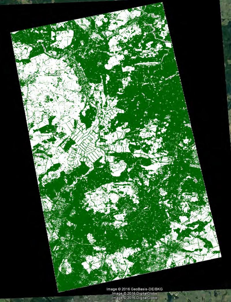

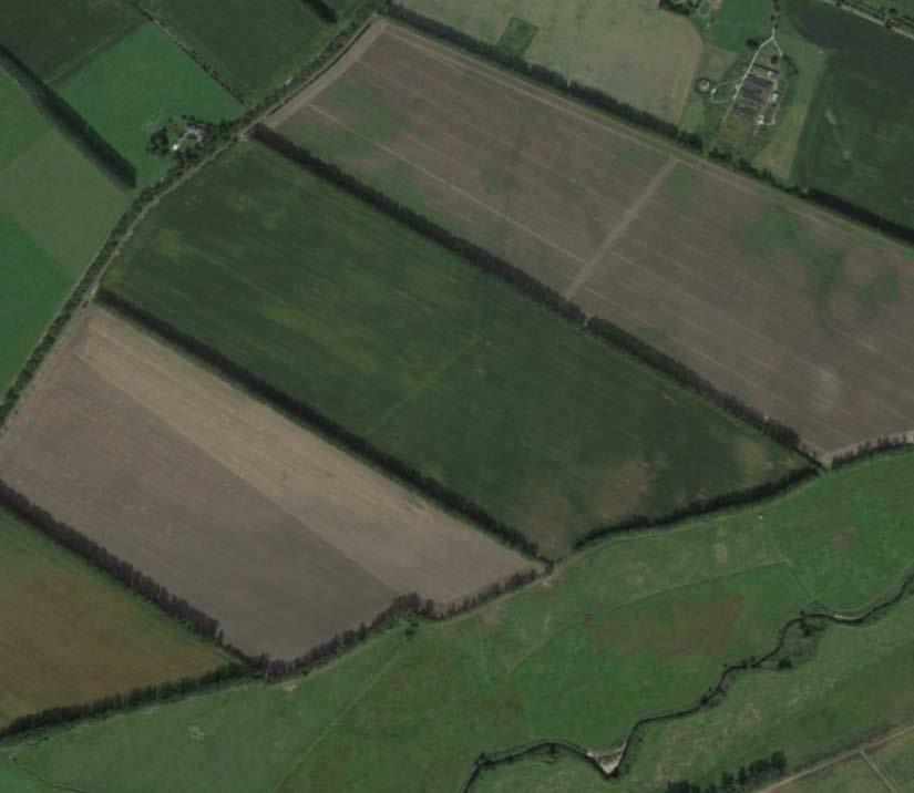
20 Forest/Non-Forest Classification Quicklook Image Temperate Forest, Germany, (5555 mm rrrrrrrrrrrrrrrrrrrr) Optical Image Forest Map 5 km x 5 km 1 km x 1 km

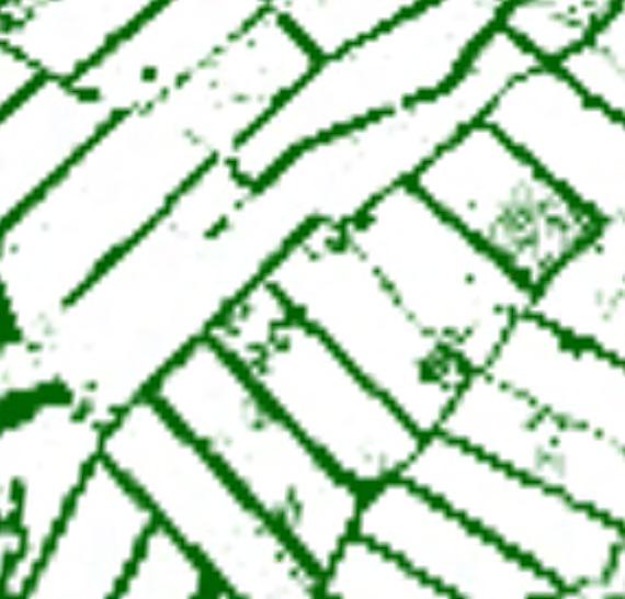
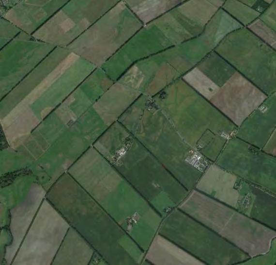
21 High-Resolution Maps at Regional Scale m x m


22 Potential for Change Detection Deforestation in the Amazon Rain Forest Rondonia State Changes between 2012 and 2013 Rondônia
TerraSAR-X Applications Guide
 TerraSAR-X Applications Guide Extract: Change Detection and Monitoring: Forestry April 2015 Airbus Defence and Space Geo-Intelligence Programme Line Change Detection and Monitoring: Forestry Issue Anthropogenic
Joint GFOI/GOFC-GOLD Expert Workshop 2: Approaches to monitoring forest degradation for REDD+
 Joint GFOI/GOFC-GOLD Expert Workshop 2: Approaches to monitoring forest degradation for REDD+ Forest carbon monitoring for REDD MRV with satellite 3D SAR Svein Solberg Norwegian Forest and Landscape Institute
TAKING STOCK OF OUR FORESTS
 Measurement, Reporting and Verification (MRV) systems are expected to be a crucial part of any future international climate agreement, including Reducing Emissions from Deforestation and forest Degradation,
Rice crop monitoring using EO data in the Mekong Delta, Vietnam
 The 10th GEOSS Asia-Pacific Symposium WG5: Agriculture and Food Security Hanoi, 18-20 th, Sep. 2017 Rice crop monitoring using EO data in the Mekong Delta, Vietnam Lam Dao Nguyen, Hoang Phi Phung, Dang
A global perspective on land use and cover change
 A global perspective on land use and cover change Alan Belward The Global Environment Monitoring Unit Institute for Environment and Sustainability European Commission Joint Research Centre 21027 Ispra
Role and importance of Satellite data in the implementation of the COMIFAC Convergence Plan
 Plenary Meeting of the Congo Basin Forest Partnership (CBFP) Palais des Congrès, Yaoundé. Cameroon 11-12 November, 2009 Role and importance of Satellite data in the implementation of the COMIFAC Convergence
The Seven Year Itch. A story by Jose Achache. Starring. Now Playing at The 27 th CEOS SIT La Jolla, California. GEO Secretariat
 The Seven Year Itch A story by Jose Achache Starring Now Playing at The 27 th CEOS SIT La Jolla, California GEOSS has been building-up on 3 Pillars 1. Coordinated Data Access 2. Open Data Policy 3. Political
Fragmentation of tropical forests a forgotten process in the global carbon cycle?
 Fragmentation of tropical forests a forgotten process in the global carbon cycle? A. Huth 1,2, K. Brinck 1,3, R. Fischer 1, J. Groeneveld 1, S. Puetz 1 1 Helmholtz Centre for Environmental Research, Leipzig,
Integration methods for forest degradation assessment and change monitoring
 VTT TECHNICAL RESEARCH CENTRE OF FINLAND LTD Joint GFOI / GOFC-GOLD / CONABIO / SilvaCarbon R&D Expert and Capacity Building workshop on: Regional solutions to forest type stratification and characterising
Polar Space Task Group Permafrost Review of Requirements, Achievements and Expected Data
 Polar Permafrost Review of Requirements, Achievements and Expected Data Annett Bartsch Central Institute for Meteorology and Geodynamics, Vienna, Austria PSTG 6, ESTEC, Sept., 2016 Developments since last
IEEE TRANSACTIONS ON GEOSCIENCE AND REMOTE SENSING 1
 IEEE TRANSACTIONS ON GEOSCIENCE AND REMOTE SENSING 1 TanDEM-X Pol-InSAR Performance for Forest Height Estimation Florian Kugler, Daniel Schulze, Irena Hajnsek, Fellow, IEEE, Hans Pretzsch, and Konstantinos
FOREST AND FOREST CHANGE MAPPING WITH C- AND L-BAND SAR IN LIWALE, TANZANIA
 FOREST AND FOREST CHANGE MAPPING WITH C- AND L-BAND SAR IN LIWALE, TANZANIA J. Haarpaintner a, C. Davids a, H. Hindberg a, E. Zahabu b, R.E. Malimbwi b a Norut, P.O. Box 6434, Tromsø Science Park, N-9294
ESA UNCLASSIFIED - For Official Use
 ESA UNCLASSIFIED - For Official Use Forestry TEP Renne Tergujeff VTT Technical Research Centre of Finland Ltd ESA UNCLASSIFIED - For Official Use Objective of Forestry TEP (F-TEP) One-stop shop for forestry
Mapping the world s forests: work by FAO and partners in the global Forest Resource Assessment (FRA) Mette L. Wilkie Adam Gerrand FAO
 Mette L. Wilkie Adam Gerrand FAO") Mapping the world s forests: work by FAO and partners in the global Forest Resource Assessment (FRA) Mette L. Wilkie Adam Gerrand FAO www.fao.org/forestry/fra2010 Main points Challenges unprecedented global
Mapping the world s forests: work by FAO and partners in the global Forest Resource Assessment (FRA) Mette L. Wilkie Adam Gerrand FAO www.fao.org/forestry/fra2010 Main points Challenges unprecedented global
MONITORING OF CROP GROWTH AND SOIL MOISTURE RETRIEVAL USING NISAR DATA. HARI SHANKER SRIVASTAVA Indian Institute of Remote Sensing (IIRS),
,") NISAR Science Workshop 2015 Space Applications Centre MONITORING OF CROP GROWTH AND SOIL MOISTURE RETRIEVAL USING NISAR DATA HARI SHANKER SRIVASTAVA Indian Institute of Remote Sensing (IIRS), Indian Space
NISAR Science Workshop 2015 Space Applications Centre MONITORING OF CROP GROWTH AND SOIL MOISTURE RETRIEVAL USING NISAR DATA HARI SHANKER SRIVASTAVA Indian Institute of Remote Sensing (IIRS), Indian Space
ALOS Kyoto & Carbon Initiative Brief (forest) summary for GlobBiomass. Ake Rosenqvist, K&C Science Coordinator
 summary for GlobBiomass. Ake Rosenqvist, K&C Science Coordinator") ALOS Kyoto & Carbon Initiative Brief (forest) summary for GlobBiomass Ake Rosenqvist, K&C Science Coordinator Heritage and objectives The ALOS Kyoto & Carbon Initiative is a JAXA-led international collaboration,
ALOS Kyoto & Carbon Initiative Brief (forest) summary for GlobBiomass Ake Rosenqvist, K&C Science Coordinator Heritage and objectives The ALOS Kyoto & Carbon Initiative is a JAXA-led international collaboration,
Forest Changes and Biomass Estimation
 Forest Changes and Biomass Estimation Project Title: Comparative Studies on Carbon Dynamics in Disturbed Forest Ecosystems: Eastern Russia and Northeastern China Supported by NASA Carbon Cycle Science
Deforestation evaluation by synergetic use of ERS SAR coherence and ATSR hot spots: The Indonesian fire event of 1997
 sar/atsr synergy 34 Deforestation evaluation by synergetic use of ERS SAR coherence and ATSR hot spots: The Indonesian fire event of 1997 E. Antikidis, O. Arino, H. Laur & A. Arnaud ESA Directorate of
Hervé YESOU Claire HUBER, Henri GIRAUD, Mathias STUDER, Sadri HAOUET, Paul de FRAIPONT Maria VIRELLI & Yves Louis DESNOS
 Mapping water bodies exploited multi-sensors and multi resolution optical and SAR data: gained experience from plain flood monitoring in Western Europe and Asia Hervé YESOU Claire HUBER, Henri GIRAUD,
DISASTER RESPONSE IN AFRICA BY THE INTERNATIONAL CHARTER
 DISASTER RESPONSE IN AFRICA BY THE INTERNATIONAL CHARTER Ahmed Mahmood *, Canadian Space Agency, Saint-Hubert (Quebec), Canada, J3Y 8Y9, Ahmed.Mahmood@space.gc.ca Eliane Cubero-Castan, Centre National
The Global Forest Observations Initiative Research & Development Coordination component. GFOI R&D Programme. Technical Progress Report
 The Global Forest Observations Initiative Research & Development Coordination component GFOI R&D Programme Technical Progress Report 31 March 2017 1 Group 1 Yosio Shimabukuro National Institute for Space
SAR forest canopy penetration depth as an indicator for forest health monitoring based on leaf area index (LAI)
") SAR forest canopy penetration depth as an indicator for forest health monitoring based on leaf area index (LAI) Svein Solberg 1, Dan Johan Weydahl 2, Erik Næsset 3 1 Norwegian Forest and Landscape Institute,
SAR forest canopy penetration depth as an indicator for forest health monitoring based on leaf area index (LAI) Svein Solberg 1, Dan Johan Weydahl 2, Erik Næsset 3 1 Norwegian Forest and Landscape Institute,
VALIDATION OF HEIGHTS FROM INTERFEROMETRIC SAR AND LIDAR OVER THE TEMPERATE FOREST SITE NATIONALPARK BAYERISCHER WALD
 VALIDATION OF HEIGHTS FROM INTERFEROMETRIC SAR AND LIDAR OVER THE TEMPERATE FOREST SITE NATIONALPARK BAYERISCHER WALD T. Aulinger (1,3), T. Mette (1), K.P. Papathanassiou (1), I. Hajnsek (1), M. Heurich
Forest and Land Cover Monitoring by Remote Sensing Data Analysis
 Low Carbon Asia Research Network (LoCARNet) 3rd Annual Meeting Bogor, Indonesia November 24 26, 2014 Forest and Land Cover Monitoring by Remote Sensing Data Analysis Muhammad Ardiansyah Center for Climate
Radar Polarimetry for Forestry Applications: ALOS and Radarsat-2 studies in Canada
 Radar Polarimetry for Forestry Applications: ALOS and Radarsat-2 studies in Canada by S. R. Cloude (1), A. Marino (2), D. Goodenough (3), H Chen (3), A. Richardson (3), B. Moa (4) (1) AEL Consultants,
INDREX II INDONESIAN AIRBORNE RADAR EXPERIMENT CAMPAIGN OVER TROPICAL FOREST IN L- AND P-BAND
 INDREX II INDONESIAN AIRBORNE RADAR EXPERIMENT CAMPAIGN OVER TROPICAL FOREST IN L- AND P-BAND (1) Microwaves and Radar Institute Department: SAR-Technology German Aerospace Center e.v. (DLR) PO Box 1116,
Is Tropical Forest Conservation through silviculture possible? The contribution of Tropical Production Forest Observatory Sentinel Landscape
 Is Tropical Forest Conservation through silviculture possible? The contribution of Tropical Production Forest Observatory Sentinel Landscape Plinio Sist, Cirad B&SEF, sist@cirad.fr The Context Logged and
Indonesia Burning The Impact of Fire on Tropical Peatlands : Focus on Central Kalimantan
 Indonesia Burning The Impact of Fire on Tropical Peatlands : Focus on Central Kalimantan A collaborative research programme: *Sue Page, Univ. of Leicester, UK *Jack Rieley, Univ. of Nottingham, UK *Florian
Tiger project #2 : Biomass evaluation of tropical dry and wet forests. Climate change impacts
 Tiger II Workshop Hartebeeshoek, South Africa, 12 13 December 2011 Tiger project #2 : Biomass evaluation of tropical dry and wet forests. Climate change impacts Laboratory Institution Partners Project
GLOBAL PALM OIL SOURCING UPDATE KEY FACTS. SIGNIFICANT PROGRESS: 87% global traceability to the mill at the end of 2016 MARCH 2017
 GLOBAL PALM OIL SOURCING UPDATE KEY FACTS MARCH 2017 SIGNIFICANT PROGRESS: 87% global traceability to the mill at the end of CLOSING THE TRACEABILITY GAP: Continuing collaborative efforts to improve traceability
DMC 22m Sensors for Supertemporal Land Cover Monitoring. Gary Holmes DMC International Imaging Ltd June 2014
 DMC 22m Sensors for Supertemporal Land Cover Monitoring Gary Holmes DMC International Imaging Ltd June 2014 DMC 2 nd Generation Satellites UK-DMC2 and Deimos-1 launched 29 th July 2009 650km swath width
Improving flood inundation monitoring and modelling using remotely sensed data
 Improving flood inundation monitoring and modelling using remotely sensed data Article Accepted Version Mason, D., Garcia Pintado, J. and Dance, S. (2014) Improving flood inundation monitoring and modelling
PRODES - INPE INPE. PRODES Methodology- PRODES Methodology - INPE. Mapping and Monitoring Deforestation and Forest Degradation in the Brazilian Amazon
 Mapping and Monitoring Deforestation and Forest Degradation in the Brazilian Amazon GOFC-GOLD GOLD Symposium on Forest and Land Cover Observations March 21st-26 26 th, 2006 Jena, Germany Carlos Souza Jr.
Data Handling and Preservation of the TanDEM-X Satellite Mission. Sven Kröger, Maximilian Schwinger, Max Wegner, Meinhard Wolfmüller DLR, DFD
 ata Handling and Preservation of the TanE-X Satellite ission Sven Kröger, aximilian Schwinger, ax Wegner, einhard Wolfmüller LR, F Ensuring Long-Term Preservation and Adding Value to Scientific and Technical
Click to edit Master title style. Fire_cci status. Emilio Chuvieco
 Click to edit Master title style Fire_cci status Emilio Chuvieco Fire Click is a to global edit phenomenon Master title style Around 3.5 millon sq km are burned annually From MODIS hot-spot databases,
FCPF and BioCarbon Fund Financing in the context of World Bank s Programmatic Approach to Forests
 FCPF and BioCarbon Fund Financing in the context of World Bank s Programmatic Approach to Forests Rama Chandra Reddy The World Bank, Washington DC Presentation at the Third Forum of UNFCCC Standing Committee
Global Biomass Map Products
 Global Biomass Map Products Maurizio Santoro (santoro@gamma-rs.ch) & GlobBiomass team Status of global biomass datasets at UW3 A first version of the global AGB and GSV datasets were delivered to ESA and
SENSOR PERFORMANCES, PRODUCT AND ALGORITHM THE EVOLUTION OF QUALITY ASSURANCE TOWARD GMES
 SENSOR PERFORMANCES, PRODUCT AND ALGORITHM THE EVOLUTION OF QUALITY ASSURANCE TOWARD GMES Lecomte Pascal European Space Agency, Via Galileo Galilei, 00044 Frascati, Italy, pascal.lecomte@esa.int ABSTRACT
JICA s Cooperation for. Sustainable Forest. Management
 JICA s Cooperation for Sustainable Forest Management 9 March 2016 GOSEKI Kazuhiro Forestry & Nature Conservation Group, Global Environment Department, Japan International Cooperation Agency Outline of
AGRICULTURAL PERFORMANCE MONITORING WITH POLARIMETRIC SAR AND OPTICAL IMAGERY
 AGRICULTURAL PERFORMANCE MONITORING WITH POLARIMETRIC SAR AND OPTICAL IMAGERY Tishampati Dhar [1][2], Doug Gray [1], Carl Menges [2] [1] Dept of Electrical and Electronic Engineering, University of Adelaide,
3/1/18 USING RADAR FOR WETLAND MAPPING IMPORTANCE OF SOIL MOISTURE TRADITIONAL METHODS TO MEASURE SOIL MOISTURE. Feel method Electrical resistance
 3/1/18 USING RADAR FOR WETLAND MAPPING SOIL MOISTURE AND WETLAND CLASSIFICATION Slides modified from a presentation by Charlotte Gabrielsen for this class. Southeast Arizona: Winter wet period From C.
Terms of Reference MONITORING THE IMPACT OF GOLD MINING ON THE FOREST COVER AND FRESHWATER AT THE GUIANA SHIELD REGIONAL SCALE
 Terms of Reference MONITORING THE IMPACT OF GOLD MINING ON THE FOREST COVER AND FRESHWATER AT THE GUIANA SHIELD REGIONAL SCALE REDD+ for the Guiana Shield Regional technical collaboration project in cooperation
Modified Antarctic Mapping Mission-2. RADARSAT-1 Antarctic Mapping Project. Project Requirements Document. April 25, 2000 DRAFT DRAFT DRAFT
 Modified Antarctic Mapping Mission-2 RADARSAT-1 Antarctic Mapping Project Project Requirements Document DRAFT DRAFT DRAFT 1 SIGNATURE PAGE NASA, CSA, ASF, GSFC, Wallops, JPL, VEXCEL, OSU 2 Introduction
LiDAR based sampling for subtle change, developments, and status
 LiDAR based sampling for subtle change, developments, and status Erik Næsset Norwegian University of Life Sciences, Norway 2111 2005 Conclusions: 1. LiDAR is an extremely precise tool for measuring forest
Monitoring Deforestation and Forest Degradation on National and Local Level in Indonesia
 Monitoring Deforestation and Forest Degradation on National and Local Level in Indonesia Dr. Ir. Ruandha A. Sugardiman, M.Sc. Dr. Ir. Belinda A. Margono, M.Sc. Ministry of Environment and Forestry Indonesia
Near Real Time Applications for Maritime Situational Awareness
 Near Real Time Applications for Maritime Situational Awareness E. Schwarz *, D. Krause, M. Berg, H. Daedelow, H. Maass German Aerospace Center (DLR), Earth Observation Center, German Remote Sensing Data
Intersection of SAR imagery with medium resolution DEM for the estimation of regional water storage changes
 Intersection of SAR imagery with medium resolution DEM for the estimation of regional water storage changes Sonya Spiridonova 1, Karin Hedman 1, Florian Seitz 2 1 Earth Oriented Space Science and Technology
GEO-FCT Product Development Team 2012 Technical Status Report (v. 1.0) 18 October 2012
 18 October 2012") GEO-FCT Product Development Team 2012 Technical Status Report (v. 1.0) 18 October 2012 GEO FOREST CARBON TRACKING Page 1 ! Table of Contents Contents' Table of Contents 2! 1! Introduction 3! 1.1! GEO FCT
GEO-FCT Product Development Team 2012 Technical Status Report (v. 1.0) 18 October 2012 GEO FOREST CARBON TRACKING Page 1 ! Table of Contents Contents' Table of Contents 2! 1! Introduction 3! 1.1! GEO FCT
Global air quality monitoring from space
 I. De Smedt, BIRA Global air quality monitoring from space Michel Van Roozendael SCIAMACHY book Royal Belgian Institute for Space Aeronomy (BIRA-IASB) Content Introduction AQ from space what can be seen?
K&C Phase 4 Status report. Utilising L-Band SAR Data for Natural Resource Management in the Philippines
 K&C Phase 4 Status report Utilising L-Band SAR Data for Natural Resource Management in the Philippines Mari Trix Estomata 1, Jose Don De Alban 2, Angelica Kristina Monzon 2, Patricia Sanchez 3, and Enrico
Use of Earth Observation Data for Water Resources Management by the Nile Basin Initiative. - Tigernet Project
 Use of Earth Observation Data for Water Resources Management by the Nile Basin Initiative. - Tigernet Project By Milly Mbuliro GIS/ Remote Sensing Specialist Nile Basin Initiative Secretariat 25-27 March,
LAND AND WATER - EARTH OBSERVATION INFORMATICS FSP
 Earth Observation for Water Resources Management Arnold Dekker,Juan P Guerschman, Randall Donohue, Tom Van Niel, Luigi Renzullo,, Tim Malthus, Tim McVicar and Albert Van Dijk LAND AND WATER - EARTH OBSERVATION
Forests. NEW INTERNATIONALIST EASIER ENGLISH Intermediate READY LESSON
 Forests NEW INTERNATIONALIST EASIER ENGLISH Intermediate READY LESSON Today s lesson: Quiz Reading Speaking Writing Discuss: How much do you know about forests? Now do the quiz on the next slide and check
MONITORING LAND USE AND LAND USE CHANGES IN FRENCH GUIANA BY OPTICAL REMOTE SENSING
 MONITORING LAND USE AND LAND USE CHANGES IN FRENCH GUIANA BY OPTICAL REMOTE SENSING Photo : Valéry Gond Photo : Valéry Gond Photo Photo : Gaëlle : : Valéry VERGER Gond Gaëlle VERGER ONF, French National
Remote sensing as a tool to detect and quantify vegetation properties in tropical forest-savanna transitions Edward Mitchard (University of Edinburgh)
") Remote sensing as a tool to detect and quantify vegetation properties in tropical forest-savanna transitions Edward Mitchard (University of Edinburgh) Presentation to Geography EUBAP 10 th Oct 2008 Supervisor:
Remote sensing as a tool to detect and quantify vegetation properties in tropical forest-savanna transitions Edward Mitchard (University of Edinburgh) Presentation to Geography EUBAP 10 th Oct 2008 Supervisor:
Annual Deforestation Mapping in Sumatera using multi temporal digital classification
 Annual Deforestation Mapping in Sumatera 1990-2014 using multi temporal digital classification Kustiyo Remote Sensing Technology and Data Center LAPAN International Workshop on Land Use/Cover Change and
Product Delivery Report for K&C Phase 2. Christian Thiel Friedrich-Schiller-University Jena
 Product Delivery Report for K&C Phase 2 Christian Thiel Friedrich-Schiller-University Jena Science Team meeting #15 JAXA TKSC/RESTEC HQ, Tsukuba/Tokyo, January 24-28, 2011 1. Published (please provide
Forest Biomass Change Detection Using Lidar in the Pacific Northwest. Sabrina B. Turner Master of GIS Capstone Proposal May 10, 2016
 Forest Biomass Change Detection Using Lidar in the Pacific Northwest Sabrina B. Turner Master of GIS Capstone Proposal May 10, 2016 Outline Relevance of accurate biomass measurements Previous Studies Project
FOREST BIOMASS & CARBON STOCKS MAPPING USING SATELLITE IMAGERIES & ISSUES RELATING TO REDD+ IN MALAYSIA
 FOREST BIOMASS & CARBON STOCKS MAPPING USING SATELLITE IMAGERIES & ISSUES RELATING TO REDD+ IN MALAYSIA Hamdan Omar GeoInformation Programme Division of Forestry and Environment, FRIM Workshop on Methods
Antarctic Mapping Mission - 2
 Antarctic Mapping Mission - 2 RADARSAT-1 Antarctic Mapping Project Science Requirements Document June 12, 2000 (updated August 14, 2000) (reviewed April 5, 2001) AMM-2 Science Requirements Document SIGNATURE
Bioenergy Research at The University of Glasgow
 Bioenergy Research at University of Bioenergy Research at The University of Zakir Khan, Ian Watson Zakir.Khan@glasgow.ac.uk Bioenergy Research at University of Contents Introduction Biomass Gasification
Land use change and rice crop monitoring in the Mekong Delta, Vietnam
 International Meeting on Land Use and Emissions in South/Southeast Asia Ho Chi Minh City, 17-19 October 2016 Land use change and rice crop monitoring in the Mekong Delta, Vietnam Nguyen Lam-Dao, Phung
Forest Monitoring in Tropical Regions
 Forest Monitoring in Tropical Regions Manuela Hirschmugl & Mathias Schardt Institute of Digital Image Processing, Joanneum Research Content: 1. Background 2. Data 3. Methods 3.1. Pre-processing 3.2. Segmentation
Integration of SAR multi-frequency and optical data for the retrieval of soil moisture and vegetation water content
 Integration of SAR multi-frequency and optical data for the retrieval of soil moisture and vegetation water content A. Padovano 1,2, F. Greifeneder 1, R. Colombo 2, G. Cuozzo 1, C. Notarnicola 1 1 - Eurac
GEOGLAM international cooperation activities
 GEOGLAM international cooperation activities Chris Justice Center for Global Agricultural Monitoring and Research Dept. of Geographical Sciences University of Maryland GEO: an International Coordinating
Future remote sensors for chlorophyll a. Dimitry Van der Zande, Quinten Vanhellemont & Kevin Ruddick
 Future remote sensors for chlorophyll a Dimitry Van der Zande, Quinten Vanhellemont & Kevin Ruddick Workshop Scheldt Commission: eutrophication 20 th October 2016 Ocean colour from space ESA MERIS 7 May
Earth Observation for Sustainable Development of Forests (EOSD) - A National Project
 - A National Project") Earth Observation for Sustainable Development of Forests (EOSD) - A National Project D. G. Goodenough 1,5, A. S. Bhogal 1, A. Dyk 1, R. Fournier 2, R. J. Hall 3, J. Iisaka 1, D. Leckie 1, J. E. Luther
Earth Observation for Sustainable Development of Forests (EOSD) - A National Project D. G. Goodenough 1,5, A. S. Bhogal 1, A. Dyk 1, R. Fournier 2, R. J. Hall 3, J. Iisaka 1, D. Leckie 1, J. E. Luther
Assessment of areas of selective logging and burned forests in Mato Grosso State, Brazil, from satellite imagery
 XIV WORLD FORESTRY CONGRESS, Durban, South Africa, 7-11 September 2015 Assessment of areas of selective logging and burned forests in Mato Grosso State, Brazil, from satellite imagery Yosio Edemir Shimabukuro
Monitoring Crop Leaf Area Index (LAI) and Biomass Using Synthetic Aperture Radar (SAR)
 and Biomass Using Synthetic Aperture Radar (SAR)") Monitoring Crop Leaf Area Index (LAI) and Biomass Using Synthetic Aperture Radar (SAR) Mehdi Hosseini, Heather McNairn, Andrew Davidson, Laura Dingle-Robertson *Agriculture and Agri-Food Canada JECAM SAR
Monitoring Crop Leaf Area Index (LAI) and Biomass Using Synthetic Aperture Radar (SAR) Mehdi Hosseini, Heather McNairn, Andrew Davidson, Laura Dingle-Robertson *Agriculture and Agri-Food Canada JECAM SAR
Introducing the Moors for the Future Pilot, Peak District National Park
 Introducing the Moors for the Future Pilot, Peak District National Park Winner of The Copernicus Masters Sustainable Living Challenge 2016 Gail Millin-Chalabi Ioanna Tantanasi Adam Johnston Team based
Developing and testing Airborne LiDAR-Based Sampling Procedures for Regional Forest Biomass and Carbon Estimation On-going and New Initiatives
 Developing and testing Airborne LiDAR-Based Sampling Procedures for Regional Forest Biomass and Carbon Estimation On-going and New Initiatives Erik Næsset Norwegian University of Life Sciences Dept. of
User Contact. Greenhouse Gas Reporting (GHG) for Kyoto
 for Kyoto") F+S_Service case_neu.qxd 23.10.2006 12:51 Uhr Seite 1 SWITZERLAND Client Profile The Federal Office for the Environment (FOEN) and specifically the Federal Department of Environment, Transport, Energy
F+S_Service case_neu.qxd 23.10.2006 12:51 Uhr Seite 1 SWITZERLAND Client Profile The Federal Office for the Environment (FOEN) and specifically the Federal Department of Environment, Transport, Energy
User Awareness & Training: LAND. Tallinn, Estonia 9 th / 10 th April 2014 GAF AG
 User Awareness & Training: LAND Tallinn, Estonia 9 th / 10 th April 2014 GAF AG Day 2 - Contents LAND (1) General Introduction to EO and the COPERNICUS Sentinel Programme Overview of COPERNICUS/GMES LAND
Detecting deforestation with multitemporal L-band SAR imagery: a case study in western Brazilian Amazônia
 INT. J. REMOTE SENSING INPE eprint: sid.inpe.br/eprint@80/2006/12.08.13.17 v1 2006-12-09 2006, 1 8, PrEview article Detecting deforestation with multitemporal L-band SAR imagery: a case study in western
Rainforests and Tropical Diversity. Gaby Orihuela Visitor Experience Manager
 Rainforests and Tropical Diversity Gaby Orihuela Visitor Experience Manager Global Strategy for Plant Conservation Objective IV: Education and awareness about plant diversity, its role in sustainable livelihoods
Surveying and Mapping Techniques in Land Management. Bernard Griesmar Trimble Cadastral Solutions
 Surveying and Mapping Techniques in Land Management Bernard Griesmar Trimble Cadastral Solutions LAGF - 17 August 2012 Outline Geodetic Control & Scaled implementation of GNSS infrastructure Technology
Energy in the 21st Century John S. MacDonald
 Energy in the 21st Century John S. MacDonald February 25, 2010 Energy Issues Security - Dependence Environmental Concerns on Foreign Energy Climate Change Demand and Supply Demand and Supply - A key Question
Application of PALSAR data to classify vegetation in an anthropogenically affected wetland area in Central Spain (Las Tablas de Daimiel)
") Rhodes, Greece, Application of PALSAR data to classify vegetation in an anthropogenically affected wetland area in Central Spain (Las Tablas de Daimiel) Thomas Schmid 1, Magaly Koch 2, Jesús Solana 3 and
Rhodes, Greece, Application of PALSAR data to classify vegetation in an anthropogenically affected wetland area in Central Spain (Las Tablas de Daimiel) Thomas Schmid 1, Magaly Koch 2, Jesús Solana 3 and
Forest Carbon Partnership Facility (FCPF) Participants Committee (PC23) Meeting. March 27-29, 2017, Washington DC
 Participants Committee (PC23) Meeting. March 27-29, 2017, Washington DC") Forest Carbon Partnership Facility (FCPF) Participants Committee (PC23) Meeting Update on Gabon s Readiness progress March 27-29, 2017, Washington DC 1 Agenda I. Characteristics and challenge of Gabon
Forest Carbon Partnership Facility (FCPF) Participants Committee (PC23) Meeting Update on Gabon s Readiness progress March 27-29, 2017, Washington DC 1 Agenda I. Characteristics and challenge of Gabon
GEO GFOI 19-23, 2015 INPE
 12 th Regional Workshop on Forest Monitoring GEO GFOI Early Warning Systems for Deforestation Report January 19-23, 2015 INPE Headquarters, São José Dos Campos, Brazil Meeting Objective: The main objective
Remote Sensing and the Kyoto Protocol: A Review of Available and Future Technology for Monitoring Treaty Compliance
 Remote Sensing and the Kyoto Protocol: A Review of Available and Future Technology for Monitoring Treaty Compliance Ann Arbor, Michigan, USA, October 20-22, 1999 Workshop Report Edited by: Å. Rosenqvist,
Woods Hole. For the Earth
 Woods Hole Research Center For the Earth A large Parkia tree on the Tanguro Ranch in Mato Grasso, Brazil. Photo: Chris Linder Climate Solutions Depend on Science Woods Hole Research Center (WHRC) conducts
The GLAS is Half Full:
 The GLAS is Half Full: Photo courtesy of Image courtesy of the National Aeronautics and Space Administration. Satellites and Changing Tropical Forests 29 Meet the Scientists Dr. Eileen Helmer, Ecologist:
K&C Phase 3 Brief project essentials. Climate-Relevant Modernization of the National Forest Policy and Piloting of REDD+ Measures in the Philippines
 K&C Phase 3 Brief project essentials Climate-Relevant Modernization of the National Forest Policy and Piloting of REDD+ Measures in the Philippines Francisco B. Tavora, Jr. 1, Jose Don T. De Alban 2, Enrico
Validation of MERIS Near IR water vapour retrievals using MWR and GPS measurements. ENVISAT Project: 853 (HAZARDMAP)
") Validation of MERIS Near IR water vapour retrievals using MWR and GPS measurements ENVISAT Project: 853 (HAZARDMAP) Jan-Peter Muller, Zhenhong Li, Paul Cross, Peter Albert*, Robert Watson**, and Tim Hewison***
Validation of MERIS Near IR water vapour retrievals using MWR and GPS measurements ENVISAT Project: 853 (HAZARDMAP) Jan-Peter Muller, Zhenhong Li, Paul Cross, Peter Albert*, Robert Watson**, and Tim Hewison***
Asia RiCE Highlights (Asian Rice crop estimation & monitoring)
") Asia RiCE Highlights (Asian Rice crop estimation & monitoring) Thuy Le Toan CESBIO, Toulouse, France On behalf of the GEOGLAM Asia RiCE team 13/01/2016 1 Importance of rice monitoring in SE Asia Rice is
Asia RiCE Highlights (Asian Rice crop estimation & monitoring) Thuy Le Toan CESBIO, Toulouse, France On behalf of the GEOGLAM Asia RiCE team 13/01/2016 1 Importance of rice monitoring in SE Asia Rice is
THE GLOBAL WATER CYCLE THEME WITHIN THE INTEGRATED GLOBAL OBSERVING STRATEGY FRAMEWORK
 THE GLOBAL WATER CYCLE THEME WITHIN THE INTEGRATED GLOBAL OBSERVING STRATEGY FRAMEWORK RICK LAWFORD & JOSEF ASCHBACHER WATER FOR THE WORLD: SPACE SOLUTIONS FOR WATER MANAGEMENT SEPTEMBER 13, 2004 GRAZ,
UK Trade Statistics 2015
 Value ( million) Rate of exchange (GBP to USD) ORNAMENTAL AQUATIC TRADE ASSOCIATION LTD. "The Voice of the Ornamental Fish Industry" st Floor Office Suite, Wessex House 4 Station Road, Westbury, Wiltshire
2014REDD302_41_JCM_PM_ver01
 Joint Crediting Mechanism Proposed Methodology Form Cover sheet of the Proposed Methodology Form Form for submitting the proposed methodology Host Country Indonesia Name of the methodology proponents Mitsubishi
MRV for REDD: Indonesia experience
 MRV for REDD: Indonesia experience Doddy Sukadri Indonesia National Council on Climate Change Prepared for The workshop on REDD-plus After Cancun: Moving from Negotiation to Implementation Organized by
F-TEP Forestry Thematic Exploitation Platform
 F-TEP Forestry Thematic Exploitation Platform Forest monitoring platforms workshop San Cristóbal de las Casas, Chiapas, Mexico 23 February 2016 Renne Tergujeff, Tuomas Häme VTT Technical Research of Finland
Remote sensing systems to monitor conversion areas
 Supported by Remote sensing systems to monitor conversion areas Lao-EU FLEGT VPA, Crowne Plaza, Seite 1 Supported by Contents 1 Monitoring of Conversion Areas 2 Optical Earth Observation 3 Forest Degradation
White Paper Status of X-Band SAR Applications in Forestry
 White Paper Status of X-Band SAR Applications in Forestry Steffen Kuntz & Felicitas v. Poncet (Astrium GEO) Ralf Knuth (Univ. Jena) Josef Kellndorfer (Woodshole Research Centre) Michael Köhl & Thomas Baldauf
Environmental Science Exam 5 Biomes Conserve Paper Don t Write on This Test!
 Environmental Science Exam 5 Biomes Conserve Paper Don t Write on This Test! 1. What are the two most significant abiotic factors that influence what type of biome is found in a geographic area? a. Wind
Aligning objectives. International climate commitments and national energy strategies. ODI Insights. Policy brief December 2016
 ODI Insights Policy brief December 2016 Aligning objectives International climate commitments and national energy strategies Andrew Scott Laurie Van der Burg Sejal Patel Parties to the Paris Agreement
FOREST MEASUREMENT AND MONITORING WORKSHOP September 4-5 Puyo, Ecuador
 FOREST MEASUREMENT AND MONITORING WORKSHOP September 4-5 Puyo, Ecuador Wayne Walker, Alessandro Baccini, Nadine Laporte, Josef Kellndorfer, and Scott Goetz The Woods Hole Research Center www.whrc.org Supported
K&C Science Report Phase 1 Change in forest cover in Central Siberia using ALOS/PALSAR
 K&C Science Report Phase 1 Change in forest cover in Central Siberia using ALOS/PALSAR Thuy Le Toan Centre d Etudes Spatiales de la Biosphère 18 Avenue Edouard Belin, 31401 Toulouse Cedex 9, France Thuy.Letoan@cesbio.cnes.fr
SESSION 2 - Working Groups
 REDD+ FOR THE GUIANA SHIELD Technical Cooperation Project SESSION 2 - Working Groups Sérgio Milheiras & Marie Calmel, ONF International 02 June 2014 3 rd SC meeting - Cayenne, French Guiana Capacity Building
Airship-based LiDAR and multi-sensor forest monitoring
 Airship-based LiDAR and multi-sensor forest monitoring S. Esposito, P. Fallavollita, M. Balsi, R. Tognetti, M. Marchetti COST WORKSHOP Green Engineering Camp ( GEC) Plitvice Lakes National Park, Croatia
Classification of Agricultural Sites using Time-series of Highresolution dual-polarisation TerraSAR X Spotlight images
 Classification of Agricultural Sites using Time-series of Highresolution dual-polarisation TerraSAR X Spotlight images Peter Lohmann Leibniz University of Hannover, Institute of Photogrammetry and GeoInformation,