ALOS K&C Project updated
|
|
|
- Gladys Kennedy
- 5 years ago
- Views:
Transcription
1 ALOS K&C Project updated Thuy Le Toan CESBIO, France 1. Forest products: forest and biomass maps 2. Wetlands products: rice maps inundation maps
2 Forest and forest biomass maps K&C product(s): Algorithms for biomass mapping using multitemporal PALSAR FBD data Algorithms for regional forest mapping with PALSAR WB1 Assessment of repeat pass interferometry in Northern latitudes Synthesis of the algorithms Biomass maps at representative study regions. Intended use: Assessment of carbon budgets in forests (carbon sources and sinks, in particular related to post-disturbance forests), in conjunction with in situ and climatic data and ecological modelling. Prototype areas: Individual sites in France Siberia: collaboration C. Schmullius and Gamma Canada: collaboration A. Beaudoin UK: collaboration S. Quegan Sweden: collaboration H. Olson Finland: collaboration M. Hallikainen Brasil :collaboration N. Valerano Australia: collaboration R. Lucas Products to be delivered Collaboration for algorithm synthesis
3 400 km Forest and biomass classes by ENVISAT ASAR WideSwath Siberia-2 region 900 km Water Agriculture, bogs, grass Open forest, cut, fire Forest t/ha Forest t/ha Forest> 50 t/ha

4 Modelling: need to use EO for testing Sheffield Dynamic Vegetation Model 90 E Siberia-I radar biomass map 100 E 60 N N kg C m Le Toan et al., 2004 J. of Climatic Change Thuy Le Toan ALOS K&C 7, Jan


")


5 Ground data updated in in les Landes forest (preparation P-band BIOMASS) L-band P-band Intensity Coherence Phase Height measurement by SAR polarimetric Interferometry
6 Evaluation of Proposals for the 3rd Core Earth Explorer Mission Biomass mission ranked 1 st (highest priority) of the 6 mission concepts recommended for further assessment at pre-phase A level BIOMASS can provide key contribution to understanding and quantification of terrestrial part of carbon cycle Schedule and cost of mission within boundary conditions of third ESA EE core mission cycle Results from experiments including airborne campaigns have demonstrated that P-Band SAR can lead to reliable quantitative products Success of mission to offer important tool for compliance with Kyoto commitments
7 BIOMASS: areas to be clarified Algorithms Robustness and limitations (e.g. saturation) of intensity relationship with biomass Feasibility of extending retrieval biomass range using PolInSAR techniques Added-value P-Band SAR with respect to L-Band SAR Exploitation Use of BIOMASS products for data assimilation within carbon modelling
8 Regional irrigated rice fields K&C product(s): Algorithms for rice mapping using multitemporal PALSAR FBD data Algorithms for regional mapping using multitemporal WB1 data Synthesis of the algorithms at different test areas Rice maps at representative study regions. Intended use: Assessment of regional rice production and methane emission in conjunction with in situ, climatic data and ecological modelling Prototype areas: Individual sites in Vietnam China Thailand: collaboration W. Salas India: collaboration W. Salas
9 Relation ASAR HH/VV and rice wet biomass Hongze and Gaoyou - Beginning of Tillering to Flowering 2004 (Blue), 2005 (Magenta) 6 5 y = 1,0266x - 0,1058 R 2 = 0, HH/VV ,5 1 1,5 2 2,5 3 3,5 4 4,5 5 Wet Biomass

10 Shuyang Suqian Funing 210 km * km pixel size : 75 m magenta : August 18green : October 27 HuaiAn Chuzhou ASAR WSM region North of Qingjiang Jiangsu province Yancheng

11 Rice mapping using WSM ASAR data Lianyungang Jieyu River Huaimuxi nriver Qiangwei River Guboshanhou River Guanyun Xinqi River Guang river Guannian


12 Ground campaign for biomass and mapping validation In situ mapping of 1km x 1km samples with DGPS (October 2005) Overall accuracy: 86-88% Ground campaign in China (Dragon project) - Vietnam, for ASAR project Eroded in situ map


13 Regional mapping using SPOT VGT (1 km, 10 days) Wheat Rice Rice Rice SPOT VGT-NDVI

14 Estimation of Methane emission from ricefields IAP-CAS Institute of Atmospheric Physics, Beijing In June and August, the extreme high tropospheric CH 4 enrichment appeared over central China
15 In addition: flood dynamics in tropical wetlands K&C product(s): Algorithms for mapping flood dynamics using multitemporal FBD and WB1 data Maps at representative study regions. Prototype areas: Individual sites in Amazone floodplains (Curuai, Januaca and Maranon) Collaboration : KC team

16 Ground measurements available (JM Martinez, IRD)
17 Practicabilities ALOS-PALSAR for biomass mapping: National funding when the data will be received PALSAR for evaluating L band versus P-band: post-docs at CESBIO working on BIOMASS PALSAR for rice monitoring: China: Ph.D working on Dragon project Vietnam: Ph.D from Vietnam PALSAR for wetlands: work by Jean Michel Martinez
18 Preliminary analysis of PALSAR data samples Thuy Le Toan, Alexandre Bouvet CESBIO, Toulouse, France Jean Michel Martinez LMTG, Toulouse, France
19 Data and analysis FBS HH July 2006 over Japan: HH backscatter of rice FBD over Amazon: HH HV of deforestation areas HH HV of wetland forests WB1 over S America: HH backscatter of forest plantation
20 RICE FBS


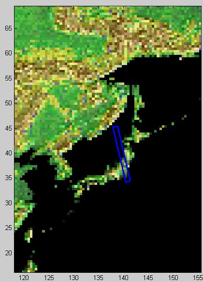
21 Rice fields Akita - Japan 40 N 140 E PALSAR FBS 22/07/ dB < HH < -12dB
 203 PALSAR [12 db, -14 db], 50-60 days after sowing: Similar range of rice backscatter HH, 35 from JERS (Rosenquist & Oguma, 1995) and from ground based data (from Inoue et al.")
22 Backscatter from rice fields Backscattering Coefficient (db) Malaysia Days after sowing (Tsukuba, 36 N E) 203 PALSAR [12 db, -14 db], days after sowing: Similar range of rice backscatter HH, 35 from JERS (Rosenquist & Oguma, 1995) and from ground based data (from Inoue et al., 2002) need data during critical stage (end of tillering-flowering) for methodology development

23 WB1 FOREST THEME Pine plantation, Venezuela Deforestation Brasil JERS mosaic FBD


 Forest dynamic range HH, 34.")
24 -16dB < HH < -14dB -8dB < HH < -5dB JERS dB < HH < -12dB -6dB < HH < -4dB PALSAR WB1 19/11/2006 Change in plantation of Pinus caribaea var. Hondurensis, Venezuela ( N, W) Forest dynamic range HH, 34.2 : 8 db Thuy Le Toan ALOS K&C 7, Jan 2007


25 JERS-1995 PALSAR-WB1 November year biomass variation in forest stands due to logging and regrowth

 HH")
26 Deforestation monitoring Brasil 8 23 S W JERS 10/1995 Thuy Le Toan PALSAR FBD 21/08/2006 ALOS K&C 7, Jan 2007 HV (green) HH (magenta)

27 PALSAR FBD 21/08/2006 HH (magenta) HV (green) -10dB < HH < -8dB -18dB < HV < -15dB HH < -15dB HV < -25dB (JERS=-11dB) Forest / deforested area ~7 db HH ~10 db HV -9dB < HH < -7dB -17dB < HV < -14dB Thuy Le Toan ALOS K&C 7, Jan dB < JERS < -6.5dB
 Alluvial forest HH : -7.7 db HV : -15.6 db (J-ERS -6.2 db) Marsh HH : -6 db HV : -15.8 db Open water HH : -15.5 db HV : -23.5 db Thuy Le Toan ALOS (J-ERS K&C -15.")
28 PALSAR dualpol mode over the Amazon river floodplain (ortho path) Alluvial forest HH : -7.7 db HV : -16 db (J-ERS -6.8 db) Terra firme forest HH : -8.7 db HV : db (J-ERS -6.8 db) Alluvial forest HH : -7.7 db HV : db (J-ERS -6.2 db) Marsh HH : -6 db HV : db Open water HH : db HV : db Thuy Le Toan ALOS (J-ERS K&C , db) Jan 2007 Terra firme forest HH : -8.2 db HV : -16 db (J-ERS -7.1 db)
 J-ERS PALSAR HH : -13.")

29 Wetlands Changes in the river morphology PALSAR dualpol mode and J-ERS over the Gaviare River (Colombia) J-ERS PALSAR HH : db HH : db HV : db HH : db HH : -9.4 db HV : db HH : db HH : db HV : db Red : HH Green : HV Blue : HH
")

30 PALSAR dualpol mode and J-ERS over the Gaviare River (Colombia) Monitoring of changes in the river morphology PALSAR FBD 08/2006 J-ERS - 10/ km

")

31 PALSAR dualpol mode over swamps and bogs Madre de Dios River (Peru) HH : 5 db! HV : -15 db (J-ERS : 1.6 db)


32 2-3 db increase of HH channel over flooded vegetation PALSAR Mode WB1 Pol. HH Casiquiare Channel J-ERS
33 Summary of the preliminary analysis Good calibration of PALSAR data on samples analysed Good dynamic range Some pattern problems Tropical forest: stable response compatible with JERS, small distinction forest types, e.g. alluvial, terra firme Deforestation:contrast 5-10 db, HV (slightly) higher than HH Potential monitoring forest logging/ regrowth in forest plantation Wetlands: potential monitoring changes in river morphology Rice: HH at 1 date in agreement with previous data.
SAR data for forestry and agriculture
 SAR data for forestry and agriculture Thuy Le Toan September 5, 2007 Lecture D3L3 Assets of radar data for vegetation monitoring? All weather capability to secure data acquisition during growing season
Use of SAR in applications
 Use of SAR in applications Methodology development Thuy Le Toan Centre d'etudes Spatiales de la Biosphère (CESBIO), Toulouse, France Use of SAR data in applications (1) SAR data are used in ocean applications
The Biomass mission How it works, what it measures? Thuy Le Toan, CESBIO, Toulouse, France & The Biomass Mission Advisory Group
 The Biomass mission How it works, what it measures? Thuy Le Toan, CESBIO, Toulouse, France & The Biomass Mission Advisory Group Why Synthetic Aperture Radars to observe the world forests? Transmit and
BIOMASS. * US Observers
 1 BIOMASS Malcolm Davidson, A. Thompson, C. Lin, P. Benzi, F. Heliere (ESA-ESTEC) and the BIOMASS MAG (T. Le Toan, S. Quegan, H. Baltzer, P. Paillou, K. Papathanassiou, F. Rocca, L. Ulander, S. Plummer,
TropiSAR data analysis and biomass inversion
 TropiSAR data analysis and biomass inversion Thuy Le Toan, Ludovic Villard, Yannick Lasne,Thierry Koleck CESBIO Toulouse, France Réunion TOSCA-TropiSAR 19-20 January 2011 Outline Data analysis Revisiting
SAR time series in forest research Biomass
 SAR time series in forest research Biomass Thuy Le Toan Centre D Etudes Spatiales de la Biosphere (CESBIO) Toulouse, France Thuy.Letoan@cesbio.cnes.fr The research question on the global Carbon budget
Globbiomass: new products and approaches
 Globbiomass: new products and approaches Global mapping of forest biomass: status-quo Maurizio Santoro 1, Oliver Cartus 1, GAMMA Remote Sensing Thuy Le Toan 2, Stephane Mermoz 2, Alexandre Bouvet 2, Ludovic
Assessment of tropical forest biomass: A challenging objective for the Biomass mission
 Assessment of tropical forest biomass: A challenging objective for the Biomass mission Thuy Le Toan, Ludovic Villard, Ho Tong M. D., Thierry Koleck, CESBIO, Toulouse, France Pascale Dubois Fernandez, ONERA,
Science I EARTH EXPLORER 7 USER CONSULTATION MEETING. An Earth Explorer to observe forest biomass
 Science I EARTH EXPLORER 7 USER CONSULTATION MEETING An Earth Explorer to observe forest biomass Primary Mission Objectives 1. Reducing the major uncertainties in carbon fluxes linked to Land Use Change,
ALOS Kyoto & Carbon Initiative Brief (forest) summary for GlobBiomass. Ake Rosenqvist, K&C Science Coordinator
 summary for GlobBiomass. Ake Rosenqvist, K&C Science Coordinator") ALOS Kyoto & Carbon Initiative Brief (forest) summary for GlobBiomass Ake Rosenqvist, K&C Science Coordinator Heritage and objectives The ALOS Kyoto & Carbon Initiative is a JAXA-led international collaboration,
ALOS Kyoto & Carbon Initiative Brief (forest) summary for GlobBiomass Ake Rosenqvist, K&C Science Coordinator Heritage and objectives The ALOS Kyoto & Carbon Initiative is a JAXA-led international collaboration,
Product Delivery Report for K&C Phase 3. Christian Thiel et al. Friedrich-Schiller-University Jena, Germany
 Product Delivery Report for K&C Phase 3 Christian Thiel et al. Friedrich-Schiller-University Jena, Germany Science Team meeting #21 Phase 3 Result Presentations Kyoto Research Park, Kyoto, Japan, December
K&C Phase 4 Brief project essentials. Asia-RiCE: Rice Crop Estimation and Monitoring. Shin-ichi Sobue Remote Sensing Technology Center of Japan
 K&C Phase 4 Brief project essentials Asia-RiCE: Rice Crop Estimation and Monitoring Shin-ichi Sobue Remote Sensing Technology Center of Japan Science Team meeting #21 Phase 4 Kick-off Kyoto Research Park,
MOSAICKING. Affiliation: European Commission DG Joint Research Centre. Method
 MOSAICKING Affiliation: European Commission DG Joint Research Centre Geocoding using: Method JAXA slant range 50 m HH+HV detected data + SCANSAR data SRTM, GTOPO elevation data JAXA orbital data Radiometric
SAR Tomographic imaging of tropical forests: P and L-band
 SAR Tomographic imaging of tropical forests: P and L-band Dinh Ho Tong Minh 1, Thuy Le Toan 1, Stefano Tebaldini 2, Fabio Rocca 2 (1) Centre d Ėtudes Spatiales de la Biosphère (CESBIO), Toulouse, France
Introduction to ESA's CCI Biomass
 The CCI Biomass Consortium Introduction to ESA's CCI Biomass Frank Martin Seifert ESA s Climate Change Initiative (CCI) ESA UNCLASSIFIED - For Official Use Slide 2 Overview of ESA's CCI Biomass and Purpose
Product Delivery Report for K&C Phase 3. Maurizio Santoro. GAMMA Remote Sensing
 Product Delivery Report for K&C Phase 3 Maurizio Santoro GAMMA Remote Sensing Science Team meeting #21 Phase 3 Result Presentations Kyoto Research Park, Kyoto, Japan, December 3-4, 2014 Nuno Carvalhais,
The BIOMASS mission. Quantifying biomass for global carbon assessment. Biomass
 The BIOMASS mission Quantifying biomass for global carbon assessment Biomass Thuy Le Toan Centre D Etudes Spatiales de la Biosphere (CESBIO) Toulouse, France On behalf of the Biomass Mission Advisory Group
K&C Phase 4 Brief project essentials
 K&C Phase 4 Brief project essentials Measuring above-ground biomass and its changes over Brazilian tropical secondary forests and savanna woodlands (Cerrado) using L-band SAR data Shaun Quegan, João Carreiras
K&C Phase 4 Status report. Retrieval of forest biomass and biomass change with spaceborne SAR
 K&C Phase 4 Status report Retrieval of forest biomass and biomass change with spaceborne SAR Johan Fransson 1, Jonas Fridman 1, Ivan Huuva, Håkan Olsson 1, Henrik J. Persson 1, Jörgen Wallerman 1, Maurizio
K&C Science Report Phase 1 Change in forest cover in Central Siberia using ALOS/PALSAR
 K&C Science Report Phase 1 Change in forest cover in Central Siberia using ALOS/PALSAR Thuy Le Toan Centre d Etudes Spatiales de la Biosphère 18 Avenue Edouard Belin, 31401 Toulouse Cedex 9, France Thuy.Letoan@cesbio.cnes.fr
K&C Phase 4 Status report
 K&C Phase 4 Status report Measuring above ground biomass and changes over Brazilian tropical secondary forests and savanna woodlands (Cerrado) using L-band SAR data Shaun Quegan, João Carreiras National
K&C Phase 4 Status report
 K&C Phase 4 Status report Measuring above ground biomass and changes over Brazilian tropical secondary forests and savanna woodlands (Cerrado) using L-band SAR data Shaun Quegan, João Carreiras National
ALOS Kyoto & Carbon Initiative Brief intro for potential new members. Ake Rosenqvist for JAXA
 ALOS Kyoto & Carbon Initiative Brief intro for potential new members Ake Rosenqvist for JAXA K&C January, 2011 Outline 1. Heritage and objectives 2. Project organization 3. Data- and information requirements
K&C Phase 4 Status report. Retrieval of forest biomass and biomass change with spaceborne SAR
 K&C Phase 4 Status report Retrieval of forest biomass and biomass change with spaceborne SAR Johan Fransson 1, Jonas Fridman 1, Ivan Huuva 1 Håkan Olsson 1, Henrik Persson 1, Jörgen Wallerman 1, Maurizio
Guiana Shield Activities Radar Point of view
 Guiana Shield Activities Radar Point of view SAR Technical Workshop for Forest Mapping Session 2 Applications - April 2015 Cédric Lardeux Jean-Paul Rudant Pierre-Louis Frison cedric.lardeux@onfinternational.com
Forest Applications. Christiana Schmullius. 2 July 2009
 Forest Applications Christiana Schmullius 2 July 29 Contents Motivation Need for Biomass Mapping Biomass Components Physical Background Wavelength Polarisation Coherence Mapping Results Siberia: Coherence
UK NCEO work on Global Forest. SDCG-10: Reading, 7-9 September, 2016
 UK NCEO work on Global Forest SDCG-: Reading, 7- September, 26 Examples from NCEO-University of Leicester Pedro Rodriguez-Veiga, Heiko Balzter, Kevin Tansey, Ciaran Robb, Ana Maria Pacheco, Ramesh Ningthoujam
Radar Polarimetry for Forestry Applications: ALOS and Radarsat-2 studies in Canada
 Radar Polarimetry for Forestry Applications: ALOS and Radarsat-2 studies in Canada by S. R. Cloude (1), A. Marino (2), D. Goodenough (3), H Chen (3), A. Richardson (3), B. Moa (4) (1) AEL Consultants,
LiDAR/SAR-based mapping of savannahs forests in Southern Africa
 Joint GFOI / GOFC-GOLD / CONABIO / SilvaCarbon R&D Expert and Capacity Building workshop on: Regional solutions to forest type stratification and characterising the forest state for national forest monitoring
ASSESSMENT AND MONITORING OF FOREST RESOURCES IN THE FRAMEWORK OF THE EU-RUSSIAN SPACE DIALOGUE THE ZAPÁS PROJECT
 Friedrich-Schiller-University Jena Institute for Geography Earth Observation ASSESSMENT AND MONITORING OF FOREST RESOURCES IN THE FRAMEWORK OF THE EU-RUSSIAN SPACE DIALOGUE THE ZAPÁS PROJECT 2011-14 C.C.
Tropical forest mapping and change detection using ALOS PALSAR data
 Tropical forest mapping and change detection using ALOS PALSAR data Wenmei Li a, Qi Feng a, Erxue Chen a, Zengyuan Li *a a The research institute of forest resources information technique, Chinese Academy
K&C Phase 3 Brief project essentials. Wide area forest monitoring of Insular SE Asia and Guiana Shield. Dirk Hoekman Wageningen University
 K&C Phase 3 Brief project essentials Wide area forest monitoring of Insular SE Asia and Guiana Shield Dirk Hoekman Wageningen University Science Team meeting #16 Phase 3 Kick-off JAXA TKSC/RESTEC HQ, Tsukuba/Tokyo,
Rice crop monitoring using EO data in the Mekong Delta, Vietnam
 The 10th GEOSS Asia-Pacific Symposium WG5: Agriculture and Food Security Hanoi, 18-20 th, Sep. 2017 Rice crop monitoring using EO data in the Mekong Delta, Vietnam Lam Dao Nguyen, Hoang Phi Phung, Dang
Product Delivery Report for K&C Phase 3. Francesco Holecz sarmap
 Product Delivery Report for K&C Phase 3 Francesco Holecz sarmap Science Team meeting #21 Phase 3 Result Presentations Kyoto Research Park, Kyoto, Japan, December 3-4, 2014 Project objectives The objective
RADAR for Biomass Mapping
 RADAR for Biomass Mapping Josef Kellndorfer Wayne Walker, Katie Kirsch, Greg Fiske The Woods Hole Research Center GOFC-GOLD Biomass Workshop Missoula, 15-June-2009 Outline Some Radar principles Measurements
K&C Phase 4 Status report. Coupling radar-based estimates of forest information with biosphere models for improved carbon flux estimation
 K&C Phase 4 Status report Coupling radar-based estimates of forest information with biosphere models for improved carbon flux estimation Maurizio Santoro & Oliver Cartus GAMMA Remote Sensing Nuno Carvalhais
RICE CROP MONITORING USING NEW GENERATION SYNTHETIC APERTURE RADAR (SAR) IMAGERY
 IMAGERY") UNIVERSITY OF SOUTHERN QUEENSLAND RICE CROP MONITORING USING NEW GENERATION SYNTHETIC APERTURE RADAR (SAR) IMAGERY A Dissertation submitted by Nguyen Lam-Dao, M Eng. For the award of Doctor of Philosophy
UNIVERSITY OF SOUTHERN QUEENSLAND RICE CROP MONITORING USING NEW GENERATION SYNTHETIC APERTURE RADAR (SAR) IMAGERY A Dissertation submitted by Nguyen Lam-Dao, M Eng. For the award of Doctor of Philosophy
The BIOMASS Mission. Klaus Scipal 24/01/2019. ESA UNCLASSIFIED - For Official Use
 The BIOMASS Mission Klaus Scipal 24/01/2019 ESA UNCLASSIFIED - For Official Use The BIOMASS Mission 1. ESA s 7 th Earth Explorer Mission 2. An interferometric, polarimetric P-band SAR 3. To be deployed
Forest Applications. Chris Schmullius, Oliver Cartus, Maurizio Santoro. 5 September 2007, D3PB
 Forest Applications Chris Schmullius, Oliver Cartus, Maurizio Santoro 5 September 2007, D3PB 4 September 2007 D3PB-2 Forest practicals Christiane Schmullius 2 Einführung mit C/X-Äthna-Beispielen MFFU Sommerschule
Chalmers Publication Library
 Chalmers Publication Library Estimation of Forest Stem Volume using ALOS-2 PALSAR-2 Satellite Images This document has been downloaded from Chalmers Publication Library (CPL). It is the author s version
STUDY ON ENVISAT ASAR DATA ASSIMILATION IN RICE GROWTH MODEL FOR YIELD ESTIMATION
 STUDY ON ENVISAT ASAR DATA ASSIMILATION IN RICE GROWTH MODEL FOR YIELD ESTIMATION S. H. Shen a, S. B. Yang a, B. B. Li b, X. Y. Zhao a, B. X. Tan c, Z. Y. Li c, T. Le Toan d a College of Applied Meteorology,
Forest Disturbances Requirements of Biomass Datasets
 CENTRE FOR LANDSCAPE AND CLIMATE RESEARCH Forest Disturbances Requirements of Biomass Datasets Heiko Balzter Pedro Rodriguez-Veiga 1 st ESA CCI Biomass Workshop, Paris, France 25-26 September 2018 Biomass
Epsilon Open Archive
 This is an article in conference proceedings from the conference IGARSS 2016 Symposium, Advancing the understanding of our living planet, Beijing, China, 10-15 July. This paper has been peer-reviewed but
Biomass Level-2 DATE: ISSUE: AUTHOR: Wednesday, 30 May 2018 Issue 1.0. Francesco Banda
 Biomass Level-2 DATE: ISSUE: AUTHOR: Wednesday, 30 May 2018 1.0 Francesco Banda 2 Level-2 implementation study 3 BIOMASS mission ESAs 7th Earth Explorer studying the forested areas of our planet launch
Mapping Scotland with PALSAR: An Assessment of the Importance of L-Band Polarimetry
 Mapping Scotland with PALSAR: An Assessment of the Importance of L-Band Polarimetry Shane R. Cloude, AEL Consultants,Scotland, UK E-mail : aelc@mac.com Web :http://web.mac.com/aelc Iain H Woodhouse (2),
Jo rg Haarpaintner Norut, N-9294 Tromsø, Norway
 Validation of SAR-based forest land cover and forest change maps and detectability of slash-and-burn activities in the Kwamouth region, Mai-Ndombe District, DRC. Jo rg Haarpaintner Norut, N-9294 Tromsø,
Multitemporal analysis of SAR data
 Multitemporal analysis of SAR data 11/09/2018 With Sentinel-1, systematic multitemporal SAR images are now available worldwide No cloud cover on SAR images 6 October 2014 S1 over S Vietnam: every 12 /6
The BIOMASS mission: Quantifying biomass for carbon assessment. Thuy Le Toan CESBIO, Toulouse, France
 The BIOMASS mission: Quantifying biomass for carbon assessment Thuy Le Toan CESBIO, Toulouse, France The science question: role of forests in the global carbon cycle Anthropogenic perturbation of the global
GFOI Plenary/SDCG 11. GFOI R&D Groups. Martin Herold, Brice Mora (GOFC-GOLD) Anthea Mitchell (UNSW) Ake Rosenqvist (soloeo)
 Anthea Mitchell (UNSW) Ake Rosenqvist (soloeo)") GFOI Plenary/SDCG 11 GFOI R&D Groups Martin Herold, Brice Mora (GOFC-GOLD) Anthea Mitchell (UNSW) Ake Rosenqvist (soloeo) Defining research priorities & stimulating R&D Country needs and priorities UN-REDD,
GFOI Plenary/SDCG 11 GFOI R&D Groups Martin Herold, Brice Mora (GOFC-GOLD) Anthea Mitchell (UNSW) Ake Rosenqvist (soloeo) Defining research priorities & stimulating R&D Country needs and priorities UN-REDD,
The BIOMASS mission An ESA Earth Explorer candidate to measure the BIOMASS of the earth's forests
 Downloaded from orbit.dtu.dk on: May 08, 2018 The BIOMASS mission An ESA Earth Explorer candidate to measure the BIOMASS of the earth's forests Scipal, K.; Arcioni, M.; Chave, J.; Dall, Jørgen; Fois, F.;
Report on Kyoto & Carbon Initiative Project Change detection in Swedish forest
 Report on Kyoto & Carbon Initiative Project Change detection in Swedish forest Johan Fransson, Anders Krantz, Mattias Magnusson and Håkan Olsson Swedish University of Agricultural Sciences, Sweden Leif
Use of multi-temporal PalSAR ScanSAR data for soil moisture retrieval
 Use of multi-temporal PalSAR ScanSAR data for soil moisture retrieval Francesco Mattia (1), Giuseppe Satalino (1), Anna Balenzano (1) and Michele Rinaldi () (1) Consiglio Nazionale delle Ricerche (CNR)
Rice Monitoring from Space?
 Rice Monitoring from Space? Thuy Le Toan CESBIO, Toulouse, France The GEORICE Project Towards Operational Rice Monitoring Benjamin Koetz Thuy Le Toan, Phan Thi Hoa Alexandre Bouvet Lam Dao Nguyen, VNSC
Product Delivery Report for K&C Phase 3. Wide area forest monitoring of Insular SE Asia and Guiana Shield. Dirk Hoekman Wageningen University
 Product Delivery Report for K&C Phase 3 Wide area forest monitoring of Insular SE Asia and Guiana Shield Dirk Hoekman Wageningen University Martin Vissers and Marcela Quiñones, SarVision Hidayat and Johannes
Product Delivery Report for K&C Phase 3. Nathan Torbick, William Salas Applied Geosolutions. Collaborators: J. Dong, M. Ducey, C. Li, J. Qi, X.
 Product Delivery Report for K&C Phase 3 Nathan Torbick, William Salas Applied Geosolutions Collaborators: J. Dong, M. Ducey, C. Li, J. Qi, X. Xiao Science Team meeting #21 Phase 3 Result Presentations
K&C Initiative, Extension Phase : Mapping and monitoring of forests in Sweden using ALOS PALSAR data
 K&C Initiative, Extension Phase 2009-2011: Mapping and monitoring of forests in Sweden using ALOS PALSAR data Johan Fransson and Håkan Olsson Swedish University of Agricultural Sciences, Sweden Leif Eriksson
ESTIMATION OF THE RICE YIELD IN THE MEKONG DELTA USING SAR DUAL POLARISATION DATA
 ESTIMATION OF THE RICE YIELD IN THE MEKONG DELTA USING SAR DUAL POLARISATION DATA Nguyen Lam-Dao *a, Phung Hoang-Phi a, Juliane Huth b and Phung Cao-Van c a GIS and Remote Sensing Research Center, HCMC
Integration methods for forest degradation assessment and change monitoring
 VTT TECHNICAL RESEARCH CENTRE OF FINLAND LTD Joint GFOI / GOFC-GOLD / CONABIO / SilvaCarbon R&D Expert and Capacity Building workshop on: Regional solutions to forest type stratification and characterising
Overview of Land Surface Parameters From Earth Observation
 Overview of Land Surface Parameters From Earth Observation Prof. Dr. Christiane Schmullius Friedrich Schiller University Jena, Germany Department of Geoinformatics and Remote Sensing FSU Jena Institut
Forest Structural Classification and Above Ground Biomass Estimation for Australia
 Forest Structural Classification and Above Ground Biomass Estimation for Australia Professor Richard Lucas 1 Jingyi Sun 2 Centre for Ecosystem Sciences (CES) School of Biological, Earth and Environmental
JAXA s MRV - current status and future envision -
 JAXA s MRV - current status and future envision - Masanobu Shimada Japan Aerospace Exploration Agency Earth Observation Research Center MRV symposium at Tokyo Forum Feb. 17, 2011 Concept Satellite data
Using multi-temporal ALOS PALSAR to investigate flood dynamics in semi-arid wetlands: Murray Darling Basin, Australia.
 Using multi-temporal ALOS PALSAR to investigate flood dynamics in semi-arid wetlands: Murray Darling Basin, Australia. Rachel Melrose, Anthony Milne Horizon Geoscience Consulting and University of New
Rice crop monitoring in Vietnam using radar remote sensing data
 Earth Observation Technologies for Crop Monitoring: A Workshop to Promote Collaborations among GEOGLAM/JECAM/Asia-RiCE 2018 17-20 September 2018 Taichung, Taiwan Rice crop monitoring in Vietnam using radar
Nguyen Lam-Dao Thuy Le-Toan Armando Apan Juliane Huth Phung Hoang-Phi. VAST, Vietnam CESBIO, France USQ, Australia DLR, Germany VAST, Vietnam
 The 33rd Asian Conference on Remote Sensing Pattaya, November 26-30, 2012 RICE MONITORING IN THE MEKONG DELTA, VIETNAM Nguyen Lam-Dao Thuy Le-Toan Armando Apan Juliane Huth Phung Hoang-Phi VAST, Vietnam
Forest Dragon 3 Project Id
 Forest Dragon 3 Project Id. 10666 Principle Investigator: Co-Investigator: Young Scientists: Prof. Li, Academy of Forest Sciences Prof. Schmullius, University of Jena Prof. Pang, Dr. Feilong, Dr. Santoro
carbon cycle Ulander 11
 5 Final submitted version of: Le Toan, T., Quegan, S., Davidson, M., Balzter, H., Paillou, P., Papathanassiou, K., Plummer, S., Rocca, F., Saatchi, S., Shugart, H. and Ulander, L. (2011): The BIOMASS Mission:
ALOS K&C Activities in Sweden
 ALOS K&C Activities in Sweden Dr. Johan Fransson, Dr. Mattias Magnusson, Prof. Håkan Olsson (SLU) Prof. Lars Ulander, Dr. Leif Eriksson, Klas Folkesson, Gustaf Sandberg Chalmers University of Technology
REDDAF. Infosheet. Content. Objective and Concept. November 2012
 November 2012 REDDAF Infosheet Content Objective and Concept Objective and Concept 1 User Requirements 2 Methods Development 2 Service Development 5 Validation and Proof of Concept 6 Capacity Building/Training
Integration of Alos PalSAR and LIDAR IceSAT data in a multistep approach for wide area biomass mapping
 Integration of Alos PalSAR and LIDAR IceSAT data in a multistep approach for wide area biomass mapping. Above Ground Biomass (carbon) mapping and monitoring: Importance Supporting UNFCC KP, REDD+, Monitoring
Amazon Wetlands Applications of JERS-1 SAR and ALOS PALSAR Datasets
 Amazon Wetlands Applications of JERS-1 SAR and ALOS PALSAR Datasets Laura Hess Institute for Computational Earth System Science University of California, Santa Barbara The Large-Scale Biosphere-Atmosphere
Problem. Land should be paid in order to reduce deforestation. Particularly challenging to turn data into useful information / country statistics
 FAO / Norway SEPAL April 2016 Problem Deforestation in the tropics constitutes of 15-20% of global greenhouse gas emissions (GHG) Reduction of GHG needed to achieve the two-degree target Norway advocates
ALOS Kyoto & Carbon (K&C) Initiative 9th Science Team Meeting. Marcela Quinones & Dirk Hoekman January 2008,Tokio
 Initiative 9th Science Team Meeting. Marcela Quinones & Dirk Hoekman January 2008,Tokio") ALOS Kyoto & Carbon (K&C) Initiative 9th Science Team Meeting Marcela Quinones & Dirk Hoekman January 8,Tokio Contents Mapping approach new developments & new products: Example maps based on PALSAR. Peat
ALOS Kyoto & Carbon (K&C) Initiative 9th Science Team Meeting Marcela Quinones & Dirk Hoekman January 8,Tokio Contents Mapping approach new developments & new products: Example maps based on PALSAR. Peat
I. SOIL MOISTURE, CROP AND VEGETATION STUDY USING AIRSAR DATA
 I. SOIL MOISTURE, CROP AND VEGETATION STUDY USING AIRSAR DATA Dr. Flaviana Hilario (1) and Dr. Juliet Mangera (2) (1) PAGASA (Weather Bureau), ATB 1424 Quezon Ave, Quezon City, Philippines, 1100, Philippines
PALSAR TROPICAL FOREST COVER MAPPING, MOSAICING AND VALIDATION, CASE STUDY BORNEO
 PALSAR TROPICAL FOREST COVER MAPPING, MOSAICING AND VALIDATION, CASE STUDY BORNEO Dirk H. Hoekman 1), M.J. Quiñones 2), R. Verhoeven 2), M.A.M. Vissers 2), V. Schut 2) and N. Wielaard 2) 1) Wageningen
Malawi Multi-purpose use of ALOS PALSAR-1 data. sarmap and Forest Research Institute of Malawi (FRIM)
") Malawi Multi-purpose use of ALOS PALSAR-1 data sarmap and Forest Research Institute of Malawi (FRIM) Objective The objective is to demonstrate, at country-level, the multi-purpose use of ALOS PALSAR-1
Malawi Multi-purpose use of ALOS PALSAR-1 data sarmap and Forest Research Institute of Malawi (FRIM) Objective The objective is to demonstrate, at country-level, the multi-purpose use of ALOS PALSAR-1
Tropical Forest Mapping using Multiband Polarimetric and Interferometric SAR Data
 Tropical Forest Mapping using Multiband Polarimetric and Interferometric SAR Data Kemal Unggul Prakoso Wageningen University, Nieuwe Kanaal 11, 6709 PA Wageningen, The Netherlands tel:+31-317-483576, fax:+31-317-484885,
Applications of SAR Polarimetry on Land: Soil Moisture and Wetlands
 Applications of SAR Polarimetry on Land: Soil Moisture and Wetlands Session Summary and Recommendations R. Touzi and S. Cloude Session Summary T. Jagdhuber et. Al.: Polarimetric Decompositions for Soil
SENSITIVITY OF ASAR AP DATA TO WHEAT CROP PARAMETERS
 SENSITIVITY OF ASAR AP DATA TO WHEAT CROP PARAMETERS Francesco Mattia, Laura Dente, Giuseppe Satalino, and Thuy Le Toan Istituto di Studi sui Sistemi Intelligenti per l Automazione, ISSIA-CNR, via Amendola
Use of ENVISAT/ASAR wide-swath data for timely rice fields mapping in the Mekong River Delta
 Use of ENVISAT/ASAR wide-swath data for timely rice fields mapping in the Mekong River Delta Alexandre Bouvet, Thuy Le Toan To cite this version: Alexandre Bouvet, Thuy Le Toan. Use of ENVISAT/ASAR wide-swath
Measuring global forest biomass: current
 Measuring global forest biomass: current status and new developments Shaun Quegan University of Sheffield & National Centre for Earth Observation Fate of anthropogenic CO 2 emissions (2005 2014 average)
Results from the Land & Environment Crop & Drought. projects in Dragon-3. Chaired by S. Pignatti & F. Jinlong
 Results from the Land & Environment Crop & Drought projects in Dragon-3 Chaired by S. Pignatti & F. Jinlong Project 10367: Desertification Monitoring and Assessment Committed products optimal indicators
ESA s GlobBiomass project and datasets. Maurizio Santoro. Gamma Remote Sensing. On behalf of GlobBiomass project team
 ESA s GlobBiomass project and datasets Maurizio Santoro Gamma Remote Sensing On behalf of GlobBiomass project team CCI Biomass 1 st User Workshop, Paris, 25 Sept. 2018 What is GlobBiomass? GlobBiomass
Taikichiro Mori Memorial Research Grants Graduate Student Researcher Development Grant Report
 Taikichiro Mori Memorial Research Grants Graduate Student Researcher Development Grant Report February 2016 Research Project: Detection and delineation of water bodies using Synthetic Aperture Radar data
Asia RiCE Highlights (Asian Rice crop estimation & monitoring)
") Asia RiCE Highlights (Asian Rice crop estimation & monitoring) Thuy Le Toan CESBIO, Toulouse, France On behalf of the GEOGLAM Asia RiCE team 13/01/2016 1 Importance of rice monitoring in SE Asia Rice is
Asia RiCE Highlights (Asian Rice crop estimation & monitoring) Thuy Le Toan CESBIO, Toulouse, France On behalf of the GEOGLAM Asia RiCE team 13/01/2016 1 Importance of rice monitoring in SE Asia Rice is
Global Biomass Map Products
 Global Biomass Map Products Maurizio Santoro (santoro@gamma-rs.ch) & GlobBiomass team Status of global biomass datasets at UW3 A first version of the global AGB and GSV datasets were delivered to ESA and
Asia-RiCE 2016 Implementation Report
 Asia-RiCE 2016 Implementation Report Asia-RiCE has been organised to develop the rice crop estimation and monitoring component for the GEO Global Agricultural Monitoring (GEOGLAM) initiative. GEOGLAM aims
The NISAR Mission. Paul Siqueira Emerging Technologies and Methods in Earth Observation for Agriculture Monitoring College Park, 2018
 The NISAR Mission Paul Siqueira Emerging Technologies and Methods in Earth Observation for Agriculture Monitoring College Park, 2018 Flyer A one-page paper-flyer is available with more information NISAR
Monitoring forest & tree cover in Africa with Japanese satellite. JAXA Presented by Manabu Watanabe (Tokyo Denki University)
") Monitoring forest & tree cover in Africa with Japanese satellite. JAXA Presented by Manabu Watanabe (Tokyo Denki University) Contents 1. Japanese satellites 2. Forest/Non-Forest Map 3. JICA-JAXA Forest
Monitoring forest & tree cover in Africa with Japanese satellite. JAXA Presented by Manabu Watanabe (Tokyo Denki University) Contents 1. Japanese satellites 2. Forest/Non-Forest Map 3. JICA-JAXA Forest
RESULTS & RECOMMENDATIONS from. The Dragon Forest Projects
 RESULTS & RECOMMENDATIONS from The Dragon Forest Projects Forest Fire Id. 10350 Forest Change Monitoring Id. 10549 PolInSAR Id. 10609 The Forest Dragon 3 Id. 10666 Forest Resources Research Id. 10667 Forest
CMS and Decision Support Discussion Forum: Current and Near-term Satellite Assets
 CMS and Decision Support Discussion Forum: Current and Near-term Satellite Assets February 6, 2013 Diane E. Wickland 1 and Marc L. Imhoff 2 1 - NASA HQ, Science Mission Directorate, Earth Science Division
FOREST AND FOREST CHANGE MAPPING WITH C- AND L-BAND SAR IN LIWALE, TANZANIA
 FOREST AND FOREST CHANGE MAPPING WITH C- AND L-BAND SAR IN LIWALE, TANZANIA J. Haarpaintner a, C. Davids a, H. Hindberg a, E. Zahabu b, R.E. Malimbwi b a Norut, P.O. Box 6434, Tromsø Science Park, N-9294
Role and importance of Satellite data in the implementation of the COMIFAC Convergence Plan
 Plenary Meeting of the Congo Basin Forest Partnership (CBFP) Palais des Congrès, Yaoundé. Cameroon 11-12 November, 2009 Role and importance of Satellite data in the implementation of the COMIFAC Convergence
Remote sensing as a tool to detect and quantify vegetation properties in tropical forest-savanna transitions Edward Mitchard (University of Edinburgh)
") Remote sensing as a tool to detect and quantify vegetation properties in tropical forest-savanna transitions Edward Mitchard (University of Edinburgh) Presentation to Geography EUBAP 10 th Oct 2008 Supervisor:
Remote sensing as a tool to detect and quantify vegetation properties in tropical forest-savanna transitions Edward Mitchard (University of Edinburgh) Presentation to Geography EUBAP 10 th Oct 2008 Supervisor:
JECAM and the Manitoba Super Site
 JECAM and the Manitoba Super Site GEO-DRI Drought Monitoring Workshop May 10 & 11, 2010 Grant Wiseman, M.Sc. AAFC, AESB, Winnipeg, Canada grant.wiseman@agr.gc.ca Joint Experiments on Crop Assessment and
Forest Biomass Estimation, Australia
 Forest Biomass Estimation, Australia 1 Richard Lucas, 2 John Armston, 1 Peter Bunting, 1 Daniel Clewley, 2 Peter Scarth, 2 Michael Schmidt, 2 Arnon Accad, 3 Paul Siqueira and 3 Yang Lei 1 Institute of
DEMONSTRATING THE POTENTIAL OF ALOS PALSAR BACKSCATTER AND INSAR COHERENCE FOR FOREST GROWING STOCK VOLUME ESTIMATION IN CENTRAL SIBERIA
 DEMONSTRATING THE POTENTIAL OF ALOS PALSAR BACKSCATTER AND INSAR COHERENCE FOR FOREST GROWING STOCK VOLUME ESTIMATION IN CENTRAL SIBERIA Christian Thiel, Christiane Schmullius Department for Earth Observation,
Regional Mapping and Monitoring Rice Production and Greenhouse Gas Emissions in Asia with PALSAR
 Regional Mapping and Monitoring Rice Production and Greenhouse Gas Emissions in Asia with PALSAR William Salas 1, Nathan Torbick 1, Changsheng Li 2 and Xiangming Xiao 2 1 Applied Geosolutions, LLC, 87
Forest Changes and Biomass Estimation
 Forest Changes and Biomass Estimation Project Title: Comparative Studies on Carbon Dynamics in Disturbed Forest Ecosystems: Eastern Russia and Northeastern China Supported by NASA Carbon Cycle Science
Monitoring of the Rice Cropping System in the Mekong Delta Using ENVISAT/ASAR Dual Polarization Data
 Monitoring of the Rice Cropping System in the Mekong Delta Using ENVISAT/ASAR Dual Polarization Data Alexandre Bouvet, Thuy Le Toan, Nguyen Lam-Dao To cite this version: Alexandre Bouvet, Thuy Le Toan,
ESA UNCLASSIFIED - For Official Use
 ESA UNCLASSIFIED - For Official Use Forestry TEP Renne Tergujeff VTT Technical Research Centre of Finland Ltd ESA UNCLASSIFIED - For Official Use Objective of Forestry TEP (F-TEP) One-stop shop for forestry