Use of SAR in applications
|
|
|
- Britton Martin
- 6 years ago
- Views:
Transcription
, Toulouse,")
1 Use of SAR in applications Methodology development Thuy Le Toan Centre d'etudes Spatiales de la Biosphère (CESBIO), Toulouse, France
2 Use of SAR data in applications (1) SAR data are used in ocean applications for which the SAR is unrivalled, such as wind and wave ocean oil slick sea ice monitoring for navigation

3 Use of SAR data in applications (2) Oil slick detection, SIR-C image Arabic Sea, West of Bombay

4 Use of SAR data in applications (2) Radarsat image, Scansar Narrow A Saint-Laurent golf, Quebec (Canada) Surface : 140 km x 159 km, 21/01/96 Resolution : 50 m Incidence : Horizontal polarization Use of SAR for ship routing in the Arctic zone. Radarsat has been optimized to facilitate the water/ice discrimination
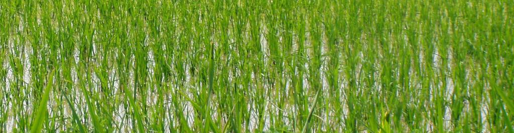
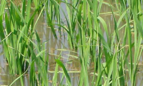
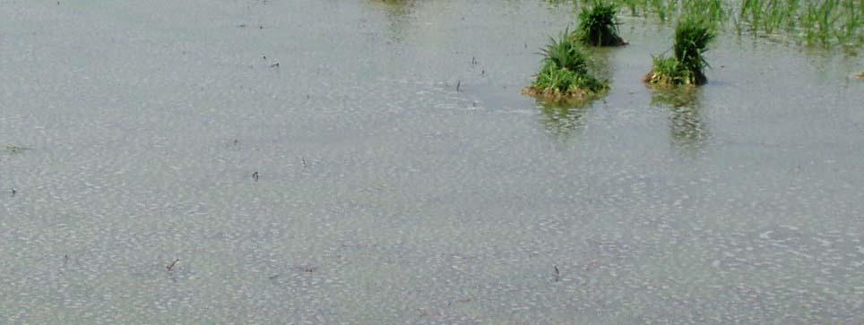
5 Use of SAR in land applications For land applications, the SAR data are unrivalled for: Displacement measurement (by interferometry) All weather change detection (flood, storm damage..) Mapping of geological features Other potential applications are based on the use of multitemporal intensity SAR data. For C-band SAR: Crop monitoring Wetland and water bodies mapping Forest mapping at regional scale Land use mapping

6 Flood monitoring using ASAR (1) Water response varies with wind conditions Temporal change detection is more robust

7 Flood monitoring using ASAR (2)
8 Flood monitoring using ASAR (3) soil water soil water Change in backscatter? At HH, VV, HV? In no wind condition? When water surface is affected by wind? water
 are required")
9 Land cover using ASAR Detection of structure, features and surface type with low temporal change For surfaces with strong temporal change, a-priori knowledge and good choice of data (dates, polarisation, incidences) are required Tianjing
 400km RUSSIA Hailar Hulun Nur Buir Nur CHINA MONGOLIA Russia, Mongolia, China border August (R), October (G), November (B)")
10 Land cover at large scale (1) Wide Swath image Interest: large area (400 km width) with a resolution of 75 m (MERIS resolution is 250 m, MODIS, m and 400km SPOT VGT 1km) 400km RUSSIA Hailar Hulun Nur Buir Nur CHINA MONGOLIA Russia, Mongolia, China border August (R), October (G), November (B) 2004

11 Land cover at large scale (2) Detail of WS colour composite image RUSSIA


12 Land cover at large scale (3) ASAR WSM forest map GLC 2000 forest map 65km Forest map using temporal change Land cover map using SPOT VGT
13 Crop monitoring Crop responses varies with crop type, growth stage, soil moisture and roughness. The same crop type may have various backscatter responses at a given time. For crop mapping, unsupervised classification with training samples, as applied to optical data, may not work. A-priori knowledge (types of crop in the region, approximate crop calendar, cultivation practices) required for - choice of appropriate acquisition dates - choice of polarisation, incidence angle
14 Rice monitoring To illustrate Steps from research to application Physical background Experiment Theoretical modelling and simulation Development of algorithms Testing in other conditions Improvement of the methods Integration in research or application programme
 HH and VV increases with the plant biomass.the increase is very important (up to 10 db during the growth season) (Le Toan et al., 1997).")
15 Scattering from a rice canopy At C band, HH and VV: the dominant scattering mechanism is the double bounce vegetation-water HH>VV because of the stronger attenuation of VV by vertical stems (and Fresnel reflection R H > R V ) HH and VV increases with the plant biomass.the increase is very important (up to 10 db during the growth season) (Le Toan et al., 1997). Water HH/VV is related to biomass
16 Experimental studies 140 LEGEND : Test site 110 Java Sea LEGEND : Test site Sapporo 6 Jakarta Japan Sea 8 Pekalongan JATISARI SEMARANG JAVA (INDONESIA) Surakarta Yogyakarta Niigata AKITA Sendai 500 km Indian Ocean Tropical rice W N S E Fukuoka Kyoto Osaka JAPON Yokohama Pacific Ocean N W E Short Cycle : days 500 km S Temperate rice Long Cycle:150 days
17 ERS data analysis Backscattering Coefficient (db) Sowing Stem elongation -18 Plant height (cm) Backscattering Coefficient (db) Backscattering Coefficient (db) Age (# days after sowing) Moist Biomass (g/m²) Semarang test site Akita test site ESA-MOST Dragon Programme Advanced training course in Land Remote Sensing, 1 000Beijing, October
18 Electromagnetic modelling The rice plants are planted by bunches, regularly placed on the field Within a rice bunch, the cylindric stems are randomly placed with uniform distribution inside a circle The stems have leaves of elliptical disc shape c b
19 Electromagnetic modelling Er ( ) e ikr Nt = t + t + t + t r vi svi vsi svsi t i= With t = index for stem or leaf v = volume s = surface 1 2 Water Water 3 4 Water Water
20 Model data comparison Effect of Polarisation Effet of Incidence angle Backscattering Coefficient (db) RADARSAT (HH) ERS (VV) Solid line: modelling result Moist Biomass (g/m²) Backscattering Coefficient (db) -4-5 C-HH C-HH Solid line: modelling result Age (# days after sowing) Strong increase from transplanting to grain maturity HH>VV Increase smaller at high incidence
21 Methodology development Simulation of non uniform crop calendar (Indonesia) Backscattering Coefficient (db) nov 12-nov Acquisition ERS-1 22-nov 02-eéc 12-dec 22-dec 01-jan 11-jan 23/01/ jan 10/02/ /02/1994 Date 31-jan 10-feb 20-feb 01-mar 06/03/ mar 21-mar 31-mar 10-apr 20-apr 30-apr Early Late Large variability of backscatter of rice field at a single date Method based of a «rice signature» not applicable 10-may 20-may 30-may
22 Error (%) Methodology development To detect rice/non rice based on temporal change Change >3 db: rice L= Bruniquel L= L=25 5 L=256L=169 L= σ (db) Change 3 db -->Number of looks required: 50 to 75 Field size -->Window size for spatial filtering (1, 3x3,5x5..) -->Number of images needed for filtering
23 date 1 Methodology development date M date M. Calibration Registration. Initial images 1 2. M Multi image filtering 1 2. M Spatial filtering Geocoding 1 2. M Analysis, Retrieval Classification Calibrated coregistered Filtered Filtered geocoded Example of Chain developed using: Gamma ASAR (Gamma RS) Multi-image filtering (Quegan et al., 2000) Temporal change (Le Toan et al., 1997)

24 Methodology development

25 Rice in Vietnam
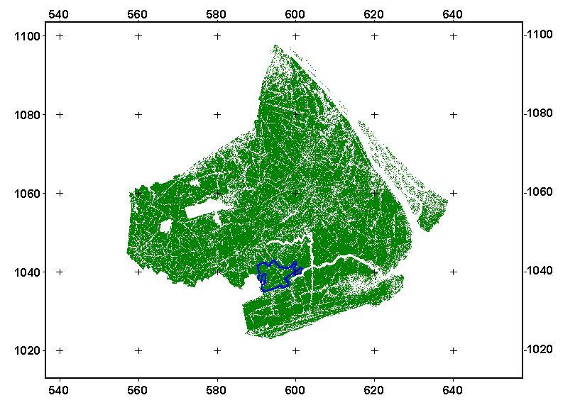
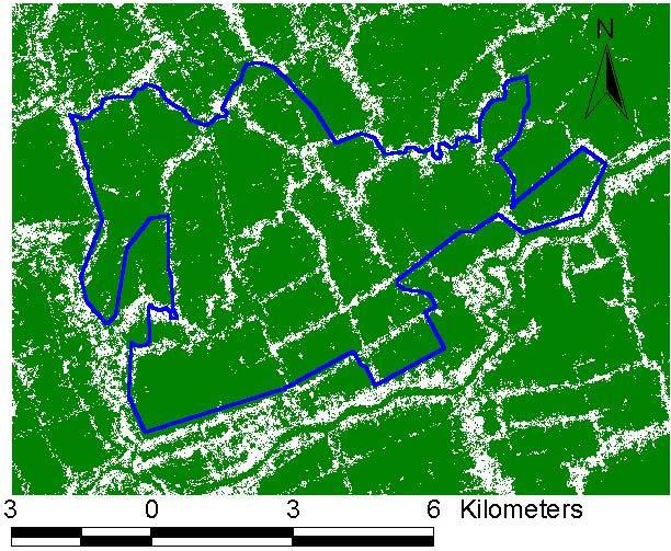
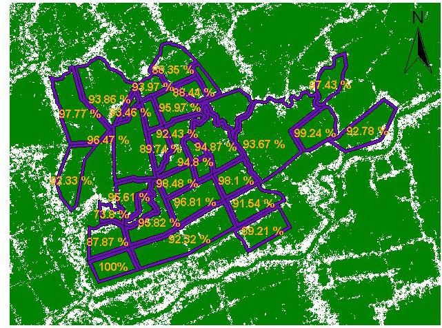
26 Method validation Good classification : 93,35%


27 Rice mapping ERS map Blue : single crop Green : double crop Red : triple crop GIS 1999
28 Retrieval of rice biomass Backscattering coefficient (db) ERS Dry biomass (g/m²)
29 Use of radar in crop models Rice production model : ORYZA 1 (Kropff et al ) Climatic data T. Radiation. Humidity. Rainfall Sowing date Development rate CO2 assimilation Biomass Parti- -tioning Biomass Leaves Stems Development stage Panicles Roots YIELD Sowing date Biomass Radar Data (s vs. Age) Radar Data (s vs. Biomass)


30 Rice monitoring using ENVISAT Jiangsu Province
31 Rice monitoring using ENVISAT Improvement of the method ENVISAT Polarisation (2 instead of 1) Choice of incidence angle Use of Wide Swath mode for large regions or provinces Rice in China Narrow Field Change in practices (one or two rice crop per year) Mid season drainage Different varieties

32 Small field: powerful filtering Filtering using 20 images (2 polarisations, 10 dates)
 2004 09")
33 Use of polarisation HH Hongze (Jiangsu) VV


34 Rice mapping at a single date Using HH/VV Magenta=HH, Green=VV 34km*38km yellow=rice, red=urban, black=other September 6th, 2004, Hongze area

35 Hybrid rice June

36 Japonica rice 15 June 2005
37 Mapping of varieties Hybrid rice Japonica rice

38 Mapping of rice varieties Hybrid rice

39 Mapping of rice varieties Hybrid rice Japonica Rice with different calendar
40 Retrieval of biomass Seasonal variations of HH/VV ratio and rice wet biomass measured in 2004 at a test field (Gaoyou, province of Jiangsu)

41 Regional rice mapping Shuyang Suqian Funing 210 km * km 75m magenta pixel : size Aug18th Green : October 27th HuaiAn Chuzhou ASAR WSM region North of Qingjiang, Jiangsu province Yancheng

42 Regional rice mapping

43 Regional rice mapping Lianyungang Jieyu River Huaimu xin River Qiangwei River Guboshanh ou River Guanyun Xinqi River Guannian Guang river

44 Regional rice mapping HengGe Reservoir Lulan River Donghai Huaimuxin River Fengshan Reservoir
45 Summary A number of applications using SAR data are outlined Rice monitoring is presented as illustration for the different steps towards application Knowledge of the SAR scattering physics and SAR data statistical properties help to develop methodology for using SAR data in applications Remark: Availability of SAR data for the appropriate dates is crucial
SAR data for forestry and agriculture
 SAR data for forestry and agriculture Thuy Le Toan September 5, 2007 Lecture D3L3 Assets of radar data for vegetation monitoring? All weather capability to secure data acquisition during growing season
Rice crop monitoring using EO data in the Mekong Delta, Vietnam
 The 10th GEOSS Asia-Pacific Symposium WG5: Agriculture and Food Security Hanoi, 18-20 th, Sep. 2017 Rice crop monitoring using EO data in the Mekong Delta, Vietnam Lam Dao Nguyen, Hoang Phi Phung, Dang
Forest Applications. Chris Schmullius, Oliver Cartus, Maurizio Santoro. 5 September 2007, D3PB
 Forest Applications Chris Schmullius, Oliver Cartus, Maurizio Santoro 5 September 2007, D3PB 4 September 2007 D3PB-2 Forest practicals Christiane Schmullius 2 Einführung mit C/X-Äthna-Beispielen MFFU Sommerschule
3/1/18 USING RADAR FOR WETLAND MAPPING IMPORTANCE OF SOIL MOISTURE TRADITIONAL METHODS TO MEASURE SOIL MOISTURE. Feel method Electrical resistance
 3/1/18 USING RADAR FOR WETLAND MAPPING SOIL MOISTURE AND WETLAND CLASSIFICATION Slides modified from a presentation by Charlotte Gabrielsen for this class. Southeast Arizona: Winter wet period From C.
The Biomass mission How it works, what it measures? Thuy Le Toan, CESBIO, Toulouse, France & The Biomass Mission Advisory Group
 The Biomass mission How it works, what it measures? Thuy Le Toan, CESBIO, Toulouse, France & The Biomass Mission Advisory Group Why Synthetic Aperture Radars to observe the world forests? Transmit and
Forest Applications. Christiana Schmullius. 2 July 2009
 Forest Applications Christiana Schmullius 2 July 29 Contents Motivation Need for Biomass Mapping Biomass Components Physical Background Wavelength Polarisation Coherence Mapping Results Siberia: Coherence
Land use change and rice crop monitoring in the Mekong Delta, Vietnam
 International Meeting on Land Use and Emissions in South/Southeast Asia Ho Chi Minh City, 17-19 October 2016 Land use change and rice crop monitoring in the Mekong Delta, Vietnam Nguyen Lam-Dao, Phung
MONITORING OF CROP GROWTH AND SOIL MOISTURE RETRIEVAL USING NISAR DATA. HARI SHANKER SRIVASTAVA Indian Institute of Remote Sensing (IIRS),
,") NISAR Science Workshop 2015 Space Applications Centre MONITORING OF CROP GROWTH AND SOIL MOISTURE RETRIEVAL USING NISAR DATA HARI SHANKER SRIVASTAVA Indian Institute of Remote Sensing (IIRS), Indian Space
NISAR Science Workshop 2015 Space Applications Centre MONITORING OF CROP GROWTH AND SOIL MOISTURE RETRIEVAL USING NISAR DATA HARI SHANKER SRIVASTAVA Indian Institute of Remote Sensing (IIRS), Indian Space
Satellite Earth Observation
 Satellite Earth Observation Services for Ecosystem valuation Prof Nick Veck Head of the CEO s Office Satellite Applications Catapult 17 March 2017 Outline Introduction to Earth observation and ecosystem
Expert Meeting on Crop Monitoring for Improved Food Security, 17 February 2014, Vientiane, Lao PDR. By: Scientific Context
 Satellite Based Crop Monitoring & Estimation System for Food Security Application in Bangladesh Expert Meeting on Crop Monitoring for Improved Food Security, 17 February 2014, Vientiane, Lao PDR By: Bangladesh
Radar Polarimetry for Forestry Applications: ALOS and Radarsat-2 studies in Canada
 Radar Polarimetry for Forestry Applications: ALOS and Radarsat-2 studies in Canada by S. R. Cloude (1), A. Marino (2), D. Goodenough (3), H Chen (3), A. Richardson (3), B. Moa (4) (1) AEL Consultants,
Monitoring Crop Leaf Area Index (LAI) and Biomass Using Synthetic Aperture Radar (SAR)
 and Biomass Using Synthetic Aperture Radar (SAR)") Monitoring Crop Leaf Area Index (LAI) and Biomass Using Synthetic Aperture Radar (SAR) Mehdi Hosseini, Heather McNairn, Andrew Davidson, Laura Dingle-Robertson *Agriculture and Agri-Food Canada JECAM SAR
Monitoring Crop Leaf Area Index (LAI) and Biomass Using Synthetic Aperture Radar (SAR) Mehdi Hosseini, Heather McNairn, Andrew Davidson, Laura Dingle-Robertson *Agriculture and Agri-Food Canada JECAM SAR
ANALYSIS OF ALOS/PALSAR POLARIMETRIC SIGNATURES AND SCATTERING MECHANISMS OF FOREST TYPES IN TAPAJÓS S REGION, BRAZIL
 ANALYSIS OF ALOS/PALSAR POLARIMETRIC SIGNATURES AND SCATTERING MECHANISMS OF FOREST TYPES IN TAPAJÓS S REGION, BRAZIL J. R. dos Santos 1 ; I. S. Narvaes 1.; P. M. L. A. Graça 2 ; F. G. Gonçalves 3 (1)
Combining Moderate-Resolution Time-Series RS Data from SAR and Optical Sources for Rice Crop Characterisation: Examples from Bangladesh
 Chapter 4 Combining Moderate-Resolution Time-Series RS Data from SAR and Optical Sources for Rice Crop Characterisation: Examples from Bangladesh Andrew Nelson, Mirco Boschetti, Giacinto Manfron, Franceco
Asia RiCE Highlights (Asian Rice crop estimation & monitoring)
") Asia RiCE Highlights (Asian Rice crop estimation & monitoring) Thuy Le Toan CESBIO, Toulouse, France On behalf of the GEOGLAM Asia RiCE team 13/01/2016 1 Importance of rice monitoring in SE Asia Rice is
Asia RiCE Highlights (Asian Rice crop estimation & monitoring) Thuy Le Toan CESBIO, Toulouse, France On behalf of the GEOGLAM Asia RiCE team 13/01/2016 1 Importance of rice monitoring in SE Asia Rice is
Integration of SAR multi-frequency and optical data for the retrieval of soil moisture and vegetation water content
 Integration of SAR multi-frequency and optical data for the retrieval of soil moisture and vegetation water content A. Padovano 1,2, F. Greifeneder 1, R. Colombo 2, G. Cuozzo 1, C. Notarnicola 1 1 - Eurac
Strategic Rice Cultivation for Sustainable Low Carbon Society Development in South East Asia
 Strategic Rice Cultivation for Sustainable Low Carbon Society Development in South East Asia Dr Sebastien Bonnet The Joint Graduate School of Energy and Environment Capacity Building Workshop on: Strategic
Intersection of SAR imagery with medium resolution DEM for the estimation of regional water storage changes
 Intersection of SAR imagery with medium resolution DEM for the estimation of regional water storage changes Sonya Spiridonova 1, Karin Hedman 1, Florian Seitz 2 1 Earth Oriented Space Science and Technology
TerraSAR-X Applications Guide
 TerraSAR-X Applications Guide Extract: Change Detection and Monitoring: Forestry April 2015 Airbus Defence and Space Geo-Intelligence Programme Line Change Detection and Monitoring: Forestry Issue Anthropogenic
Deforestation evaluation by synergetic use of ERS SAR coherence and ATSR hot spots: The Indonesian fire event of 1997
 sar/atsr synergy 34 Deforestation evaluation by synergetic use of ERS SAR coherence and ATSR hot spots: The Indonesian fire event of 1997 E. Antikidis, O. Arino, H. Laur & A. Arnaud ESA Directorate of
Forest Changes and Biomass Estimation
 Forest Changes and Biomass Estimation Project Title: Comparative Studies on Carbon Dynamics in Disturbed Forest Ecosystems: Eastern Russia and Northeastern China Supported by NASA Carbon Cycle Science
Hervé YESOU Claire HUBER, Henri GIRAUD, Mathias STUDER, Sadri HAOUET, Paul de FRAIPONT Maria VIRELLI & Yves Louis DESNOS
 Mapping water bodies exploited multi-sensors and multi resolution optical and SAR data: gained experience from plain flood monitoring in Western Europe and Asia Hervé YESOU Claire HUBER, Henri GIRAUD,
ESTIMATION OF RICE GROWTH PARAMETER AND CROP PHENOLOGY WITH CONJUNCTIVE USE OF RADARSAT AND ENVISAT
 ESTIMATION OF RICE GROWTH PARAMETER AND CROP PHENOLOGY WITH CONJUNCTIVE USE OF RADARSAT AND ENVISAT Indrani Choudhury, M.Chakraborty and J.S. Parihar Remote Sensing Applications and Image Processing Area
Joint Experiment for Crop Assessment and Monitoring GEOGLAM Implementation Meeting Washington D.C. February 21, 2013
 Joint Experiment for Crop Assessment and Monitoring GEOGLAM Implementation Meeting Washington D.C. February 21, 2013 Ian Jarvis JECAM Sub-Task Lead Earth Observation Service, Agriculture and Agri-Food
FOREST AND FOREST CHANGE MAPPING WITH C- AND L-BAND SAR IN LIWALE, TANZANIA
 FOREST AND FOREST CHANGE MAPPING WITH C- AND L-BAND SAR IN LIWALE, TANZANIA J. Haarpaintner a, C. Davids a, H. Hindberg a, E. Zahabu b, R.E. Malimbwi b a Norut, P.O. Box 6434, Tromsø Science Park, N-9294
Polar Space Task Group Permafrost Review of Requirements, Achievements and Expected Data
 Polar Permafrost Review of Requirements, Achievements and Expected Data Annett Bartsch Central Institute for Meteorology and Geodynamics, Vienna, Austria PSTG 6, ESTEC, Sept., 2016 Developments since last
VALIDATION OF HEIGHTS FROM INTERFEROMETRIC SAR AND LIDAR OVER THE TEMPERATE FOREST SITE NATIONALPARK BAYERISCHER WALD
 VALIDATION OF HEIGHTS FROM INTERFEROMETRIC SAR AND LIDAR OVER THE TEMPERATE FOREST SITE NATIONALPARK BAYERISCHER WALD T. Aulinger (1,3), T. Mette (1), K.P. Papathanassiou (1), I. Hajnsek (1), M. Heurich
IOP Conference Series: Earth and Environmental Science. Related content PAPER OPEN ACCESS
 IOP Conference Series: Earth and Environmental Science PAPER OPEN ACCESS Monitoring spatial and temporal variations of the rice backscatter coefficient (σ 0 ) at different phenological stages in Sungai
Crop Mapping in the Hindu Kush Himalaya Region
 Crop Mapping in the Hindu Kush Himalaya Region Mir Matin Faisal Mueen Qamar Haqiq Rahmani Krishna Vadrevu Lee Ellenburg NASA ICIMOD Varun Tiwari Nabin Kumar Yadav Begum Rabeya Rushi MAIL, GIRoA Noorullah
AGRICULTURAL PERFORMANCE MONITORING WITH POLARIMETRIC SAR AND OPTICAL IMAGERY
 AGRICULTURAL PERFORMANCE MONITORING WITH POLARIMETRIC SAR AND OPTICAL IMAGERY Tishampati Dhar [1][2], Doug Gray [1], Carl Menges [2] [1] Dept of Electrical and Electronic Engineering, University of Adelaide,
Integration methods for forest degradation assessment and change monitoring
 VTT TECHNICAL RESEARCH CENTRE OF FINLAND LTD Joint GFOI / GOFC-GOLD / CONABIO / SilvaCarbon R&D Expert and Capacity Building workshop on: Regional solutions to forest type stratification and characterising
Role and importance of Satellite data in the implementation of the COMIFAC Convergence Plan
 Plenary Meeting of the Congo Basin Forest Partnership (CBFP) Palais des Congrès, Yaoundé. Cameroon 11-12 November, 2009 Role and importance of Satellite data in the implementation of the COMIFAC Convergence
Asia RiCE: Rice Crop Estimation and Monitoring (the role of PALSAR 2)
") ALOS Kyoto & Carbon Initiative 22snd Science Team meeting (KC#22) Asia RiCE: Rice Crop Estimation and Monitoring (the role of PALSAR 2) Toshio Okumura (RESTEC) On behalf of the GEOGLAM Asia RiCE team Feb
ALOS Kyoto & Carbon Initiative 22snd Science Team meeting (KC#22) Asia RiCE: Rice Crop Estimation and Monitoring (the role of PALSAR 2) Toshio Okumura (RESTEC) On behalf of the GEOGLAM Asia RiCE team Feb
Global Biomass Map Products
 Global Biomass Map Products Maurizio Santoro (santoro@gamma-rs.ch) & GlobBiomass team Status of global biomass datasets at UW3 A first version of the global AGB and GSV datasets were delivered to ESA and
BUILDING EXPOSURE MAPS OF URBAN INFRASTRUCTURE AND CROP FIELDS IN THE MEKONG RIVER BASIN
 BUILDING EXPOSURE MAPS OF URBAN INFRASTRUCTURE AND CROP FIELDS IN THE MEKONG RIVER BASIN E. Haas (1), J. Weichselbaum (1), U. Gangkofner (1), J. Militzer (1), A. Walli (1) (1) GeoVille, Sparkassenplatz
Analysis of Temporal Polarization Phase Difference for Major Crops in India
 Progress In Electromagnetics Research B, Vol.,, Analysis of Temporal Polarization Phase Difference for Major Crops in India Dipanwita Haldar, *, Anup Das, Manoj Yadav, Ramesh S. Hooda, Shiv Mohan, and
Remote sensing as a tool to detect and quantify vegetation properties in tropical forest-savanna transitions Edward Mitchard (University of Edinburgh)
") Remote sensing as a tool to detect and quantify vegetation properties in tropical forest-savanna transitions Edward Mitchard (University of Edinburgh) Presentation to Geography EUBAP 10 th Oct 2008 Supervisor:
Remote sensing as a tool to detect and quantify vegetation properties in tropical forest-savanna transitions Edward Mitchard (University of Edinburgh) Presentation to Geography EUBAP 10 th Oct 2008 Supervisor:
5.5 Improving Water Use Efficiency of Irrigated Crops in the North China Plain Measurements and Modelling
 183 5.5 Improving Water Use Efficiency of Irrigated Crops in the North China Plain Measurements and Modelling H.X. Wang, L. Zhang, W.R. Dawes, C.M. Liu Abstract High crop productivity in the North China
On SEBI-SEBS validation in France, Italy, Spain, USA and China
 On SEBI-SEBS validation in France, Italy, Spain, USA and China Massimo Menenti Li Jia 2 and ZongBo Su 2 - Laboratoire des Sciences de l Image, de l Informatique et de la Télédétection (LSIIT), Strasbourg,
Remote sensing: A suitable technology for crop insurance?
 Remote sensing: A suitable technology for crop insurance? Geospatial World Forum 2014 May 9, 2014, Geneva, Switzerland Agenda 1. Challenges using RS technology in crop insurance 2. Initial situation Dominance
DMC 22m Sensors for Supertemporal Land Cover Monitoring. Gary Holmes DMC International Imaging Ltd June 2014
 DMC 22m Sensors for Supertemporal Land Cover Monitoring Gary Holmes DMC International Imaging Ltd June 2014 DMC 2 nd Generation Satellites UK-DMC2 and Deimos-1 launched 29 th July 2009 650km swath width
Watershed Hydrology. a) Water Balance Studies in Small Experimental Watersheds
 Water Balance Studies in Small Experimental Watersheds") Watershed Hydrology a) Water Balance Studies in Small Experimental Watersheds In order to characterize the geometry of the regolith as well as the directions of the fractures or fissures in the protolith,
Watershed Hydrology a) Water Balance Studies in Small Experimental Watersheds In order to characterize the geometry of the regolith as well as the directions of the fractures or fissures in the protolith,
Recent Progress of Air Pollution Modelling for co-benefit estimation
 Kyoto University 1 21 st AIM International Workshop 13 th 15 th November, 2015 NIES, Tsukuba, JAPAN Recent Progress of Air Pollution Modelling for co-benefit estimation Gakuji KURATA Kyoto University Kyoto
HIGH RESOLUTION AIRBORNE SOIL MOISTURE MAPPING
 HIGH RESOLUTION AIRBORNE SOIL MOISTURE MAPPING Jeffrey Walker 1, Rocco Panciera 1 and Ed Kim 2 1. Department of Civil and Environmental Engineering, University of Melbourne 2. Hydrospheric and Biospheric
Future remote sensors for chlorophyll a. Dimitry Van der Zande, Quinten Vanhellemont & Kevin Ruddick
 Future remote sensors for chlorophyll a Dimitry Van der Zande, Quinten Vanhellemont & Kevin Ruddick Workshop Scheldt Commission: eutrophication 20 th October 2016 Ocean colour from space ESA MERIS 7 May
The BIOMASS mission An ESA Earth Explorer candidate to measure the BIOMASS of the earth's forests
 Downloaded from orbit.dtu.dk on: May 08, 2018 The BIOMASS mission An ESA Earth Explorer candidate to measure the BIOMASS of the earth's forests Scipal, K.; Arcioni, M.; Chave, J.; Dall, Jørgen; Fois, F.;
Crop Water Requirement. Presented by: Felix Jaria:
 Crop Water Requirement Presented by: Felix Jaria: Presentation outline Crop water requirement Irrigation Water requirement Eto Penman Monteith Etcrop Kc factor Ks Factor Total Available water Readily available
Application of Envisat/ASAR for Monitoring of Tropical Forest Plantation Biomass in Indonesia
 Application of Envisat/ASAR for Monitoring of Tropical Forest Plantation Biomass in Indonesia M. A. Raimadoya (1), B.H. Trisasongko (1), D.R. Panuju (1), D. Shiddiq (1), and R. Maulida (1) (1) Radar Analysis
RETRIEVING FOREST BIOMASS FROM THE TEXTURE OF SAR IMAGES
 EARSeL eproceedings 1, 2/211 12 RETRIEVING FOREST BIOMASS FROM THE TEXTURE OF SAR IMAGES Isabelle Champion 1, Pascale Dubois-Fernandez 2, and Xavier Dupuis 2 1. INRA, UR1263 EPHYSE, F-331 Villenave d Ornon,
Crop Growth Monitor System with Coupling of AVHRR and VGT Data 1
 Crop Growth Monitor System with Coupling of AVHRR and VGT Data 1 Wu Bingfng and Liu Chenglin Remote Sensing for Agriculture and Environment Institute of Remote Sensing Application P.O. Box 9718, Beijing
Real-time crop mask production using high-spatial-temporal resolution image times series
 Real-time crop mask production using high-spatial-temporal resolution image times series S.Valero and CESBIO TEAM 1 1 Centre d Etudes Spatiales de la BIOsphre, CESBIO, Toulouse, France Table of Contents
Inside of forest (for example) Research Flow
 Research Flow") Study on Relationship between Watershed Hydrology and Lake Water Environment by the Soil and Water Assessment Tool (SWAT) Shimane University Hiroaki SOMURA Watershed degradation + Global warming Background
Study on Relationship between Watershed Hydrology and Lake Water Environment by the Soil and Water Assessment Tool (SWAT) Shimane University Hiroaki SOMURA Watershed degradation + Global warming Background
Agricultural Technical Cooperation Working Group Strategic Plan
 Agricultural Technical Cooperation Working Group Strategic Plan 2015-2019 Agriculture substantially contributes to the economy of most APEC member economies, and the issues of food security that includes
BAEN 673 / February 18, 2016 Hydrologic Processes
 BAEN 673 / February 18, 2016 Hydrologic Processes Assignment: HW#7 Next class lecture in AEPM 104 Today s topics SWAT exercise #2 The SWAT model review paper Hydrologic processes The Hydrologic Processes
K&C Science Report Phase 1 Change in forest cover in Central Siberia using ALOS/PALSAR
 K&C Science Report Phase 1 Change in forest cover in Central Siberia using ALOS/PALSAR Thuy Le Toan Centre d Etudes Spatiales de la Biosphère 18 Avenue Edouard Belin, 31401 Toulouse Cedex 9, France Thuy.Letoan@cesbio.cnes.fr
THE SIBERIA-II PROJECT AS SEEN BY ENVISAT ASAR
 THE SIBERIA-II PROJECT AS SEEN BY ENVISAT ASAR Maurizio Santoro (1), Christiane Schmullius (1), Heiko Balzter (2), Annett Bartsch (3), Manuela Grippa (4), Richard Kidd (3), Thuy Le Toan (4), Julien L'Hermitte
Oil & Gas Industry. Solutions from the space. Satellite applications in support to
 Satellite applications in support to Oil & Gas Industry Solutions from the space RARTEL S.A. 70 Dr. Iacob Felix, 011041, Bucharest, Romania Phone: +4021 3196804 Fax: +40213196806 www.rartel.ro Summary
MERIS Global Vegetation Index Land products. Nadine Gobron
 MERIS Global Vegetation Index Land products Nadine Gobron Contribution from: O. Aussedat, B. Pinty, M. Taberner, F. Mélin, T. Lavergne, M. Robustelli, M.M. Verstraete & J.-L. Widlowski (JRC). O. Faber
Operational products for crop monitoring. Hervé Kerdiles, JRC MARS
 Operational products for crop monitoring Hervé Kerdiles, JRC MARS Outline Meteo products Rainfall, temperature, global radiation, ETa, snow depth Biomass indicators & crop yield prediction NDVI & other
The role of Remote Sensing in Irrigation Monitoring and Management. Mutlu Ozdogan
 The role of Remote Sensing in Irrigation Monitoring and Management Mutlu Ozdogan Outline Why do we care about irrigation? Remote sensing for irrigated agriculture What are the needs of irrigators? Future
Application of PALSAR data to classify vegetation in an anthropogenically affected wetland area in Central Spain (Las Tablas de Daimiel)
") Rhodes, Greece, Application of PALSAR data to classify vegetation in an anthropogenically affected wetland area in Central Spain (Las Tablas de Daimiel) Thomas Schmid 1, Magaly Koch 2, Jesús Solana 3 and
Rhodes, Greece, Application of PALSAR data to classify vegetation in an anthropogenically affected wetland area in Central Spain (Las Tablas de Daimiel) Thomas Schmid 1, Magaly Koch 2, Jesús Solana 3 and
Energy in the 21st Century John S. MacDonald
 Energy in the 21st Century John S. MacDonald February 25, 2010 Energy Issues Security - Dependence Environmental Concerns on Foreign Energy Climate Change Demand and Supply Demand and Supply - A key Question
Issues include coverage gaps, delays, measurement continuity and consistency, data format and QC, political restrictions
 Satellite-based Estimates of Groundwater Depletion, Ph.D. Chief, Hydrological Sciences Laboratory NASA Goddard Space Flight Center Greenbelt, MD Groundwater Monitoring Inadequacy of Surface Observations
Application of Space Technology to Water Resources Management & Dragon Project. Li Jiren. Digital Basin Research Centre Institute of Digital china
 Application of Space Technology to Water Resources Management & Dragon Project Li Jiren Digital Basin Research Centre Institute of Digital china 1. Application of space technology to water resources management
Monitoring Volumetric Surface Soil Moisture Content at the La Grande Basin Boreal Wetland by Radar Multi Polarization Data
 Remote Sens. 2013, 5, 4919-4941; doi:10.3390/rs5104919 Article OPEN ACCESS Remote Sensing ISSN 2072-4292 www.mdpi.com/journal/remotesensing Monitoring Volumetric Surface Soil Moisture Content at the La
DOCUMENTING ADOPTION. Alternative Wetting and Drying (AWD) Technique in Vietnam
 Technique in Vietnam") DOCUMENTING ADOPTION Alternative Wetting and Drying (AWD) Technique in Vietnam Outline of Presentation Basic description of AWD Motivations for AWD study Methods Results Future research What is AWD? The
DOCUMENTING ADOPTION Alternative Wetting and Drying (AWD) Technique in Vietnam Outline of Presentation Basic description of AWD Motivations for AWD study Methods Results Future research What is AWD? The
Jeffrey Richey & Colleague University of Washington SEA-BASINS
 Does Deforestation affect River Flows across the Mekong Basin? What Controls Water Flows across the Mekong Basin: (Geology), Climate, Landcover (Change), Engineering, Jeffrey Richey & Colleague University
Airborne Laser Scanning (ALS) for forestry applications
 for forestry applications") Airborne Laser Scanning (ALS) for forestry applications International School on Lidar Technology 2008 IIT Kanpur, India Norbert Pfeifer + I.P.F.-Team http://www.ipf.tuwien.ac.at/ Christian Doppler Laboratory
Airborne Laser Scanning (ALS) for forestry applications International School on Lidar Technology 2008 IIT Kanpur, India Norbert Pfeifer + I.P.F.-Team http://www.ipf.tuwien.ac.at/ Christian Doppler Laboratory
Satellite data and hydrological model to asses water quantity and quality in the Yangtze river basin, ID Third year activity
 Satellite data and hydrological model to asses water quantity and quality in the Yangtze river basin, ID 10664 Third year activity Marco Mancini1; Jiren Li2; Chiara Corbari1 Antonio Di Trapani ; Jinfeng
Introduction to Climate Change. Rodel D. Lasco Professor University of the Philippines
 RD Lasco 1 Introduction to Climate Change Rodel D. Lasco Professor University of the Philippines Outline The climate system What is climate change? Evidence for climate change Predicted change in climate
The use of satellite pictures and data provided by drones for the purposes of identification of crops and assessment of plant production
 The use of satellite pictures and data provided by drones for the purposes of identification of crops and assessment of plant production Tomasz Milewski Białobrzeska 11/64, 02-379 Warsaw Central Statistical
SOIL MOISTURE RETRIEVAL FROM OPTICAL AND THERMAL SPACEBORNE REMOTE SENSING
 Comm. Appl. Biol. Sci, Ghent University, 70/2, 2005 1 SOIL MOISTURE RETRIEVAL FROM OPTICAL AND THERMAL SPACEBORNE REMOTE SENSING W.W. VERSTRAETEN 1,2 ; F. VEROUSTRAETE 2 ; J. FEYEN 1 1 Laboratory of Soil
Remote Sensing in Support of Multilateral Environmental Agreements
 Remote Sensing in Support of Multilateral Environmental Agreements Alex de Sherbinin CIESIN, The Earth Institute, Columbia University Presented at the Satellites and the Law Enforcement Meeting London,
CHAPTER THREE. Radar remote sensing of regenerating tropical forests
 CHAPTER THREE Radar remote sensing of regenerating tropical forests The framework for the research presented in this thesis is the interaction of SAR backscatter, depending on its temporal, spatial, spectral
Distributed Mapping of SNTHERM-Modelled Snow Properties for Monitoring Seasonal Freeze/Thaw Dynamics
 58th EASTERN SNOW CONFERENCE Ottawa, Ontario, Canada, 2001 Distributed Mapping of SNTHERM-Modelled Snow Properties for Monitoring Seasonal Freeze/Thaw Dynamics JANET P. HARDY 1, KYLE MCDONALD 2, ROBERT
Climate Change Challenges faced by Agriculture in Punjab
 Climate Change Challenges faced by Agriculture in Punjab Dr. M. Mohsin Iqbal and Dr. Arshad M. Khan Global Change Impact Studies Centre (GCISC), Islamabad Seminar on Impacts of Climate Change on Agriculture
RICE PADDY MONITERRING USING RADARSAT DATA
 RICE PADDY MONITERRING USING RADARSAT DATA Naoki ISHITSUKA *, Genya SAITO *, Shigeo OGAWA **, Ayumi FUKUO* * National Institute for Agro-Environmental Sciences 3-1-3 Kannondai Tsukuba Ibaraki, 305-8604,
The BIOMASS mission: Quantifying biomass for carbon assessment. Thuy Le Toan CESBIO, Toulouse, France
 The BIOMASS mission: Quantifying biomass for carbon assessment Thuy Le Toan CESBIO, Toulouse, France The science question: role of forests in the global carbon cycle Anthropogenic perturbation of the global
LARGE SCALE SOIL MOISTURE MODELLING
 Soil Moisture Workshop LARGE SCALE SOIL MOISTURE MODELLING Giuseppe Formetta, Vicky Bell, and Eleanor Blyth giufor@nerc.ac.uk Centre for Ecology and Hydrology, Wallingford, UK Wednesday 25 th January 2017
Agricultural drought index and monitoring on national scale. LU Houquan National Meteorological Center, CMA
 Agricultural drought index and monitoring on national scale LU Houquan National Meteorological Center, CMA Contents Agricultural drought disasters in China Agricultural drought indices --Precipitation
Chief, Hydrological Sciences Laboratory NASA Goddard Space Flight Center
 Detection of Extreme Events with GRACE and Data Assimilation, Ph.D. Chief, Hydrological Sciences Laboratory NASA Goddard Space Flight Center Gravity Recovery and Climate Experiment (GRACE) Soil Moisture
ALOS Kyoto & Carbon Initiative Brief (forest) summary for GlobBiomass. Ake Rosenqvist, K&C Science Coordinator
 summary for GlobBiomass. Ake Rosenqvist, K&C Science Coordinator") ALOS Kyoto & Carbon Initiative Brief (forest) summary for GlobBiomass Ake Rosenqvist, K&C Science Coordinator Heritage and objectives The ALOS Kyoto & Carbon Initiative is a JAXA-led international collaboration,
ALOS Kyoto & Carbon Initiative Brief (forest) summary for GlobBiomass Ake Rosenqvist, K&C Science Coordinator Heritage and objectives The ALOS Kyoto & Carbon Initiative is a JAXA-led international collaboration,
Soil & Climate Anne Verhoef
 Soil Research Centre Anne Verhoef December 12, 2014 University of Reading 2014 www.reading.ac.uk Overview Aim: Improve understanding of soil-plant-atmosphere feedbacks for sustainable soil services Selection
GEOGRAPHY. H.C.G. Paper 2 (Two hours)
") GEOGRAPHY H.C.G. Paper 2 (Two hours) Answers to this Paper must be written on the paper provided separately. You will not be allowed to write during the first 15 minutes. This time is to be spent in reading
GEOGRAPHY H.C.G. Paper 2 (Two hours) Answers to this Paper must be written on the paper provided separately. You will not be allowed to write during the first 15 minutes. This time is to be spent in reading
Remote Sensing and Environmental Security
 Remote Sensing and Environmental Security Space Agencies & Operational monitoring systems Dirk H. Hoekman Niels Wielaard Vincent Schut www.sarvision.nl Remote sensing: Lifting the veil Train explosion
Estimation of chlorophyll-a concentration in estuarine waters:
 Estimation of chlorophyll-a concentration in estuarine waters: case study of the Pearl River estuary Yuanzhi Zhang *, Chuqun Chen #, Hongsheng Zhang *, Xiaofei*, Chen Guiying Chen# *Institute of Space
Use of Earth Observation Data for Water Resources Management by the Nile Basin Initiative. - Tigernet Project
 Use of Earth Observation Data for Water Resources Management by the Nile Basin Initiative. - Tigernet Project By Milly Mbuliro GIS/ Remote Sensing Specialist Nile Basin Initiative Secretariat 25-27 March,
Tiger project #2 : Biomass evaluation of tropical dry and wet forests. Climate change impacts
 Tiger II Workshop Hartebeeshoek, South Africa, 12 13 December 2011 Tiger project #2 : Biomass evaluation of tropical dry and wet forests. Climate change impacts Laboratory Institution Partners Project
Satellite image classification of vegetation and surface water for assessment of flood damage to agricultural crops
 Satellite image classification of vegetation and surface water for assessment of flood damage to agricultural crops Lisa Colson 2, Mark Lindeman 1, Dath Mita 1, Tatiana Nawrocki 2, Paulette Sandene 1,
A global perspective on land use and cover change
 A global perspective on land use and cover change Alan Belward The Global Environment Monitoring Unit Institute for Environment and Sustainability European Commission Joint Research Centre 21027 Ispra
Crop Modelling & Yield Forecasting
 Crop Modelling & Yield Forecasting AGRICAB FINAL MEETING 23-24/03/2015 Hendrik Boogaard Alterra, WUR hendrik.boogaard@wur.nl WP31 Crop Production Systems Agricultural statistics Agro-meteorological modeling
The Use of C- and L-Band Repeat-Pass Interferometric SAR Coherence for Soil Moisture Change Detection in Vegetated Areas
 The Open Remote Sensing Journal, 2012, 5, 37-53 37 Open Access The Use of C- and L-Band Repeat-Pass Interferometric SAR Coherence for Soil Moisture Change Detection in Vegetated Areas Brian Barrett*,1,
Sensor Based Fertilizer Nitrogen Management. Jac J. Varco Dept. of Plant and Soil Sciences
 Sensor Based Fertilizer Nitrogen Management Jac J. Varco Dept. of Plant and Soil Sciences Mississippi State University Nitrogen in Cotton Production Increased costs linked to energy costs Deficiency limits
Decision Making under Uncertainty in a Decision Support System for the Red River
 Decision Making under Uncertainty in a Decision Support System for the Red River Inge A.T. de Kort and Martijn J. Booij Faculty of Engineering Technology, University of Twente, P.O. Box 217, 7 AE Enschede,
LAND AND WATER - EARTH OBSERVATION INFORMATICS FSP
 Earth Observation for Water Resources Management Arnold Dekker,Juan P Guerschman, Randall Donohue, Tom Van Niel, Luigi Renzullo,, Tim Malthus, Tim McVicar and Albert Van Dijk LAND AND WATER - EARTH OBSERVATION
M.L. Kavvas, Z. Q. Chen, M. Anderson, L. Liang, N. Ohara Hydrologic Research Laboratory, Civil and Environmental Engineering, UC Davis
 Assessment of the Restoration Activities on Water Balance and Water Quality at Last Chance Creek Watershed Using Watershed Environmental Hydrology (WEHY) Model M.L. Kavvas, Z. Q. Chen, M. Anderson, L.
and spatial resolution)
") Analysis of different synergy schemes to improve SMOS soil moisture retrievals (accuracy and spatial resolution) A. Chanzy 1, B. Berthelot 2, S. Cros 1, M. Weiss 2, J.-C. Calvet 3, T. Pellarin 4, J.-P
Analysis of different synergy schemes to improve SMOS soil moisture retrievals (accuracy and spatial resolution) A. Chanzy 1, B. Berthelot 2, S. Cros 1, M. Weiss 2, J.-C. Calvet 3, T. Pellarin 4, J.-P
BMP s FOR FACING DROUGHT STRESS ON OIL PALM
 BMP s FOR FACING DROUGHT STRESS ON OIL PALM Marihat, September, 29 th 2016 Suroso Rahutomo Soil Science & Agronomy Research Group Indonesian Oil Palm Research Institute (IOPRI) Outline Introduction El
Climate Change: Scientific basis and risks for the finance sector
 Climate Change: Scientific basis and risks for the finance sector P. Hadjinicolaou 1,2 and C. Zerefos 1,3 1 Lab. of Climatology and Atmospheric Environment, University of Athens 2 Frederick Institute of
Working with the Water Balance
 Working with the Water Balance Forest Hydrology and Land Use Change Paul K. Barten, Ph.D. Professor of Forestry and Hydrology Department of Environmental Conservation www.forest-to-faucet.org The Living