Cesalea N. Osborne Environmental Science Haskell Indian Nations University This project was sponsored by Haskell Indian Nations University through
|
|
|
- Deborah Tyler
- 5 years ago
- Views:
Transcription


1 Impacts of Land Use Changes Over Time on the Arbuckle Simpson Aquifer in South Central Oklahoma Cesalea N. Osborne Environmental Science Haskell Indian Nations University This project was sponsored by Haskell Indian Nations University through NASA CAN NNX14AK04A

2 Introduction and Background What is an aquifer? Where is the Arbuckle- Simpson Aquifer? Why is it important? Sources Who s involved? Methodology & Results Spatial data Satellite imagery Difference maps Overview

3 Aquifers = Water Storehouses
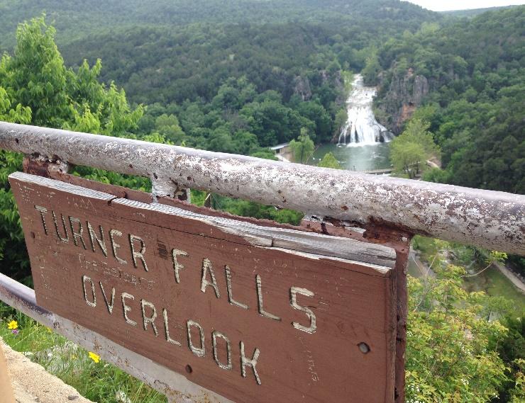
4 The Arbuckle-Simpson Aquifer spans five counties in south-central Oklahoma.


5

6 The objective of my research is to characterize the change in demand on the Arbuckle Simpson Aquifer using land use and land cover change over time.
 State/county boundaries Oklahoma Geographic")

7 Data Needs & Sources Spatial Data Arbuckle-Simpson Aquifer outcrop Oklahoma Water Resources Board (OWRB) State/county boundaries Oklahoma Geographic Information Council Surficial Hydrology Data HUC 8 subbasins OWRB Landsat Data Landsat L8 OLI/TIRS and L4-5 TM Earth Explorer United States Geological Survey (USGS)
8 Methodology Researched current water demand on the Arbuckle Simpson Aquifer Determined study area based on HUC-8 watersheds (4) that impact the Arbuckle-Simpson Aquifer Acquired spatial base data and Landsat images from L8 OLI/TIRS and L4-5 TM sensors for the years of 2015, 2005, 1995, and 1985 Characterized land use and land cover change over time using an ISO unsupervised classification (15 classes) on Landsat imagery Created difference maps for each 10 year time step Classified the difference maps into three classes No Change Undetermined change Development Analyzed results to determine impacts of demand over time
9 Results ISO unsupervised classification did not accurately distinguish exposed rock/soil from urbanization and development transitions from grasslands to rangeland Could not determine if large portions of change were natural change or man-made due to lack of knowledge of the land ISO may have worked better using more classes Went through final processes to determine difference maps, and to validate that the Landsat based unsupervised classifications where inadequate to map the change in development

10 Original Classification Water Forest Agriculture Grass/Pasture Bare rock/soil Development Changed original 6 classes to 4 classes Water Agriculture/Forest/Pasture Exposed rock/soil Development Results Continued
11 Difference Map showing areas of development from 1985 to 1995 Notice large areas showing change based on classification Areas were misclassified or misidentified using unsupervised classification
12 Difference Map showing areas of development from 1995 to 2005

13 Difference Map showing areas of development from 2005 to 2015


14 Close up of aquifer outcrop showing areas of misclassification
15 Future Recommendations Obtain higher spatial/spectral resolution imagery Create a supervised classification Possible to use training data collected in field Look at other supervised methods outside of ArcGIS Determine other methods to analyze potential detrimental impacts to aquifer and recharge area Meeting with water CPASA, OWRB
16 Sources Blome, C. D., Christenson, S., Faith, J. R., Neel, C. R., Osborn, N. I., Pantea, M. P., & Puckette, J. (2011). Hydrogeology and Simulation of Groundwater Flow in the Arbuckle-Simpson Aquifer, South-Central Oklahoma. U.S. Department of the Interior; U.S. Geological Survey. Oklahoma Geographic Information Council. (2015). OKMaps. Retrieved from Oklahoma Water Resources Board. (2015). Arbuckle-Simpson Aquifer Study - GIS Datasets. Retrieved from U.S. Geological Survey. (2015). Retrieved from Earth Explorer :

17
To provide timely, accurate, and useful statistics in service to U.S. agriculture
 NASS MISSION: To provide timely, accurate, and useful statistics in service to U.S. agriculture What does NASS do? Administer USDA s Statistical Estimating Program Conduct the 5-year Census of Agriculture
APPENDIX B: POLLUTANT LOADING ANALYSIS. Appendix B: Pollutant Loading Analysis
 APPENDIX B: POLLUTANT LOADING ANALYSIS Appendix B: Pollutant Loading Analysis This page has been intentionally left blank. Appendix B: Pollutant Loading Analysis Appendix B Pollutant Loading Analysis Methodology
CLIMATE CHANGE IMPACTS ON THE HYDROLOGY OF A TROPICAL DRAINAGE BASIN. Work in Progress
 CLIMATE CHANGE IMPACTS ON THE HYDROLOGY OF A TROPICAL DRAINAGE BASIN Work in Progress Marcel Giovanni Prieto Graduate Student,, Civil Eng. Department,, UPRM Eric W. Harmsen Assisstant Professor, Agric
Sufficiency of publicly-available data to monitor Central Texas groundwater salamanders
 Katie Lyons CE 394K.3 GIS in Water Resources Term Project Sufficiency of publicly-available data to monitor Central Texas groundwater salamanders Central Texas is home to a group of endemic salamander
Remote Sensing Uses in Agriculture at NASS
 Remote Sensing Uses in Agriculture at NASS United States Department of Agriculture (USDA) National Agriculture Statistics Service (NASS) Research and Development Division Geospatial Information Branch
Urban Ecosystem Analysis Roanoke, Virginia
 June 2002 Urban Ecosystem Analysis Roanoke, Virginia Calculating the Value of Nature Report Contents 2-3 Project Overview 4 Major Findings 5 Roanoke Area Green Data Layer 6 Tree Canopy Loss Over Time 7
Analysis of Environmental and Climate Change for Pyin OO Lwin using Geographic Information System (GIS)
") 2018; SP1: 45-50 E-ISSN: 2278-4136 P-ISSN: 2349-8234 JPP 2018; SP1: 45-50 Hnin Hnin Htun Htet NE OO Aye Pwint Phyu, Thett OO Eain Analysis of Environmental and Climate Change for Pyin OO Lwin using Geographic
2018; SP1: 45-50 E-ISSN: 2278-4136 P-ISSN: 2349-8234 JPP 2018; SP1: 45-50 Hnin Hnin Htun Htet NE OO Aye Pwint Phyu, Thett OO Eain Analysis of Environmental and Climate Change for Pyin OO Lwin using Geographic
Surface Water Study. Groundwater Land Cover. Spencer Schnier PWPG Meeting January 19, Panhandle Water Planning Area
 Surface Water Study Groundwater Land Cover Spencer Schnier PWPG Meeting January 19, 2009 Background New map will show: Canadian River Streams NOAA stations USGS stream gages Study Area Background What
SAN MATEO PLAIN GROUNDWATER BASIN ASSESSMENT STAKEHOLDER WORKSHOP#2 SEPTEMBER 7, 2016
 SAN MATEO PLAIN GROUNDWATER BASIN ASSESSMENT STAKEHOLDER WORKSHOP#2 SEPTEMBER 7, 2016 PRESENTATION OVERVIEW Introductions Project Overview Summary of Stakeholder Meeting #1 Feedback Snapshot of Results
Hydrologic Information System Status Report
 Hydrologic Information System Status Report Version 1: September 15, 2005 Edited by David R. Maidment Full report is available at: http://www.ce.utexas.edu/prof/maidment/cuahsi/hisstatussept15.pdf Developing
Utilization of the SWAT Model and Remote Sensing to Demonstrate the Effects of Shrub Encroachment on a Small Watershed
 Utilization of the SWAT Model and Remote Sensing to Demonstrate the Effects of Shrub Encroachment on a Small Watershed Jason Afinowicz Department of Biological and Agricultural Engineering Texas A&M University
Environmental Resource Inventories. What are ERIs? Significance of information How to use them
 Environmental Resource Inventories What are ERIs? Significance of information How to use them Environmental Resource Inventory - ERI Compiled by the environmental commission Information about the natural
Effects of land use change on the water resources of the Basoda basin using the SWAT model
 INDIAN INSTITUTE OF TECHNOLOGY ROORKEE Effects of land use change on the water resources of the Basoda basin using the SWAT model By Santosh S. Palmate* 1 (Ph.D. Student) Paul D. Wagner 2 (Postdoctoral
REMOTE SENSING AND GEOGRAPHICAL INFORMATION SYSTEMS APPLICATIONS TO DETERMINE GRASSLAND TYPES AND GRAZING SYSTEMS IN HIGHLANDS OF THE EASTERN TURKEY
 SESSION 38-9 REMOTE SENSING AND GEOGRAPHICAL INFORMATION SYSTEMS APPLICATIONS TO DETERMINE GRASSLAND TYPES AND GRAZING SYSTEMS IN HIGHLANDS OF THE EASTERN TURKEY Y. BOZKURT 1, L. BASAYIGIT 1 and I. KAYA
Object-oriented Classification and Sampling Rate of Landsat TM Data for Forest Cover Assessment. Yasumasa Hirata 1, Tomoaki Takahashi 1
 Object-oriented Classification and Sampling Rate of Landsat TM Data for Forest Cover Assessment Yasumasa Hirata 1, Tomoaki Takahashi 1 1 Forest Management Department, Forestry and Forest Products Research
The Washington Hardwoods Commission. Presents: A Hardwood Resource Assessment for Western Washington
 The Washington Hardwoods Commission Presents: A Hardwood Resource Assessment for Western Washington June, 2002 Abstract This project used Landsat TM images for mapping current forest distribution across
DETERMINING LAND USE CHANGE WITHIN THE DOG RIVER WATERSHED USING LANDSAT IMAGERY
 DETERMINING LAND USE CHANGE WITHIN THE DOG RIVER WATERSHED USING LANDSAT IMAGERY Joshua M. Pritchard, Department of Earth Sciences, University of South Alabama, Mobile, AL 36688-0002. E-mail: jmp601@gmail.com.
Goal of project Importance of work Software and processes Methods Results and discussion Strengths and limitations Conclusions 3/11/2010
 Presented by Joey Roberts and James Bradd Goal of project Importance of work Software and processes Methods Results and discussion Strengths and limitations Conclusions 1 Test hypothesis that the distribution
Water Mission Area (WMA) Don Cline, Associate Director November 1, 2017
 Don Cline, Associate Director November 1, 2017") Water Mission Area (WMA) Don Cline, Associate Director November 1, 2017 USGS Water Resources Mission Since establishment in 1879, the USGS has been a primary source for scientific data to describe and
Water Mission Area (WMA) Don Cline, Associate Director November 1, 2017 USGS Water Resources Mission Since establishment in 1879, the USGS has been a primary source for scientific data to describe and
Worldwide Exchange of Water Data
 Worldwide Exchange of Water Data Fernando R. Salas and David R. Maidment Center for Research in Water Resources University of Texas at Austin 2014 AWRA Spring Specialty Conference: GIS and Water Resources
Nitrate Tracking in the Lower Yakima Basin
 Nitrate Tracking in the Lower Yakima Basin Matt Bachmann, Ph.D. September 19 th, 2013 U.S. Department of the Interior U.S. Geological Survey GWMA objectives reduce nitrate concentrations in groundwater
Vermillion River Headwaters Groundwater Recharge Area Inventory and Protection Plan
 Vermillion River Headwaters Groundwater Recharge Area Inventory and Protection Plan A project funded through a Metro Environmental Partnership grant from the Metropolitan Council with technical analysis
MOBILE BAY. Darius Hixon (Project Lead) Austin Clark Tyler Lynn Manoela Rosa. Monitoring Marsh Conditions in Coastal Alabama. Conservation Initiatives
 Austin Clark Tyler Lynn Manoela Rosa. Monitoring Marsh Conditions in Coastal Alabama. Conservation Initiatives") National Aeronautics and Space Administration MOBILE BAY MOBILE ECOLOGICAL BAY ECOLOGICAL FORECASTING FORECASTING II II Monitoring Marsh Conditions in Coastal Alabama Monitoring Using NASA Marsh Earth
National Aeronautics and Space Administration MOBILE BAY MOBILE ECOLOGICAL BAY ECOLOGICAL FORECASTING FORECASTING II II Monitoring Marsh Conditions in Coastal Alabama Monitoring Using NASA Marsh Earth
WATERSHED LAND COVER CHANGE IN GUAM. Yuming Wen Shahram Khosrowpanah Leroy F. Heitz
 WATERSHED LAND COVER CHANGE IN GUAM Yuming Wen Shahram Khosrowpanah Leroy F. Heitz Technical Report No. 124 March 2009 Watershed Land Cover Change in Guam by Yuming Wen Shahram Khosrowpanah Leroy F. Heitz
A Report on the City of Chesapeake s Existing and Possible Urban Tree Canopy
 A Report on the City of Chesapeake s Existing and Possible Urban Tree Canopy Project Background The analysis of Chesapeake s urban tree canopy (UTC) was carried out at the request of the Virginia Department
Open File Report D
 A S V Open File Report 2002-25D Exploring Relationships Between Water Table Elevations, Reported Water Use, and Aquifer Lifetime as Parameters for Consideration in Aquifer Subunit Delineations By B. B.
Dynamics and Drivers of Land Cover & Land Use Changes in Bangladesh Integration of Satellite Data with Socioeconomic Dataset
 LC/LUC and Impacts on Environment in SSEA Intl. Regional Science Team Meeting Philippines, May 28-30, 2018 Dynamics and Drivers of Land Cover & Land Use Changes in Bangladesh Integration of Satellite Data
Remote Sensing of Water Quality in Wisconsin
 Remote Sensing of Water Quality in Wisconsin 1 Steve Greb, UW-Madison Daniela Gurlin, WDNR ----------------------------------- Wisconsin Lakes Convention April 19 th, 218 MODIS Today website are acquired
Laura Zanolli Geography Major/GIS/Geology/Water Resources Portland State University
 Laura Zanolli Geography Major/GIS/Geology/Water Resources Portland State University The canopy is one part of a system of shade and cover that promotes bank stability and along with vegetation helps to
Developing spatial information database for the targeted areas
 Developing spatial information database for the targeted areas 1 Table of Contents Jericho and Al- Auja (Palestine) 1 Background... 3 2 Monitoring the plant biomass using NDVI in Jericho and Al Auja...
Development of a National Forest Resources Database under the Kyoto Protocol
 Development of a National Forest Resources Database under the Kyoto Protocol Research Institute Forestry and Forest Products Research Institute Background and Purpose In order to mitigate global warming,
Ottawa County Water Resources Study Phase 2
 Ottawa County Water Resources Study Phase 2 Overview David P. Lusch, Ph.D. Department of Geography and Institute of Water Research Michigan State University 1 / 24 Ottawa County Planning and Performance
Progress and prospects for soil moisture monitoring and applications in Oklahoma and beyond
 Progress and prospects for soil moisture monitoring and applications in Oklahoma and beyond Tyson Ochsner Dep. of Plant and Soil Sciences Oklahoma State University Presented at: Oklahoma NSF EPSCoR 2018
DRAFT KERN GROUNDWATER AUTHORITY COORDINATION AGREEMENT COMPONENTS WHITE PAPER SERIES. Item D Total Water Use
 KERN GROUNDWATER AUTHORITY COORDINATION AGREEMENT COMPONENTS WHITE PAPER SERIES Item D Total Water Use Introduction There are seven components to Groundwater Sustainability Plan (GSP) coordination agreements.
MONITORING LAND USE AND LAND USE CHANGES IN FRENCH GUIANA BY OPTICAL REMOTE SENSING
 MONITORING LAND USE AND LAND USE CHANGES IN FRENCH GUIANA BY OPTICAL REMOTE SENSING Photo : Valéry Gond Photo : Valéry Gond Photo Photo : Gaëlle : : Valéry VERGER Gond Gaëlle VERGER ONF, French National
Optimizing crop water consumption using ET maps in GIS CEE6640 Term Paper Leila Esfahani
 Introduction Optimizing crop water consumption using ET maps in GIS CEE6640 Term Paper Leila Esfahani Water is essential for crop production, and any shortage has an impact on final yields. Since farmers
A Report on the City of Newport News Existing and Possible Urban Tree Canopy
 A Report on the City of Newport News Existing and Possible Urban Tree Canopy Key Terms UTC: Urban tree canopy (UTC) is the layer of leaves, branches, and stems of trees that cover the ground when viewed
HYDROLOGICAL MODELING OF AN AGRICULTURAL WATERSHED USING HEC-HMS HYDROLOGICAL MODEL, REMOTE SENSING AND GEOGRAPHICAL INFORMATION SYSTEM
 HYDROLOGICAL MODELING OF AN AGRICULTURAL WATERSHED USING HEC-HMS HYDROLOGICAL MODEL, REMOTE SENSING AND GEOGRAPHICAL INFORMATION SYSTEM Niravkumar K. Pampaniya 1, Mukesh K. Tiwari 2, M. L. Gaur 3 1 M.Tech.
A Report on the City of Lexington s Existing and Possible Urban Tree Canopy
 A Report on the City of Lexington s Existing and Possible Urban Tree Canopy Project Background Key Terms The analysis of Lexington s urban tree canopy (UTC) was carried out at the request of the Virginia
Numerical Groundwater Model for the Kaweah Delta Water Conservation District
 Numerical Groundwater Model for the Kaweah Delta Water Conservation District Nels Ruud and Peter Leffler Fugro West, Inc. Larry Dotson Kaweah Delta Water Conservation District Presentation Outline Background
Runoff and geomorphic properties of North Carolina rivers
 Runoff and geomorphic properties of North Carolina rivers Michael Kanarek Dec. 7, 2012 CE 394K.3 Introduction Hypsometric analysis is used in a several geologic fields, including hydrology. A number of
Spatial-temporal variation of groundwater and land subsidence evolution in Beijing area
 doi:10.5194/piahs-372-7-2015 Author(s) 2015. CC Attribution 3.0 License. Spatial-temporal variation of groundwater and land subsidence evolution in Beijing area K. Lei 1, Y. Luo 1, B. Chen 2, M. Guo 3,
A Report on the City of Richmond s Existing and Possible Urban Tree Canopy
 A Report on the City of Richmond s Existing and Possible Urban Tree Canopy Key Terms UTC: Urban tree canopy (UTC) is the layer of leaves, branches, and stems of trees that cover the ground when viewed
GIS APPLICATION IN GROUNDWATER QUALITY ESTIMATION
 GIS APPLICATION IN GROUNDWATER QUALITY ESTIMATION CRP 514 Term Paper Hatim H. Gazaz 5/18/2013 ID #: 200903270 Table of Contents GIS Application in Groundwater Quality Estimation 2013 TABLE OF CONTENTS...
Long Island Groundwater Resources USGS involvement in previous efforts
 Long Island Groundwater Resources USGS involvement in previous efforts Public Kickoff Meeting, February 14, 2017 Suffolk County Water Authority Education Center Chris Schubert U.S. Geological Survey U.S.
Evaluation of climate and land use changes on hydrologic processes in the Salt River Basin, Missouri, United States
 Evaluation of climate and land use changes on hydrologic processes in the Salt River Basin, Missouri, United States Quang Phung a, Thompson Allen a *, Claire Baffaut b, Christine Costello a, John Sadler
ENVIRONMENTAL HYDROGEOLOGY
 ENVIRONMENTAL HYDROGEOLOGY m LEWIS Mostafa M. Soliman Professor, Faculty of Engineering Ain Shams University Cairo, Egypt Philip E. LaMoreaux Senior Hydrogeologist Bashir A. Memon Executive Vice President
SANSA EO -VALUE ADDED PRODUCTS
 SANSA EO -VALUE ADDED PRODUCTS Current and Future Products Willard Mapurisa, Dr. P. Mhangara, Oupa Malahlela, Bruno Meyer 2013 SPOT 5 Mosaic Launch 05/09/2013 Innovation Hub Contents Value of Satellite
List of Figures and Tables
 List of Figures and Tables p. xv Preface p. xvii Acknowledgments p. xix Introduction p. 1 Current Issues p. 1 Bases for Water Resources Decisions p. 3 Historical Perspectives on Water Resources Development
A Report on the City of Radford s Existing and Possible Urban Tree Canopy
 A Report on the City of Radford s Existing and Possible Urban Tree Canopy Project Background Key Terms The analysis of Radford s urban tree canopy (UTC) was carried out at the request of the Virginia Department
How Groundwater Interacts with Lakes and Streams
 How Groundwater Interacts with Lakes and Streams Ken Bradbury Wisconsin Geological and Natural History Survey University of Wisconsin-Extension AGI Critical Issues Webinar July 13, 2015 Groundwater basics
Research projects of Landuse changes in Latvia
 Research projects of Landuse changes in Latvia Ilmars Krampis University of Latvia, faculty of Geography and Earth Science Juris Zariņš Latvian State Forest Research Institute "Silava" Joint NASA LCLUC
West Fork White River Watershed Conservation Map Summaries. Prepared for the Beaver Watershed Alliance. By the Watershed Conservation Resource Center
 West Fork White River Watershed Conservation Map Summaries Prepared for the Beaver Watershed Alliance By the Watershed Conservation Resource Center November 2014 The Watershed Conservation Resource Center
Mapping the Boreal zone forest cover and forest cover loss 2000 to 2005
 Matthew Hansen a, Peter Potapov a, Steve Stehman b, Kyle Pittman a, Thomas Loveland c, Mark Carroll d, Charlene DiMiceli d Mapping the Boreal zone forest cover and forest cover loss 2000 to 2005 a - South
To accomplish the above objectives, the project is comprised of four primary tasks consisting of: (1)
") . Project Summary This proposal is for a single project to develop a Groundwater Sustainability Plan (GSP) for the entire Sonoma Valley Groundwater Subbasin (Basin), which is designated as medium priority
. Project Summary This proposal is for a single project to develop a Groundwater Sustainability Plan (GSP) for the entire Sonoma Valley Groundwater Subbasin (Basin), which is designated as medium priority
Preface. Riparian Wetland Restoration Site Selection Using GIS
 Riparian Wetland Restoration Site Selection Using GIS i Preface This bulletin is intended as a guide for managers, planners, and policy-makers involved in wetland restoration projects. This step-by-step
Gathering Data to Assess Your Watershed
 Gathering Data to Assess Your Watershed Nikki Dictson Kevin Wagner Presentation Goals: What data do you need? Where do you find the data? How do you get info from TCEQ and other agencies? This session
Forest and land cover change detection is one of the major applications of satellite-based remote
 4.3 Trend, Nature and Rate of Forest Cover Change 4.3.1 Extent of Ikhoho Forest Cover in the year 2000 and to 2010 Forest and land cover change detection is one of the major applications of satellite-based
Update of Tributary Concentration and Loading Estimates to Lake Champlain
 Update of Tributary Concentration and Loading Estimates to Lake Champlain Maurie Clark, Annie Procaccini, and Jamie Van Clief University of Vermont (UVM) April 24, 2015 EXECUTIVE SUMMARY: Evaluating long-term
Gathering Data to Assess Your Watershed
 Gathering Data to Assess Your Watershed Nikki Dictson Texas Water Resources Institute Presentation Goals: What data do you need? Where do you find the data? How do you get info from TCEQ and other agencies?
Measuring and Monitoring a Lack of Resilience, and Informing Resilience Operations
 Measuring and Monitoring a Lack of Resilience, and Informing Resilience Operations Using existing, often emergency-oriented tools and data, in a slightly different manner, to measure long-standing, underlying,
Using Federal Environmental Data for Exposure Assessment in Epidemiologic Studies of Cancer
 Using Federal Environmental Data for Exposure Assessment in Epidemiologic Studies of Cancer Mary H. Ward, Ph.D. wardm@mail.nih.gov Occupational and Environmental Epidemiology Branch Division of Cancer
Operational Monitoring of Alteration in Regional Forest Cover Using Multitemporal Remote Sensing Data ( )
") Operational Monitoring of Alteration in Regional Forest Cover Using Multitemporal Remote Sensing Data (2000-2003) Janet Franklin Doug Stow John Rogan Lisa Levien Chris Fischer Curtis Woodcock Consultant:
Operational Monitoring of Alteration in Regional Forest Cover Using Multitemporal Remote Sensing Data (2000-2003) Janet Franklin Doug Stow John Rogan Lisa Levien Chris Fischer Curtis Woodcock Consultant:
Physically-based Distributed Hydrologic Modeling
 Physically-based Distributed Hydrologic Modeling Goal of Phys.-based Distrib. Hydrologic Modeling To date we have learned about: Key forcings at land surface (precipitation/net radiation) Physical processes
Rapid Land Use and Land Cover Database Development
 Rapid Land Use and Land Cover Database Development Utility of the Land Use and Land Cover Database Socio-Economic Climate Change Water Quantity Water Quality 2 Overview of the Mapping Approach Goal: Develop
Chapter 5 Changes to the Landscape of the Upper Gila River Watershed
 Chapter 5 Changes to the Landscape of the Upper Gila Watershed 5 Atlas of the Upper Gila Watershed Chapter 5 - Changes to the Landscape Section 5-1 Automated Geospatial Watershed Assessment (AGWA) Introduction
Draft Fact Sheet Butte County Stable Isotope Recharge Study
 Agenda Item #4 Draft Fact Sheet Butte County Stable Isotope Recharge Study Purpose of the Study: To develop a better understanding of how various water sources contribute to recharge of Butte County groundwater.
Overview of Selected USDA Agencies and Efforts Related to Agriculture, Groundwater, and Water Availability
 Overview of Selected USDA Agencies and Efforts Related to Agriculture, Groundwater, and Water Availability Mary Scruggs Senior Advisor for Water Resources Office of the Chief Scientist United States Department
Weather and Climate in the FY 2016 Budget
 AAAS - The World's Largest General Scientific Society (http://www.aaas.org) Disciplinary Budgets: CHAPTER TWENTY TWO Weather and Climate in the FY 2016 Budget Paul A.T. Higgins American Meteorological
Pilot Study to Integrate Existing Karst Flow Data for Kentucky into the National Hydrography Dataset created by the U.S.
 Pilot Study to Integrate Existing Karst Flow Data for Kentucky into the National Hydrography Dataset created by the U.S. Geological Survey Kentucky Division of Water Frankfort, KY and Kentucky Geological
Project Brief: Small Forestland Owner Parcel Identification and County GIS Data Compilation for Washington State WRIAs 23 & 49
 Project Brief: Small Forestland Owner Parcel Identification and County GIS Data Compilation for Washington State WRIAs 23 & 49 Prepared For: Mary McDonald Program Director Small Forest Landowner Office
A Spatial and Temporal Analysis of Groundwater Elevation in the Colorado. River Delta in Response to the Minute 319 Pulse-Flow.
 A Spatial and Temporal Analysis of Groundwater Elevation in the Colorado River Delta in Response to the Minute 319 Pulse-Flow by Stephanie Arnold GIS term project Dr. David Maidment Energy and Earth Resources
Analysis of Runoff Impact by Land Use Change Scenarios in an Urbanizing Watershed Using SWAT Model
 2012 SWAT International Conference Analysis of Runoff Impact by Land Use Change Scenarios in an Urbanizing Watershed Using SWAT Model July 20, 2012 YU, Young-Seok* Graduate Student KIM, Sang-Ho / LEE,
Satellite Remote Sensing of Algal Blooms in the southcentral USA:
 Satellite Remote Sensing of Algal Blooms in the southcentral USA: Landsat 8 based algal and turbidity indices in the Grand Lake watershed Abu Mansaray, Doctoral Candidate Environmental Science Graduate
Estimating Groundwater Recharge within Wisconsin s Central Sands
 Estimating Groundwater Recharge within Wisconsin s Central Sands Adam Freihoefer and Robert Smail Wisconsin Department of Natural Resources [study objective] Identify a defensible approach to quantify
Appendix E: Regional Ecosystem Framework Methodology and Calculations
 The data utilized in this scoring methodology are derived from the U.S. Environmental Protection Agency (EPA) Region 6 Geographic Information Systems Screening Tool (GISST) User s Manual, the Texas Grid,
Drought-Proofing Oklahoma
 Drought-Proofing Oklahoma Red River Valley Association 5 th Annual OK Water Resource Conference J. D. Strong August 27, 2015 Cyclical Drought/Flooding Experts predict that drought will only become more
Jacek P. Siry, Pete Bettinger & Krista Merry Warnell School of Forestry and Natural Resources University of Georgia
 Jacek P. Siry, Pete Bettinger & Krista Merry Warnell School of Forestry and Natural Resources University of Georgia J.M. Bowker US Forest Service Southern Research Station ISSRM 2011 Madison Conference,
Table of Contents. Table of Figures
 Appendix A: Modeling Report Little Manatee WBID: 1790 Nutrients and Dissolved Oxygen September 30, 2009 Table of Contents 1. WATERSHED DESCRIPTION... 1 2. TMDL TARGETS... 2 3. MODELING APPROACH... 2 3.1.
What is SWAT? SWAT GI-LID Module
 What is SWAT? Jeff Arnold SWAT GI-LID Module Jaehak Jeong, Roger Glick, Fouad Jaber Hydrologic and Water Quality System (HAWQS) Raghavan Srinivasan Soil and Water Assessment Tool (SWAT) Developed by USDA-ARS
Scale Effects in Large Scale Watershed Modeling
 Scale Effects in Large Scale Watershed Modeling Mustafa M. Aral and Orhan Gunduz Multimedia Environmental Simulations Laboratory School of Civil and Environmental Engineering Georgia Institute of Technology
Locating Domestic Water Supply Wells: National, Regional and Local Scale
 Locating Domestic Water Supply Wells: National, Regional and Local Scale Fran Kremer, Jim Weaver USEPA, Office of Research and Development Greg Pashia, David Anderson USEPA, Region 6 Jeffrey Lyons, Leonard
MONITORING LAND COVER CHANGE IN THE UPPER PART OF DONG NAI RIVER BASIN, VIETNAM BY USING REMOTE SENSING AND GIS
 International Meeting on Land Cover and Emissions in South and Southeast Asia Ho Chi Minh City, 17 19 October 2016 MONITORING LAND COVER CHANGE IN THE UPPER PART OF DONG NAI RIVER BASIN, VIETNAM BY USING
Appendix A: Datasets and Hydrologic Models
 Appendix A: Datasets and Hydrologic Models 1. Existing Datasets 2. Land Use and Land Cover Update 3. Modeling the Effects of Stormwater Runoff on Current Conditions 4. Long-Term Hydrologic Impact Assessment
INTRODUCTION cont. INTRODUCTION. What is Impervious Surface? Implication of Impervious Surface
 Mapping Impervious Surface Changes In Watersheds In Part Of South Eastern Region Of Nigeria Using Landsat Data By F. I. Okeke Department of Geoinformatics and Surveying, University of Nigeria, Enugu Campus
Groundwater Resources of the Kabul Basin, Afghanistan
 Groundwater Resources of the Kabul Basin, Afghanistan Dr. Thomas Himmelsbach Joint Afghan-BGR BGR-Project commissioned by Federal Foreign Office of Germany Federal Institute for Geosciences and Natural
Water Management for Mines. Solutions and Technology
 Water Management for Mines Solutions and Technology Water Management for Mines Too Much Water? Too Little Water? Innovative technologies that minimize uncertainty INTEGRATED SOLUTIONS FOR MINES Water supply
Root Creek Water District Agriculture Water Flow Meter and Water Level Measurement Policy
 Root Creek Water District Agriculture Water Flow Meter and Water Level Measurement Policy Adopted: January 8, 2018 Purpose and Scope The purpose of this policy is to enact Root Creek Water District s (the
Water Availability and Use Science Program and WUDR Updates
 Water Availability and Use Science Program and WUDR Updates Water Budgets provide a unifying theme Scale Matters Estimating Flows in Ungaged Basins Estimates of daily ungaged streamflow at a HUC-12 scale,
DRAFT Grassland/Prairie/Savanna in the East and West Gulf Coastal Plain (EWGCP)
") DRAFT Grassland/Prairie/Savanna in the East and West Gulf Coastal Plain (EWGCP) This Assessment has not yet been peer reviewed. From the Executive Summary of the 2016 State of the GCPO PHOTOS, CITATION,
DRAFT Grassland/Prairie/Savanna in the East and West Gulf Coastal Plain (EWGCP) This Assessment has not yet been peer reviewed. From the Executive Summary of the 2016 State of the GCPO PHOTOS, CITATION,
National Strategy for the Assessment of Water Availability and Use in the United States
 Philippine National Workshop Water Availability Enhancement (WAVE) Project March 1-4, 2011 National Strategy for the Assessment of Water Availability and Use in the United States Kevin F. Dennehy Reston,
WMS Tools For Computing Hydrologic Modeling Parameters
 WMS Tools For Computing Hydrologic Modeling Parameters Lesson 9 9-1 Objectives Use the drainage coverage as a basis for geometric parameters as well as overlaying coverages to compute important hydrologic
GROUND WATER/SURFACE WATER INTERACTIONS AWRA SUMMER SPECIALTY CONFERENCE Judith Schenk'
 July 1-3 GROUND WATER/SURFACE WATER INTERACTIONS AWRA SUMMER SPECIALTY CONFERENCE 2002 326x6 pjf= INTEGRATION OF DATA USING GIS AND STATEPP TO ESTIMATE GROUNDWATER MODEL INPUT PARAMETERS Judith Schenk'
Supplemental Guide II-Delineations
 Supplemental Guide II-Delineations Contents Source Water Protection Area Delineation... 1 Delineation Criteria for Systems Using Groundwater Sources... 2 Time of Travel... 4 Flow Boundaries... 4 Delineation
Municipal Groundwater Flow Modelling Study. Town of Torbay, NL
 Municipal Groundwater Flow Modelling Study Town of Torbay, NL October 19, 2015 Agenda 1 Purpose 2 What is a Groundwater Model 3 Approach 4 Conceptual Model & GW Flow Model Construction 5 Model Predictions
April 4, Dear Congressman Grijalva,
 School of Earth Sciences and Environmental Sustainability, Northern Arizona University, PO Box 4099, Flagstaff, AZ 86011-4099, ph: 928-523- 7198, fax: 928-523- 9220 April 4, 2010 The Honorable Congressman
What s New in Groundwater at the USGS: Data, Tools, Assessments, and Integrated Modeling
 What s New in Groundwater at the USGS: Data, Tools, Assessments, and Integrated Modeling William L. Cunningham Senior Science Advisor for Groundwater Director, Earth Systems Processes Division U.S. Geological
Objectives of the Study
 Integration of AGNPS, GIS, and Remote Sensing for Estimating Nonpoint Source Pollution in the Saginaw Bay, Michigan Chansheng He Department of Geograophy Western Michigan University Kalamazoo, MI 49008
A Report on the City of Portsmouth s Existing and Possible Urban Tree Canopy
 A Report on the City of Portsmouth s Existing and Possible Urban Tree Canopy Key Terms Project Background UTC: Urban tree canopy (UTC) is the layer of leaves, branches, and stems of trees that cover the