MOBILE BAY. Darius Hixon (Project Lead) Austin Clark Tyler Lynn Manoela Rosa. Monitoring Marsh Conditions in Coastal Alabama. Conservation Initiatives
|
|
|
- Cameron Jacobs
- 6 years ago
- Views:
Transcription

1 National Aeronautics and Space Administration MOBILE BAY MOBILE ECOLOGICAL BAY ECOLOGICAL FORECASTING FORECASTING II II Monitoring Marsh Conditions in Coastal Alabama Monitoring Using NASA Marsh Earth Conditions Observations in Coastal to Support Alabama the Alabama Using NASA Coastal Earth Foundation s Observations Restoration to Support and the Alabama Coastal Conservation Foundation s Initiatives Restoration and Conservation Initiatives Darius Hixon (Project Lead) Austin Clark Tyler Lynn Manoela Rosa


2 What is DEVELOP? NASA Applied Sciences program that collaborates with decision makers to conduct environmental research projects using NASA Earth observations. DATA NASA DEVELOP DECISION MAKERS DEVELOP DEVELOP bridges the gap between NASA Earth Science and society, building capacity in both its participants and end-user organizations to better prepare them to handle the environmental challenges that face society. DEVELOP is a dual-capacity building program: Partners & Participants

3 Objectives Apply NASA Earth observations in Mobile and Baldwin Counties to investigate: Marsh health trends Marsh extent Urban development Image Credit :Mobile Bay Eco Forecasting II Team


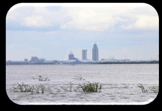
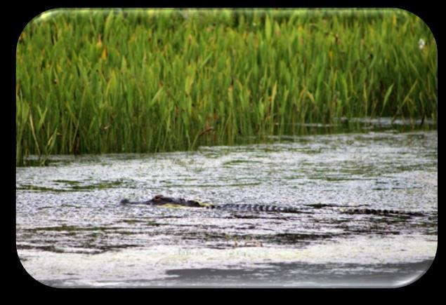
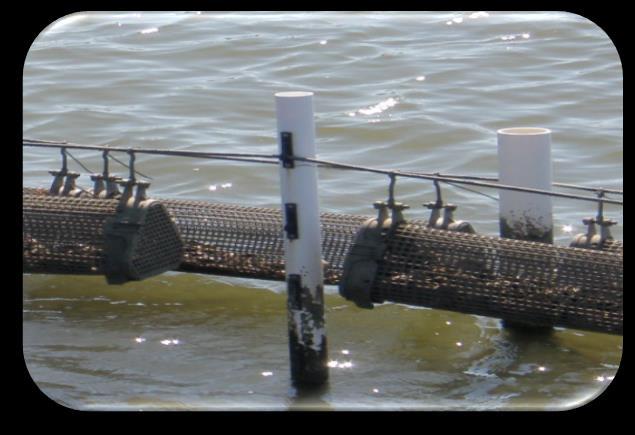
4 Community Concerns Image Credit: Mobile Bay Eco Forecasting II Team Image Credit: Mobile Bay Eco Forecasting II Team Image Credit: Mobile Bay Eco Forecasting II Team Image Credit: Mobile Bay Eco Forecasting II Team Pollution Trash Dumping Water Quality Turbidity Image Credit: Mobile Bay Eco Forecasting II Team Image Credit: Mobile Bay Eco Forecasting II Team Image Credit: Mobile Bay Eco Forecasting II Team Image Credit: National Oceanic and Atmospheric Administration Marsh Extent Urbanization Ecological Diversity Economic Cost


5 Study Area and Period The study area included Mobile and Baldwin Counties, located in Coastal Alabama Study Period: Jan 1987-May 2016 Forecast models and maps through 2030 MARSH HEALTH FORECAST Alabama Study Area ± Kilometers MARSH EXTENT URBANIZATION Image Source: Mobile Bay Eco Forecasting II Team
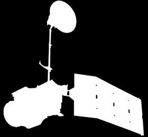


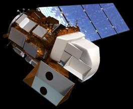

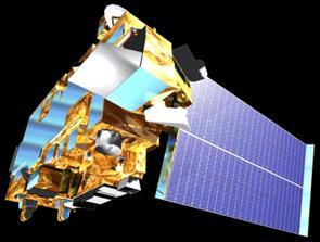

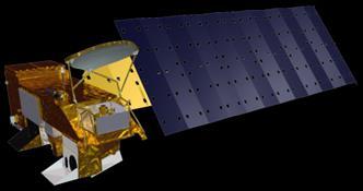

6 NASA Satellites and Sensors Used Landsat 5 - TM Landsat 7 ETM+ Landsat 8 - OLI AQUA - MODIS TERRA - MODIS Image Credit: NASA

 Calculated")

7 Methodology: Marsh Extent Analysis Landsat's 5, 7 and 8 images from , once every 5 years Stack of 4 images each year (12 band composite) Calculated reflectance at the top of the atmosphere Segmented Images Used segments to create training samples Data


8 Methodology: Marsh Extent Analysis Produced Land Cover Map Masked out everything but the marshes Calculated area of marshes for each year Analysis Water Woody Wetland Urban Non-Woody Wetland Upland Herbaceous Barren Upland Forest
 and Katrina (2005) Drought (2006 & 2007), Winter (2010) Conservation efforts &/or natural")
9 Acres Results: Marsh Extent Marsh Extent Years Marsh Extent Marsh extent increasingly changed from 1987 to 2001 Between 2001 and 2006, extent has dropped significantly Hurricanes Ivan (2004) and Katrina (2005) Drought (2006 & 2007), Winter (2010) Conservation efforts &/or natural regeneration
 (2001-2011) National Land Cover Databases (2001-2011) NDISI Formula: TIR-(VIS+NIR+SWIR)/3 TIR+(VIS+NIR-SWIR)/3 ISAT: C-CAP, NLCD,")
10 Methodology: Urban Development Analysis Methods and Software Normalized Difference Impervious Surface Index (NDISI) NOAA Impervious Surface Analysis Tool (ISAT) Top of atmosphere reflectance Data 2015 Landsat 8 Images NOAA Coastal Change Analysis Program (C- CAP) ( ) National Land Cover Databases ( ) NDISI Formula: TIR-(VIS+NIR+SWIR)/3 TIR+(VIS+NIR-SWIR)/3 ISAT: C-CAP, NLCD, and HUC-12 watershed shapefiles to estimate risk, percent imperviousness, and impervious surface area Impervious Surfaces 2015 Value High : 1.00 Low: 0.16 Analysis ± Miles
11 Acres Results: Urban Development Impervious Surface Growth in Priority Watersheds R² = (Estimated) Years Impervious Surfaces Trend Line Impervious surfaces increased by over 24% in priority watersheds from Addition of acres of impervious surfaces Average growth of +2.4 percent each year Seven watersheds exceed 10% surface imperviousness including four priority watersheds Additional eight watersheds fall into 5-10% warning category Many of these watersheds contain marshes


12 Results: Urban Development Percent Imperviousness Average
13 Methodology: Marsh Health Trends Software and Manipulation 8-Day MODIS Composite NDVI Images from the USDA Forest Service ForWarn Dataset from 2000 to 2014 ArcGIS and model builder Microsoft Excel Maps and excel time series plots displaying the diversity of health trends in the study area Datasets Analysis

14 Methodology: Marsh Health Trends NDVI was selected because it is calibrated for chlorophyll in the leaves of plants This detects seasonality in plant types as well as significant change in biodiversity and leaf coverage Works by comparing the amount of near infrared light reflected from each pixel to the amount of red light reflected


15 Methodology: Marsh Health Trends Marsh health trends were generated using the model pictured at left This model created graphs in Microsoft Excel and maps to spatially analyze relative trends Percent maximum was used to account for different plant species Mask PMAX Wetlands
16 Percentage of Max Results: Marsh Health Palustrine (PST) vs. Estuarine (EST) These differences in vegetation can be seen in the health patterns Trend lines were also drawn, indicating a downward trend in both palustrine and estuarine wetlands, with the palustrine health declining faster than the estuarine Years PST PMAX EST PMAX Linear (PST PMAX) Linear (EST PMAX)


17 Results: Marsh Health PMAX Other interesting features can be determined from the trends, such as hurricanes, droughts, and harsh winters Little Lagoon Hurricane Ivan Little Lagoon was hit directly by Hurricane Ivan in 2004 and then a drought two years later in 2006, significantly affecting the health
18 Percentage of Max Results: Marsh Health Little Lagoon These trends can help to pinpoint areas in need of restoration following significant stressing events Years Ivan PMAX Linear (PMAX)

19 Conclusions Impervious surface areas are increasing in priority watersheds Marsh extent declined during study period but there is evidence of recovery Overall wetland health trends are downward Health trends seem to be most impacted by weather conditions and urbanization

20 Errors and Uncertainties Spatial and temporal resolution In situ monitoring Ground truth validation Atmospheric correction Cloud Removal Processing time


21 Acknowledgements Bernard Eichold, M.D., Dr. PH, Mobile County Health Department Kenton Ross, Ph. D., NASA Langley Research Center Saranee Dutta, Previous contributor Vishal Arya, Previous contributor Jeanett Bosarge, Previous contributor Courtney Kirkham, Previous contributor Mark Berte, Alabama Coastal Foundation Just Cebrian, Ph. D., Dauphin Island Sea Lab Mobile Bay National Estuary Program Eastern Forest Environmental Threat Assessment Center of the USDA Forest Service Any opinions, findings, and conclusions or recommendations expressed in this material are those of the author(s) and do not necessarily reflect the views of the National Aeronautics and Space Administration. This material is based upon work supported by NASA through contract NNL11AA00B and cooperative agreement NNX14AB60A.
To provide timely, accurate, and useful statistics in service to U.S. agriculture
 NASS MISSION: To provide timely, accurate, and useful statistics in service to U.S. agriculture What does NASS do? Administer USDA s Statistical Estimating Program Conduct the 5-year Census of Agriculture
Real-time Live Fuel Moisture Retrieval with MODIS Measurements
 Real-time Live Fuel Moisture Retrieval with MODIS Measurements Xianjun Hao, John J. Qu 1 {xhao1, jqu}@gmu.edu School of Computational Science, George Mason University 4400 University Drive, Fairfax, VA
30 Years of Tree Canopy Cover Change in Unincorporated and Incorporated Areas of Orange County,
 30 Years of Tree Canopy Cover Change in Unincorporated and Incorporated Areas of Orange County, 1986-2016 Final Report to Orange County July 2017 Authors Dr. Shawn Landry, USF Water Institute, University
Role and importance of Satellite data in the implementation of the COMIFAC Convergence Plan
 Plenary Meeting of the Congo Basin Forest Partnership (CBFP) Palais des Congrès, Yaoundé. Cameroon 11-12 November, 2009 Role and importance of Satellite data in the implementation of the COMIFAC Convergence
Regional Ecosystem Analysis Puget Sound Metropolitan Area
 Final Report: 7/25/98 Regional Ecosystem Analysis Puget Sound Metropolitan Area Calculating the Value of Nature Report Contents 2 Project Overview and Major Findings 3 Regional Level Analysis 4 Neighborhood
Mapping water constituents concentrations in estuaries using MERIS full resolution satellite data
 Mapping water constituents concentrations in estuaries using MERIS full resolution satellite data David Doxaran, Marcel Babin Laboratoire d Océanographie de Villefranche UMR 7093 CNRS - FRANCE In collaboration
Using the ForWarn System
 Highlights of Satellite-Based Forest Change Recognition and Tracking Using the ForWarn System Steven P. Norman, William W. Hargrove, Joseph P. Spruce, William M. Christie, and Sean W. Schroeder ii Table
The Forest Changescape: a view from above
 The Forest Changescape: a view from above Daniel J. Hayes ORNL Environmental Science Division SAMSI - Program on Mathematical and Statistical Ecology (ECOL) Workshop Wednesday, 20 August 2014 Research
Expert Meeting on Crop Monitoring for Improved Food Security, 17 February 2014, Vientiane, Lao PDR. By: Scientific Context
 Satellite Based Crop Monitoring & Estimation System for Food Security Application in Bangladesh Expert Meeting on Crop Monitoring for Improved Food Security, 17 February 2014, Vientiane, Lao PDR By: Bangladesh
Satellite image classification of vegetation and surface water for assessment of flood damage to agricultural crops
 Satellite image classification of vegetation and surface water for assessment of flood damage to agricultural crops Lisa Colson 2, Mark Lindeman 1, Dath Mita 1, Tatiana Nawrocki 2, Paulette Sandene 1,
INTRODUCTION cont. INTRODUCTION. What is Impervious Surface? Implication of Impervious Surface
 Mapping Impervious Surface Changes In Watersheds In Part Of South Eastern Region Of Nigeria Using Landsat Data By F. I. Okeke Department of Geoinformatics and Surveying, University of Nigeria, Enugu Campus
Remote sensing technology contributes towards food security of Bangladesh
 American Journal of Remote Sensing 2013; 1(3): 67-71 Published online June 20, 2013 (http://www.sciencepublishinggroup.com/j/ajrs) doi: 10.11648/j.ajrs.20130103.12 Remote sensing technology contributes
Remote Sensing (C) School Name: Student Name(s):
 School Name: Student Name(s):") School Name: Student Name(s): Remote Sensing (C) Nebraska Science Olympiad State Competition University of Nebraska-Lincoln Saturday, April 2 nd 2011 Question and Answer Sheet 100 points total Show all
School Name: Student Name(s): Remote Sensing (C) Nebraska Science Olympiad State Competition University of Nebraska-Lincoln Saturday, April 2 nd 2011 Question and Answer Sheet 100 points total Show all
Deforestation in the Kayabi Indigenous Territory: Simulating and Predicting Land Use and Land Cover Change in the Brazilian Amazon
 Deforestation in the Kayabi Indigenous Territory: Simulating and Predicting Land Use and Land Cover Change in the Brazilian Amazon Hugo de Alba 1, Joana Barros 2 GEDS, Birkbeck, University of London, Malet
Utilization of the SWAT Model and Remote Sensing to Demonstrate the Effects of Shrub Encroachment on a Small Watershed
 Utilization of the SWAT Model and Remote Sensing to Demonstrate the Effects of Shrub Encroachment on a Small Watershed Jason Afinowicz Department of Biological and Agricultural Engineering Texas A&M University
THE IMPACTS OF URBANIZATION ON THE SURFACE ALBEDO IN THE YANGTZE RIVER DELTA IN CHINA
 THE IMPACTS OF URBANIZATION ON THE SURFACE ALBEDO IN THE YANGTZE RIVER DELTA IN CHINA 08/24/2011 Mélanie Bourré Motivation Since the 20th century, rapid urbanization of the world population. United Nation
Critical review of the Climate Change Impact on urban areas by assessment of Heat Island effect. Case of Pune, India
 Critical review of the Climate Change Impact on urban areas by assessment of Heat Island effect. Case of Pune, India Abstract O.G. Parishwad 1*, V. Shinkar 2 1, 2 College of Engineering, Pune, India *
EVALUATING THE ACCURACY OF 2005 MULTITEMPORAL TM AND AWiFS IMAGERY FOR CROPLAND CLASSIFICATION OF NEBRASKA INTRODUCTION
 EVALUATING THE ACCURACY OF 2005 MULTITEMPORAL TM AND AWiFS IMAGERY FOR CROPLAND CLASSIFICATION OF NEBRASKA Robert Seffrin, Statistician US Department of Agriculture National Agricultural Statistics Service
New Jersey Forest Stewardship Program Spatial Analysis Project Map Products And Data Layers Descriptions
 New Jersey Forest Stewardship Program Spatial Analysis Project 2007 Map Products And Data Layers Descriptions 01/07 NJ Forest Stewardship Program (FSP) Spatial Analysis Project (SAP) Methodology Project
Crop Growth Remote Sensing Monitoring and its Application
 Sensors & Transducers 2014 by IFSA Publishing, S. L. http://www.sensorsportal.com Crop Growth Remote Sensing Monitoring and its Application Delan Xiong International School of Education, Xuchang University,
Nutrient Loading: NAWQA Regional SPARROW model
 Nutrient Loading: NAWQA Regional SPARROW model Pee Dee River Basin and Winyah Bay Estuary Waccamaw Water Quality Data Conference Wednesday, September 19, 2013 Celeste Journey, Water-Quality Specialist
Future remote sensors for chlorophyll a. Dimitry Van der Zande, Quinten Vanhellemont & Kevin Ruddick
 Future remote sensors for chlorophyll a Dimitry Van der Zande, Quinten Vanhellemont & Kevin Ruddick Workshop Scheldt Commission: eutrophication 20 th October 2016 Ocean colour from space ESA MERIS 7 May
Remotely-Sensed Fire Danger Rating System to Support Forest/Land Fire Management in Indonesia
 Remotely-Sensed Fire Danger Rating System to Support Forest/Land Fire Management in Indonesia Orbita Roswintiarti Indonesian National Institute of Aeronautics and Space (LAPAN) SE Asia Regional Research
ASSESSMENT OF TEMPORAL AND SPATIAL ALTERATION IN COASTAL LAKES - EGYPT
 ASSESSMENT OF TEMPORAL AND SPATIAL ALTERATION IN COASTAL LAKES - EGYPT ABSTRACT Hala Abayazid Coastal Research Institute, National Water Research Center, Egypt, E-mail: halazid@yahoo.com Northern region
To Understand and Protect Our Home Planet: An Overview of the Applications of National Priority
 To Understand and Protect Our Home Planet: An Overview of the Applications of National Priority Jared K. Entin Program Manager, Water Management Applied Sciences Program Science Mission Directorate 1 Remote
Climate-Informed Water Resources in the Southeast United States. Rachel M. Gregg June 2015
 Climate-Informed Water Resources in the Southeast United States Rachel M. Gregg June 2015 Responding to Climate Change Mitigation is what we do to decrease the potential of climate change itself. Adaptation
Towards a European Forest Fire Simulator
 Towards a European Forest Fire Simulator J.M. Baetens Research Unit Knowledge-based Systems Ghent University COST Green Engineering Camp July 2, 2012 KERMIT J.M. Baetens (KERMIT) A European Forest Fire
LAND AND WATER - EARTH OBSERVATION INFORMATICS FSP
 Earth Observation for Water Resources Management Arnold Dekker,Juan P Guerschman, Randall Donohue, Tom Van Niel, Luigi Renzullo,, Tim Malthus, Tim McVicar and Albert Van Dijk LAND AND WATER - EARTH OBSERVATION
Maritime Forest Ridge and Marsh Recreation Project
 Maritime Forest Ridge and Marsh Recreation Project At Port Fourchon AAPA Environmental Awards June 1, 2006 Contact: Paula Schouest, Public Information Coordinator (985) 632-6701, paulas@portfourchon.com
Supplementary Material. A - Population density
 Gond, V. et al. Vegetation structure and greenness in Central Africa from MODIS multitemporal data. 2013. Phil Trans Roy Soc B 368 doi: 10.1098/rstb.2012.0309 Supplementary Material A - Population density
Remote Sensing in Support of Multilateral Environmental Agreements
 Remote Sensing in Support of Multilateral Environmental Agreements Alex de Sherbinin CIESIN, The Earth Institute, Columbia University Presented at the Satellites and the Law Enforcement Meeting London,
FOREST COVER MAPPING AND GROWING STOCK ESTIMATION OF INDIA S FORESTS
 FOREST COVER MAPPING AND GROWING STOCK ESTIMATION OF INDIA S FORESTS GOFC-GOLD Workshop On Reducing Emissions from Deforestations 17-19 April 2007 in Santa Cruz, Bolivia Devendra PANDEY Forest Survey of
Adapting Living Shorelines: Siting and Design for Climate Impacts
 Adapting Living Shorelines: Siting and Design for Climate Impacts Molly Mitchell & Donna Marie Bilkovic Monitoring and Assessing Impacts of Changes in Weather Patterns and Extreme Events on BMP Siting
Recent HARVIST Results: Classifying Crops from Remote Sensing Data
 Recent HARVIST Results: Classifying Crops from Remote Sensing Data Kiri Wagstaff and Dominic Mazzoni (kiri.wagstaff@jpl.nasa.gov) Jet Propulsion Laboratory, California Institute of Technology, 4800 Oak
Remotely-Sensed Carbon and Water Variations in Natural and Converted Ecosystems with Time Series MODIS Data
 Remotely-Sensed Carbon and Water Variations in Natural and Converted Ecosystems with Time Series MODIS Data Alfredo Ramon Huete 1 Piyachat Ratana 1 Yosio Edemir Shimabukuro 2 1 University of Arizona Dept.
SOUTHERN INDIANA 2008 FLOODS: DAMAGE ASSESSMENT AND WEB MAPPING
 SOUTHERN INDIANA 2008 FLOODS: DAMAGE ASSESSMENT AND WEB MAPPING Ejaz Hussain KyoHyouk kkim Jie Shan, Associate Professor {ehussain,kim458,jshan}@,j purdue.edu Tel:765-494-2168 School Of Civil Engineering
User Awareness & Training: LAND. Tallinn, Estonia 9 th / 10 th April 2014 GAF AG
 User Awareness & Training: LAND Tallinn, Estonia 9 th / 10 th April 2014 GAF AG Day 2 - Contents LAND (1) General Introduction to EO and the COPERNICUS Sentinel Programme Overview of COPERNICUS/GMES LAND
Crop Growth Monitor System with Coupling of AVHRR and VGT Data 1
 Crop Growth Monitor System with Coupling of AVHRR and VGT Data 1 Wu Bingfng and Liu Chenglin Remote Sensing for Agriculture and Environment Institute of Remote Sensing Application P.O. Box 9718, Beijing
GLOBAL CLIMATE CHANGE
 1 GLOBAL CLIMATE CHANGE From About Transportation and Climate Change (Source; Volpe center for Climate Change and Environmental forecasting, http://climate.volpe.dot.gov/trans.html Greenhouse effect has
Remote sensing as a tool to detect and quantify vegetation properties in tropical forest-savanna transitions Edward Mitchard (University of Edinburgh)
") Remote sensing as a tool to detect and quantify vegetation properties in tropical forest-savanna transitions Edward Mitchard (University of Edinburgh) Presentation to Geography EUBAP 10 th Oct 2008 Supervisor:
Remote sensing as a tool to detect and quantify vegetation properties in tropical forest-savanna transitions Edward Mitchard (University of Edinburgh) Presentation to Geography EUBAP 10 th Oct 2008 Supervisor:
CALFED Ecosystem Restoration Program (ERP)
") CALFED Ecosystem Restoration Program (ERP) The goal of the Ecosystem Restoration Program is to improve and increase aquatic and terrestrial habitats and improve ecological functions in the Bay-Delta to
CALFED Ecosystem Restoration Program (ERP) The goal of the Ecosystem Restoration Program is to improve and increase aquatic and terrestrial habitats and improve ecological functions in the Bay-Delta to
Field Survey and Satellite Validation of Water Quality Parameters of Rivers in the Surroundings of Santo Domingo Metropolitan Area, Dominican Republic
 EMECS 9 (Baltimore, 27 31 August 2011) Field Survey and Satellite Validation of Water Quality Parameters of Rivers in the Surroundings of Santo Domingo Metropolitan Area, Dominican Republic Hiroshima University
Forest and Land Cover Monitoring by Remote Sensing Data Analysis
 Low Carbon Asia Research Network (LoCARNet) 3rd Annual Meeting Bogor, Indonesia November 24 26, 2014 Forest and Land Cover Monitoring by Remote Sensing Data Analysis Muhammad Ardiansyah Center for Climate
Center for Urban Rural Interface Studies. Pearl River County, Mississippi Land Cover Analysis
 Center for Urban Rural Interface Studies Pearl River County, Mississippi Land Cover Analysis Introduction The Center for Urban Rural Interface Studies (CURIS) created land cover maps for its focus area
Kevin L. Erwin CE PWS Kevin L. Erwin Consulting Ecologist, Inc Bayside Parkway Ft. Myers, Florida USA
 Kevin L. Erwin CE PWS Kevin L. Erwin Consulting Ecologist, Inc. 2077 Bayside Parkway Ft. Myers, Florida 33901 USA The Lee County DR/GR: Implications for future restoration and management Estero Bay Watershed
A PILOT STUDY FOR ASSESSING FRESHWATER FLOW IMPACTS TO LOUISIANA ESTUARIES
 A PILOT STUDY FOR ASSESSING FRESHWATER FLOW IMPACTS TO LOUISIANA ESTUARIES Ryan Clark, Melissa Baustian, Eric White, Yushi Wang, Andrea Jerabek, and Harris Bienn Louisiana Water Conference March 27, 2018
GeoCarb. PI: Berrien OU (Leadership, science analysis)
") PI: Berrien Moore @ OU (Leadership, science analysis) Partner Institutions: Lockheed-Martin (instrument) CSU (Algorithms) NASA Ames (Validation) GeoCarb A NASA Earth-Ventures mission, awarded in Dec 2016,
PI: Berrien Moore @ OU (Leadership, science analysis) Partner Institutions: Lockheed-Martin (instrument) CSU (Algorithms) NASA Ames (Validation) GeoCarb A NASA Earth-Ventures mission, awarded in Dec 2016,
Integrating Water Quality and Natural Filters into Maryland s Marine Spatial Planning Efforts
 Integrating Water Quality and Natural Filters into Maryland s Marine Spatial Planning Efforts Nicole Carlozo NOAA Coastal Management Fellow July 31, 2014 Watershed-scale restoration targeting helps direct
Center for Urban Rural Interface Studies. St. John the Baptist Parish, Louisiana Land Cover Analysis
 Center for Urban Rural Interface Studies St. John the Baptist Parish, Louisiana Land Cover Analysis Introduction The Center for Urban Rural Interface Studies (CURIS) created land cover maps for its focus
TARGETING WATERSHEDS FOR RESTORATION ACTIVITIES IN THE CHESAPEAKE BAY WATERSHED. Technical Documentation October 4, 2002
 TARGETING WATERSHEDS FOR RESTORATION ACTIVITIES IN THE CHESAPEAKE BAY WATERSHED Technical Documentation October 4, 2002 Acknowledgements and Disclaimer This project was funded by the Chesapeake Bay Foundation,
Marine Board Spring Meeting April 27, 2011 David M. Kennedy
 Marine Board Spring Meeting April 27, 2011 David M. Kennedy NOS Organization 2 NOAA Next Generation Strategic Plan National Ocean Policy and Coastal Goal NOAA s Coastal Goal Objectives Resilient coastal
Climate Change Impacts: Caribbean
 a work in progress Climate Change Impacts: watersheds of Mesoamerica and the Caribbean Water quality and availability Flood potential Context CATHALAC & SERVIR Climate Change and Biodiversity Increasing
Agricultural Aerial Services
 Agricultural Aerial Services Satellite Imagery Satellite LOW Imagery RESOLUTION IMAGE LOW RESOLUTION IMAGE Satellite Imagery LOW RESOLUTION IMAGE High Resolution Imagery High Resolution SUPERIOR Imagery
Integrated Modeling: ENVISION
 Integrated Modeling: ENVISION Cimarron River Watershed Gehendra Kharel Oklahoma State University Cimarron River Watershed Research and Extension Symposium November 17, 2016 1 Research, Data Archiving,
Tidal Creek Ecosystems: Consequences of Rapid Coastal Development
 Tidal Creek Ecosystems: Sentinel Habitats for Assessing the Consequences of Rapid Coastal Development Denise Sanger, SC Sea Grant Consortium Derk Bergquist, SC Dept of Natural Resources Fred Holland, NOAA
Remote sensing: A suitable technology for crop insurance?
 Remote sensing: A suitable technology for crop insurance? Geospatial World Forum 2014 May 9, 2014, Geneva, Switzerland Agenda 1. Challenges using RS technology in crop insurance 2. Initial situation Dominance
Appendix E: Regional Ecosystem Framework Methodology and Calculations
 The data utilized in this scoring methodology are derived from the U.S. Environmental Protection Agency (EPA) Region 6 Geographic Information Systems Screening Tool (GISST) User s Manual, the Texas Grid,
Dynamic Maps of Open Surface Water Bodies in Oklahoma at 30- m Spatial Resolution during
 Dynamic Maps of Open Surface Water Bodies in Oklahoma at 30- m Spatial Resolution during 1984-2014 Xiangming Xiao Center for Spatial Analysis Earth Observation and Modeling Facility Department of Microbiology
Five Ways How Geospatial Technologies are Transforming Conservation in Practice
 Five Ways How Geospatial Technologies are Transforming Conservation in Practice Lilian Pintea Vice President, Conservation Science the Jane Goodall Institute lpintea@janegoodall.org Photo: Launching an
FORMA: Forest Monitoring for Action
 FORMA: Forest Monitoring for Action FORMA uses freely-available satellite data to generate rapidly-updated online maps of tropical forest clearing. We have designed it to provide useful information for
Monitoring Trends in Burn Severity (MTBS) Project Overview
 Project Overview") Monitoring Trends in Burn Severity (MTBS) Project Overview Adrian Grell US Forest Service Remote Sensing Applications Center Webinar for the Northern Rockies Fire Science Network February 6, 2013 Consistently
Monitoring Trends in Burn Severity (MTBS) Project Overview Adrian Grell US Forest Service Remote Sensing Applications Center Webinar for the Northern Rockies Fire Science Network February 6, 2013 Consistently
A Report on Existing and Possible Tree Canopy in the City of Charlotte and Mecklenburg County, NC
 A Report on Existing and Possible Tree Canopy in the City of Charlotte and Mecklenburg County, NC Why is Tree Canopy Important? Tree canopy (TC) is the layer of leaves, branches, and stems of trees that
Instructions to Regional Planners
 Module 1 Educator s Guide, Handout 3: Regional Planner Instructions Investigation 1 Instructions to Regional Planners You are a planner on the Chesapeake Bay regional planning council. Prior to the town
DRAFT Grassland/Prairie/Savanna in the East and West Gulf Coastal Plain (EWGCP)
") DRAFT Grassland/Prairie/Savanna in the East and West Gulf Coastal Plain (EWGCP) This Assessment has not yet been peer reviewed. From the Executive Summary of the 2016 State of the GCPO PHOTOS, CITATION,
DRAFT Grassland/Prairie/Savanna in the East and West Gulf Coastal Plain (EWGCP) This Assessment has not yet been peer reviewed. From the Executive Summary of the 2016 State of the GCPO PHOTOS, CITATION,
Monitoring and modeling agricultural drought for famine early warning
 Monitoring and modeling agricultural drought for famine early warning James Verdin Chris Funk, Michael Budde, Ronald Lietzow, Gabriel Senay, Ronald Smith, Diego Pedreros 1 James Rowland, Guleid Artan 2
NIAGARA RIVER WATERSHED MANAGEMENT PLAN (Phase 1) Buffalo Sewer Authority (BSA), Long Term Control Plan, Buffalo: BSA, 2012
 Buffalo Sewer Authority (BSA), Long Term Control Plan, Buffalo: BSA, 2012") Bibliography Alden, M., Mortsch, L., Sheraga, J., Climate Change & Water Quality in the Great Lakes Region: Risks, Opportunities & Responses. Detroit: Report of the Great Lakes Water Quality Board to the
Bibliography Alden, M., Mortsch, L., Sheraga, J., Climate Change & Water Quality in the Great Lakes Region: Risks, Opportunities & Responses. Detroit: Report of the Great Lakes Water Quality Board to the
Climate Change, Human Activities, and the State of New Jersey. Michael J. Kennish Institute of Marine and Coastal Sciences Rutgers University
 Climate Change, Human Activities, and the State of New Jersey Michael J. Kennish Institute of Marine and Coastal Sciences Rutgers University New Jersey Climate and Environmental Change Conclusions from
Elkhorn Slough Researchers Link Salt Marsh Dieback to Algal Blooms Generated by Increased Nutrients
 MEDIA RELEASE For immediate release: June 5, 2017 For more information: Lorili Toth, Director of Development & Communications Elkhorn Slough Foundation Email: Lorili@elkhornslough.org phone: 831.728.5939
CHESAPEAKE BAY COMPREHENSIVE WATER RESOURCES AND RESTORATION PLAN. Habitat GIT Meeting 9 May 2017
 CHESAPEAKE BAY COMPREHENSIVE WATER RESOURCES AND 255 255 255 237 237 237 0 0 0 217 217 217 163 163 163 200 200 200 131 132 122 239 65 53 80 119 27 RESTORATION PLAN 110 135 120 252 174.59 112 92 56 62 102
What s Your Drought Vulnerability? (Surviving the Drought of )
") What s Your Drought Vulnerability? (Surviving the Drought of 2012-2014) Jay Jasperse, P.E. Chief Engineer Sonoma County Water Agency February 21, 2014 www.sonomacountywater.org Historical Ukiah Precipitation
What s Your Drought Vulnerability? (Surviving the Drought of 2012-2014) Jay Jasperse, P.E. Chief Engineer Sonoma County Water Agency February 21, 2014 www.sonomacountywater.org Historical Ukiah Precipitation
Zu-Tao Ou-Yang Center for Global Change and Earth Observation Michigan State University
 Zu-Tao Ou-Yang Center for Global Change and Earth Observation Michigan State University Ocean Color: Spectral Visible Radiometry Color of the ocean contains latent information on the water qualitycdom,
MONITORING LAND USE AND LAND USE CHANGES IN FRENCH GUIANA BY OPTICAL REMOTE SENSING
 MONITORING LAND USE AND LAND USE CHANGES IN FRENCH GUIANA BY OPTICAL REMOTE SENSING Photo : Valéry Gond Photo : Valéry Gond Photo Photo : Gaëlle : : Valéry VERGER Gond Gaëlle VERGER ONF, French National
Rangeland Conservation Effects Assessment Program (CEAP)
") Rangeland Conservation Effects Assessment Program (CEAP) Program Overview with Emphasis on the Literature Review of Rangeland Practices Pat L. Shaver, PhD Rangeland Management Specialist USDA-NRCS West
Rangeland Conservation Effects Assessment Program (CEAP) Program Overview with Emphasis on the Literature Review of Rangeland Practices Pat L. Shaver, PhD Rangeland Management Specialist USDA-NRCS West
Assessment of Land Use Change in the Coterminous. Organization of the United Nations
 Assessment of Land Use Change in the Coterminous United States and Alaska for Global Assessment of Forest Loss Conducted by the Food and Agricultural Organization of the United Nations Tanushree Biswas,
November 24, The Honorable Shaun Donovan Director, Office of Management and Budget th Street, NW Washington, DC 20503
 The Honorable Shaun Donovan Director, Office of Management and Budget 725 17 th Street, NW Washington, DC 20503 Dear Director Donovan: November 24, 2014 As supporters, stakeholders, employees, and partners
INTRODUCTION. STEP M Executive Summary 1
 INTRODUCTION Global migration is a long-standing behavioral trait of humankind that has shaped our existing and ever-changing population distribution. As the global population has increased seven-fold
Major atmospheric emissions from peat fires in SEA during non-drought years: Evidence from the 2013 Sumatran fires David Gaveau
 SOCP/YEL Paul Hilton/SOCP/YEL Reuters Major atmospheric emissions from peat fires in SEA during non-drought years: Evidence from the 2013 Sumatran fires David Gaveau Salim MA, Hergoualc h K, Locatelli
3/1/18 USING RADAR FOR WETLAND MAPPING IMPORTANCE OF SOIL MOISTURE TRADITIONAL METHODS TO MEASURE SOIL MOISTURE. Feel method Electrical resistance
 3/1/18 USING RADAR FOR WETLAND MAPPING SOIL MOISTURE AND WETLAND CLASSIFICATION Slides modified from a presentation by Charlotte Gabrielsen for this class. Southeast Arizona: Winter wet period From C.
Tree Canopy Mapping & Modeling of Ecosystem Services for Georgia Communities
 Brown Bag Webinar March 31, 2010 Tree Canopy Mapping & Modeling of Ecosystem Services for Georgia Communities AGRICULTURE COMMERCIAL INDUSTRIAL/OFFICE PROW PUBLIC/SEMI-PUBLIC RESIDENTIAL VACANT 0 1,000
Lower Columbia River Pile Dike Assessment
 Lower Columbia River Pile Dike Assessment David Gorman, PE August 2, 2011 Credits Hans R. Moritz, US Army Corps of Engineers Portland District Carl Kassebaum, AECOM Project Manager AECOM Coastal and Rivers
Estimation of chlorophyll-a concentration in estuarine waters:
 Estimation of chlorophyll-a concentration in estuarine waters: case study of the Pearl River estuary Yuanzhi Zhang *, Chuqun Chen #, Hongsheng Zhang *, Xiaofei*, Chen Guiying Chen# *Institute of Space
Agricultural monitoring of Russia using Remote Sensing: an overview
 Russian Academy of Sciences Space Research Institute Agricultural monitoring of Russia using Remote Sensing: an overview Savin I., Bartalev S., Loupian E. Some features of R&D at IKI Focus is on national
Elin Betanzo July 14, 2015
 Water Data to Answer Urgent Water Policy Questions: Harmful Algal Blooms, Agriculture, and Lake Erie Elin Betanzo July 14, 2015 Harmful Algal Blooms in Lake Erie Photo: NOAA Satellite Image What Causes
Using Landsat Imagery and FIA Data to Examine Wood Supply Uncertainty
 Using Landsat Imagery and FIA Data to Examine Wood Supply Uncertainty Curtis A. Collins 1 and Ruth C. Seawell 2 Abstract: As members of the forest products industry continue to reduce their landholdings,
A North-American Forest Disturbance Record from Landsat Imagery
 GSFC Carbon Theme A North-American Forest Disturbance Record from Landsat Imagery Jeffrey Masek, NASA GSFC Forrest G. Hall, GSFC & UMBC Robert Wolfe, GSFC & Raytheon Warren Cohen, USFS Corvallis Eric Vermote,
Risk of Amazon rainforest dieback is higher than IPCC
 PUBLIC RELEASE DATE: 21-Oct-2013 [ Print E-mail ] Share [ Close Window ] Risk of Amazon rainforest dieback is higher than IPCC projects A new study suggests the southern portion of the Amazon rainforest
Afforestation/Reforestation Afforestation/Reforestation Clean Development Mechanism Projects in Uttar Pradesh State August
 Afforestation/Reforestation Clean Development Mechanism Projects in Uttar Pradesh State August 9, 2014 Suresh Chauhan TERI, New Delhi Presentation outlines 1. Guidelines for preparing Project Design Document
King County, Washington Climate Change Adaptation Efforts
 King County, Washington Climate Change Adaptation Efforts Models for Adapting to Climate Change New Partners for Smart Growth Conference Seattle, WA, Feb. 4, 2010 Matt Kuharic (matt.kuharic@kingcounty.gov)
Remote Sensing (C) Team Name: Student Name(s):
 Team Name: Student Name(s):") Team Name: Student Name(s): Remote Sensing (C) Nebraska Science Olympiad Regional Competition Henry Doorly Zoo Saturday, February 27 th 2010 96 points total Please answer all questions with complete sentences
Team Name: Student Name(s): Remote Sensing (C) Nebraska Science Olympiad Regional Competition Henry Doorly Zoo Saturday, February 27 th 2010 96 points total Please answer all questions with complete sentences
NASA and Carbon Management
 NASA Land-Cover and Land-Use Change Science Team Meeting NASA and Carbon Management Ed Sheffner Earth Science Division April 11, 2006 1 NASA Organization Four Mission Directorates: 1. Aeronautics 2. Exploration
Forest Biomass Change Detection Using Lidar in the Pacific Northwest. Sabrina B. Turner Master of GIS Capstone Proposal May 10, 2016
 Forest Biomass Change Detection Using Lidar in the Pacific Northwest Sabrina B. Turner Master of GIS Capstone Proposal May 10, 2016 Outline Relevance of accurate biomass measurements Previous Studies Project
NASA s Next Generation Earth-Observing Satellites; Opportunities for Global Change Research and Applications
 NASA s Next Generation Earth-Observing Satellites; Opportunities for Global Change Research and Applications By John Dwyer, USGS, EROS for NASA s Applied Sciences Program L. DeWayne Cecil Chief Scientist
Conservation Assessment & Prioritization System (CAPS)
") Conservation Assessment & Prioritization System (CAPS) Assessing ecological integrity and supporting decision-making for land conservation, habitat management, project review & permitting to protect biodiversity
Conservation Assessment & Prioritization System (CAPS) Assessing ecological integrity and supporting decision-making for land conservation, habitat management, project review & permitting to protect biodiversity
Laila Racevskis University of Florida, Food & Resource Economics Presented at the 9 th INTECOL International Wetlands Conference June 8, 2012,
 Laila Racevskis University of Florida, Food & Resource Economics Presented at the 9 th INTECOL International Wetlands Conference June 8, 2012, Orlando, FL Sea Level Rise & Coastal Ecosystems Global sea
Building resilience to extreme weather events
 Building resilience to extreme weather events Scott Vaughan Federal / Provincial / Territorial Deputy Ministers of Agriculture Fall Retreat October 29 th, 2014 Toronto, Ontario www.iisd.org 2014 The International
Update on NOAA Ocean Color Activities: VIIRS et al.
 Update on NOAA Ocean Color Activities: VIIRS et al. Cara Wilson, NOAA-NMFS Menghua Wang & Paul DiGiacomo, NOAA-NESDIS International Ocean Color Science Meeting Darmstadt, Germany, 6 May 2013 NMFS: National
LARGE SCALE SOIL MOISTURE MODELLING
 Soil Moisture Workshop LARGE SCALE SOIL MOISTURE MODELLING Giuseppe Formetta, Vicky Bell, and Eleanor Blyth giufor@nerc.ac.uk Centre for Ecology and Hydrology, Wallingford, UK Wednesday 25 th January 2017
Landsat 5 & 7 Band Combinations
 Landsat 5 & 7 Band Combinations By James W. Quinn Landsat 5 (TM sensor) Wavelength (micrometers) Resolution (meters) Band 1 0.45-0.52 30 Band 2 0.52-0.60
Developing the next generation of coastal water quality products and services - the FP7/HIGHROC project
 Developing the next generation of coastal water quality products and services - the FP7/HIGHROC project K. Ruddick, C. Brockmann, E. Capuzzo, K. Collingridge, S. Constantin, V. Créach, L. De Keukelaere,
Use of EO for integrated Coastal Zone Management [ICZM]
![Use of EO for integrated Coastal Zone Management [ICZM]](/thumbs/78/78380350.jpg "Use of EO for integrated Coastal Zone Management [ICZM]") Use of EO for integrated Coastal Zone Management [ICZM] Prof. George Zalidis Aristotle University of Thessaloniki, School of Agriculture Director of the Laboratory of Applied Soil Science Director of the
Use of EO for integrated Coastal Zone Management [ICZM] Prof. George Zalidis Aristotle University of Thessaloniki, School of Agriculture Director of the Laboratory of Applied Soil Science Director of the