Fish Passage Design for Roughened Channels. Pre-Presentation Note
|
|
|
- Alberta Cannon
- 6 years ago
- Views:
Transcription


1 NOAA 9/23/2010 Science, Service, Stewardship Aaron Beavers Hydraulic Engineer Fish Passage Design for Roughened Channels Northwest Region E.I.T. M.S.C.E. NOAA FISHERIES SERVICE Pre-Presentation Note The majority of material in this presentation is design concepts, techniques, and methods. Concepts, techniques, and methods ARE NOT NMFS CRITERIA. Please do not disseminate this presentation as NMFS criteria. 1
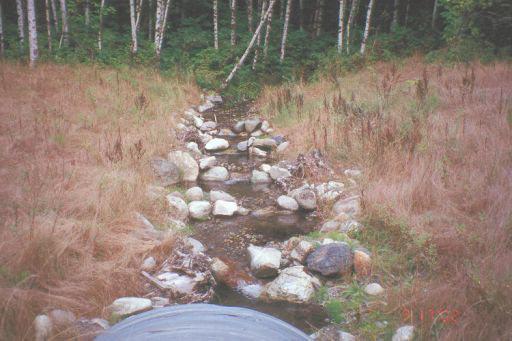
2 Background What Are Roughened Channels? Roughened Channels Rocky stream channel The main structure component is large rock. Used to Control stream grade Increase stream slope Other generic terms Rock ramps Roughened chutes 2

3 Roughened Channels Image: NOAA Roughened Channels Image: WDFW 3

4 Roughened Channels Image: USFS Roughened Channels Structure slope is > natural slope. Rock or roughness elements > natural channel. Higher velocities than natural channel. More turbulent than natural channel. 4

5 Roughened Channels Image: WDFW Roughened Channels Structure provides Debris transport Sediment transport Fish passage Elements provide Structure stability Fish refuge Hydraulic diversity 5

6 Background Design Guidance Design Guidance WDFW st design literature Appendix E Rock ramp approach Little experience Experimental Image: WDFW 6


7 Design Guidance USBR st comprehensive design guidance for rock ramps. Focus on large system application. Little experience Still experimental Image: USBR Design Guidance CDFG 2009 Introduces morphologic design approach. Better understanding of failure mechanisms. Moderate experience Small systems. Still experimental But more confidence in small system design. Image: CDFG 7
8 Recommendations Manuals ARE NOT NMFS criteria. Manuals ARE an excellent source of information for designers. BPA project managers become familiar with these documents. Provide as design references to BPA contractors and consultants. THESE DESIGNS ARE STILL CONSIDERED EXPERIMENTAL. Background A Simple Model of Flow Effects of Roughened Channels 8
9 Recommendations Recommendations 9
10 Recommendations 10
11 11
12 Discussion As flows increase Stream depth Stream slope Equations to calculate scour, velocity, and turbulence ALL depend on depth and slope! Discussion Highest velocity MAY occur at lower flows rather than at higher flows. Greatest turbulence MAY occur at lower flows rather than at higher flows. Greatest scour forces MAY occur at lower flows rather than at higher flows. 12
13 Fish Passage Implication High fish passage flow (5% exceedence) MAY NOT produce the highest velocities OR greatest turbulence across the roughened channel! Designers must evaluate several flows between the low and high fish passage flows to correctly evaluate fish passage! Structural Implication High design flow MAY NOT BE the most unstable flow across the roughened channel! Designers must determine what flow will cause the most structural instability and then design the framework elements based on that flow! 13
14 Designs & Methods Roughened Channels Designs & Methods Outline 1. Three degrees of design difficulty 2. Types 3. Design 14
15 Three Degrees of Difficulty 1. Design variables 2. Morphologic considerations 3. Modeling Design Variables Design variables (what you can change). Slope Cross section area Bed roughness Constraint (what you can t change). Discharge 15
16 Design Variables Designer changes variables to develop appropriate depths, velocity, turbulence, and scour. Variables must produces a design that is BOTH structurally stable and passes fish. REMEMBER: These components must be evaluated over a range of flows! Three Degrees of Difficulty 1. Design variables 2. Morphologic considerations 3. Modeling 16
17 Morphologic Considerations When you deviate too far from the natural stream template The stream will impose its natural pattern on the structure (failure). The structure may resist changes to such a degree that adverse hydraulic conditions are created. Morphologic Considerations The design should be as morphologically transparent as possible. Transitions between the structure and the natural channel must be as smooth and seamless as all constraints allow. Use of natural templates to facilitate better transitions. 17
18 Morphologic Considerations Transitions Slope Channel width Cross section area Roughness Planform OK Image: Montgomery & Buffington (1997) 18
19 Probably Not OK Image: Montgomery & Buffington (1997) General Stability Issues Steep rough engineered structures are inherently unstable. Stability of roughened channels rely heavily on large rock as ballast. Increasing rock size may increases turbulence which may lead to a porous design or a passage barrier. 19
20 Sediment Transport Discontinuities in stream slope and roughness create dissimilar sediment transport conditions. Dissimilar conditions induce changes in bed material size and composition. Relationships For steeper slopes (relative to the natural channel) material continues move when transport has ceased in the natural channel. Net loss of fines to gravel size material occurs. This condition effects structure porosity AND turbulence. Sub-surface flow or increased turbulence may create a passage barrier. 20

21 Turbulence Image: USBR Net Loss of Smaller Material 21
22 Net Loss of Smaller Material Net Loss of Smaller Material 22
23 Results Net loss of material increases roughness and turbulence. Net loss of material due to scour facilitates piping. Piping can also be the stand alone mechanism for removal of material. Piping 23
24 Problematic Applications Many roughened channels are built to retrofit lost stream grade at diversion dams and bridge aprons. Some designs have tried to incorporate material retention weirs. These applications bring their own set of problems to the design. Piping/Scour 24
25 Piping/Scour Piping/Scour/Transport 25
26 General Design Difficulties If we assume the framework of structure is stable (a big IF) we have three major design obstacles Creating low velocity migration paths. Stabilizing fines and gravels. Providing non-turbulent conditions. Design Process The design process is extremely iterative. Change in one stream condition or variable affects several other stream conditions or variables. 26
27 Design Process Three Degrees of Difficulty 1. Design variables 2. Morphologic considerations 3. Modeling 27
28 Modeling Designers use equations to model fish passage conditions in their channel design. Certain hydraulic conditions are assumed in these equations. When the hydraulic condition is violated the equation no longer produces valid results. Hydraulic Assumptions For most equations in open channel hydraulics the equations assume steady uniform flow. Velocity does not change with position in the stream or with time. Example: Constant discharge (flow) in a pipe with a constant diameter. 28
29 Hydraulic Assumptions Hydraulic Assumptions However velocity across a roughened channel is steady NON-uniform. Velocity changes from point to point in the stream but do not change with time. Example: Constant discharge (flow) in a pipe with a tapered diameter. 29
30 Hydraulic Assumptions Hydraulic Conditions 30
31 Hydraulic Assumptions Most equations assume a low relative roughness. However relative roughness in roughened channels is HIGH. Hydraulic Conditions 31
32 Invalid Assumptions Equations are ill-suited to accurately predict the fish passage conditions of the design. Only experience can bridge the unknown between model results and actual function. Little experience with roughened channels so designers are at a severe disadvantage. Selecting Roughness Value Paramount in modeling roughened channel designs is the selection of a roughness value. Simply defined, the roughness value models the rock size and the distance it protrudes above the streambed. Its really not that simple there other conditions which effect roughness. 32
33 Manning s n Typically the roughness value used is the Manning s n value. The value of n effects model output for ALL the other design variables. n is the only value we don t know or can solve for in the design. Overestimate n If we overestimate n velocities are higher and depth is shallower Is real world velocity and turbulence acceptable for fish passage? 33
34 Underestimate n If we underestimate n velocities are lower and depth is higher Is the design going to affect upstream landowners or infrastructure? Manning s n n values have been determined for a myriad of materials and conditions. Not for roughened channels the selection of a n value is there for a non-trivial matter. 34
35 Calculating n Where can we go to get a defendable n value? Experience (as before limited) Equations (assumptions are strained) Lets take a look at experience and equations anyway! Calculating n Several equations exist to model n. Highly technical procedure to select and use them. Each equation has a limited range of application. 35
36 Empirical Methods Image: CDFG Calculating n This method DEMANDS significant engineering experience which we ve already described as being limited due to the experimental nature of the design and a general lack of design specific data and research 36
37 Calibrated n Where ELSE can we go to get a defendable n value? Developed data (non-available) Calibrate from reference reach (?) Calibrated n USGS has some pretty picture data...but this method also has its drawbacks. Many designers are unaware of what they are. 37


38 Field Survey n Engineers often reference photos and associated data to ESTIMATE n. Image: USGS USGS Reach Average Length 126 ft Width 50 ft Slope 4.5% Manning s n 0.75 Image: USGS 38
39 Drawback #1 Photo doesn t represent the surveyed discharge! Actual discharge is A LOT higher than shown in the picture. Surveyed condition is 5ft higher. Measured flow was > 1000 cfs. Image: USGS Drawback #1 n is lower for higher discharge. Basing roughness on picture is very misleading. Actual n value for conditions in picture could be higher or lower! Image: USGS 39
40 Drawback #2: Reach conditions are not constant. Width 43 ft to 54 ft Slope 3.5% - 7.5% Manning s n 0.50 to 0.85 Reach specific values vary! Image: USGS Effects of Variation on Design Width 30 ft Rectangular channel n = 0.50 Depth = 5.0 ft Velocity (ave) = 10 ft/s n = 0.85 Depth = 7.0 ft Velocity (ave) = 7 ft/s Image: USGS 40
41 Calibrated n The best method may be to go out and collect your own data (measure discharge). Before we can go out and collect some good n data. Lets look at some of its characteristics. Quirky n n changes relative to channel depth. n changes relative to rock size. n changes relative to stream slope. Other conditions effect n as well. 41

42 Calibration Method Image: USGS Calibration Method 42
43 BUT Only Provides a Snapshot Final Thoughts on n Since flow depth effects n designers should develop a relationship between n and stream depth when collecting field data for design. Several discharges (preferably within the expected fish passage window) should be measured and the n value back-calculated. 43
44 Final Thoughts on n Once you have a defendable method for selecting a suite of n values you can move to the design phase. TAKE HOME It s not a trivial task! It s not an easy task! Requires significant experience! Designers are reduced to extrapolation and guest-imation. Selected roughness has a SIGNIFICANT effect on hydraulics of the design. 44
45 TAKE HOME BPA should select designers which have a proven track record of designing roughened channels. BPA should contact NMFS engineering as soon as a roughened chute design has been established as an alternative or conceptual design. Designs & Methods Outline 1. Three degrees of design difficulty 2. Types 3. Design 45

46 Rock Ramp Rock ramp and pool (Bates & Love 2009) Contain no bedform (uniform size material). Continuous slope and material. Limited to slopes < 4% and drops of 5ft or less. Design with an energy dissipation pool at the downstream end. Rock Ramp Image: USBR 46

47 Chutes and Pools Chutes and Pools: Subunit ramp and pool (Bates & Love 2009) Rock ramp/pool is a discrete subunit Armored pool dissipates energy and protects from scour Over all structure slope <4% Pools at 0% and chutes >4% Drop across the subunit is 2 ft or less Chutes and Pools Image: CDFG 47
48 Morphologic Morphology based (Bates & Love 2009) Based on the morphology and composition of natural channels. May be used where natural slopes > 4% May be used for design slope > 4% CAUTION: The greater the structure slope deviates from natural conditions the greater the risk of failure. Morphologic Considerations Bedform morphology changes with stream slope. Natural morphology, slope, spacing, and rock size should be considered when selecting an appropriate design template. 48
49 Morphologic Considerations Design template should be as close to natural channel as possible. Will require significant data collection (burden of proof is on the designer). OK Image: Montgomery & Buffington (1997) 49
50 Probably Not OK Image: Montgomery & Buffington (1997) Designs & Methods Outline 1. Three degrees of design difficulty 2. Types 3. Design 50
51 General Fish Passage Design With so many design constraints the application of this type of fish passage structure is very narrow. Structure must be shown to pass fish between the low and high fish passage flows. Low flow (95% exceedence) High flow (5% exceedence) General Fish Passage Design The shorter the ramp the more controlled the hydraulics. Issue with longer ramps (flow acceleration) Exhaustion barrier Less stable due to increasing velocities the further the ramp extends Retaining fines Shallower depths 51
52 Slope and Roughness Slope > adjacent stream slope Slope should be as close to natural slope as possible. Not to exceed 6% (NMFS criteria) Roughness > adjacent stream channel Roughness should be as close to natural stream roughness as possible. Channel Design Bates & Love 2009 Triangular and trapezoidal cross sections Hydraulic diversity Design width => adjacent stream width Active channel should become fully wetted at the low fish passage flow. 52
53 Channel Design Transition: Bates & Love 2009 Transition should take into consideration flow acceleration due to constriction of the active channel AND the adjacent floodplain. Steep side slopes can destabilize the channel by constricting flow in the structure. Channel Design Bates & Love 2009 Should fully contain the bankfull or 2 yr flood event. Require a downstream armored pool to dissipate energy and protect from scour. 53
54 Channel Design Bates & Love 2009 General guidance when a roughened channel extends more than 5 channel widths the structure should be Broken up with a large pool, adequately sized, to dissipate energy before the next section. Bank Design Bates & Love 2009 Streambank is designed as an armored bank. Largest rock at toe to protect bank from scour. Generally composed of smaller material than channel bed. Height of bank should extend sufficient to protect from scour, flanking, and channel avulsion. 54
55 General Design The bed and banks should be made of a stable framework at the structural design flow. 50%-70% of the structure should be immobile The bed and bank material should be well graded (NMFS criteria). General Design Bed and banks should be framework supported not matrix supported. Larger roughness/stability elements should be in contact with each other. Bed should contain 5%-10% fines. 55
 Streambed Types Framework-supported Fines <25% Matrix-supported Fines >40%")
56 Design Bed Components Framework rock Immobile component of design (structural design flood) Void material Provides seal Small cobbles & gravels Fines (< 2mm) Streambed Types Framework-supported Fines <25% Matrix-supported Fines >40% 56
57 General Design Bed and banks should contain sufficient fines to seal sufficiently (NMFS criteria). Subsurface flows are the typical mechanism for failure. Due to these constraints roughened channel designs are ONLY to be used in systems with sufficient bedload (NMFS criteria). General Design The design should therefore include collecting and quantifying both the sediment load and size. Typical methods to evaluate energy dissipation in fishways can be used to quantify turbulence in roughened channel designs. 57
58 General Design Although no studies have been performed to definitely correlate fish passage with turbulence levels, a common maximum turbulence (energy dissipation value) used in design is 7 ft-lb/s over the range of flows expected to pass fish. Fish Passage Criteria Roughened Channel 58
59 Fish Passage Criteria Channel must be designed around stream simulation techniques. Channel slope < 6%. Total channel length is < 150 ft. Bed material must be uniformly graded. No subsurface flow. Minimum flow depth of 1 ft for adult salmonids. Fish Passage Criteria Bed materials and rock placement mimic channel complexity of the adjacent stream reaches. NO hydraulic drops across the entire width of the roughened channel. Design must demonstrate that any scouring of fines from the engineered channel will be refilled by subsequent bedload transport. 59
60 Fish Passage Criteria It is noted that if the channel roughness of adjacent stream reaches is heavily influenced by woody debris, it may be difficult to mimic this condition with any sort of constructed roughened channel. Fish Passage Criteria Guidance on the mixture of bed material is still evolving, but general guidance is provided in 1. WDFW (2003) 2. CDFG (2009) 60
61 Project Review & Assessment Roughened Channel Project Review & Assessment NMFS engineering support should be anticipated and sought after, for review and approval of roughened channel projects. 61
62 Data for Review Roughened Channel Data for Review Selection of roughness values (Manning s n ) and accompanying justification. Hydraulic model assumptions and output. Target species, life stages and migration timing at project site. 62
63 Data for Review Calculation of lower and upper fish passage stream flows for each life stage and species and 100-year flow. Water surface profiles at existing conditions for upper and lower fish passage stream flows and 100-year flow. Data for Review Water surface profiles with proposed roughened channel for upper and lower fish passage stream flows and 100-year flow. Rock and engineered streambed material sizing and thickness calculations. 63
64 Data for Review Geotechnical information may be necessary to ensure project design is structurally appropriate. Calculations of depths and velocities along length of roughened channel. Calculation of overall drop and slope along roughened channel. Data for Review If at a water diversion, ditch/pump hydraulic calculations showing roughened channel provides sufficient head to divert maximum diversion flow + bypass flow at minimum stream flow considering head losses at flow measurement devices, fish screens, pipes, open ditches, headgates, etc. 64
65 Data for Review Design drawings showing structural dimensions in plan, elevation, longitudinal profile, and cross-sectional views along with important component details including construction notes on placement of bed material and boulders. Post construction evaluation and monitoring plan. Monitoring Roughened Channel 65
66 Monitoring Contingency plan (what are you going to do if it fails?) Study plan (collect data to further develop design concept!) Monitoring plan Adaptive management record (what did you modify and why?) Provide a report for presentation/peer review. Evaluated until the 50 year return flood. Monitoring must include an assessment of passage conditions and/or maintenance of original design conditions, and repaired as necessary to accomplish design passage conditions. 66
67 Maintenance Roughened Channel Maintenance May require seasonal or annual maintenance. Monitoring plan should include specific maintenance measures to ensure the upstream passage of salmonids in the event that flow goes subsurface. the structure becomes a turbulent barrier. the structure becomes a velocity barrier. passage is in any other way impeded. 67
68 END Thank you! Contact Info Contact INFO:
LOW WATER CROSSINGS, fords, or drifts, as they
 Chapter 9 For ords and Low-Water Crossings Keep the ford profile low, armor the driving surface, and protect against scour. LOW WATER CROSSINGS, fords, or drifts, as they are commonly called, can offer
Stream Simulation in Very Low Gradient Channels
 University of Massachusetts - Amherst ScholarWorks@UMass Amherst International Conference on Engineering and Ecohydrology for Fish Passage International Conference on Engineering and Ecohydrology for Fish
Temporary Watercourse Crossing: Culverts
 Temporary Watercourse Crossing: Culverts DRAINAGE CONTROL TECHNIQUE Low Gradient Velocity Control Short Term Steep Gradient Channel Lining Medium-Long Term Outlet Control Soil Treatment Permanent Symbol
Culvert Sizing procedures for the 100-Year Peak Flow
 CULVERT SIZING PROCEDURES FOR THE 100-YEAR PEAK FLOW 343 APPENDIX A: Culvert Sizing procedures for the 100-Year Peak Flow A. INTRODUCTION Several methods have been developed for estimating the peak flood
iv) Alberta fish weirs
 Alberta fish weirs") Fish passage at culverts in New Zealand 36 iv) Alberta fish weirs The fish weirs used by Alberta Transportation are weir baffles with a partial slot (Figure 16). The best designs from Rajaratnam et al.
Fish passage at culverts in New Zealand 36 iv) Alberta fish weirs The fish weirs used by Alberta Transportation are weir baffles with a partial slot (Figure 16). The best designs from Rajaratnam et al.
Geneva Dam. Design of a Steep, Temporary, Riprap Ramp
 Geneva Dam Design of a Steep, Temporary, Riprap Ramp A Run-of of-river Dam Analysis for Geneva Dam Credit to: Yu-Chun Su, Ph.D., P.E., CFM David T. Williams. Ph.D., P.E, CFM Presentation Purpose History
Old Mill School Stream Restoration
 Project Overview This conceptual plan restores and stabilizes two consecutive reaches of a highly incised and unstable stream and reconnects them with the floodplain. The restoration reaches are part of
Modular Sediment Barriers (Instream)
") Modular Sediment Barriers (Instream) INSTREAM PRACTICES Flow Control No Channel Flow Dry Channels Erosion Control Low Channel Flows Shallow Water Sediment Control High Channel Flows Deep Water Symbol Photo
Modular Sediment Barriers (Instream) INSTREAM PRACTICES Flow Control No Channel Flow Dry Channels Erosion Control Low Channel Flows Shallow Water Sediment Control High Channel Flows Deep Water Symbol Photo
Filter Tube Barriers (Instream)
") Filter Tube Barriers (Instream) INSTREAM PRACTICES Flow Control No Channel Flow Dry Channels Erosion Control Low Channel Flows Shallow Water Sediment Control High Channel Flows Deep Water Symbol Photo
Filter Tube Barriers (Instream) INSTREAM PRACTICES Flow Control No Channel Flow Dry Channels Erosion Control Low Channel Flows Shallow Water Sediment Control High Channel Flows Deep Water Symbol Photo
Highway Drainage 1- Storm Frequency and Runoff 1.1- Runoff Determination
 Highway Drainage Proper drainage is a very important consideration in design of a highway. Inadequate drainage facilities can lead to premature deterioration of the highway and the development of adverse
Fish Passage Assessment at Road/Stream Crossings Nounan Reach of the Bear River 4/6/2015
 Fish Passage Assessment at Road/Stream Crossings Nounan Reach of the Bear River 4/6/2015 Corey Lyman, Fisheries Biologist Lee Mabey, Forest Fisheries Biologist Caribou-Targhee National Forest RESULTS SUMMARY
South Diversion Channel Project
 Physical Modeling Report II October 23, 2009 South Diversion Channel Project Recommendations on Flow Diversion System and Structures Based on Physical Model Studies at UNM Hydraulics Laboratory Prepared
Low Head Stone Weirs By: Jon Fripp 1, Dr. Craig Fischenich 2, and Dr. David Biedenharn 2
 Low Head Stone Weirs By: Jon Fripp 1, Dr. Craig Fischenich 2, and Dr. David Biedenharn 2 Complexity Low Moderate High Environmental Value Low Moderate High Cost Low Moderate High OVERVIEW Establishing
Application for resource consent Form B Damming and diversion of water
 Application for resource consent Form B Damming and diversion of water Notes Resource use activities must meet all the conditions of any relevant Permitted Activity Rules in the Waikato Regional Plan or
LOCATION AND DESIGN DIVISION
 VIRGINIA DEPARTMENT OF TRANSPORTATION LOCATION AND DESIGN DIVISION INSTRUCTIONAL AND INFORMATIONAL MEMORANDUM GENERAL SUBJECT: CULVERT DESIGN SPECIFIC SUBJECT: COUNTERSINKING AND LOW FLOW CONSIDERATIONS
Standards for Soil Erosion and Sediment Control in New Jersey May 2012 STANDARD FOR RIPRAP. Conditions Where Practice Applies
 STANDARD FOR RIPRAP Definition A layer of loose rock, aggregate, bagged concrete, gabions, or concrete revetment blocks placed over an erodible soil surface. Purpose The purpose of riprap is to protect
Follow this and additional works at:
 University of Massachusetts - Amherst ScholarWorks@UMass Amherst International Conference on Engineering and Ecohydrology for Fish Passage International Conference on Engineering and Ecohydrology for Fish
Comparison between 2D and 3D Hydraulic Modelling Approaches for Simulation of Vertical Slot Fishways
 5 th International Symposium on Hydraulic Structures Brisbane, Australia, 25-27 June 2014 Hydraulic Structures and Society: Engineering Challenges and Extremes ISBN 9781742721156 - DOI: 10.14264/uql.2014.49
(b) Discuss in brief shaft spillway with neat sketches. Marks 04. OR Q (2) Explain in brief USBR stilling basin. Marks 08
 Discuss in brief shaft spillway with neat sketches. Marks 04. OR Q (2) Explain in brief USBR stilling basin. Marks 08") (b) Discuss in brief shaft spillway with neat sketches. Marks 04 OR Q (2) Explain in brief USBR stilling basin. Marks 08 Stilling Basins The basins are usually provided with special appurtenances including
(b) Discuss in brief shaft spillway with neat sketches. Marks 04 OR Q (2) Explain in brief USBR stilling basin. Marks 08 Stilling Basins The basins are usually provided with special appurtenances including
Created by Simpo PDF Creator Pro (unregistered version) Asst.Prof.Dr. Jaafar S. Maatooq
 Asst.Prof.Dr. Jaafar S. Maatooq") Lect.No.9 2 nd Semester Barrages, Regulators, Dams 1 of 15 In order to harness the water potential of a river optimally, it is necessary to construct two types of hydraulic structures, as shown in Figure
Lect.No.9 2 nd Semester Barrages, Regulators, Dams 1 of 15 In order to harness the water potential of a river optimally, it is necessary to construct two types of hydraulic structures, as shown in Figure
Irrigation Structures 2. Dr. M. R. Kabir
 CHAPTER 9 Irrigation Structures 2 Dr. M. R. Kabir Professor and Head, Department of Civil Engineering University of Asia Pacific (UAP), Dhaka LECTURE 22 What is Cross Drainage Works? In an irrigation project,
Prepared for Urban Drainage and Flood Control District
 BERM FAILURE TECHNICAL ANALYSES SOUTH PLATTE GRAVEL PIT EVALUATION CRITERIA Prepared for Urban Drainage and Flood Control District Wright Water Engineers, Inc. January 2013 121-030.000 TABLE OF CONTENTS
CHAPTER 3 Environmental Guidelines for WATERCOURSE CROSSINGS GOVERNMENT OF NEWFOUNDLAND AND LABRADOR DEPARTMENT OF ENVIRONMENT AND LABOUR
 GOVERNMENT OF NEWFOUNDLAND AND LABRADOR DEPARTMENT OF ENVIRONMENT AND LABOUR CHAPTER 3 Environmental Guidelines for WATERCOURSE CROSSINGS WATER RESOURCES MANAGEMENT DIVISION Water Investigations Section
Session A6- Mannings "n" roughness characteristic occurring in semi-smooth turbulent flow of nature- Iike fishways
 University of Massachusetts - Amherst ScholarWorks@UMass Amherst International Conference on Engineering and Ecohydrology for Fish Passage International Conference on Engineering and Ecohydrology for Fish
Lateral Outflow from Supercritical Channels
 Lateral Outflow from Supercritical Channels J. Coonrod 1, J. Ho 2 and N. Bernardo 3 1 Associate Professor, Department of Civil Engineering, University of New Mexico, Albuquerque, NM 87131; PH (505) 277-3233;
Stormwater Local Design Manual For Houston County, Georgia
 Stormwater Local Design Manual For Houston County, Georgia Adopted November 15, 2005 TABLE OF CONTENTS 1. FORWARD... 1 2. GENERAL LEVEL OF SERVICE STANDARDS... 2 2.1. DETENTION REQUIREMENTS... 2 2.1.1.
LITTLE SHADES CREEK RESTORATION PROJECT CWA Section 319(h) Nonpoint Source Implementation Grant Project Workplan #17 ADEM Contract #C
 Nonpoint Source Implementation Grant Project Workplan #17 ADEM Contract #C") LITTLE SHADES CREEK RESTORATION PROJECT CWA Section 319(h) Nonpoint Source Implementation Grant Project Workplan #17 ADEM Contract #C90593066 PARTNERS Alabama Department of Environmental Management Cawaco
LITTLE SHADES CREEK RESTORATION PROJECT CWA Section 319(h) Nonpoint Source Implementation Grant Project Workplan #17 ADEM Contract #C90593066 PARTNERS Alabama Department of Environmental Management Cawaco
Drop Height For Channel Erosion Control
 Drop Height For Channel Erosion Control James C.Y. Guo, Professor and Director Department of Civil Engineering, U. of Colorado at Denver, Denver, Colorado 8017 E-mail: James.Guo@cudenver.edu Introduction
MODEL Stormwater Local Design Manual. City of Centerville
 MODEL Stormwater Local Design Manual City of Centerville Adopted December 6, 2005 TABLE OF CONTENTS 1. FORWARD... 1 2. GENERAL LEVEL OF SERVICE STANDARDS... 1 2.1. DETENTION REQUIREMENTS... 1 2.1.1. Discharge
Mike Jastremski, CFM Watershed Conservation Director
 Planning for Flood Resilient and Fish Friendly Road-Stream Crossings in CT s Northwest Hills Mike Jastremski, CFM Watershed Conservation Director Presentation Outline Project area Climate threats Field
Chapter 9 Hydraulic Structures
 Chapter 9 Hydraulic Structures Contents Structures in Streams... 1 Grade Control Structures... 2 Overview... 2 Simplified Design Procedures for Drop Structures... 4 2.2.1 Introduction... 4 2.2.2 Geometry...
Welded Mesh Gabions and Mattresses River Protection Design Guide Anping County Zhuoda Hardware Mesh Co.,Ltd. Wire Mesh Industrial Zone, Anping
 Welded Mesh Gabions and Mattresses River Protection Design Guide Anping County Zhuoda Hardware Mesh Co.,Ltd. Wire Mesh Industrial Zone, Anping County, Hebei, P. R. China. Tel : 0086-318-7752001 7531068
STONYBROOK CREEK SALMONID MIGRATION BARRIER REMOVAL PROJECT. October 2005
 04-1016-01.003 STONYBROOK CREEK SALMONID MIGRATION BARRIER REMOVAL PROJECT October 2005 Prepared for: Gordon Becker Center for Ecosystem Management and Restoration (CEMAR) 4179 Piedmont Ave. Ste 325 Oakland,
EART 204. Water. Dr. Slawek Tulaczyk. Earth Sciences, UCSC
 EART 204 Water Dr. Slawek Tulaczyk Earth Sciences, UCSC 1 Water is an amazing liquid, (high heat capacity - particularly in phase transitions, maximum density at ca. 4 deg. C) 2 3 4 5 6 7 8 9 Basin Hydrologic
Freight Street Development Strategy
 Freight Street Development Strategy Appendix B: Naugatuck River Floodplain Analysis Freight Street Development Strategy DECEMBER 2017 Page B-1 1.0 NAUGATUCK RIVER FLOODPLAIN AT FREIGHT STREET 1.1 Watershed
In re: Town of Norwich Pool Dam Reconstruction, Stream Alteration Permit Application
 Agency of Natural Resources October 20, 2015 Neil R. Fulton Town Manager Town of Norwich P.O. Box 376 Norwich, VT 05055 In re: Town of Norwich Pool Dam Reconstruction, Stream Alteration Permit Application
Funding Guidelines State Fiscal Year 2016
 State Fiscal Year 2016 Water Quality Financial Assistance Centennial Clean Water Program Clean Water Act Section 319 Program Stormwater Financial Assistance Program Washington State Water Pollution Control
Evaluation of ALDOT Ditch Check Practices using Large Scale Testing Techniques
 Research Report No. 2 Project Number: 930 826R Evaluation of ALDOT Ditch Check Practices using Large Scale Testing Techniques Large scale Channel Testing (ASTM D 7208 modified) of Evaluation of ALDOT Class
f) Culverts in series shall be spaced at least 20 feet between each other. 2.7 C Culverts
 Culverts in series shall be spaced at least 20 feet between each other. 2.7 C Culverts") 2.7 C Culverts 1. General Culverts are intended to safely pass flow under road crossings. Criteria are designed to protect, maintain, and enhance public health, safety, and the environment. Where culverts
2.7 C Culverts 1. General Culverts are intended to safely pass flow under road crossings. Criteria are designed to protect, maintain, and enhance public health, safety, and the environment. Where culverts
Scoring Road Stream Crossings as Part of the North Atlantic Aquatic Connectivity Collaborative (NAACC)
") Scoring Road Stream Crossings as Part of the North Atlantic Aquatic Connectivity Collaborative (NAACC) Adopted by the NAACC Steering Committee November 10, 2015 INTRODUCTION The North Atlantic Aquatic
Scoring Road Stream Crossings as Part of the North Atlantic Aquatic Connectivity Collaborative (NAACC) Adopted by the NAACC Steering Committee November 10, 2015 INTRODUCTION The North Atlantic Aquatic
MEMORANDUM Oregon Department of Fish and Wildlife Fish Division
 MEMORADUM Oregon Department of Fish and Wildlife Fish Division Date: March 28, 2008 To: From: Art Martin, Statewide Transportation Coordinator Tom Stahl, Fish Passage Coordinator Subject: Clarification
Appendix D - Evaluation of Interim Solutions
 Appendix D - Evaluation of Interim Solutions D.1 Introduction The implementation of long-term improvements is projected to take 5 to 8 years. To reduce the number of years of flooding impacts, the partner
REQUEST FOR PROPOSAL
 REQUEST FOR PROPOSAL Submittal Deadline: 5:00 pm July 7, 2017 The Vermont Chapter of The Nature Conservancy invites proposals from qualified consultants for two fish passage restoration projects on culverts
Chapter 11 Culverts and Bridges
 Chapter 11 Culverts and Bridges Contents 1.0 Introduction... 1 2.0 General Design... 1 2.1 Design Criteria... 1 2.2 Design Flows... 1 2.3 Permitting and Regulations... 1 2.4 Aesthetics and Safety... 2
STREAMBANK RESTORATION DESIGN
 STREAMBANK RESTORATION DESIGN WITH VINYL SHEET PILE GRADE CONTROL STRUCTURES BRUCE M. PHILLIPS, M.S., P.E. ABSTRACT Grade control structures are an effective channel stabilization measure which can eliminate
Sediment Basin. Fe= (Depends on soil type)
") 3.9 Sediment Control Description: A sediment basin is an embankment with a controlled outlet that detains stormwater runoff, resulting in the settling of suspended sediment. The basin provides treatment
3.9 Sediment Control Description: A sediment basin is an embankment with a controlled outlet that detains stormwater runoff, resulting in the settling of suspended sediment. The basin provides treatment
Brush layering construction
 Brush layering construction Brush layering consists of embedding live branches on successive horizontal rows along contours on the face of a slope. Rooted plants can also be placed among the live branches.
Section 1000 Culverts and Bridges Table of Contents
 Section 1000 Culverts and Bridges Table of Contents 1001 INTRODUCTION... 1000 1 1002 CULVERT DESIGN STANDARDS... 1000 1 1002.1 CONSTRUCTION MATERIALS... 1000 1 1002.2 MINIMUM CULVERT SIZE... 1000 2 1002.3
Open Channel Flow. Ch 10 Young, Handouts
 Open Channel Flow Ch 10 Young, Handouts Introduction Many Civil & Environmental engineering flows have a free surface open to the atmosphere Rivers, streams and reservoirs Flow in partially filled pipes
Standard Operating Procedure for Critical Riffle Analysis for Fish Passage in California
 Standard Operating Procedure for Critical Riffle Analysis for Fish Passage in California DFG-IFP-001 October 2012, updated February 2013 California Department of Fish and Game Instream Flow Program Sacramento,
Prospect No. 3 Hydroelectric Project FERC Project No. P-2337 Updated Study Report: Fish Passage Facilities May 2016
 Prospect No. 3 Hydroelectric Project FERC Project No. P-2337 Updated Study Report: Fish Passage Facilities May 2016 Prepared by: Alden Research Laboratory, Inc. 9521 Willows Road NE Redmond, WA 98052 And
CHAPTER 13 SECTION 7
 SEPTEMBER 30, 2008 CH13-700 TABLE OF CONTENTS 7.1 INTRODUCTION 702 7.2 STRUCTURE SAFETY 702 7.3 BOATABLE CHANNELS 703 7.4 STRUCTURE INTEGRITY AND PREDICTABILITY 704 7.5 CRITERIA FROM SECTION 6 DROP 704
Holly Swartz and Jason Shirey
 Chapter 105 General Permits for Stream and Wetland Impacts DEP Ch. 105 CONTACTS FOR BERKS COUNTY: Holly Swartz and Jason Shirey What DEP Regulates Under Chapter 105 Waters of the Commonwealth, which includes
APPENDIX C INLETS. The application and types of storm drainage inlets are presented in detail in this Appendix.
 Storm Drainage 13-C-1 APPENDIX C INLETS 1.0 Introduction The application and types of storm drainage inlets are presented in detail in this Appendix. 2.0 Inlet Locations Inlets are required at locations
POROSITY, SPECIFIC YIELD & SPECIFIC RETENTION. Physical properties of
 POROSITY, SPECIFIC YIELD & SPECIFIC RETENTION Porosity is the the ratio of the voids to the total volume of an unconsolidated or consolidated material. Physical properties of n = porosity as a decimal
Flow Measuring Structures
 Flow Measuring Structures Flow measurement structures are required in irrigation canals in order to facilitate the distribution of water through out the system and to keep account for seepage losses, etc.
These potential changes and their implications are outlined in Annex 1.
 Guidance Note Hydropower Guidance Note: This Guidance Note has been prepared by Natural Resources Wales (NRW) to provide applicants for abstraction and impoundment licences for hydropower schemes with
South St. Vrain / Hall Meadows Restoration Planning August 20, 2015
 South St. Vrain / Hall Meadows Restoration Planning August 20, 2015 Agenda Introductions Purpose & Goals of Meeting Planning Area Master Plan Restoration Planning: Cost Estimates, Grants, Scope, Timeline
Chapter Table of Contents
 Chapter 9 CULVERTS Culverts 9-1 Chapter Table of Contents 9.1 Introduction...9-5 9.2 Policy and Practice...9-5 9.3 Large, Medium, and Small Culverts...9-8 9.4 Sources of Information...9-8 9.5 Culvert
Chapter 7 Ditches and Channels
 Chapter 7 Ditches and Channels TABLE OF CONTENTS CHAPTER 7 - DITCHES AND CHANNELS... 7-1 7.1 Introduction... 7-1 7.2 Design Policy... 7-2 7.2.1 Federal Policy... 7-2 7.2.2 Commonwealth of Virginia Policy...
Determination of Design Infiltration Rates for the Sizing of Infiltration based Green Infrastructure Facilities
 Determination of Design Infiltration Rates for the Sizing of Infiltration based Green Infrastructure Facilities 1 Introduction This document, developed by the San Francisco Public Utilities Commission
INTERMEDIATE BMI ASSESSMENT TIER 2 FIELD SHEET
 INTERMEDIATE BMI ASSESSMENT TIER 2 FIELD SHEET PHYSICAL PARAMETERS ASSESSMENT FIELD SHEET ALL TIERS NAME: DATE: TIME: STREAM OR RIVER NAME: WATERSHED NAME: TOWN: WEATHER PRESENT PAST 48 HOURS SITE DESCRIPTION
FIRM NAME DESIGNER: CHECKER: DATE: FPID #: DESCRIPTION: COUNTY: DRAINAGE DESIGN CHECKLIST. Designers Initials. Checkers Initials.
 I. Drainage Report A. Executive Summary - Brief Overview of Project Drainage Design B. Project Description 1. Existing Conditions 2. Proposed Project Conditions 3. Project Justification Narrative - Basin
Floodplain Restoration with Large Wood
 Floodplain Restoration with Large Wood Caitlin Alcott, CE, CFM ASFPM Conference June 21, 2016 Overview: 1. Functions of large wood in rivers and floodplains 2. Human impacts on large wood dynamics 3. Design
Jacobi, Toombs, and Lanz, Inc.
 Area 5: Blackiston Mill Road at Dead Man's Hollow Flooding Assessment Jacobi, Toombs, and Lanz, Inc. This document summarizes an assessment of drainage and flooding concerns and provides recommendations
STREAM STABILIZATION PLAN
 DISTRICT COUNTY ROUTE SECTION SHEET 6- PHILADELPHIA 47 14B 1 OF 2 NOTES: REVISION NUMBER REVISIONS DATE BY 1. REFER TO EROSION AND SEDIMENT POLLUTION CONTROL PLANS FOR LOCATION OF TEMPORARY CONSTRUCTION
Hydraulic Jumps. CIVE 401: Fall Team 10: Yalin Mao, Natalie Pace, Kyle Nickless. November 19, 2014
 Hydraulic Jumps CIVE 401: Fall 014 Team 10: Yalin Mao, Natalie Pace, Kyle Nickless November 19, 014 1 INTRODUCTION The fields of fluid mechanics and hydraulics contain a wide range of phenomena. Some concepts
B421-2 PIPE CULVERTS OPSS 421
 B421-2 OPSS 421 421.1 GENERAL Pipe culverts are installations designed to provide for the conveyance of surface water, pedestrians or livestock using preformed or pre-cast pipe sections, circular or non-circular
Appendix J Hydrology and Hydraulics
 Appendix J Hydrology and Hydraulics Marsh Lake Dam Ecosystems Restoration Feasibility Study Hydraulics & Hydrology Appendix January 2011 Contents List of Figures iii List of Tables iii I. General 1 II.
Flood Hazard Assessment Report Falls Gulch, Larimer County, Colorado January 16, 2013
 United States Department of Agriculture Natural Resources Conservation Service Denver Federal Center Building 56, Room 2604 P.O. Box 25426 Denver, CO 80225 720-544-2818-OFFICE alton.albin@co.usda.gov Flood
Context of Extreme Alberta Floods
 Context of Extreme Alberta Floods Introduction Design of water management and stream crossing infrastructure requires determination of hydrotechnical design parameters. These parameters often consist of
4.8. Subsurface Infiltration
 4.8. Subsurface Infiltration Subsurface infiltration systems are designed to provide temporary below grade storage infiltration of stormwater as it infiltrates into the ground. Dry wells, infiltration
Chapter 8. Inlets. 8.0 Introduction. 8.1 General
 . Introduction This chapter provides criteria and design guides for evaluating and designing storm sewer inlets in the City of Centennial. The review of all planning submittals will be based on the criteria
Fish Habitat Design, Operation and Reclamation Workbook and Worksheets for Placer Mining in the Yukon Territory
 Fish Habitat Design, Operation and Reclamation Workbook and Worksheets for Placer Mining in the Yukon Territory Version 1.3 November 2010 This document is available from: Yukon Placer Secretariat, 206B
Water Control Structures Selected Design Guidelines Alberta Environment Page 17-1
 Alberta Transportation Water Control Structures Selected Design Guidelines Alberta Environment Page 17-1 17.0 MAIN CANAL CONVEYANCE STRUCTURES 17.1 General Conveyance structures typically employed on main
Oatka Creek Stream Stabilization and Habitat Restoration Project Narrative
 Oatka Creek Stream Stabilization and Habitat Restoration Project Narrative This project was started from a previous Great Lakes Grant to identify concerns in the Oatka and Black Creek watersheds. Through
Water Measurement. Presentation by. L. Niel Allen Extension Irrigation Specialist Utah State University
 Water Measurement Presentation by L. Niel Allen Extension Irrigation Specialist Utah State University to Utah State Engineer s Office Division of Water Rights Salt Lake City, Utah December 11, 2013 Introduction
PART 3 - STANDARDS FOR SEWERAGE FACILITIES DESIGN OF STORM SEWERS
 PART 3 - STANDARDS FOR SEWERAGE FACILITIES 3.3 - DESIGN OF STORM SEWERS 3.301 Design of Storm Sewers A. General Information B. Investigations and Surveys C. Special Projects 3.302 Design Criteria for Storm
APPENDIX H. Stabilization Measure Fact Sheets
 APPENDIX H Stabilization Measure Fact Sheets Prepared for The Boeing Company 5800 Woolsey Canyon Road, MC: 033-T436 Canoga Park, CA 91304-1148 Appendix H Stabilization Measure Fact Sheets Prepared by 6701
CITY OF KIMBERLEY HYDROLOGICAL & HYDRAULIC ASSESSMENT
 HYDROLOGICAL & HYDRAULIC ASSESSMENT ISSUED FOR USE January 31, 2012 FILE: 2011-015 LACAS CONSULTANTS INC. CONSULTING ENGINEERS & HYDROLOGICAL SPECIALISTS, SINCE 1991 Suite 200, 1311 Howe Street, Vancouver,
Open Trench Construction Plan Review The open trench construction plan review involves the following general investigative elements:
 TNC Fisher Slough Final Design and Permitting Subject: Inverted Siphon Construction Feasibility To: From: Jenny Baker (TNC) Dave Olson (DD3) Brian Olson (DD17) Bob Boudinot Skagit County David Cline (Tetra
DRAINAGE & DESIGN OF DRAINAGE SYSTEM
 Drainage on Highways DRAINAGE & DESIGN OF DRAINAGE SYSTEM P. R.D. Fernando Chartered Engineer B.Sc.(Hons), M.Eng. C.Eng., MIE(SL) Drainage Requirement of Highway Drainage System Introduction Drainage means
Nell Creek Fish Passage
 Nell Creek Fish Passage Conceptual Project Design September 2, 2014 Prepared By: Project Location: Project Ownership: Curry Soil and Water Conservation District & Swanson Ecological Services, LLC Nell
Standards for Soil Erosion and Sediment Control in New Jersey May 2012 STANDARD FOR SLOPE PROTECTION STRUCTURES. Definition
 STANDARD FOR SLOPE PROTECTION STRUCTURES Definition Structures to safely conduct surface runoff from the top of a slope to the bottom of the slope. Purpose The purpose of this practice is to convey storm
LID PLANTER BOX MODELING
 LID PLANTER BOX MODELING Clear Creek Solutions, Inc., 2010 Low Impact Development (LID) planter boxes are small, urban stormwater mitigation facilities. They are rain gardens in a box. WWHM4 provides the
Developing Tools for Hydromodification Management and Assessment
 Developing Tools for Hydromodification Management and Assessment Hydromodification: Channel Erosion Before Development After Development Increase in: - Imperviousness - Drainage Slope - Direct Runoff Decrease
Methods of Streamflow Analysis
 4 Methods of Streamflow Analysis CHAPTER 4 Streamflow Measurements Danielle M. Andrews Department of Crop and Soil Sciences, The Pennsylvania State University I. INTRODUCTION Perennial carries water all
APPENDIX D WATER DRAFTING GUIDELINES. D-1 NMFS Water Drafting Specifications. D-2 DFG Guidelines for Temporary Water Drafting: Preliminary Draft
 APPENDIX D WATER DRAFTING GUIDELINES D-1 NMFS Water Drafting Specifications D-2 DFG Guidelines for Temporary Water Drafting: D-1 NMFS - WATER DRAFTING WATER-DRAFTING SPECIFICATIONS National Marine Fish
MASSACHUSETTS RIVER AND STREAM CROSSING STANDARDS RIVER AND STREAM CONTINUITY PARTNERSHIP. Developed by the
 MASSACHUSETTS RIVER AND STREAM CROSSING STANDARDS Developed by the RIVER AND STREAM CONTINUITY PARTNERSHIP Including: University of Massachusetts Amherst The Nature Conservancy Massachusetts Division of
E. STORMWATER MANAGEMENT
 E. STORMWATER MANAGEMENT 1. Existing Conditions The Project Site is located within the Lower Hudson Watershed. According to the New York State Department of Environmental Conservation (NYSDEC), Lower Hudson
December 7, Dr. Christine Pomeroy University of Utah Civil and Environmental Engineering MCE Salt Lake City, UT. Dear Dr.
 December 7, 2012 Dr. Christine Pomeroy University of Utah Civil and Environmental Engineering MCE 2042 Salt Lake City, UT 84112 Dear Dr. Pomeroy, The following document is the final report of the Red Butte
Hydraulics Dr. Arup Kumar Sarma Department Of Civil Engineering Indian Institute of Technology, Guwahati
 Hydraulics Dr. Arup Kumar Sarma Department Of Civil Engineering Indian Institute of Technology, Guwahati Module No. #01 Introduction to open channel flow Lecture No. #01 Introduction to Hydraulics We in
Best Practices for Building High-Performance Resource Roads. Road Drainage. Developed by: The Roads and Infrastructure Group
 Best Practices for Building High-Performance Resource Roads Road Drainage Developed by: The Roads and Infrastructure Group THIS GUIDE IS INTENDED FOR EQUIPMENT OPERATORS CONSTRUCTION CONTRACTORS FIELD
Honeysuckle Reservoir decommissioning
 Honeysuckle Reservoir decommissioning Christopher Dwyer Earth Tech, PO Box 165 Wangaratta, 3676. Web: www.earthtech.com.au, Email: chris.dwyer@earthtech.com.au Abstract Often significant investment is
Lyon Creek Cedar Way Stormwater Detention Dam Operation and Maintenance Manual
 Lyon Creek Cedar Way Stormwater Detention Dam Operation and Maintenance Manual Prepared by: Mike Shaw Stormwater Program Manager City of Mountlake Terrace January 2010 Section I General Information This
Monotoring of instream habitats with focus on morphological dynamics based on Airborne Laser Bathymetry
 Monotoring of instream habitats with focus on morphological dynamics based on Airborne Laser Bathymetry Gottfried Mandlburger, Christoph Hauer, and Martin Wieser gottfried.mandlburger[martin.wieser]@geo.tuwien.ac.at
4.8. Subsurface Infiltration
 4.8. Subsurface Infiltration Subsurface infiltration systems are designed to provide temporary below grade storage infiltration of storm water as it infiltrates into the ground. Dry wells, infiltration
FISH HABITAT RESTORATION DESIGNS FOR CAVE CREEK, WITHIN THE NAHWITTI RIVER WATERSHED
 FISH HABITAT RESTORATION DESIGNS FOR CAVE CREEK, WITHIN THE NAHWITTI RIVER WATERSHED Prepared for: Tom Cole, RPF Richmond Plywood Corporation 13911 Vulcan Way Richmond, B.C. V6V 1K7 March 2004 Prepared
New Developments in Design and Application of Long-Throated Flumes
 New Developments in Design and Application of Long-Throated Flumes Tony L. Wahl (1), John A. Replogle (2), Brian T. Wahlin (3), and James A. Higgs (4) (1) Hydraulic Engineer, U.S. Bureau of Reclamation,