CALIFORNIA HEAVY DUTY TRUCK TRAVEL SURVEY ON SELECTED SITES
|
|
|
- Sylvia Kelly
- 6 years ago
- Views:
Transcription

1 CALIFORNIA HEAVY DUTY TRUCK TRAVEL SURVEY ON SELECTED SITES DECEMBER 2001
2 CALIFORNIA HEAVY DUTY TRUCK TRAVEL SURVEY ON SELECTED SITES GOVERNOR GRAY DAVIS STATE OF CALIFORNIA MARIA CONTRERAS-SWEET, SECRETARY BUSINESS, TRANSPORTATION AND HOUSING AGENCY JEFF MORALES, DIRECTOR DEPARTMENT OF TRANSPORTATION DIVISION OF TRANSPORTATION SYSTEM INFORMATION OFFICE OF TRAVEL FORECASTING AND ANALYSIS STATEWIDE TRAVEL ANALYSIS BRANCH DECEMBER 2001
3 TABLE OF CONTENTS Executive Summary i Page Acknowledgments Summary of Survey Data, Charts iii iv Summary of Region to Region Daily Truck Trips, Maps v 1.0 INTRODUCTION Purpose and Objectives Project Organization STUDY APPROACH AND SAMPLING STRATEGY Overall Study Approach Sample Size Requirements Site Selection Supplemental Data Sources Data Collection Methods and Instruments Geocoding SURVEY STRENGTHS AND WEAKNESSES Sampling Design and Survey Execution Data Deficiencies RECOMMENDATIONS Collect Supplemental Survey Data Increase Survey Productivity 23
4 - EXECUTIVE SUMMARY - PURPOSE OF STUDY The overall goal of the Heavy Duty Truck Travel (HDT) Survey was to collect representative truck travel data for selected sites in California. An integral aspect of the project was a literature search and inventory study of freight data survey collection methods. Additional study objectives included 1) Development of procedures to acquire basic truck travel data 2) Actual conduct of data collection, 3) Collection of data useful to the identification of relationships between economic activity and truck travel patterns, and 4) Collection of data for analysis of commodity flow throughout California. METHODOLOGY To achieve the objectives outlined above; data was collected on the following items through direct, in-person interviews with truck drivers. Freeway/Route Traveled Direction of Travel Interview Facility Location Truck Type Truck Body Style Number of Axles Gross Vehicle Weight Percent Full Primary Commodity Carried Last Stop Location Last Stop Facility Type Last Stop Activity (load/unload) Last Stop Departure Time Next Stop Location Next Stop Facility Type Next Stop Activity (load/unload) Next Stop Arrival Time Distance From Last to Next Stop Total Number of Stops for Day Total Distance Traveled for Day Last State for Refueling Presence of Hazardous Material Sign The survey data collected took place though assisted interviews of 8,287 truck drivers at a total of 33 sites throughout the state. The sites included California Highway Patrol weigh stations, agricultural inspection stations and roadside rest areas. The interviews were conducted over the busiest periods of the day for each site, ranging from eight to sixteen hours based on the site s hours of operation and traffic volume. To expand the data to a 24-hour time period, videotaping was conducted over a full 24 hours at each of these locations. Since the amount of data that can be collected by video is limited to what can be observed, the 24-hour video data was comprised solely of truck type, truck body style, and number of axles for each observed vehicle. A project team incorporating a wide range of expertise, practical experience and resources was assembled to achieve the objectives of the study. Project team members included Strategic Consulting & Research, Cambridge Systematics, K.T. Analytics, and ATD Northwest. i
5 A Technical Advisory Committee comprised of members from various Caltrans Divisions and District offices, the California Highway Patrol, several Metropolitan Planning Organizations, the Air Resources Board, the California Energy Commission, the Federal Highway Administration, and the California Trucking Association guided the consultant team. The project was conducted in five stages that included a literature search, sampling design, survey instrument design, data collection, and reporting. RESULTS Overall, the results from the HDT survey addresses the objectives defined for the project. These results are useful for regional and system planning and provide a foundation to expand heavy-duty truck travel data collection activities for forecasting purposes. The results also provide, specifically, the following statistical abstract information on selected state highway routes between four major metropolitan regions in California: Descriptions of HDT travel activities by truck body type, geographic area, axle group and other factors. Descriptions of travel patterns and trip definitions based on last/next stop information, trip time, and trip distance. Percent of heavy-duty truck travel between and within the four major metro regions. Percent of truck travel activity by axle groups. Percent of truck weight by cargo type. Percent of last/next stop by type of facility (e.g. port, rail facility, truck terminal, etc.). Distance traveled in and between most recent and next stop. Collection of statewide heavy-duty truck travel activity by intercept survey represents several challenges. California maintains about 15,200 miles of state highways with a truck population in excess of 661,000 vehicles. Potential exists for double counting on some routes, and missing counts on others. In order to obtain enough data to provide complete origin/destination tables for forecasting purposes, a more comprehensive survey will be needed to enhance the results presented in this report. ii
6 ACKNOWLEDGEMENTS Strategic Consulting & Research served as the prime contractor for this project. Strategic Consulting & Research managed all field data collection activities, survey design, geocoding, data analysis and overall project management. Cambridge Systematics conducted the Literature Search and Inventory study for this project, as well as, the Site Selection Plan and Recommended Model Design Plan. K. T. Analytics provided statistical expertise in the overall development of the Site Selection Plan and in analysis of results. The Project Team greatly appreciates the outstanding cooperation and support of the California Highway Patrol in the conduct of this study. This survey project was sponsored by: Division of Transportation System Information Office of Travel Forecasting and Analysis Statewide Travel Analysis Branch. Project funding was provided by the California Department of Transportation. iii
7 Summary of Survey Data, Charts The following charts, A through M, will illustrate the survey data weighted and expanded according to the total truck counts recorded by the video camera. It should be noted that those trucks that travel on routes not covered by the interviewing locations would not be included in these totals. Without a completely exhaustive coverage of the state, it is likely that there is additional truck travel that has not been included in this survey and consequently in the following charts. iv
8 Chart A: Truck Type TRUCK TYPE SINGLE-UNIT 2% SINGLE-UNIT WITH TRAILER 6% MULTIPLE- TRAILER 8% SINGLE-TRAILER 84% A
9 Chart B: Truck Body TRUCK BODY OPEN TRAILER 8% TANKER 5% HOPPER 2% SPECIALIZED/ OTHER 5% CONTAINER 5% VAN 61% FLATBED 15% B
10 Chart C: Number of Axles NUMBER OF AXLES 100% 90% 80% 60% 40% 20% 4% 5% 1% 0% 3 AXLES 4 AXLES 5 AXLES 6+ AXLES C
11 Chart D: Truck Weight WEIGHT OF TRUCK INCLUDING CARGO 60% 50% 44% 40% 30% 30% 21% 20% 10% 6% 0% EMPTY UNDER 33,000 POUNDS 33,000 TO 60,000 POUNDS OVER 60,000 POUNDS D
12 Chart E: Last Stop Facility Type WHAT TYPE OF FACILITY DID YOU COME FROM? 7% 16% 23% 8% 2% 1% 3% 9% 2% 8% 2% 17% MARINE PORT RAIL FACILITY TRUCK TERMINAL RESIDENTIAL MANUFACTURING WHOLESALE RETAIL GOVERNMENT DISTRIBUTION CENTER AG PROC/PACK MOTEL/REST AREA OTHER E
13 Chart F: Last Stop Activity DID YOU...? AT YOUR LAST STOP? LOAD 47% UNLOAD 24% BOTH 3% NEITHER (START OF DAY) 27% 0% 5% 10% 15% 20% 25% 30% 35% 40% 45% 50% F
14 Chart G: Next Stop Facility Type WHAT TYPE OF FACILITY ARE YOU GOING TO? 6% 13% 24% 9% 1% 2% 1% 1% 3% 13% 10% 3% 2% 12% MARINE PORT RAIL FACILITY AIR CARGO TRUCK TERMINAL RESIDENTIAL MANUFACTURING WHOLESALE RETAIL GOVERNMENT DISTRIBUTION CENTER AG PROC/PACK MOTEL/REST AREA OTHER DON T KNOW G
15 Chart H: Next Stop Activity WILL YOU...? AT YOUR NEXT STOP LOAD 16% UNLOAD 52% BOTH 3% NEITHER (END OF DAY) 29% 0% 10% 20% 30% 40% 50% 60% 70% H
16 Chart I: Distance Between Last and Next Stops DISTANCE (IN MILES) BETWEEN MOST RECENT AND NEXT STOPS 30% 25% 24% 20% 18% 16% 16% 15% 10% 8% 7% 5% 6% 5% 0% < >400 I
17 Chart J: Hazardous Materials Signage DO YOU HAVE HAZARDOUS MATERIALS SIGNAGE? YES 4% NO 96% J
18 Chart K: Total Number of Stops Today TOTAL STOPS FOR DAY 35% 30% 25% 20% 15% 10% 5% 0% MORE THAN 6 K
19 Chart L: Total Miles Driven Today TOTAL NUMBER OF MILES DRIVEN TODAY FROM START TO FINISH 40% 35% 31% 30% 25% 20% 15% 15% 10% 12% 9% 13% 10% 6% 5% 3% 0% < >400 L
20 Chart M: State for Last Purchase of Fuel STATE FOR LAST FUELING OF TRUCK NEVADA 5% OREGON 3% MEXICO 1% OTHER 3% ARIZONA 10% CALIFORNIA 78% M
21 Summary of Region to Region Daily Truck Trips, Maps The following four maps, N through Q, illustrate the daily heavy duty truck trips between the four major metropolitan regions in California. The region to region trip pairs as shown in the following maps were derived from the actual truck driver surveys and were expanded using the video tape counts. v
22
23

24

25
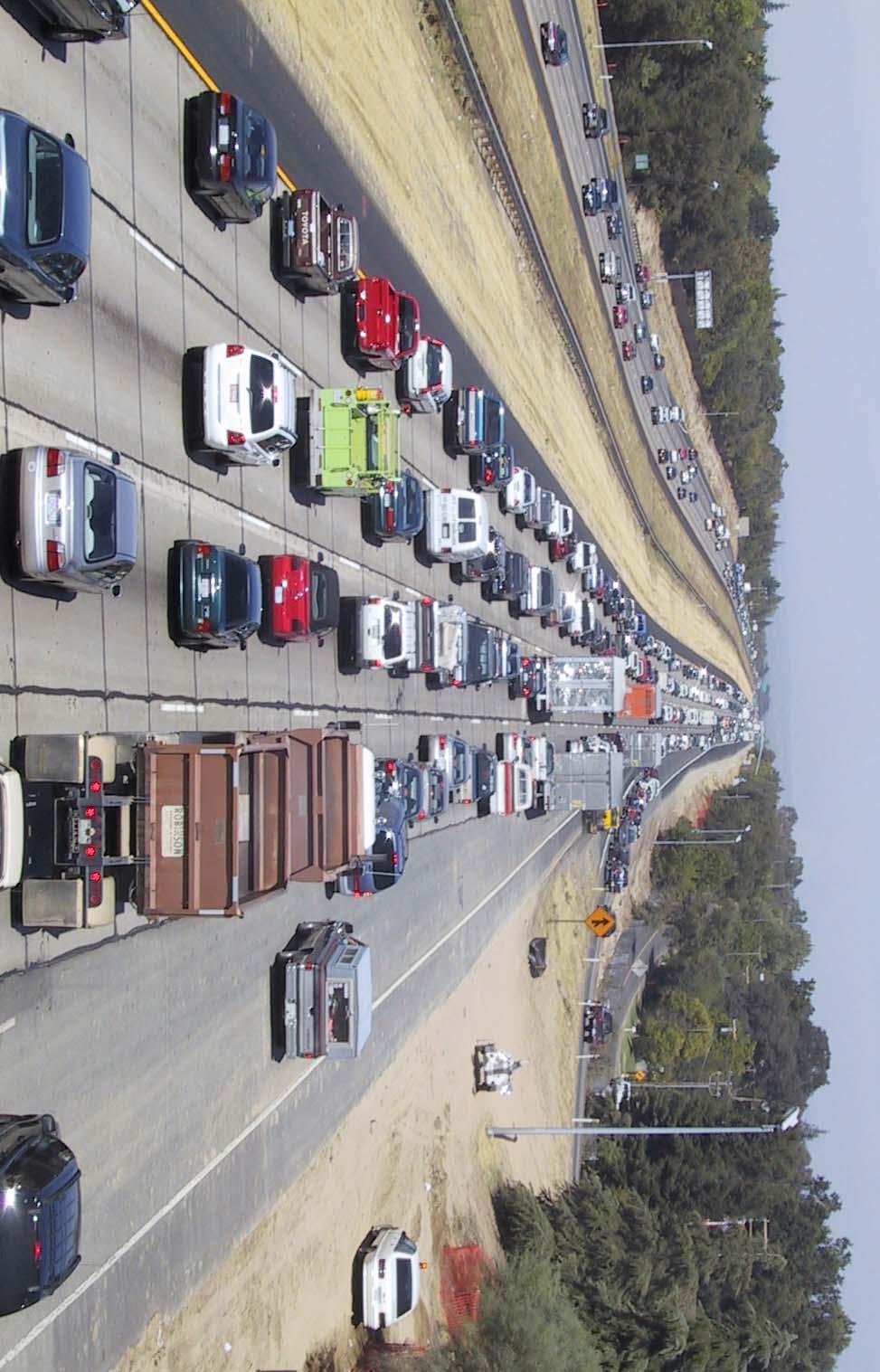
26 1.0 Introduction 1.1 Purpose and Objectives This report documents the findings and procedures of the California Heavy Duty Truck Survey. The overall goal of this project was to collect representative truck travel data for a subsequent forecasting model for statewide interregional heavy-duty truck travel in California. An integral aspect of the project was a literature search and inventory study of freight data survey collection methods. Findings from the search and inventory study were instrumental in identifying a recommended model structure suited to meet objectives of modeling and assessing impacts of line haul or inter-city/ inter-county heavy duty truck movements on California state highways. Additional study objectives included 1) Development of procedures to acquire basic truck travel data 2) Actual conduct of data collection, 3) Collection of data useful to the identification of relationships between economic activity and truck travel patterns, and 4) Collection of data for analysis of commodity flow throughout California. 1.2 Project Organization A) Team Approach A project team incorporating a wide range of expertise, practical experience and resources was assembled to achieve the objectives of the study. Project team members included Strategic Consulting & Research (SCR), Cambridge Systematics, K.T. Analytics and ATD Northwest. SCR provided overall project management. B) Model and Survey Design Cambridge Systematics conducted model research and design efforts including the Literature Search and Inventory Study and the resulting Recommended Model Design Plan. Survey instrument design and procedures were developed by SCR with the active participation of Cambridge Systematics, K.T. Analytics, and Caltrans. C) Field Data Collection Survey data collection took place through assisted interviews of 8,287 truck drivers at the California Highway Patrol weight stations, agricultural inspection stations and roadside rest areas throughout the state. These locations were selected for inclusion in the survey through the Model Design Plan. Truck counts by truck body type were also collected at these sites 1 through videotape technology and used for the survey data expansion process. Survey collection and management was conducted by SCR with video taping activities conducted by ATD Northwest. 1 Videotaping was actually conducted on the freeway at the closest possible lighted location so that accurate 24-hour counts on the road could be conducted even when the inspection site is closed. 1

27 D) Data Base Management Raw survey data was delivered to SCR and incorporated into the database. SCR geocoded approximately 16,500 trip ends from 8,287 field surveys, as well as information on truck type, body type, number of axles, truck weight, commodity carried and other data, as requested by Caltrans. Additionally videotapes documenting truck activity by truck-type, body-type and number of axles were obtained at every survey location. E) Data Analysis The data for the spring wave was expanded from the in-person surveys to total daily truck volume using the video counts for each survey location. Since the video coverage was comprised of a one-tenth of each hour (totaling four hours per day), the raw video counts were multiplied by six to expand the data to a 24-hour day. 2
28 2.0 Study Approach and Sampling Strategy 2.1 Overall Study Approach The primary objective of the project is to provide a database of heavy duty truck travel that includes last stop and next stop data for the trip segment in question, and which is as representative as possible of all heavy duty truck travel throughout the state. To accomplish this, the methodology was comprised of two major components; in person interviews of truck drivers, and video recording of truck traffic at the same locations over a 24-hour period of time. The in-person interviews of truck drivers covered between eight and sixteen hours based on the relative volume of the sites with the objective of providing the broadest coverage at the heaviest traffic locations. Interviewing at all sites was scheduled for the heaviest volume portion of the day. The data collected in these interviews included last and next stops, types of facilities at both ends, number of axles, truck body type and truck configuration. There were also questions addressing the extent to which the truck was full, cargo being carried, and where the truck last refueled. The videotaped data provided the number of trucks that passed the target location over the full 24-hour time period. It included only the number of trucks with each one identified by number of axles, body type, and truck configuration. The interviews provided the distribution of last stops and next stops for the data collection point for the time period when the interviews were collected. This data was then expanded to the full 24 hours using the video data truck counts. The truck counts, which were comprised of 10 minutes per hour (totaling 240 minutes or four hours per day at each location), were expanded to the full day by multiplying by six. The subsequent results that were used for both the last stop / next stop tables and the cross-tabulated data were weighted using this total number of trucks per day (typical Tuesday/ Wednesday/ Thursday). As a result, all data that is presented is in the form of total truck volume on a typical Tuesday, Wednesday or Thursday weekday basis. 2.2 Sample Size Requirements The sample size required for a sample of heavy-duty truck trips depends on the intended use of the data and the parameter(s) being estimated from the sample. In a typical statistical estimation exercise, the goal of the data collection is to estimate a population parameter(s) with a given degree of precision at a given confidence level. If, for example, the population to be measured is all regional truck trips on an average weekday, variables of interest could include the average payload, or percent of trips that are empty. Calculation of a sample size to estimate a population mean, such as average payload, requires some knowledge of the expected mean and variation of the variable in question. For the California heavy-duty truck survey, the primary intended use of the data is for estimation of truck demand models. Rather than directly estimating a population 3
29 parameter, we will be estimating a relationship between the population and some exogenous variable. For example, a trip generation rate is the relationship between employment in a zone and the number of truck trips generating there. The chief data collection concerns thus become collecting enough data to estimate statistically significant model coefficients and avoiding bias in the sample. With respect to the first data collection concern, a rule of thumb often used in travel demand modeling is that trip generation models require a minimum of 200 observations per stratification to estimate statistically significant coefficients. For example, to estimate a separate trip generation model for each of three vehicle classifications would require at least 200 observations in each vehicle category. Similarly, separate models by commodity category, or special generator type would require 200 observations in each cell. With respect to the second data collection concern, it is quite possible to estimate statistically significant (as measured by the T or other statistics) coefficients in travel demand models that are wrong due to bias in the estimation data set. The bias would not usually become apparent until the models are applied and give anomalous results (although one could compare the survey set to national data to assure that it does not stray to far from the national norm). For the California truck survey, avoiding bias means striving to capture and equally represent truck trips with variation in any variable that we think might influence truck travel behavior: geographic location, time of day, type of vehicle, season and so forth. Because we do not yet know the exact form that the truck travel models will take, it is not possible to explicitly calculate the required sample size on this basis. Typically, model development is an iterative process starting with an initial form that is than influenced by the limitations and potential of the data set. However the number of observations projected for this survey (about 7,500) should provide for a good range of model development options. 2.3 Site Selection Having ensured that the total sample size is likely to be sufficient for the intended application of the data, the project team focused on developing a list of survey sites and data collection procedures to minimize potential bias. 4
30 Figure 1: Interview Site Map 5


31 The basic criterion for site selection was to obtain the broadest geographic, time of day and seasonal coverage within the constraints of the available study resources. The constraints included the following: Potential sites for data collection-these were initially limited to CHP and agricultural inspections stations but later expanded to include rest stops, Hours of operation-safety concerns dictate the CHP personnel be present at each interview location and the CHP is only able to provide a certain number of hours for assistance at each site; and The data collection budget. 6
32 Given the above criteria and constraints, the project team selected sites by first identifying which locations would give general geographic coverage. Using visual inspection, sites that would capture trips crossing screenlines, trips entering or exiting major metropolitan areas, and trips at the state border were selected. The project team also took into account input received from Technical Advisory Committee members and Caltrans regarding locations that should be included. These sites were then arrayed by truck AADT as a guide to relative importance and the likely productivity at each site. Several alternative lists of sites were developed with the aim of maximizing geographic coverage and second seasonal variation. Using assumptions regarding labor productivity, it does not appear possible to obtain both sufficient geographic coverage and total coverage of seasonal variation within the given project budget. In other words, it would not be possible to visit each of the recommended sites four times (once for each season). The recommended approach involves obtaining a comprehensive data set for a single season (spring) with seasonal data collection at a limited number of sites. Three alternative surveying options were designed to assess the ability to provide optimal coverage in the spring and offspring seasons. These included options with 75%, 56%, and 38% for spring, with the balance being distributed to the offspring seasons. It was only with the first option with 75% spring surveying that we were able to achieve a representative sample of statewide heavy-duty truck travel. The other two options resulted in reducing spring coverage beyond the point needed to provide representative coverage. In addition, although options two and three increase off-spring surveying, it is still not sufficient to provide the level of coverage that would be needed to develop independent seasonal models. 2.4 Supplemental Data Sources The project team has investigated the availability of truck origin-destination data that might be used to supplement the data collected as part of this project, to date only data collected by Caltrans District 11 has been identified as a promising supplemental data source. These data include approximately 2000 survey records collected in Imperial County at Calexico, and in San Diego County at Tecate, Otay Mesa, I-15 at the Riverside County border, and I-5 at the Orange County border, from August through December of The data collected appear to be largely compatible with the questionnaire designed for this project. With the exception of Tecate, these locations coincide with sites selected for the statewide survey. 7

33 Figure 2 Reliance on the combination of data from different sources is a risky strategy for model development. For this reason, the project team does not recommend substituting the District 11 data for sites that would be surveyed as part of this project. Instead, the data should be viewed as a supplemental data source. Since none of these southern California sites are selected for offspring data collection, the District 11 data can provide some information on variation between fall and spring characteristics at the sites. Additional supplemental origin-destination data may be available from the neighboring states of Arizona and Oregon. Oregon, in fact, conducted a truck survey at its ports of entry in Data from the border crossings would be especially useful since this project will only be able to intercept inbound traffic at the borders. 8
34 2.5 Data Collection Methods and Instruments As previously discussed, data needs identified to support both truck generation and trip distribution models included 1) vehicle classifications and counts to expand survey data for a wide range of modeling purposes and 2) truck intercept surveys from approximately 7,500 trucks, maximizing geographical coverage and seasonal variation within project constraints. Specifically the following data needs were identified for the truck intercept survey element: Interstate/state route Direction of travel, Date Time of travel Vehicle classification Truck body type Gross vehicle weight estimates Empty vehicle weight Cargo carrying status Commodity carried (by type consistent with SCTG codes for origin and destination) Origin and destination (of surveyed trip segment) Number of loading/unloading stops on the one-way journey and total day of travel Other travel behavior data 9
.")
35 Geographically, 32 site locations were selected for surveying including 26 CHP Inspection/Platform stations, 4 Agricultural Inspection facilities and 2 Truck Rest Areas. Of these, 19 were surveyed in both directions of travel and 13 were surveyed in one direction (with the exception of Two Rock which was closed). One direction of travel was surveyed when only one direction of travel was covered by CHP or Agricultural inspection facilities. All 32 sites were surveyed during the spring survey wave, with the exception of Cajon South and Two Rock, which were closed. Additionally, five sites were surveyed during all four seasons, one site was surveyed three seasons, and two sites were surveyed in one season. 10
36 Table 1: Survey Facilities and Completed Survey Counts SPRING WAVE FACILITY SURVEYS COLLECTED FACILITY SURVEYS COLLECTED ANTELOPE - EAST 132 KEENE - EAST 104 ANTELOPE - WEST 137 LIVERMORE - EAST 242 BLYTHE - WEST 148 LIVERMORE - WEST 178 CACHE CREEK - WEST 89 NEEDLES - WEST 134 CAJON - NORTH 247 NIMITZ - NORTH 202 CAJON - SOUTH 1 0 NIMITZ - SOUTH 113 CALEXICO - NORTH 132 OTAY MESA - NORTH 94 CARSON - NORTH 95 PERALTA - EAST 118 CARSON - SOUTH 79 PERALTA - WEST 141 CASTAIC - NORTH 260 RAINBOW - NORTH 160 CONEJO - NORTH 180 RAINBOW - SOUTH 134 CONEJO - SOUTH 164 RAINE - NORTH 97 CORDELIA - EAST 102 RAINE - SOUTH 120 CORDELIA - WEST 126 SAN ONOFRE - NORTH 155 COTTONWOOD - NORTH 113 SAN ONOFRE - SOUTH 180 COTTONWOOD - SOUTH 76 SANTA NELLA - NORTH 70 DESERT HILLS EAST SANTA NELLA - SOUTH 63 DESERT HILLS - WEST 218 ST. VINCENTS - SOUTH 51 DONNER PASS - WEST 125 TERRA LINDA - NORTH 95 ENOCH - NORTH 117 WALNUT CREEK - NORTH 107 ENOCH - SOUTH 118 WALNUT CREEK - SOUTH 110 GILROY - NORTH 122 WHISKEYTOWN - EAST 99 GILROY - SOUTH 159 WILLITS - SOUTH 87 GRAPEVINE - SOUTH 137 WINTERHAVEN - WEST 140 HORNBROOK - SOUTH 95 YERMO - WEST 105 SUMMER WAVE FACILITY SURVEYS COLLECTED FACILITY SURVEYS COLLECTED CAJON - NORTH 122 DESERT HILLS - WEST 137 CAJON - SOUTH 1 0 GRAPEVINE - SOUTH 122 CASTAIC - NORTH 117 LIVERMORE - EAST 128 DESERT HILLS - EAST 2 0 LIVERMORE - WEST 131 FALL WAVE FACILITY SURVEYS COLLECTED FACILITY SURVEYS COLLECTED CAJON - NORTH 82 DESERT HILLS - WEST 111 CAJON - SOUTH 68 GRAPEVINE - SOUTH 145 CASTAIC - NORTH 104 LIVERMORE - EAST 162 DESERT HILLS - EAST 2 12 LIVERMORE - WEST 63 WINTER WAVE FACILITY SURVEYS COLLECTED FACILITY SURVEYS COLLECTED CAJON - NORTH 64 DESERT HILLS - WEST 76 CAJON - SOUTH 1 0 GRAPEVINE - SOUTH 74 CASTAIC - NORTH 80 LIVERMORE EAST 3 0 DESERT HILLS - EAST 2 0 LIVERMORE - WEST 59 1 Facility closed with no viable alternative interviewing site 2 Unsafe interviewing conditions. One hundred sixty (160) surveys were collected during the Spring wave to satisfy all interviewing waves. 3 Survey data quality was unacceptable. Re-interviewed during the Spring wave to account for shortfall. 11

37 Figure 3 12


38 Two methods of data collection were identified as best suited to obtain this information; on-site interviews of truck drivers, and video camera recording. Logistics and instruments for data collection under these methods are discussed below. 13


39 2.5.1 On-site Interviews On-site interviewing of truck drivers at the selected survey site locations was easily recognized as the only feasible approach of collecting the detailed information listed above. The development of an efficient and productive survey form and adequate training and procedural materials was more involved. 14

40 Two small-scale pre-tests or convenience surveys were conducted prior to actual surveying to test the value of preliminary survey instruments and procedures. The pretests were conducted under conditions replicating those of the actual survey and numerous changes to both the survey form and procedures were incorporated based on their results. Once site selections had been finalized, commanders at the selected facilities were contacted to obtain permission for surveying and video taping activities. The commanders were asked to designate a staff member to continuously direct trucks to a designated area (clearly marked by cones) where the surveyors would administer the survey. Commanders were also asked to stagger staff break periods so that surveying activities would not cease during staff lunches and breaks. A team of two trained surveyors was assigned to administer surveys at each site using the survey instrument shown in the pictures. The more experienced of the team members was also charged with supervisory tasks such as periodically (about every two hours) reviewing survey forms for completeness and logic and dealing with any questions or concerns of facility staff. 15
41 On the day of the survey, the survey team was sent to the facility to conduct the surveys. On-route to the facility a team member would enter survey identification numbers on the forms, identifying the order the survey was to be taken, the season, month, day, and location. This was done to conserve time not always available during the survey day. Upon arrival the team member designated for supervisor tasks would introduce him/herself to the commander and briefly review project forms and productivity targets with the facility staff member assisting with the survey. Once cones were set up to designate the survey area, the assisting CHP staff member would direct trucks over to the surveyors. When the vehicle had come to a complete stop the surveyors would first request the driver to set his brakes as a safety concern and request the drivers participation in the surveys by reading the salutation on the survey form. The driver would then be asked to shut off the vehicle to reduce the noise level. During the next few moments the surveyor would enter visual information about the truck onto the survey form such as, truck type, number of axles (see figure 2). The survey would then be conducted with the surveyor reading the question exactly as stated on the form, with the following exceptions; If the driver was uncertain about the vehicle's weight with cargo, the surveyor was directed to prompt by asking if the weight was in certain ranges. The ranges used were 60,000 pounds+, 60,000-33,000 pounds and under 33,000 pounds. These ranges were selected because they are consistent with other major truck studies such as the SACOG commercial vehicle study. If a trucker would or could not provide an address or two cross streets he was asked for the nearest landmark, a single cross street or a well-known building, and the town name within a quarter mile of his next stop. If this was not offered any information offered was taken down, such as town name. Due to the uniformity of layouts and truck movements at CHP Inspection facilities the survey area was always set up after the trucks had gone by the weigh scales where vehicle inspections are typically performed. An exception was the Eastbound Desert Hills facility. Space at this facility was very restricted and took place in a wide shoulder adjacent to the exit lanes of the facility. A very important element of this procedure was the use of a CHP or Agricultural Inspection facility staff member to direct trucks to the surveyors. This was important because it assured a safe process for directing the trucks and because the truck drivers recognized the authority of the CHP or Agricultural Inspection staff. By design all of the selected facilities had large and continuous flows of heavy trucks. It would not have been feasible for anyone other than a uniformed professional staff member to safely or effectively direct the trucks. Coincidentally the procedure may have aided survey participation. Several truck drivers expressed relief that they had not been pulled over for a vehicle inspection and were quite willing to participate in the survey. 16
42 Table 2: California Truck Travel Survey 1.Survey ID: 2.Date: 3Time: 4AM PM 5.Surveyor: 6.CHP/ AG 7Facility Name 8Fwy/Route: Direction of Travel 9. N E S W 10Hazardous Materials Signage? Yes No (CHECK ONE) 11Truck Type: Single-Unit (CIRCLE ONE) Single-Unit w/trailer Single-Trailer Multiple-Trailer 12Number of Axles: (FILL IN) 13Truck body: Van Container Flatbed Tanker Hopper Open Trailer Specialized/Other (CIRCLE ONE) - PLEASE SET YOUR BRAKES - Good morning/afternoon. We are conducting a survey of truck travel for the California Department of Transportation. This information will be used to determine improvements to the California State Highway System. The interview should take no longer than three minutes of your time. 14.Is the truck empty now? Yes (skip to #18) No (CHECK ONE) 15What % of total capacity are you carrying now? % (volume or weight) 16What is this truck s weight including the cargo? (in pounds) If driver is uncertain prompt 17Would it be over 60,000 pounds? 60,000-33,000 pounds? under 33,000 pounds? What is the primary cargo being carried? (normally carried if empty) 18 SCTG CODE Where did the truck last stop to load, unload or start the day? 23Was this your Starting location? Yes No ADDRESS/CROSS STREETS OR NEAREST INTERSECTION CITY STATE ZIP 24Did you load or unload at this location, or both? neither (start of day)? (if start skip arrive time) What time did you arrive and depart that location? 25Arrive 26AM PM 27Depart 28AM PM 29What type of facility or terminal was that? (code letter or write in) (port, rail yard, air cargo facility, truck terminal, residential, etc.) Where will the truck stop next to load, unload, or end the day? ADDRESS/CROSS STREETS OR NEAREST INTERSECTION CITY STATE ZIP 34Will you load or unload cargo at this location, or both? neither (end of day)? 35At what time will you arrive there? 36AM PM 37What type of facility or terminal is this? (code letter or write in) (port, rail yard, air cargo facility, truck terminal, residential, etc.) 38 What is the distance between the most recent and next stops that we just identified? (miles) 39 How many total stops will you make today for loading or unloading including your starting and ending points? 40How many total miles will you drive the truck today from start to finish? (miles) 41In which state did you last fuel your truck? CA NV AZ OR MX Other THANK-YOU FOR PARTICIPATING IN THE SURVEY! ** FACILITY CODES Survey Revised 9/1/99 A. Marine port B. Rail facility C. Air cargo facility D. Truck terminal/reload facility E. Residential F. Manufacturing G. Wholesale H. Retail store I. Hospital/medical J. Public/government K. Office services L. Distribution Center M. Agricultural Processing/Packaging N. Truckstop, Roadside rest area, or motel/hotel O. Other P. Don t know (Do not state) 17

. A 12-hour facility would have 20 minutes of tape review for each hour of operation (20 minutes x 12 hours/ 60 = 4 hours).")
43 2.5.2 Video Recording Video recordings were taken at each site to document truck counts by body type. The tapes were reviewed and truck counts documented for a total of four hours over each sites operational time. For example, a 24-hour facility would have 10 minutes of truck counts by body type documented for each of its 24 hours of operation (10 minutes x 24 hours/ 60 = 4hours). A 12-hour facility would have 20 minutes of tape review for each hour of operation (20 minutes x 12 hours/ 60 = 4 hours). The recordings were conducted seasonally by site to be consistent with the on-site survey schedule. 18
44 2.6 Geocoding The last stop and next stop locations for all 8,287 surveys have been geocoded to latitude and longitude using Microsoft Streets and Trips. There was an extensive cleaning process and the 57% of the data points were geocodable to an exact address, cross-streets, or a California border location. An additional 26% were geocoded to cross-streets using the appropriate freeway or highway and an exit street. Sixteen percent were geocoded to the center of a town or place name location, and 1% could not be successfully geocoded. The cleaning and geocoding processes are described in detail in Appendix I, which is Technical memorandum H.1: Geocoding Process and Results. Using the geocoded data, each location was aggregated to the county level and subsequently to the regional level. This is the data that was used to provide the county to county and region to region last / next stop trip tables. 3.0 Survey Strengths and Weaknesses This section presents a discussion of the California Heavy Duty Truck Survey methodology including the strengths and weaknesses of the approach. 3.1 Sampling Design and Survey Execution Strategic Consulting and Research designed and implemented truck intercept surveys using a roadside interview method to obtain representative travel activity data from truckers using the statewide transportation network. This survey was primarily designed to collect specific trip segment travel behavior information for long-distance truck travel. Useful information for truck travel modeling and planning were obtained using this survey method including last stop and next stop locations, travel distance and times, commodity types, and truck types. During the truck survey implementation phase, we refined this survey method to obtain additional information about travel behavior in addition to the intercepted trip segment. For example, questions were added to the survey instrument to better understand the truckers' entire trip. The strengths of this survey method included: Proven track record for obtaining representative truck travel behavior information; Traditionally have high response rates; Truckers are more amenable to responding to this survey method than other survey methods; and 19
45 Good truck travel information for travel modeling (distribution modeling, model validation) and transportation planning can be obtained using this survey method. The weaknesses to using this survey method included: Additional data need to be collected from other sources to support modeling, and in particular, truck trip generation; and Limited data were obtained to represent the characteristics of the entire (or total) truck trips. Other truck data collection methods, primarily both the truck diary/mail back method has proven ineffective in obtaining representative truck travel behavior information compared to the method used for this truck survey. Several areas including Sacramento, Southern California, and Portland, Oregon, have failed to obtain quality and representative data using the truck diary/mail back method. In Sacramento, for example, the California Trucking Association (CTA) led the survey effort that proved to be costly, time consuming, and marginally successful. Many regions throughout the United States have had similar experiences using the truck diary/mail back method. 3.2 Data Deficiencies The project team considered proven survey methods to collect travel behavior information from truck drivers. However, there were some weaknesses to the data collection methods, primarily as a result of the following constraints: Survey locations were primarily restricted to Agriculture and CHP Inspection Station Locations and in a small number of cases, rest stop locations were also used for surveying; Survey resources were prioritized to collect data during a concentrated period during the typical day (8 to 16 hour periods) rather than the entire 24-hour period; and Survey resources were also prioritized in the spring with less focus on other seasons (summer, fall, and winter). As a result, the full range of statewide truck travel behavior was not collected in this survey. Many state routes and potentially many California counties are not being represented in the survey process. Other data quality factors include the following: Only a limited number of surveys were collected on roadways entering and exiting California during this survey. The external to internal California truck movement data is currently limited and would need to be enriched with other data sources to support truck modeling. 20
46 A limited number of survey locations were collected on roadways into and out of major metropolitan areas in California. This weakness has contributed to the need to collect available data from other sources or to collect a fuller sample of inter-regional truck movements as part of ongoing Caltrans activities. Truck last stop and next stop pairs surveyed at one location could have been surveyed at other survey locations. In these instances, the resulting last stop and next stop trips should be processed to identify the number of stations they would be expected to pass by as part of the data modeling process. There will be numerous last stop and next stop pairs for which no crossings of survey locations would be expected. In order to deal effectively with these potentially numerous cases, it will be necessary to increase the survey sites and other survey data (from metropolitan areas, ports, etc.) to obtain estimated trip tables and/or trip ends for modeling. Because only trucks with three or more axles were included in this survey, and empty vehicles were treated differently than loaded vehicles, the truck counts to be used for survey expansion should only include the types of vehicles actually surveyed. Survey expansion should be conducted separately by time of day and vehicle type (and potentially commodity type). Since commodity data and last stop / next stop data was only collected during the more heavily traveled hours of the day, it does not provide a representative sample of how these factors fall out in the low volume, late PM and early AM hours. Since they may be significantly different than peak travel hours, some commodities and stops may be (for example agricultural products) might be under stated, and other categories overstated. 4.0 Recommendations The truck survey intercept approach using roadside interviews implemented for this survey was the most appropriate method to obtain representative long-distance truck travel in the state of California. This method has proven effective in many metropolitan areas and states including Oregon, southern California, and Ohio. In addition, it was recognized early on in this project that additional, supplementary data would be needed to support this survey effort, and in particular, to support truck travel model development. For example, this intercept data, in addition to the following supplementary data, were specified in the Model Design Plan as requirements to support statewide truck travel modeling and planning in California: Commodity flow data by origin and destination collected by other public agencies or the private sector; 21
47 Truck classification counts collected at interview locations through videotaping; and Available truck counts and travel behavior information at Port facilities (Oakland, Long Beach) obtained from Port representatives. 4.1 Collect Supplemental Survey Data Supplementary information could be obtained to enrich the vehicle intercept, commodity flow, and truck classification data already available to Caltrans. The following additional data collection efforts are recommended to support this survey and future truck modeling for California: Collect Intercept Data at External Cordons 2. Conduct additional surveys, using the same intercept survey method on roadways entering and exiting the state of California. This is a weakness of the data collection plan for this project. For example, locations surveyed in this project were limited to CHP and Agriculture Inspection and Rest Stop locations that do not encompass an entire cordon of truck movements entering and exiting the state. This data would be very useful in developing external-to-internal truck models for California. In order to use this method, Caltrans should explore the possibility of using Rest Stop locations and other methods (establish temporary survey stations) to survey truckers coming into and out of the state. Collect Intercept Data at Regional Cordons. Collect truck vehicle intercept data using this project's survey method representing regional cordon areas to capture truck trips to and from large regional centers, i.e., Bay Area to/from Sacramento, Sacramento to/from Fresno/Bakersfield. The limitations of this project regarding survey locations has contributed to the need to collect a fuller sample of inter-regional truck movements. As with the external surveying above, we should explore the possibility of using Rest Stop locations and other methods (establish temporary survey stations) to survey truckers coming into and out of the state. Design and Collect Freight Distribution Center Surveys. Commodity flow data collected by the U.S. Bureau of the Census includes good information on the ultimate origin and destination of activity but, generally does not obtain commodity flow data related to re-load facility activity. For example, truck activity and commodity flow data at key distribution centers, such as in Stockton, are not represented in the commodity flow databases available in other Divisions in Caltrans. A supplemental survey targeted at key distribution centers in California (Stockton, San Bernardino, Riverside, Otay Mesa) is recommended to better understand truck activities at these re-load facilities that are traditionally under-represented. These surveys can be designed to have dispatchers distribute and collect surveys on travel behavior to truckers entering and exiting these facilities or by having survey interview teams 2 Although this was an original objective of the project, this approach was not employed in this study because there was no feasible way to safely conduct interviews at many of these locations where there was no CHP or Agricultural inspection facility or rest area where trucks could safely pull over. If this approach is to be pursued in future data collection efforts, some new method will have to be developed to collect the data in a safer manner. 22
48 conduct the surveys at each location. This method has worked in Monterey, California and other locations in the United States. At the conclusion of this project, we completed over 8,000 truck intercept surveys. These surveys in conjunction with additional data, to be collected in future, can be used to develop statewide truck models for California. The three supplemental surveys identified above are designed to provide Caltrans with additional truck activity to represent truck movements on the entire transportation system including into and out of major distribution truck centers. Supplemental survey questionnaires and sampling plans should use the current heavy duty truck travel survey methods as its foundation with some revision required associated with the Freight Distribution Center Surveys. 4.2 Increase Survey Productivity Survey productivity was negatively impacted by the following factors: Inadequate space at CHP Platform stations Facility closures due to freeway congestion and Hazardous Materials alarms Unannounced facility closures due to facility staff reassignments and construction being performed at the facilities Several CHP Platform facilities have severe space restrictions, which can greatly limit the frequency that surveys can be conducted. As there is not a uniform site layout it is difficult to predetermine which stations will present these challenges or how much they will impede the survey process. If Platform stations are to be utilized for survey purposes they should be visited prior to final planning efforts to realistically assess productivity expectations. Most facility closures due to freeway congestion and other factors are unforeseen and unavoidable, however, they are predictable. While most freeway congestion closures last only minutes, they are frequent enough to impact productivity. Hazardous Material alarms can last 2 hours or more and severely effect productivity. A 10-15% reduction factor should be applied to overall productivity expectations to reflect these circumstances. There were instances where surveyors arrived at a facility that was closed for the day, even though the survey day had been scheduled in advance and confirmed with the station no more than a week preceding the survey date. More coordination with the CHP is recommended to increase the survey productivity. This will be possible if a CHP officer is assigned to guide the survey crews and their activities at each site. 23
49
Date: May 4, Clare M. Look-Jaeger, P.E. Kevin C. Jaeger Linscott, Law & Greenspan, Engineers Weingart Projects Construction Traffic Analysis
 MEMORANDUM To: CAJA Environmental Services, LLC Date: From: Subject: Clare M. Look-Jaeger, P.E. Kevin C. Jaeger Linscott, Law & Greenspan, Engineers Weingart Projects Construction Traffic Analysis LLG
Freight Transportation Planning and Modeling Spring 2012
 Freight Model Validation Techniques Abstract Several reviews of validation techniques for statewide passenger and freight models have been published over the past several years. In this paper I synthesize
INTELLIGENT TRANSPORTATION SYSTEMS APPENDIX
 INTELLIGENT TRANSPORTATION SYSTEMS APPENDIX Southern California Association of Governments ADOPTED APRIL 2012 INTELLIGENT TRANSPORTATION SYSTEMS Introduction 1 Existing System Description 1 Existing System
Database and Travel Demand Model
 Database and Travel Demand Model 7 The CMP legislation requires every CMA, in consultation with the regional transportation planning agency (the Metropolitan Transportation Commission (MTC) in the Bay
CALIFORNIA HIGHWAY PATROL BORDER DIVISION. Chief R. D. Skip Carter Commander
 CALIFORNIA HIGHWAY PATROL BORDER DIVISION Chief R. D. Skip Carter Commander The California Highway Patrol is a department in state government within the Business, Transportation and Housing Agency. Its
UCI ITS Research Team
 UCI ITS Research Team Principal Investigator: Professor Stephen G. Ritchie Asst. Project Scientist: Dr. Andre Tok Graduate Student Researcher: Fatemeh Ranaiefar Graduate Student Researcher: Kyungsoo Jeong
Ontario Commercial Vehicle Survey Use of GIS for Data Collection, Processing, Analyses and Dissemination
 Ontario Commercial Vehicle Survey Use of GIS for Data Collection, Processing, Analyses and Dissemination Presented at FREIGHT DEMAND MODELLING: TOOLS FOR PUBLIC SECTOR DECISSION MAKING September 26, 2006
Operations Analysis using Simulation Modeling to Evaluate Capacity Requirements. for Direct Intermodal Rail Facilities at the Port of Long Beach
 Operations Analysis using Simulation Modeling to Evaluate Capacity Requirements for Direct Intermodal Rail Facilities at the Port of Long Beach Beth C. Kulick Sr. Professional, TranSystems Corporation
Appendix O Congestion Management Program REGIONAL TRANSPORTATION PLAN/SUSTAINABLE COMMUNITIES STRATEGY
 Appendix O Congestion Management Program REGIONAL TRANSPORTATION PLAN/SUSTAINABLE COMMUNITIES STRATEGY 2014 REGIONAL CONGESTION MANAGEMENT PROGRAM 2014 RTP/SCS APPENDIX O SAN JOAQUIN COUNCIL OF GOVERNMENTS
ITS NEWS. Building Southern California s Goods Movement System for the Next Century. Gateway Cities. I-710 Zero Emissions Freight Corridor
 Building Southern California s Goods Movement System for the Next Century Gateway Cities ITS NEWS Summer 2013 I-710 Zero Emissions Freight Corridor PAGE 4 FRATIS Demonstration Advances PAGE 10 ALSO IN
CITY OF VALLEJO PUBLIC WORKS DEPARTMENT TRAFFIC IMPACT Analysis/Study GUIDELINES
 The City Engineer, under the authority of the Public Works Director and recommendations from the Traffic Engineer, will make the final decision on the need for a traffic study. The purpose of the traffic
Project WIP. Transportation Performance October 10, 2015
 Project WIP Transportation Performance October 10, 2015 FOR DISCUSSION Executive Summary Trucks are the predominant mode used for domestic freight movements Shafter is well positioned for access to interstate
9. TRAVEL FORECAST MODEL DEVELOPMENT
 9. TRAVEL FORECAST MODEL DEVELOPMENT To examine the existing transportation system and accurately predict impacts of future growth, a travel demand model is necessary. A travel demand model is a computer
6.0 CONGESTION HOT SPOT PROBLEM AND IMPROVEMENT TRAVEL DEMAND MODEL ANALYSIS
 6.0 CONGESTION HOT SPOT PROBLEM AND IMPROVEMENT TRAVEL DEMAND MODEL ANALYSIS 6.1 MODEL RUN SUMMARY NOTEBOOK The Model Run Summary Notebook (under separate cover) provides documentation of the multiple
TRUCK MANAGEMENT PLAN
 West Oakland TRUCK MANAGEMENT PLAN APPENDIX C Signs and Communication Technical Memorandum A joint plan by the City of Oakland and Port of Oakland SIGNS AND COMMUNICATION TECHNICAL MEMORANDUM West Oakland
The Next Mode of Transportation. Presented By: Ronald J. Silva CEO-Westar Transport
 The Next Mode of Transportation Presented By: Ronald J. Silva CEO-Westar Transport - Short Sea Shipping is the diversion of domestic and international cargos that move by highway from major metropolitan
Mendocino Forest Products Grading For Industrial Land Improvements
 Mendocino Forest Products Grading For Industrial Land Improvements Technical Memorandum #10 CEQA Evaluation of Environmental Impacts Prepared for: Mendocino Forest Products Company, LLC Consulting Engineers
Classifying California Truck Activity Using Loop Sensors
 Classifying California Truck Activity Using Loop Sensors Innovations in Freight Data Workshop: Technologies for Monitoring, Tracking, and Data Collection Andre Tok May 17th, 2017 Trailer Configurations
Refined Statewide California Transportation Model. Progress Report November 2009
 Refined Statewide California Transportation Model Progress Report November 2009 Study area - the State of California. Forecast trips made on a typical fall / spring weekday i.e. when schools are in session.
EXHIBIT A. TRANSIT AND MULTIMODAL DEVELOPMENT SUPPORT CONTINUING SERVICES SCOPE OF SERVICES FM No
 EXHIBIT A TRANSIT AND MULTIMODAL DEVELOPMENT SUPPORT CONTINUING SERVICES SCOPE OF SERVICES FM No. 429768-4-12-01 This Exhibit forms an integral part of the Agreement between the DEPARTMENT and, the CONSULTANT,
TRANSPORTATION RESEARCH BOARD
 TRANSPORTATION RESEARCH BOARD Data and Tools for Linking Goods Movement, Air Quality, and Transportation Infrastructure Decisions June 2-3, 2009 Overview of the Model Improvement Plan for the SCAG Heavy-Duty
Congestion Management Process (CMP)
") Congestion Management Process (CMP) Introduction The Congestion Management Process (CMP) is a systematic, data-driven, and regionally accepted approach that aims to improve the performance of the transportation
Congestion Management Process (CMP) Introduction The Congestion Management Process (CMP) is a systematic, data-driven, and regionally accepted approach that aims to improve the performance of the transportation
Will County Freight Advisory Council Meeting. April 11, 2017
 Will County Freight Advisory Council Meeting April 11, 2017 1 Agenda Summary of Last Meeting Plan Progress and Update Performance Measures Break-Out Discussion Projects and Project Evaluation Criteria
REGIONAL PLANNING AND POLICY FRAMEWORK A Preferred Approach for our Regional Growth
 REGIONAL PLANNING AND POLICY FRAMEWORK A Preferred Approach for our Regional Growth The Regional Comprehensive Plan (RCP) establishes a new approach to planning in the San Diego region. This approach is
Interactive Statewide Transportation Planning Modeling Process
 TRANSPORTATION RESEARCH RECORD 1499 Interactive Statewide Transportation Planning Modeling Process JIANGYAN WANG AND EUGENE M. WILSON The Wyoming Multimodal Statewide Transportation Planning (WMSTP) model
THE PROJECT. Executive Summary. City of Industry. City of Diamond Bar. 57/60 Confluence.
 THE PROJECT A freeway segment ranked 6th worst in the Nation, with levels of congestion, pollution and accidents that are simply unacceptable and which have Statewide and National implications. Executive
California Statewide Interregional Integrated Modeling (SIIM) Framework. California STDM. HBA Specto Incorporated ULTRANS, UC Davis
 Framework. California STDM. HBA Specto Incorporated ULTRANS, UC Davis") California Statewide Interregional Integrated Modeling (SIIM) Framework California STDM HBA Specto Incorporated ULTRANS, UC Davis SIIM Advisory Group Meeting June 2010 model-wide economic / demographic
California Statewide Interregional Integrated Modeling (SIIM) Framework California STDM HBA Specto Incorporated ULTRANS, UC Davis SIIM Advisory Group Meeting June 2010 model-wide economic / demographic
Chapter 3 - Goals, Objectives, & Strategies
 Chapter 3 - This chapter presents goals, objectives, and strategies that have been developed as part of the Richmond Area MPO 2026 Long-Range Transportation Plan (LRTP) update. Strategies have been developed
SCS Scenario Planning
 E SCS Scenario Planning Introduction As part of the 2035 MTP/SCS process, AMBAG developed a series of land use and transportation alternative scenarios for evaluation and testing to demonstrate how the
Sunrise Project South I-205 Corridor Improvement Project
 Sunrise Project South I-205 Corridor Improvement Project January 24, 2007 Sunrise and I-205 Project Summary Conclusions Sunrise Scoping Study Key Results South I-205 Scoping Study Key Results South I-205
INDIANA S INTERMODAL MANAGEMENT SYSTEM Stephen C. Smith Planning Manager, Transportation Planning Division Indiana Department of Transportation
 96 INDIANA S INTERMODAL MANAGEMENT SYSTEM Stephen C. Smith Planning Manager, Transportation Planning Division Indiana Department of Transportation Indiana is in the process of developing an Intermodal
Modeling Truck Traffic Volume Growth Congestion
 Modeling Truck Traffic Volume Growth Congestion By Mr. Gregory Harris, P. E. (Principal Investigator) Office of Freight, Logistics and Transportation The University of Alabama in Huntsville Huntsville,
Chapter 6 Freight Plan
 Chapter 6 Freight Plan Overview This chapter presents a review and assessment of needs, deficiencies, policies and improvement options affecting the freight transportation system within the Medford Urban
Chapter 10. Intelligent Transportation Systems. Ohio Kentucky Indiana Regional Council of Governments Regional Transportation Plan
 Chapter 10 Intelligent Transportation Systems Ohio Kentucky Indiana Regional Council of Governments 2030 Regional Transportation Plan Chapter 10 Intelligent Transportation Systems INTRODUCTION Intelligent
APPENDIX D. Glossary D-1
 APPENDIX D Glossary D-1 Glossary of Transportation Planning Terms ANNUAL AVERAGE DAILY TRAFFIC (AADT): The total number of vehicles passing a given location on a roadway over the course of one year, divided
Connectivity North and Beyond Nevada s I 80 Corridor
 I 11 NORTHERN NEVADA ALTERNATIVES ANALYSIS Connectivity North and Beyond Nevada s I 80 Corridor May 2018 Prepared for Nevada Department of Transportation Contents 1. Introduction... 1 1.1. I 11 Corridor
3.6 GROUND TRANSPORTATION
 3.6.1 Environmental Setting 3.6.1.1 Area of Influence The area of influence for ground transportation consists of the streets and intersections that could be affected by automobile or truck traffic to
CHAPTER 2 - TRAVEL DEMAND MODEL DEVELOPMENT
 CHAPTER 2 - TRAVEL DEMAND MODEL DEVELOPMENT 2.1 EXISTING TRAVEL DEMAND MODEL In order to accurately project future year traffic volumes within this regional study area, it was first necessary to construct
CALIFORNIA URBAN INFILL TRIP GENERATION STUDY. Luke Schwartz Kimley-Horn and Associates
 CALIFORNIA URBAN INFILL TRIP GENERATION STUDY Luke Schwartz Kimley-Horn and Associates Overview What is the CA Urban Infill Trip Generation Study Why was this study undertaken? Research methodology Trip
GUIDE FOR THE PREPARATION OF TRAFFIC IMPACT STUDIES
 GUIDE FOR THE PREPARATION OF TRAFFIC IMPACT STUDIES Adopted by Town Council on November 25, 2008 Prepared By: HNTB Engineering Department Planning Department TABLE OF CONTENTS I. INTRODUCTION... 1 II.
THE TRANSSHIPMENT PROBLEM IN TRAVEL FORECASTING: TOUR STRUCTURES FROM THE ONTARIO COMMERCIAL VEHICLE SURVEY
 THE TRANSSHIPMENT PROBLEM IN TRAVEL FORECASTING: TOUR STRUCTURES FROM THE ONTARIO COMMERCIAL VEHICLE SURVEY University of Wisconsin Milwaukee Paper No. 09-3 National Center for Freight & Infrastructure
APPENDIX A6: OPERATIONAL CONCEPTS BY SERVICE CATEGORY
 APPENDIX A6: OPERATIONAL CONCEPTS BY SERVICE CATEGORY Traffic Management Traveler Information Goods Movement Electronic Payment Toll Collection Fare Payment Public Transportation State-Level Archived Data
Lesson 3 4-Hour Version Slide: 4H-45
 Lesson 3 4-Hour Version Slide: 4H-45 Lesson Objectives 4-Hour Version Slide: 4H-46 Lesson Objectives: 3.1 and 3.2 4-Hour Version Slide: 4H-47 The first step of the TIM process is detection, a term used
THE DEATH OF DISTANCE?
 Location Matters BY MARKUS HESSE THE DEATH OF DISTANCE? The merger of modern communications technologies and physical distribution systems is transforming many aspects of the shipping industries, including
2004 FEASIBILITY STUDY UPDATE
 Austin-San Antonio Intermunicipal Commuter Rail District 2004 FEASIBILITY STUDY UPDATE December 2004 EXECUTIVE SUMMARY INTRODUCTION Almost 3 million people in Central Texas, living and working between
2009 AASHTO Value Engineering Conference. How VE and Decision Analysis are Improving Mobility across Borders 6/22/09
 2009 AASHTO Value Engineering Conference How VE and Decision Analysis are Improving Mobility across Borders By Mark Baza, Nicola Bernard, & Rob Stewart District 11 of the California Department of Transportation
Intermodalism -- Metropolitan Chicago's Built-In Economic Advantage
 May 1, 2015 Intermodalism -- Metropolitan Chicago's Built-In Economic Advantage CMAP's regional economic indicators microsite features key measures of metropolitan Chicago's economy and, where applicable,
Statewide Bluetooth Data Collection
 Statewide Bluetooth Data Collection presented by Thomas Hill Florida Department of Transportation State Transportation Systems Modeling Division December 7, 2016 Purpose To develop and test the feasibility
Comprehensive Regional Goods Movement Plan and Implementation Strategy Study Introduction and Overview
 Comprehensive Regional Goods Movement Plan and Implementation Strategy Study Introduction and Overview presented to Regional Goods Movement Steering Committee SCAG s Consulting Team: Cambridge Systematics,
III. ENVIRONMENTAL IMPACT ANALYSIS F. TRAFFIC
 III. ENVIRONMENTAL IMPACT ANALYSIS F. TRAFFIC This section summarizes the traffic impact analysis prepared by Kaku Associates in May, 2002. Detailed calculation worksheets are contained in Appendix D to
Evaluating Two Low-Cost Methods of Collecting Truck Generation Data Using Grocery Stores
 Evaluating Two Low-Cost Methods of Collecting Truck Generation Data Using Grocery Stores Information on the rates of truck trips generated by different land uses is uncommon but necessary for freight planning
8.0 Chapter 8 Alternatives Analysis
 8.0 Chapter 8 Alternatives Analysis The primary purpose for using CORSIM in the context of this manual is to guide the design process and program delivery. To this point in the manual, you have been given
Bringing Vital CVO Information to San Diego and Imperial Counties Truckers
 Bringing Vital CVO Information to San Diego and Imperial Counties Truckers Session D2: CVO Keeping Freight Moving 2011 National Rural ITS Conference August 28-31, 2011 Coeur d Alene, Idaho Tracy Manzo
Lubbock Outer Route Feasibility Study Report Executive Summary
 Lubbock Outer Route Feasibility Study Report Executive Summary Prepared for: Texas Department of Transportation Lubbock District Prepared by: MACTEC Engineering and Consulting, Inc. 6701 Aberdeen, Suite
Summary of Technical Memoranda 6a, 6b, and 7 for the Stakeholder Advisory Group. July 25, 2007
 1 Summary of Technical Memoranda 6a, 6b, and 7 for the Stakeholder Advisory Group July 25, 2007 2 Presentation Overview 1. Review of the Multi-County Goods Movement Action Plan (MCGMAP) study area and
Corpus Christi Metropolitan Transportation Plan Fiscal Year Introduction:
 Introduction: Traffic congestion in the Corpus Christi Metropolitan area is not as much a function of population growth as the function of the increase in single occupant trips. Using census data, the
Should we Expect ITS Programs to Generate Revenue?
 Should we Expect ITS Programs to Generate Revenue? ITS California Annual Meeting Carol Kuester Director, Electronic Payments September 23, 2015 Transportation Funding Needs are Tremendous 2 Neglected Improvements
FHWA Programs Supporting Freight
 FHWA Programs Supporting Freight Institute for Trade and Transportation Studies Conference Office of Operations 1200 New Jersey Avenue S.E. Washington, D.C. 20590 www.ops.fhwa.dot.gov/freight Jeff Purdy,
TECHNICAL MEMORANDUM I-710 EIR/EIS INITIAL FEASIBILITY ANALYSIS (IFA) TECHNICAL APPENDIX WBS TASK ID:
 TECHNICAL APPENDIX WBS TASK ID:") FINAL REPORT TECHNICAL MEMORANDUM I-710 EIR/EIS INITIAL FEASIBILITY ANALYSIS (IFA) TECHNICAL APPENDIX WBS TASK ID: 165.10.09 Prepared for Los Angeles County Metropolitan Transportation Authority December
FINAL REPORT TECHNICAL MEMORANDUM I-710 EIR/EIS INITIAL FEASIBILITY ANALYSIS (IFA) TECHNICAL APPENDIX WBS TASK ID: 165.10.09 Prepared for Los Angeles County Metropolitan Transportation Authority December
Access Operations Study: Analysis of Traffic Signal Spacing on Four Lane Arterials
 Mn/DOT Access Management Guidelines Background Technical Report Access Operations Study: Analysis of Traffic Signal Spacing on Four Lane Arterials November 2002 Minnesota Department of Transportation Office
Strategic Transportation Plan FOCUS ON TRANSIT
 Strategic Transportation Plan FOCUS ON TRANSIT Presented to: Gateway Cities Service Council Presented by: Jerry Wood, GCCOG Director of Transportation and Engineering COG2013\2013 - POWER POINTS for JRW
City of Menifee. Public Works Department. Traffic Impact Analysis Guidelines
 Public Works Department Traffic Impact Analysis Guidelines Revised: August 2015 TABLE OF CONTENTS INTRODUCTION... 3 PURPOSE... 3 EXEMPTIONS... 3 SCOPING... 4 METHODOLOGY... 5 STUDY AREA... 6 STUDY SCENARIOS...
TRANSPORTATION IMPACT ANALYSISGUIDELINES
 TRANSPORTATION IMPACT ANALYSISGUIDELINES ADOPTED OCTOBER2014 SANTACLARAVALLEYTRANSPORTATION AUTHORITY CONGESTION MANAGEMENTPROGRAM CONGESTION MANAGEMENT PROGRAM TRANSPORTATION IMPACT ANALYSIS GUIDELINES
Developing Resilient Freight Systems
 Developing Resilient Freight Systems Barbara Ivanov Co-Director Freight Systems Division TRB 2011 Transportation Hazards and Security Summit August 23, 2011 How Can States Develop Resilient Freight Systems?
As Sent Via by FSJ District Office to Canfor on May 16 th. 1. Explain how this proposal is the lowest cost solution for taxpayers?
 As Sent Via Email by FSJ District Office to Canfor on May 16 th 1. Explain how this proposal is the lowest cost solution for taxpayers? Virtually all roads in the province are public roads funded and maintained
Presented to : I 710 Project Committee June 30, 2011
 Presented to : I 710 Project Committee June 30, 2011 Overview Metro s Public Private Partnership (PPP) program Traffic Effects of Tolling Trucks on I 710 Statutory Authority for Tolling Interstate Highways
Truck Management ` Strategies in Los Angeles
 Truck Management ` Strategies in Los Angeles Susan Bok, AICP Senior Transportation Planner Los Angeles Department of Transportation NACTO Chicago Workshop May 11-12, 2009 Context Population Downtown LA
The Next Mode of Transportation. Presented By: Ronald J. Silva CEO-Westar Transport
 The Next Mode of Transportation Presented By: Ronald J. Silva CEO-Westar Transport - Short Sea Shipping is the diversion of domestic and international cargos that move by highway from major metropolitan
Appendix L Greenhouse Gas 4-part Strategy
 Appendix L Greenhouse Gas 4-part Strategy Supplementary information regarding options for further reducing greenhouse gas emissions in the Puget Sound region State and Federal Greenhouse Gas Emissions
Regional Transportation Studies Regional Council
 Pima Association of Governments 1 E. Broadway, Tucson, Arizona Santa Rita Conference Room Regional Transportation Studies Regional Council September 28, 2017 I-11 Tier 1 Environmental Impact Statement
Truck GPS Data for Freight Planning
 Truck GPS Data for Freight Planning presented to Florida Model Task Force, Orlando presented by Frank Tabatabaee Abdul Pinjari Jeff Short (ATRI) Florida DOT University of South Florida (USF) American Transportation
Traffic Impact Study Requirements
 [TYPE THE COMPANY NAME] Traffic Impact Study Requirements County of San Mateo Department of Public Works Roadway Services 9/1/2013 I. Introduction The County of San Mateo (County), Department of Public
Connected/Autonomous Vehicles in a
 Connected/Autonomous Vehicles in a Freight Corridor: Implementation Issues and Assumptions presented to ITS 3C Summit 2014 Mobile, AL presented by Cambridge Systematics, Inc. Kenny Voorhies, PE, PTOE September
Richard Clarke Executive Director Program Management. Capital Program Management
 Richard Clarke Executive Director Program Management Capital Program Management Department Overview > Transit, Highway Programs, and Regional Rail o Transit Deliver construction projects on-time and within
RESOLUTION NO
 RESOLUTION NO. 2018-12 RESOLUTION OF THE SOUTHEASTERN WISCONSIN REGIONAL PLANNING COMMISSION AMENDING THE TRANSPORTATION IMPROVEMENT PROGRAM FOR SOUTHEASTERN WISCONSIN: 2017-2020 WHEREAS, the Southeastern
Innovative Assignment Process for a Statewide Model
 Innovative Assignment Process for a Statewide Model William G. Allen, Jr., PE TRB Innovations in Travel Modeling Conference Atlanta June 2018 1 New Statewide Travel Model for Kansas Conventional four-step
Survey Methodology for Collecting Freight Truck and Destination Data
 TRANSPORTATION RESEARCH RECORD 1477 7 Survey Methodology for Collecting Freight Truck and Destination Data KENNETH L. CASAVANT, WILLIAM R. GILLIS, DOLLY BLANKENSHIP, AND CHARLES HOWARD, JR. State departments
Piedmont Triad Motor Carriers Survey
 Piedmont Triad Motor Carriers Survey The Winston-Salem Forsyth Urban Area Metropolitan Planning Organization in cooperation with the Piedmont Authority for Regional Transportation (PART), the N.C. Department
ALBION FLATS DEVELOPMENT EXISTING TRAFFIC CONDITIONS AND POTENTIAL IMPACTS
 EXISTING TRAFFIC CONDITIONS AND POTENTIAL IMPACTS FINAL REPORT SEPTEMBER 2010 TABLE OF CONTENTS 1.0 INTRODUCTION 1 2.0 EXISTING TRAFFIC CONDITIONS 2 3.0 FUTURE TRAFFIC CONDITIONS 3 4.0 POTENTIAL IMPACTS
SIMULATION OF TRUCK SAFETY INSPECTION PROCEDURES AT THE TEXAS/MEXICO BORDER
 SIMULATION OF TRUCK SAFETY INSPECTION PROCEDURES AT THE TEXAS/MEXICO BORDER José Weissmann 1 and, Angela J. Weissmann 2 ABSTRACT The transportation funding bill approved by the US Congress in November
What is the Dakota County Principal Arterial Study?
 What is the Dakota County Principal Arterial Study? The Dakota County is underway and will address future designations of certain highways as Principal Arterials. What Are Principal Arterials? Principal
Freight Performance Measures. Task 3 DRAFT Technical Memorandum. August, 2015
 Freight Performance Measures Task 3 DRAFT Technical Memorandum August, 2015 1 This memorandum presents information on the freight performance measures adopted by other metropolitan planning organizations
OTHER CEQA CONSIDERATIONS
 Chapter 5 OTHER CEQA CONSIDERATIONS CEQA Guidelines Section 15128 requires that an EIR disclose the reasons why various possible environmental effects of a proposed project are found not to be significant
Rail Freight and Passenger
 Take Care of the System Critical Investments in the areas of: Rail Freight rehabilitate rail bridges o Rail Bridge Inventory Database... $0.5 - $1.0 million (one time) Rail Freight rail replacement and
Mileage savings from optimization of coordinated trucking 1
 Mileage savings from optimization of coordinated trucking 1 T.P. McDonald Associate Professor Biosystems Engineering Auburn University, Auburn, AL K. Haridass Former Graduate Research Assistant Industrial
CHARLIE JAMES MANAGER, PROCESSING AND DISTRIBUTION, MOBILE PROCESSING AND DISTRIBUTION CENTER. SUBJECT: Management Advisory Color Coding of
 June 26, 2007 CHARLIE JAMES MANAGER, PROCESSING AND DISTRIBUTION, MOBILE PROCESSING AND DISTRIBUTION CENTER SUBJECT: Management Advisory Color Coding of Standard Mail at the Mobile Processing and Distribution
report final Decennial Model Update Executive Summary Contra Costa Transportation Authority Cambridge Systematics, Inc.
 final report prepared for Contra Costa Transportation Authority prepared by with Dowling Associates Caliper Corporation June 2003 Table of Contents 1.0 Introduction... ES-1 2.0 Data Development... ES-5
Kansas Freight Advisory Committee
 Kansas Freight Advisory Committee Meeting Summary April 2, 2014 Topeka, KS Observations From The Full Committee Kansas is a business friendly state KDOT does a good job of supporting rail and rail customers
Goods Movement Challenges. Opportunities. Solutions. Hasan Ikhrata Director of Planning & Policy Southern California Association of Governments
 Goods Movement Challenges. Opportunities. Solutions Hasan Ikhrata Director of Planning & Policy Southern California Association of Governments The Regional Planning Agency for Southern California 15 th
Neighborhood Traffic Management Element
 Neighborhood Traffic Management Element As a result of continued growth in the community, there is a greater potential for the quality of life in neighborhoods to be impacted by increased traffic volumes
Part 3: Concepts and methods for designing and operating dry ports
 Capacity building seminar on planning, design, development and operation of intermodal freight interfaces, including dry ports Part 3: Concepts and methods for designing and operating dry ports Peter Hodgkinson,
CHAPTER 5: TRANSPORTATION
 CHAPTER 5: TRANSPORTATION GOAL 12: TRANSPORTATION BACKGROUND SUMMARY INTRODUCTION Albany s location and transportation facilities provide excellent advantages for commerce and economic development. Albany
Route Management. White Paper. More than just route optimization.
 Route Management More than just route optimization White Paper www.fleetmind.com Table of Contents Introduction from FleetMind...1 What is route management?...2 What are the potential savings/benefits?...3
Task 6.4 Freight Trends and Forecasts
 Task 6.4 Freight Trends and Forecasts AMATS Freight Mobility Study Prepared for AMATS Prepared by Anchorage, AK March 15, 2016 Contents 1 Introduction... 1 2 All Modes... 1 3 Highway Cargo... 8 3.1 Base
GIS USE IN PAVEMENT MARKING AND SIGN MANAGEMENT: AN INTEGRATED APPROACH
 GIS USE IN PAVEMENT MARKING AND SIGN MANAGEMENT: AN INTEGRATED APPROACH Omar Smadi 1, Zachary Hans 2, and Neal Hawkins 3 ABSTRACT Geographic information system (GIS) technology is a key component of all
RDEIR/SDEIS Traffic Forecasting Key Assumptions Update
 RDEIR/SDEIS Traffic Forecasting Key Assumptions Update presented to the Technical Advisory Committee August 21, 2013 Traffic Forecasting Assumptions RDEIR/SDEIS Planning Horizon Year Socio-Economic Inputs
NAPA-SOLANO TRAVEL DEMAND MODEL PURPOSE AND USE STATEMENT
 NAPA-SOLANO TRAVEL DEMAND MODEL PURPOSE AND USE STATEMENT NAPA-SOLANO TRAVEL DEMAND MODEL PURPOSE AND USE STATEMENT 1. The Napa-Solano Travel Demand Model is a regional travel forecasting tool. 2. Because
EXISTING AND FUTURE FREIGHT GOODS MOVEMENT ASSESSMENT
 Technical Memorandum EXISTING AND FUTURE FREIGHT GOODS MOVEMENT ASSESSMENT Prepared by: April 2014 TABLE OF CONTENTS 1. Introduction... 3 1.1 Study Purpose... 3 1.2 Data Reference List... 3 2. Data sources...
Transportation Model Report
 1. Introduction The traffic impacts of the future developments in the IL130/High Cross Road corridor for different scenarios were analyzed using a Travel Demand Model (TDM). A four step modeling process
Modeling Applications for Freight Tennessee DOT Freight Planning
 Modeling Applications for Freight Tennessee DOT Freight Planning presented to Tennessee Model Users Group presented by Dike Ahanotu Cambridge Systematics, Inc. July 17, 2008 Transportation leadership you