Estimating Future Floods to Manage Flood Risk
|
|
|
- Noel Young
- 6 years ago
- Views:
Transcription
1 Estimating Future Floods to Manage Flood Risk Michael Anderson California State Climatologist Extreme Precipitation Symposium 2012
2 Talk Overview Statistics Physics Climate Change Flood Management and the 200 year Event Panel Discussion Set Up
3 The 200 Year Event A State mandated target threshold for flood peak and volume for a critical duration to use for flood management planning for current and future climate conditions
 in 3 days Blue Canyon NOAA Atlas 14 200 Year 3 Day Estimate: 24.4 inches (19.1 31.")
4 What does a 200 year Event Look Like? Buck s Creek NOAA Atlas Year 3 Day Estimate 23.5 inches ( inch 90% confidence interval CAT 3 is > 30 cm (12 in) in 3 days Blue Canyon NOAA Atlas Year 3 Day Estimate: 24.4 inches ( inch 90% confidence interval) HMR 58/59 3 Day PMP Estimate : 37.8 inches CAT 5 is > 50 cm (20 in.) in 3 days

5 What does a 200 year Event Look Like?

6 California s Wild Precipitation Regime California precipitation is uniquely variable Std Dev of Annual Precipitation Mean Annual Precipitation Dettinger et al, 2011

7 American River Feather River Given this history How to anticipate, plan and operate to this Feather River American River
8 More Statistics 3 Day Peak Flows Pre-1955 Total Period Q10 Q50 Q100 Q10 Q50 Q100 American 58, , ,185 71, , ,349 Feather 88, , , , , ,266 Extrapolation 50 years out Q10 Q50 Q100 American 89, , ,334 Feather 114, , ,232
9 Flood Frequency Curve 3-Day Peak Flow Thousands of cfs Dry Years 0.1 Frequency Snow Level Varies 0.01 Rain to top of watershed 0.001

10 Key Phenomena Affecting California Water Supply/Flooding: Storm Track changes Cyclogensis L Flooding & water supply MJO/Tropical Convection Easterly Wave ENSO The most extreme CA storm would result from a rare alignment of key processes


11 From AR Flux to Runoff How does a flux of moisture impacting a watershed translate Into a runoff hydrograph?
12 Physical Boundaries Watershed Size and Elevation Atmospheric River Event Duration Atmospheric River Flux Limits Limits on Flux to Precipitation Conversion Process


13 Climate Change and CA Hydrology


14 Climate Change and CA Hydrology Snow Lines
15 Precipitation/Temperature Distribution Plot Standard Variate Precipitation Cold/Wet Cold/Dry Climate system plays a role in what extremes are possible Standard Variate Temperature Hot/Wet As distribution shifts, new extremes possible Some extremes are unique need to diagnose why Hot/Dry
16 Climate Change and AR Flux

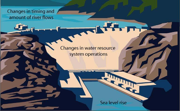
17 Slide from Jamie Anderson DWR Bay Delta Sea Level Rise
18 Managing Floods and the 200 year Event
19 Components of Managing Floods Monitoring Networks Reservoirs Designated Flood Storage and Incidental Flood Space Levees Control Structures/Urban Drainage O&M Considerations Critical Event Duration Determination

20 Climate Change and Flood Planning
21 Threshold Analysis Approach Combination of approaches Begin with a Bottomup approach Vulnerability assessment at critical system thresholds Work at Developing Top down approach to define physical conditions for flood event Source: Dessai and Hulme, 2003
22 Developing a Strategy Identify target flood peak, volume, and duration Identify critical thresholds Identify timing of transition points Identify adaptive capacity Identify capital investments needed for present and future conditions
23 Adaptive Management for a Changing Climate Planning Process and Policy Monitoring Change Thresholds, Timing, and Transitions What About Forecasts?
24 Water cycle changes UNCERTAINTY Climate Projections Converting GCM data to watershed scales and event runoff $$$$ Ecosystem response Future Mandates Future Watershed Conditions Adaptation Strategies Sea level rise Changes in societal values
25 Panel Discussion What information is available/needed? What are important knowledge gaps? What are challenges to adapting existing methods? What is missing from the discussion?
26 Questions? Michael Anderson State Climatologist, California California Department of Water Resources
Here is an overview of the material I will present over the next 20 minutes or so. We ll start with statistics, move on to physics, and look at
 1 Here is an overview of the material I will present over the next 20 minutes or so. We ll start with statistics, move on to physics, and look at climate change issues. Then we will move onto discussion
Advanced Observing Systems and S2S Forecasting California Investments
 Advanced Observing Systems and S2S Forecasting California Investments Dr. Michael Anderson, CA State Climatologist WSWC S2S Workshop May 14, 2018 Talk Overview Motivation History of the Past Decade Current
SOUTHEAST TEXAS CONTINUING EDUCATION
 EXAM No. 118 FLOOD - RUNOFF ANALYSIS 1. Information gained from flood - runoff analysis includes which one: A. Stage, discharge, volume. B. Measure depth, volume. C. Velocity, depth, storm occurrence.
Introduction to Hydrology, Part 2. Notes, Handouts
 Introduction to Hydrology, Part 2 Notes, Handouts Precipitation Much of hydrology deals with precipitation How much? How frequently/infrequently? What form? How quickly? Seasonal variation? Drought frequency?
Engineering Hydrology Class 3
 Engineering Hydrology Class 3 Topics and Goals: I.Develop s (estimate precipitation) II.Develop simple constant intensity design storm III.Develop SCS design storm Ocean s Why do we want to derive the?
SLIDES: Summary The California Perspective and California Perspective: Climate Change and Water Resources
 University of Colorado Law School Colorado Law Scholarly Commons Climate Change and the Future of the American West: Exploring the Legal and Policy Dimensions (Summer Conference, June 7-9) Getches-Wilkinson
The Drainage Basin System
 The Drainage Basin System These icons indicate that teacher s notes or useful web addresses are available in the Notes Page. This icon indicates that the slide contains activities created in Flash. These
A Hydrologic Study of the. Ryerson Creek Watershed
 A Hydrologic Study of the Ryerson Creek Watershed Dave Fongers Hydrologic Studies Unit Land and Water Management Division Michigan Department of Environmental Quality May 8, 2002 Table of Contents Summary...2
Engineering Hydrology. Class 16: Direct Runoff (DRO) and Unit Hydrographs
 and Unit Hydrographs") Engineering Hydrology Class 16: and s Topics and Goals: 1. Calculate volume of DRO from a hydrograph; 2. Complete all steps to develop a. Class 14: s? HG? Develop Ocean Class 14: s? HG? Develop Timing
Engineering Hydrology Class 16: and s Topics and Goals: 1. Calculate volume of DRO from a hydrograph; 2. Complete all steps to develop a. Class 14: s? HG? Develop Ocean Class 14: s? HG? Develop Timing
IPCC WG II Chapter 3 Freshwater Resources and Their Management
 IPCC WG II Chapter 3 Freshwater Resources and Their Management Impacts increasingly harmful & more costly to adapt as global temperature increases May imperil sustainable development goals Semi-arid /
CE 2031 WATER RESOURCES ENGINEERING L T P C
 CE 2031 WATER RESOURCES ENGINEERING L T P C 3 0 0 3 QUESTION BANK PART - A UNIT I GENERAL 1. Write short notes on Water Resources Survey. 2. How do you calculate Average Annual Runoff depth? 3. Write short
ICELANDIC RIVER / WASHOW BAY CREEK INTEGRATED WATERSHED MANAGEMENT PLAN STATE OF THE WATERSHED REPORT CONTRIBUTION SURFACE WATER HYDROLOGY REPORT
 ICELANDIC RIVER / WASHOW BAY CREEK INTEGRATED WATERSHED MANAGEMENT PLAN STATE OF THE WATERSHED REPORT CONTRIBUTION SURFACE WATER HYDROLOGY REPORT Disclaimer: The hydrologic conditions presented in this
INFLOW DESIGN FLOOD CONTROL SYSTEM PLAN 40 C.F.R. PART PLANT DANIEL ASH POND B MISSISSIPPI POWER COMPANY
 INFLOW DESIGN FLOOD CONTROL SYSTEM PLAN 40 C.F.R. PART 257.82 PLANT DANIEL ASH POND B MISSISSIPPI POWER COMPANY EPA s Disposal of Coal Combustion Residuals from Electric Utilities Final Rule (40 C.F.R.
Lecture 19: Down-Stream Floods and the 100-Year Flood
 Lecture 19: Down-Stream Floods and the 100-Year Flood Key Questions 1. What is a downstream flood? 2. What were the setup conditions that caused the Nov, 1990 Nooksack flood? 3. What is a 100-year flood?
RUN-ON AND RUN-OFF CONTROL PLAN 40 C.F.R. PART PLANT DANIEL NORTH ASH MANAGEMENT UNIT MISSISSIPPI POWER COMPANY
 RUN-ON AND RUN-OFF CONTROL PLAN 40 C.F.R. PART 257.81 PLANT DANIEL NORTH ASH MANAGEMENT UNIT MISSISSIPPI POWER COMPANY EPA s Disposal of Coal Combustion Residuals from Electric Utilities Final Rule (40
Distribution Restriction Statement Approved for public release; distribution is unlimited.
 CECW-EH-Y Regulation No. 1110-2-1464 Department of the Army U.S. Army Corps of Engineers Washington, DC 20314-1000 Engineering and Design HYDROLOGIC ANALYSIS OF WATERSHED RUNOFF Distribution Restriction
Interest in a Community Model for Operational Delta Forecasting
 NOAA s National Weather Service California-Nevada River Forecast Center Interest in a Community Model for Operational Delta Forecasting Rob Hartman Hydrologist in Charge Mission of NWS Hydrologic Services
Uncertainty in Hydrologic Modelling for PMF Estimation
 Uncertainty in Hydrologic Modelling for PMF Estimation Introduction Estimation of the Probable Maximum Flood (PMF) has become a core component of the hydrotechnical design of dam structures 1. There is
INFLOW DESIGN FLOOD CONTROL SYSTEM PLAN 40 C.F.R. PART PLANT YATES ASH POND B (AP-B ) GEORGIA POWER COMPANY
 GEORGIA POWER COMPANY") INFLOW DESIGN FLOOD CONTROL SYSTEM PLAN 40 C.F.R. PART 257.82 PLANT YATES ASH POND B (AP-B ) GEORGIA POWER COMPANY EPA s Disposal of Coal Combustion Residuals from Electric Utilities Final Rule (40 C.F.R.
INFLOW DESIGN FLOOD CONTROL SYSTEM PLAN 40 C.F.R. PART 257.82 PLANT YATES ASH POND B (AP-B ) GEORGIA POWER COMPANY EPA s Disposal of Coal Combustion Residuals from Electric Utilities Final Rule (40 C.F.R.
2
 1 2 3 4 5 6 The program is designed for surface water hydrology simulation. It includes components for representing precipitation, evaporation, and snowmelt; the atmospheric conditions over a watershed.
Appendix VI: Illustrative example
 Central Valley Hydrology Study (CVHS) Appendix VI: Illustrative example November 5, 2009 US Army Corps of Engineers, Sacramento District Prepared by: David Ford Consulting Engineers, Inc. Table of contents
Sacramento and San Joaquin river basins: Procedures for hydrologic analysis September 9, 2008
 Sacramento and San Joaquin river basins: Procedures for hydrologic analysis September 9, 2008 David Ford Consulting Engineers, Inc. 2015 J Street, Suite 200 Sacramento, CA 95811 Ph. 916.447.8779 Fx. 916.447.8780
Estimating the 100-year Peak Flow for Ungagged Middle Creek Watershed in Northern California, USA
 American Journal of Water Resources, 2014, Vol. 2, No. 4, 99-105 Available online at http://pubs.sciepub.com/ajwr/2/4/3 Science and Education Publishing DOI:10.12691/ajwr-2-4-3 Estimating the 100-year
Sea Level Rise and Recurrent Flooding Update
 Sea Level Rise and Recurrent Flooding Update Informational Briefing City Council Meeting September 18, 2018 Thomas M. Leahy, Deputy City Manager The Sea, Inland Waters, & Groundwater are Rising Projected
Uncertainty in projected impacts of climate change on water
 1928 2000 Uncertainty in projected impacts of climate change on water Ed Maurer Civil Engineering Cambio Climático y Políticas Públicas Centro de Cambio Global Universidad Católica de Chile 23 abril 2009
INFLOW DESIGN FLOOD CONTROL SYSTEM PLAN PLANT BARRY ASH POND ALABAMA POWER COMPANY
 INFLOW DESIGN FLOOD CONTROL SYSTEM PLAN PLANT BARRY ASH POND ALABAMA POWER COMPANY Section 257.82 of EPA s regulations requires the owner or operator of an existing or new CCR surface impoundment or any
Managing Forests for Snowpack Storage & Water Yield
 Managing Forests for Snowpack Storage & Water Yield Roger Bales Professor & Director Sierra Nevada Research Institute UC Merced NASA-MODIS satellite image NASA-MODIS satellite image Outline of talk Mountain
San Luis Obispo Creek Watershed Hydrologic Model Inputs
 Jeff Werst San Luis Obispo County Department of Public Works 1050 Monterey Street San Luis Obispo CA 93408 December 14, 2007 Subject: San Luis Obispo Creek Watershed Hydrology and Hydraulic Model Dear
CVEN 339 Summer 2009 Final Exam. 120 minutes allowed. 36 Students. No curve applied to grades. Median 70.6 Mean 68.7 Std. Dev High 88 Low 24.
 CVEN 339 Final Exam 120 minutes allowed 36 Students No curve applied to grades Median 70.6 Mean 68.7 Std. Dev. 13.7 High 88 Low 24.5 Name: CVEN 339 Water Resources Engineering Summer Semester 2009 Dr.
INFLOW DESIGN FLOOD CONTROL SYSTEM PLAN PLANT GREENE COUNTY ASH POND ALABMA POWER COMPANY
 INFLOW DESIGN FLOOD CONTROL SYSTEM PLAN PLANT GREENE COUNTY ASH POND ALABMA POWER COMPANY Section 257.82 of EPA s regulations requires the owner or operator of an existing or new CCR surface impoundment
INFLOW DESIGN FLOOD CONTROL SYSTEM PLAN 40 C.F.R. Part PLANT MCINTOSH ASH POND 1 GEORGIA POWER COMPANY
 INFLOW DESIGN FLOOD CONTROL SYSTEM PLAN 40 C.F.R. Part 257.82 PLANT MCINTOSH ASH POND 1 GEORGIA POWER COMPANY EPA s Disposal of Coal Combustion Residuals from Electric Utilities Final Rule (40 C.F.R. Part
Who s in Charge!? 8/9/2018. Houston Geological Society Presents. Peak Floods Brays Bayou
 Houston Geological Society Presents An Informational Workshop Flooding and Floodplains in the Houston Area: Past, Present, and Future: Part 1 Presented May 18, 2018 Dr. William R. Dupre Professor Emeritus
Forecast Informed Reservoir Operations An Opportunity to Improve the Resiliency of our Water Supply
 Forecast Informed Reservoir Operations An Opportunity to Improve the Resiliency of our Water Supply 2016 International Atmospheric Rivers Conference August 8 2016 Jay Jasperse, Chief Engineer Sonoma County
T. Frank, J. Jensen, Ch. Mudersbach, B. Schubert, M. Wörner
 Research Institute for for Water and Environment University of of Siegen Protection of Nuclear Power Plants against Flooding Considerations for the Determination of a 10.000 Years Return Period Flood between
Water Supply Board Briefing. Water Operations Department March 22, 2016
 Water Supply Board Briefing Water Operations Department March 22, 2016 Water Supply Briefing California Water Supply District Water Supply Water Supply Projections Water Supply Schedule 2 California Water
Planning for Variability & Uncertainty: Climate Change and
 Planning for Variability & Uncertainty: Climate Change and the UDFCD Urban Drainage System David Bennetts, P.E. Manger of Design, Construction, and Maintenance Programs, UDFCD Dr. Andrew Earles, P.E.,
5/11/2007. WinTR-55 for Plan Reviewers Small Watershed Hydrology Hydrology Terms and Definitions
 WinTR-55 for Plan Reviewers Small Watershed Hydrology Hydrology Terms and Definitions 1 Course Outline Overview Review of Hydrology Terms and Definitions Modeling Single Sub-area Watersheds Multiple Sub-area
INFLOW DESIGN FLOOD CONTROL SYSTEM PLAN 40 C.F.R. PART PLANT BOWEN ASH POND 1 (AP-1) GEORGIA POWER COMPANY
 GEORGIA POWER COMPANY") INFLOW DESIGN FLOOD CONTROL SYSTEM PLAN 40 C.F.R. PART 257.82 PLANT BOWEN ASH POND 1 (AP-1) GEORGIA POWER COMPANY EPA s Disposal of Coal Combustion Residuals from Electric Utilities Final Rule (40 C.F.R.
INFLOW DESIGN FLOOD CONTROL SYSTEM PLAN 40 C.F.R. PART 257.82 PLANT BOWEN ASH POND 1 (AP-1) GEORGIA POWER COMPANY EPA s Disposal of Coal Combustion Residuals from Electric Utilities Final Rule (40 C.F.R.
Lectures by ElenaYulaeva
 Lectures by ElenaYulaeva eyulaeva@ucsd.edu;858-534-6278 1. 07-13: Overview of Climate Change 2. 07-15:Climate change modeling (topic for research project) 3. 07-18:Forecasting climate (topic for research
Implications of Climate Change on Fish Passage and Reintroduction. Future of Our Salmon Conference. April 23, Bob Heinith Heinith Consulting
 Implications of Climate Change on Fish Passage and Reintroduction Future of Our Salmon Conference April 23, 2014 Bob Heinith Heinith Consulting Outline Understanding Climate Change Defining Fish Vulnerability
Unit 2: Geomorphologic and Hydrologic Characteristics of Watersheds. ENVS 435: Watershed Management INSTR.: Dr. R.M. Bajracharya
 Unit 2: Geomorphologic and Hydrologic Characteristics of Watersheds ENVS 435: Watershed Management INSTR.: Dr. R.M. Bajracharya Watersheds are hydro-geologic units Water flow and cycling are basic and
INFLOW DESIGN FLOOD CONTROL SYSTEM PLAN PLANT GASTON GYPSUM POND ALABAMA POWER COMPANY
 INFLOW DESIGN FLOOD CONTROL SYSTEM PLAN PLANT GASTON GYPSUM POND ALABAMA POWER COMPANY Section 257.82 of EPA s regulations requires the owner or operator of an existing or new CCR surface impoundment or
SECTION IV WATERSHED TECHNICAL ANALYSIS
 A. Watershed Modeling SECTION IV WATERSHED TECHNICAL ANALYSIS An initial step in the preparation of this stormwater management plan was the selection of a stormwater simulation model to be utilized. It
IBS Site Drainage: Senior Design Project
 IBS Site Drainage: Senior Design Project Len Wright, Ph.D., PE Lecturer, CEAE Wright.Len@gmail.com September 11, 2008 mwsw204i1.ppt/1 OUTLINE Motivation for Stormwater Management Quantity (both onsite,
INFLOW DESIGN FLOOD CONTROL SYSTEM PLAN 40 C.F.R. PART PLANT YATES ASH POND 3 (AP-3) GEORGIA POWER COMPANY
 GEORGIA POWER COMPANY") INFLOW DESIGN FLOOD CONTROL SYSTEM PLAN 40 C.F.R. PART 257.82 PLANT YATES ASH POND 3 (AP-3) GEORGIA POWER COMPANY EPA s Disposal of Coal Combustion Residuals from Electric Utilities Final Rule (40 C.F.R.
INFLOW DESIGN FLOOD CONTROL SYSTEM PLAN 40 C.F.R. PART 257.82 PLANT YATES ASH POND 3 (AP-3) GEORGIA POWER COMPANY EPA s Disposal of Coal Combustion Residuals from Electric Utilities Final Rule (40 C.F.R.
Reservoir on the Rio Boba
 Reservoir on the Rio Boba Michael J. Burns II Guillermo Bustamante J. James Peterson Executive Summary The National Institute of Water Resources in the Dominican Republic (INDRHI) plans to construct a
HEC-17: Highways in the River Environment Flood Plains, Extreme Events, Risk, and Resilience
 HEC-17: Highways in the River Environment Flood Plains, Extreme Events, Risk, and Resilience Roger Kilgore, P.E., D.WRE, Kilgore Consulting and Management George Herrmann, Ph.D., P.E., D. WRE, Desert Sky
Definition Recurrence Interval. The 100 year flood--what it means. Sacramento flooding issues Flood control methods
 Definition Recurrence Interval The 100 year flood--what it means Sacramento flooding issues Flood control methods Occurs when water overtops a stream s banks and spills out onto the flood plain. http://waterdata.usgs.gov/ca/nwi
On Course for Sustainable Water Resources Management
 On Course for Sustainable Water Resources Management December 2015 Gary Bardini Deputy Director CA Department of Water Resources Topics To Cover Today Managing Risk in California Today Investing in Flood
An Integrated Framework for Assessing Climate Change Impacts on Water Resources
 An Integrated Framework for Assessing Climate Change Impacts on Water Resources 1 Stakeholder Needs for Climate Information Related to Agriculture and Natural Resources Phil Pasteris Principal Technologist
Flood Prevention in Champasack district, Champasak province
 Flood Prevention in Champasack district, Champasak province Prepared by Khamfeuane SIOUDOM,PhD Lecture and Deputy Head of Research & Post Graduate Faculty of Engineering, National University of Laos Contents
Figure 1: Overview of all AutoCAD generated cross-sections.
 RocScience Slope Stability Modeling Software RocScience s Slide is a program that was used to evaluate Odell Dam slope stability conditions. Slide is a 2D limit equilibrium slope stability program that
Hydrologic Regime; Past and Present and Water Quality Implications
 Hydrologic Regime; Past and Present and Water Quality Implications Waseca County Water Plan Meeting Waseca County Courthouse Annex November 16, 2016 Dan Girolamo, Area Hydrologist, Waterville, MN Topics
HYDROLOGY WORKSHEET 1 PRECIPITATION
 HYDROLOGY WORKSHEET 1 PRECIPITATION A watershed is an area of land that captures rainfall and other precipitation and funnels it to a lake or stream or wetland. The area within the watershed where the
FISHER RIVER INTEGRATED WATERSHED MANAGEMENT PLAN STATE OF THE WATERSHED REPORT CONTRIBUTION SURFACE WATER HYDROLOGY REPORT
 FISHER RIVER INTEGRATED WATERSHED MANAGEMENT PLAN STATE OF THE WATERSHED REPORT CONTRIBUTION SURFACE WATER HYDROLOGY REPORT Disclaimer: The hydrologic conditions presented in this report are estimates
Introduction, HYDROGRAPHS
 HYDROGRAPHS Sequence of lecture Introduction Types of Hydrograph Components of Hydrograph Effective Rainfall Basin Lag or Time Lag Parts of Hydrograph Hydrograph Analysis Factors Affecting Hydrograph Shape
Managing Reservoirs for Atmospheric Rivers The Uneven Balance of Flood Risk and Water Supply
 Managing Reservoirs for Atmospheric Rivers The Uneven Balance of Flood Risk and Water Supply Larry Schick Water Management Seattle District 2016 International Atmospheric River Conference Scripps Institute
The Future of Integrated Water Management: Moving the Program Forward
 The Future of Integrated Water Management: Moving the Program Forward Gary Bardini, Deputy Director CA Department of Water Resources Santa Ana River Watershed 2013 Conference April 11, 2013 1 Today s Presentation
Module 3. Lecture 4: Introduction to unit hydrograph
 Lecture 4: Introduction to unit hydrograph (UH) The unit hydrograph is the unit pulse response function of a linear hydrologic system. First proposed by Sherman (1932), the unit hydrograph (originally
Advancing Cross Line Office Execution: Achieving the Climate Goal Strategy
 U N I T E D S T A T E S D E P A R T M E N T O F C O M M E R C E N A T I O N A L O C E A N I C A N D A T M O S P H E R I C A D M I N I S T R A T I O N Advancing Cross Line Office Execution: Achieving the
Climate Change in the Columbia Basin. Stephanie Smith Manager of Hydrology, BC Hydro
 Climate Change in the Columbia Basin Stephanie Smith Manager of Hydrology, BC Hydro June 20, 2017 Outline Climate change in the Columbia River basin What has happened? What could happen? What can we do
Stormwater: Too Simple?
 Stormwater: Too Simple? Getting Closer to Advertised Level of Service Brandon Klenzendorf, Ph.D., P.E. 13 December 2017 - CWEA Fall Seminar Introduction Traditional approaches to solving stormwater problems
Summary ECONOMIC STUDIES
 ECONOMIC STUDIES The Comprehensive Study performed basin-wide economic evaluations that incorporated a risk-based analysis. The primary tool for the economic studies was the Corps Flood Damage Analysis
Anticipating Future Climate Change Impacts on California mountain hydrology
 Anticipating Future Climate Change Impacts on California mountain hydrology 1928 2000 Photos from USGS Ed Maurer California Water and Environmental Modeling Forum March 1, 2006 California as a Global Warming
INFLOW DESIGN FLOOD CONTROL SYSTEM PLAN. Bremo Power Station CCR Surface Impoundment: North Ash Pond INFLOW DESIGN FLOOD
 INFLOW DESIGN FLOOD CONTROL SYSTEM PLAN INFLOW DESIGN FLOOD CONTROL SYSTEM PLAN Bremo Power Station CCR Surface Impoundment: North Ash Pond Submitted To: Bremo Power Station 1038 Bremo Bluff Road Bremo
Climate Change and Water Resources: A Primer for Municipal Water Providers
 Climate Change and Water Resources: A Primer for Municipal Water Providers David Yates & Kathleen Miller National Center for Atmospheric Research 1. Introduction A recent collaboration between the AWWA
ERIC D. STEIN SOUTHERN CALIFORNIA COASTAL WATER RESEARCH PROJECT
 Effect of Sea Level Rise on Coastal Wetlands ERIC D. STEIN SOUTHERN CALIFORNIA COASTAL WATER RESEARCH PROJECT Sea level rise presents substantial challenges to managing wetlands and other coastal resources
Uncertainty in hydrologic impacts of climate change: A California case study
 Uncertainty in hydrologic impacts of climate change: A California case study Ed Maurer Civil Engineering Dept. Santa Clara University Photos from USGS Motivating Questions What are potential impacts of
Assessing Real Time - Drainage Water Management
 Assessing Real Time - Drainage Water Management Jim Klang, PE Kieser & Associates, LLC 536 East Michigan Ave / Suite 300, Kalamazoo, MI 49007 (269) 344-7117 Photo Credit: Purdue Engineering Today s Talk
Rainfall, Runoff and Peak Flows: Calibration of Hydrologic Design Methods for the Kansas City Area
 Rainfall, Runoff and Peak Flows: Calibration of Hydrologic Design Methods for the Kansas City Area Bruce McEnroe, Bryan Young, Ricardo Gamarra and Ryan Pohl Department of Civil, Environmental, and Architectural
Alberta Rainfall Runoff Response
 Alberta Rainfall Runoff Response Introduction The runoff response to a rainfall event is a function of many complex hydrologic processes. Some of the major factors in the rainfall-runoff process are basin
US Army Corps of Engineers Kansas City District. A Dam Safety Study Involving Cascading Dam Failures
 A Dam Safety Study Involving Cascading Dam Failures Policy / Technical Issues How to account for the failure of other dams in the drainage basin How to account for the behavior of all basin dams acting
Module 3. Lecture 6: Synthetic unit hydrograph
 Lecture 6: Synthetic unit hydrograph Synthetic Unit Hydrograph In India, only a small number of streams are gauged (i.e., stream flows due to single and multiple storms, are measured) There are many drainage
CENTRAL ASSINIBOINE INTEGRATED WATERSHED MANAGEMENT PLAN SURFACE WATER HYDROLOGY REPORT
 CENTRAL ASSINIBOINE INTEGRATED WATERSHED MANAGEMENT PLAN SURFACE WATER HYDROLOGY REPORT Planning Area Boundary: The Central Assiniboine planning area covers the reach of the Assiniboine River from just
Chapter 1 Introduction
 Engineering Hydrology Chapter 1 Introduction 2016-2017 Hydrologic Cycle Hydrologic Cycle Processes Processes Precipitation Atmospheric water Evaporation Infiltration Surface Runoff Land Surface Soil water
Norman Maclean Snowmelt Flow rate Storm flows fs (c flow m a tre S
 Eventually, all things merge into one, and a river runs through it. Norman Maclean Understanding Streamflow ADEQ SW Short Course June 13, 213 Phoenix, AZ Hydrographs Discharge (Q) USGS flow data & plots
Potential Use of Real-time Information for Flood Operation Rules for Folsom Reservoir. Katherine M. Maher B.S. (University of California, Davis) 2008
 2008") Potential Use of Real-time Information for Flood Operation Rules for Folsom Reservoir By Katherine M. Maher B.S. (University of California, Davis) 2008 THESIS Submitted in partial satisfaction of the Requirements
Potential Use of Real-time Information for Flood Operation Rules for Folsom Reservoir By Katherine M. Maher B.S. (University of California, Davis) 2008 THESIS Submitted in partial satisfaction of the Requirements
Hydrology and Water Management. Dr. Mujahid Khan, UET Peshawar
 Hydrology and Water Management Dr. Mujahid Khan, UET Peshawar Course Outline Hydrologic Cycle and its Processes Water Balance Approach Estimation and Analysis of Precipitation Data Infiltration and Runoff
Camp Far West Hydroelectric Project Relicensing
 Camp Far West Hydroelectric Project Relicensing Water Operations Model FERC Project No. 2997 July 16, 2018 Overview Project and South Sutter Water District overview Operations model Overview Model Updates
ADVANCED APPLICATIONS OF HEC-HMS
 Hydrologic Engineering Center Training Course on ADVANCED APPLICATIONS OF HEC-HMS 18 22 April 2016 Davis, California Course Objectives The course covers a variety of areas that go beyond the Basic HEC-HMS
From Global Climate Models to Local Choices: Lessons Learned about Providing and Using Climate Information in the Carolinas
 From Global Climate Models to Local Choices: Lessons Learned about Providing and Using Climate Information in the Carolinas Carolinas Integrated Sciences & Assessments Amanda Brennan and Kirsten Lackstrom
Technical Memorandum
 Tucson Office 3031 West Ina Road Tucson, AZ 85741 Tel 520.297.7723 Fax 520.297.7724 www.tetratech.com Technical Memorandum To: Kathy Arnold From: Greg Hemmen, P.E. Company: Rosemont Copper Company Date:
GIS Applications in Water Resources Engineering
 King Fahd University of Petroleum & Minerals City & Regional Planning Department Introduction to Geographic Information Systems Term Paper Presentation GIS Applications in Water Resources Engineering Prepared
Baseline Hydrologic Analyses for South Fork Battle Creek
 Baseline Hydrologic Analyses for South Fork Battle Creek Report Prepared for Rugraw, LLC Redding, CA Upstream View of Proposed Diversion Site 28 Table of Contents 1. Introduction...1 2. Available Data...3
A Century of Precipitation Trends in the Mississippi Delta Region and Implications for Agroecosystem Management
 A Century of Precipitation Trends in the Mississippi Delta Region and Implications for Agroecosystem Management LINDSEY YASARER, RESEARCH HYDROLOGIST WATER QUALITY AND ECOLOGY RESEARCH UNIT USDA-ARS NATIONAL
Napa Watershed Symposium. Factors affecting future water quantity and quality in Napa County, and strategies for adaptation
 Napa Watershed Symposium Factors affecting future water quantity and quality in Napa County, and strategies for adaptation Pierre Stephens California Department of Water Resources May 21, 2009 Source:
THE CALIFORNIA DROUGHT
 THE CALIFORNIA DROUGHT Helen Dahlke Assistant Professor in Integrated Hydrologic Sciences, LAWR, UC Davis DECEMBER 13, 2015 EMAIL: hdahlke@ucdavis.edu Signs of a 4-year drought NOAA drought index THE DILEMMA
APPENDIX H Guidance for Preparing/Reviewing CEQA Initial Studies and Environmental Impact Reports
 APPENDIX H H.1 Guidance for Preparing and Reviewing CEQA Initial Studies Step 1: Consider the Project Characteristics as Provided by the Project Applicant Review the project application and draft plan
Using Information from Data Rich Sites to Improve Prediction at Data Limited Sites
 Using Information from Data Rich Sites to Improve Prediction at Data Limited Sites A Challenge for Hydrologic Prediction from Mountain Basins: DANNY MARKS Northwest Watershed Research Center USDA-Agricultural
Inflow Design Flood Control System Plan for Louisa Generating Station CCR Impoundment. MidAmerican Energy Company
 Control System Plan for Louisa Generating Station CCR Impoundment MidAmerican Energy Company October 10, 2016 Control System Plan for Louisa Generating Station CCR Impoundment Prepared for MidAmerican
Suspended Sediment Discharges in Streams
 US Army Corps of Engineers Hydrologic Engineering Center Suspended Sediment Discharges in Streams April 1969 Approved for Public Release. Distribution Unlimited. TP-19 REPORT DOCUMENTATION PAGE Form Approved
500-Year Flood Can It Be Reliably Estimated?
 500-Year Flood Can It Be Reliably Estimated? By Joseph D. Countryman PE; D. WRE President MBK Engineers, 2450 Alhambra Boulevard, Sacramento, California, 95817, PH (916) 456-4400; FAX (916) 456-0253; email:
Russian River Watershed Hydrograph Separation using Stable Isotopes and Natural Geochemical Tracers. July 28, 2018
 Russian River Watershed Hydrograph Separation using Stable Isotopes and Natural Geochemical Tracers Stephen J. Turnbull1, Charles W. Downer1, Anna M. Wilson2, Carolyn J. Ellis2, Brian Henn2, and Hari T.
1 n. Flow direction Raster DEM. Spatial analyst slope DEM (%) slope DEM / 100 (actual slope) Flow accumulation
 slope DEM / 100 (actual slope) Flow accumulation") 1 v= R S n 2/3 1/2 DEM Flow direction Raster Spatial analyst slope DEM (%) Flow accumulation slope DEM / 100 (actual slope) 0 = no cell contributing 215 = 215 cell contributing towards that cell sqrt (actual
1 v= R S n 2/3 1/2 DEM Flow direction Raster Spatial analyst slope DEM (%) Flow accumulation slope DEM / 100 (actual slope) 0 = no cell contributing 215 = 215 cell contributing towards that cell sqrt (actual
2017 Central Valley Flood Protection Plan Update: Overview
 2017 Central Valley Flood Protection Plan Update: Overview 2015 FMA Conference CVFPP Overview- Mike Mierzwa, DWR Basin-wide Feasibility Study Planning Context- Eric Tsai, DWR Technical Tools/Methodologies-
Pre-Event Activities. Blue River. Pre Field Trip Suggestions
 Blue River Have you heard we all live in a watershed? Well, it is true! This total body activity will allow students to demonstrate how water flows in a watershed while exploring how seasonal variations
Adjusting NRCS Curve Number for Rainfall Durations Less Than 24 Hours
 Journal of South Carolina Water Resources Volume 3, Issue 1, Pages 43-47, 2016 Adjusting NRCS Curve Number for Rainfall Durations Less Than 24 Hours Michael E. Meadows AUTHOR: Associate Professor, Department
Hydrologic Implications of Climate Change for the Western U.S., Pacific Northwest, and Washington State
 Hydrologic Implications of Climate Change for the Western U.S., Pacific Northwest, and Washington State Alan F. Hamlet JISAO/CSES Climate Impacts Group Dept. of Civil and Environmental Engineering University
5/25/2017. Overview. Flood Risk Study Components HYDROLOGIC MODEL (HEC-HMS) CALIBRATION FOR FLOOD RISK STUDIES. Hydraulics. Outcome or Impacts
 CALIBRATION FOR FLOOD RISK STUDIES. Hydraulics. Outcome or Impacts") HYDROLOGIC MODEL (HEC-HMS) CALIBRATION FOR FLOOD RISK STUDIES C. Landon Erickson, P.E.,CFM Water Resources Engineer USACE, Fort Worth District April 27 th, 2017 US Army Corps of Engineers Overview Flood
HYDROLOGIC MODEL (HEC-HMS) CALIBRATION FOR FLOOD RISK STUDIES C. Landon Erickson, P.E.,CFM Water Resources Engineer USACE, Fort Worth District April 27 th, 2017 US Army Corps of Engineers Overview Flood
California s water cycle: climate, snowpack & forest management
 California s water cycle: climate, snowpack & forest management Roger Bales Professor & Director Sierra Nevada Research Institute UC Merced UC Merced NASA-MODIS satellite image SNRI mission Foster interdisciplinary