PHASE I ENVIRONMENTAL SITE ASSESSMENT REPORT
|
|
|
- Damon Arnold
- 6 years ago
- Views:
Transcription
1
 383-0486 (802) 383-0490 fax info@kas-consulting.com KAS Proj.")
2 PHASE I ENVIRONMENTAL SITE ASSESSMENT REPORT Miscellaneous Property Group Various Properties South Burlington, Vermont October 14, 2011 Prepared for: Stantec Consulting Inc. 55 Green Mountain Drive South Burlington, Vermont Prepared by: P.O. Box Avenue D, Suite 15 Williston, VT (802) (802) fax info@kas-consulting.com KAS Proj. #
3 Phase I Environmental Site Assessment Report Miscellaneous Property Group, South Burlington, Vermont Table of Contents Section Page 1.0 EXECUTIVE SUMMARY ii 2.0 INTRODUCTION SITE DESCRIPTION USER SUPPLIED INFORMATION RECORDS REVIEW SITE RECONAISSANCE INTERVIEWS FINDINGS OPINION CONCLUSIONS DEVIATIONS ADDITIONAL SERVICES REFERENCES SIGNATURES OF ENVIRONMENTAL PROFESSIONALS QUALIFICATIONS OF ENVIRONMENTAL PROFESSIONALS APPENDICIES 21 October 14, 2011 i KAS Project #
4 Phase I Environmental Site Assessment Report Miscellaneous Property Group, South Burlington, Vermont 1.0 EXECUTIVE SUMMARY KAS, Inc. of Williston, Vermont conducted a Phase I Environmental Site Assessment (ESA) of land and premises at nine residential properties located in the City of South Burlington, Vermont (collectively referred to as Miscellaneous Property Group). The ESA was conducted pursuant to the American Society of Testing and Materials (ASTM) Standard Practice for Environmental Site Assessments: Phase I Environmental Site Assessment Process (ASTM E ). This assessment was conducted for Stantec Consulting Inc., herein referred to as client. The properties are currently owned by the City of Burlington. The user of this document is the Burlington International Airport. Miscellaneous Property Group consists of nine individual residential properties located at the following addresses: 1103, 1107, 1111, 1131, 1159, 1171, 1205, 1237 and 1257 Airport Drive (see Appendix 1 - Site Location Map and Appendix 2 - Site Plan). All of the properties are single-family residences with the exception of 1107 Airport Drive, which is a duplex. The properties are located on typical residential size lots generally ranging from 0.16-acre to 0.33-acre lots. The properties are in a predominantly suburban residential portion of the City of South Burlington. Prior to the current residential development, the subject properties appear to have been undeveloped land. East of the residential neighborhoods is the Burlington International Airport. To the north of the residential area is commercial development including retail stores, public works facility, and interstate 89. To the south is Williston Road and commercial development. The nine properties within the Miscellaneous Property Group have been assessed and it has been determined that the historic and current uses have been for residential housing. Prior to the development of the properties the area appeared to be primarily undeveloped land. None of the properties were identified in the federal, state or tribal regulatory database listings. A few properties in the vicinity appear in the regulatory database report but none appear to present a tangible environmental risk to the subject properties. The properties in Miscellaneous Property Group are served by municipal water and sewer services and natural gas service. The majority of Heating, Ventilation, and Air Conditioning (HVAC) equipment is relatively new and several of the residences have been renovated in the last 20 years. Three of the eight property buildings inspected contained approximately 275- gallon heating oil aboveground storage tanks (ASTs). The ASTs observed, were in good condition with only de minimis staining under the tank. Two of the ASTs contained less than an eighth of tank of fuel oil and the other AST contained approximately a half of a tank of fuel oil. The potential exists that ASTs were historically present at the other residences; however, no evidence of former ASTs or fuel oil was encountered. Furthermore, no evidence of underground storage tanks (USTs) was identified at the subject properties. October 14, 2011 ii KAS Project #
5 Phase I Environmental Site Assessment Report Miscellaneous Property Group, South Burlington, Vermont The following table is a summary of the environmental issues associated with each property: Property Environmental Issues Recommendations 1103 Airport Drive 1107 Airport Drive 1111 Airport Drive 1131 Airport Drive 1159 Airport Drive 1171 Airport Drive 1205 Airport Drive 1237 Airport Drive 1257 Airport Drive 5-gallon fuel oil or diesel container Suspect ACBM Suspect LBP Suspect ACBM Suspect LBP Suspect ACBM Suspect LBP ~275-gallon fuel oil AST (<1/8 full) Suspect ACBM Suspect LBP Suspect ACBM Suspect LBP ~275-gallon fuel oil AST (~1/2 full) Suspect ACBM Suspect LBP Suspect ACBM Suspect LBP Suspect ACBM Suspect LBP ~275-gallon fuel oil AST (<1/8 full) Suspect ACBM Suspect LBP Remove 5-gallon container prior to demolition Pre-Demolition Asbestos Inspection Assume LBP is present Pre-Demolition Asbestos Inspection Assume LBP is present Pre-Demolition Asbestos Inspection Assume LBP is present Fuel oil pumped out and AST removed prior to demolition Pre-Demolition Asbestos Inspection Assume LBP is present Pre-Demolition Asbestos Inspection Assume LBP is present Fuel oil pumped out and AST removed prior to demolition Pre-Demolition Asbestos Inspection Assume LBP is present Pre-Demolition Asbestos Inspection Assume LBP is present Pre-Demolition Asbestos Inspection Assume LBP is present Fuel oil pumped out and AST removed prior to demolition Pre-Demolition Asbestos Inspection Assume LBP is present We have performed a Phase I Environmental Site Assessment in conformance with the scope and limitations of ASTM Practice E 1527 at 1103, 1107, 1111, 1131, 1159, 1171, 1205, 1237 and 1257 Airport Drive in the City of South Burlington, Chittenden County, Vermont. Any exceptions to, or deletions from, this practice are described in Section 11.0 of this report. This assessment has revealed no evidence of recognized environmental conditions in connection with the properties. A recognized environmental condition is defined in ASTM E 1527 as the presence or likely presence of any hazardous substances or petroleum products on a property under conditions that indicate an existing release, a past release, or a material threat of a release of any hazardous substances or petroleum products into structures on the property or into the ground, groundwater or surface water of the property. The term includes hazardous substances or petroleum products even under conditions in compliance with laws. The term is not intended to include de minimis conditions that generally do not present a threat to human health or the environment and that generally would not be the subject of an enforcement action if brought to the attention of October 14, 2011 iii KAS Project #
6 Phase I Environmental Site Assessment Report Miscellaneous Property Group, South Burlington, Vermont appropriate governmental agencies. Conditions determined to be de minimis are not recognized environmental conditions. As part of the Phase I ESA, KAS also provided an opinion regarding asbestos-containing building materials (ACBMs) and lead-based paint (LBP) in accordance with List of Additional Issues in the ASTM E Standard. In accordance with National Emissions Standard for Hazardous Air Pollutants (NESHAPS) Asbestos and 18 VSA Chapter 26, suspect building materials are assumed to be asbestos-containing until proven otherwise. As such, a Pre- Demolition Asbestos Inspection must be performed and NESHAPS notification submitted 10 business days prior to commencement of demolition of all structures. Based on the ages of the buildings (pre-1978), LBP may be present in these buildings. KAS recommends that paints present in the Miscellaneous Property Group buildings be assumed to be lead based and the demolition contractor be required to comply with applicable local, state and federal safety and disposal requirements. Appropriate waste characterization testing for lead should be conducted prior to demolition of the structures. October 14, 2011 iv KAS Project #
7 Phase I Environmental Site Assessment Report Miscellaneous Property Group, South Burlington, Vermont 2.0 INTRODUCTION KAS, Inc. of Williston, Vermont (KAS) conducted a Phase I Environmental Site Assessment (ESA) of land and premises at nine residential properties located in the City of South Burlington, Vermont (collectively referred to as Miscellaneous Property Group; see Appendix A Site Location Map 1 and Appendix B Site Sketches). The ESA was conducted pursuant to the American Society of Testing and Materials (ASTM) Standard Practice for Environmental Site Assessments: Phase I Environmental Site Assessment Process (ASTM E ). This assessment was conducted for Stantec Consulting Inc. herein referred to as client. The subject properties are owned by the City of Burlington 2. The user of this document is the Burlington International Airport Purpose The purpose of this ESA was to identify recognized environmental conditions (RECs), historic RECs and de minimis conditions in association with the property as defined and described in the ASTM standard Detailed Scope-of-Services KAS was engaged by client to conduct a Phase I ESA as defined in ASTM E The Phase I ESA work scope included the following elements: A general description of the site and vicinity, current property and adjoining property uses, description of improvements. An evaluation of user supplied information including land records, liens, limitations, specialized knowledge, and valuation information. A review of practically reviewable regulatory and historic records in connection with the property. A site reconnaissance including general site setting, interior and exterior observations. Interviews with owner, site manager, occupants, local government officials and others as available. Presentation of Findings, Opinion, Conclusions, Deviations and the results of any out of scope contract obligations between client and KAS. Unless otherwise stated in Section 12.0 of this document, no invasive environmental testing was conducted, and no assessment or testing of asbestos, lead paint, radon or other structural environmental hazards was conducted. If any of these tasks were contracted between KAS and client, the methodology, limitations and results of such tasks may be presented in Section 12.0 of this document. 1 USGS, 1987 and Acquired Land Location Plan 2 City of South Burlington Grand List/Tax Information October 14, KAS Project #
8 Phase I Environmental Site Assessment Report Miscellaneous Property Group, South Burlington, Vermont 3.0 SITE DESCRIPTION 3.1. Location Miscellaneous Property Group consists of nine individual residential properties located at the following addresses: 1103, 1107, 1111, 1131, 1157, 1171, 1205, 1237 and 1257 Airport Drive (see Appendix 1 - Site Location Map and Appendix 2 - Site Plan). The properties are located on typical residential size lots generally ranging from 0.16-acre to 0.33-acre lots Site and Vicinity General Characteristics The property is located in a predominantly suburban residential portion of the City of South Burlington, Vermont (see Site Location Map in Appendix 1). The character of the area is fully developed with residential structures on suburban lots. Neighboring properties are residential with the exception of the Aviation Deli to the north of 1205 Airport Drive and the Burlington International Airport to the east. To the north of the residential area is commercial development including retail stores, public works facility, and Interstate 89. To the south is Williston Road and commercial development. The general topography in the area is flat. Depth to groundwater is likely to be more than 10 below grade. The groundwater flow direction beneath the property is most likely toward the north based on the location of the Winooski River. The depth to groundwater and predicted flow direction were not confirmed during this Phase I ESA Current Use of the Property Site reconnaissance was performed on September 23, 2011 for all of the properties except 1111 and 1171 Airport Drive Airport Drive was inspection on September 26, 2011 and 1111 Airport Drive was inspected on October 11, The properties were unoccupied with the exception of 1111, 1171 and 1205 Airport Drive, which were being used as single-family residences Descriptions of On-Site Structures, Roads and Other Improvements As of September 23 and 26, 2011 and October 11, 2011 the properties were developed as follows: 3 City of South Burlington Grand List/Tax Information October 14, KAS Project #
9 Phase I Environmental Site Assessment Report Miscellaneous Property Group, South Burlington, Vermont 1103 Airport Drive Property Description: The property consists of a 0.21 acre parcel of land developed with an approximately 1,500- square foot single-family residence with a full basement. The building is a single-story wood frame structure with a poured concrete basement. The structure appeared to have been built in the 1950s or 1960s. The basement space is partially finished and has extensive mold growth. The residential building was unoccupied on the date of the reconnaissance. A paved driveway and single bay wood frame garage are located adjoining the residence. The garage has a space heater with a makeshift plastic container with fuel to service the unit. The remainder of the property consists of overgrown landscaping. No other improvements were noted on the subject property. The subject property was serviced by municipal water, sewer and natural gas. Electric power and telephone utilities were noted overhead on the subject property. The natural gas, electric power and telephone utilities had been disconnected Airport Drive Property Description: 1111 Airport Drive Property Description: 1131 Airport Drive Property Description: The property consists of a 0.21 acre parcel of land developed with an approximately 1,600- square foot duplex with a full basement. The building is a two-story wood frame structure with a concrete block foundation and a poured concrete basement. The building appeared to have been built in the 1950s or 1960s. The basement is unfinished. A paved driveway is located adjoining the building and the remainder is grassy yard with an approximately 6 X 6 shed. The subject property was serviced by municipal water, sewer and natural gas. Electric power and telephone utilities were noted overhead on the property. The natural gas, electric power and telephone utilities had been disconnected. The property consists of a 0.22-acre parcel of land developed with a single-family residence with a basement. The building is a two-story wood frame structure with a concrete foundation and a poured concrete basement. The building appeared to have built in the 1950s or 1960s. The basement is unfinished. A gravel driveway and approximately 6 by 10 shed are located on the property. The remainder of the property has grass and landscaping. The subject property is serviced by municipal water, sewer and natural gas. Electric power and telephone utilities were noted overhead on the property. The property consists of a 0.21-acre parcel of land developed with a 1,200-square foot singlefamily residence with a full basement. The building is a single-story wood frame structure with a concrete block foundation and a poured concrete basement. The building appeared to have been built in the 1950s or 1960s. The basement is unfinished and contains a 275-gallon heating oil AST that was no longer in service. The property has a paved driveway and a grass backyard. No other improvements were noted on the subject property. The subject property was serviced by municipal water, sewer and natural gas. Electric power and telephone utilities were noted overhead on the subject property. The natural gas, electric power and telephone utilities had been disconnected. October 14, KAS Project #
10 Phase I Environmental Site Assessment Report Miscellaneous Property Group, South Burlington, Vermont 1159 Airport Drive Property Description: 1171 Airport Drive Property Description: 1205 Airport Drive Property Description: The property consists of a 0.21-acre parcel of land developed with an approximately 1,200- square foot single-family residence with a full basement. The building is a two-story wood frame structure with a poured concrete basement. The building appeared to have been built in the 1950s or 1960s. The basement is unfinished. The property has a paved driveway, small shed and a grassy backyard. No other improvements were noted on the subject property. The subject property was serviced by municipal water, sewer and natural gas. Electric power and telephone utilities were noted overhead on the subject property. The natural gas, electricity and telephone service has been disconnected. The property consists of a 0.17-acre parcel of land developed with an approximately 1,200- square foot single-family residence. The building is a single-story wood frame structure with a poured concrete basement. The basement is finished and contains a half full 275-gallon heating oil AST, which is no longer used for heating. The building appeared to have been built in the 1950s or 1960s. The property has an attached garage, gravel driveway and grassy yard. No other improvements were noted in the subject property. The subject property is serviced by municipal water, sewer and natural gas. Electric power and telephone utilities were noted overhead on the subject property. The property consists of a 0.16-acre parcel of land developed with a 1,200-square foot singlefamily residence. The building is a single-story wood frame structure with a full basement. The building appeared to have been built in the 1950s and 1960s. The basement is finished. The property has a detached garage, paved driveway and gassy yard. No other improvements were noted on the subject property. The subject property is serviced by municipal water, sewer and natural gas. Electric power and telephone utilities were noted overhead on the subject property Airport Drive Property Description: The property consists of a 0.33-acre parcel of land developed with a 1,800-square foot singlefamily residence. The building is a two-story wood frame structure with a poured concrete basement. The building appeared to have been built in the 1950s or 1960s with more recent additions. The basement is unfinished. A paved driveway is located along the side of the residence and a grassy backyard three vehicle garage is located to the rear of the residence. Significant outdoor storage was observed while performing the site reconnaissance. A gravel driveway is present along the east side of the property. No other improvements were noted on the subject property. The subject property was serviced by municipal water, sewer and natural gas. Electric power and telephone utilities were noted overhead on the subject property Airport Drive Property Description: The property consists of a 0.16-acre parcel of land developed with a 1,600-square foot singlefamily residence. The building is a two-story wood frame structure with a concrete block basement. The building appeared to have been built in the 1950s or 1960s. The basement is unfinished and contains an approximately 275-gallon heating oil AST that was nearly empty. The property has an attached garage (under the second story), a short paved driveway and a small fenced in backyard. The subject property was serviced by municipal water, sewer and natural gas. Electric power and telephone utilities were noted overhead on the subject property. The natural gas, electricity and telephone service has been disconnected. October 14, KAS Project #
11 Phase I Environmental Site Assessment Report Miscellaneous Property Group, South Burlington, Vermont 3.5. Current Uses of Adjoining Properties Land uses adjacent to the properties as of the date of this assessment were suburban residential except for the Aviation Deli adjoining 1205 Airport Drive to the north and Burlington International Airport to the east. 4.0 USER SUPPLIED INFORMATION 4.1. Title Records KAS reviewed chain of title information for all of the properties except for 1103 and 1171 Airport Drive at the City of South Burlington Clerk s office. Chain of title records for 1103 and 1171 Airport Drive were not readily available. In addition, only the most recent chain of title record was available for 1111 and 1257 Airport Drive. The other title records were traced to first apparent development or earlier. No environmental concerns for the properties were identified in review of the chain of titles. A summary of the land record research for each property is included in Appendix C Environmental Liens or Activity and Use Limitations No environmental liens or activity and use limitations were discovered during review of land records. User did not provide positive information of the existence of environmental liens or activity and use limitations in connection with the properties Specialized Knowledge User provided the following specialized knowledge regarding the properties: see Section Commonly Known or Reasonably Ascertainable Information User provided the following commonly known or reasonable ascertainable information regarding the properties: see Section Valuation Reduction for Environmental Issues User indicated that the transaction was executed at fair market value with no valuation reduction for environmental issues. Based on assessed values of the properties it does not appear that a valuation reduction has occurred 4. 4 City of South Burlington Grand List/Tax Information October 14, KAS Project #
12 4.6. Owner, Property Manager, and Occupant Information Phase I Environmental Site Assessment Report Miscellaneous Property Group, South Burlington, Vermont The User identified the current owner and manager as the Burlington International Airport for the subject properties. The subject properties were unoccupied at the time of the site reconnaissance with the exception of 1111, 1171 and 1205 Airport Drive Reasons for Performing Phase I User indicated that this Phase I ESA was being performed in advance of demolition of the subject properties as part of the owner s noise impact reduction program Other User Supplied Information and Documentation User provided the following other information and documentation: current/past owner contact information. 5.0 RECORDS REVIEW 5.1. Standard Environmental Record Sources Regulatory Database Search KAS contracted with Environmental FirstSearch Technology Corporation to perform a review of state and federal regulatory records during this Phase I ESA. A copy of the FirstSearch Search Report is included in Appendix F. A summary of the pertinent data contained in the First Search report is presented below. Property The subject properties were not listed on the FirstSearch Report. Immediately Adjacent Sites One immediately adjacent Site to one or more of the subject properties (The Burlington International Airport) was listed on the FirstSearch Report as being a RCRA generator (RCRAGN) site, an underground storage tank (UST) site, and a leaking UST site. Other Sites All of the subject properties are in close proximity to the Burlington International Airport which was listed on the FirstSearch Report as being a RCRA generator (RCRAGN) site, an underground storage tank (UST) site, and a leaking UST site. Based on the FirstSearch Report various quantities of ignitable waste, corrosive waste, reactive waste, and petroleum products are stored at the Burlington International Airport. The storage of these materials classifies the site property as a RCRA generator site. The airport also has USTs present on the property. It is unclear from reading the FirstSearch Report exactly how many USTs are located on the October 14, KAS Project #
13 Phase I Environmental Site Assessment Report Miscellaneous Property Group, South Burlington, Vermont property; however, the report does list fuel oil and aviation fuel as being present in some of the USTs. The FirstSearch report also indicates that several USTs have been removed from the Airport property. The FirstSearch Report indicates no contamination or contamination below state standards was found beneath several of the removed USTs; however, the report states that contamination was encountered above state standards at some of the removed UST locations. It appears the presence of contamination was reported to the Vermont Department of Environmental Conservation (VTDEC); however, no additional information is given on the extent of contamination. The Hertz Rental Corp, located at the Burlington International Airport, was also listed on the FirstSearch Report has being a RCRA generator site, a UST site, and a state listed site. Based on the FirstSearch report one 10,000-gallon gasoline UST is currently present on the property and one was removed in The UST removed in 1992 appears to have leaked which resulted in contamination present on the property. The contamination has been monitored since 1992 and groundwater enforcement standards are currently exceeded in several wells. According to the FirstSearch Report there are no sensitive receptor impacts. The North/South hanger at the Burlington International Airport is a state listed site according to the FirstSearch Report. Based on the report it appears a dry well was removed and contamination was encountered. However, the report indicates that the site was closed as of November 1999 and it does not appear additional work is necessary as a result of this contamination. The Vermont Air National Guard located at the Burlington International Airport is a state listed site according to the FirstSearch Report. Based on the report remedial activities were conducted at this property in the summer 2004 to clean up petroleum contamination from above ground tanks and spills. According to the report sensitive receptors are impacted and the site is listed as a high priority clean up site by the VTDEC. Several other sites are included in the FirstSearch report within ½ mile of the subject properties. None of these properties appear to pose an environmental threat to the subject properties. The listed properties are located downgradient from or at a significant distance away from the properties so as to not pose a tangible environmental threat to the subject properties Additional Environmental Record Sources The following reports/documents pertaining to environmental investigations conducted on adjacent properties were reviewed on line at the VTDEC Waste Management Interactive Database ( during this Phase I ESA: Subsurface Investigation Report Hertz Rent-A-Car, Burlington International Airport dated May 20, 1993 and prepared by Groundwater Technology, Inc; October 14, KAS Project #
14 Phase I Environmental Site Assessment Report Miscellaneous Property Group, South Burlington, Vermont Site Investigation Report - Burlington International Airport Innotech Fuel Farm dated September 21, 1994 and prepared by Groundwater of Vermont; Vermont Department of Environmental Conservation Site Management Activity Completed Letter for the Ethan Allen Air Force Base, dated June 30, 1997; Vermont Department of Environmental Conservation Site Management Activity Completed Letter for the North/South Hanger Burlington International Airport, dated November 23, 1999; and, Site Status Letter, Vermont Air National Guard Base, May These five documents pertain to the reported contamination at properties located at the Burlington International Airport. It appears that two of the properties, Ethan Allen Air Force Base (VTDEC Site # ) and the North/South Hanger (VTDEC Site # ) have received site closure status from the VTDEC. According to the Subsurface Investigation Report dated June 4, 1993 prepared for the Hertz Car Rental property groundwater was documented to flow towards the northeast and contamination was determined to be limited to the immediate area of the site property. According to the Site Investigation Report dated September 21, 1994 prepared for the Burlington International Airport Innotech Fuel Farm property groundwater was documented to flow towards the southwest. Contamination was determined to be extensive and the full extent of the plume was not defined. According to the Site Status letter for the Vermont Air National Guard Base dated May 2002 contamination is present on this property from multiple sources including a former landfill dump areas, former dry wells, former underground storage tanks, and former fuel pits. Both petroleum and chlorinated contamination is present on this property which reportedly extends off the base property towards Poor Farm Road and Country Club Estates property. Copies of these reports/documents are included in Appendix J Physical Setting Sources USGS Topographic Maps The most recent USGS topographic quadrangle map 5 was reviewed during this assessment. No buildings are identified on the map due to the housing density of the area. In general the topography appears to slope gentle to the north and the subject properties are located at approximately 320 feet above mean sea level. 5 USGS, 1987 October 14, KAS Project #
15 5.3.2 State Geological Maps Phase I Environmental Site Assessment Report Miscellaneous Property Group, South Burlington, Vermont Bedrock in the vicinity of the property consists of Ordovician-aged Cutting Dolomite and/or Bascom formation. 6 Both bedrock units are carbonate rocks with varying amounts of sandstone. The overburden deposits in the area of the property are mapped as pebbly marine sand Other Physical Setting Sources KAS reviewed the current City of South Burlington Comprehensive Land Use Plan for information about the subject properties. According to this plan, land use of all the subject properties is currently residential. Future land uses are also indicated as residential Historical Use Information on the Property and Adjoining Properties Standard Historical Sources Aerial Photographs KAS reviewed aerial photographs dated May 1962, 9 April and April The aerial photograph dated May 1962 depicts the subject properties as developed. The surrounding properties were in a similar configuration to that observed during the site reconnaissance. An April 1999 and April 2004 aerial photograph of the subject properties was reviewed on line at the KAS office. The photographs show the subject properties and the surrounding properties consistent with how they were observed during the site reconnaissance. Copies of the aerial photographs are included in Appendix E. Fire Insurance Maps KAS has determined that there is no available Sanborn Fire Insurance Map coverage for the subject properties. 12 Historic USGS Topographic Maps Two historic USGS topographic quadrangle maps were reviewed during this assessment. These included the 1906 and the 1948 USGS topographic quadrangle maps for Burlington, Vermont. 13 Based on review of these maps, in 1906 the area was largely undeveloped except for scattered buildings along the main roads. The Burlington Airport was not present in By 1948, the 6 Doll et. al Doll et. al South Burlington Comprehensive Plan, Maps 1 and 6. 9 VT 82-L Vermont Law Library 10 MSR Aerial Photographs 11 Google Earth Image. 12 FirstSearch No Coverage Letter. 13 University of New Hampshire Collections. October 14, KAS Project #
16 Phase I Environmental Site Assessment Report Miscellaneous Property Group, South Burlington, Vermont southeastern part of the airport had been developed and there were more structures along the roads. The northern part of the airport had not yet been developed. The resolution of these maps is not sufficient to determine the identity of individual homes included in this assessment. 6.0 SITE RECONAISSANCE 6.1. Methodology and Limiting Conditions On September 23, 2011, Mr. Aaron Roth of KAS conducted site reconnaissance of 1103, 1107, 1131, 1159, 1205, 1237 and 1257 Airport Drive. On September 26, 2011, Mr. Jeremy Roberts of KAS conducted site reconnaissance of 1171 Airport Drive. On October 11, 2011, Mr. Jeremy Roberts of KAS conducted site reconnaissance of 1111 Airport Drive. The site reconnaissance was to inspect the individual properties for indications of environmental risks or hazardous conditions. A completed site inspection checklist is included in Appendix H. KAS was accompanied by Kurt Miller, Burlington International Airport s Project Coordinator during the site reconnaissance with the exception of 1111 Airport Drive. Photographs of the properties are included in Appendix D General Site Setting Current Uses All properties were single-family residences with the exception of 1107 Airport Drive, which was a duplex. 1111, 1171 and 1205 Airport Drive were occupied at the time of the site reconnaissance. The other six properties were unoccupied Past Uses Past uses appear to be residential in nature. No evidence of other uses was observed Current and Past Uses of the Adjoining Properties Current uses of adjacent properties are included in Section 3.5. Past uses appear to be similar to current uses Current and Past Uses in the Surrounding Area The surrounding area is predominately residential with the airport to the east. Past uses appear to be similar to current uses. October 14, KAS Project #
17 Phase I Environmental Site Assessment Report Miscellaneous Property Group, South Burlington, Vermont Geologic, Hydrogeologic and Topographic Conditions All properties are generally flat. No bedrock was observed General Description of Structures The residences all consisted of wood framed structures. All the residences contained a basement and concrete foundation. The residences generally contained between 2 and 4 bedrooms. Several of the properties had attached or detached garage and/or small wood or metal sheds Roads The properties are abutted by Airport Drive to the east and 1205 Airport Drive is abutted by Patrick Street to the north Potable Water Supply Potable water supply is reportedly municipal for the subject properties. Water meters were noted inside the basement at each residence Sewage Disposal System Sewage disposal system is reportedly municipal for the subject properties Exterior Observations Current Usage The exterior of the subject properties is primarily used as a driveway and a lawn area. The lawn area is located behind the subject property buildings Hazardous Substances and Petroleum Products No evidence of hazardous substance and/or petroleum products was noted on the subject properties with the exception of vents and fill ports associated with heating oil ASTs in the basement of 1131, 1171 and 1257 Airport Drive Storage Tanks No evidence of storage tanks were noted on the exterior of the subject properties with the exception of the vents and fill ports mentioned in Section October 14, KAS Project #
18 Phase I Environmental Site Assessment Report Miscellaneous Property Group, South Burlington, Vermont Odors No unusual odors were noted on the subject properties Pools of Liquid No pools of liquid were noted on the subject properties Drums No drums were noted on the subject properties PCBs No evidence of PCB containing materials or products was noted on the subject properties. Polemounted transformers were noted in the general vicinity of the subject properties. The transformers were noted to be in good condition with no obvious leakage or staining Pits, Ponds and Lagoons No pits, ponds, or lagoons were noted on the subject properties Stained Soil or Pavement No stained soil or pavement was noted on the subject properties Stressed Vegetation No evidence of stressed vegetation was noted on the subject properties Solid Waste No evidence of solid waste was noted on the properties Drains and Waste Water No evidence of waste water was noted on the subject property Wells No wells were noted on the subject property. October 14, KAS Project #
19 Phase I Environmental Site Assessment Report Miscellaneous Property Group, South Burlington, Vermont Septic Systems No evidence of septic systems was noted for the subject properties Interior Observations Current Usage 1111, 1171 and 1205 Airport Drive were occupied and used as a single-family residence. The remaining properties were vacant and unoccupied Hazardous Substances and Petroleum Products No hazardous substances or petroleum products were noted on the interior of the properties with the exception of the occupied properties which maintained retail-sized quantities of household cleaning supplies and 1131, 1171 and 1257 Airport Drive, which have heating oil ASTs Storage Tanks Approximately 275-gallon heating oil ASTs were identified in 1131, 1171 and 1257 Airport Drive during the site reconnaissance. The ASTs were in good condition with only de minimis staining observed below Odors No odors were noted during the site reconnaissance with the exception of mold/mildew odors from isolated areas within the subject property buildings. The mold/mildew odor was especially strong in the basement of 1103 Airport Drive and back apartment of 1107 Airport Drive Pools of Liquid No pools of liquid were noted during the site reconnaissance Drums No drums were noted during the site reconnaissance PCBs No electrical or hydraulic equipment that may contain PCBs were noted during the site reconnaissance. Given the age of the buildings on the subject properties, the potential exists for PCB containing building materials to be present. October 14, KAS Project #
20 Phase I Environmental Site Assessment Report Miscellaneous Property Group, South Burlington, Vermont Heating and Cooling The subject properties are heated via natural gas with isolated areas heated by electric baseboard heaters. Three of the residences had heating oil ASTs that were no longer in service in the basement. The garage associated with 1103 Airport Drive had an industrial-sized space heater that was connected to an approximately 5-gallon container with fuel oil or diesel. No significant staining was observed around the container at the time of the site reconnaissance Stains and Corrosion No stains or corrosion was noted during the site reconnaissance Drains and Sumps No drains or sumps were noted during the site reconnaissance. 7.0 INTERVIEWS 7.1. Interview with Property Owner The properties are owned by the City of Burlington. KAS performed a property owner interview with the occupant and previous owner Ms. Deborah Morin (1171 Airport Drive). Attempts to contact the other previous property owners were made, but failed. The contact information in the Burlington International Airport file was between 6 and 8 years old. Important points raised during this interview included the following: A half full approximately 275-gallon heating oil AST was identified in the basement Interview with Site Manager See Section Interview with Occupants The previous owner interviewed at 1171 Airport Drive (see Section 7.1) was the occupant. KAS interviewed the tenants of the 1205 Airport Drive during the site reconnaissance. No environmental concerns were identified at 1205 Airport Drive Interview with Local Government Officials KAS interviewed Chief Douglas Brent and Captain Gary Rounds of the City of South Burlington Fire Department in person at the South Burlington Fire Department on September 26, October 14, KAS Project #
21 Phase I Environmental Site Assessment Report Miscellaneous Property Group, South Burlington, Vermont Chief Brent and Captain Rounds have been with the department for more than 40 years. Neither Chief Brent nor Captain Rounds recall having responded to a hazardous materials incident at any of the properties in the Miscellaneous Property Group or the surrounding properties during their tenure at the department Interview with Others The user of this document (Ms. Heather Kendrew of the Burlington International Airport) completed an interview form on October 14, A copy of the interview questionnaire is provided in Appendix G. Important information noted in the interview included the following. No environmental cleanups liens or activity and use limitations are known to exist for the properties. No environmental cleanups are known to have occurred at the properties. 8.0 FINDINGS No RECs were identified during this Phase I ESA as defined by ASTM and as outlined in Sections 9.0 and OPINION The properties have been adequately assessed and it has been determined that the dominant historic and current uses have been for residential housing. Three of the subject properties contained approximately 275-gallon heating oil ASTs. The ASTs were in good condition. Typical of Chittenden County urban areas, natural gas was installed in the 1960 s and many of the tanks and oil burners were removed or left in place. De minimis staining below the existing heating oil ASTs was observed. KAS also identified an approximately 5-gallon container of fuel oil or diesel being used in the garage of 1103 Airport Drive for an industrial-sized space heater. No staining was observed around the container at the time of the site reconnaissance. No other evidence of fuel oil on the subject properties was identified including no indications of foundation wall penetrations by oil lines which could be indicative of USTs outside the buildings. There are no nearby properties on record of environmental concern that present tangible environmental risk. The nearest properties are located some distance away, and in locations that do not appear to jeopardize the environmental status of these properties. October 14, KAS Project #
22 Phase I Environmental Site Assessment Report Miscellaneous Property Group, South Burlington, Vermont 9.1 Additional Investigation No additional investigations are deemed necessary to ascertain the presence or absence of RECs. Per ASTM E , this opinion regarding additional investigations is only intended to convey those additional investigations that may be necessary to ascertain the presence or absence of a REC. It does not convey any recommendation relative to the need to evaluate identified RECs at the property CONCLUSIONS We have performed a Phase I Environmental Site Assessment in conformance with the scope and limitations of ASTM Practice E 1527 of land and premises at nine residential properties located at 1103, 1107, 1111, 1131, 1159, 1171, 1205, 1237 and 1257 Airport Drive in the City of South Burlington, Vermont (collectively referred to as Miscellaneous Property Group). Any exceptions to, or deletions from, this practice are described in Section 11.0 of this report. This assessment has revealed no evidence of recognized environmental conditions in connection with the property. A recognized environmental condition is defined in ASTM E 1527 as the presence or likely presence of any hazardous substances or petroleum products on a property under conditions that indicate an existing release, a past release, or a material threat of a release of any hazardous substances or petroleum products into structures on the property or into the ground, groundwater or surface water of the property. The term includes hazardous substances or petroleum products even under conditions in compliance with laws. The term is not intended to include de minimis conditions that generally do not present a threat to human health or the environment and that generally would not be the subject of an enforcement action if brought to the attention of appropriate governmental agencies. Conditions determined to be de minimis are not recognized environmental conditions DEVIATIONS Deviations/Data Gaps Noted deviations to the ASTM Standard Practice for Environmental Site Assessments: Phase I Environmental Site Assessment Process (ASTM E ) included: None. Data gaps were encountered in KAS inability to contact past property owners of eight of nine properties and land records were not reviewed for 1103 and 1171 Airport Drive. The lack of information from the previous property owners and land records is considered to be low priority data and does not appear to have significantly impact the findings of this report. The historical resources for the subject properties appear sufficient to develop a history of the previous uses of the property and surrounding area. October 14, KAS Project #
23 Phase I Environmental Site Assessment Report Miscellaneous Property Group, South Burlington, Vermont Significant Assumptions KAS undertook performance of this Phase I ESA according to the following assumptions: None Limitations and Exclusions KAS has prepared this Phase I ESA report in accord with ASTM E using the best efforts of Environmental Professionals and information available at the time of preparation. This report is intended to convey a point-in-time environmental evaluation of the property, as well as relevant information on past uses. The user of this document must recognize the limitations inherent in conducting a Phase I ESA, as stated in ASTM E , which include but are not necessarily limited to: This document does not address regulatory compliance issues and KAS makes no assurances relative to the federal, state or local regulatory compliance of the property (ref. Section 1.4). All appropriate inquiry as defined by ASTM E is not an exhaustive assessment of a clean property (ref. Section 4.5.2). A variable level of inquiry may be conducted depending on the specific characteristics and features of the property and the information developed during the course of the assessment (ref. Section 4.5.3). An assessment meeting or exceeding the requirements of ASTM E and completed less than 180 days prior to the date of acquisition or intended transaction is presumed to be valid (ref. Section 4.6). All appropriate inquiry as defined by ASTM E is not exhaustive and does not require assessment of historic uses more frequently than every five years (ref. Section ) Special Contractual Conditions None User Reliance This report is for the use and benefit of client as defined herein. Affiliates of client, and third parties authorized in writing by KAS and client, may rely upon this report to the extent that client is entitled to do so, provided said parties agree to abide by the limitations and exclusions as stated herein. October 14, KAS Project #
24 Phase I Environmental Site Assessment Report Miscellaneous Property Group, South Burlington, Vermont 12.0 ADDITIONAL SERVICES At Client request, KAS conducted a preliminary visual assessment of the potential for asbestoscontaining building materials (ACM) and lead-based paint (LBP) in each of the assessed homes. This work did not include inspections as defined by relevant ACM/LBP regulations, and no sampling was conducted. The purpose of performing this work was to provide a preliminary indication of the need to conduct ACM/LBP inspections in the future. This work was performed pursuant to List of Additional Issues contained in ASTM E In accordance with National Emissions Standard for Hazardous Air Pollutants (NESHAPS) Asbestos and 18 VSA Chapter 26, suspect building materials identified in the Miscellaneous Property Group are assumed to be asbestos-containing until proven otherwise. As such, a Pre- Demolition Asbestos Inspection must be performed and NESHAPS notification submitted 10 business days prior to commencement of demolition of all structures. Based on the ages of the buildings (pre-1978), LBP may be present in these buildings. KAS recommends that paints present in the Miscellaneous Property Group buildings be assumed to be lead based and the demolition contractor be required to comply with applicable local, state and federal safety and disposal requirements. Appropriate waste characterization testing for lead should be conducted prior to demolition of the structures REFERENCES 1. United States Geological Survey (USGS), Topographic Map of South Burlington, Vermont, 1987, viewed on line at 2. City of South Burlington Land Records viewed in person at the South Burlington City Clerk s office, 575 Dorset Street, South Burlington, Vermont. 3. Environmental FirstSearch Technology Corporation, Norwood, MA, FirstSearch Database Report for South Burlington, Vermont, acquired by KAS on September 20, Environmental data for Burlington International Airport viewed on line at the Vermont DEC Waste Management Interactive Database 5. Doll, Charles G., ed., 1961, Centennial Geologic Map of Vermont, State of Vermont, on file at KAS offices, Williston, Vermont. 6. Doll, Charles G., ed., 1970, Surficial Geologic Map of Vermont, State of Vermont, on file at KAS offices, Williston, Vermont. 7. City of South Burlington Comprehensive Land-Use Plan, March 2011, viewed on line at 8. City of South Burlington Title Records, viewed October 13, Vermont Law Library, State St. Montpelier, Vermont, 1962 low altitude aerial photograph collection. 10. USGS, Aerial Photograph of South Burlington, Vermont, April 1999, viewed on line at Google Earth Image, South Burlington, Vermont April Historic USGS Topographic Maps of South Burlington, Vermont acquired from the University of New Hampshire on line at KAS, Inc., Property Owner Interview with Ms. Deborah Moran (1171 Airport Drive). October 14, KAS Project #
25
26 Phase I Environmental Site Assessment Report Miscellaneous Property Group, South Burlington, Vermont 16.0 APPENDICIES A. Site Location Maps B. Site Plan C. Land Record Research D. Site Photographs E. Historical Research Documentation F. Regulatory Records Documentation G. Interview Documentation H. Site Reconnaissance Checklist I. Qualifications of Environmental Professionals J. Additional Environmental Records October 14, KAS Project #
27 Phase I Environmental Site Assessment Report Miscellaneous Property Group, South Burlington, Vermont APPENDIX A SITE LOCATION MAPS

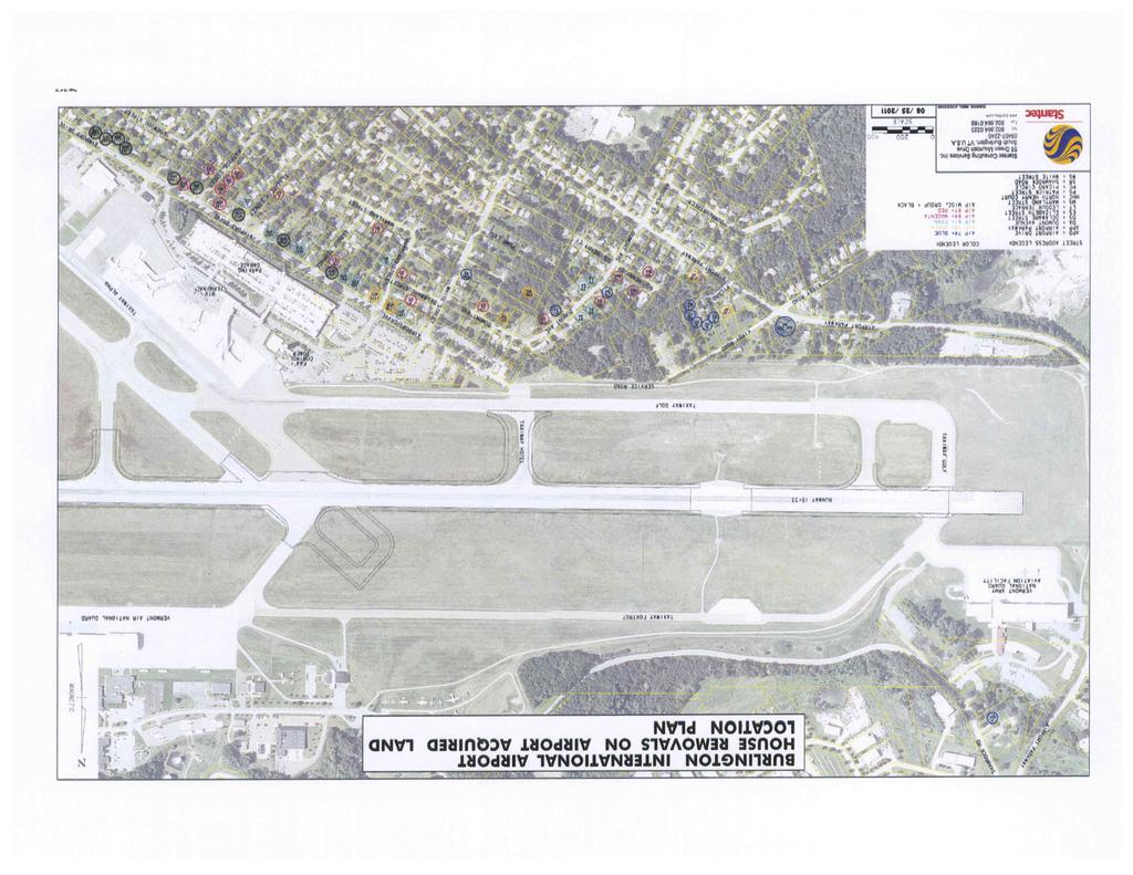
28 N O R T H Subject Property Area KAS Job Number Source: Burlington International Airport Misc. Property Group, South Burlington, VT Site Location map July 1987 USGS Map Date: 09/29/11 Drawing No. 0 Scale: 1:24,000 By: JR
29
30 Phase I Environmental Site Assessment Report Miscellaneous Property Group, South Burlington, Vermont APPENDIX B SITE PLAN
31
32
33
34
35
36
37
38
39
40 Phase I Environmental Site Assessment Report Miscellaneous Property Group, South Burlington, Vermont APPENDIX C LAND RECORD RESEARCH
41 Phase I Environmental Site Assessment Report Miscellaneous Property Group, South Burlington, Vermont Table 4-1 Property Ownership Summary (1107 Airport Drive) Grantor Grantee Book Page Date Hamel, Ronald D and Sylvia City of Burlington /3/04 Ronald D. Hamel Hamel, Ronald D and Sylvia /19/80 William O. Sears & Clardette Ronald D. Hamel /12/75 Sears Richard J. Audette & Elaine William O. Sears & Clardette /21/75 Audette Sears Wendell V. & Emily R Machia Richard J. Audette & Elaine /27/71 Audette Paul & Barbara W. Cosavant Wendell V. & Emily R Machia /25/66 Paul L. Robar & Janice M. Robar Paul & Barbara W. Cosavant /26/64 Noel and Edna Viens Paul L. Robar & Janice M /25/63 Robar Angelo Pizzagalli, Thomas Marx and Margaret Ryan Noel and Edna Viens /14/62 Lot B - Property of Angelo Pizzagalli 11/60 Table 4-1 Property Ownership Summary (1111 Airport Drive) Grantor Grantee Book Page Date Charles and Susan Letourneau City of Burlington /12/03 Table 4-1 Property Ownership Summary (1131 Airport Drive) Grantor Grantee Book Page Date Renzoni, Ann and Scott City of Burlington /20/05 Decendent s Estate of Robert Renzoni, Ann and Scott /18/75 Renzoni Robert A. Roberts and Helen Robert Renzoni /18/67 Roberts Charles Goetz and Mary Goetz Charles Goetz and Mary Goetz /7/66 Angelo Pizzagalli, Thomas Marx Richard J. Audette & Elaine /5/60 and Margaret Ryan Audette Luigi Lamartiere Angelo Pizzagalli, Thomas Marx and Margaret Ryan /30/59 Portion of Lot E and E of Lands of Angelo Pizzagalli
42 Phase I Environmental Site Assessment Report Miscellaneous Property Group, South Burlington, Vermont Table 4-1 Property Ownership Summary (1159 Airport Drive) Grantor Grantee Book Page Date Ashton, Harold L and Kay E. City of Burlington /16/03 Dibbelli Richard W and Theresa L. Ashton, Harold L and Kay E /23/77 Lunn, William E and Dianne M. Dibbelli Richard W and Theresa /25/76 L. Ernest Lunn and Irene Lunn Lunn, William E and Dianne M /22/71 Myron Samuelson Trustee to Ernest Lunn and Irene Lunn /28/70 reconvey Ernest Lunn Myron Samuelson Trustee to /28/70 reconvey M. Alfred and Hazel Hayes Ernest C. and Beulah Lunn /27/64 Morris R. Wilcox Jr. and Glona M. Alfred and Hazel Hayes /28/59 Wilcox George W. Heaton Morris R. Wilcox Jr. and Glona /27/51 Wilcox Thomas Thompson George W. Heaton /9/50 Lester G. and Beverly N Parizo Thomas Thompson /26/49 James J. and Rita Shappy Lester G. and Beverly N Parizo /10/49 Luigi Lamartiere James J. and Rita Shappy /14/46 Table 4-1 Property Ownership Summary (1205 Airport Drive) Grantor Grantee Book Page Date Deborah Roberts City of Burlington /29/03 Chastenay, Camille M and Ronald Roberts, Deborah and Camille /7/88 P and Deobrah Roberts Andrew D. Mikell M. Chastenay Chastenay, Camille M and Ronald P and Deobrah Roberts /7/84 Table 4-1 Property Ownership Summary (1237 Airport Drive) Grantor Grantee Book Page Date Rooney, Richard and Donna City of Burlington /29/04 Estate of Doris Willey Rooney, Richard and Donna /30/93 Leo J Giroux and Grace Giroux Mahlon D. Willey and Doris M /15/59 Willey George and Rebecca Krugen Leo J Giroux and Grace Giroux /6/59 Robert L. and Marguerite Moore George and Rebecca Krugen /23/48 Prentice and Sylvia Putnam Robert L. and Marguerite Moore /1/46 Leo J and Ernestine Giroux Prentice and Sylvia Putnam /12/46 Table 4-1 Property Ownership Summary (1257 Airport Drive) Grantor Grantee Book Page Date Allen Porter City of Burlington /24/03
43 Phase I Environmental Site Assessment Report Miscellaneous Property Group, South Burlington, Vermont APPENDIX D SITE PHOTOGRAPHS


44 Photograph ID: Sep-11 Location: 1103 Airport Drive Photographic Documentation Phase I Environmental Site Assessment Burlington International Airport Misc. Property Group, South Burlington, VT KAS Job # Direction: West Comments: Front of residence Photograph ID: Sep-11 Location: 1103 Airport Drive Direction: South Comments: View of basement wall Extensive mold growth


45 Photograph ID: Sep-11 Location: 1107 Airport Drive Photographic Documentation Phase I Environmental Site Assessment Burlington International Airport Misc. Property Group, South Burlington, VT KAS Job # Direction: Northwest Comments: Front of residence Photograph ID: Sep-11 Location: 1107 Airport Drive Direction: North Comments: View of the interior living space


46 Photograph ID: Sep-11 Location: 1131 Airport Drive Photographic Documentation Phase I Environmental Site Assessment Burlington International Airport Misc. Property Group, South Burlington, VT KAS Job # Direction: West Comments: Rear of residence Photograph ID: Sep-11 Location: 1131 Airport Drive Direction: South Comments: View of AST in the basement


47 Photograph ID: Sep-11 Location: 1159 Airport Drive Photographic Documentation Phase I Environmental Site Assessment Burlington International Airport Misc. Property Group, South Burlington, VT KAS Job # Direction: West Comments: Front of residence Photograph ID: Sep-11 Location: 1159 Airport Drive Direction: South Comments: View of back apartment ceiling Significant mold growth
48 Photograph ID: Sep-11 Location: 1171 Airport Drive Photographic Documentation Phase I Environmental Site Assessment Burlington International Airport Misc. Property Group, South Burlington, VT KAS Job # Direction: Southwest Comments: Front of residence Photograph ID: Sep-11 Location: 1171 Airport Drive Direction: South Comments: View of AST in the basement


49 Photograph ID: Sep-11 Location: 1205 Airport Drive Photographic Documentation Phase I Environmental Site Assessment Burlington International Airport Misc. Property Group, South Burlington, VT KAS Job # Direction: Northwest Comments: Front and side of residence Photograph ID: Sep-11 Location: 1205 Airport Drive Direction: South Comments: View of the garage


50 Photograph ID: Sep-11 Location: 1237 Airport Drive Photographic Documentation Phase I Environmental Site Assessment Burlington International Airport Misc. Property Group, South Burlington, VT KAS Job # Direction: West Comments: Front of residence Photograph ID: Sep-11 Location: 1237 Airport Drive Direction: West Comments: View of the interior living space


51 Photograph ID: Sep-11 Location: 1257 Airport Drive Photographic Documentation Phase I Environmental Site Assessment Burlington International Airport Misc. Property Group, South Burlington, VT KAS Job # Direction: West Comments: Front of residence Photograph ID: Sep-11 Location: 1257 Airport Drive Direction: West Comments: View of AST in the basement


52 Photograph ID: Oct-11 Location: 1111 Airport Drive Photographic Documentation Phase I Environmental Site Assessment Burlington International Airport Misc. Property Group, South Burlington, VT KAS Job # Direction: Southwest Comments: Front and side of residence Photograph ID: Oct-11 Location: 1111 Airport Drive Direction: West Comments: View of the backyard
53 Phase I Environmental Site Assessment Report Miscellaneous Property Group, South Burlington, Vermont APPENDIX E HISTORICAL RESEARCH DOCUMENTATION
54 HISTORICAL FIRE INSURANCE MAPS NO MAPS AVAILABLE Report Date: 9/23/2011 Client Job Number: FirstSearch Index Number: Site Address(es): 200 AIRPORT PKWY SOUTH BURLINGTON, VT A search of FirstSearch Technology Corporation's proprietary database of historical fire insurance map availability confirmed that there are NO MAPS AVAILABLE for the Subject Location as shown above. FirstSearch Technology Corporation s proprietary database of historical fire insurance map availability represents abstracted information from the Sanborn Map Company LLC obtained through online access to the Library of Congress as well as the result of a review of the other fire insurance map microfilm collections available via various local libraries. Copyright Policy Disclaimer Certain Sanborn Fire Insurance Maps are copyrighted material and may not be reproduced without the expressed permission of the Sanborn Map Company or other authorized third party distributors. Any reproduction of this material is covered under the copyright law of the United States (Title 17 U.S. Code) for which customer assumes all liability for the making of photocopies or other reproductions of copyrighted material. FirstSearch Technology Corporation warrants that it will employ its best efforts to maintain and deliver its information in an efficient and timely manner. Customer acknowledges that it understands that FirstSearch Technology Corporation obtains the above information from sources FirstSearch Technology Corporation considers reliable. However, THE WARRANTIES EXPRESSED HEREIN ARE IN LIEU OF ALL OTHER WARRANTIES, either expressed or implied, including without limitation any implied warranty of merchantability or fitness or suitability for a particular purpose (whether or not FirstSearch Technology Corporation may know, have reason to know, or have been advised of such purpose), whether arising by law or by reason of industry custom or usage. ALL SUCH OTHER WARRANTIES ARE HEREBY EXPRESSLY DISCLAIMED. FirstSearch Technology Corporation 10 Cottage Street, Norwood, MA Tel: Fax:
55 N O R T H KAS Job Number Source: Vermont Law Library Burlington International Airport Misc. Property Group, South Burlington, VT Aerial Photography May 1962 Aerial photo Date: 09/29/11 Drawing No. 0 Scale: 1:24,000 By: ARL

56 N O R T H KAS Job Number Source: Burlington International Airport Misc. Property Group, South Burlington, VT Aerial Photography April 1999 USGS Image Date: 09/29/11 Drawing No. 0 Scale: 1:24,000 By: ARL

57 N O R T H KAS Job Number Source: Google Earth Burlington International Airport Misc. Property Group, South Burlington, VT Aerial Photography April 2004 Google Earth Image Date: 09/29/11 Drawing No. 0 Scale: 1:24,000 By: ARL


58 N O R T H Subject Property Area KAS Job Number Source: University of New Hampshire on line map collection, Burlington International Airport Misc. Property Group, South Burlington, VT 1906 USGS Topographic Map Date: 09/29/11 Drawing No. 0 Scale: 1:62,500 By: JR


59 N O R T H Subject Property Area KAS Job Number Source: University of New Hampshire on line map collection, Burlington International Airport Misc. Property Group, South Burlington, VT 1948 USGS Topographic Map Date: 09/29/11 Drawing No. 0 Scale: 1:62,500 By: JR
60 Phase I Environmental Site Assessment Report Miscellaneous Property Group, South Burlington, Vermont APPENDIX F REGULATORY RECORDS DOCUMENTATION
 551-0470 Fax: (781) 551-0471 Environmental FirstSearch is a registered trademark of FirstSearch Technology Corporation.")
61 FirstSearch Technology Corporation TM Environmental FirstSearch Report Target Property: 200 AIRPORT PKWY SOUTH BURLINGTON VT Job Number: PREPARED FOR: KAS, Inc. 368 Avenue D, Suite 15 Williston, VT Tel: (781) Fax: (781) Environmental FirstSearch is a registered trademark of FirstSearch Technology Corporation. All rights reserved.
62 Environmental FirstSearch Search Summary Report Target Site: 200 AIRPORT PKWY SOUTH BURLINGTON VT FirstSearch Summary Database Sel Updated Radius Site 1/8 1/4 1/2 1/2> ZIP TOTALS NPL Y NPL Delisted Y CERCLIS Y NFRAP Y RCRA COR ACT Y RCRA TSD Y RCRA GEN Y Federal Brownfield Y ERNS Y Tribal Lands Y State/Tribal Sites Y State Spills 90 Y State/Tribal SWL Y State/Tribal LUST Y State/Tribal UST/AST Y State/Tribal EC Y NA State/Tribal IC Y NA State/Tribal VCP Y NA State/Tribal Brownfields Y Federal IC/EC Y TOTALS Notice of Disclaimer Due to the limitations, constraints, and inaccuracies and incompleteness of government information and computer mapping data currently available to FirstSearch Technology Corp., certain conventions have been utilized in preparing the locations of all federal, state and local agency sites residing in FirstSearch Technology Corp.'s databases. All EPA NPL and state landfill sites are depicted by a rectangle approximating their location and size. The boundaries of the rectangles represent the eastern and western most longitudes; the northern and southern most latitudes. As such, the mapped areas may exceed the actual areas and do not represent the actual boundaries of these properties. All other sites are depicted by a point representing their approximate address location and make no attempt to represent the actual areas of the associated property. Actual boundaries and locations of individual properties can be found in the files residing at the agency responsible for such information. Waiver of Liability Although FirstSearch Technology Corp. uses its best efforts to research the actual location of each site, FirstSearch Technology Corp. does not and can not warrant the accuracy of these sites with regard to exact location and size. All authorized users of FirstSearch Technology Corp.'s services proceeding are signifying an understanding of FirstSeaarch Technology Corp.'s searching and mapping conventions, and agree to waive any and all liability claims associated with search and map results showing incomplete and or inaccurate site locations.
63 Environmental FirstSearch Site Information Report Request Date: Search Type: AREA Requestor Name: ALAN LIPTAK 0.07 sq mile(s) Standard: ASTM-05 Job Number: Filtered Report Target Site: 200 AIRPORT PKWY SOUTH BURLINGTON VT Demographics Sites: 97 Non-Geocoded: 21 Population: NA Radon: PCI/L Fire Insurance Map Coverage: No Site Location Degrees (Decimal) Degrees (Min/Sec) UTMs Longitude: :9:55 Easting: Latitude: :28:35 Northing: Elevation: 326 Zone: 18 Comment: Comment Additional Requests/Services Adjacent ZIP Codes: Services: ZIP Code City Name ST Dist/Dir Sel Requested? Date Fire Insurance Maps Yes Aerial Photographs No Historical Topos No City Directories No Title Search No Municipal Reports No Liens No Historic Map Works No Online Topos No
64 Environmental FirstSearch Target Site Summary Report Target Property: 200 AIRPORT PKWY JOB: SOUTH BURLINGTON VT TOTAL: 97 GEOCODED: 76 NON GEOCODED: 21 SELECTED: 0 Map ID DB Type Site Name/ID/Status Address Dist/Dir ElevDiff Page No. No sites found for target address
65 Environmental FirstSearch Sites Summary Report Target Property: 200 AIRPORT PKWY JOB: SOUTH BURLINGTON VT TOTAL: 97 GEOCODED: 76 NON GEOCODED: 21 SELECTED: 0 Map ID DB Type Site Name/ID/Status Address Dist/Dir ElevDiff Page No. 1 RCRAGN F A A SSC-86EB 1250 AIRPORT DR 0.03 SE VTR /VGN SOUTH BURLINGTON VT UST BURLINGTON INTERNATIONAL FUEL 1160 AIRPORT DR 0.04 SE /INSTITUTIONAL SOUTH BURLINGTON VT UST MORTAIR RAMP 1160 AIRPORT DR 0.04 SE /INSTITUTIONAL SOUTH BURLINGTON VT LUST BURLINGTON INTERNATIONAL FUEL 1160 AIRPORT DR 0.04 SE /PULLED UST DATABASE SOUTH BURLINGTON VT LUST BURLINGTON INTL AIRPORT AIRPORT DR 0.04 SE /PULLED UST DATABASE SOUTH BURLINGTON VT LUST MORTAIR RAMP 1160 AIRPORT DR 0.04 SE /PULLED UST DATABASE SOUTH BURLINGTON VT UST INNOTECH/BURLINGTON AIRPORT AIRPORT DR 0.11 SE / SOUTH BURLINGTON VT LUST INNOTECH/BURLINGTON AIRPORT AIRPORT DR 0.11 SE /PULLED UST DATABASE SOUTH BURLINGTON VT LUST GAMACHE RESIDENCE 82 SUBURBAN SQ 0.11 SW /PULLED UST DATABASE SOUTH BURLINGTON VT 5 LUST CHAMBERLIN SCHOOL 262 WHITE ST 0.12 NW /PULLED UST DATABASE SOUTH BURLINGTON VT RCRAGN HERTZ RENTAL CORP BURLINGTON INTERNATIONAL A 0.13 NE VTR /VGN SOUTH BURLINGTON VT STATE HERTZ RENT A CAR/NATIONAL CAR 0 BURLINGTON INTRNTNL AIRPO 0.13 NE /ACTIVE SOUTH BURLINGTON VT 6 UST HERTZ BURLINGTON AIRPORT 0.13 NE /ACTIVE SOUTH BURLINGTON VT RCRAGN ATLANTIC AVIATION SERVICES BURLINGTON INTERNATIONAL A 0.15 SE VTR /SGN SOUTH BURLINGTON VT RCRAGN BURLINGTON INTL AIRPORT 1200 AIRPORT 1 DR 0.15 SE VTD /VGN SOUTH BURLINGTON VT RCRAGN F B O AVCENTER 1200 AIRPORT DR 0.15 SE VTR /SGN SOUTH BURLINGTON VT RCRAGN US T S A BURLINGTON INTL AIRPORT 1200 AIRPORT DR 0.15 SE VTR /VGN SOUTH BURLINGTON VT UST ATLANTIC AVIATION - EAST HANGER BURLINGTON INTERNATIONAL A 0.15 SE /ACTIVE SOUTH BURLINGTON VT UST BURLINGTON INTERNATIONAL AIRPORT 1200 AIRPORT DR 0.15 SE /ACTIVE SOUTH BURLINGTON VT UST BURLINGTON INTERNATIONAL AIRPORT 0 NATIONAL WEATHER SERVICE 0.15 SE /INSTITUTIONAL SOUTH BURLINGTON VT 05403
66 Environmental FirstSearch Sites Summary Report Target Property: 200 AIRPORT PKWY JOB: SOUTH BURLINGTON VT TOTAL: 97 GEOCODED: 76 NON GEOCODED: 21 SELECTED: 0 Map ID DB Type Site Name/ID/Status Address Dist/Dir ElevDiff Page No. 7 UST FAA ASR BURLINGTON INTERNATIONAL A 0.15 SE /ACTIVE SOUTH BURLINGTON VT UST NATIONAL ALAMOENTERPRISE CAR RENTA BURLINGTON INTERNATIONAL A 0.15 SE /ACTIVE SOUTH BURLINGTON VT LUST BROCKWAY AIRCRAFT HANGER BURLINGTON INTERNATIONAL A 0.15 SE /PULLED UST DATABASE SOUTH BURLINGTON VT LUST BURLINGTON INTERNATIONAL AIRPORT NATIONAL WEATHER SERVICE 0.15 SE /PULLED UST DATABASE SOUTH BURLINGTON VT LUST FAA ASR BURLINGTON INTERNATIONAL A 0.15 SE /PULLED UST DATABASE SOUTH BURLINGTON VT LUST POWER RESIDENCE 4 MILLS AVE 0.15 SE /PULLED UST DATABASE SOUTH BURLINGTON VT 8 LUST POWER RESIDENCE 4 MILLS AVE 0.15 SE / SOUTH BURLINGTON VT LUST THRIFTY CAR RENTAL 1700 WILLISTON RD 0.19 SE /PULLED UST DATABASE SOUTH BURLINGTON VT RCRAGN INNOTECH AVIATION INC 1130 AIRPORT DR 0.20 SE VTD /VGN SOUTH BURLINGTON VT LUST FBO AVCENTER NEW HANGER 1130 AIRPORT DR 0.20 SE /PULLED UST DATABASE SOUTH BURLINGTON VT STATE NORTH/SOUTH HANGER B I A 0 AIRPORT DR 0.21 SE /CLOSED SOUTH BURLINGTON VT 12 RCRAGN DR JOHN L WOLFF DDS 1683 WILLISTON RD 0.22 SE VTR /VGN SOUTH BURLINGTON VT RCRAGN WESCO INC AIRPORT EXXON 1800 WILLISTON RD 0.23 SE VTR /VGN SOUTH BURLINGTON VT STATE AIRPORT EXXON 1800 WILLISTON RD 0.23 SE /CLOSED SOUTH BURLINGTON VT 13 UST AIRPORT SHELL B WILLISTON RD 0.23 SE /ACTIVE SOUTH BURLINGTON VT RCRAGN KINNEY DRUGS # WILLISTON RD 0.24 SE 0 44 VTR /VGN SOUTH BURLINGTON VT LUST MERRIAM-GRAVES COMPANY 1550 WILLISTON RD 0.24 SW /PULLED UST DATABASE SOUTH BURLINGTON VT LUST MAYNARD AUTO 1725 WILLISTON RD 0.25 SE /PULLED UST DATABASE SOUTH BURLINGTON VT 17 STATE AIRPORT MOBIL 1801 WILLISTON RD 0.32 SE /ACTIVE SOUTH BURLINGTON VT 18 STATE BUDGET RENT A CAR 700 AIRPORT PKWY 0.38 NW /CLOSED SOUTH BURLINGTON VT
67 Environmental FirstSearch Sites Summary Report Target Property: 200 AIRPORT PKWY JOB: SOUTH BURLINGTON VT TOTAL: 97 GEOCODED: 76 NON GEOCODED: 21 SELECTED: 0 Map ID DB Type Site Name/ID/Status Address Dist/Dir ElevDiff Page No. 18 LUST BUDGET RENT A CAR 700 AIRPORT PKWY 0.38 NW /PULLED UST DATABASE SOUTH BURLINGTON VT STATE NORTHERN RENT A CAR 1890 WILLISTON RD 0.40 SE /CLOSED SOUTH BURLINGTON VT 20 STATE HOWARD BANK-WILLISTON RD. 0 WILLISTON RD 0.40 SE /CLOSED SOUTH BURLINGTON VT 21 STATE CRW CORP 1879 WILLISTON RD 0.42 SE /CLOSED SOUTH BURLINGTON VT 21 LUST CRW CORPORATION 1879 WILLISTON RD 0.42 SE /PULLED UST DATABASE SOUTH BURLINGTON VT 22 LUST VERMONT AIR NATIONAL GUARD 105 NCO DRIVE/BURLINGTON AI 0.46 NE /PULLED UST DATABASE SOUTH BURLINGTON VT LUST KNEELAND FLIGHT FACILITY 0 BLDG 890 BURLINGTON AIRPO 0.47 SE /PULLED UST DATABASE SOUTH BURLINGTON VT STATE NORTH COUNTRY RESTAURANT SERVICES 1891 WILLISTON RD 0.47 SE /CLOSED SOUTH BURLINGTON VT 24 LUST ZACHERY S 1891 WILLISTON RD 0.47 SE /PULLED UST DATABASE SOUTH BURLINGTON VT STATE LOGAN EQUIPMENT 1901 WILLISTON RD 0.47 SE /ACTIVE SOUTH BURLINGTON VT 26 LUST LAKE CHAMPLAIN SUBARU 1907 WILLISTON RD 0.50 SE /PULLED UST DATABASE SOUTH BURLINGTON VT 27 STATE U S POST OFFICE 60 WHITE ST 0.53 SW /CLOSED SOUTH BURLINGTON VT 28 STATE GRACEY S STORE 0 WILLISTON RD 0.54 SW /ACTIVE SOUTH BURLINGTON VT 29 STATE WILLISTON ROAD MOBIL 1314 WILLISTON RD 0.54 SW /ACTIVE SOUTH BURLINGTON VT 30 STATE U-SAVE BEVERAGE 0 WILLISTON RD 0.55 SW /ACTIVE SOUTH BURLINGTON VT 31 STATE BURLINGTON INTERNATIONAL AIRPORT 0 AIRPORT RD 0.58 NE /ACTIVE SOUTH BURLINGTON VT 32 STATE VERMONT AIR NATIONAL GUARD 0 AIRPORT RD 0.58 NE /ACTIVE SOUTH BURLINGTON VT 33 STATE KELCO FACILITY 73 ETHAN ALLEN DR 0.60 NE /CLOSED SOUTH BURLINGTON VT 34 STATE OFFSET HOUSE UNKNOWN 0.66 NW /CLOSED SOUTH BURLINGTON VT 34 STATE OFFSET HOUSE PROPERTY UNKNOWN 0.66 NW /CLOSED SOUTH BURLINGTON VT
68 Environmental FirstSearch Sites Summary Report Target Property: 200 AIRPORT PKWY JOB: SOUTH BURLINGTON VT TOTAL: 97 GEOCODED: 76 NON GEOCODED: 21 SELECTED: 0 Map ID DB Type Site Name/ID/Status Address Dist/Dir ElevDiff Page No. 35 STATE WILLISTON ROAD CITGO - DAVE S CITG 1241 WILLISTON RD 0.66 SW /ACTIVE SOUTH BURLINGTON VT 36 STATE ETHAN ALLEN AIR FORCE BASE 0 AIRPORT DR 0.67 SE /CLOSED SOUTH BURLINGTON VT 37 STATE SOUTH BURLINGTON STREET DEPT PATCHEN RD 0.68 NW /ACTIVE SOUTH BURLINGTON VT 38 STATE BURLINGTON AIRPORT 0 AIRPORT PKWY 0.70 NE /CLOSED SOUTH BURLINGTON VT 39 STATE P J S AUTOMOTIVE 2073 WILLISTON RD 0.71 SE /CLOSED SOUTH BURLINGTON VT 40 STATE SOUTH BURLINGTON CENTRAL SCHOOL 1181 WILLISTON RD 0.71 SW /CLOSED SOUTH BURLINGTON VT 41 STATE DOLANS VARIETY 1160 WILLISTON RD 0.74 SW /ACTIVE SOUTH BURLINGTON VT 42 STATE SARVAK RESIDENCE 290 HINESBURG RD 0.77 SW /CLOSED SOUTH BURLINGTON VT 43 STATE CHAMPLAIN VALLEY SUNOCO 1143 WILLISTON RD 0.78 SW /ACTIVE SOUTH BURLINGTON VT 44 STATE UNIVERSITY GULF 0 WILLISTON RD 0.80 SW /ACTIVE SOUTH BURLINGTON VT 45 STATE GREERS DRY CLEANING DORSET STREET UNKNOWN 0.91 SW /ACTIVE SOUTH BURLINGTON VT 46 STATE REILLY TIRE UNKNOWN 0.91 SW /CLOSED SOUTH BURLINGTON VT 47 STATE KENNEDY DRIVE MOBIL 110 KENNEDY DR 0.93 SW /CLOSED SOUTH BURLINGTON VT 48 STATE FORMER GOODRICH BUILDING 625 HINESBURG RD 0.96 SW /ACTIVE SOUTH BURLINGTON VT 49 STATE UNIVERSITY INN 5 DORSET ST 0.96 SW /CLOSED SOUTH BURLINGTON VT 50 STATE ACTION EQUIPMENT UNKNOWN 1.00 SE /CLOSED SOUTH BURLINGTON VT
69 Environmental FirstSearch Sites Summary Report Target Property: 200 AIRPORT PKWY JOB: SOUTH BURLINGTON VT TOTAL: 97 GEOCODED: 76 NON GEOCODED: 21 SELECTED: 0 Map ID DB Type Site Name/ID/Status Address Dist/Dir ElevDiff Page No. STATE GADUE DRY CLEANER DORSET STREET UNKNOWN NON GC N/A N/A /ACTIVE SOUTH BURLINGTON VT STATE GORDIES TEXACO UNKNOWN NON GC N/A N/A /CLOSED SOUTH BURLINGTON VT SPILLS AIR GUARD BURLINGTON INTNL AIRPORT NON GC N/A N/A 09-WMD239/CLOSED SOUTH BURLINGTON VT SPILLS JAMES KNEELAND FLIGHT FACILITY AIRPORT RD NON GC N/A N/A 06-WMD192/CLOSED SOUTH BURLINGTON VT SPILLS MAINTENANCE BUILDING B 1 A AIRPORT RD NON GC N/A N/A 02-WMD239/CLOSED SOUTH BURLINGTON VT SPILLS N/A AIRPORT PKWY NON GC N/A N/A 95-WMD116/CLOSED SOUTH BURLINGTON VT SPILLS VT AIR NATIONAL GUARD AIRPORT DR NON GC N/A N/A 10-WMD167/CLOSED BURLINGTON VT SPILLS VT ANG AIRPORT DR NON GC N/A N/A 11-WMD316/CLOSED SOUTH BURLINGTON VT SWL A. MARCELINO AND COMPANY, INC. UNKNOWN NON GC N/A N/A CH772/RECYCLING SOUTH BURLINGTON VT SWL CHITTENDEN SWM DISTRICT DROP-OFF C PATCHEN ROAD NON GC N/A N/A CH771/DROP OFF CENTER SOUTH BURLINGTON VT SWL CHITTENDEN SWMD TRANS STATION PATCHEN ROAD NON GC N/A N/A 11/A SOUTH BURLINGTON VT SWL CHITTENDEN SWMD TRANS STATION PATCHEN ROAD NON GC N/A N/A 011/A SOUTH BURLINGTON VT SWL CSWD ENVIRONMENTAL DEPOT UNKNOWN NON GC N/A N/A CH080/HHW/CESQG SOUTH BURLINGTON VT SWL ENGINEERS CONSTRUCTION DISPOSAL SI UNKNOWN NON GC N/A N/A CH980/LANDFILL SOUTH BURLINGTON VT UST KNEELAND FLIGHT FACILITY AIRPORT BIAP RD NON GC N/A N/A 1037/ACTIVE SOUTH BURLINGTON VT LUST AIRPORT PARKWAY SEWER PUMP STATION HINESBURGH RD NON GC N/A N/A 2736/PULLED UST DATABASE SOUTH BURLINGTON VT LUST MUNT RESIDENCE 85 SOUTH ST NON GC N/A N/A /PULLED UST DATABASE BURLINGTON VT LUST NEW ENGLAND TELEPHONE CENTRAL OFFI FARRELL ST NON GC N/A N/A 895/PULLED UST DATABASE SOUTH BURLINGTON VT LUST STRATTON CORP GOLF MAINTENANCE ORCUTT MEADOW RD NON GC N/A N/A 517/PULLED UST DATABASE WINHALL VT LUST VERMONT TIRE WILLISTON RD NON GC N/A N/A /PULLED UST DATABASE SOUTH BURLINGTON VT
70 Environmental FirstSearch Sites Summary Report Target Property: 200 AIRPORT PKWY JOB: SOUTH BURLINGTON VT TOTAL: 97 GEOCODED: 76 NON GEOCODED: 21 SELECTED: 0 Map ID DB Type Site Name/ID/Status Address Dist/Dir ElevDiff Page No. TRIBALLA BUREAU OF INDIAN AFFAIRS CONTACT I UNKNOWN NON GC N/A N/A BIA-05403/ VT 05403
71 Environmental FirstSearch Site Detail Report Target Property: 200 AIRPORT PKWY JOB: SOUTH BURLINGTON VT No sites were found!
72 Environmental FirstSearch Site Detail Report Target Property: 200 AIRPORT PKWY JOB: SOUTH BURLINGTON VT RCRAGN SEARCH ID: 4 DIST/DIR: 0.03 SE ELEVATION: 338 MAP ID: 1 NAME: F A A SSC-86EB REV: 7/11/11 ADDRESS: 1250 AIRPORT DR ID1: VTR SOUTH BURLINGTON VT ID2: CHITTENDEN STATUS: VGN CONTACT: PHONE: SOURCE: EPA SITE INFORMATION CONTACT INFORMATION: JEFF LOLLER 1250 AIRPORT DR SOUTH BURLINGTON VT PHONE: CONTACT INFORMATION: MARTIN ROOTS 1250 AIRPORT DR SOUTH BURLINGTON VT PHONE: UNIVERSE INFORMATION: NAIC INFORMATION ENFORCEMENT INFORMATION: VIOLATION INFORMATION: VIOLATION NUMBER: 0001 RESPONSIBLE: S - STATE DETERMINED: 11/13/1997 DETERMINED BY: S - STATE CITATION: 7-303(3)(a)(iii) RESOLVED: 11/17/1997 TYPE: HAZARDOUS WASTE DETERMINATIONS HAZARDOUS WASTE INFORMATION: Ignitable waste VT08 VT02 Benzene Site Details Page - 2
73 Environmental FirstSearch Site Detail Report Target Property: 200 AIRPORT PKWY JOB: SOUTH BURLINGTON VT SEARCH ID: 40 DIST/DIR: 0.04 SE ELEVATION: 336 MAP ID: 2 UST NAME: BURLINGTON INTERNATIONAL FUEL REV: ADDRESS: 1160 AIRPORT DR ID1: 966 SOUTH BURLINGTON VT ID2: CHITTENDEN STATUS: INSTITUTIONAL CONTACT: PHONE: SOURCE: VTDEC Tanks Installed Capacity CURRENT: 0 REMOVED: 0 PERMANENT: 0 UNKNOWN: 0 TEMP: 0 CLOSED: 0 PRODUCTS: TANK MATERIAL: PIPE MATERIAL: Site Details Page - 3
74 Environmental FirstSearch Site Detail Report Target Property: 200 AIRPORT PKWY JOB: SOUTH BURLINGTON VT SEARCH ID: 44 DIST/DIR: 0.04 SE ELEVATION: 336 MAP ID: 2 UST NAME: MORTAIR RAMP REV: ADDRESS: 1160 AIRPORT DR ID1: 965 SOUTH BURLINGTON VT ID2: CHITTENDEN STATUS: INSTITUTIONAL CONTACT: PHONE: SOURCE: VTDEC Tanks Installed Capacity CURRENT: 0 REMOVED: 0 PERMANENT: 0 UNKNOWN: 0 TEMP: 0 CLOSED: 1??? PRODUCTS: #2&4 FUEL OIL TANK MATERIAL: UNPROTECTED PIPE MATERIAL: Site Details Page - 4
75 Environmental FirstSearch Site Detail Report Target Property: 200 AIRPORT PKWY JOB: SOUTH BURLINGTON VT LUST SEARCH ID: 70 DIST/DIR: 0.04 SE ELEVATION: 336 MAP ID: 2 NAME: BURLINGTON INTERNATIONAL FUEL REV: 7/8/11 ADDRESS: 1160 AIRPORT DR ID1: 966 SOUTH BURLINGTON VT ID2: CHITTENDEN STATUS: PULLED UST DATABASE CONTACT: MONTAIR FLIGHT SERVICE INC PHONE: SOURCE: VT DEC This site comes from the Vermont Department of Environmental Conservation Pulled Underground Storage Tanks database and may or may not be considered a leaking underground storage tank, please review the data below for further indications of contamination. SITE FINDINGS: CONTAMINATION FOUND ABOVE STATE STANDARD. REFERRED TO SITE MANAGEMENT FACILITY AND OWNER INFORMATION TYPE OF FACILITY: INDUSTRIAL/COMMERCIAL OWNER NAME: MONTAIR FLIGHT SERVICE INC CONTACT: OWNER ADDRESS: 1160 AIRPORT DRIVE SOUTH BURLINGTON, VT LAND OWNER: ** UNKNOWN *** PERMITTED TO: NUM OF PULLED TANKS: 2 NUM OF REMOVED TANKS: 2 NUM OF GROUNDWATER MONITORING WELLS: NUM OF VAPOR MONITORING WELLS: TANK INFORMATION TOTAL NUMBER OF TANKS: 2 TANK ID: 844 TANK STATUS: PULLED SUBSTANCE STORED: TANK CAPACITY IN GAL.: 1000 TANK PROTECTION: UNPROTECTED STEEL YEAR REMOVED: 1995 TANK MONITORING: / SPILL/OVERFILL PROT.: PUMP TYPE: PIPE PROTECTION: TESTED DATE: PIPE MONITORING: TANK LABEL: TANK ID: 843 TANK STATUS: PULLED SUBSTANCE STORED: TANK CAPACITY IN GAL.: 2000 TANK PROTECTION: UNPROTECTED STEEL YEAR REMOVED: 1995 TANK MONITORING: / SPILL/OVERFILL PROT.: PUMP TYPE: PIPE PROTECTION: TESTED DATE: PIPE MONITORING: TANK LABEL: -1-2 Site Details Page - 5
76 Environmental FirstSearch Site Detail Report Target Property: 200 AIRPORT PKWY JOB: SOUTH BURLINGTON VT LUST SEARCH ID: 71 DIST/DIR: 0.04 SE ELEVATION: 336 MAP ID: 2 NAME: BURLINGTON INTL AIRPORT REV: 7/8/11 ADDRESS: AIRPORT DR ID1: SOUTH BURLINGTON VT ID2: CHITTENDEN STATUS: PULLED UST DATABASE CONTACT: US ARMY CORPS OF ENGINEERS PHONE: SOURCE: VT DEC This site comes from the Vermont Department of Environmental Conservation Pulled Underground Storage Tanks database and may or may not be considered a leaking underground storage tank, please review the data below for further indications of contamination. SITE FINDINGS: CONTAMINATION FOUND ABOVE STATE STANDARD. REFERRED TO SITE MANAGEMENT FACILITY AND OWNER INFORMATION TYPE OF FACILITY: INDUSTRIAL/COMMERCIAL OWNER NAME: US ARMY CORPS OF ENGINEERS CONTACT: AL LARAWAY OWNER ADDRESS: 505 RECALL AVENUE CHICOPEE, MA LAND OWNER: ** UNKNOWN *** PERMITTED TO: NUM OF PULLED TANKS: 3 NUM OF REMOVED TANKS: 3 NUM OF GROUNDWATER MONITORING WELLS: NUM OF VAPOR MONITORING WELLS: TANK INFORMATION TOTAL NUMBER OF TANKS: 3 TANK ID: 6458 TANK STATUS: PULLED SUBSTANCE STORED: TANK CAPACITY IN GAL.: 1000 TANK PROTECTION: YEAR REMOVED: 1994 TANK MONITORING: / SPILL/OVERFILL PROT.: PUMP TYPE: PIPE PROTECTION: TESTED DATE: PIPE MONITORING: TANK LABEL: -1-2 TANK ID: 6459 TANK STATUS: PULLED SUBSTANCE STORED: TANK CAPACITY IN GAL.: 3000 TANK PROTECTION: YEAR REMOVED: 1994 TANK MONITORING: / SPILL/OVERFILL PROT.: PUMP TYPE: PIPE PROTECTION: TESTED DATE: PIPE MONITORING: TANK LABEL: -1-3 TANK ID: 6457 TANK STATUS: PULLED SUBSTANCE STORED: TANK CAPACITY IN GAL.: 500 TANK PROTECTION: YEAR REMOVED: 1994 TANK MONITORING: / SPILL/OVERFILL PROT.: PUMP TYPE: PIPE PROTECTION: TESTED DATE: PIPE MONITORING: TANK LABEL: -1-1 Site Details Page - 6
77 Environmental FirstSearch Site Detail Report Target Property: 200 AIRPORT PKWY JOB: SOUTH BURLINGTON VT LUST SEARCH ID: 77 DIST/DIR: 0.04 SE ELEVATION: 336 MAP ID: 2 NAME: MORTAIR RAMP REV: 7/8/11 ADDRESS: 1160 AIRPORT DR ID1: 965 SOUTH BURLINGTON VT ID2: CHITTENDEN STATUS: PULLED UST DATABASE CONTACT: CITY OF BURLINGTON PHONE: SOURCE: VT DEC This site comes from the Vermont Department of Environmental Conservation Pulled Underground Storage Tanks database and may or may not be considered a leaking underground storage tank, please review the data below for further indications of contamination. SITE FINDINGS: CONTAMINATION FOUND ABOVE STATE STANDARD. REFERRED TO SITE MANAGEMENT FACILITY AND OWNER INFORMATION TYPE OF FACILITY: TOWN OWNER NAME: CITY OF BURLINGTON CONTACT: BURLINGTON INTERNATIONAL AIRPORT OWNER ADDRESS: 1200 BURLINGTON, VT LAND OWNER: ** UNKNOWN *** PERMITTED TO: NUM OF PULLED TANKS: 1 NUM OF REMOVED TANKS: 1 NUM OF GROUNDWATER MONITORING WELLS: NUM OF VAPOR MONITORING WELLS: TANK INFORMATION TOTAL NUMBER OF TANKS: 1 TANK ID: 842 TANK STATUS: PULLED SUBSTANCE STORED: TANK CAPACITY IN GAL.: 7500 TANK PROTECTION: UNPROTECTED STEEL YEAR REMOVED: 1994 TANK MONITORING: / SPILL/OVERFILL PROT.: PUMP TYPE: PIPE PROTECTION: TESTED DATE: PIPE MONITORING: TANK LABEL: Site Details Page - 7
78 Environmental FirstSearch Site Detail Report Target Property: 200 AIRPORT PKWY JOB: SOUTH BURLINGTON VT SEARCH ID: 43 DIST/DIR: 0.11 SE ELEVATION: 330 MAP ID: 3 UST NAME: INNOTECH/BURLINGTON AIRPORT REV: 10/23/98 ADDRESS: AIRPORT DR ID1: 1604 SOUTH BURLINGTON VT ID2: CHITTENDEN STATUS: CONTACT: PHONE: SOURCE: VTDEC TOTAL NUMBER OF TANKS: 4 TANK ID: 1 INSTALLED: 1963 SUBSTANCE STORED: AVIATION FUEL TANK CAP. (gallons): TYPE OF OPERATION: INDUSTRIAL/COMMERCIAL TANK PROTECTION: UNPROTECTED TANK MONITORING: MY97 PERMIT CANCELLED OR REVOKED?: Y TANK ID: 2 INSTALLED: 1963 SUBSTANCE STORED: AVIATION FUEL TANK CAP. (gallons): TYPE OF OPERATION: INDUSTRIAL/COMMERCIAL TANK PROTECTION: UNPROTECTED TANK MONITORING: MY97 PERMIT CANCELLED OR REVOKED?: Y TANK ID: 3 INSTALLED: 1983 SUBSTANCE STORED: AVIATION FUEL TANK CAP. (gallons): TYPE OF OPERATION: INDUSTRIAL/COMMERCIAL TANK PROTECTION: UNPROTECTED TANK MONITORING: MY96 PERMIT CANCELLED OR REVOKED?: Y TANK ID: 4 INSTALLED: 1983 SUBSTANCE STORED: AVIATION FUEL TANK CAP. (gallons): TYPE OF OPERATION: INDUSTRIAL/COMMERCIAL TANK PROTECTION: UNPROTECTED TANK MONITORING: MY96 PERMIT CANCELLED OR REVOKED?: Y Site Details Page - 8
79 Environmental FirstSearch Site Detail Report Target Property: 200 AIRPORT PKWY JOB: SOUTH BURLINGTON VT LUST SEARCH ID: 72 DIST/DIR: 0.11 SE ELEVATION: 330 MAP ID: 3 NAME: INNOTECH/BURLINGTON AIRPORT REV: 7/8/11 ADDRESS: AIRPORT DR ID1: 1604 SOUTH BURLINGTON VT ID2: STATUS: PULLED UST DATABASE CONTACT: CITY OF BURLINGTON NEW OWNER PHONE: SOURCE: VT DEC This site comes from the Vermont Department of Environmental Conservation Pulled Underground Storage Tanks database and may or may not be considered a leaking underground storage tank, please review the data below for further indications of contamination. SITE FINDINGS: CONTAMINATION FOUND ABOVE STATE STANDARD. REFERRED TO SITE MANAGEMENT FACILITY AND OWNER INFORMATION TYPE OF FACILITY: INDUSTRIAL/COMMERCIAL OWNER NAME: CITY OF BURLINGTON NEW OWNER CONTACT: JAY HAMILTON OWNER ADDRESS: AIRPORT ROAD SOUTH BURLINGTON, VT LAND OWNER: ** UNKNOWN *** PERMITTED TO: NUM OF PULLED TANKS: 4 NUM OF REMOVED TANKS: 4 NUM OF GROUNDWATER MONITORING WELLS: NUM OF VAPOR MONITORING WELLS: TANK INFORMATION TOTAL NUMBER OF TANKS: 4 TANK ID: 1490 TANK STATUS: PULLED SUBSTANCE STORED: TANK CAPACITY IN GAL.: TANK PROTECTION: UNPROTECTED STEEL YEAR REMOVED: 1998 TANK MONITORING: / SPILL/OVERFILL PROT.: PUMP TYPE: PIPE PROTECTION: TESTED DATE: PIPE MONITORING: TT TANK LABEL: TANK ID: 1491 TANK STATUS: PULLED SUBSTANCE STORED: TANK CAPACITY IN GAL.: TANK PROTECTION: UNPROTECTED STEEL YEAR REMOVED: 1998 TANK MONITORING: / SPILL/OVERFILL PROT.: PUMP TYPE: PIPE PROTECTION: TESTED DATE: PIPE MONITORING: TT TANK LABEL: TANK ID: 1492 TANK STATUS: PULLED SUBSTANCE STORED: TANK CAPACITY IN GAL.: TANK PROTECTION: UNPROTECTED STEEL YEAR REMOVED: 1998 TANK MONITORING: / SPILL/OVERFILL PROT.: PUMP TYPE: PIPE PROTECTION: TESTED DATE: PIPE MONITORING: TT TANK LABEL: TANK ID: 1493 TANK STATUS: PULLED SUBSTANCE STORED: TANK CAPACITY IN GAL.: TANK PROTECTION: UNPROTECTED STEEL YEAR REMOVED: 1998 TANK MONITORING: / - Continued on next page - Site Details Page - 9
80 Environmental FirstSearch Site Detail Report Target Property: 200 AIRPORT PKWY JOB: SOUTH BURLINGTON VT LUST SEARCH ID: 72 DIST/DIR: 0.11 SE ELEVATION: 330 MAP ID: 3 NAME: INNOTECH/BURLINGTON AIRPORT REV: 7/8/11 ADDRESS: AIRPORT DR ID1: 1604 SOUTH BURLINGTON VT ID2: STATUS: PULLED UST DATABASE CONTACT: CITY OF BURLINGTON NEW OWNER PHONE: SOURCE: VT DEC PIPE PROTECTION: TESTED DATE: PIPE MONITORING: TT TANK LABEL: Site Details Page - 10
81 Environmental FirstSearch Site Detail Report Target Property: 200 AIRPORT PKWY JOB: SOUTH BURLINGTON VT LUST SEARCH ID: 50 DIST/DIR: 0.11 SW ELEVATION: 350 MAP ID: 4 NAME: GAMACHE RESIDENCE REV: 7/8/11 ADDRESS: 82 SUBURBAN SQ ID1: SOUTH BURLINGTON VT ID2: CHITTENDEN STATUS: PULLED UST DATABASE CONTACT: CLEMENT GAMACHE PHONE: SOURCE: VT DEC This site comes from the Vermont Department of Environmental Conservation Pulled Underground Storage Tanks database and may or may not be considered a leaking underground storage tank, please review the data below for further indications of contamination. SITE FINDINGS: NO CONTAMINATION FOUND FACILITY AND OWNER INFORMATION TYPE OF FACILITY: RESIDENTIAL OWNER NAME: CLEMENT GAMACHE CONTACT: OWNER ADDRESS: 82 SUBURBAN SQUARE SOUTH BURLINGTON, VT LAND OWNER: ** UNKNOWN *** PERMITTED TO: NUM OF PULLED TANKS: 1 NUM OF REMOVED TANKS: 1 NUM OF GROUNDWATER MONITORING WELLS: NUM OF VAPOR MONITORING WELLS: TANK INFORMATION TOTAL NUMBER OF TANKS: 1 TANK ID: 2659 TANK STATUS: PULLED SUBSTANCE STORED: TANK CAPACITY IN GAL.: 2000 TANK PROTECTION: YEAR REMOVED: 2001 TANK MONITORING: / SPILL/OVERFILL PROT.: PUMP TYPE: PIPE PROTECTION: TESTED DATE: PIPE MONITORING: TANK LABEL: -1-1-R Site Details Page - 11
82 Environmental FirstSearch Site Detail Report Target Property: 200 AIRPORT PKWY JOB: SOUTH BURLINGTON VT LUST SEARCH ID: 46 DIST/DIR: 0.12 NW ELEVATION: 334 MAP ID: 5 NAME: CHAMBERLIN SCHOOL REV: 7/8/11 ADDRESS: 262 WHITE ST ID1: 628 SOUTH BURLINGTON VT ID2: CHITTENDEN STATUS: PULLED UST DATABASE CONTACT: SOUTH BURLINGTON SCHOOL DISTRICT PHONE: SOURCE: VT DEC This site comes from the Vermont Department of Environmental Conservation Pulled Underground Storage Tanks database and may or may not be considered a leaking underground storage tank, please review the data below for further indications of contamination. SITE FINDINGS: NO CONTAMINATION FOUND FACILITY AND OWNER INFORMATION TYPE OF FACILITY: TOWN OWNER NAME: SOUTH BURLINGTON SCHOOL DISTRICT CONTACT: OWNER ADDRESS: 550 DORSET STREET SOUTH BURLINGTON, VT LAND OWNER: ** UNKNOWN *** PERMITTED TO: NUM OF PULLED TANKS: 1 NUM OF REMOVED TANKS: 1 NUM OF GROUNDWATER MONITORING WELLS: NUM OF VAPOR MONITORING WELLS: TANK INFORMATION TOTAL NUMBER OF TANKS: 1 TANK ID: 538 TANK STATUS: PULLED SUBSTANCE STORED: TANK CAPACITY IN GAL.: TANK PROTECTION: UNPROTECTED STEEL YEAR REMOVED: 1992 TANK MONITORING: / SPILL/OVERFILL PROT.: PUMP TYPE: PIPE PROTECTION: TESTED DATE: PIPE MONITORING: TANK LABEL: Site Details Page - 12
83 Environmental FirstSearch Site Detail Report Target Property: 200 AIRPORT PKWY JOB: SOUTH BURLINGTON VT RCRAGN SEARCH ID: 6 DIST/DIR: 0.13 NE ELEVATION: 342 MAP ID: 6 NAME: HERTZ RENTAL CORP REV: 7/11/11 ADDRESS: BURLINGTON INTERNATIONAL ARPT ID1: VTR SOUTH BURLINGTON VT ID2: STATUS: VGN CONTACT: PHONE: SOURCE: EPA SITE INFORMATION CONTACT INFORMATION: KEVIN DESOTEL BURLINGTON INTERNATIONAL ARPT SOUTH BURLINGTON VT PHONE: UNIVERSE INFORMATION: NAIC INFORMATION ENFORCEMENT INFORMATION: VIOLATION INFORMATION: HAZARDOUS WASTE INFORMATION: Benzene Cadmium Ignitable waste Tetrachloroethylene Trichloroethylene Site Details Page - 13
84 Environmental FirstSearch Site Detail Report Target Property: 200 AIRPORT PKWY JOB: SOUTH BURLINGTON VT STATE SEARCH ID: 24 DIST/DIR: 0.13 NE ELEVATION: 342 MAP ID: 6 NAME: HERTZ RENT A CAR/NATIONAL CAR REV: 7/8/11 ADDRESS: 0 BURLINGTON INTRNTNL AIRPORT ID1: SOUTH BURLINGTON VT ID2: STATUS: ACTIVE CONTACT: PHONE: SOURCE: VT DEC 6900 SITE INFORMATION PRIORITY: NO SENSITIVE RECEPTOR IMPACT (VT SITE PRIORITY SCORE<30) PROJECT STATUS: ANNUAL GROUNDWATER MONITORING TO TRACK 1992 GASOLINE RELEASE FROM BOTH HERTZ AND NATIONAL CAR RENTAL TANKS. MONITORING CONTINUES TO REVEAL GROUNDWATER ENFORCEMENT STANDARD EXCEEDANCES IN SEVERAL WELLS. NEXT ROUND SCHEDULED FOR OCTOBER DATE OF SITE DISCOVERY: DATE OF SITE CLOSURE: SOURCE: 6900 UST-GASOLINE, 6900 OWNER INFORMATION: OWNER: THE HERTZ CORP OWNER ADDRESS: 225 BRAE BLVD. PARK RIDGE NJ Site Details Page - 14
85 Environmental FirstSearch Site Detail Report Target Property: 200 AIRPORT PKWY JOB: SOUTH BURLINGTON VT SEARCH ID: 42 DIST/DIR: 0.13 NE ELEVATION: 342 MAP ID: 6 UST NAME: HERTZ REV: 7/8/11 ADDRESS: BURLINGTON AIRPORT ID1: 1182 SOUTH BURLINGTON VT ID2: CHITTENDEN STATUS: ACTIVE CONTACT: HERTZ CORPORATION PHONE: SOURCE: VT DEC FACILITY AND OWNER INFORMATION TYPE OF FACILITY: INDUSTRIAL/COMMERCIAL OWNER NAME: HERTZ CORPORATION CONTACT: AREA MANAGER OWNER ADDRESS: 1200 AIRPORT DRIVE S BURLINGTON, VT TANK INFORMATION TOTAL NUMBER OF TANKS: 2 TANK ID: TANK STATUS: PULLED SUBSTANCE STORED: TANK CAPACITY IN GAL.: TANK PROTECTION: YEAR REMOVED: 1992 TANK MONITORING: / SPILL/OVERFILL PROT.: PUMP TYPE: PIPE PROTECTION: TESTED DATE: PIPE MONITORING: TANK LABEL: R TANK ID: TANK STATUS: ACTIVE SUBSTANCE STORED: TANK CAPACITY IN GAL.: TANK PROTECTION: FIBERGLASS REINFORCED PLASTIC YEAR REMOVED: TANK MONITORING: / SPILL/OVERFILL PROT.: PUMP TYPE: PIPE PROTECTION: TESTED DATE: PIPE MONITORING: INTERSTITIAL ELECTRONIC TANK LABEL: Site Details Page - 15
86 Environmental FirstSearch Site Detail Report Target Property: 200 AIRPORT PKWY JOB: SOUTH BURLINGTON VT RCRAGN SEARCH ID: 1 DIST/DIR: 0.15 SE ELEVATION: 347 MAP ID: 7 NAME: ATLANTIC AVIATION SERVICES REV: 7/11/11 ADDRESS: BURLINGTON INTERNATIONAL ARPT ID1: VTR SOUTH BURLINGTON VT ID2: CHITTENDEN STATUS: SGN CONTACT: PHONE: SOURCE: EPA SITE INFORMATION CONTACT INFORMATION: GEORGE BACIGALUPO BURLINGTON INTERNATIONAL ARPT SOUTH BURLINGTON VT PHONE: UNIVERSE INFORMATION: NAIC INFORMATION ENFORCEMENT INFORMATION: VIOLATION INFORMATION: VIOLATION NUMBER: 0001 RESPONSIBLE: S - STATE DETERMINED: 11/25/1997 DETERMINED BY: S - STATE CITATION: 7-303(3)(a) RESOLVED: 12/4/1997 TYPE: GENERATOR-GENERAL REQUIREMENTS HAZARDOUS WASTE INFORMATION: VT08 VT02 Benzene Ignitable waste Site Details Page - 16
87 Environmental FirstSearch Site Detail Report Target Property: 200 AIRPORT PKWY JOB: SOUTH BURLINGTON VT RCRAGN SEARCH ID: 2 DIST/DIR: 0.15 SE ELEVATION: 347 MAP ID: 7 NAME: BURLINGTON INTL AIRPORT REV: 7/11/11 ADDRESS: 1200 AIRPORT 1 DR ID1: VTD SOUTH BURLINGTON VT ID2: CHITTENDEN STATUS: VGN CONTACT: PHONE: SOURCE: EPA CT MANIFEST INFORMATION MANIFEST ID SHIPPED TSD ID TRANS ID QTY MATERIAL CTF /11/1992 CTD ILD G RQ HAZARDOUS WASTE LIQUID NOS Site Details Page - 17
88 Environmental FirstSearch Site Detail Report Target Property: 200 AIRPORT PKWY JOB: SOUTH BURLINGTON VT RCRAGN SEARCH ID: 5 DIST/DIR: 0.15 SE ELEVATION: 347 MAP ID: 7 NAME: F B O AVCENTER REV: 2/16/10 ADDRESS: 1200 AIRPORT DR ID1: VTR SOUTH BURLINGTON VT ID2: CHITTENDEN STATUS: SGN CONTACT: PHONE: SOURCE: EPA SITE INFORMATION CONTACT INFORMATION: GEORGE BACIGALUPO AIRPORT DR SOUTH BURLINGTON VT PHONE: CONTACT INFORMATION: CHRIS HILL 1200 AIRPORT DR SOUTH BURLINGTON VT PHONE: UNIVERSE INFORMATION: NAIC INFORMATION OTHER SUPPORT ACTIVITIES FOR AIR TRANSPORTATION ENFORCEMENT INFORMATION: VIOLATION INFORMATION: HAZARDOUS WASTE INFORMATION: VT02 Ignitable waste Benzene VT08 Site Details Page - 18
89 Environmental FirstSearch Site Detail Report Target Property: 200 AIRPORT PKWY JOB: SOUTH BURLINGTON VT RCRAGN SEARCH ID: 9 DIST/DIR: 0.15 SE ELEVATION: 347 MAP ID: 7 NAME: US T S A BURLINGTON INTL AIRPORT REV: 7/11/11 ADDRESS: 1200 AIRPORT DR ID1: VTR SOUTH BURLINGTON VT ID2: CHITTENDEN STATUS: VGN CONTACT: PHONE: SOURCE: EPA SITE INFORMATION CONTACT INFORMATION: DEBBIE NIETO KIMBALL AVE STE 100 SOUTH BURLINGTON VT PHONE: UNIVERSE INFORMATION: NAIC INFORMATION OTHER AIRPORT OPERATIONS ENFORCEMENT INFORMATION: VIOLATION INFORMATION: HAZARDOUS WASTE INFORMATION: Ignitable waste Corrosive waste Reactive waste Site Details Page - 19
90 Environmental FirstSearch Site Detail Report Target Property: 200 AIRPORT PKWY JOB: SOUTH BURLINGTON VT SEARCH ID: 65 DIST/DIR: 0.15 SE ELEVATION: 347 MAP ID: 7 UST NAME: ATLANTIC AVIATION - EAST HANGER REV: 7/8/11 ADDRESS: BURLINGTON INTERNATIONAL AIRPORT ID1: SOUTH BURLINGTON VT ID2: CHITTENDEN STATUS: ACTIVE CONTACT: BTV AVCENTER INC DBA ATLANTIC AVIATI PHONE: SOURCE: VT DEC FACILITY AND OWNER INFORMATION TYPE OF FACILITY: INDUSTRIAL/COMMERCIAL OWNER NAME: BTV AVCENTER INC DBA ATLANTIC AVIATI CONTACT: GEORGE BACIGALUPO OWNER ADDRESS: 1130 AIRPORT DRIVE SOUTH BURLINGTON, VT TANK INFORMATION TOTAL NUMBER OF TANKS: 2 TANK ID: TANK STATUS: PULLED SUBSTANCE STORED: TANK CAPACITY IN GAL.: TANK PROTECTION: Ps YEAR REMOVED: 2009 TANK MONITORING: / SPILL/OVERFILL PROT.: PUMP TYPE: PIPE PROTECTION: TESTED DATE: PIPE MONITORING: IN TANK MONITOR TANK LABEL: TANK ID: TANK STATUS: ACTIVE SUBSTANCE STORED: TANK CAPACITY IN GAL.: TANK PROTECTION: Ps YEAR REMOVED: TANK MONITORING: / SPILL/OVERFILL PROT.: PUMP TYPE: PIPE PROTECTION: TESTED DATE: PIPE MONITORING: IN TANK MONITOR TANK LABEL: Site Details Page - 20
91 Environmental FirstSearch Site Detail Report Target Property: 200 AIRPORT PKWY JOB: SOUTH BURLINGTON VT SEARCH ID: 66 DIST/DIR: 0.15 SE ELEVATION: 347 MAP ID: 7 UST NAME: BURLINGTON INTERNATIONAL AIRPORT REV: 7/8/11 ADDRESS: 1200 AIRPORT DR ID1: 460 SOUTH BURLINGTON VT ID2: CHITTENDEN STATUS: ACTIVE CONTACT: CITY OF BURLINGTON BTV AIRPORT PHONE: SOURCE: VT DEC FACILITY AND OWNER INFORMATION TYPE OF FACILITY: TOWN OWNER NAME: CITY OF BURLINGTON CONTACT: BTV BRIAN SEARLES DIR OF AVIATION OWNER ADDRESS: 1200 AIRPORT DRIVE SUITE 1 SOUTH BURLINGTON, VT TANK INFORMATION TOTAL NUMBER OF TANKS: 13 TANK ID: 8628 TANK STATUS: PULLED SUBSTANCE STORED: TANK CAPACITY IN GAL.: 275 TANK PROTECTION: YEAR REMOVED: 1989 TANK MONITORING: / SPILL/OVERFILL PROT.: PUMP TYPE: PIPE PROTECTION: TESTED DATE: PIPE MONITORING: TANK LABEL: -1-1-R TANK ID: 8629 TANK STATUS: PULLED SUBSTANCE STORED: TANK CAPACITY IN GAL.: 550 TANK PROTECTION: YEAR REMOVED: 1989 TANK MONITORING: / SPILL/OVERFILL PROT.: PUMP TYPE: PIPE PROTECTION: TESTED DATE: PIPE MONITORING: TANK LABEL: -1-2-R TANK ID: 8630 TANK STATUS: PULLED SUBSTANCE STORED: TANK CAPACITY IN GAL.: 1000 TANK PROTECTION: YEAR REMOVED: 1989 TANK MONITORING: / SPILL/OVERFILL PROT.: PUMP TYPE: PIPE PROTECTION: TESTED DATE: PIPE MONITORING: TANK LABEL: -1-3-R TANK ID: 8631 TANK STATUS: PULLED SUBSTANCE STORED: TANK CAPACITY IN GAL.: 100 TANK PROTECTION: YEAR REMOVED: 1989 TANK MONITORING: / SPILL/OVERFILL PROT.: PUMP TYPE: PIPE PROTECTION: TESTED DATE: PIPE MONITORING: TANK LABEL: -1-8-R TANK ID: 8632 TANK STATUS: PULLED SUBSTANCE STORED: TANK CAPACITY IN GAL.: TANK PROTECTION: YEAR REMOVED: 1989 TANK MONITORING: / SPILL/OVERFILL PROT.: PUMP TYPE: PIPE PROTECTION: TESTED DATE: - Continued on next page - Site Details Page - 21
92 Environmental FirstSearch Site Detail Report Target Property: 200 AIRPORT PKWY JOB: SOUTH BURLINGTON VT SEARCH ID: 66 DIST/DIR: 0.15 SE ELEVATION: 347 MAP ID: 7 UST NAME: BURLINGTON INTERNATIONAL AIRPORT REV: 7/8/11 ADDRESS: 1200 AIRPORT DR ID1: 460 SOUTH BURLINGTON VT ID2: CHITTENDEN STATUS: ACTIVE CONTACT: CITY OF BURLINGTON BTV AIRPORT PHONE: SOURCE: VT DEC PIPE MONITORING: TANK LABEL: R TANK ID: 8633 TANK STATUS: PULLED SUBSTANCE STORED: TANK CAPACITY IN GAL.: 4000 TANK PROTECTION: YEAR REMOVED: 1989 TANK MONITORING: / SPILL/OVERFILL PROT.: PUMP TYPE: PIPE PROTECTION: TESTED DATE: PIPE MONITORING: TANK LABEL: R TANK ID: 8634 TANK STATUS: PULLED SUBSTANCE STORED: TANK CAPACITY IN GAL.: TANK PROTECTION: YEAR REMOVED: 1997 TANK MONITORING: / SPILL/OVERFILL PROT.: PUMP TYPE: PIPE PROTECTION: TESTED DATE: PIPE MONITORING: TANK LABEL: R TANK ID: 8635 TANK STATUS: PULLED SUBSTANCE STORED: TANK CAPACITY IN GAL.: TANK PROTECTION: YEAR REMOVED: 1989 TANK MONITORING: / SPILL/OVERFILL PROT.: PUMP TYPE: PIPE PROTECTION: TESTED DATE: PIPE MONITORING: TANK LABEL: R TANK ID: 8636 TANK STATUS: PULLED SUBSTANCE STORED: TANK CAPACITY IN GAL.: TANK PROTECTION: YEAR REMOVED: 1989 TANK MONITORING: / SPILL/OVERFILL PROT.: PUMP TYPE: PIPE PROTECTION: TESTED DATE: PIPE MONITORING: TANK LABEL: R TANK ID: 8637 TANK STATUS: PULLED SUBSTANCE STORED: TANK CAPACITY IN GAL.: TANK PROTECTION: YEAR REMOVED: 1997 TANK MONITORING: / SPILL/OVERFILL PROT.: PUMP TYPE: PIPE PROTECTION: TESTED DATE: PIPE MONITORING: TANK LABEL: R TANK ID: 8638 TANK STATUS: ACTIVE SUBSTANCE STORED: TANK CAPACITY IN GAL.: 550 TANK PROTECTION: FIBERGLASS REINFORCED PLASTIC YEAR REMOVED: TANK MONITORING: / - Continued on next page - Site Details Page - 22
93 Environmental FirstSearch Site Detail Report Target Property: 200 AIRPORT PKWY JOB: SOUTH BURLINGTON VT SEARCH ID: 66 DIST/DIR: 0.15 SE ELEVATION: 347 MAP ID: 7 UST NAME: BURLINGTON INTERNATIONAL AIRPORT REV: 7/8/11 ADDRESS: 1200 AIRPORT DR ID1: 460 SOUTH BURLINGTON VT ID2: CHITTENDEN STATUS: ACTIVE CONTACT: CITY OF BURLINGTON BTV AIRPORT PHONE: SOURCE: VT DEC SPILL/OVERFILL PROT.: PUMP TYPE: PIPE PROTECTION: TESTED DATE: PIPE MONITORING: INTERSTITIAL ELECTRONIC TANK LABEL: TANK ID: 8639 TANK STATUS: ACTIVE SUBSTANCE STORED: TANK CAPACITY IN GAL.: TANK PROTECTION: POLYETHYLENE JACKETED STEEL TANK YEAR REMOVED: TANK MONITORING: / SPILL/OVERFILL PROT.: PUMP TYPE: PIPE PROTECTION: TESTED DATE: PIPE MONITORING: INTERSTITIAL ELECTRONIC TANK LABEL: TANK ID: 8640 TANK STATUS: PULLED SUBSTANCE STORED: TANK CAPACITY IN GAL.: TANK PROTECTION: UNPROTECTED STEEL YEAR REMOVED: 2005 TANK MONITORING: / SPILL/OVERFILL PROT.: PUMP TYPE: PIPE PROTECTION: TESTED DATE: PIPE MONITORING: TANK LABEL: -1-9-R Site Details Page - 23
94 Environmental FirstSearch Site Detail Report Target Property: 200 AIRPORT PKWY JOB: SOUTH BURLINGTON VT SEARCH ID: 39 DIST/DIR: 0.15 SE ELEVATION: 347 MAP ID: 7 UST NAME: BURLINGTON INTERNATIONAL AIRPORT REV: ADDRESS: 0 NATIONAL WEATHER SERVICE ID1: SOUTH BURLINGTON VT ID2: CHITTENDEN STATUS: INSTITUTIONAL CONTACT: US DEPT OF COMM NAT PHONE: SOURCE: VTDEC Tanks Installed Capacity CURRENT: 1??? REMOVED: 0 PERMANENT: 0 UNKNOWN: 0 TEMP: 0 CLOSED: 0 PRODUCTS: DIESEL TANK MATERIAL: UNPROTECTED PIPE MATERIAL: Site Details Page - 24
95 Environmental FirstSearch Site Detail Report Target Property: 200 AIRPORT PKWY JOB: SOUTH BURLINGTON VT SEARCH ID: 41 DIST/DIR: 0.15 SE ELEVATION: 347 MAP ID: 7 UST NAME: FAA ASR REV: 3/8/10 ADDRESS: BURLINGTON INTERNATIONAL AIRPORT ID1: 1663 SOUTH BURLINGTON VT ID2: CHITTENDEN STATUS: ACTIVE CONTACT: FAA PHONE: SOURCE: VT DEC FACILITY AND OWNER INFORMATION TYPE OF FACILITY: FEDERAL OWNER NAME: FAA SSC-86EB CONTACT: MICHAEL DAVIS MANAGER OWNER ADDRESS: 1250 AIRPORT DRIVE SOUTH BURLINGTON, VT TANK INFORMATION TOTAL NUMBER OF TANKS: 4 TANK ID: TANK STATUS: PULLED SUBSTANCE STORED: DIESEL TANK CAPACITY IN GAL.: 500 TANK PROTECTION: YEAR REMOVED: 1998 TANK MONITORING: / SPILL/OVERFILL PROT.: PUMP TYPE: PIPE PROTECTION: TESTED DATE: PIPE MONITORING: TANK LABEL: R TANK ID: TANK STATUS: PULLED SUBSTANCE STORED: DIESEL TANK CAPACITY IN GAL.: 2000 TANK PROTECTION: YEAR REMOVED: 1997 TANK MONITORING: / SPILL/OVERFILL PROT.: PUMP TYPE: PIPE PROTECTION: TESTED DATE: PIPE MONITORING: TANK LABEL: R TANK ID: TANK STATUS: PULLED SUBSTANCE STORED: DIESEL TANK CAPACITY IN GAL.: 2500 TANK PROTECTION: FIBERGLASS REINFORCED PLASTIC YEAR REMOVED: 2002 TANK MONITORING: / SPILL/OVERFILL PROT.: OVERFILL PUMP TYPE: PIPE PROTECTION: TESTED DATE: PIPE MONITORING: INTERSTITIAL TANK LABEL: R TANK ID: TANK STATUS: ACTIVE SUBSTANCE STORED: DIESEL TANK CAPACITY IN GAL.: 1000 TANK PROTECTION: FIBERGLASS REINFORCED PLASTIC YEAR REMOVED: TANK MONITORING: / SPILL/OVERFILL PROT.: SPILL & OVERFILL ALARM PUMP TYPE: PIPE PROTECTION: TESTED DATE: PIPE MONITORING: INTERSTITIAL TANK LABEL: Site Details Page - 25
96 Environmental FirstSearch Site Detail Report Target Property: 200 AIRPORT PKWY JOB: SOUTH BURLINGTON VT SEARCH ID: 45 DIST/DIR: 0.15 SE ELEVATION: 347 MAP ID: 7 UST NAME: NATIONAL ALAMOENTERPRISE CAR RENTAL REV: 7/8/11 ADDRESS: BURLINGTON INTERNATIONAL AIRPORT ID1: 1453 SOUTH BURLINGTON VT ID2: CHITTENDEN STATUS: ACTIVE CONTACT: ENTERPRISE CAR RENTALS PHONE: SOURCE: VT DEC FACILITY AND OWNER INFORMATION TYPE OF FACILITY: INDUSTRIAL/COMMERCIAL OWNER NAME: DESARNO ENTERPRISES INC CONTACT: STEVE DESARNO OWNER ADDRESS: PO BOX 1644 WILLISTON, VT TANK INFORMATION TOTAL NUMBER OF TANKS: 2 TANK ID: TANK STATUS: PULLED SUBSTANCE STORED: TANK CAPACITY IN GAL.: TANK PROTECTION: YEAR REMOVED: 1996 TANK MONITORING: / SPILL/OVERFILL PROT.: PUMP TYPE: PIPE PROTECTION: TESTED DATE: PIPE MONITORING: TANK LABEL: R TANK ID: TANK STATUS: ACTIVE SUBSTANCE STORED: TANK CAPACITY IN GAL.: TANK PROTECTION: FIBERGLASS JACKETED STEEL TANK YEAR REMOVED: TANK MONITORING: / SPILL/OVERFILL PROT.: PUMP TYPE: PIPE PROTECTION: TESTED DATE: PIPE MONITORING: INTERSTITIAL ELECTRONIC TANK LABEL: Site Details Page - 26
97 Environmental FirstSearch Site Detail Report Target Property: 200 AIRPORT PKWY JOB: SOUTH BURLINGTON VT LUST SEARCH ID: 67 DIST/DIR: 0.15 SE ELEVATION: 347 MAP ID: 7 NAME: BROCKWAY AIRCRAFT HANGER REV: 7/8/11 ADDRESS: BURLINGTON INTERNATIONAL AIRPORT ID1: SOUTH BURLINGTON VT ID2: CHITTENDEN STATUS: PULLED UST DATABASE CONTACT: BROCKWAY AIR INC PHONE: SOURCE: VT DEC This site comes from the Vermont Department of Environmental Conservation Pulled Underground Storage Tanks database and may or may not be considered a leaking underground storage tank, please review the data below for further indications of contamination. SITE FINDINGS: NO CONTAMINATION FOUND FACILITY AND OWNER INFORMATION TYPE OF FACILITY: INDUSTRIAL/COMMERCIAL OWNER NAME: BROCKWAY AIR INC CONTACT: OWNER ADDRESS: 1 CALKINS COURT SOUTH BURLINGTON, VT LAND OWNER: ** UNKNOWN *** PERMITTED TO: NUM OF PULLED TANKS: 1 NUM OF REMOVED TANKS: 1 NUM OF GROUNDWATER MONITORING WELLS: NUM OF VAPOR MONITORING WELLS: TANK INFORMATION TOTAL NUMBER OF TANKS: 1 TANK ID: 4762 TANK STATUS: PULLED SUBSTANCE STORED: TANK CAPACITY IN GAL.: 500 TANK PROTECTION: UNPROTECTED STEEL YEAR REMOVED: 1988 TANK MONITORING: / SPILL/OVERFILL PROT.: PUMP TYPE: PIPE PROTECTION: TESTED DATE: PIPE MONITORING: TANK LABEL: Site Details Page - 27
98 Environmental FirstSearch Site Detail Report Target Property: 200 AIRPORT PKWY JOB: SOUTH BURLINGTON VT LUST SEARCH ID: 69 DIST/DIR: 0.15 SE ELEVATION: 347 MAP ID: 7 NAME: BURLINGTON INTERNATIONAL AIRPORT REV: 7/8/11 ADDRESS: NATIONAL WEATHER SERVICE ID1: SOUTH BURLINGTON VT ID2: CHITTENDEN STATUS: PULLED UST DATABASE CONTACT: US DEPT OF COMM NAT WEATHER PHONE: SOURCE: VT DEC This site comes from the Vermont Department of Environmental Conservation Pulled Underground Storage Tanks database and may or may not be considered a leaking underground storage tank, please review the data below for further indications of contamination. SITE FINDINGS: NO CONTAMINATION FOUND FACILITY AND OWNER INFORMATION TYPE OF FACILITY: FEDERAL OWNER NAME: US DEPT OF COMM NAT WEATHER CONTACT: ROBERT E BELL OWNER ADDRESS: BURLINGTON INTERNATIONAL AIRPORT SOUTH BURLINGTON, VT LAND OWNER: ** UNKNOWN *** PERMITTED TO: TANK OWNER NUM OF PULLED TANKS: 1 NUM OF REMOVED TANKS: 1 NUM OF GROUNDWATER MONITORING WELLS: NUM OF VAPOR MONITORING WELLS: TANK INFORMATION TOTAL NUMBER OF TANKS: 1 TANK ID: 2293 TANK STATUS: PULLED SUBSTANCE STORED: TANK CAPACITY IN GAL.: 2000 TANK PROTECTION: UNPROTECTED STEEL YEAR REMOVED: 1996 TANK MONITORING: / SPILL/OVERFILL PROT.: PUMP TYPE: PIPE PROTECTION: TESTED DATE: PIPE MONITORING: TANK LABEL: Site Details Page - 28
99 Environmental FirstSearch Site Detail Report Target Property: 200 AIRPORT PKWY JOB: SOUTH BURLINGTON VT LUST SEARCH ID: 48 DIST/DIR: 0.15 SE ELEVATION: 347 MAP ID: 7 NAME: FAA ASR REV: 7/8/11 ADDRESS: BURLINGTON INTERNATIONAL AIRPORT ID1: 1663 SOUTH BURLINGTON VT ID2: CHITTENDEN STATUS: PULLED UST DATABASE CONTACT: FAA PHONE: SOURCE: VT DEC This site comes from the Vermont Department of Environmental Conservation Pulled Underground Storage Tanks database and may or may not be considered a leaking underground storage tank, please review the data below for further indications of contamination. SITE FINDINGS: FACILITY AND OWNER INFORMATION TYPE OF FACILITY: FEDERAL OWNER NAME: FAA SSC-86EB CONTACT: MICHAEL DAVIS MANAGER OWNER ADDRESS: 1250 AIRPORT DRIVE SOUTH BURLINGTON, VT LAND OWNER: CITY OF BURLINGTON PERMITTED TO: TANK OWNER NUM OF PULLED TANKS: NUM OF REMOVED TANKS: NUM OF GROUNDWATER MONITORING WELLS: NUM OF VAPOR MONITORING WELLS: TANK INFORMATION TOTAL NUMBER OF TANKS: 4 TANK ID: TANK STATUS: PULLED SUBSTANCE STORED: TANK CAPACITY IN GAL.: 2500 TANK PROTECTION: FIBERGLASS REINFORCED PLASTIC YEAR REMOVED: 2002 TANK MONITORING: / SPILL/OVERFILL PROT.: PUMP TYPE: PIPE PROTECTION: TESTED DATE: PIPE MONITORING: INTERSTITIAL TANK LABEL: R TANK ID: TANK STATUS: PULLED SUBSTANCE STORED: TANK CAPACITY IN GAL.: 2000 TANK PROTECTION: YEAR REMOVED: 1997 TANK MONITORING: / SPILL/OVERFILL PROT.: PUMP TYPE: PIPE PROTECTION: TESTED DATE: PIPE MONITORING: TANK LABEL: R TANK ID: TANK STATUS: PULLED SUBSTANCE STORED: TANK CAPACITY IN GAL.: 500 TANK PROTECTION: YEAR REMOVED: 1998 TANK MONITORING: / SPILL/OVERFILL PROT.: PUMP TYPE: PIPE PROTECTION: TESTED DATE: PIPE MONITORING: TANK LABEL: R TANK ID: TANK STATUS: PULLED SUBSTANCE STORED: TANK CAPACITY IN GAL.: 1000 TANK PROTECTION: FIBERGLASS REINFORCED PLASTIC YEAR REMOVED: 2010 TANK MONITORING: / - Continued on next page - Site Details Page - 29
100 Environmental FirstSearch Site Detail Report Target Property: 200 AIRPORT PKWY JOB: SOUTH BURLINGTON VT LUST SEARCH ID: 48 DIST/DIR: 0.15 SE ELEVATION: 347 MAP ID: 7 NAME: FAA ASR REV: 7/8/11 ADDRESS: BURLINGTON INTERNATIONAL AIRPORT ID1: 1663 SOUTH BURLINGTON VT ID2: CHITTENDEN STATUS: PULLED UST DATABASE CONTACT: FAA PHONE: SOURCE: VT DEC PIPE PROTECTION: TESTED DATE: PIPE MONITORING: INTERSTITIAL ELECTRONIC TANK LABEL: r Site Details Page - 30
101 Environmental FirstSearch Site Detail Report Target Property: 200 AIRPORT PKWY JOB: SOUTH BURLINGTON VT LUST SEARCH ID: 51 DIST/DIR: 0.15 SE ELEVATION: 344 MAP ID: 8 NAME: POWER RESIDENCE REV: 7/8/11 ADDRESS: 4 MILLS AVE ID1: SOUTH BURLINGTON VT ID2: CHITTENDEN STATUS: PULLED UST DATABASE CONTACT: JENNIFER POWER PHONE: SOURCE: VT DEC This site comes from the Vermont Department of Environmental Conservation Pulled Underground Storage Tanks database and may or may not be considered a leaking underground storage tank, please review the data below for further indications of contamination. SITE FINDINGS: NO CONTAMINATION FOUND FACILITY AND OWNER INFORMATION TYPE OF FACILITY: RESIDENTIAL OWNER NAME: JENNIFER POWER CONTACT: OWNER ADDRESS: 4912 PARK AVE SOUTH MINNEAPOLIS, MN LAND OWNER: ** UNKNOWN *** PERMITTED TO: NUM OF PULLED TANKS: 1 NUM OF REMOVED TANKS: 1 NUM OF GROUNDWATER MONITORING WELLS: NUM OF VAPOR MONITORING WELLS: TANK INFORMATION TOTAL NUMBER OF TANKS: 1 TANK ID: 3006 TANK STATUS: PULLED SUBSTANCE STORED: TANK CAPACITY IN GAL.: 275 TANK PROTECTION: YEAR REMOVED: 2004 TANK MONITORING: / SPILL/OVERFILL PROT.: PUMP TYPE: PIPE PROTECTION: TESTED DATE: PIPE MONITORING: TANK LABEL: -1-1-R Site Details Page - 31
102 Environmental FirstSearch Site Detail Report Target Property: 200 AIRPORT PKWY JOB: SOUTH BURLINGTON VT LUST SEARCH ID: 52 DIST/DIR: 0.15 SE ELEVATION: 344 MAP ID: 8 NAME: POWER RESIDENCE REV: 3/16/05 ADDRESS: 4 MILLS AVE ID1: SOUTH BURLINGTON VT ID2: CHITTENDEN STATUS: CONTACT: PHONE: SOURCE: VTDEC OWNER AND OPERATOR INFORMATION OWNER NAME: JENNIFER POWER OWNER PERSON: 4 MILLS AVENUE BURLINGTON VT, OPERATOR NAME: JENNIFER POWER OPERATOR PERSON:, LANDOWNER: FACILITY TYPE: RESIDENTIAL PERMITTED TO: SITE FINDINGS: NO CONTAMINATION FOUND NUMBER OF TANKS PULLED: 1 NUMBER OF GROUNDWATER MONITORING WELLS: NUMBER OF VAPOR MONITORING WELLS: COMMENTS: 2004 TANK INFORMATION TANK ID: -1-1-R YEAR REMOVED: 2004 DATE OUT OF SERVICE: TANK CAPACITY IN GALL.: 275 SUBSTANCE STORED: #2 OR #4 FUEL OIL TANK PROTECTION: Site Details Page - 32
103 Environmental FirstSearch Site Detail Report Target Property: 200 AIRPORT PKWY JOB: SOUTH BURLINGTON VT LUST SEARCH ID: 53 DIST/DIR: 0.19 SE ELEVATION: 334 MAP ID: 9 NAME: THRIFTY CAR RENTAL REV: 7/8/11 ADDRESS: 1700 WILLISTON RD ID1: 236 SOUTH BURLINGTON VT ID2: CHITTENDEN STATUS: PULLED UST DATABASE CONTACT: PECOR/NORDIC LEASING/SPILLANE PHONE: SOURCE: VT DEC This site comes from the Vermont Department of Environmental Conservation Pulled Underground Storage Tanks database and may or may not be considered a leaking underground storage tank, please review the data below for further indications of contamination. SITE FINDINGS: NO CONTAMINATION FOUND FACILITY AND OWNER INFORMATION TYPE OF FACILITY: RETAIL OWNER NAME: PECOR/NORDIC LEASING/SPILLANE CONTACT: OWNER ADDRESS: KING STREET DOCK BURLINGTON, VT LAND OWNER: RAY PECOR PERMITTED TO: NUM OF PULLED TANKS: 3 NUM OF REMOVED TANKS: 3 NUM OF GROUNDWATER MONITORING WELLS: NUM OF VAPOR MONITORING WELLS: TANK INFORMATION TOTAL NUMBER OF TANKS: 3 TANK ID: 244 TANK STATUS: PULLED SUBSTANCE STORED: TANK CAPACITY IN GAL.: 4000 TANK PROTECTION: UNPROTECTED STEEL YEAR REMOVED: 2002 TANK MONITORING: / SPILL/OVERFILL PROT.: PUMP TYPE: PIPE PROTECTION: TESTED DATE: PIPE MONITORING: TANK LABEL: -1-1-R TANK ID: 246 TANK STATUS: PULLED SUBSTANCE STORED: TANK CAPACITY IN GAL.: 3000 TANK PROTECTION: YEAR REMOVED: 2002 TANK MONITORING: / SPILL/OVERFILL PROT.: PUMP TYPE: PIPE PROTECTION: TESTED DATE: PIPE MONITORING: TANK LABEL: -1-3-R TANK ID: 245 TANK STATUS: PULLED SUBSTANCE STORED: TANK CAPACITY IN GAL.: 4000 TANK PROTECTION: UNPROTECTED STEEL YEAR REMOVED: 2002 TANK MONITORING: / SPILL/OVERFILL PROT.: PUMP TYPE: PIPE PROTECTION: TESTED DATE: PIPE MONITORING: TANK LABEL: -1-2-R Site Details Page - 33
104 Environmental FirstSearch Site Detail Report Target Property: 200 AIRPORT PKWY JOB: SOUTH BURLINGTON VT RCRAGN SEARCH ID: 7 DIST/DIR: 0.20 SE ELEVATION: 337 MAP ID: 10 NAME: INNOTECH AVIATION INC REV: 7/11/11 ADDRESS: 1130 AIRPORT DR ID1: VTD SOUTH BURLINGTON VT ID2: CHITTENDEN STATUS: VGN CONTACT: PHONE: SOURCE: EPA SITE INFORMATION CONTACT INFORMATION: CRAIG BACON PO BOX 2283 SOUTH BURLINGTON VT PHONE: UNIVERSE INFORMATION: NAIC INFORMATION ENFORCEMENT INFORMATION: AGENCY: S - STATE DATE: 12/29/1986 TYPE: WRITTEN INFORMAL AGENCY: S - STATE DATE: 12/29/1986 TYPE: WRITTEN INFORMAL AGENCY: S - STATE DATE: 4/20/1989 TYPE: WRITTEN INFORMAL AGENCY: S - STATE DATE: 4/20/1989 TYPE: WRITTEN INFORMAL VIOLATION INFORMATION: VIOLATION NUMBER: 0001 RESPONSIBLE: S - STATE DETERMINED: 12/10/1986 DETERMINED BY: S - STATE CITATION: RESOLVED: 3/7/1987 TYPE: GENERATOR-ALL REQUIREMENTS (OVERSIGHT) VIOLATION NUMBER: 0002 RESPONSIBLE: S - STATE DETERMINED: 2/17/1989 DETERMINED BY: S - STATE CITATION: RESOLVED: 7/20/1989 TYPE: GENERATOR-ALL REQUIREMENTS (OVERSIGHT) VIOLATION NUMBER: 0003 RESPONSIBLE: S - STATE DETERMINED: 2/17/1989 DETERMINED BY: S - STATE CITATION: RESOLVED: 2/12/1997 TYPE: GENERATOR-ALL REQUIREMENTS (OVERSIGHT) HAZARDOUS WASTE INFORMATION: VT02 NH01 - Continued on next page - Site Details Page - 34
105 Environmental FirstSearch Site Detail Report Target Property: 200 AIRPORT PKWY JOB: SOUTH BURLINGTON VT RCRAGN SEARCH ID: 7 DIST/DIR: 0.20 SE ELEVATION: 337 MAP ID: 10 NAME: INNOTECH AVIATION INC REV: 7/11/11 ADDRESS: 1130 AIRPORT DR ID1: VTD SOUTH BURLINGTON VT ID2: CHITTENDEN STATUS: VGN CONTACT: PHONE: SOURCE: EPA waste VT08 Benzene Site Details Page - 35
106 Environmental FirstSearch Site Detail Report Target Property: 200 AIRPORT PKWY JOB: SOUTH BURLINGTON VT LUST SEARCH ID: 49 DIST/DIR: 0.20 SE ELEVATION: 337 MAP ID: 10 NAME: FBO AVCENTER NEW HANGER REV: 7/8/11 ADDRESS: 1130 AIRPORT DR ID1: SOUTH BURLINGTON VT ID2: CHITTENDEN STATUS: PULLED UST DATABASE CONTACT: UNKNOWN PHONE: SOURCE: VT DEC This site comes from the Vermont Department of Environmental Conservation Pulled Underground Storage Tanks database and may or may not be considered a leaking underground storage tank, please review the data below for further indications of contamination. SITE FINDINGS: CONTAMINATION FOUND BELOW STATE STANDARD, <20 PPM GAS OR 10 PPM DIESEL/HEATING OIL #2 FACILITY AND OWNER INFORMATION TYPE OF FACILITY: TOWN OWNER NAME: CITY OF BURLINGTON CONTACT: BTV BRIAN SEARLES DIR OF AVIATION OWNER ADDRESS: 1200 AIRPORT DRIVE SUITE 1 SOUTH BURLINGTON, VT LAND OWNER: CITY OF BURLINGTON PERMITTED TO: NUM OF PULLED TANKS: 1 NUM OF REMOVED TANKS: 1 NUM OF GROUNDWATER MONITORING WELLS: NUM OF VAPOR MONITORING WELLS: TANK INFORMATION TOTAL NUMBER OF TANKS: 1 TANK ID: TANK STATUS: PULLED SUBSTANCE STORED: TANK CAPACITY IN GAL.: 1000 TANK PROTECTION: UNPROTECTED STEEL YEAR REMOVED: 2004 TANK MONITORING: / SPILL/OVERFILL PROT.: PUMP TYPE: PIPE PROTECTION: TESTED DATE: PIPE MONITORING: TANK LABEL: -1-1-R Site Details Page - 36
107 Environmental FirstSearch Site Detail Report Target Property: 200 AIRPORT PKWY JOB: SOUTH BURLINGTON VT STATE SEARCH ID: 30 DIST/DIR: 0.21 SE ELEVATION: 339 MAP ID: 11 NAME: NORTH/SOUTH HANGER B I A REV: 12/3/09 ADDRESS: 0 AIRPORT DR ID1: SOUTH BURLINGTON VT ID2: CHITTENDEN STATUS: CLOSED CONTACT: PHONE: SOURCE: VT DEC 6900 SITE INFORMATION PRIORITY: SITES MANAGEMENT ACTIVITY COMPLETED PROJECT STATUS: SMAC ED DATE OF SITE DISCOVERY: DATE OF SITE CLOSURE: 11/23/1999 0:00:00 SOURCE: 6900 OTHER, 6900 DRY WELL, 6900 OWNER INFORMATION: OWNER: BURLINGTON INTERNATIONAL AIRPORT OWNER ADDRESS: 1200 AIRPORT DRIVE SOUTH BURLINGTON VT Site Details Page - 37
108 Environmental FirstSearch Site Detail Report Target Property: 200 AIRPORT PKWY JOB: SOUTH BURLINGTON VT RCRAGN SEARCH ID: 3 DIST/DIR: 0.22 SE ELEVATION: 335 MAP ID: 12 NAME: DR JOHN L WOLFF DDS REV: 7/11/11 ADDRESS: 1683 WILLISTON RD ID1: VTR SOUTH BURLINGTON VT ID2: CHITTENDEN STATUS: VGN CONTACT: PHONE: SOURCE: EPA SITE INFORMATION CONTACT INFORMATION: KAREN WOLFF WILLISTON RD STE 1 SOUTH BURLINGTON VT PHONE: UNIVERSE INFORMATION: NAIC INFORMATION OFFICES OF DENTISTS ENFORCEMENT INFORMATION: VIOLATION INFORMATION: HAZARDOUS WASTE INFORMATION: Lead Mercury Silver Site Details Page - 38
109 Environmental FirstSearch Site Detail Report Target Property: 200 AIRPORT PKWY JOB: SOUTH BURLINGTON VT RCRAGN SEARCH ID: 10 DIST/DIR: 0.23 SE ELEVATION: 322 MAP ID: 13 NAME: WESCO INC AIRPORT EXXON REV: 7/11/11 ADDRESS: 1800 WILLISTON RD ID1: VTR SOUTH BURLINGTON VT ID2: CHITTENDEN STATUS: VGN CONTACT: PHONE: SOURCE: EPA SITE INFORMATION CONTACT INFORMATION: DAVID SIMENDINGER PO BOX 2287 SOUTH BURLINGTON VT PHONE: CONTACT INFORMATION: DAVID SIMENDINGER SAN REMO DR SOUTH BURLINGTON VT PHONE: UNIVERSE INFORMATION: NAIC INFORMATION ENFORCEMENT INFORMATION: AGENCY: S - STATE DATE: 9/4/2000 TYPE: WRITTEN INFORMAL AGENCY: S - STATE DATE: 9/4/2000 TYPE: WRITTEN INFORMAL AGENCY: S - STATE DATE: 8/7/2002 TYPE: INITIAL 3008(A) COMPLIANCE ORDER AGENCY: S - STATE DATE: 8/7/2002 TYPE: INITIAL 3008(A) COMPLIANCE ORDER VIOLATION INFORMATION: VIOLATION NUMBER: 0001 RESPONSIBLE: S - STATE DETERMINED: 9/4/2000 DETERMINED BY: S - STATE CITATION: 7-306(c)(1)(D), 7-311(a)(2) RESOLVED: TYPE: CONTAINER MGT=SAT LITE ACCUMS/CONTAINER HAZARDOUS WASTE INFORMATION: VT02 VT09 Ignitable waste Site Details Page - 39
110 Environmental FirstSearch Site Detail Report Target Property: 200 AIRPORT PKWY JOB: SOUTH BURLINGTON VT STATE SEARCH ID: 12 DIST/DIR: 0.23 SE ELEVATION: 322 MAP ID: 13 NAME: AIRPORT EXXON REV: 12/3/09 ADDRESS: 1800 WILLISTON RD ID1: SOUTH BURLINGTON VT ID2: CHITTENDEN STATUS: CLOSED CONTACT: PHONE: SOURCE: VT DEC 6900 SITE INFORMATION PRIORITY: SITES MANAGEMENT ACTIVITY COMPLETED PROJECT STATUS: CONTAMINATION FOUND BENEATH FORMER UST DISPENSER ISLAND DURING PIPING REPLACEMENT. PCS DISPOSED BY CLEANUP CONTRACTOR, SITE INVESTIGATION COMPLETED.NO GW IMPACT. SMAC. DATE OF SITE DISCOVERY: 1/1/1997 0:00:00 DATE OF SITE CLOSURE: 8/12/2003 0:00:00 SOURCE: 6900 UST-GASOLINE, 6900 OWNER INFORMATION: OWNER: WESCO, INC OWNER ADDRESS: 32 SAN REMO DRIVE SOUTH BURLINGTON VT Site Details Page - 40
111 Environmental FirstSearch Site Detail Report Target Property: 200 AIRPORT PKWY JOB: SOUTH BURLINGTON VT SEARCH ID: 64 DIST/DIR: 0.23 SE ELEVATION: 322 MAP ID: 13 UST NAME: AIRPORT SHELL B8 REV: 7/8/11 ADDRESS: 1800 WILLISTON RD ID1: 1679 SOUTH BURLINGTON VT ID2: CHITTENDEN STATUS: ACTIVE CONTACT: WESCO INC PHONE: SOURCE: VT DEC FACILITY AND OWNER INFORMATION TYPE OF FACILITY: RETAIL OWNER NAME: WESCO INC CONTACT: DAVE MCQUADE COMPLIANCE MGR OWNER ADDRESS: 32 SAN REMO DRIVE SOUTH BURLINGTON, VT TANK INFORMATION TOTAL NUMBER OF TANKS: 14 TANK ID: TANK STATUS: PULLED SUBSTANCE STORED: TANK CAPACITY IN GAL.: 500 TANK PROTECTION: YEAR REMOVED: 1989 TANK MONITORING: / SPILL/OVERFILL PROT.: PUMP TYPE: PIPE PROTECTION: TESTED DATE: PIPE MONITORING: TANK LABEL: R TANK ID: TANK STATUS: PULLED SUBSTANCE STORED: TANK CAPACITY IN GAL.: 2000 TANK PROTECTION: YEAR REMOVED: 1989 TANK MONITORING: / SPILL/OVERFILL PROT.: PUMP TYPE: PIPE PROTECTION: TESTED DATE: PIPE MONITORING: TANK LABEL: R TANK ID: TANK STATUS: PULLED SUBSTANCE STORED: TANK CAPACITY IN GAL.: 2000 TANK PROTECTION: YEAR REMOVED: 1989 TANK MONITORING: / SPILL/OVERFILL PROT.: PUMP TYPE: PIPE PROTECTION: TESTED DATE: PIPE MONITORING: TANK LABEL: R TANK ID: TANK STATUS: PULLED SUBSTANCE STORED: TANK CAPACITY IN GAL.: 4000 TANK PROTECTION: YEAR REMOVED: 1989 TANK MONITORING: / SPILL/OVERFILL PROT.: PUMP TYPE: PIPE PROTECTION: TESTED DATE: PIPE MONITORING: TANK LABEL: R TANK ID: TANK STATUS: PULLED SUBSTANCE STORED: TANK CAPACITY IN GAL.: 4000 TANK PROTECTION: YEAR REMOVED: 1989 TANK MONITORING: / SPILL/OVERFILL PROT.: PUMP TYPE: PIPE PROTECTION: TESTED DATE: - Continued on next page - Site Details Page - 41
112 Environmental FirstSearch Site Detail Report Target Property: 200 AIRPORT PKWY JOB: SOUTH BURLINGTON VT SEARCH ID: 64 DIST/DIR: 0.23 SE ELEVATION: 322 MAP ID: 13 UST NAME: AIRPORT SHELL B8 REV: 7/8/11 ADDRESS: 1800 WILLISTON RD ID1: 1679 SOUTH BURLINGTON VT ID2: CHITTENDEN STATUS: ACTIVE CONTACT: WESCO INC PHONE: SOURCE: VT DEC PIPE MONITORING: TANK LABEL: R TANK ID: TANK STATUS: PULLED SUBSTANCE STORED: TANK CAPACITY IN GAL.: 500 TANK PROTECTION: YEAR REMOVED: 1989 TANK MONITORING: / SPILL/OVERFILL PROT.: PUMP TYPE: PIPE PROTECTION: TESTED DATE: PIPE MONITORING: TANK LABEL: R TANK ID: TANK STATUS: PULLED SUBSTANCE STORED: TANK CAPACITY IN GAL.: 8000 TANK PROTECTION: YEAR REMOVED: 1996 TANK MONITORING: / SPILL/OVERFILL PROT.: PUMP TYPE: PIPE PROTECTION: TESTED DATE: PIPE MONITORING: TANK LABEL: R TANK ID: TANK STATUS: PULLED SUBSTANCE STORED: TANK CAPACITY IN GAL.: 6000 TANK PROTECTION: YEAR REMOVED: 1996 TANK MONITORING: / SPILL/OVERFILL PROT.: PUMP TYPE: PIPE PROTECTION: TESTED DATE: PIPE MONITORING: TANK LABEL: R TANK ID: TANK STATUS: PULLED SUBSTANCE STORED: TANK CAPACITY IN GAL.: 6000 TANK PROTECTION: YEAR REMOVED: 1996 TANK MONITORING: / SPILL/OVERFILL PROT.: PUMP TYPE: PIPE PROTECTION: TESTED DATE: PIPE MONITORING: TANK LABEL: R TANK ID: TANK STATUS: PULLED SUBSTANCE STORED: TANK CAPACITY IN GAL.: 4000 TANK PROTECTION: YEAR REMOVED: 1996 TANK MONITORING: / SPILL/OVERFILL PROT.: PUMP TYPE: PIPE PROTECTION: TESTED DATE: PIPE MONITORING: TANK LABEL: R TANK ID: TANK STATUS: ACTIVE SUBSTANCE STORED: TANK CAPACITY IN GAL.: 4000 TANK PROTECTION: PROTECTED STEEL YEAR REMOVED: TANK MONITORING: / - Continued on next page - Site Details Page - 42
113 Environmental FirstSearch Site Detail Report Target Property: 200 AIRPORT PKWY JOB: SOUTH BURLINGTON VT SEARCH ID: 64 DIST/DIR: 0.23 SE ELEVATION: 322 MAP ID: 13 UST NAME: AIRPORT SHELL B8 REV: 7/8/11 ADDRESS: 1800 WILLISTON RD ID1: 1679 SOUTH BURLINGTON VT ID2: CHITTENDEN STATUS: ACTIVE CONTACT: WESCO INC PHONE: SOURCE: VT DEC SPILL/OVERFILL PROT.: PUMP TYPE: PIPE PROTECTION: TESTED DATE: PIPE MONITORING: INTERSTITIAL ELECTRONIC TANK LABEL: TANK ID: TANK STATUS: ACTIVE SUBSTANCE STORED: TANK CAPACITY IN GAL.: 8000 TANK PROTECTION: PROTECTED STEEL YEAR REMOVED: TANK MONITORING: / SPILL/OVERFILL PROT.: PUMP TYPE: PIPE PROTECTION: TESTED DATE: PIPE MONITORING: INTERSTITIAL ELECTRONIC TANK LABEL: M TANK ID: TANK STATUS: ACTIVE SUBSTANCE STORED: TANK CAPACITY IN GAL.: 6000 TANK PROTECTION: PROTECTED STEEL YEAR REMOVED: TANK MONITORING: / SPILL/OVERFILL PROT.: PUMP TYPE: PIPE PROTECTION: TESTED DATE: PIPE MONITORING: INTERSTITIAL ELECTRONIC TANK LABEL: M TANK ID: TANK STATUS: ACTIVE SUBSTANCE STORED: TANK CAPACITY IN GAL.: 6000 TANK PROTECTION: PROTECTED STEEL YEAR REMOVED: TANK MONITORING: / SPILL/OVERFILL PROT.: PUMP TYPE: PIPE PROTECTION: TESTED DATE: PIPE MONITORING: INTERSTITIAL ELECTRONIC TANK LABEL: Site Details Page - 43
114 Environmental FirstSearch Site Detail Report Target Property: 200 AIRPORT PKWY JOB: SOUTH BURLINGTON VT RCRAGN SEARCH ID: 8 DIST/DIR: 0.24 SE ELEVATION: 326 MAP ID: 14 NAME: KINNEY DRUGS #55 REV: 7/11/11 ADDRESS: 1653 WILLISTON RD ID1: VTR SOUTH BURLINGTON VT ID2: CHITTENDEN STATUS: VGN CONTACT: PHONE: SOURCE: EPA SITE INFORMATION CONTACT INFORMATION: DAVID SIMPSON 1653 WILLISTON RD SOUTH BURLINGTON VT 5403 PHONE: (802) NAIC INFORMATION HAZARDOUS WASTE D011 - Silver Site Details Page - 44
115 Environmental FirstSearch Site Detail Report Target Property: 200 AIRPORT PKWY JOB: SOUTH BURLINGTON VT LUST SEARCH ID: 76 DIST/DIR: 0.24 SW ELEVATION: 338 MAP ID: 15 NAME: MERRIAM-GRAVES COMPANY REV: 7/8/11 ADDRESS: 1550 WILLISTON RD ID1: SOUTH BURLINGTON VT ID2: CHITTENDEN STATUS: PULLED UST DATABASE CONTACT: MERRIAM-GRAVES CORPORATION PHONE: SOURCE: VT DEC This site comes from the Vermont Department of Environmental Conservation Pulled Underground Storage Tanks database and may or may not be considered a leaking underground storage tank, please review the data below for further indications of contamination. SITE FINDINGS: NO STATE INSPECTION OR SITE ASSESMENT FACILITY AND OWNER INFORMATION TYPE OF FACILITY: INDUSTRIAL/COMMERCIAL OWNER NAME: MERRIAM-GRAVES CORPORATION CONTACT: OWNER ADDRESS: 1550 WILLISTON ROAD SOUTH BURLINGTON, VT LAND OWNER: ** UNKNOWN *** PERMITTED TO: NUM OF PULLED TANKS: 3 NUM OF REMOVED TANKS: 3 NUM OF GROUNDWATER MONITORING WELLS: NUM OF VAPOR MONITORING WELLS: TANK INFORMATION TOTAL NUMBER OF TANKS: 3 TANK ID: 5090 TANK STATUS: PULLED SUBSTANCE STORED: TANK CAPACITY IN GAL.: 3000 TANK PROTECTION: UNPROTECTED STEEL YEAR REMOVED: 1987 TANK MONITORING: / SPILL/OVERFILL PROT.: PUMP TYPE: PIPE PROTECTION: TESTED DATE: PIPE MONITORING: TANK LABEL: TANK ID: 5091 TANK STATUS: PULLED SUBSTANCE STORED: TANK CAPACITY IN GAL.: TANK PROTECTION: UNPROTECTED STEEL YEAR REMOVED: 1987 TANK MONITORING: / SPILL/OVERFILL PROT.: PUMP TYPE: PIPE PROTECTION: TESTED DATE: PIPE MONITORING: TANK LABEL: TANK ID: 5092 TANK STATUS: PULLED SUBSTANCE STORED: TANK CAPACITY IN GAL.: 550 TANK PROTECTION: UNPROTECTED STEEL YEAR REMOVED: 1987 TANK MONITORING: / SPILL/OVERFILL PROT.: PUMP TYPE: PIPE PROTECTION: TESTED DATE: PIPE MONITORING: TANK LABEL: Site Details Page - 45
116 Environmental FirstSearch Site Detail Report Target Property: 200 AIRPORT PKWY JOB: SOUTH BURLINGTON VT LUST SEARCH ID: 75 DIST/DIR: 0.25 SE ELEVATION: 327 MAP ID: 16 NAME: MAYNARD AUTO REV: 7/8/11 ADDRESS: 1725 WILLISTON RD ID1: SOUTH BURLINGTON VT ID2: CHITTENDEN STATUS: PULLED UST DATABASE CONTACT: TONY SOCINSKI PHONE: SOURCE: VT DEC This site comes from the Vermont Department of Environmental Conservation Pulled Underground Storage Tanks database and may or may not be considered a leaking underground storage tank, please review the data below for further indications of contamination. SITE FINDINGS: CONTAMINATION FOUND BELOW STATE STANDARD, <20 PPM GAS OR 10 PPM DIESEL/HEATING OIL #2 FACILITY AND OWNER INFORMATION TYPE OF FACILITY: INDUSTRIAL/COMMERCIAL OWNER NAME: TONY SOCINSKI CONTACT: OWNER ADDRESS: 1459 SHELBURNE ROAD SOUTH BURLINGTON, VT LAND OWNER: ** UNKNOWN *** PERMITTED TO: NUM OF PULLED TANKS: 1 NUM OF REMOVED TANKS: 1 NUM OF GROUNDWATER MONITORING WELLS: NUM OF VAPOR MONITORING WELLS: TANK INFORMATION TOTAL NUMBER OF TANKS: 1 TANK ID: 5705 TANK STATUS: PULLED SUBSTANCE STORED: TANK CAPACITY IN GAL.: 1000 TANK PROTECTION: UNPROTECTED STEEL YEAR REMOVED: 1991 TANK MONITORING: / SPILL/OVERFILL PROT.: PUMP TYPE: PIPE PROTECTION: TESTED DATE: PIPE MONITORING: TANK LABEL: -1-1 Site Details Page - 46
117 Environmental FirstSearch Site Detail Report Target Property: 200 AIRPORT PKWY JOB: SOUTH BURLINGTON VT STATE SEARCH ID: 13 DIST/DIR: 0.32 SE ELEVATION: 306 MAP ID: 17 NAME: AIRPORT MOBIL REV: 7/8/11 ADDRESS: 1801 WILLISTON RD ID1: SOUTH BURLINGTON VT ID2: CHITTENDEN STATUS: ACTIVE CONTACT: PHONE: SOURCE: VT DEC 6900 SITE INFORMATION PRIORITY: NO SENSITIVE RECEPTOR IMPACT (VT SITE PRIORITY SCORE<30) PROJECT STATUS: MONITORING ONGOING FOLLOWING UST REMOVAL AND ASSESSMENT. DURING 2008 PIPING REPLACEMENT, PCSS REMOVED AND DISPOSED AND SVE PIPING OPERATED TO RECOVER VOCS. SYSTEM DISCONTINUED IN 1/2011. DATE OF SITE DISCOVERY: 1/1/1990 0:00:00 DATE OF SITE CLOSURE: SOURCE: 6900 UST-GASOLINE, 6900 OWNER INFORMATION: OWNER: MOBIL OIL CORP OWNER ADDRESS: 187 WOLF RD ALBANY NY Site Details Page - 47
118 Environmental FirstSearch Site Detail Report Target Property: 200 AIRPORT PKWY JOB: SOUTH BURLINGTON VT STATE SEARCH ID: 14 DIST/DIR: 0.38 NW ELEVATION: 307 MAP ID: 18 NAME: BUDGET RENT A CAR REV: 12/3/09 ADDRESS: 700 AIRPORT PKWY ID1: SOUTH BURLINGTON VT ID2: CHITTENDEN STATUS: CLOSED CONTACT: PHONE: SOURCE: VT DEC 6900 SITE INFORMATION PRIORITY: NO FURTHER ACTION PLANNED PROJECT STATUS: DETERMINE DEGREE AND EXTENT OF CONTAMINATION DATE OF SITE DISCOVERY: 12/1/1993 0:00:00 DATE OF SITE CLOSURE: 5/1/1994 0:00:00 SOURCE: 6900 UST-GASOLINE, 6900 OWNER INFORMATION: OWNER: VAL PREDA LEASING INC OWNER ADDRESS: 700 AIRPORT PKWY SOUTH BURLINGTON VT Site Details Page - 48
119 Environmental FirstSearch Site Detail Report Target Property: 200 AIRPORT PKWY JOB: SOUTH BURLINGTON VT LUST SEARCH ID: 68 DIST/DIR: 0.38 NW ELEVATION: 307 MAP ID: 18 NAME: BUDGET RENT A CAR REV: 7/8/11 ADDRESS: 700 AIRPORT PKWY ID1: 621 SOUTH BURLINGTON VT ID2: CHITTENDEN STATUS: PULLED UST DATABASE CONTACT: VAL PREDA LEASING INC PHONE: SOURCE: VT DEC This site comes from the Vermont Department of Environmental Conservation Pulled Underground Storage Tanks database and may or may not be considered a leaking underground storage tank, please review the data below for further indications of contamination. SITE FINDINGS: CONTAMINATION FOUND ABOVE STATE STANDARD. REFERRED TO SITE MANAGEMENT FACILITY AND OWNER INFORMATION TYPE OF FACILITY: INDUSTRIAL/COMMERCIAL OWNER NAME: VAL PREDA LEASING INC CONTACT: PETER VAL PREDA, PRESIDENT OWNER ADDRESS: 700 AIRPORT PARKWAY SOUTH BURLINGTON, VT LAND OWNER: ** UNKNOWN *** PERMITTED TO: TANK OWNER NUM OF PULLED TANKS: 2 NUM OF REMOVED TANKS: 2 NUM OF GROUNDWATER MONITORING WELLS: NUM OF VAPOR MONITORING WELLS: TANK INFORMATION TOTAL NUMBER OF TANKS: 2 TANK ID: 529 TANK STATUS: PULLED SUBSTANCE STORED: TANK CAPACITY IN GAL.: 4000 TANK PROTECTION: UNPROTECTED STEEL YEAR REMOVED: 1993 TANK MONITORING: / SPILL/OVERFILL PROT.: PUMP TYPE: PIPE PROTECTION: TESTED DATE: PIPE MONITORING: TANK LABEL: TANK ID: 530 TANK STATUS: PULLED SUBSTANCE STORED: TANK CAPACITY IN GAL.: 500 TANK PROTECTION: UNPROTECTED STEEL YEAR REMOVED: UNK TANK MONITORING: / SPILL/OVERFILL PROT.: PUMP TYPE: PIPE PROTECTION: TESTED DATE: PIPE MONITORING: TANK LABEL: Site Details Page - 49
120 Environmental FirstSearch Site Detail Report Target Property: 200 AIRPORT PKWY JOB: SOUTH BURLINGTON VT STATE SEARCH ID: 31 DIST/DIR: 0.40 SE ELEVATION: 292 MAP ID: 19 NAME: NORTHERN RENT A CAR REV: 12/3/09 ADDRESS: 1890 WILLISTON RD ID1: SOUTH BURLINGTON VT ID2: CHITTENDEN STATUS: CLOSED CONTACT: PHONE: SOURCE: VT DEC 6900 SITE INFORMATION PRIORITY: NO FURTHER ACTION PLANNED PROJECT STATUS: SITE INVEST COMPLETE, SITE CLOSED DATE OF SITE DISCOVERY: DATE OF SITE CLOSURE: 7/1/1994 0:00:00 SOURCE: 6900 UST-GASOLINE, 6900 OWNER INFORMATION: OWNER: NORTHERN RENT A CAR OWNER ADDRESS: 1890 WILLISTON RD SOUTH BURLINGTON VT Site Details Page - 50
121 Environmental FirstSearch Site Detail Report Target Property: 200 AIRPORT PKWY JOB: SOUTH BURLINGTON VT STATE SEARCH ID: 25 DIST/DIR: 0.40 SE ELEVATION: 297 MAP ID: 20 NAME: HOWARD BANK-WILLISTON RD. REV: 12/3/09 ADDRESS: 0 WILLISTON RD ID1: SOUTH BURLINGTON VT ID2: STATUS: CLOSED CONTACT: PHONE: SOURCE: VT DEC 6900 SITE INFORMATION PRIORITY: NO FURTHER ACTION PLANNED PROJECT STATUS: SITE ASSESSMENT FOUND CONTAMINATION. MONITORING TO CONTINUE. DATE OF SITE DISCOVERY: DATE OF SITE CLOSURE: 7/6/1992 0:00:00 SOURCE: 6900 OWNER INFORMATION: OWNER: OWNER ADDRESS: Site Details Page - 51
122 Environmental FirstSearch Site Detail Report Target Property: 200 AIRPORT PKWY JOB: SOUTH BURLINGTON VT STATE SEARCH ID: 18 DIST/DIR: 0.42 SE ELEVATION: 300 MAP ID: 21 NAME: CRW CORP REV: 12/3/09 ADDRESS: 1879 WILLISTON RD ID1: SOUTH BURLINGTON VT ID2: CHITTENDEN STATUS: CLOSED CONTACT: PHONE: SOURCE: VT DEC 6900 SITE INFORMATION PRIORITY: SITES MANAGEMENT ACTIVITY COMPLETED PROJECT STATUS: 2800 GALLON WASTE OIL TANK REMOVED 8/14/03. 4 MONITORING WELLS INSTALLED; ONE WELL CONTAINS 124TMB AND 135TMB IN EXCESS OF STANDARDS. A NOTICE WAS PLACED IN THE LAND RECORD. ALL ONSITE MONITORING WELLS WERE PROPERLY CLOSED.. DATE OF SITE DISCOVERY: 8/20/2003 0:00:00 DATE OF SITE CLOSURE: 3/30/2004 0:00:00 SOURCE: 6900 UST-WASTE OIL, 6900 OWNER INFORMATION: OWNER: BOB WOODS OWNER ADDRESS: P.O. BOX 1099 WILLISTON VT Site Details Page - 52
123 Environmental FirstSearch Site Detail Report Target Property: 200 AIRPORT PKWY JOB: SOUTH BURLINGTON VT LUST SEARCH ID: 47 DIST/DIR: 0.42 SE ELEVATION: 300 MAP ID: 21 NAME: CRW CORPORATION REV: 7/8/11 ADDRESS: 1879 WILLISTON RD ID1: SOUTH BURLINGTON VT ID2: CHITTENDEN STATUS: PULLED UST DATABASE CONTACT: CRW CORPORATION PHONE: SOURCE: VT DEC This site comes from the Vermont Department of Environmental Conservation Pulled Underground Storage Tanks database and may or may not be considered a leaking underground storage tank, please review the data below for further indications of contamination. SITE FINDINGS: CONTAMINATION FOUND ABOVE STATE STANDARD. REFERRED TO SITE MANAGEMENT FACILITY AND OWNER INFORMATION TYPE OF FACILITY: INDUSTRIAL/COMMERICAL OWNER NAME: CRW CORPORATION CONTACT: BOB WOOD OWNER ADDRESS: 795 MARSHALL AVENUE WILLISTON, VT LAND OWNER: ** UNKNOWN *** PERMITTED TO: NUM OF PULLED TANKS: 1 NUM OF REMOVED TANKS: 1 NUM OF GROUNDWATER MONITORING WELLS: NUM OF VAPOR MONITORING WELLS: TANK INFORMATION TOTAL NUMBER OF TANKS: 1 TANK ID: 4258 TANK STATUS: PULLED SUBSTANCE STORED: TANK CAPACITY IN GAL.: 2800 TANK PROTECTION: YEAR REMOVED: 2003 TANK MONITORING: / SPILL/OVERFILL PROT.: PUMP TYPE: PIPE PROTECTION: TESTED DATE: PIPE MONITORING: TANK LABEL: -1-1-R Site Details Page - 53
124 Environmental FirstSearch Site Detail Report Target Property: 200 AIRPORT PKWY JOB: SOUTH BURLINGTON VT LUST SEARCH ID: 54 DIST/DIR: 0.46 NE ELEVATION: 308 MAP ID: 22 NAME: VERMONT AIR NATIONAL GUARD REV: 7/8/11 ADDRESS: 105 NCO DRIVE/BURLINGTON AIRPORT ID1: 1995 SOUTH BURLINGTON VT ID2: STATUS: PULLED UST DATABASE CONTACT: VERMONT AIR NATIONAL GUARD PHONE: SOURCE: VT DEC This site comes from the Vermont Department of Environmental Conservation Pulled Underground Storage Tanks database and may or may not be considered a leaking underground storage tank, please review the data below for further indications of contamination. SITE FINDINGS: CONTAMINATION FOUND ABOVE STATE STANDARD. REFERRED TO SITE MANAGEMENT FACILITY AND OWNER INFORMATION TYPE OF FACILITY: STATE OWNER NAME: VERMONT AIR NATIONAL GUARD CONTACT: MATTHEW R COTE MAJOR OWNER ADDRESS: 105 NCO DRIVE SOUTH BURLINGTON, VT LAND OWNER: ** UNKNOWN *** PERMITTED TO: TANK OWNER NUM OF PULLED TANKS: 61 NUM OF REMOVED TANKS: 61 NUM OF GROUNDWATER MONITORING WELLS: NUM OF VAPOR MONITORING WELLS: TANK INFORMATION TOTAL NUMBER OF TANKS: 61 TANK ID: 1936 TANK STATUS: PULLED SUBSTANCE STORED: TANK CAPACITY IN GAL.: 550 TANK PROTECTION: YEAR REMOVED: 1997 TANK MONITORING: / SPILL/OVERFILL PROT.: PUMP TYPE: PIPE PROTECTION: TESTED DATE: PIPE MONITORING: TANK LABEL: TANK ID: 1935 TANK STATUS: PULLED SUBSTANCE STORED: TANK CAPACITY IN GAL.: 1000 TANK PROTECTION: YEAR REMOVED: 1995 TANK MONITORING: / SPILL/OVERFILL PROT.: PUMP TYPE: PIPE PROTECTION: TESTED DATE: PIPE MONITORING: TANK LABEL: TANK ID: 1934 TANK STATUS: PULLED SUBSTANCE STORED: TANK CAPACITY IN GAL.: 1000 TANK PROTECTION: YEAR REMOVED: 1995 TANK MONITORING: / SPILL/OVERFILL PROT.: PUMP TYPE: PIPE PROTECTION: TESTED DATE: PIPE MONITORING: TANK LABEL: TANK ID: 1917 TANK STATUS: PULLED SUBSTANCE STORED: TANK CAPACITY IN GAL.: 2000 TANK PROTECTION: YEAR REMOVED: 1994 TANK MONITORING: / - Continued on next page - Site Details Page - 54
125 Environmental FirstSearch Site Detail Report Target Property: 200 AIRPORT PKWY JOB: SOUTH BURLINGTON VT LUST SEARCH ID: 54 DIST/DIR: 0.46 NE ELEVATION: 308 MAP ID: 22 NAME: VERMONT AIR NATIONAL GUARD REV: 7/8/11 ADDRESS: 105 NCO DRIVE/BURLINGTON AIRPORT ID1: 1995 SOUTH BURLINGTON VT ID2: STATUS: PULLED UST DATABASE CONTACT: VERMONT AIR NATIONAL GUARD PHONE: SOURCE: VT DEC PIPE PROTECTION: TESTED DATE: PIPE MONITORING: TANK LABEL: TANK ID: 1937 TANK STATUS: PULLED SUBSTANCE STORED: TANK CAPACITY IN GAL.: 3000 TANK PROTECTION: YEAR REMOVED: 1997 TANK MONITORING: / SPILL/OVERFILL PROT.: PUMP TYPE: PIPE PROTECTION: TESTED DATE: PIPE MONITORING: TANK LABEL: TANK ID: 1916 TANK STATUS: PULLED SUBSTANCE STORED: TANK CAPACITY IN GAL.: 4000 TANK PROTECTION: YEAR REMOVED: 1994 TANK MONITORING: / SPILL/OVERFILL PROT.: PUMP TYPE: PIPE PROTECTION: TESTED DATE: PIPE MONITORING: TANK LABEL: TANK ID: 1933 TANK STATUS: PULLED SUBSTANCE STORED: TANK CAPACITY IN GAL.: 2000 TANK PROTECTION: YEAR REMOVED: 1994 TANK MONITORING: / SPILL/OVERFILL PROT.: PUMP TYPE: PIPE PROTECTION: TESTED DATE: PIPE MONITORING: TANK LABEL: TANK ID: 1915 TANK STATUS: PULLED SUBSTANCE STORED: TANK CAPACITY IN GAL.: 275 TANK PROTECTION: YEAR REMOVED: 1994 TANK MONITORING: / SPILL/OVERFILL PROT.: PUMP TYPE: PIPE PROTECTION: TESTED DATE: PIPE MONITORING: TANK LABEL: TANK ID: 1914 TANK STATUS: PULLED SUBSTANCE STORED: TANK CAPACITY IN GAL.: 1000 TANK PROTECTION: YEAR REMOVED: 1994 TANK MONITORING: / SPILL/OVERFILL PROT.: PUMP TYPE: PIPE PROTECTION: TESTED DATE: PIPE MONITORING: TANK LABEL: TANK ID: 1913 TANK STATUS: PULLED SUBSTANCE STORED: TANK CAPACITY IN GAL.: TANK PROTECTION: YEAR REMOVED: Continued on next page - Site Details Page - 55
126 Environmental FirstSearch Site Detail Report Target Property: 200 AIRPORT PKWY JOB: SOUTH BURLINGTON VT LUST SEARCH ID: 54 DIST/DIR: 0.46 NE ELEVATION: 308 MAP ID: 22 NAME: VERMONT AIR NATIONAL GUARD REV: 7/8/11 ADDRESS: 105 NCO DRIVE/BURLINGTON AIRPORT ID1: 1995 SOUTH BURLINGTON VT ID2: STATUS: PULLED UST DATABASE CONTACT: VERMONT AIR NATIONAL GUARD PHONE: SOURCE: VT DEC TANK MONITORING: / SPILL/OVERFILL PROT.: PUMP TYPE: PIPE PROTECTION: TESTED DATE: PIPE MONITORING: TANK LABEL: TANK ID: 1938 TANK STATUS: PULLED SUBSTANCE STORED: TANK CAPACITY IN GAL.: 500 TANK PROTECTION: YEAR REMOVED: 1997 TANK MONITORING: / SPILL/OVERFILL PROT.: PUMP TYPE: PIPE PROTECTION: TESTED DATE: PIPE MONITORING: TANK LABEL: TANK ID: 1911 TANK STATUS: PULLED SUBSTANCE STORED: TANK CAPACITY IN GAL.: 5000 TANK PROTECTION: YEAR REMOVED: 1994 TANK MONITORING: / SPILL/OVERFILL PROT.: PUMP TYPE: PIPE PROTECTION: TESTED DATE: PIPE MONITORING: TANK LABEL: TANK ID: 1929 TANK STATUS: PULLED SUBSTANCE STORED: TANK CAPACITY IN GAL.: TANK PROTECTION: YEAR REMOVED: UNK TANK MONITORING: / SPILL/OVERFILL PROT.: PUMP TYPE: PIPE PROTECTION: TESTED DATE: PIPE MONITORING: TANK LABEL: TANK ID: 1912 TANK STATUS: PULLED SUBSTANCE STORED: TANK CAPACITY IN GAL.: 5000 TANK PROTECTION: YEAR REMOVED: 1994 TANK MONITORING: / SPILL/OVERFILL PROT.: PUMP TYPE: PIPE PROTECTION: TESTED DATE: PIPE MONITORING: TANK LABEL: TANK ID: 1924 TANK STATUS: PULLED SUBSTANCE STORED: TANK CAPACITY IN GAL.: TANK PROTECTION: YEAR REMOVED: 1991 TANK MONITORING: / SPILL/OVERFILL PROT.: PUMP TYPE: PIPE PROTECTION: TESTED DATE: PIPE MONITORING: TANK LABEL: TANK ID: 1925 TANK STATUS: PULLED - More Details Exist For This Site; Max Page Limit Reached - Site Details Page - 56
127 Environmental FirstSearch Site Detail Report Target Property: 200 AIRPORT PKWY JOB: SOUTH BURLINGTON VT LUST SEARCH ID: 73 DIST/DIR: 0.47 SE ELEVATION: 341 MAP ID: 23 NAME: KNEELAND FLIGHT FACILITY REV: 7/8/11 ADDRESS: 0 BLDG 890 BURLINGTON AIRPORT ID1: 1037 SOUTH BURLINGTON VT ID2: CHITTENDEN STATUS: PULLED UST DATABASE CONTACT: VERMONT MILITARY DEPARTMENT PHONE: SOURCE: VT DEC This site comes from the Vermont Department of Environmental Conservation Pulled Underground Storage Tanks database and may or may not be considered a leaking underground storage tank, please review the data below for further indications of contamination. SITE FINDINGS: CONTAMINATION FOUND BELOW STATE STANDARD, <20 PPM GAS OR 10 PPM DIESEL/HEATING OIL #2 FACILITY AND OWNER INFORMATION TYPE OF FACILITY: STATE OWNER NAME: VERMONT MILITARY DEPARTMENT CONTACT: LTC ROBERT J. GINGRAS OWNER ADDRESS: BUILDING 14 CAMP JOHNSON COLCHESTER, VT LAND OWNER: VERMONT MILITARY DEPARTMENT PERMITTED TO: NUM OF PULLED TANKS: 2/1/1 NUM OF REMOVED TANKS: 4 NUM OF GROUNDWATER MONITORING WELLS: NUM OF VAPOR MONITORING WELLS: TANK INFORMATION TOTAL NUMBER OF TANKS: 4 TANK ID: 9900 TANK STATUS: PULLED SUBSTANCE STORED: TANK CAPACITY IN GAL.: 4450 TANK PROTECTION: YEAR REMOVED: 1992 TANK MONITORING: / SPILL/OVERFILL PROT.: PUMP TYPE: PIPE PROTECTION: TESTED DATE: PIPE MONITORING: TANK LABEL: R TANK ID: 9903 TANK STATUS: PULLED SUBSTANCE STORED: TANK CAPACITY IN GAL.: TANK PROTECTION: PROTECTED STEEL YEAR REMOVED: 2008 TANK MONITORING: / SPILL/OVERFILL PROT.: PUMP TYPE: PIPE PROTECTION: TESTED DATE: PIPE MONITORING: INTERSTITIAL TANK LABEL: TANK ID: 9902 TANK STATUS: PULLED SUBSTANCE STORED: TANK CAPACITY IN GAL.: TANK PROTECTION: YEAR REMOVED: 1996 TANK MONITORING: / SPILL/OVERFILL PROT.: PUMP TYPE: PIPE PROTECTION: TESTED DATE: PIPE MONITORING: TANK LABEL: R TANK ID: 9901 TANK STATUS: PULLED SUBSTANCE STORED: TANK CAPACITY IN GAL.: 4450 TANK PROTECTION: YEAR REMOVED: 1992 TANK MONITORING: / - Continued on next page - Site Details Page - 57
128 Environmental FirstSearch Site Detail Report Target Property: 200 AIRPORT PKWY JOB: SOUTH BURLINGTON VT LUST SEARCH ID: 73 DIST/DIR: 0.47 SE ELEVATION: 341 MAP ID: 23 NAME: KNEELAND FLIGHT FACILITY REV: 7/8/11 ADDRESS: 0 BLDG 890 BURLINGTON AIRPORT ID1: 1037 SOUTH BURLINGTON VT ID2: CHITTENDEN STATUS: PULLED UST DATABASE CONTACT: VERMONT MILITARY DEPARTMENT PHONE: SOURCE: VT DEC PIPE PROTECTION: TESTED DATE: PIPE MONITORING: TANK LABEL: R Site Details Page - 58
129 Environmental FirstSearch Site Detail Report Target Property: 200 AIRPORT PKWY JOB: SOUTH BURLINGTON VT STATE SEARCH ID: 29 DIST/DIR: 0.47 SE ELEVATION: 302 MAP ID: 24 NAME: NORTH COUNTRY RESTAURANT SERVICES PROPER REV: 12/3/09 ADDRESS: 1891 WILLISTON RD ID1: SOUTH BURLINGTON VT ID2: CHITTENDEN STATUS: CLOSED CONTACT: PHONE: SOURCE: VT DEC 6900 SITE INFORMATION PRIORITY: SITES MANAGEMENT ACTIVITY COMPLETED PROJECT STATUS: CONTAMINATION DISCOVERED DURING THE REMOVAL OF A GASOLINE UST. FOUR MONITORING WELLS SAMPLED ON ADJACENT, DOWNGRADIENT PROPERTY THE MONTH BEFORE TANK WAS REMOVED, AND HAD NO SIGNIFICANT CONCENTRATIONS OF PETROLEUM CONTAMINATION. WATER AND SEWER SUPPLIED BY THE MUNICIPAL SYSTEM. DATE OF SITE DISCOVERY: 11/20/2003 0:00:00 DATE OF SITE CLOSURE: 3/17/2010 0:00:00 SOURCE: 6900 UST-GASOLINE, 6900 OWNER INFORMATION: OWNER: LEE ZACHERY OWNER ADDRESS: 1891 WILLISTON RD SOUTH BURLINGTON VT Site Details Page - 59
130 Environmental FirstSearch Site Detail Report Target Property: 200 AIRPORT PKWY JOB: SOUTH BURLINGTON VT LUST SEARCH ID: 78 DIST/DIR: 0.47 SE ELEVATION: 302 MAP ID: 24 NAME: ZACHERY S REV: 7/8/11 ADDRESS: 1891 WILLISTON RD ID1: SOUTH BURLINGTON VT ID2: CHITTENDEN STATUS: PULLED UST DATABASE CONTACT: NORTH COUNTRY RESTAURANT SERVICE PHONE: SOURCE: VT DEC This site comes from the Vermont Department of Environmental Conservation Pulled Underground Storage Tanks database and may or may not be considered a leaking underground storage tank, please review the data below for further indications of contamination. SITE FINDINGS: CONTAMINATION FOUND ABOVE STATE STANDARD. REFERRED TO SITE MANAGEMENT FACILITY AND OWNER INFORMATION TYPE OF FACILITY: INDUSTRIAL/COMMERICAL OWNER NAME: NORTH COUNTRY RESTAURANT SERVICE CONTACT: LEE ZACHERY OWNER ADDRESS: 1891 WILLISTON ROAD SOUTH BURLINGTON, VT LAND OWNER: ** UNKNOWN *** PERMITTED TO: NUM OF PULLED TANKS: 1 NUM OF REMOVED TANKS: 1 NUM OF GROUNDWATER MONITORING WELLS: NUM OF VAPOR MONITORING WELLS: TANK INFORMATION TOTAL NUMBER OF TANKS: 1 TANK ID: 4583 TANK STATUS: PULLED SUBSTANCE STORED: TANK CAPACITY IN GAL.: 2000 TANK PROTECTION: YEAR REMOVED: 2003 TANK MONITORING: / SPILL/OVERFILL PROT.: PUMP TYPE: PIPE PROTECTION: TESTED DATE: PIPE MONITORING: TANK LABEL: -1-1-R Site Details Page - 60
131 Environmental FirstSearch Site Detail Report Target Property: 200 AIRPORT PKWY JOB: SOUTH BURLINGTON VT STATE SEARCH ID: 28 DIST/DIR: 0.47 SE ELEVATION: 299 MAP ID: 25 NAME: LOGAN EQUIPMENT REV: 7/8/11 ADDRESS: 1901 WILLISTON RD ID1: SOUTH BURLINGTON VT ID2: CHITTENDEN STATUS: ACTIVE CONTACT: PHONE: SOURCE: VT DEC 6900 SITE INFORMATION PRIORITY: NO SENSITIVE RECEPTOR IMPACT (VT SITE PRIORITY SCORE<30) PROJECT STATUS: CONTAM FOUND DURING PROPERTY ESA ISI DONE. 1/18/00, 3/23/00 CONTAMINATION ABOVE VGES IN 2 MWS. ANNUAL MONITOR OR SMAC W/NOTICE TO LAND RECORDS. CONTAM PRE-DATES TENANT, TENANT HAS LEFT SITE. 7/5/2000 OWNER UNRESPONSIVE/UNKNOWN. DATE OF SITE DISCOVERY: 6/23/1999 0:00:00 DATE OF SITE CLOSURE: SOURCE: 6900 FLOOR DRAIN/DRY WELL, 6900 OWNER INFORMATION: OWNER: LOGAN EQUIPMENT CO OWNER ADDRESS: 1901 WILLISTON RD SOUTH BURLINGTON VT Site Details Page - 61
132 Environmental FirstSearch Site Detail Report Target Property: 200 AIRPORT PKWY JOB: SOUTH BURLINGTON VT LUST SEARCH ID: 74 DIST/DIR: 0.50 SE ELEVATION: 304 MAP ID: 26 NAME: LAKE CHAMPLAIN SUBARU REV: 7/8/11 ADDRESS: 1907 WILLISTON RD ID1: SOUTH BURLINGTON VT ID2: CHITTENDEN STATUS: PULLED UST DATABASE CONTACT: DOROTHY MAYO PHONE: SOURCE: VT DEC This site comes from the Vermont Department of Environmental Conservation Pulled Underground Storage Tanks database and may or may not be considered a leaking underground storage tank, please review the data below for further indications of contamination. SITE FINDINGS: CONTAMINATION FOUND BELOW STATE STANDARD, <20 PPM GAS OR 10 PPM DIESEL/HEATING OIL #2 FACILITY AND OWNER INFORMATION TYPE OF FACILITY: INDUSTRIAL/COMMERCIAL OWNER NAME: DOROTHY MAYO CONTACT: OWNER ADDRESS: 1977 WILLISTON ROAD SOUTH BURLINGTON, VT LAND OWNER: ** UNKNOWN *** PERMITTED TO: NUM OF PULLED TANKS: 1 NUM OF REMOVED TANKS: 1 NUM OF GROUNDWATER MONITORING WELLS: NUM OF VAPOR MONITORING WELLS: TANK INFORMATION TOTAL NUMBER OF TANKS: 1 TANK ID: 5704 TANK STATUS: PULLED SUBSTANCE STORED: TANK CAPACITY IN GAL.: 500 TANK PROTECTION: UNPROTECTED STEEL YEAR REMOVED: 1991 TANK MONITORING: / SPILL/OVERFILL PROT.: PUMP TYPE: PIPE PROTECTION: TESTED DATE: PIPE MONITORING: TANK LABEL: -1-1 Site Details Page - 62
133 Environmental FirstSearch Site Detail Report Target Property: 200 AIRPORT PKWY JOB: SOUTH BURLINGTON VT STATE SEARCH ID: 57 DIST/DIR: 0.53 SW ELEVATION: 315 MAP ID: 27 NAME: U S POST OFFICE REV: 12/3/09 ADDRESS: 60 WHITE ST ID1: SOUTH BURLINGTON VT ID2: CHITTENDEN STATUS: CLOSED CONTACT: PHONE: SOURCE: VT DEC 6900 SITE INFORMATION PRIORITY: SITES MANAGEMENT ACTIVITY COMPLETED PROJECT STATUS: UST REMOVED. CONTAMINATION FOUND. INVESTIGATION PERFORMED AND PCS EXCAVATED/DISPOSED OF AT ESMI. MWS HAVE BEEN PROPERLY ABANDONED. RONALD ROBBINS OF USPS IS OFFICIAL CONTACT. DATE OF SITE DISCOVERY: 11/1/1997 0:00:00 DATE OF SITE CLOSURE: 1/12/2006 0:00:00 SOURCE: 6900 UST-HEATING OIL, 6900 OWNER INFORMATION: OWNER: M A PARSONS AND SONS OWNER ADDRESS: P O BOX 450 YORK ME Site Details Page - 63
134 Environmental FirstSearch Site Detail Report Target Property: 200 AIRPORT PKWY JOB: SOUTH BURLINGTON VT STATE SEARCH ID: 22 DIST/DIR: 0.54 SW ELEVATION: 333 MAP ID: 28 NAME: GRACEY S STORE REV: 7/8/11 ADDRESS: 0 WILLISTON RD ID1: SOUTH BURLINGTON VT ID2: CHITTENDEN STATUS: ACTIVE CONTACT: PHONE: SOURCE: VT DEC 6900 SITE INFORMATION PRIORITY: NO SENSITIVE RECEPTOR IMPACT (VT SITE PRIORITY SCORE<30) PROJECT STATUS: SEVERAL REQUESTS FOR WORK MADE BETWEEN 1996 AND VERTERRE WP APPROVED 8/05. ISI FOUND SIGNIFICANT LEVELS OF CONTAMIATION AT THIS SSITE UST LEAK FOUND IN OCTOBER, ,500 GALLONS OF CONTAMINATED WATER REMOVED FROM SUBSURFACE. PID READINGS IN ONSITE STORM SEWER UP TO 1,100 PARTS PER MILLION. LARGE SCALE SOIL REMOVAL COMPLETED AND TANK DEFICIENCIES CORRECTED. ONGOING GROUNDWATER MONITORING IS BEING CONDUCTED AT THIS SITE. GROUNDWATER CONTAMINATION APPEARS TO BE SUBSIDING. NO SIGNIFICANT VAPORS PRESENT IN ONSITE STORM SEWER ACCESS POINTS. DATE OF SITE DISCOVERY: 2/1/1996 0:00:00 DATE OF SITE CLOSURE: SOURCE: 6900 UST-GASOLINE, 6900 OWNER INFORMATION: OWNER: SALAMIN HANDY OWNER ADDRESS: 75 WINOOSKI AVE BURLINGTON VT Site Details Page - 64
135 Environmental FirstSearch Site Detail Report Target Property: 200 AIRPORT PKWY JOB: SOUTH BURLINGTON VT STATE SEARCH ID: 63 DIST/DIR: 0.54 SW ELEVATION: 329 MAP ID: 29 NAME: WILLISTON ROAD MOBIL REV: 7/8/11 ADDRESS: 1314 WILLISTON RD ID1: SOUTH BURLINGTON VT ID2: CHITTENDEN STATUS: ACTIVE CONTACT: PHONE: SOURCE: VT DEC 6900 SITE INFORMATION PRIORITY: NO SENSITIVE RECEPTOR IMPACT (VT SITE PRIORITY SCORE<30) PROJECT STATUS: GW IMPACTED FROM UST. INVEST NEEDED; 01/ RECEVIED EXPRESSWAY NOTIFICATION - SI TO OCCUR JAN/FEB. 2006; VGES EXCEEDENCES REPORTED; MOST LIKELY OFFSITE CONTAMINATION - FURTHER INVESTIGATION TO OCCUR. OFFSITE MIGRATION CONFIRMED IN JUNE STILL NOT DEFINED, FURTHER DOWNGRADIENT WELLS PLANNED FOR FALL VTGES EXCEEDENCES IN ADDITIONAL DOWNGRADIENT WELLS. MORE SITE CHARACTERIZATION PLANNED FOR SPRING LOW LEVELS; NO SENSITIVE RECEPTORS. CURRENT RECOMMENDATION IS FOR NEIGHBORING GAS STATION SMS SITE # TO DO FURTHER CHARACTERIZATION TO DETERMINE IF DOWNGRADIENT PLUMES ARE COMBINED. QUARTERLY GW SAMPLING ONGOING. 1/20/ REDUCED TO SEMIANNUAL IN 2009, WILL CONTINUE THRU MAY DECREASE TO ANNUAL AFTER THAT. NO CORRECTIVE ACTION PLANNED. DATE OF SITE DISCOVERY: 12/8/1992 0:00:00 DATE OF SITE CLOSURE: SOURCE: 6900 UST-GASOLINE, 6900 OWNER INFORMATION: OWNER: S.B. COLLINS, INC. OWNER ADDRESS: P O BOX 671 ST. ALBANS VT Site Details Page - 65
136 Environmental FirstSearch Site Detail Report Target Property: 200 AIRPORT PKWY JOB: SOUTH BURLINGTON VT STATE SEARCH ID: 58 DIST/DIR: 0.55 SW ELEVATION: 320 MAP ID: 30 NAME: U-SAVE BEVERAGE REV: 7/8/11 ADDRESS: 0 WILLISTON RD ID1: SOUTH BURLINGTON VT ID2: CHITTENDEN STATUS: ACTIVE CONTACT: PHONE: SOURCE: VT DEC 6900 SITE INFORMATION PRIORITY: NO SENSITIVE RECEPTOR IMPACT (VT SITE PRIORITY SCORE<30) PROJECT STATUS: UST CONTAMINATION FOUND. 5/ OF 6 MWS ABOVE VGES. ANNUAL MONITORING DATE OF SITE DISCOVERY: 4/4/1990 0:00:00 DATE OF SITE CLOSURE: SOURCE: 6900 UST-GASOLINE, 6900 OWNER INFORMATION: OWNER: CHAMPLAIN OIL CO OWNER ADDRESS: P O BOX 2126 SOUTH BURLINGTON VT Site Details Page - 66
137 Environmental FirstSearch Site Detail Report Target Property: 200 AIRPORT PKWY JOB: SOUTH BURLINGTON VT STATE SEARCH ID: 16 DIST/DIR: 0.58 NE ELEVATION: 328 MAP ID: 31 NAME: BURLINGTON INTERNATIONAL AIRPORT REV: 7/8/11 ADDRESS: 0 AIRPORT RD ID1: SOUTH BURLINGTON VT ID2: CHITTENDEN STATUS: ACTIVE CONTACT: PHONE: SOURCE: VT DEC 6900 SITE INFORMATION PRIORITY: NO SENSITIVE RECEPTOR IMPACT (VT SITE PRIORITY SCORE<30) PROJECT STATUS: ANNUAL GROUNDWATER MONITORING ONGOING AND FREE PRODUCT MONITORING. DATE OF SITE DISCOVERY: DATE OF SITE CLOSURE: SOURCE: 6900 ABOVE GROUND STORAGE TANK, 6900 UST-HEATING OIL, 6900 OWNER INFORMATION: OWNER: BURLINGTON INTERNATIONAL AIRPORT OWNER ADDRESS: 1200 AIRPORT DRIVE SOUTH BURLINGTON VT Site Details Page - 67
138 Environmental FirstSearch Site Detail Report Target Property: 200 AIRPORT PKWY JOB: SOUTH BURLINGTON VT STATE SEARCH ID: 61 DIST/DIR: 0.58 NE ELEVATION: 307 MAP ID: 32 NAME: VERMONT AIR NATIONAL GUARD REV: 7/8/11 ADDRESS: 0 AIRPORT RD ID1: SOUTH BURLINGTON VT ID2: STATUS: ACTIVE CONTACT: PHONE: SOURCE: VT DEC 6900 SITE INFORMATION PRIORITY: DIRECTLY IMPACTED SENSITIVE RECEPTOR (VT SITE PRIORITY SCORE>60) PROJECT STATUS: BASEWIDE SUPPLEMENTAL REMEDIAL INVESTIGATION UNDERWAY SUMMER 04; REPORT BY EARLY 05. SITE 1 GROUNDWATER INTERCEPTION TRENCH OPERATING AS DESIGNED. SITE 3 FREE PRODUCT RECOVERY SYSTEMS OPERATING AS DESIGNED. DATE OF SITE DISCOVERY: DATE OF SITE CLOSURE: SOURCE: 6900 ABOVE GROUND STORAGE TANK, 6900 UST-KEROSENE, 6900 SPILL, 6900 OTHER, 6900 OWNER INFORMATION: OWNER: VERMONT AIR NATIONAL GUARD OWNER ADDRESS: AIRPORT ROAD SOUTH BURLINGTON VT Site Details Page - 68
139 Environmental FirstSearch Site Detail Report Target Property: 200 AIRPORT PKWY JOB: SOUTH BURLINGTON VT STATE SEARCH ID: 26 DIST/DIR: 0.60 NE ELEVATION: 225 MAP ID: 33 NAME: KELCO FACILITY REV: 12/3/09 ADDRESS: 73 ETHAN ALLEN DR ID1: SOUTH BURLINGTON VT ID2: CHITTENDEN STATUS: CLOSED CONTACT: PHONE: SOURCE: VT DEC 6900 SITE INFORMATION PRIORITY: SITES MANAGEMENT ACTIVITY COMPLETED PROJECT STATUS: THREE USTS REMOVED JUNE 2000, LIMITED CONTAMINATION REMAINS IN THE VICINITY OF THE FORMER DIESEL UST. ETHYLBENZENE, 1,2,4- AND 1,3,5-TRIMETHYLBENZENE REMAIN, AT LEVELS BELOW VGES, IN THE DIESEL SOURCE AREA WELL. NO SENSITIVE RECEPTOS AFFECTED, RESIDUAL CONTAMINATION CONFINED TO BETWEEN 6 AND 9 FT BGS. DATE OF SITE DISCOVERY: 6/5/2000 0:00:00 DATE OF SITE CLOSURE: 4/9/2009 0:00:00 SOURCE: 6900 UST-WASTE OIL, 6900 OTHER, 6900 UST-DIESEL, 6900 OWNER INFORMATION: OWNER: JEFF MYERS & MICHAEL CRETE OWNER ADDRESS: 73 ETHAN ALLEN DRIVE SOUTH BURLINGTON VT Site Details Page - 69
140 Environmental FirstSearch Site Detail Report Target Property: 200 AIRPORT PKWY JOB: SOUTH BURLINGTON VT STATE SEARCH ID: 32 DIST/DIR: 0.66 NW ELEVATION: 298 MAP ID: 34 NAME: OFFSET HOUSE REV: 12/3/09 ADDRESS: UNKNOWN ID1: SOUTH BURLINGTON VT ID2: CHITTENDEN STATUS: CLOSED CONTACT: PHONE: SOURCE: VT DEC 6900 SITE INFORMATION PRIORITY: NO FURTHER ACTION PLANNED PROJECT STATUS: SITE CLOSED DATE OF SITE DISCOVERY: DATE OF SITE CLOSURE: SOURCE: 6900 OWNER INFORMATION: OWNER: OWNER ADDRESS: Site Details Page - 70
141 Environmental FirstSearch Site Detail Report Target Property: 200 AIRPORT PKWY JOB: SOUTH BURLINGTON VT STATE SEARCH ID: 33 DIST/DIR: 0.66 NW ELEVATION: 298 MAP ID: 34 NAME: OFFSET HOUSE PROPERTY REV: 12/3/09 ADDRESS: UNKNOWN ID1: SOUTH BURLINGTON VT ID2: CHITTENDEN STATUS: CLOSED CONTACT: PHONE: SOURCE: VT DEC 6900 SITE INFORMATION PRIORITY: NO FURTHER ACTION PLANNED PROJECT STATUS: CONTAMINATION BELOW ACTION LEVELS, SITE CLOSED DATE OF SITE DISCOVERY: DATE OF SITE CLOSURE: SOURCE: 6900 OWNER INFORMATION: OWNER: OWNER ADDRESS: Site Details Page - 71
142 Environmental FirstSearch Site Detail Report Target Property: 200 AIRPORT PKWY JOB: SOUTH BURLINGTON VT STATE SEARCH ID: 62 DIST/DIR: 0.66 SW ELEVATION: 322 MAP ID: 35 NAME: WILLISTON ROAD CITGO - DAVE S CITGO REV: 7/8/11 ADDRESS: 1241 WILLISTON RD ID1: SOUTH BURLINGTON VT ID2: CHITTENDEN STATUS: ACTIVE CONTACT: PHONE: SOURCE: VT DEC 6900 SITE INFORMATION PRIORITY: THREATENED SENSITIVE RECEPTOR (30 >= VT SITE PRIORITY SCORE <= 60) PROJECT STATUS: VAPOR IMPACTS IN ADJACENT BUILDING. SVE REMEDIAL SYSTEM INSTALLED 11/00. REMEDIATION COMPLETED, REMEDIATION SYSTEM HAS BEEN SHUT OFF, MONITORING ONGOING. NO INDOOR AIR IMPACTS. 11/ SEMI ANNUAL GW MONITORING ONGOING. DATE OF SITE DISCOVERY: 9/1/1996 0:00:00 DATE OF SITE CLOSURE: SOURCE: 6900 UST-GASOLINE, 6900 OWNER INFORMATION: OWNER: CHAMPLAIN OIL CO OWNER ADDRESS: P O BOX 2126 SOUTH BURLINGTON VT Site Details Page - 72
143 Environmental FirstSearch Site Detail Report Target Property: 200 AIRPORT PKWY JOB: SOUTH BURLINGTON VT STATE SEARCH ID: 20 DIST/DIR: 0.67 SE ELEVATION: 315 MAP ID: 36 NAME: ETHAN ALLEN AIR FORCE BASE REV: 12/3/09 ADDRESS: 0 AIRPORT DR ID1: SOUTH BURLINGTON VT ID2: STATUS: CLOSED CONTACT: PHONE: SOURCE: VT DEC 6900 SITE INFORMATION PRIORITY: SITES MANAGEMENT ACTIVITY COMPLETED PROJECT STATUS: ALL CONTAMINATED SOIL FROM FUEL OIL UST REMOVED & DISPOSED DATE OF SITE DISCOVERY: 8/1/1994 0:00:00 DATE OF SITE CLOSURE: 6/1/1997 0:00:00 SOURCE: 6900 UST-HEATING OIL, 6900 OWNER INFORMATION: OWNER: CARL LAROE OWNER ADDRESS: Site Details Page - 73
144 Environmental FirstSearch Site Detail Report Target Property: 200 AIRPORT PKWY JOB: SOUTH BURLINGTON VT STATE SEARCH ID: 38 DIST/DIR: 0.68 NW ELEVATION: 280 MAP ID: 37 NAME: SOUTH BURLINGTON STREET DEPT REV: 7/8/11 ADDRESS: PATCHEN RD ID1: SOUTH BURLINGTON VT ID2: CHITTENDEN STATUS: ACTIVE CONTACT: PHONE: SOURCE: VT DEC 6900 SITE INFORMATION PRIORITY: NO SENSITIVE RECEPTOR IMPACT (VT SITE PRIORITY SCORE<30) PROJECT STATUS: ANNUAL GW MONITORING OF GASOLINE UST RELEASE. NEXT ROUND MAY EVALUATING WAYS TO BETTER DEFINE DOWNGRADIENT EXTENT OF CONTAMINATION, E.G., USE LANDFILL WELLS. DATE OF SITE DISCOVERY: DATE OF SITE CLOSURE: SOURCE: 6900 UST-GASOLINE, 6900 OWNER INFORMATION: OWNER: CITY OF BURLINGTON OWNER ADDRESS: 53 LAVALLEY LANE BURLINGTON VT Site Details Page - 74
145 Environmental FirstSearch Site Detail Report Target Property: 200 AIRPORT PKWY JOB: SOUTH BURLINGTON VT STATE SEARCH ID: 15 DIST/DIR: 0.70 NE ELEVATION: 340 MAP ID: 38 NAME: BURLINGTON AIRPORT REV: 12/3/09 ADDRESS: 0 AIRPORT PKWY ID1: SOUTH BURLINGTON VT ID2: CHITTENDEN STATUS: CLOSED CONTACT: PHONE: SOURCE: VT DEC 6900 SITE INFORMATION PRIORITY: NO FURTHER ACTION PLANNED PROJECT STATUS: SITE ASSESS COMPLETE, NO IMPACT TO SENSITIVE RECEPTORS DATE OF SITE DISCOVERY: DATE OF SITE CLOSURE: 8/18/1993 0:00:00 SOURCE: 6900 OTHER, 6900 OWNER INFORMATION: OWNER: AIR B P OWNER ADDRESS: CLEVELAND HOPKINS INTNL AIRPOR CLEVELAND OH Site Details Page - 75
146 Environmental FirstSearch Site Detail Report Target Property: 200 AIRPORT PKWY JOB: SOUTH BURLINGTON VT STATE SEARCH ID: 34 DIST/DIR: 0.71 SE ELEVATION: 329 MAP ID: 39 NAME: P J S AUTOMOTIVE REV: 12/3/09 ADDRESS: 2073 WILLISTON RD ID1: SOUTH BURLINGTON VT ID2: CHITTENDEN STATUS: CLOSED CONTACT: PHONE: SOURCE: VT DEC 6900 SITE INFORMATION PRIORITY: SITES MANAGEMENT ACTIVITY COMPLETED PROJECT STATUS: UNDRGROUND STORAGE TANK REMOVED. CONTAMINATION FOUND. INVESTIGATION COMPLETED. SITE CLOSED. DATE OF SITE DISCOVERY: 5/19/1998 0:00:00 DATE OF SITE CLOSURE: 5/5/1999 0:00:00 SOURCE: 6900 WASTE OIL, 6900 OWNER INFORMATION: OWNER: PAUL CHOINIERE OWNER ADDRESS: 2073 ILLISTON RD SOUTH BURLINGTON VT Site Details Page - 76
147 Environmental FirstSearch Site Detail Report Target Property: 200 AIRPORT PKWY JOB: SOUTH BURLINGTON VT STATE SEARCH ID: 37 DIST/DIR: 0.71 SW ELEVATION: 319 MAP ID: 40 NAME: SOUTH BURLINGTON CENTRAL SCHOOL REV: 12/3/09 ADDRESS: 1181 WILLISTON RD ID1: SOUTH BURLINGTON VT ID2: CHITTENDEN STATUS: CLOSED CONTACT: PHONE: SOURCE: VT DEC 6900 SITE INFORMATION PRIORITY: NO FURTHER ACTION PLANNED PROJECT STATUS: UST REMOVED. IDENTIFIED CONTAMINATION. FURTHER WORK PENDING. DATE OF SITE DISCOVERY: DATE OF SITE CLOSURE: 5/27/1993 0:00:00 SOURCE: 6900 UST-GASOLINE, 6900 OWNER INFORMATION: OWNER: BURLINGTON SCHOOL DISTRICT OWNER ADDRESS: 287 SHELBURNE RD BURLINGTON VT Site Details Page - 77
148 Environmental FirstSearch Site Detail Report Target Property: 200 AIRPORT PKWY JOB: SOUTH BURLINGTON VT STATE SEARCH ID: 19 DIST/DIR: 0.74 SW ELEVATION: 318 MAP ID: 41 NAME: DOLANS VARIETY REV: 7/8/11 ADDRESS: 1160 WILLISTON RD ID1: SOUTH BURLINGTON VT ID2: CHITTENDEN STATUS: ACTIVE CONTACT: PHONE: SOURCE: VT DEC 6900 SITE INFORMATION PRIORITY: NO SENSITIVE RECEPTOR IMPACT (VT SITE PRIORITY SCORE<30) PROJECT STATUS: 03/11: CONTAMINANT CONCENTRATIONS DECLINING OVER TIME. MONITORING ONCE EVERY OTHER YEAR. NEXT MONITORING ROUND SCHEDULED FOR SPRING DATE OF SITE DISCOVERY: 2/1/1996 0:00:00 DATE OF SITE CLOSURE: SOURCE: 6900 UST-GASOLINE, 6900 OWNER INFORMATION: OWNER: PRECOURT INVESTMENT CO OWNER ADDRESS: 21 MAPLE LEAF LANE SHELBURNE VT Site Details Page - 78
149 Environmental FirstSearch Site Detail Report Target Property: 200 AIRPORT PKWY JOB: SOUTH BURLINGTON VT STATE SEARCH ID: 36 DIST/DIR: 0.77 SW ELEVATION: 324 MAP ID: 42 NAME: SARVAK RESIDENCE REV: 12/3/09 ADDRESS: 290 HINESBURG RD ID1: SOUTH BURLINGTON VT ID2: CHITTENDEN STATUS: CLOSED CONTACT: PHONE: SOURCE: VT DEC 6900 SITE INFORMATION PRIORITY: SITES MANAGEMENT ACTIVITY COMPLETED PROJECT STATUS: UNDERGROUND STORAGE TANK REMOVED. CONTAMINATION FOUND. EPS VT REMOVED 6 TONS OF PETROLEUM CONTAMINATED SOIL FROM THE TANK AREA. CONFIRMATORY SOIL SAMPLES INDICATED THAT THE AREA HAS BEEN ADEQUATELY REMEDIATED. NO FURTHER INVESTIGATION REQUIRED. DATE OF SITE DISCOVERY: 4/10/2006 0:00:00 DATE OF SITE CLOSURE: 10/9/2006 0:00:00 SOURCE: 6900 UST-HEATING OIL, 6900 OWNER INFORMATION: OWNER: CHRIS SARVAK OWNER ADDRESS: 290 HINESBURG RD SOUTH BURLINGTON VT Site Details Page - 79
150 Environmental FirstSearch Site Detail Report Target Property: 200 AIRPORT PKWY JOB: SOUTH BURLINGTON VT STATE SEARCH ID: 17 DIST/DIR: 0.78 SW ELEVATION: 312 MAP ID: 43 NAME: CHAMPLAIN VALLEY SUNOCO REV: 7/8/11 ADDRESS: 1143 WILLISTON RD ID1: SOUTH BURLINGTON VT ID2: CHITTENDEN STATUS: ACTIVE CONTACT: PHONE: SOURCE: VT DEC 6900 SITE INFORMATION PRIORITY: NO SENSITIVE RECEPTOR IMPACT (VT SITE PRIORITY SCORE<30) PROJECT STATUS: CONTAM SOIL AND GW. INVESTIGATION COMPLETED. 12/16/99 2 OF 4 MWS ABOVE VGES. 3/21, 9/5/00, 3/30, 9/19/01, 3/15/02, 3/18/03 3 OF 4 MWS, 3/24/04 2 OF 3MWS ABOVE VGES, 9/09 2 OF 9 MWS ABOVE VGES, SITE REDEVELOPED AS NSB BANK, BIENNIAL MONITOR DATE OF SITE DISCOVERY: 9/21/1998 0:00:00 DATE OF SITE CLOSURE: SOURCE: 6900 UST-GASOLINE, 6900 OWNER INFORMATION: OWNER: NSB SAVINGS BANK OWNER ADDRESS: PO BOX 347 NORTHFIELD VT Site Details Page - 80
151 Environmental FirstSearch Site Detail Report Target Property: 200 AIRPORT PKWY JOB: SOUTH BURLINGTON VT STATE SEARCH ID: 59 DIST/DIR: 0.80 SW ELEVATION: 313 MAP ID: 44 NAME: UNIVERSITY GULF REV: 7/8/11 ADDRESS: 0 WILLISTON RD ID1: SOUTH BURLINGTON VT ID2: STATUS: ACTIVE CONTACT: PHONE: SOURCE: VT DEC 6900 SITE INFORMATION PRIORITY: THREATENED SENSITIVE RECEPTOR (30 >= VT SITE PRIORITY SCORE <= 60) PROJECT STATUS: MONITORING ONGOING FOLLOWING UST REMOVAL. DATE OF SITE DISCOVERY: DATE OF SITE CLOSURE: SOURCE: 6900 UST-GASOLINE, 6900 OWNER INFORMATION: OWNER: OWNER ADDRESS: Site Details Page - 81
152 Environmental FirstSearch Site Detail Report Target Property: 200 AIRPORT PKWY JOB: SOUTH BURLINGTON VT STATE SEARCH ID: 23 DIST/DIR: 0.91 SW ELEVATION: 320 MAP ID: 45 NAME: GREERS DRY CLEANING DORSET STREET REV: 7/8/11 ADDRESS: UNKNOWN ID1: SOUTH BURLINGTON VT ID2: CHITTENDEN STATUS: ACTIVE CONTACT: PHONE: SOURCE: VT DEC 6900 SITE INFORMATION PRIORITY: THREATENED SENSITIVE RECEPTOR (30 >= VT SITE PRIORITY SCORE <= 60) PROJECT STATUS: DATE OF SITE DISCOVERY: 7/1/2005 0:00:00 DATE OF SITE CLOSURE: SOURCE: 6900 OWNER INFORMATION: OWNER: OWNER ADDRESS: Site Details Page - 82
153 Environmental FirstSearch Site Detail Report Target Property: 200 AIRPORT PKWY JOB: SOUTH BURLINGTON VT STATE SEARCH ID: 35 DIST/DIR: 0.91 SW ELEVATION: 329 MAP ID: 46 NAME: REILLY TIRE REV: 12/3/09 ADDRESS: UNKNOWN ID1: SOUTH BURLINGTON VT ID2: CHITTENDEN STATUS: CLOSED CONTACT: PHONE: SOURCE: VT DEC 6900 SITE INFORMATION PRIORITY: NO FURTHER ACTION PLANNED PROJECT STATUS: SITE CLOSED DATE OF SITE DISCOVERY: DATE OF SITE CLOSURE: SOURCE: 6900 UST-GASOLINE, 6900 OWNER INFORMATION: OWNER: OWNER ADDRESS: Site Details Page - 83
154 Environmental FirstSearch Site Detail Report Target Property: 200 AIRPORT PKWY JOB: SOUTH BURLINGTON VT STATE SEARCH ID: 27 DIST/DIR: 0.93 SW ELEVATION: 327 MAP ID: 47 NAME: KENNEDY DRIVE MOBIL REV: 12/3/09 ADDRESS: 110 KENNEDY DR ID1: SOUTH BURLINGTON VT ID2: CHITTENDEN STATUS: CLOSED CONTACT: PHONE: SOURCE: VT DEC 6900 SITE INFORMATION PRIORITY: SITES MANAGEMENT ACTIVITY COMPLETED PROJECT STATUS: LOW LEVEL GROUNDWATER CONTAMINATION IDENTIFIED DURING PROPERTY DIVESTMENT. QUARTERLY MONITORING OF FIVE MWS FOR ONE YEAR BEFORE ADDITIONAL RECOMMENDATIONS. GWESS MET ON ENTIRE SITE. MWS CLOSED. DATE OF SITE DISCOVERY: 4/28/2003 0:00:00 DATE OF SITE CLOSURE: 7/22/2009 0:00:00 SOURCE: 6900 UST-GASOLINE, 6900 OWNER INFORMATION: OWNER: EXXONMOBIL OIL CORP OWNER ADDRESS: 52 BEACHAM STREET EVERETT MA Site Details Page - 84
155 Environmental FirstSearch Site Detail Report Target Property: 200 AIRPORT PKWY JOB: SOUTH BURLINGTON VT STATE SEARCH ID: 21 DIST/DIR: 0.96 SW ELEVATION: 326 MAP ID: 48 NAME: FORMER GOODRICH BUILDING REV: 7/8/11 ADDRESS: 625 HINESBURG RD ID1: SOUTH BURLINGTON VT ID2: CHITTENDEN STATUS: ACTIVE CONTACT: PHONE: SOURCE: VT DEC 6900 SITE INFORMATION PRIORITY: THREATENED SENSITIVE RECEPTOR (30 >= VT SITE PRIORITY SCORE <= 60) PROJECT STATUS: HIENDEL AND NOYES NOTIFIED THE SMS AFTER REPORTABLE LEVELS OF CONTAMINATION (TCE) WAS DISCOVERED IN THE FLOOR DRAINS OF THE GARAGE BUILDING LOCATED ONSITE. A PHASE 1 HAS BEEN COMPLETED AS WELL AS A PHASE 2. NAPTHELENE WAS ALSO NOTED IN THE GROUNDWATER, LIKELY IN RELATION TO A FORMER GASOLINE UST. REQUESTING THAT CHLONATED BE DEALT WITH ACCORDINGLY AND MONITORING WELL ARRAY BE INSTALLED NEAR FORMER UST LOCATION. DATE OF SITE DISCOVERY: 11/1/2010 0:00:00 DATE OF SITE CLOSURE: SOURCE: 6900 FLOOR DRAIN/DRY WELL, 6900 UST-GASOLINE, 6900 ABOVE GROUND STORAGE TANK, 6900 OWNER INFORMATION: OWNER: SCOTT RIELEY OWNER ADDRESS: 1184 WILLISTON ROAD SOUTH BURLINGTON VT Site Details Page - 85
156 Environmental FirstSearch Site Detail Report Target Property: 200 AIRPORT PKWY JOB: SOUTH BURLINGTON VT STATE SEARCH ID: 60 DIST/DIR: 0.96 SW ELEVATION: 312 MAP ID: 49 NAME: UNIVERSITY INN REV: 12/3/09 ADDRESS: 5 DORSET ST ID1: SOUTH BURLINGTON VT ID2: CHITTENDEN STATUS: CLOSED CONTACT: PHONE: SOURCE: VT DEC 6900 SITE INFORMATION PRIORITY: SITES MANAGEMENT ACTIVITY COMPLETED PROJECT STATUS: 2 FUEL OIL USTS CLOSED IN PLACE. CONTAM FOUND. 6/00, 3/01 4 OF 5 MWS, 7/03 2 OF 5 MWS ABOVE VGES, 1 FP, 5/04 3 OF 5 ABOVE VGES. DATE OF SITE DISCOVERY: 2/29/2000 0:00:00 DATE OF SITE CLOSURE: 1/27/2010 0:00:00 SOURCE: 6900 UST-HEATING OIL, 6900 UST-GASOLINE, 6900 FREE PRODUCT PRESENT, 6900 OWNER INFORMATION: OWNER: UNIVERSITY INN OWNER ADDRESS: P O BOX 993 SOUTH BURLINGTON VT Site Details Page - 86
157 Environmental FirstSearch Site Detail Report Target Property: 200 AIRPORT PKWY JOB: SOUTH BURLINGTON VT STATE SEARCH ID: 11 DIST/DIR: 1.00 SE ELEVATION: 346 MAP ID: 50 NAME: ACTION EQUIPMENT REV: 12/3/09 ADDRESS: UNKNOWN ID1: SOUTH BURLINGTON VT ID2: CHITTENDEN STATUS: CLOSED CONTACT: PHONE: SOURCE: VT DEC 6900 SITE INFORMATION PRIORITY: NO FURTHER ACTION PLANNED PROJECT STATUS: SITE INVESTIGATED, NO CONTAMINATION DETECTED, SITE CLOSED DATE OF SITE DISCOVERY: DATE OF SITE CLOSURE: SOURCE: 6900 OWNER INFORMATION: OWNER: OWNER ADDRESS: Site Details Page - 87
158 Environmental FirstSearch Descriptions NPL: EPA NATIONAL PRIORITY LIST - The National Priorities List is a list of the worst hazardous waste sites that have been identified by Superfund. Sites are only put on the list after they have been scored using the Hazard Ranking System (HRS), and have been subjected to public comment. Any site on the NPL is eligible for cleanup using Superfund Trust money. A Superfund site is any land in the United States that has been contaminated by hazardous waste and identified by the Environmental Protection Agency (EPA) as a candidate for cleanup because it poses a risk to human health and/or the environment.final - Currently on the Final NPLPROPOSED - Proposed for NPL NPL DELISTED: EPA NATIONAL PRIORITY LIST Subset - Database of delisted NPL sites. The National Oil and Hazardous Substances Pollution Contingency Plan (NCP) establishes the criteria that the EPA uses to delete sites from the NPL. In accordance with 40 CFR (e), sites may be deleted from the NPL where no further response is appropriate.delisted - Deleted from the Final NPL CERCLIS: EPA COMPREHENSIVE ENVIRONMENTAL RESPONSE COMPENSATION AND LIABILITY INFORMATION SYSTEM (CERCLIS)- CERCLIS is a database of potential and confirmed hazardous waste sites at which the EPA Superfund program has some involvement. It contains sites that are either proposed to be or are on the National Priorities List (NPL) as well as sites that are in the screening and assessment phase for possible inclusion on the NPL.PART OF NPL- Site is part of NPL sitedeleted - Deleted from the Final NPLFINAL - Currently on the Final NPLNOT PROPOSED - Not on the NPLNOT VALID - Not Valid Site or IncidentPROPOSED - Proposed for NPLREMOVED - Removed from Proposed NPLSCAN PLAN - Pre-proposal SiteWITHDRAWN - Withdrawn NFRAP: EPA COMPREHENSIVE ENVIRONMENTAL RESPONSE COMPENSATION AND LIABILITY INFORMATION SYSTEM ARCHIVED SITES - database of Archive designated CERCLA sites that, to the best of EPA's knowledge, assessment has been completed and has determined no further steps will be taken to list this site on the National Priorities List (NPL). This decision does not necessarily mean that there is no hazard associated with a given site; it only means that, based upon available information, the location is not judged to be a potential NPL site.nfrap No Further Remedial Action PlanP - Site is part of NPL sited - Deleted from the Final NPLF - Currently on the Final NPLN - Not on the NPLO - Not Valid Site or IncidentP - Proposed for NPLR - Removed from Proposed NPLS - Pre-proposal SiteW Withdrawn RCRA COR ACT: EPA RESOURCE CONSERVATION AND RECOVERY INFORMATION SYSTEM SITES - Database of hazardous waste information contained in the Resource Conservation and Recovery Act Information (RCRAInfo), a national program management and inventory system about hazardous waste handlers. In general, all generators, transporters, treaters, storers, and disposers of hazardous waste are required to provide information about their activities to state environmental agencies. These agencies, in turn pass on the information to regional and national EPA offices. This regulation is governed by the Resource Conservation and Recovery Act (RCRA), as amended by the Hazardous and Solid Waste Amendments of 1984.RCRAInfo facilities that have reported violations and subject to corrective actions. RCRA TSD: EPA RESOURCE CONSERVATION AND RECOVERY INFORMATION SYSTEM TREATMENT, STORAGE, and DISPOSAL FACILITIES. - Database of hazardous waste information contained in the Resource Conservation and Recovery Act Information (RCRAInfo), a national program management and inventory system about hazardous waste handlers. In general, all generators, transporters, treaters, storers, and disposers of hazardous waste are
159 required to provide information about their activities to state environmental agencies. These agencies, in turn pass on the information to regional and national EPA offices. This regulation is governed by the Resource Conservation and Recovery Act (RCRA), as amended by the Hazardous and Solid Waste Amendments of 1984.Facilities that treat, store, dispose, or incinerate hazardous waste. RCRA GEN: EPA/MA DEP/CT DEP RESOURCE CONSERVATION AND RECOVERY INFORMATION SYSTEM GENERATORS - Database of hazardous waste information contained in the Resource Conservation and Recovery Act Information (RCRAInfo), a national program management and inventory system about hazardous waste handlers. In general, all generators, transporters, treaters, storers, and disposers of hazardous waste are required to provide information about their activities to state environmental agencies. These agencies, in turn pass on the information to regional and national EPA offices. This regulation is governed by the Resource Conservation and Recovery Act (RCRA), as amended by the Hazardous and Solid Waste Amendments of 1984.Facilities that generate or transport hazardous waste or meet other RCRA requirements.lgn - Large Quantity GeneratorsSGN - Small Quantity GeneratorsVGN Conditionally Exempt Generator.Included are RAATS (RCRA Administrative Action Tracking System) and CMEL (Compliance Monitoring & Enforcement List) facilities. CONNECTICUT HAZARDOUS WASTE MANIFEST Database of all shipments of hazardous waste within, into or from Connecticut. The data includes date of shipment, transporter and TSD info, and material shipped and quantity. This data is appended to the details of existing generator records. MASSACHUSETTES HAZARDOUS WASTE GENERATOR database of generators that are regulated under the MA DEP. VQN-MA = generates less than 220 pounds or 27 gallons per month of hazardous waste or waste oil.sqn-ma = generates 220 to 2,200 pounds or 27 to 270 gallons per month of waste oil.lqg-ma = generates greater than 2,200 lbs of hazardous waste or waste oil per month. Fed Brownfield: EPA BROWNFIELD MANAGEMENT SYSTEM (BMS) - database designed to assist EPA in collecting, tracking, and updating information, as well as reporting on the major activities and accomplishments of the various Brownfield grant Programs./n CLEANUPS IN MY COMMUNITY (subset) - Sites, facilities and properties that have been contaminated by hazardous materials and are being, or have been, cleaned up under EPA's brownfield s program. ERNS: EPA/NRC EMERGENCY RESPONSE NOTIFICATION SYSTEM (ERNS) - Database of incidents reported to the National Response Center. These incidents include chemical spills, accidents involving chemicals (such as fires or explosions), oil spills, transportation accidents that involve oil or chemicals, releases of radioactive materials, sightings of oil sheens on bodies of water, terrorist incidents involving chemicals, incidents where illegally dumped chemicals have been found, and drills intended to prepare responders to handle these kinds of incidents. Data since January 2001 has been received from the National Response System database as the EPA no longer maintains this data. Tribal Lands: DOI/BIA INDIAN LANDS OF THE UNITED STATES - Database of areas with boundaries established by treaty, statute, and (or) executive or court order, recognized by the Federal Government as territory in which American Indian tribes have primary governmental authority. The Indian Lands of the United States map layer shows areas of 640 acres or more, administered by the Bureau of Indian Affairs. Included are Federally-administered lands within a reservation which may or may not be considered part of the reservation.bureau OF INDIAN AFFIARS CONTACT - Regional contact information for the Bureau of Indian Affairs offices. State/Tribal Sites: VT DEC ACTIVE AND CLOSED HAZARDOUS SITES LIST - database of active and closed hazardous waste sites. The data includes priority, project status, source, date of site discovery, date of site closure, and
160 owner information. State Spills 90: VT DEC VERMONT SPILLS DATABASE - database of spills reported to the Vermont Department of Environmental Conservation. The data includes information regarding incident date, type of incident, reporter, responsible party, and action taken. State/Tribal SWL: VT DEC SOLID WASTE MANAGEMENT FACILITIES LIST - database of both landfills and transfer stations for the state of Vermont. The list includes contact information for each site. State/Tribal LUST: VT DEC PULLED UNDERGROUND STORAGE TANKS LIST - database of tanks that have been pulled/removed due to a leak. Under state law any tank that has reported a leak must be pulled/removed. The data includes owner and operator name, facility type, and tank information. State/Tribal UST/AST: VT DEC REGISTERED UNDERGROUND STORAGE TANKS LIST - database of underground storage tanks registered with the Vermont Department of Environmental Conservation. The data includes facility type, owner contact information, and tank substance, protection, and capacity. State/Tribal Brownfields: VT ANR BROWNFIELD SITE LIST SUBSET- database of sites that have been classified as Brownfields and have Institutional Controls. Information regarding size, response action, cleanup type, and project manager is included. Management System (BMS) - database designed to assist EPA in collecting, tracking, and updating information, as well as reporting on the major activities and accomplishments of the various brownfield grant programs. State/Tribal Brownfields: VT ANR BROWNFIELD SITE LIST - database of sites that have been classified as Brownfields and/or have Institutional Controls. Information regarding size, response action, cleanup type, and project manager is included. Management System (BMS) - database designed to assist EPA in collecting, tracking, and updating information, as well as reporting on the major activities and accomplishments of the various brownfield grant programs. Federal IC / EC: EPA FEDERAL ENGINEERING AND INSTITUTIONAL CONTROLS- Superfund sites that have either engineering or an institutional control. The data includes the control and the media contaminated. RESOURCE CONSERVATION AND RECOVERY INFORMATION SYSTEM SITES (RCRA) RCRA site that have institutional controls.
161 Environmental FirstSearch Database Sources NPL: EPA Environmental Protection Agency Updated quarterly NPL DELISTED: EPA Environmental Protection Agency Updated quarterly CERCLIS: EPA Environmental Protection Agency Updated quarterly NFRAP: EPA Environmental Protection Agency. Updated quarterly RCRA COR ACT: EPA Environmental Protection Agency. Updated quarterly RCRA TSD: EPA Environmental Protection Agency. Updated quarterly RCRA GEN: EPA/MA DEP/CT DEP Environmental Protection Agency, Massachusetts Department of Environmental Protection, Connecticut Department of Environmental Protection Updated quarterly Fed Brownfield: EPA Environmental Protection Agency Updated quarterly ERNS: EPA/NRC Environmental Protection AgencyNational Response Center. Updated annually Tribal Lands: DOI/BIA United States Department of the InteriorBureau of Indian Affairs Updated annually
162 State/Tribal Sites: VT DEC Vermont Department of Environmental Conservation Updated quarterly State Spills 90: VT DEC Vermont Department of Environmental Conservation Updated quarterly State/Tribal SWL: VT DEC Vermont Department of Environmental Conservation, Solid Waste Management Division Updated annually State/Tribal LUST: VT DEC Vermont Department of Environmental Conservation, Hazardous Materials Management Division Updated quarterly State/Tribal UST/AST: VT DEC Vermont Department of Environmental Conservation, Hazardous Materials Management Division Updated quarterly State/Tribal Brownfields: VT ANR Vermont Agency of Natural Resources, Waste Management Division of Brownfields Program Updated quarterly State/Tribal Brownfields: VT ANR Vermont Agency of Natural Resources, Waste Management Division of Brownfields Program Updated quarterly Federal IC / EC: EPA Environmental Protection Agency Updated quarterly
163 Environmental FirstSearch Street Name Report for Streets within.25 Mile(s) of Target Property Target Property: 200 AIRPORT PKWY JOB: SOUTH BURLINGTON VT Street Name Dist/Dir Street Name Dist/Dir Airport Cir 0.01 SE Airport Dr 0.01 SE Airport Drive Ext 0.05 NE AIRPORT PKWY Airport Rd 0.15 SE Airport Ter 0.12 NW Barber Ter 0.05 SW Berkeley St 0.18 NW Berkley St 0.18 NW Clover St 0.15 NW Delaware St Dumont Ave Duval St 0.07 NW Elizabeth St Forest St 0.01 SE Hanover St 0.02 NW Helen Ave 0.19 SW Kirby Rd 0.1 NW Ledoux Ter Logwood St Lynn Ave 0.05 SW Maryland St Mills Ave 0.07 SW Myers Ct 0.2 SW N Henry Ct Patrick St Peterson Ter Picard Cir 0.04 NW Pine Tree Ter 0.23 SW Pinetree Ter 0.23 SW Pump Ln Richard Ter 0.2 NW S Henry Ct Suburban Sq 0.13 SW US Hwy SW Victoria Dr 0.23 SW Victory Dr 0.18 SW White St Williston Rd 0.19 SW
164 HISTORICAL FIRE INSURANCE MAPS NO MAPS AVAILABLE AIRPORT PKWY SOUTH BURLINGTON VT A search of FirstSearch Technology Corporation's proprietary database of historical fire insurance map availability confirmed that there are NO MAPS AVAILABLE for the Subject Location as shown above. FirstSearch Technology Corporation's proprietary database of historical fire insurance map availability represents abstracted information from the Sanborn Map Company obtained through online access to the U.S. Library of Congress via local libraries. Copyright Policy & Disclaimer Certain Sanborn Fire Insurance Maps are copyrighted material and may not be reproduced without the expressed permission of the Sanborn Map Company. FirstSearch Technology Corporation warrants that it will employ its best efforts to maintain and deliver its information in an efficient and timely manner. Customer acknowledges that it understands that FirstSearch Technology Corporation obtains the above information from sources FirstSearch Technology Corporation considers reliable. However, THE WARRANTIES EXPRESSED HEREIN ARE IN LIEU OF ALL OTHER WARRANTIES, either expressed or implied, including without limitation any implied warranty of merchantability or fitness or suitability for a particular purpose (whether or not FirstSearch Technology Corporation may know, have reason to know, or have been advised of such purpose), whether arising by law or by reason of industry custom or usage. ALL SUCH OTHER WARRANTIES ARE HEREBY EXPRESSLY DISCLAIMED.
, Hazardous Waste Triballand.")
165 Environmental FirstSearch 1 Mile Radius from Area ASTM Map: NPL, RCRACOR, STATE Sites 200 AIRPORT PKWY, SOUTH BURLINGTON VT Source: Tele Atlas Area Polygon... Identified Site, Multiple Sites, Receptor... NPL, DELNPL, Brownfield, Solid Waste Landfill (SWL), Hazardous Waste Triballand... Black Rings Represent 1/4 Mile Radius; Red Ring Represents 500 ft. Radius
, Hazardous Waste Triballand.")
166 Environmental FirstSearch.5 Mile Radius from Area ASTM Map: CERCLIS, RCRATSD, LUST, SWL 200 AIRPORT PKWY, SOUTH BURLINGTON VT Source: Tele Atlas Area Polygon... Identified Site, Multiple Sites, Receptor... NPL, DELNPL, Brownfield, Solid Waste Landfill (SWL), Hazardous Waste Triballand... Black Rings Represent 1/4 Mile Radius; Red Ring Represents 500 ft. Radius
, Hazardous Waste Triballand.")
167 Environmental FirstSearch.25 Mile Radius from Area ASTM Map: RCRAGEN, ERNS, UST, FED IC/EC, METH LABS 200 AIRPORT PKWY, SOUTH BURLINGTON VT Source: Tele Atlas Area Polygon... Identified Site, Multiple Sites, Receptor... NPL, DELNPL, Brownfield, Solid Waste Landfill (SWL), Hazardous Waste Triballand... Black Rings Represent 1/4 Mile Radius; Red Ring Represents 500 ft. Radius
, Hazardous Waste Triballand... National Historic Sites and Landmark Sites... Black Rings Represent 1/4 Mile Radius; Red Ring Represents 500 ft.")
168 Environmental FirstSearch.12 Mile Radius from Area Non-ASTM Map: Spills AIRPORT PKWY, SOUTH BURLINGTON VT Source: Tele Atlas Area Polygon... Identified Site, Multiple Sites, Receptor... NPL, DELNPL, Brownfield, Solid Waste Landfill (SWL), Hazardous Waste Triballand... National Historic Sites and Landmark Sites... Black Rings Represent 1/4 Mile Radius; Red Ring Represents 500 ft. Radius
169 Phase I Environmental Site Assessment Report Miscellaneous Property Group, South Burlington, Vermont APPENDIX G INTERVIEW DOCUMENTATION
170
171
172
173
174 Interview Questionnaire Phase I ESA User Phase I Environmental Site Assessment Page 1 of 3 Date: Site Name: Airport Land Acquisition Program All Residential Properties Location: _Multiple Person Interviewed: Title/ Affiliation: Relationship to Subject Property: Address: Heather Kendrew Director of Maintenance, Engineering & Env. Owner Representative 1200 Airport Drive Telephone: South Burlington, VT Signed: (1.) Are you aware of any environmental cleanup liens against the property that are filed or recorded under federal, tribal, state or local law? No for all properties
175 Interview Questionnaire Phase I ESA User Phase I Environmental Site Assessment Page 2 of 3 (2.) Are you aware of any Activity and Use Limitations, such as engineering controls, land use restrictions or institutional controls that are in place at the site and/or have been filed or recorded in a registry under federal, tribal, state or local law? No for all properties (3.) Do you have any specialized knowledge or experience related to the property or nearby properties? For example, are you involved in the same line of business as the current or former occupants of the property or an adjoining property so that you would have specialized knowledge of the chemicals and processes used by this type of business? No for all properties, these were long term residential single/multi family homes (4.) Does the purchase price being paid for this property reasonably reflect the fair market value of the property? If you conclude that there is a difference, have you considered whether the lower purchase price is because contamination is known or believed to be present at the property? Yes, all properties were bought at fair market value based on appraisal, and a second review appraisal as required by the FAA for their federal land acquisition program (5.) (a.) Do you know the past uses of the property? Residential use for all properties, primarily single family dwellings, some duplex units.
176 Interview Questionnaire Phase I ESA User Phase I Environmental Site Assessment Page 3 of 3 (5.) (b.) Do you know of specific chemicals that are present or once were present at the property? We have no knowledge of chemicals present currently or historically on the properties. (5.) (c.) Do you know of spills or other chemical releases that have taken place at the property? We have no knowledge or records of chemical releases on the properties (5.) (d.) Do you know of any environmental cleanups that have taken place at the property? We have no knowledge or records of environmental cleanups on the properties (6.) Based on your knowledge and experience related to the property are there any obvious indicators that point to the presence or likely presence of contamination at the property? There are no obvious indicators of contamination on the properties. No issues were noted during the appraisal process or subsequent inspection process as part of airport final acceptance of properties.
177 Phase I Environmental Site Assessment Report Miscellaneous Property Group, South Burlington, Vermont APPENDIX H SITE RECONAISSANCE CHECKLIST
178
179 Site Reconnaissance Checklist Phase I Environmental Site Assessment B. Past uses of the property (Section ): To the extent visually evident, describe past property uses with emphasis on those likely to involve use, treatment, storage, disposal and/or generation of hazardous substances and/or petroleum products. o The subject properties appear to have been used for residential purposes for some time. No other evidence of other uses or the use of hazardous substances or petroleum products (other than heating oil) was observed. C. Current and past uses of adjoining properties (Section and ): To the extent visually identifiable from the subject property, list current uses of adjoining properties with emphasis on those likely to indicate recognized environmental conditions on the subject property. If past uses of adjoining properties with such potential are evident list these also. o o The adjoining properties wee all residential with the exception of the Aviation Deli located adjoining 1205 Airport Drive to the north and the Burlington International Airport to the east of the subject properties. None of the adjoining properties appeared to pose a tangible environmental concern to subject properties. KAS, Inc. February 2006 Page 2 of 12
180 Site Reconnaissance Checklist Phase I Environmental Site Assessment D. Current or past uses in the surrounding area (Section ): To the extent visually identifiable from the subject property and public thoroughfares in the vicinity, describe general area development with potential to indicate recognized environmental conditions with the subject property. o o o o The surrounding area consists of suburban development (residential). The major thoroughfare in the area is Airport Drive. To the east of the suburban development is the airport and to the north and south is commercial development. Nothing in the immediately proximity of subject properties appears to represent a tangible environmental concern or REC. E. Geologic, Hydrogeologic, Hydrologic and Topographic Conditions (Section ): Describe the overall property setting. Describe natural bodies of water (including springs and seeps) and possible wetlands on subject property and indicate location(s) on site sketch map. Note presence of exposed bedrock on property grounds and indicate general location(s) on site sketch map. o o o Subject properties are generally flat. No bodies of water or wetland areas were noted. No exposed bedrock was noted. KAS, Inc. February 2006 Page 3 of 12
181 Site Reconnaissance Checklist Phase I Environmental Site Assessment F. General Description of Structures (Section ): Describe structures or other improvements on the property including number and size of buildings, footprints, number of stories each, approximate age of buildings, occupancy status, pavement, fences, foundations/ruins, utilities, product pipelines, and ancillary structures such as railroad spurs and power transmission lines. o o o o o o o o o o o residences are wood frame structures; residences generally contain 2 to 4 bedrooms; properties are a mix of single and two-story structures; residences have concrete basements; residences appear to be approximately 50 years old; residences were unoccupied with the exception of 1111, 1171 and 1205 Airport Drive; residences on public waster and sewer; natural gas provide to all residences; overhead electricity and telephone; several wood or metal frame sheds; and, Several of the properties have garages (attached or detached). G. Roads (Section ): List public thoroughfares, roads, streets and parking facilities adjoining / on the subject property. o The subject properties are abutted by Airport Drive to the east H Potable Water Supply (Section ): Identify potable water supply source(s) for the subject property as apparent from visual inspection. o Municipal water based on visual inspection. I. Sewage Disposal System (Section ): Identify current sewage disposal system as apparent from visual inspection. o Municipal sewer based on visual inspection. KAS, Inc. February 2006 Page 4 of 12
182 Site Reconnaissance Checklist Phase I Environmental Site Assessment Section 2. Interior and Exterior Observations (ASTM E Section 9.4.2) A. Current and Past Property Use (Sections and ): If building structures are identified on the subject property, visually inspect accessible common areas (lobbies, hallways), maintenance and repair areas (boiler rooms) and a representative sample of occupant spaces. Identify below which interior spaces were inspected and describe. Also note which interior spaces were not inspected. o All interior and exterior spaces were inspected. B. Hazardous Substances and Petroleum Products (Sections , and ): List apparent hazardous substances, petroleum products, pollutants, contaminants and raw materials observed on the subject property. Include type, container size and quantity, locations and whether stored appropriately. Note presence or absence of labeling, content according to labels, drum condition. Are adverse environmental conditions observed? Obtain/ review Material Safety Data Sheets if possible. o o o 1131, 1171 and 1257 Airport Drive had approximately 275-gallon heating oil ASTs. The ASTs were in good shape and contained less than 1/8 tank of fuel. The garage associated with 1103 Airport Drive had an industrial sized space heater that was connected to a 5-gallon container of fuel oil or diesel. The container was in good condition and no staining was observed. Household cleaning supplies in retail sizes were present in the occupied residences. KAS, Inc. February 2006 Page 5 of 12
183 Site Reconnaissance Checklist Phase I Environmental Site Assessment C. Storage Tanks (Section ): Identify ASTs and USTs on the subject property. Note pumps, fill pipes, vents, access ways, concrete pads, saw cuts in paved areas, etc. Determine location, size and construction material to the extent visually identifiable, apparent contents, spill/ release protection, containment measures, status (active or inactive). Note upgrades such as corrosion protection, spill and overfill protection, secondary containment systems, etc. Note visual evidence of whether tank(s) have been taken out of operation, removed, closed in place, or otherwise closed. o ~275-gallon heating oil ASTs at 1131, 1171 and 1257 Airport Drive. There were no longer in use and were nearly empty with the exception of 1171 Airport Drive, which was nearly half full. The ASTs were in good condition with only minor (de minimis) staining underneath the ASTs. KAS, Inc. February 2006 Page 6 of 12
184 Site Reconnaissance Checklist Phase I Environmental Site Assessment D. Odors (Section ): Note strong, pungent, or noxious odors and attempt to identify source. o No strong or pungent or noxious odors with the exception of mildew/mold smells were noted. The mold/mildew odor was strongest in the basement of 1103 Airport Drive and back apartment in 1107 Airport Drive. E. Pools of Liquid (Section ): Note standing surface water, and pools or sumps containing liquids likely to be hazardous substances or petroleum products, to the extent visually identifiable. o No pools of liquid were noted. F. Drums (Section ): Identify drums potentially containing hazardous substances, petroleum products, pollutants, or contaminants. Identify storage methods including whether release protection measures are in place. Are adverse environmental conditions such as leakage, weeping or overfilling observed? If drums are identified, indicate whether they are labeled and identify drum contents according to labeling. o No drums were observed. KAS, Inc. February 2006 Page 7 of 12
185 Site Reconnaissance Checklist Phase I Environmental Site Assessment G. PCBs (Section ): List suspect sources of polychlorinated biphenyls (PCBs) such as electrical or other equipment with potential to contain PCBs (transformers, circuit breakers, capacitors, hydraulic fluids, pesticide extenders, lubricants, cutting oils, vacuum pumps, heat transfer systems, plasticizer applications). Fluorescent light ballasts need not be noted. Note with respect to each whether known to contain PCBs (as indicated by labeling), name of utility company (if applicable) and serial numbers, other marks, manufacturer, and model number; evidence of spill or release. Indicate location(s) on site sketch map. o o Pole-mounted transformers on utility poles adjoining various properties. The transformers appeared to be in good condition with no significant leakage or staining. No other hydraulically driven equipment was observed. Section 3. Interior Observations (ASTM E Section 9.4.3) A. Heating/Cooling (Section ): Identify current fuel source(s) for heating and cooling. If possible to identify past fuel sources for heating and cooling, list these also. o o Natural gas HVAC units in the residences. Limited electric baseboard heaters were used for heating of isolated rooms. KAS, Inc. February 2006 Page 8 of 12
186 Site Reconnaissance Checklist Phase I Environmental Site Assessment B. Stains/Corrosion (Section ): Identify stains or corrosion of floors, walls, or ceilings except for staining from water. o Minor (de minimis) staining was observed underneath the ASTs. C. Drains and Sumps (Section ): Identify floor drains, other drains, ditches, and sumps on the subject property. Note the presence or absence of wastewater or other liquid discharge, and sediments, in or into these structures. Describe whether flowing or pooled, sheens, color, odor Note processes active in their vicinity and whether drains are sealed or operational. Can discharge pipes be seen and if so, note the direction they exit the floor drain. Do drains daylight on the property? o No floor drains or sumps KAS, Inc. February 2006 Page 9 of 12
187 Site Reconnaissance Checklist Phase I Environmental Site Assessment Section 4. Exterior Observations (ASTM E Section 9.4.4) A. Pits, Ponds and Lagoons (Section ): Note pits, pools, ponds, lagoons, sumps, or catch basins and indicate location on site sketch map and indicate whether they appear to have been used in connection with waste disposal or treatment. o None noted B. Stained soil or pavement (Section ): Note stained soil or pavement. o None noted C. Stressed Vegetation (section ): Note areas of stressed vegetation from cause other than lack of water and indicate location on site sketch map. o None noted D. Solid Waste (Section ): Note landfills for solid waste or hazardous waste and whether active or abandoned. Note presence of trash and/or construction debris. Note areas that are apparently filled or graded by non-natural causes or filled with material of unknown origin, mounds, or depressions suggesting solid waste disposal. o o Domestic waste at occupied residences in garbage cans. No other evidence of dumping. KAS, Inc. February 2006 Page 10 of 12
188 Site Reconnaissance Checklist Phase I Environmental Site Assessment D. Waste Water (Section ): Describe wastewater or other liquid (including storm water) discharge into drain, ditch, or stream on or adjacent to the subject property. Note the condition of wastewater or liquid discharge (e.g., water flowing or pooled, sheens on the liquid surface, color, odor) o None noted E. Wells (Section ): Note active or inactive wells on the subject property (including oil or gas wells, injection wells, irrigation wells, groundwater monitoring wells, dry wells, abandoned wells, or other wells) and indicate location on site sketch map. o None noted F. Septic Systems (Section ): Indicate whether evidence exists of on site septic systems and/or cesspools, to the extent visually identifiable. o None noted G. Limitations (Section 9.2.4): Identify condition(s) which prevented thorough inspection of building interiors and/or property grounds (snow cover, denied access, safety or structural issues). o None KAS, Inc. February 2006 Page 11 of 12
189 Site Reconnaissance Checklist Phase I Environmental Site Assessment H. Additional Site Reconnaissance Observations: This section is used to describe other contract specific requests not addressed above, whether ASTM or non-astm criteria are used to evaluate the specific feature (Attach additional pages as needed.) o All properties were noted to be of an age where asbestos containing materials and/or lead based paint may be present. KAS, Inc. February 2006 Page 12 of 12
190 Phase I Environmental Site Assessment Report Miscellaneous Property Group, South Burlington, Vermont APPENDIX I QUALIFICATIONS OF ENVIRONMENTAL PROFESSIONALS
191 KAS, INC. PROFESSIONAL PROFILE AARON ROTH TITLE EXPERTISE EXPERIENCE Branch Supervisor, Plattsburgh Environmental project management, property due diligence assessments, asbestos consulting, contaminated site investigation and clean up. KAS, Inc., Williston, Vermont. December 2009 Present. Branch Supervisor of KAS s Plattsburgh, New York office. Project management of Phase I Environmental Site Assessments, site investigation and remediation, and asbestos consulting. Business development activities and personnel supervision. Talus Environmental Consulting, LLC, Lakewood, Colorado Conducted and managed Phase I Environmental Site Assessments, asbestos consulting, contaminated site investigations, Superfund Site operations, remedial systems installation, operations and maintenance, senior document review, supervision, client interaction. ATC Associates, Inc., Centennial, Colorado Conducted Phase I and Phase II Environmental Site Assessments, asbestos consulting, contaminated sites management, field work design, senior report review, RCRA facility investigations. Freudenthal and Elkowitz Consulting Group, Inc., Commack, New York, Conducted Environmental Impact Statements, NEPA screening reports, Phase I and Phase II Environmental Site Assessments, report preparation, field work. ACADEMIC BACKGROUND B.A., SUNY Plattsburgh, Environmental Planning and Resource Management PROFESSIONAL ASTM/EPA Environmental Professional QUALIFICATIONS State of Colorado Listed Consultant #6161 Mold Inspection and Assessment Condition Training New York State and Vermont Certified Asbestos Inspector and Management Planner OTHER OSHA Hazardous Waste Site Worker
192 KAS, INC. PROFESSIONAL PROFILE JEREMY P. ROBERTS TITLE EXPERTISE EXPERIENCE Manager of State Regulated Programs, Soil Scientist Environmental project management. Collection of environmental samples and operation and maintenance of hazardous waste treatment systems. Project management, geological investigations, hazardous waste site assessments, water system monitoring and maintenance, groundwater and soil contamination, remedial system design, installation, and operation. Wetland delineation. Phase I and Phase II Environmental Site Assessments. KAS, Inc., Williston, VT October 2004 Present. Project management. Technical report writing. Geological investigations. Hazardous waste site assessments. Phase I and Phase II environmental site assessments. Collection of groundwater, surface water, and soil samples, soil screening, and soil vapor extraction system monitoring and maintenance Griffin International, Inc., Williston, VT January 2002 October Project management. Technical report writing. Geological investigations. Hazardous waste site assessments. Phase I and Phase II environmental site assessments. Collection of groundwater, surface water, and soil samples, soil screening, and soil vapor extraction system monitoring and maintenance. ACADEMIC BACKGROUND BS, Plant and Soil Science, University of Vermont. May PROFESSIONAL QUALIFICATIONS 40 Hour OSHA 29CFR Hazardous Worker Training 40 Hour Certification in Federal Wetland Delineation, Identification, and Classification. Vermont Certified Asbestos Site Inspector ASTM/EPA Environmental Professional
193 KAS, INC. PROFESSIONAL PROFILE ALAN R. LIPTAK, PG, CPG TITLE EXPERTISE EXPERIENCE Vice-President/Principal Environmental project management, solid waste site design, operations, permitting, closure and post closure; contaminated site investigation and clean up, state and local permitting, innovative test methods. KAS, Inc., Williston, Vermont. September 2004 Present. Management of KAS environmental projects/ programs, including environmental site assessments, UST removals, site investigations, and environmental clean up activities. Foster technical innovation, quality control and assurance on projects and written materials. Business development activities for environmental programs. Project Management. Griffin International, Inc., Williston, Vermont May 1999 September Environmental Programs Manager June 2001-September 2004; Senior Staff Geologist May 1999 June Management and supervision of Griffin s environmental programs. Supervised professional staff of scientists and engineers. Business development activities for environmental programs. Management of individual projects. The Johnson Company, Inc., Montpelier, Vermont October 1990 May Senior Scientist. Management of hazardous and solid waste projects and business development. Assisted with company administration including insurance and retirement planning. State of Vermont Department of Environmental Conservation, Waterbury, Vermont October 1984 October Progressively responsible positions included assistant regional wastewater engineer, solid waste engineer and supervisor of engineering and technical assistance for the Solid Waste Division. ACADEMIC MBA, Norwich University, June 2005 BACKGROUND M.S. Geology, Chemistry Minor, University of Montana, 1984 B.A. Geology, State University of New York at Potsdam, 1982 PROFESSIONAL Certified Professional Geologist # QUALIFICATIONS American Institute of Professional Geologists, Arvada, CO New Hampshire Licensed Geologist #0142 ASTM/EPA Environmental Professional OTHER OSHA Hazardous Waste Site Worker President, Vermont Philharmonic Orchestra Board of Directors Williston-Richmond Rotary Club Member
194 Phase I Environmental Site Assessment Report Miscellaneous Property Group, South Burlington, Vermont APPENDIX J ADDITIONAL ENVIRONMENTAL RECORD SOURCES
195
196
197
198
199
200
201
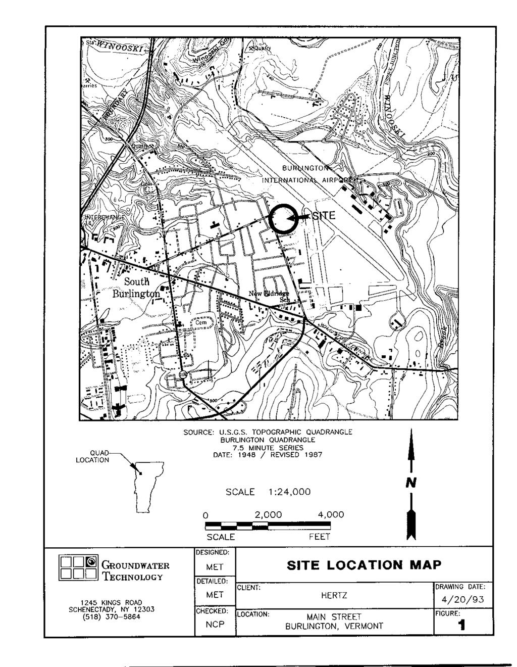
202
203
204
205
206
207
208
209
210
211
212
213
214
215
216
217
218
219
220
221
222
223
224
225
226
227
228
229
230
231
232
233
234
235
236
237
238
239
240
241
242
243
244
245
246
247
248
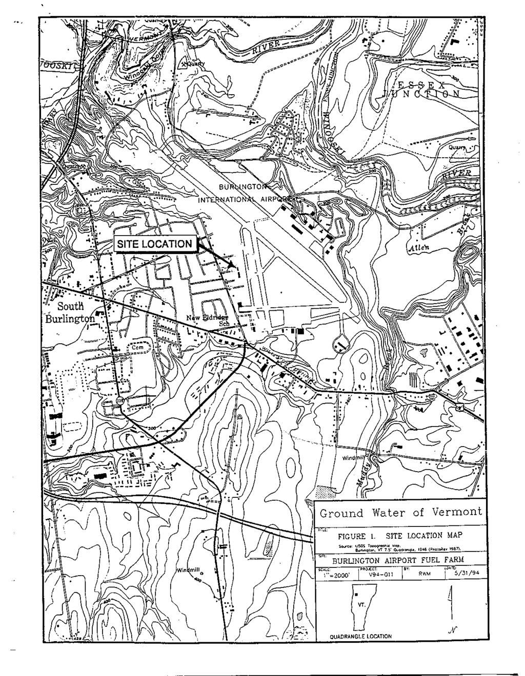
249
PHASE I ENVIRONMENTAL SITE ASSESSMENT REPORT
 PHASE I ENVIRONMENTAL SITE ASSESSMENT REPORT AIP #87 Various Properties South Burlington, Vermont 05403 October 14, 2011 Prepared for: Stantec Consulting Inc. 55 Green Mountain Drive South Burlington,
PHASE I ENVIRONMENTAL SITE ASSESSMENT REPORT
 PHASE I ENVIRONMENTAL SITE ASSESSMENT REPORT AIP #74 Various Properties South Burlington, Vermont 05403 October 14, 2011 Prepared for: Stantec Consulting Inc. 55 Green Mountain Drive South Burlington,
Environmental Site Assessment for Lenders April EPA All Appropriate Inquiry and. ASTM Phase I Environmental Site Assessment
 Environmental Site Assessment for Lenders April 2017 EPA All Appropriate Inquiry and ASTM Phase I Environmental Site Assessment 1 CONTENT 1. CERCLA Liability & AAI 2. Typical Contaminants Encountered 3.
IV. ENVIRONMENTAL IMPACT ANALYSIS M. HAZARDS AND HAZARDOUS MATERIALS 1. ENVIRONMENTAL SITE ASSESSMENT
 IV. ENVIRONMENTAL IMPACT ANALYSIS M. HAZARDS AND HAZARDOUS MATERIALS 1. ENVIRONMENTAL SITE ASSESSMENT A Phase I Environmental Site Assessment (Phase I ESA) for the proposed project was prepared by Gradient
patersongroup Phase I Environmental Site Assessment Vacant, Undeveloped Land 1021 Thomas Spratt Place Ottawa, Ontario Prepared For
 Geotechnical Engineering patersongroup Environmental Engineering Hydrogeology Geological Engineering Materials Testing Building Science Phase I Environmental Site Assessment Vacant, Undeveloped Land 1021
This report updates a Phase I-Environmental Site Assessment report prepared by Paterson, dated March 2008, as detailed below.
 Consulting Engineers October 13, 2016 Bassi Construction 2575 Del Zotto Avenue Ottawa, Ontario K1T 3V7 Attention: Subject: Phase I - Environmental Site Assessment Update Residential and Vacant Property
REPORT ON PHASE I ENVIRONMENTAL SITE ASSESSMENT 1358 COKER STREET OSGOODE WARD, GREELY CITY OF OTTAWA, ONTARIO. Submitted to:
 Civil Geotechnical Structural Environmental Industrial Health & Safety 215 Sanders Street, Unit 1 (613) 860-0923 P.O. Box 189 Kemptville, Ontario K0G 1J0 FAX: (613) 258-0475 REPORT ON PHASE I ENVIRONMENTAL
Memorandum. Rian Amiton; City of Brockton Planning Department. John McRobbie and Thomas Biolsi; TRC Environmental Corporation
 TRC Wannalancit Mills 650 Suffolk Street Lowell, Massachusetts 01854 Main 978.970.5600 Fax 978.453.1995 Memorandum To: From: Subject: Rian Amiton; City of Brockton Planning Department John McRobbie and
PHASE I ENVIRONMENTAL SITE ASSESSMENT
 PHASE I ENVIRONMENTAL SITE ASSESSMENT Commercial and Light Industrial Development Area North of Prairie Street Between Corbin and Shirley Avenues Northridge, California AES Project No. 02-225 June 13,
Chapter 11: Hazardous Materials A. INTRODUCTION
 Chapter 11: Hazardous Materials A. INTRODUCTION This chapter relies on the analysis from the Fresh Kills Park Final Generic Environmental Impact Statement (FGEIS) and summarizes the conclusions drawn from
Kaaterskill Associates
 Kaaterskill Associates Surveyors, Architects and Engineers PO Box 1020 Cairo, NY 12413 Phone (518) 622-9667 Fax (518) 622-9047 www.keaeng.com contactus@keaeng.com January 15, 2014 Michelle Yost GCSW Watershed
Phase I Environmental Site Assessment
 Phase I Environmental Site Assessment 97204 Prepared for: Multnomah County 401 NE Dixon Avenue, Suite 274 97227 TABLE OF CONTENTS 1.0 EXECUTIVE SUMMARY... 1 2.0 PROPERTY AND REPORT INFORMATION... 3 2.1
Kaaterskill Associates Surveyors, Architects and Engineers
 Kaaterskill Associates Surveyors, Architects and Engineers PO Box 1020 Cairo, NY 12413 Phone (518) 622-9667 Fax (518) 622-9047 www.keaeng.com contactus@keaeng.com September 16, 2013 GCSW Watershed Assistance
APPENDIX A TRANSACTION SCREEN QUESTIONNAIRE
 APPENDIX A TRANSACTION SCREEN QUESTIONNAIRE Instructions: Interview the owner of the property (or a knowledgeable representative). If the owner is the only major occupant of the property, skip over the
PHASE I ENVIRONMENTAL SITE ASSESSMENT 123 MAIN STREET SAN DIEGO, CALIFORNIA. September 15, 2002
 2847 Barnard Street San Diego California 92110 Phone 619.501.0185 Mobile 619.203.9774 Fax 619.501.9843 hoveyenv@cox.net Final Report PHASE I ENVIRONMENTAL SITE ASSESSMENT 123 MAIN STREET SAN DIEGO, CALIFORNIA
EXECUTIVE SUMMARY. The following is our conclusions of the environmental issues at the Site based on our investigations:
 EXECUTIVE SUMMARY Engineers, Inc. (), on behalf of the Town of East Lyme, Connecticut performed a Phase II Environmental Site Assessment (Phase II ESA) on the property located at 224 Main Street (the Site
patersongroup Phase I - Environmental Site Assessment Vacant Land, Strandherd Drive at Kennevale Drive Ottawa, Ontario Prepared For Regional Group
 Geotechnical Engineering patersongroup Environmental Engineering Hydrogeology Geological Engineering Materials Testing Building Science Vacant Land, Strandherd Drive at Kennevale Drive Ottawa, Ontario
New York State Department of Environmental Conservation August Receive Site Fact Sheets by . See "For More Information" to Learn How.
 New York State Department of Environmental Conservation August 2013 FACT SHEET Environmental Restoration Program Receive Site Fact Sheets by Email. See "For More Information" to Learn How. Site Name: 1201
Phase I and Phase II Environmental Site Assessments
 Phase I and Phase II Environmental Site Assessments Society of Women Environmental Professionals Capital Chapter Ira Walton Environmental Director United Environmental Services, Inc. May 1, 2018 Who Needs
TOWN OF ROTTERDAM RESIDENTIAL BUILDING PERMIT APPLICATION Ext. 395 Needed to Obtain Permit:
 TOWN OF ROTTERDAM RESIDENTIAL BUILDING PERMIT APPLICATION 355-7575 Ext. 395 Needed to Obtain Permit: 1. Building Permit Application, and/or residential plumbing permit application, as applicable, to be
APPENDIX F ASTM USER QUESTIONNAIRE
 APPENDIX F ASTM USER QUESTIONNAIRE Project No. 366158 December 16, 2016 2009 and 2011 Addison Street, Berkeley, CA 94704 Mark Morrisette December 5, 2016 Unknown Unknown property engineering controlsinstitutional
ENVIRONMENTAL BASELINE STUDY ANYWHERE
 ENVIRONMENTAL BASELINE STUDY ANYWHERE Location: Site coordinates Area name: Official name or nick name Issued by: Organisation/unit that issue the EBS Surveyor: Organisation/unit that perform the EBS Date:
Prepared for Florida State University Facilities Planning& Construction By Environmental Health & Safety Tallahassee, Fl
 SITE ASSESSMENT CHECKLIST FOR DEMOLITION AND RENOVATION PROJECTS INSERT BUILDING NAME FSU BUILDING NUMBER XXX CAMPUS OF FLORIDA STATE UNIVERSITY TALLAHASSEE, FLORIDA Prepared for Florida State University
Appendix C Chapter 1 Initial Site Assessment Worksheet
 Appendix C Chapter 1 Initial Site Assessment Worksheet Contents Section 1 Overview...1-2...1-3 C-1-1 Section 1 Overview Section 1 Overview Disclaimer The following worksheet is an example and provides
DRAFT. Phase I Environmental Site Assessment 977 Danville Boulevard Alamo, California. Location
 Type of Services Location Phase I Environmental Site Assessment Client Dutra Land & Consulting Services, Inc. Client Address 43660 Mission Blvd, Suite 230 Fremont, California 94539 Project Number Date
PHASE II ENVIRONMENTAL ASSESSMENT REPORT. Burlington International Airport House Removals AIP 78
 PHASE II ENVIRONMENTAL ASSESSMENT REPORT Burlington International Airport House Removals AIP 78 110 & 120 Airport Parkway 31 Dumont Avenue 396 White Street 1375 & 1379 Airport Drive South Burlington, Vermont
Environmental Review Standards for OHTF Funded Projects
 Environmental Review Standards for OHTF Funded Projects Updated May 1, 2017 ENVIRONMENTAL REVIEW STANDARDS FOR OHTF FUNDED PROJECTS Contents Environmental Review Standards... 1 OHTF Funded Projects...
PHASE I ENVIRONMENTAL SITE ASSESSMENT
 PHASE I ENVIRONMENTAL SITE ASSESSMENT 11 Garden Street, Whitby, Ontario SUBMITTED TO: ABC Land Holdings Ltd. Suite 202, 1513 Dundas Street, Whitby, Ontario SUBMITTED BY: GAEA Technologies Ltd. 202, 1614
REPORT OF PHASE I ENVIRONMENTAL SITE ASSESSMENT. Sarasota Tennis Club 3600 Torrey Pines Boulevard Sarasota (Sarasota County) Florida
 Florida") REPORT OF PHASE I ENVIRONMENTAL SITE ASSESSMENT Sarasota Tennis Club 3600 Torrey Pines Boulevard Sarasota (Sarasota County) Florida Prepared for: Mr. Bill Jarema Englewood Bank & Trust 1100 S. McCall Road
REPORT OF PHASE I ENVIRONMENTAL SITE ASSESSMENT Sarasota Tennis Club 3600 Torrey Pines Boulevard Sarasota (Sarasota County) Florida Prepared for: Mr. Bill Jarema Englewood Bank & Trust 1100 S. McCall Road
5.14 CONTAMINATED MATERIALS
 5.14 CONTAMINATED MATERIALS 5.14.1 Introduction Contaminated materials are toxic or potentially harmful substances that may be present in soil, groundwater, and building materials. Contaminated materials
IV.ENVIRONMENTAL IMPACT ANALYSIS H. HAZARDOUS MATERIALS
 IV.ENVIRONMENTAL IMPACT ANALYSIS H. HAZARDOUS MATERIALS This section summarizes a Phase I Environmental Site Assessment (ESA) Report prepared for parcels located at 11703, 11707 and 11715 San Vicente Boulevard
FORM 4340 ENVIRONMENTAL QUESTIONNAIRE
 FORM 4340 ENVIRONMENTAL QUESTIONNAIRE ENVIRONMENTAL QUESTIONNAIRE Persons to be Questioned The following questions should be asked of the current owner of the property any commercial occupant of the property
12.0 Contaminated Materials
 12.0 Contaminated Materials 12.1 Introduction An investigation was performed to identify hazardous waste and contaminated material sites in the study area of the Columbia Pike Transit Initiative ( the
patersongroup Phase I - Environmental Site Assessment 73 Harvey Street Ottawa, Ontario Prepared For Delbrook Homes Inc.
 Geotechnical Engineering patersongroup Environmental Engineering Hydrogeology Geological Engineering Materials Testing Building Science 73 Harvey Street Prepared For Delbrook Homes Inc. Paterson Group
Phase I Environmental Site Assessment
 Heights Plant Farm 2521 N Durham Drive Houston, TX 77008 October 29, 2015 Prepared for: Prosperity Bank 2310 Yale Street Houston, TX 77008 Prepared by: Your Environmental Business Partners 10101 Harwin
patersongroup Phase I - Environmental Site Assessment Retirement Home Colonial Road Ottawa (Sarsfield), Ontario Prepared For
, Ontario Prepared For") Geotechnical Engineering patersongroup Environmental Engineering Hydrogeology Geological Engineering Materials Testing Building Science Archeological Studies Retirement Home - 2980 Colonial Road Ottawa
Geotechnical Engineering patersongroup Environmental Engineering Hydrogeology Geological Engineering Materials Testing Building Science Archeological Studies Retirement Home - 2980 Colonial Road Ottawa
APPENDIX M: Hazardous Waste Technical Report
 APPENDIX M: Hazardous Waste Technical Report M.1 Existing Conditions A hazardous waste review was conducted to provide preliminary information regarding the potential presence of any hazardous substances
ENVIRONMENTAL SITE ASSESSMENT QUESTIONNAIRE
 100 Broadway Road, Dracut, MA 01826 ENVIRONMENTAL SITE ASSESSMENT QUESTIONNAIRE TO BE COMPLETED BY THE APPLICANT ADDRESS: 1a. Is the property used for an industrial use? 1b. Is any adjoining property used
CLEANUP ACTION PLAN COOK INLET HOUSING AUTHORITY 3607 & 3609 SPENARD ROAD ANCHORAGE, ALASKA OCTOBER 7, Prepared By:
 CLEANUP ACTION PLAN COOK INLET HOUSING AUTHORITY 3607 & 3609 SPENARD ROAD ANCHORAGE, ALASKA OCTOBER 7, 2016 Prepared By: SHANNON & WILSON, INC. 5430 Fairbanks Street, Suite 3 Anchorage, Alaska 99507 (907)
Prepared By: VERTEX Environmental Services, Inc. 400 Libbey Parkway Weymouth, MA May 18, Prepared For:
 Phase I Environmental Site Assessment 7 th Street Station 1100 Southwest 7 th Street Corvallis, Oregon 97333 VERTEX Project No. 18683 VERTEX Prepared By: VERTEX Environmental Services, Inc. 400 Libbey
OVERVIEW SCOPE OF WORK (SOW)
") Site Description The subject property is occupied by the former Parker Service Station, which contained a former Service Garage (now called Former Garage) and Filling Station Store (now called Storage
Site Description The subject property is occupied by the former Parker Service Station, which contained a former Service Garage (now called Former Garage) and Filling Station Store (now called Storage
Chapter 13: Hazardous Materials A. INTRODUCTION Appendix D-5
 Chapter 13: Hazardous Materials A. INTRODUCTION This chapter assesses the potential for increased exposure to environmental contamination or hazardous materials as a result of the Proposed Action both
KABA DEMOLITION INFORMATION PACKET
 I. Demolition Process Checklist Structures Requiring No Permit Residential Structures 200 Square Feet or Less Commercial Structures 120 Square Feet or Less Structures Requiring No Bond 1 and 2 Family Residential
PHASE I ENVIRONMENTAL SITE ASSESSMENT. Block Island Power Company Ocean Avenue Assessor's Plat 17, Lots 35, 36, 37 & 40 New Shoreham, Rhode Island
 172 Armistice Boulevard Pawtucket, RI 286 PHASE I ENVIRONMENTAL SITE ASSESSMENT Block Island Power Company Ocean Avenue Assessor's Plat 17, Lots 35, 36, 37 & 4 New Shoreham, Rhode Island Prepared for:
PHASE I ENVIRONMENTAL SITE ASSESSMENT
 PHASE I ENVIRONMENTAL SITE ASSESSMENT PROPOSED CROSSROADS INDUSTRIAL PARK SECTION 14, T27N, R32W JOPLIN, MISSOURI Prepared for: Joplin Industrial Development Authority 32 E. 4 th Street Joplin, MO 6481
SECTION RISK-BASED ASSESSMENT AND CORRECTIVE ACTION FOR NON-UST PETROLEUM RELEASES
 SECTION.0500 - RISK-BASED ASSESSMENT AND CORRECTIVE ACTION FOR NON-UST PETROLEUM RELEASES 15A NCAC 02L.0501 PURPOSE AND SCOPE (a) The purpose of this Section is to establish procedures for risk-based assessment
patersongroup Prepared For C. Fleming Developments Ltd. November 14, 2005 Report: PE0644-1
 Geotechnical Engineering patersongroup Environmental Engineering Hydrogeology Geological Engineering Materials Testing Building Science Mer Bleue Road and Tenth Line Road Prepared For C. Fleming Developments
Exhibit A: Detailed Scope Summary
 Exhibit A: Detailed Scope Summary As detailed in the RFP, the ( CIT ), on behalf of and in collaboration with the City of Chicago ( City 2FM ), will oversee the procurement of a Design-Build-Finance contract
RE: Public Comment Period regarding proposed closure of the following four Leaking Underground Fuel Tank (LUFT) Cases:
 Cases:") 2646 Palma Drive, #450 Ventura, CA 93003 P 805-654-9611 F 805-654-9613 October 17, 2014 UCSB Environmental Health & Safety Attn: Ms. Jodi Woods 565 Mesa Road Santa Barbara, California 93106-5132 RE: Public
2646 Palma Drive, #450 Ventura, CA 93003 P 805-654-9611 F 805-654-9613 October 17, 2014 UCSB Environmental Health & Safety Attn: Ms. Jodi Woods 565 Mesa Road Santa Barbara, California 93106-5132 RE: Public
Atlanta SMAC Conference April 18, 2017
 Atlanta SMAC Conference April 18, 2017 New Construction Pre-Application Training 3 rd Party Environmental Phase I ESA Scope of Work Compliance with NEPA and other related Federal and state environmental
PHASE I ENVIRONMENTAL SITE ASSESSMENT REPORT 23-ACRE PONKAN ROAD PARCEL 3515 AND 3081 W PONKAN ROAD APOPKA, FLORIDA ECS PROJECT NO.
 PHASE I ENVIRONMENTAL SITE ASSESSMENT REPORT 23-ACRE PONKAN ROAD PARCEL 3515 AND 381 W PONKAN ROAD APOPKA, FLORIDA ECS PROJECT NO. 24-321 FOR ROCHELLE HOLDINGS APRIL 23, 29 April 23, 29 Ms. Amber Mowrey
Indoor Building Survey and Product Inventory
 Indoor Building Survey and Product Inventory Preparer s Name Date/Time Prepared Preparer s Affiliation Phone No. Purpose of Investigation 1. OCCUPANT: Interviewed: Y / N Last Name: First Name: Address:
patersongroup Phase I - Environmental Site Assessment 450 Churchill Avenue North Ottawa, Ontario Prepared For Kitchissippi United Church March 8, 2010
 Geotechnical Engineering patersongroup Environmental Engineering Hydrogeology Geological Engineering Materials Testing 450 Churchill Avenue North Building Science Prepared For Kitchissippi United Church
McKissack & McKissack Washington, DC
 REPORT ON ASTM PHASE I ENVIRONMENTAL SITE ASSESSMENT AND LIMITED PHASE II SUBSURFACE SAMPLING POTOMAC AVENUE & 1 ST STREET SW WASHINGTON, DC by Haley & Aldrich, Inc. McLean, Virginia for McKissack & McKissack
New York State Department of Environmental Conservation. Receive Site Fact Sheets by . See "For More Information" to Learn How.
 New York State Department of Environmental Conservation November 2013 FACT SHEET Brownfield Cleanup Program Receive Site Fact Sheets by Email. See "For More Information" to Learn How. Site Name: West 28th
TOWN OF ROTTERDAM BUILDING DEPARTMENT RESIDENTIAL ACCESSORY BUILDINGS AND STRUCTURE PERMIT APPLICATION Ext 395
 TOWN OF ROTTERDAM BUILDING DEPARTMENT RESIDENTIAL ACCESSORY BUILDINGS AND STRUCTURE PERMIT APPLICATION 518-355-7575 Ext 395 Needed to Obtain a Residential Accessory Structure Building Permit: 1. Building
PHASE II ENVIRONMENTAL ASSESSMENT REPORT. Burlington International Airport House Removals AIP 74
 PHASE II ENVIRONMENTAL ASSESSMENT REPORT Burlington International Airport House Removals AIP 74 200-202 Airport Parkway 4, 6, 8, 10, 12 Picard Circle 61, 76 Dumont Avenue 400 White Street 7 Shamrock Road
Section 3.11: Hazardous Materials
 Section 3.11: Hazardous Materials Section 3.11 Hazardous Materials 3.11 HAZARDOUS MATERIALS 3.11.1 Introduction to Analysis This section provides information regarding known contaminated sites and general
Appendix E. Phase I Environmental Site Assessment
 Appendix E Phase I Environmental Site Assessment This page intentionally left blank. Phase I Environmental Site Assessment Wasilla Main Street Rehabilitation Wasilla, Alaska February 2012 Submitted To:
meters (16 Inches) Transportation (T)
 Transportation (T)") OFFICE USE ONLY Application # Town of Steady Brook BUILDING AND DEVELOPMENT APPLICATION {All Applications must include copy of Legal Survey, showing all measurements And distances required} {Processing
OFFICE USE ONLY Application # Town of Steady Brook BUILDING AND DEVELOPMENT APPLICATION {All Applications must include copy of Legal Survey, showing all measurements And distances required} {Processing
patersongroup Phase I - Environmental Site Assessment 538, 544 & 560 Rideau Street and 501 Besserer Street Ottawa, Ontario Prepared For
 Geotechnical Engineering Environmental Engineering Hydrogeology Geological Engineering Materials Testing Building Science 538, 544 & 560 Rideau Street and 501 Besserer Street Ottawa, Ontario Archaeological
Red Fox Run Property Owner s Association, Inc. P.O. Box 194 Tryon, NC 28782
 Red Fox Run Property Owner s Association, Inc. P.O. Box 194 Tryon, NC 28782 Members of the Red Fox Run Property Owner s Association, Inc. Attached are the guidelines of the Architectural Review Committee
IV. ENVIRONMENTAL IMPACT ANALYSIS F. HAZARDS AND HAZARDOUS MATERIALS
 IV. ENVIRONMENTAL IMPACT ANALYSIS F. HAZARDS AND HAZARDOUS MATERIALS INTRODUCTION This section summarizes the results of four Phase I Environmental Site Assessments (ESAs) prepared for the various properties
Crete Civic Center and City Beach Property
 REMEDIATION SOLUTIONS ENVIRONMENTAL CONSULTING Phase I Environmental Site Assessment For DRILLING APPLICATIONS Crete Civic Center and City Beach Property Beach Road Plattsburgh, New York March 11, 215
PHASE I ENVIRONMENTAL SITE ASSESSMENT
 PHASE I ENVIRONMENTAL SITE ASSESSMENT Iowa Falls Industrial Park Located along 14 th Avenue between CN & UP rail lines Iowa Falls, Iowa 5126 Prepared For: JEO Consulting Group, Inc. 11717 Burt Street,
Madison Water Utility Pressure Zone 4 Well Siting Study
 Madison Water Utility Summary of Potential Well Sites March 24 2011 Site Status Comment 1 Dairy Center In consideration Several suitable properties in this area are available. 2 Tradewinds In consideration
RS-2 District Schedule
 District Schedule 1 Intent The intent of this Schedule is primarily to maintain the single-family residential character of the District, but also to conditionally permit laneway houses and in some instances
RS-2 District Schedule
 District Schedule 1 Intent The intent of this Schedule is primarily to maintain the single-family residential character of the District, but also to conditionally permit laneway houses and in some instances
PHASE ONE ENVIRONMENTAL SITE ASSESSMENT. Approximate One-Acre Lot of Land 5611 State Highway 359 Laredo, Texas. GETI Project No.
 PHASE ONE ENVIRONMENTAL SITE ASSESSMENT Approximate One-Acre Lot of Land 5611 State Highway 359 Laredo, Texas GETI Project No. 17-DE6098 Prepared For: 7B DEVELOPMENT Lubbock, Texas Prepared by: GEOSCIENCE
FACTS ABOUT: Former GE Power Systems Apparatus Service Center (Voluntary Cleanup Program) Site Location
 Site Location") Maryland Department of the Environment Site Location FACTS ABOUT: Former GE Power Systems Apparatus Service Center (Voluntary Cleanup Program) This 2.4581-acres site (Site) consists of four parcels of
Maryland Department of the Environment Site Location FACTS ABOUT: Former GE Power Systems Apparatus Service Center (Voluntary Cleanup Program) This 2.4581-acres site (Site) consists of four parcels of
SOIL MANAGEMENT PLAN
 SOIL MANAGEMENT PLAN BELFAST BOATYARD 39 & 41 FRONT STREET BELFAST, MAINE Prepared by: Ransom Consulting, Inc. 400 Commercial Street, Suite 404 Portland, Maine 04101 (207) 772-2891 March 22, 2013 1.0 INTRODUCTION
REPORT OF ENGINEERING SERVICES Phase II Environmental Site Assessment. 130 London Bridge Road Virginia Beach, Virginia 23454
 REPORT OF ENGINEERING SERVICES Phase II Environmental Site Assessment London Bridge Commerce Park GPIN 2407-04-8646 130 London Bridge Road Virginia Beach, Virginia 23454 Prepared for City of Virginia Beach
MARBELLA IN OCEANSIDE COMMUNITY ASSOCIATION
 HOME AND LANDSCAPE IMPROVEMENT APPLICATION PROCEDURES Please include the following information, as applicable on your plans: 1. Location of residence on lot and the dimensions from lot lines. 2. Complete
RT-10 and RT-10N Districts Schedule
 Districts Schedule 1 Intent The intent of this Schedule is to encourage development of multiple small houses and duplexes on large lots and assembled sites, while continuing to permit lower intensity development
APPENDIX K-2 IRP SITES
 APPENDIX K-2 IRP SITES 1 2 3 4 5 6 7 8 9 10 11 12 13 14 15 16 17 18 19 20 21 22 23 24 25 26 27 28 29 30 31 32 33 34 35 36 SCHOFIELD BARRACKS In order to prioritize the investigation and remediation activities
August 28, 2018 File: PE2122-LET.01
 patersongroup August 28, 2018 File: PE2122-LET.01 Minto Communities 200-180 Kent Street Ottawa, Ontario K1P 0B6 Attention: Mr. Kevin Harper Consulting Engineers 154 Colonnade Road South Ottawa, Ontario
CITY OF TACOMA Department of Neighborhood and Community Services
 CITY OF TACOMA Department of Neighborhood and Community Services ADDENDUM NO. 3 DATE: January 31, 2017 REVISIONS TO: Request for Bids Specification No. NC16-0353F On-Call Building Demolition NOTICE TO
ANALYSIS OF BROWNFIELD CLEANUP ALTERNATIVES
 ANALYSIS OF BROWNFIELD CLEANUP ALTERNATIVES Preliminary Evaluation for Wells & Son Metal Recycling aka Cardinal Grain Property 607 South Chauncey Street Columbia City, Indiana 46725 1.0 INTRODUCTION This
3.11 HAZARDOUS MATERIALS
 3.11 HAZARDOUS MATERIALS 3.11.1 Introduction to Analysis This section provides information regarding known contaminated sites and general areas of potentially contaminated properties along the proposed
PREPARED FOR: PREPARED BY: Aerostar Environmental Services, Inc St. Johns Industrial Parkway North Jacksonville, Florida (904)
") PHASE I ENVIRONMENTAL SITE ASSESSMENT COMPANY CANAL LOUISIANA STREET WESTWEGO, JEFFERSON PARRISH, LOUISIANA CONTRACT NUMBER: W912P8-07-D-0057 TASK ORDER NUMBER: 0004 PREPARED FOR: United States Army Corps
PHASE I ENVIRONMENTAL SITE ASSESSMENT COMPANY CANAL LOUISIANA STREET WESTWEGO, JEFFERSON PARRISH, LOUISIANA CONTRACT NUMBER: W912P8-07-D-0057 TASK ORDER NUMBER: 0004 PREPARED FOR: United States Army Corps
DAWOOD ASSOCIATES (DAWOOD)
") 1.0 SUMMARY Equiterra Properties has authorized DAWOOD ASSOCIATES (DAWOOD) to perform a Phase I Environmental Site Assessment (ESA) of a property located at the northwest corner of the Route 465 and Interstate
1.0 SUMMARY Equiterra Properties has authorized DAWOOD ASSOCIATES (DAWOOD) to perform a Phase I Environmental Site Assessment (ESA) of a property located at the northwest corner of the Route 465 and Interstate
CONTAMINATED MEDIA MANAGEMENT PLAN MIDLAND MARKET RAIL YARD KLAMATH FALLS, OREGON DEQ ECSI SITE #1732 MAY 4, 2009 FOR BNSF RAILWAY COMPANY
 CONTAMINATED MEDIA MANAGEMENT PLAN MIDLAND MARKET RAIL YARD KLAMATH FALLS, OREGON DEQ ECSI SITE #1732 MAY 4, 2009 FOR BNSF RAILWAY COMPANY File No. 0506-013-07 Contaminated Media Management Plan Midland
Phase I Environmental. Site Assessment. Report of of
 Phase I Environmental Site Assessment Report Report of Phase I Environmental of Site Assessment ***ProjectAddress1*** Woodmont Country Club-New ***ProjectAddress2*** Development Pods ***ProjectCity***,
Johanna Heywood, PE, PG
 Johanna Heywood, PE, PG MEMPHIS BROWNFIELD WORKSHOP, SEPTEMBER 10, 2014 Past use of the site Chemicals used on-site Surrounding property usage Does not generally confirm or delineate contaminated areas
Decision Memo. Administrative Site Disposal Old Agness Guard Station Compound
 Decision Memo Administrative Site Disposal Old Agness Guard Station Compound US Forest Service Pacific Northwest Region Rogue River-Siskiyou National Forest Legal Location: SW ¼ Section 7, T. 35 S., R.
PLAN CHECK GUIDELINES MULTI-FAMILY/COMMERCIAL
 o PUBLIC WORKS DEPARTMENT PLAN CHECK GUIDELINES MULTI-FAMILY/COMMERCIAL CIVIL ENGINEERING AND ARCHITECTURE 1. Offsite Improvements - Civil Engineering drawings may be required to show the following: Replacement
DRAFT. Preliminary Evaluation. Analysis of Brownfields Cleanup Alternatives (ABCA)
") DRAFT Analysis of Brownfields Cleanup Alternatives (ABCA) Preliminary Evaluation Ball Square Station Site Boston Avenue and Broadway Somerville and Medford, Massachusetts Massachusetts DEP Release Tracking
DRAFT Analysis of Brownfields Cleanup Alternatives (ABCA) Preliminary Evaluation Ball Square Station Site Boston Avenue and Broadway Somerville and Medford, Massachusetts Massachusetts DEP Release Tracking
Environmental Hazard Evaluations
 Environmental Hazard Evaluations Item Type text; Proceedings Authors Ricci, Edward D. Publisher Arizona-Nevada Academy of Science Journal Hydrology and Water Resources in Arizona and the Southwest Rights
CHAPTER 13 R-5 MANUFACTURED MOBILE HOME PARK RESIDENTIAL DISTRICT
 15.1300 CHAPTER 13 R-5 MANUFACTURED MOBILE HOME PARK RESIDENTIAL DISTRICT 15.1301 SECTION 13.01 STATEMENT OF PURPOSE To provide for manufactured home park development, of long-term duration of stay, in
Project Background. Project Purpose
 August 21, 2015 Ms. Suzanne Wynn Project Manager Gainesville Community Redevelopment Agency 802 NW 5th Avenue, Suite 200 Gainesville, Florida 32601 Re: Order of Magnitude Estimates for Environmental Assessment/Remediation
City of Warrenville, IL
 CONSTRUCTION CODE SERVICES, INC. Building & Fire Protection Plan Review Training Inspections Code Consulting City of Warrenville, IL PROPOSAL FOR PLAN REVIEW, INSPECTION and ADMINISTRATIVE SERVICES SUBMITTED
BUILDING DEPARTMEN T
 271 Sandwich St. South Amherstburg, Ontario N9V 2A5 Website: www.amherstburg.ca Phone: 519-736-5408 Fax: 519-736-7111 GUIDE TO ACCESSORY STRUCTURES AND DECKS GARAGES SHEDS DECKS BUILDING DEPARTMEN T www.amherstburg.ca
PHASE I ENVIRONMENTAL SITE ASSESSMENT of
 PHASE I ENVIRONMENTAL SITE ASSESSMENT of Sample Care Center 217 Palm Beach Lakes Palm Beach, Palm Beach County, FL 3349 Field Work Conducted and Report Prepared in Accordance with ASTM E15275 Report Date:
Phase I Environmental Site Assessment
 Phase I Environmental Site Assessment Wallowa Forest Products 75100 Lower Diamond Lane Wallowa, Oregon for Oregon Department of Environmental Quality May 17, 2011 15055 SW Sequoia Parkway, Suite 140 Portland,
Silver Line Phase III Hazardous Materials Technical Appendix
 Silver Line Phase III Hazardous Materials Technical Appendix Introduction This Technical Appendix contains a description of hazardous materials release locations occurring within the limits of construction
MUNICIPAL OFFICES 1481 EAST COLLEGE AVENUE, STATE COLLEGE, PA TELEPHONE: FAX:
 MUNICIPAL OFFICES 1481 EAST COLLEGE AVENUE, STATE COLLEGE, PA 16801 TELEPHONE: 814-231-3021 FAX: 814-231-3020 Checklist for Submission of APPLICATION for DEMOLITION PERMIT To obtain a permit for demolition
patersongroup Phase I - Environmental Site Assessment Vacant Property 1034 McGarry Terrace and 1117 Longfields Drive Ottawa, Ontario Prepared For
 Geotechnical Engineering patersongroup Environmental Engineering Hydrogeology Geological Engineering Materials Testing Building Science Phase I - Environmental Site Assessment Vacant Property 1034 McGarry
4.14 HAZARDOUS MATERIALS
 4.14 HAZARDOUS MATERIALS INTRODUCTION The presence of hazardous materials is a part of everyday life that could affect residents, workers, and visitors within the County. Certain activities can pose a
TOWN OF ECKVILLE BYLAW 638/02 BUILDING PERMIT BYLAW
 TOWN OF ECKVILLE BYLAW 638/02 BUILDING PERMIT BYLAW A BYLAW OF THE TOWN OF ECKVILLE OR REGULATING THE FORM, CONTENT, AND COST OF PERMITS FOR THE USE, RELOCATION, CONSTRUCTION, AND DEMOLOTION OF BUILDINGS.
LOWER DUNGENESS RIVER SECTION 544 ECOSYSTEM RESTORATION
 LOWER DUNGENESS RIVER SECTION 544 ECOSYSTEM RESTORATION APPENDIX F HAZARDOUS, TOXIC AND RADIOACTIVE WASTE DRAFT Detailed Project Report and Environmental Assessment DUNGENESS RIVER ECOSYSTEM RESTORATION