Radar-based flood forecasting: Quantifying hydrologic prediction uncertainty
|
|
|
- Franklin McDowell
- 6 years ago
- Views:
Transcription
1 Severe Storms Prediction and Global Climate Impact on the Gulf Coast, Rice University, October 29 31, 2008 Radar-based flood forecasting: Quantifying hydrologic prediction uncertainty Baxter E. Vieux, Ph.D., P.E. J.M. Imgarten, Graduate Research Assistant 1 University of Oklahoma, School of Civil Engineering and Environmental Science, National Weather Center, 120 David L. Boren Blvd., Suite 3600, Norman, OK 73072; PH (405) ; bvieux@ou.edu


2 Overview Stormwater runoff significantly impacts flooding and water quality in urban catchments. Weather radar captures the variability of rainfall over watersheds from catchment to river basin scale What is the accuracy that can be achieved for catchments and river basins, and how does it scale with space/time?


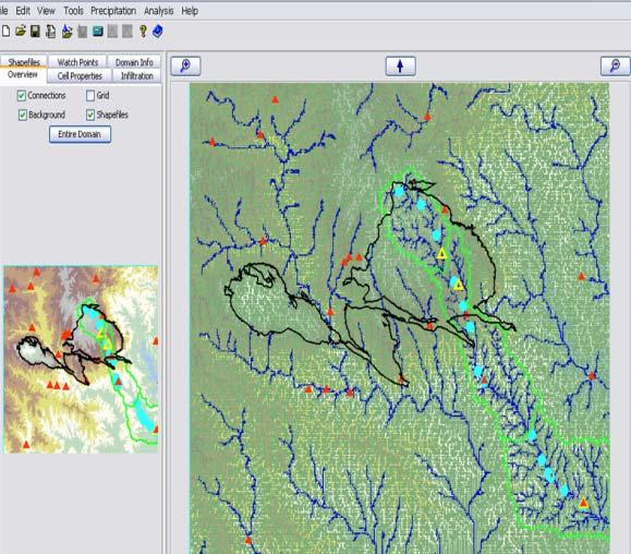
3 Hydrologic Prediction Problem KEEGANS BAYOU BRAYS BAYOU WILLOW WATE R HOL E 1. Radar QPE Action Level 2. Model 3. Stream Forecasts Sensing Predicting

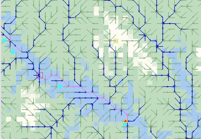
4 River Basin Hydrologic Modeling Vflo Continuous Drainage network and hydraulics determine hydrologic response without presumptive unit hydrographs. Setup with geospatial data and physically realistic parameters Saturation and infiltration rate excess is modeled as a single layer with variation throughout the basin. Kinematic wave grid-grid and in channels defined by surveyed cross-section, rating curves or trapezoids Channel hydraulics include cross-section, rating curves, trapezoidal, modified Puls and looped rating curves Continuous soil moisture tracking by adjusting climatological ET according to available soil moisture and radar rainfall in each grid cell. Vieux. B.E., Distributed Hydrologic Modeling Using GIS, Kluwer Academic Publishers, Runon A t Runon ( Q) + = q x Rainfall h ( uh) + = R I t x SO u = n R ( e) CA 12 / h 23 / Runon Infiltration Runoff T h q = N + ( R I) Ω t x new old = 0 [(1 θ ) Q + θ Q ] + Δt [(1 θ F + θ F ] = CA ΔtS ) old new old new


5 Real-time Forecasting Radar input Operational Distributed Model, Vflo Forecast stage in realtime for operational decisions Used in the Rice University/Texas Medical Center Flood Alert System (
6 Urban Catchment Radar data used in this analysis are derived from both S- band (NEXRAD) with accuracy enhanced through bias correction. Model accuracy is assessed using radar QPE derived from the existing WSR-88D (KHGX) as input to a physics-based hydrologic model. The study catchment, Harris Gully, is a 10km 2 subwatershed of the 260 km 2 Brays Bayou located in Houston TX. Parts of the stormwater sewer draining Harris Gully runs through Rice University and the TMC.
 derived from radar and rain gauge.")
7 Evaluative Study Model prediction accuracy with NEXRAD input Radar Quantitative precipitation estimates (QPE) derived from radar and rain gauge. KEEGANS BAYOU BRAYS BAYOU WILLOW WATE R HOL E
 Observed Simulated 1.")
8 Distributed hydrologic prediction Stage (ft) June 8, 2004, observed and Vflo simulated hydrographs at the Harris Gully outlet 7:12 9:36 12:00 14:24 16:48 19:12 21:36 Time (CDT) Observed Simulated 1. Harris Gully June 8, 2004, observed and Vflo simulated hydrographs at the Harris Gully outlet 2. Improved Hydraulics 3. Scaling of predictability 4. NEXRAD 1x1 km input Stage (ft) :12 9:36 12:00 14:24 16:48 19:12 21:36 Time (CDT) Observed Simulated Vflo Harris Gully 40x40m 10 km 2
 4.5 4.0 3.5 3.0 2.5 2.0 1.")
9 Radar storm total for June 14, 2005 over Harris Gully. June 8, 2004, observed and Vflo simulated hydrographs at the Harris Gully outlet June 8, 2004, observed and Vflo simulated hydrographs at the Harris Gully outlet Stage (ft) :12 9:36 12:00 14:24 16:48 19:12 21:36 Time (CDT) Observed Simulated Stage (ft) :12 9:36 12:00 14:24 16:48 19:12 21:36 Time (CDT) Observed Simulated
10 Prediction Performance Simulated Stage (ft) Difference in Peak (ft) Observed Peak Time Simulated Peak Time Difference in Peak Time (min) Event Observed Peak (ft) Simulated Peak (ft) 8-Jun :25 12: Jun :55 18: Oct :00 11: Jul :45 14: Jul :10 18: Jul :05 14: Jul :55 15: Jul :25 5: Apr :55 8: May :50 7: Jun :15 12:55-20 Stage prediction accuracy = 1.05 ft RMSE Measured Stage (ft) Peak arrival time accuracy = 10.0 min. RMSE


 200m")
 Flow")

11 Distributed Hydrologic Modeling Vflo Distributed Runoff Model 500m - Blue River (1200km2) 200m Connerville (420km2) Flow Direction Effective Porosity Soil Depth Hydraulic Conductivity Slope
12 Channel Parameterization Cross-sections
13 Blue River Selected Hydrographs
14 Model Calibration Objective Functions RMSE Volume (in) RMSE Peak (cfs) Search parameter space to find minima
 R 2 = 0.")
 Density of Mesonet Stations")
15 Rainfall Products Gauge Only 30,000 Simulated G = (Observed) R 2 = Simulated Peak (cfs) 20,000 10, ,000 20,000 30,000 Observed Peak (cfs) Density of Mesonet Stations Number of Stations = 13 Average distance = 40 Km

16 Re-Analysis of NWS Stage III/MPE MFB statistics 9 Gauges MFB AD MFB CAD LB CAD MIN AVE MAX
 20,000 10,000 0 0 10,000 20,000 30,000 Observed Peak (cfs) 14yr Storm")
17 Rainfall Products Radar MFB 30,000 Simulated MFB = (Observed) R 2 = Simulated Peak (cfs) 20,000 10, ,000 20,000 30,000 Observed Peak (cfs) 14yr Storm total=122,640 hourly maps

18 Hydrograph Predictions Observed Gauge Only Radar Local Bias Radar MFB
19 Quantitative Precipitation Estimate Verification by Streamflow Event Runoff Volume Event Peak Discharge 0.80 Coefficient of Determination (R2) Volume Improvement over Gauge-Only Peak Improvement over Gauge-Only MFB ABRFC MPE Gauge Only Re-analysis Raw Stage III Mesonet


20 Temporal Scaling of Hydrologic Prediction Accuracy Daily Streamflow Monthly Streamflow Blue River near Connerville (420 km 2 )
Lecture 9A: Drainage Basins
 GEOG415 Lecture 9A: Drainage Basins 9-1 Drainage basin (watershed, catchment) -Drains surfacewater to a common outlet Drainage divide - how is it defined? Scale effects? - Represents a hydrologic cycle
1. Stream Network. The most common approach to quantitatively describing stream networks was postulated by Strahler (1952).
.") 1. Stream Network The most common approach to quantitatively describing stream networks was postulated by Strahler (1952). First Order Streams streams with no tributaries. Second Order Streams begin at
1. Stream Network The most common approach to quantitatively describing stream networks was postulated by Strahler (1952). First Order Streams streams with no tributaries. Second Order Streams begin at
Rainfall, Runoff and Peak Flows: Calibration of Hydrologic Design Methods for the Kansas City Area
 Rainfall, Runoff and Peak Flows: Calibration of Hydrologic Design Methods for the Kansas City Area Bruce McEnroe, Bryan Young, Ricardo Gamarra and Ryan Pohl Department of Civil, Environmental, and Architectural
CEE6400 Physical Hydrology
 CEE6400 Physical Hydrology Midterm Review Learning Objectives (what you should be able to do) Hydrologic data, the hydrologic cycle and water balance (HW 1) Work with hydrologic data, quantify uncertainty
DRAFT. Jacob Torres, P.E.; Nick Fang, Ph.D., P.E.
 \ Memorandum SSPEED Center at Rice University Department of Civil & Environmental Engineering 6100 Main MS-317 Houston, Texas 77005-1827 sspeed.rice.edu tel: 713-348-4977 To Andy Yung, P.E. CFM; Lane Lease,
CONSISTENCY BETWEEN CUHP AND RATIONAL METHODS James C.Y. Guo, PhD, P.E., and Ben Urbonas, P.E., D.WRD 08/04/2008
 CONSISTENCY BETWEEN CUHP AND RATIONAL METHODS James C.Y. Guo, PhD, P.E., and Ben Urbonas, P.E., D.WRD 08/04/2008 When estimating runoff for a storm event it is assumed that the storm runoff occurs from
The Texas A&M University and U.S. Bureau of Reclamation Hydrologic Modeling Inventory (HMI) Questionnaire
 Questionnaire") The Texas A&M University and U.S. Bureau of Reclamation Hydrologic Modeling Inventory (HMI) Questionnaire May 4, 2010 Name of Model, Date, Version Number Dynamic Watershed Simulation Model (DWSM) 2002
The Texas A&M University and U.S. Bureau of Reclamation Hydrologic Modeling Inventory (HMI) Questionnaire May 4, 2010 Name of Model, Date, Version Number Dynamic Watershed Simulation Model (DWSM) 2002
Hydrologic Calibration:
 Hydrologic Calibration: UPDATE OF EFFECTIVE HYDROLOGY FOR MARYS CREEK October 2010 Agenda Background Hydrologic model Calibrated rainfall Hydrologic calibration 100 year discharges, Existing Conditions
Engineering Hydrology. Class 16: Direct Runoff (DRO) and Unit Hydrographs
 and Unit Hydrographs") Engineering Hydrology Class 16: and s Topics and Goals: 1. Calculate volume of DRO from a hydrograph; 2. Complete all steps to develop a. Class 14: s? HG? Develop Ocean Class 14: s? HG? Develop Timing
Engineering Hydrology Class 16: and s Topics and Goals: 1. Calculate volume of DRO from a hydrograph; 2. Complete all steps to develop a. Class 14: s? HG? Develop Ocean Class 14: s? HG? Develop Timing
Simulation of Event Based Runoff Using HEC-HMS Model for an Experimental Watershed
 International Journal of Hydraulic Engineering 213, 2(2): 28-33 DOI: 1.5923/j.ijhe.21322.2 Simulation of Event Based Runoff Using HEC-HMS Model for an Experimental Watershed Reshma T *, Venkata Reddy K,
Suspended Sediment Discharges in Streams
 US Army Corps of Engineers Hydrologic Engineering Center Suspended Sediment Discharges in Streams April 1969 Approved for Public Release. Distribution Unlimited. TP-19 REPORT DOCUMENTATION PAGE Form Approved
FLOOD FORECASTING MODEL USING EMPIRICAL METHOD FOR A SMALL CATCHMENT AREA
 Journal of Engineering Science and Technology Vol. 11, No. 5 (2016) 666-672 School of Engineering, Taylor s University FLOOD FORECASTING MODEL USING EMPIRICAL METHOD FOR A SMALL CATCHMENT AREA CHANG L.
Hypothetical Flood Computation for a Stream System
 US Army Corps of Engineers Hydrologic Engineering Center Hypothetical Flood Computation for a Stream System December 1968 Approved for Public Release. Distribution Unlimited. TP-12 REPORT DOCUMENTATION
Hydrology and Water Management. Dr. Mujahid Khan, UET Peshawar
 Hydrology and Water Management Dr. Mujahid Khan, UET Peshawar Course Outline Hydrologic Cycle and its Processes Water Balance Approach Estimation and Analysis of Precipitation Data Infiltration and Runoff
Uncertainty in Hydrologic Modelling for PMF Estimation
 Uncertainty in Hydrologic Modelling for PMF Estimation Introduction Estimation of the Probable Maximum Flood (PMF) has become a core component of the hydrotechnical design of dam structures 1. There is
GIS Applications in Water Resources Engineering
 King Fahd University of Petroleum & Minerals City & Regional Planning Department Introduction to Geographic Information Systems Term Paper Presentation GIS Applications in Water Resources Engineering Prepared
RAINFALL-RUNOFF STUDY FOR SINGAPORE RIVER CATCHMENT
 10 th International Conference on Hydroinformatics HIC 2012, Hamburg, GERMANY RAINFALL-RUNOFF STUDY FOR SINGAPORE RIVER CATCHMENT CHI DUNG DOAN (1)(3), JIANDONG LIU (1), SHIE-YUI LIONG (1), ADRI VERWEY
Modelling Climate Change and Urbanization Impacts on Urban Stormwater and Adaptation Capacity
 9th International Conference on Urban Drainage Modelling, Belgrade 2012 C4. Climate change impacts, pp.287-288 Modelling Climate Change and Urbanization Impacts on Urban Stormwater and Adaptation Capacity
Alternative Approaches to Water Resource System Simulation
 US Army Corps of Engineers Hydrologic Engineering Center Alternative Approaches to Water Resource System Simulation May 1972 Approved for Public Release. Distribution Unlimited. TP-32 REPORT DOCUMENTATION
Florida s Deranged Hydrology and the National Water Model Challenges and Opportunities
 Florida s Deranged Hydrology and the National Water Model Challenges and Opportunities Peter J. Singhofen, P.E. Streamline Technologies, Inc. psinghofen@icpr4.com Part 1 Florida is Different 2 2016, Streamline
July, International SWAT Conference & Workshops
 Analysis of the impact of water conservation measures on the hydrological response of a medium-sized watershed July, 212 212 International SWAT Conference & Workshops ANALYSIS OF THE IMPACT OF WATER CONSERVATION
INFLOW DESIGN FLOOD CONTROL SYSTEM PLAN PLANT BARRY ASH POND ALABAMA POWER COMPANY
 INFLOW DESIGN FLOOD CONTROL SYSTEM PLAN PLANT BARRY ASH POND ALABAMA POWER COMPANY Section 257.82 of EPA s regulations requires the owner or operator of an existing or new CCR surface impoundment or any
Comparison of three flood runoff models in the Shonai River basin, Japan
 Comparison of three flood runoff models in the Shonai River basin, Japan TOSHIHARU KOJIMA Division of Fluvial and Marine Disasters, Disaster Prevention Research Institute, Kyoto University, Gokasho, Uji,
Runoff Hydrographs. The Unit Hydrograph Approach
 Runoff Hydrographs The Unit Hydrograph Approach Announcements HW#6 assigned Storm Water Hydrographs Graphically represent runoff rates vs. time Peak runoff rates Volume of runoff Measured hydrographs are
Simulation and Modelling of Climate Change Effects on River Awara Flow Discharge using WEAP Model
 ANALELE UNIVERSITĂŢII EFTIMIE MURGU REŞIŢA ANUL XXIV, NR. 1, 2017, ISSN 1453-7397 Simulation and Modelling of Climate Change Effects on River Awara Flow Discharge using WEAP Model Oyati E.N., Olotu Yahaya
Ottawa County Water Resources Study Phase 2
 Ottawa County Water Resources Study Phase 2 Overview David P. Lusch, Ph.D. Department of Geography and Institute of Water Research Michigan State University 1 / 24 Ottawa County Planning and Performance
EFFECT OF RAINGAGE DENSITY ON RUNOFF SIMULATION MODELING by ABSTRACT
 EFFECT OF RAINGAGE DENSITY ON RUNOFF SIMULATION MODELING by Ben Urbonas, P.E., D.WRE 1, Michael Paul Jansekok 2, James C.Y. Guo, PhD, P.E. 3 ABSTRACT Rainfall and runoff data for a 3.08 square mile urban
Chapter 4 "Hydrology"
 Chapter 4 "Hydrology" Revised TxDOT Hydraulics Manual Jorge A. Millan, P.E., CFM TxDOT Design Division/Hydraulics 2012 Transportation Short Course October 17, 2012 Chapter 4 Sections 1 Hydrology s Role
M.L. Kavvas, Z. Q. Chen, M. Anderson, L. Liang, N. Ohara Hydrologic Research Laboratory, Civil and Environmental Engineering, UC Davis
 Assessment of the Restoration Activities on Water Balance and Water Quality at Last Chance Creek Watershed Using Watershed Environmental Hydrology (WEHY) Model M.L. Kavvas, Z. Q. Chen, M. Anderson, L.
CHAPTER FIVE Runoff. Engineering Hydrology (ECIV 4323) Instructors: Dr. Yunes Mogheir Dr. Ramadan Al Khatib. Overland flow interflow
 Instructors: Dr. Yunes Mogheir Dr. Ramadan Al Khatib. Overland flow interflow") Engineering Hydrology (ECIV 4323) CHAPTER FIVE Runoff Instructors: Dr. Yunes Mogheir Dr. Ramadan Al Khatib Overland flow interflow Base flow Saturated overland flow ١ ٢ 5.1 Introduction To Runoff Runoff
Engineering Hydrology (ECIV 4323) CHAPTER FIVE Runoff Instructors: Dr. Yunes Mogheir Dr. Ramadan Al Khatib Overland flow interflow Base flow Saturated overland flow ١ ٢ 5.1 Introduction To Runoff Runoff
M.L. Kavvas, Z. Q. Chen, M. Anderson, L. Liang, N. Ohara Hydrologic Research Laboratory, Civil and Environmental Engineering, UC Davis
 Assessment of the Restoration Activities on Water Balance and Water Quality at Last Chance Creek Watershed Using Watershed Environmental Hydrology (WEHY) Model M.L. Kavvas, Z. Q. Chen, M. Anderson, L.
INFLOW DESIGN FLOOD CONTROL SYSTEM PLAN PLANT GREENE COUNTY ASH POND ALABMA POWER COMPANY
 INFLOW DESIGN FLOOD CONTROL SYSTEM PLAN PLANT GREENE COUNTY ASH POND ALABMA POWER COMPANY Section 257.82 of EPA s regulations requires the owner or operator of an existing or new CCR surface impoundment
IBS Site Drainage: Senior Design Project
 IBS Site Drainage: Senior Design Project Len Wright, Ph.D., PE Lecturer, CEAE Wright.Len@gmail.com September 11, 2008 mwsw204i1.ppt/1 OUTLINE Motivation for Stormwater Management Quantity (both onsite,
Flood hazard assessment in the Raval District of Barcelona using a 1D/2D coupled model
 9 th International Conference on Urban Drainage Modelling Belgrade 2012 Flood hazard assessment in the Raval District of Barcelona using a 1D/2D coupled model Beniamino Russo, David Suñer, Marc Velasco,
History of Model Development at Temple, Texas. J. R. Williams and J. G. Arnold
 History of Model Development at Temple, Texas J. R. Williams and J. G. Arnold INTRODUCTION Then Model development at Temple A long history (1937-present) Many scientists participating in: Data collection
Module 3. Lecture 4: Introduction to unit hydrograph
 Lecture 4: Introduction to unit hydrograph (UH) The unit hydrograph is the unit pulse response function of a linear hydrologic system. First proposed by Sherman (1932), the unit hydrograph (originally
Model Results Operation and Maintenance (O& M) Results Cost-Benefit Analysis Results Conclusions
 Results Cost-Benefit Analysis Results Conclusions") BMP Performance and Outline Background Model Results Operation and Maintenance (O& M) Results Results Conclusions Melissa Baker, Water Resource Technician Capitol Region Watershed District, St. Paul, MN
BMP Performance and Outline Background Model Results Operation and Maintenance (O& M) Results Results Conclusions Melissa Baker, Water Resource Technician Capitol Region Watershed District, St. Paul, MN
Green Infrastructure Flood Reduction Computations
 Green Infrastructure Flood Reduction Computations Stephen Sands, PE, CFM ssands@hazenandsawyer.com March 24, 2016 Water JAM 2010 Discussion Topics Siting success Watershed-wide computations Individual
RAINFALL - RUNOFF MODELING IN AN EXPERIMENTAL WATERSHED IN GREECE
 Proceedings of the 14 th International Conference on Environmental Science and Technology Rhodes, Greece, 3-5 September 2015 RAINFALL - RUNOFF MODELING IN AN EXPERIMENTAL WATERSHED IN GREECE KOTSIFAKIS
Impacts of Rainfall Event Pattern and Land-Use Change on River Basin Hydrological Response: a Case in Malaysia
 International Proceedings of Chemical, Biological and Environmental Engineering, Vol. 93 (2016) DOI: 10.7763/IPCBEE. 2016. V93. 23 Impacts of Rainfall Event Pattern and Land-Use Change on River Basin Hydrological
Overview of the Surface Hydrology of Hawai i Watersheds. Ali Fares Associate Professor of Hydrology NREM-CTAHR
 Overview of the Surface Hydrology of Hawai i Watersheds Ali Fares Associate Professor of Hydrology NREM-CTAHR 5/23/2008 Watershed Hydrology Lab 1 What is Hydrology? Hydrology is the water science that
UNIT HYDROGRAPH AND EFFECTIVE RAINFALL S INFLUENCE OVER THE STORM RUNOFF HYDROGRAPH
 UNIT HYDROGRAPH AND EFFECTIVE RAINFALL S INFLUENCE OVER THE STORM RUNOFF HYDROGRAPH INTRODUCTION Water is a common chemical substance essential for the existence of life and exhibits many notable and unique
Yiwen Mei. Summary. Experience. Research Assistant at University of Connecticut
 Yiwen Mei metaphysical@live.cn Summary I am interested in any hydro-meteorological related research, especially on the hydrologic potential on satellite-based dataset. I have experiences on the evaluation
Application of HEC-HMS for Flood Forecasting in Kabkian Basin and Delibajak Subbasin in Iran
 IOSR Journal of Engineering (IOSRJE) e-iss: 2250-3021, p-iss: 2278-8719 Vol. 3, Issue 9 (September. 2013), V3 PP 10-16 Application of HEC-HMS for Flood Forecasting in Kabkian Basin and Delibajak Subbasin
INFLOW DESIGN FLOOD CONTROL SYSTEM PLAN 40 C.F.R. PART PLANT BOWEN ASH POND 1 (AP-1) GEORGIA POWER COMPANY
 GEORGIA POWER COMPANY") INFLOW DESIGN FLOOD CONTROL SYSTEM PLAN 40 C.F.R. PART 257.82 PLANT BOWEN ASH POND 1 (AP-1) GEORGIA POWER COMPANY EPA s Disposal of Coal Combustion Residuals from Electric Utilities Final Rule (40 C.F.R.
INFLOW DESIGN FLOOD CONTROL SYSTEM PLAN 40 C.F.R. PART 257.82 PLANT BOWEN ASH POND 1 (AP-1) GEORGIA POWER COMPANY EPA s Disposal of Coal Combustion Residuals from Electric Utilities Final Rule (40 C.F.R.
Flood Forecasting - What Can You Do With Your Data?
 Flood Forecasting - What Can You Do With Your Data? C Druery 1, D McConnell,2 1 WorleyParsons, Sydney, NSW 2 WorleyParsons, Sydney, NSW Abstract Driven by the large scale flooding over the past several
The Islamic University of Gaza- Civil Engineering Department Sanitary Engineering- ECIV 4325 L5. Storm water Management
 The Islamic University of Gaza- Civil Engineering Department Sanitary Engineering- ECIV 4325 L5. Storm water Management Husam Al-Najar Storm water management : Collection System Design principles The Objectives
Analysis of Runoff Reduction and Hydrologic Cycle Utilizing LID Concepts
 Maine Stormwater Conference (Portland, ME, 2015) Analysis of Runoff Reduction and Hydrologic Cycle Utilizing LID Concepts Park Jongpyo, Lee Kyoungdo: HECOREA. INC Shin Hyunsuk: Busan National University
Cokato Lake (86-263) Wright County. Hydrologic Investigation
 Wright County. Hydrologic Investigation") Cokato Lake (86-263) Wright County Hydrologic Investigation April 14, 2005 Cokato Lake (86-263) Wright County Hydrologic Investigation April 14, 2005 Problem Statement In recent years, heavy rainfall has
Cokato Lake (86-263) Wright County Hydrologic Investigation April 14, 2005 Cokato Lake (86-263) Wright County Hydrologic Investigation April 14, 2005 Problem Statement In recent years, heavy rainfall has
HYDROLOGIC & HYDRAULIC ASPECTS of the Walnut Street Bridge over the Schuylkill River Philadelphia, PA
 HYDROLOGIC & HYDRAULIC ASPECTS of the Walnut Street Bridge over the Schuylkill River Philadelphia, PA J. Richard Weggel CAEE201 Lectures 30 April & 2 May 2007 HYDROLOGY (Natural Science) Study of the waters
INFLOW DESIGN FLOOD CONTROL SYSTEM PLAN 40 C.F.R. PART PLANT DANIEL ASH POND B MISSISSIPPI POWER COMPANY
 INFLOW DESIGN FLOOD CONTROL SYSTEM PLAN 40 C.F.R. PART 257.82 PLANT DANIEL ASH POND B MISSISSIPPI POWER COMPANY EPA s Disposal of Coal Combustion Residuals from Electric Utilities Final Rule (40 C.F.R.
NOAA S NATIONAL WATER CENTER
 NOAA S NATIONAL WATER CENTER Informing Decisions for a Water-Prepared Nation Tom Graziano, Ph.D. Acting Director, National Water Center National Weather Service, NOAA 1 Outline Stakeholder Priorities NWC
Uncertainty in hydrologic impacts of climate change: A California case study
 Uncertainty in hydrologic impacts of climate change: A California case study Ed Maurer Civil Engineering Dept. Santa Clara University Photos from USGS Motivating Questions What are potential impacts of
Urbanization effects on the hydrology of the Atlanta area, Georgia (USA)
") 14/06/01 Impact of Human Activity on Groundwater Dynamics (Proceedings of a symposium held during the Sixth IAHS Scientific Assembly at Maastricht, The Netherlands, July 2001). IAHS Publ. no. 269, 2001.
14/06/01 Impact of Human Activity on Groundwater Dynamics (Proceedings of a symposium held during the Sixth IAHS Scientific Assembly at Maastricht, The Netherlands, July 2001). IAHS Publ. no. 269, 2001.
Assessment of Watershed Soundness by Water Balance Using SWAT Model for Han River Basin, South Korea
 2015 International SWAT Conference & Workshops October 12-16, 2015 Purdue University, USA SESSION A3: HYDROLOGY Room: Stewart 278 2015 International SWAT Conference Assessment of Watershed Soundness by
Flood forecasting model based on geographical information system
 doi:10.5194/piahs-368-192-2015 192 Remote Sensing and GIS for Hydrology and Water Resources (IAHS Publ. 368, 2015) (Proceedings RSHS14 and ICGRHWE14, Guangzhou, China, August 2014). Flood forecasting model
Event and Continuous Hydrological Modeling with HEC- HMS: A Review Study
 Event and Continuous Hydrological Modeling with HEC- HMS: A Review Study Sonu Duhan *, Mohit Kumar # * M.E (Water Resources Engineering) Civil Engineering Student, PEC University Of Technology, Chandigarh,
Sunset Circle Vegetated Swale and Infiltration Basin System Monitoring Report: Rainy Seasons and
 Sunset Circle Vegetated Swale and Infiltration asin System Monitoring Report: Rainy Seasons 2012-13 and 2013-14 bstract Site Summary Project Features Sunset Circle Vegetated swales and infiltration basins
APPENDIX IV. APPROVED METHODS FOR QUANTIFYING HYDROLOGIC CONDITIONS OF CONCERN (NORTH ORANGE COUNTY)
") APPENDIX IV. APPROVED METHODS FOR QUANTIFYING HYDROLOGIC CONDITIONS OF CONCERN (NORTH ORANGE COUNTY) Hydromodification design criteria for the North Orange County permit area are based on the 2- yr, 24-hr
APPENDIX IV. APPROVED METHODS FOR QUANTIFYING HYDROLOGIC CONDITIONS OF CONCERN (NORTH ORANGE COUNTY) Hydromodification design criteria for the North Orange County permit area are based on the 2- yr, 24-hr
Fort Leonard Wood, Missouri. September 2013
 Fort Leonard Wood, Missouri September 2013 1 Presenters Shannon Kelly, Physical Scientist Clean Water Act Program Manager Directorate of Public Works Environmental Division Environmental Compliance Branch
Modeling the Middle and Lower Cape Fear River using the Soil and Water Assessment Tool Sam Sarkar Civil Engineer
 Modeling the Middle and Lower Cape Fear River using the Soil and Water Assessment Tool Sam Sarkar Civil Engineer Outline Problem statement and project objectives Watershed model development Model calibration
INFLOW DESIGN FLOOD CONTROL SYSTEM PLAN 40 C.F.R. PART PLANT YATES ASH POND B (AP-B ) GEORGIA POWER COMPANY
 GEORGIA POWER COMPANY") INFLOW DESIGN FLOOD CONTROL SYSTEM PLAN 40 C.F.R. PART 257.82 PLANT YATES ASH POND B (AP-B ) GEORGIA POWER COMPANY EPA s Disposal of Coal Combustion Residuals from Electric Utilities Final Rule (40 C.F.R.
INFLOW DESIGN FLOOD CONTROL SYSTEM PLAN 40 C.F.R. PART 257.82 PLANT YATES ASH POND B (AP-B ) GEORGIA POWER COMPANY EPA s Disposal of Coal Combustion Residuals from Electric Utilities Final Rule (40 C.F.R.
San Antonio Water System Mitchell Lake Constructed Wetlands Below the Dam Preliminary Hydrologic Analysis
 San Antonio Water System enhancement. This recommendation was based on limited water quality data provided by SAWS and using a free-water surface constructed wetland with approximately 112 acres of wetted
I/I Analysis & Water Balance Modelling. Presented by Paul Edwards
 I/I Analysis & Water Balance Modelling Presented by Paul Edwards Contents Background Wet Weather Model Calibration Inflow / Infiltration Assessment Flow Containment Options Water Balance Model 20 Year
Application of a Basin Scale Hydrological Model for Characterizing flow and Drought Trend
 Application of a Basin Scale Hydrological Model for Characterizing flow and Drought Trend 20 July 2012 International SWAT conference, Delhi INDIA TIPAPORN HOMDEE 1 Ph.D candidate Prof. KOBKIAT PONGPUT
Learning objectives. Upon successful completion of this lecture, the participants will be able to:
 Solomon Seyoum Learning objectives Upon successful completion of this lecture, the participants will be able to: Describe and perform the required step for designing sewer system networks Outline Design
Impacts of changes in climate and land use on hydrology of the Flint River
 Impacts of changes in climate and land use on hydrology of the Flint River Geospatial Research and Education Center (GREC) USDA NIFA Anil Acharya Department of Mechanical and Civil Engineering Alabama
Overview of NRCS (SCS) TR-20 By Dr. R.M. Ragan
 TR-20 By Dr. R.M. Ragan") Overview of NRCS (SCS) TR-20 By Dr. R.M. Ragan TR-20 is a computer program for the simulation of runoff occurring from a single storm event. The program develops flood hydrographs from runoff and routes
Overview of NRCS (SCS) TR-20 By Dr. R.M. Ragan TR-20 is a computer program for the simulation of runoff occurring from a single storm event. The program develops flood hydrographs from runoff and routes
Runoff Processes. Daene C. McKinney
 CE 374 K Hydrology Runoff Processes Daene C. McKinney Watershed Watershed Area draining to a stream Streamflow generated by water entering surface channels Affected by Physical, vegetative, and climatic
Chapter 6. Hydrology. 6.0 Introduction. 6.1 Design Rainfall
 6.0 Introduction This chapter summarizes methodology for determining rainfall and runoff information for the design of stormwater management facilities in the City. The methodology is based on the procedures
URBAN FLOODING: HEC-HMS
 1.0 Introduction URBAN FLOODING: HEC-HMS -Sunil Kumar, Director, NWA All major ancient civilisations were developed in the river valleys because river served as source of water, food, transportation and
Norman Maclean Snowmelt Flow rate Storm flows fs (c flow m a tre S
 Eventually, all things merge into one, and a river runs through it. Norman Maclean Understanding Streamflow ADEQ SW Short Course June 13, 213 Phoenix, AZ Hydrographs Discharge (Q) USGS flow data & plots
Integrating soakaway infiltration devices in distributed urban drainage models from allotment to neighbourhood scale
 Integrating soakaway infiltration devices in distributed urban drainage models from allotment to neighbourhood scale M. Bergman*, P. Binning*, G. Kuczera **, P. S. Mikkelsen* and O. Mark*** * Department
Summary of Detention Pond Calculation Canyon Estates American Canyon, California
 July 15, 2015 Bellecci & Associates, Inc Summary of Detention Pond Calculation Canyon Estates American Canyon, California 1. Methodology: Method: Unit Hydrograph Software: Bentley Pond Pack Version 8i
Hydrologic Engineering Center. Training Course on. Hydrologic Modeling with HEC-HMS April 2018 Davis, CA. Course Description
 Hydrologic Engineering Center Training Course on Hydrologic Modeling with HEC-HMS 23-27 April 2018 Davis, CA Course Description The course provides an introduction to HEC-HMS for new users, focusing both
1 n. Flow direction Raster DEM. Spatial analyst slope DEM (%) slope DEM / 100 (actual slope) Flow accumulation
 slope DEM / 100 (actual slope) Flow accumulation") 1 v= R S n 2/3 1/2 DEM Flow direction Raster Spatial analyst slope DEM (%) Flow accumulation slope DEM / 100 (actual slope) 0 = no cell contributing 215 = 215 cell contributing towards that cell sqrt (actual
1 v= R S n 2/3 1/2 DEM Flow direction Raster Spatial analyst slope DEM (%) Flow accumulation slope DEM / 100 (actual slope) 0 = no cell contributing 215 = 215 cell contributing towards that cell sqrt (actual
Bexar County Flood Warning System. Curtis Beitel, PE, CFM, Anthony Henry and Wayne Tschirhart, PE, PMP
 Bexar County Flood Warning System Curtis Beitel, PE, CFM, Anthony Henry and Wayne Tschirhart, PE, PMP Software Overview 2 Processes Hydrometric DB Event Manager Automatic Low = Every 6 hours High = Every
INFLOW DESIGN FLOOD CONTROL SYSTEM PLAN 40 C.F.R. PART PLANT YATES ASH POND 3 (AP-3) GEORGIA POWER COMPANY
 GEORGIA POWER COMPANY") INFLOW DESIGN FLOOD CONTROL SYSTEM PLAN 40 C.F.R. PART 257.82 PLANT YATES ASH POND 3 (AP-3) GEORGIA POWER COMPANY EPA s Disposal of Coal Combustion Residuals from Electric Utilities Final Rule (40 C.F.R.
INFLOW DESIGN FLOOD CONTROL SYSTEM PLAN 40 C.F.R. PART 257.82 PLANT YATES ASH POND 3 (AP-3) GEORGIA POWER COMPANY EPA s Disposal of Coal Combustion Residuals from Electric Utilities Final Rule (40 C.F.R.
The use of soil moisture in hydrological forecasting
 The use of soil moisture in hydrological forecasting V.A. Bell, E.M. Blyth and R.J. Moore CEH Wallingford, Oxfordshire, UK vib@ceh.ac.uk Abstract Soil moisture data generated by a land-surface scheme within
HYDROLOGIC-HYDRAULIC STUDY ISABELLA OCEAN RESIDENCES ISLA VERDE, CAROLINA, PR
 HYDROLOGIC-HYDRAULIC STUDY ISABELLA OCEAN RESIDENCES ISLA VERDE, CAROLINA, PR 1 INTRODUCTION 1.1 Project Description and Location Isabella Ocean Residences is a residential development to be constructed
Tangible benefits of technological prospection and prefeasibility studies in SHP projects Ing. Sergio Armando Trelles Jasso
 5 th and 6 th December 2012, Panama City, Panama Tangible benefits of technological prospection and prefeasibility studies in SHP projects Ing. Sergio Armando Trelles Jasso Agenda Artisanal vs Technological
Continuous Simulation Modeling of Stormwater Ponds, Lakes, & Wetlands: A BUILT-IN APPLICATION OF PONDS 3.2
 Continuous Simulation Modeling of Stormwater Ponds, Lakes, & Wetlands: A BUILT-IN APPLICATION OF PONDS 3.2 PRESENTED AT THE SFWMD WORKSHOP PRE-DEVELOPMENT VERSUS POST DEVELOPMENT RUNOFF VOLUME ANALYSIS
Hydrologic Study Report for Single Lot Detention Basin Analysis
 Hydrologic Study Report for Single Lot Detention Basin Analysis Prepared for: City of Vista, California August 18, 2006 Tory R. Walker, R.C.E. 45005 President W.O. 116-01 01/23/2007 Table of Contents Page
2.3 Water Budget Data In Ontario
 2.3 Water Budget Data In Ontario Water budget data available for Ontario includes meteorologic data, hydrometric data and groundwater data. Geological and physiographical data provide information to describe
EXAMPLE Stormwater Management Plans w/ CSS BMP Sizing Calculator (v2.1)
") 525 Golden Gate Avenue, 11th Floor San Francisco, CA 94102 EXAMPLE Stormwater Management Plans w/ CSS BMP Sizing Calculator (v2.1) The following example Stormwater Management Plans (SMPs) are provided
525 Golden Gate Avenue, 11th Floor San Francisco, CA 94102 EXAMPLE Stormwater Management Plans w/ CSS BMP Sizing Calculator (v2.1) The following example Stormwater Management Plans (SMPs) are provided
SNAMP water research. Topics covered
 SNAMP water research SNAMP water team UC Merced Topics covered Objectives, goals & overview What & why the water component of SNAMP Pre-treatment Observations Water Quality Water Quantity Modeling & Scenarios:
Climate Change Impact Assessments: Uncertainty at its Finest. Josh Cowden SFI Colloquium July 18, 2007
 Climate Change Impact Assessments: Uncertainty at its Finest Josh Cowden SFI Colloquium July 18, 27 Global Climate Modeling Emission Scenarios (SRES) A1 very rapid economic growth global population that
A comparative study of the methods for estimating streamflow at ungauged sites
 22nd International Congress on Modelling and Simulation, Hobart, Tasmania, Australia, 3 to 8 December 2017 mssanz.org.au/modsim2017 A comparative study of the methods for estimating streamflow at ungauged
Sizing Calculations and Design Considerations for LID Treatment Measures
 SCVURPPP C.3 Workshop December 18, 2012 Sizing Calculations and Design Considerations for LID Treatment Measures Jill Bicknell, P.E., EOA, Inc. Santa Clara Valley Urban Runoff Pollution Prevention Program
TECHNICAL NOTE: ESTIMATION OF FRESH WATER INFLOW TO BAYS FROM GAGED AND UNGAGED WATERSHEDS. T. Lee, R. Srinivasan, J. Moon, N.
 TECHNICAL NOTE: ESTIMATION OF FRESH WATER INFLOW TO BAYS FROM GAGED AND UNGAGED WATERSHEDS T. Lee, R. Srinivasan, J. Moon, N. Omani ABSTRACT. The long term estimation of fresh water inflow to coastal bays
Texas A & M University and U.S. Bureau of Reclamation Hydrologic Modeling Inventory Model Description Form
 Texas A & M University and U.S. Bureau of Reclamation Hydrologic Modeling Inventory Model Description Form JUNE 18, 1999 Name of Model: MIKE 11 RR (Rainfall Runoff) Model Type: The MIKE 11 RR model is
Use of a distributed catchment model to assess hydrologic modifications in the Upper Ganges Basin
 River Basin Management VI 177 Use of a distributed catchment model to assess hydrologic modifications in the Upper Ganges Basin L. Bharati 1, V. Smakhtin 2, P. Jayakody 2, N. Kaushal 3 & P. Gurung 1 1
TECHNICAL MEMORANDUM. SUBJECT: Determination of watershed historic peak flow rates as the basis for detention basin design
 TECHNICAL MEMORANDUM FROM: Ken MacKenzie and Ryan Taylor SUBJECT: Determination of watershed historic peak flow rates as the basis for detention basin design DATE: June 7, 2012 The purpose of this memorandum
HYDROLOGIC IMPACTS OF DRAINAGE SYSTEMS. Submitted to: Iowa Economic Development Authority 200 East Grand Avenue Des Moines, Iowa 50309
 HYDROLOGIC IMPACTS OF DRAINAGE SYSTEMS By Kristie Franz 1, Nandita Basu 2, William Simpkins 1, Matt Helmers 3, Özlem Acar 1, Becca Scheler 2, Brandon Sloan 2, Alexander Morrison 1, Larry Weber 2, Rick
COUNTY OF KANE. Kishwaukee River Headwaters Study Stakeholder Meeting Monday, February 26, :30 am Hampshire Village Hall
 COUNTY OF KANE ENVIRONMENTAL AND BUILDING MANAGEMENT Timothy Harbaugh, P.E., DEE Director County Government Center 719 Batavia Avenue Geneva, IL 60134 www.co.kane.il.us Environmental Management: (630)
APPLICATION OF A HYDRODYNAMIC MIKE 11 MODEL FOR THE EUPHRATES RIVER IN IRAQ
 2008/2 PAGES 1 7 RECEIVED 13.1.2008 ACCEPTED 26.4.2008 A. H. KAMEL APPLICATION OF A HYDRODYNAMIC MIKE 11 MODEL FOR THE EUPHRATES RIVER IN IRAQ Ing. Ammar H. Kamel Slovak University of Technology Faculty
Background Information on the. Peace River Basin
 Background Information on the Peace River Basin Resource Conservation & Development Department August 24 Background Physiography The Peace River drainage basin occupies large parts of Polk, Hardee, DeSoto,
Peak discharge computation
 Ia/P 4 Peak Dischage Method Graphical Peak Discharge Method This chapter presents the Graphical Peak Discharge method for computing peak discharge from rural and urban areas. The Graphical method was developed