Public Rights of Way Assessment Process (PROW-AP)
|
|
|
- Lionel Allen
- 5 years ago
- Views:
Transcription
1 Public Rights of Way Assessment Process (PROW-AP) Peter Axelson and Jeremy Vlcan Barton Cline and Chris Lynskey Beneficial Designs, Inc. Minden, Nevada
2 Reasons for Assessment of Sidewalks Assess existing conditions Determine compliance with guidelines Identify obstructions and hazards Prioritize reconstruction
3 Users of Detailed Sidewalk Data Sidewalk Planners Designers Engineers Contractors Inspectors
4 Sidewalk Assessment Process (SWAP): Introduced in FHWA publication Designing Sidewalks and Trails for Access Conducted using paper data forms Tape Measure Smart Level
5 SWAP Data collection along sidewalk segments Element Data Curb Ramps Driveway Crossings Medians Pork-chops etc.

6

7
8 SWAP Tedious Time Consuming Bending and squatting 10-20x per sidewalk element and on sidewalk segments

9

10
11 SWAP Error Potential Smart level in wrong units Smart level on hold Misreading of smart level Data recording errors Data entry error
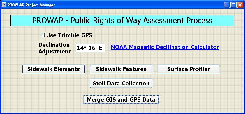
12 PROW-AP Phase I Project Main Objectives Automatic measurement of trip hazards using laser technology Develop user interface software screens with SQL database Develop and test methodologies for conducting the PROW-AP Demonstrate GIS sidewalk layer software interface specifications

13
14 PROW-AP Hardware Dual reed distance collection Camera for recording images Grade and cross slope sensors External battery power supply Laptop computer interface

15
16 PROW-AP Hardware Jogging stroller data collection vehicle Laser technology for height transition measurements GPS with USB interface Cradle to carry mini roll-a-wheel
17 Measurement of Transition Height Laser sensor Enter desired height detection Audio and visual alarm Back up cart and determine maximum transition height Keystroke input to record
18 Benefits of Automatic Height Measurement Detecting upheavals missed in SWAP Fast and efficient identification of hazards Record GPS position of each upheaval Identify and prioritize for grinding and reconstruction
19 PROW-AP Laser Sensor Specifications 2 mm height accuracy Detect heights to 8 curb Operator speed of 3ft/sec Measures any surface type Variety of lighting conditions/colors and angles Records in 13-22% less time than using profile gauge

20

21
22
23 PROW-AP Pilot Data Collection Verified accuracy of data in lab Repeatability of SWAP and PROW-AP Repeatability of assessment process Compatibility of SQL data structure with agency GIS information systems
24 PROW-AP Software Automatic report generations SQL data export capability High accuracy digital filtering to speed up data collection of grades and cross-slopes
25 PROW-AP Software Modules Smart file naming Calibration check and recalibration procedures Feature recording (e.g. bench, bus stop, etc)
26

27

28

29

30

31

32

33
34 PROW-AP Software Modules Smart file naming Calibration check and recalibration procedures Feature recording (e.g. bench, bus stop, etc)
35
36
37
38
39
40
41
42
43
44
45
46

47
48
49
50
51 PROW-AP Software Modules Continues Element recording (e.g. curb ramps, driveway crossings) Transaction height recording
52
53 PROW-AP Data Exports SQL data structure Trimble Pathfinder Office Into GIS Software Into CAD Software Excel
54 PROW-AP Data Exports GPS reading output at each measurement location Automated summary report generation
55 PROW-AP Testing Conducted Sidewalk segments Sidewalk elements Diagonal curb ramps Driveway crossings Parallel roadways
56 PROW-AP Segment Testing 51 unique sidewalk elements identified Repeated measurements on the same segment Different assessors on the same location

57
58
59

60
61 PROW-AP Segment Testing Typical grades and cross slopes were within 0.5% Maximum grades and cross slopes were within 2.0% Identified slight variations in the assessment process
62 PROW-AP Measurement Intervals Recorded Center of every sidewalk panel Every 2 nd, 3 rd, and 4 th panel Using judgment Using smart feedback
63 PROW-AP Measurement Interval Results Smart Feedback section with PROW-AG thresholds Grade 8.3% Cross Slope 2%

64
65 PROW-AP Sidewalk Element Measurement 5 Curb Ramps and 5 Driveway crossings measured with SWAP and PROW-AP Measured by 5 different assessment coordinators without experience 20 25% time savings noted
66
67
68
69
70
71
72
73
74
75

76
77
78

79

80

81
82 PROW-AP Assessment of Segment and Roadway Highway 395 closure and measurement of grade Parallel sidewalk measured with PROW-AP Quickly allowed comparison of grades
83 Designed for GIS Compatibility Points Features Elements Lines Sidewalk corridors Sidewalk symbol font library
84

85
86
87 Creation of Shape Files Use CAD software to process data - AutoCAD Map - Microstation Or bring data into GIS software using scripts written for the data - ArcMap with ArcInfo

88

89
90 Compatibility with Different Levels of GPS Garmin GPS 18 with USB using during Phase I development Trimble Pathfinder compatibility verified for integration of sub-meter GPS equipment or survey grade GPS
91 PROW-AP Municipality Benefits Complete, efficient and objective Improves planning, design and construction Cost-effective Faster turnaround of data
92 PROW-AP Municipality Benefits continued. Prevention of liability Reduction in complaints Reduce need to reconstruct
93 Eliminate High Cost of Reconstruction Planning Design Demolition and removal Layout and Farming Concrete Verification
94 PROW-AP Public Benefits Increases pedestrian safety and access Improved pedestrian infrastructure People have a safe environment to get more exercise than driving People save money not driving
95 PROW-AP Benefits 75-80% less personal time required Automatic data recording Less physical stress and fatigue No hard paper copies Increased data accuracy
96 PROW-AP Development Partners Nevada Department of Transportation Carson City Public Works Department City of Reno and Sparks
97 Nevada Department of Transportation Dennis J. Coyle - NDOT ADA coordinator Edgar Olivera - NDOT sidewalk designer Steve Lani - NDOT Resident Construction Engineer Eric Glick - ADA coordinator and past Bike Pedestrian Coordinator for NDOT
98 Carson City Public Works Department Patrick Pittinger - Transportation Manager Matt Forest - GIS coordinator Rob Fellows - Senior Project Manager
99 City of Reno and Sparks Alan Felker - Assist Civil Engineer - Reno Access Advisory advisor. Organized a workshop with 39 attendees in Reno where PROW-AP was presented. Alan Barney - Capital Projects - Senior Engineer Tech - ADA work team
100 Other Experts Donald Meeker - Meeker and Associates Inc - Symbol and Font Graphics Expert intent to develop a true type font for sidewalk environment Yvonne Barns - GIS & Cartographic Service - Mountain Mapping - Project consultant
101 Acknowledgement Phase I SBIR funding for the High Efficiency Pedestrian Sidewalk Assessment Process was provided by the U.S. Department of Transportation through Federal Highways Administration grant number DTRT57-08-C
102 Beneficial Designs, Inc. Minden, Nevada voice fax Working toward universal access through research, design & education
Final Report 2014 Addendum
 Final Report 2014 Addendum Supplemental ADA Transition Plan Inventory of Public ROW Facilities Prepared by: August 2014 Table of Contents Executive Summary...1 Introduction...2 Inventory Methodology...2
Section 7: Monitoring and Status Reporting
 Section 7: Monitoring and Status Reporting Section 7.1: Introduction SacDOT currently is engaged in an on-going effort to construct curb ramps, sidewalks, and other pedestrian facilities at numerous locations
Coordinating Minnesota s Transportation Assets and Climate Change and Extreme Weather Vulnerability
 Coordinating Minnesota s Transportation Assets and Climate Change and Extreme Weather Vulnerability Duane R. Hill, PE District Engineer, District One Minnesota Department of Transportation What is a Transportation
Congestion Management Strategy
 Congestion Management Strategy Vancouver as of 2018 50% of trips are made on foot, by bike or transit. 6 major bridges in Vancouver. 32% decrease in distance driven per person since 2007. 4.6% population
Constructability Guidelines
 Constructability Guidelines The Constructability Guidelines offer a list of items that should be considered by Constructability function personnel during the Concept Development Phase through the Final
An Automated Transit Stop Data Collection System
 ABSTRACT An Automated Transit Stop Data Collection System Albert Gan, Ike Ubaka, and Fabian Cevallos A transit stop inventory is needed for various transit planning, operational, and maintenance applications.
FIG2006 Automated Road Sign Inventory Solution. Presenter: : Claude Laflamme Director of R&D
 FIG2006 Automated Road Sign Inventory Solution Presenter: : Claude Laflamme Director of R&D PRESENTATION OVERVIEW Geo-3D Introduction System components Data Extraction Detection Recognition Results Applications
THAT Council adopt the Congestion Management Strategy as outlined in this report
 RR3 ADMINISTRATIVE REPORT Report Date: May 2, 2017 Contact: Winston Chou Contact No.: 604.873.7913 RTS No.: 011564 VanRIMS No.: 08200020 Meeting Date: May 16, 2017 TO: FROM: SUBJECT: Vancouver City Council
An Esri White Paper October 2010 Esri Production Mapping: Meeting the Needs of Water and Wastewater Utilities
 An Esri White Paper October 2010 Esri Production Mapping: Meeting the Needs of Water and Wastewater Utilities Esri, 380 New York St., Redlands, CA 92373-8100 USA TEL 909-793-2853 FAX 909-793-5953 E-MAIL
Construction Overview. Section 5 Construction Considerations. Curb Ramp Construction. Curb Ramp Construction. Overview.
 Construction Overview Section 5 Construction Considerations Fall, 2017 Ann Johnson, PE Services Brady Rutman, SRF Consulting Group Overview Pedestrian Standard Plans Grade Breaks s Removals Curb & Gutter
Designing Pedestrian Facilities for Accessibility
 Keith P. Skilton Local Programs Engineer FHWA NJ Division 840 Bear Tavern Road, Suite 310 West Trenton, NJ 08628 Phone: 609-637-4203 Fax: 609-538-4919 keith.skilton@dot.gov Note: Pictures may depict non-compliant
CITY OF ANN ARBOR, MICHIGAN Public Services Area/Project Management Unit 301 E. Huron Street P.O. Box 8647, Ann Arbor, Michigan 48107
 CITY OF ANN ARBOR, MICHIGAN Public Services Area/Project Management Unit 301 E. Huron Street P.O. Box 8647, Ann Arbor, Michigan 48107 Web: www.a2gov.org Printed on recycled paper May 17, 2016 Subject:
ADA Training Design Case Studies MnDOT
 ADA Training Design Case Studies 2018 MnDOT 2 ADA Design Case Studies Overview TH 61 (Mounds Blvd) Mill & Overlay Lesson: Steep Slopes and Construction Limits Snelling Avenue Mill & Overlay Lesson: Strategies
Iowa Department of Transportation Intelligent Work Zone Deployments
 Iowa Department of Transportation Intelligent Work Zone Deployments SMARTER WORK ZONES TECHNOLOGY APPLICATIONS CASE STUDY The Every Day Counts Initiative (EDC-3) aims to accelerate the deployment of identified,
B351 - CONCRETE SIDEWALK - OPSS 351
 B351 - - OPSS 351 351.1 GENERAL The design and construction of concrete sidewalks, when justified and approved in accordance with Provincial Engineering Memorandum, Director s Office #2011-01 (February
Boster, Kobayashi & Associates NEVIN Q. SAMS, P.E., T.E., P.T.O.E.
 Boster, Kobayashi & Associates 59 Rickenbacker Circle Office: (925) 447-6495 P.O. Box 2049 Fax: (925) 447-6589 Livermore, CA 94551-2049 NEVIN Q. SAMS, P.E., T.E., P.T.O.E. Curriculum Vitae EDUCATION: B.S.
City of St. Catharines Standard Drawings JULY Revised July 21, 2017 TES-ENG (SH)
") City of St. Catharines Standard Drawings JULY 2017 Revised July 21, 2017 TES-ENG (SH) Roads Dwg No. Revision Standard Sidewalk Detail 110-2001 1 Monolithic Curb-Faced Sidewalk for Concrete Road 110-2002
City of St. Catharines Standard Drawings JULY 2017 Revised July 21, 2017 TES-ENG (SH) Roads Dwg No. Revision Standard Sidewalk Detail 110-2001 1 Monolithic Curb-Faced Sidewalk for Concrete Road 110-2002
Connected Vehicle Pooled Fund Study
 BASIC INFRASTRUCTURE MESSAGE DEVELOPMENT AND STANDARDS SUPPORT FOR CONNECTED VEHICLES APPLICATIONS The MAP Message Beyond Intersections White Paper April 16, 2018 Prepared for: Connected Vehicle Pooled
CONSTRUCTION SURVEY. Construction survey includes personnel, equipment, and supplies required for, but not limited to, the following:
 CONSTRUCTION SURVEY PART 1 - GENERAL 1.01 SECTION INCLUDES Construction survey includes personnel, equipment, and supplies required for, but not limited to, the following: A. Construction Survey: 1. Project
Corpus Christi Metropolitan Transportation Plan Fiscal Year Introduction:
 Introduction: Traffic congestion in the Corpus Christi Metropolitan area is not as much a function of population growth as the function of the increase in single occupant trips. Using census data, the
5 Requirements for Intelligent Compaction
 5 Requirements for Intelligent Compaction by Chris Mata, Tom King, & Al Hodson Introduction Did you know a process called Intelligent Compaction (IC) has been revolutionizing the paving industry? But what
Digital Asset Inspections
 Digital Asset Inspections Roads Operations Nov 1, 2017 Presentation City of Hamilton Facts City Incorporation 1846 Amalgamation 2001 Land Area 1117 sq km Population 520,000 (2011 census) Main Assets Roads
Update on the Human Factors Guidelines (HFG) for Road Systems: Status and Implementation Activities
 for Road Systems: Status and Implementation Activities") Update on the Human Factors Guidelines (HFG) for Road Systems: Status and Implementation Activities Presentation to the AASHTO Standing Committees on Traffic Engineering & Highway Traffic Safety John L.
Update on the Human Factors Guidelines (HFG) for Road Systems: Status and Implementation Activities Presentation to the AASHTO Standing Committees on Traffic Engineering & Highway Traffic Safety John L.
How to Meet the Minimum Attributes for ADA Transition Plans. Patrick Gomez, FHWA Resource Center Candace Groudine, FHWA HCR
 How to Meet the Minimum Attributes for ADA Transition Plans Patrick Gomez, FHWA Resource Center Candace Groudine, FHWA HCR 1 Objectives At the end of this session you should be able to: List the six basic
Urban Arterial Roads Pavement Data Collection. October 23, 2012 Todd M. Halacy, P.E. VDOT Local Assistance Division
 Urban Arterial Roads Pavement Data Collection October 23, 2012 Todd M. Halacy, P.E. VDOT Local Assistance Division Presentation Topics Background Information: CTB Subcommittee & Local Government Workgroup
SIDEWALK CONSTRUCTION AND REPAIR
 SIDEWALK CONSTRUCTION AND REPAIR Q: Why all the concern over sidewalks? A: Sidewalks are the avenues and streets of pedestrian traffic. Residents should maintain the sidewalks as best as they can. The
TUBE INSPECTION SYSTEM
 PRODUCT BROCHURE TUBE INSPECTION SYSTEM Tube measurement and production with the ROMER Absolute Arm 2 TUBE INSPECTION SYSTEM HIGHLIGHTS TUBE MEASUREMENT HAS A NEW SHAPE Hexagon Metrology s Tube Inspection
DYNAC. Advanced Traffic Management.
 EN Kapsch TrafficCom DYNAC Advanced Traffic Management. DYNAC s modular design allows for full integration of ATMS and SCADA (Supervisory Control and Data Acquisition), making it an ideal solution for
Asset Management and Data Collection using Digital Video / GPS Data Extraction Techniques
 Asset Management and Data Collection using Digital Video / GPS Data Extraction Techniques TRB 6 th National Conference on Transportation Asset Management Kansas City, Missouri November 2, 2005 Presentation
Wisconsin DOT: Adopting a Model-Based Approach to Roadway Design and Construction
 Wisconsin DOT: Adopting a Model-Based Approach to Roadway Design and Construction Eric Arneson P.E. Methods Development Engineer Wisconsin Department of Transportation Rick Larson P.E. Applications Engineer,
City of St. Catharines Standard Drawings SEPTEMBER Revised September 6, 2018 TES-ENG (SH)
") City of St. Catharines Standard Drawings SEPTEMBER 2018 Revised September 6, 2018 TES-ENG (SH) Roads Dwg No. Revision Standard Sidewalk Detail 110-2001 2 Monolithic Curb-Faced Sidewalk 110-2002 3 Sidewalk
City of St. Catharines Standard Drawings SEPTEMBER 2018 Revised September 6, 2018 TES-ENG (SH) Roads Dwg No. Revision Standard Sidewalk Detail 110-2001 2 Monolithic Curb-Faced Sidewalk 110-2002 3 Sidewalk
I-17 and Happy Valley Road Diverging Diamond Interchange (DDI)
") I-17 and Happy Valley Road Diverging Diamond Interchange (DDI) Bharat Kandel (ADOT) and Jeremy Neuman (HDR) February 28, 2018 Project Purpose and Overview New interchange will accommodate current and future
I-17 and Happy Valley Road Diverging Diamond Interchange (DDI) Bharat Kandel (ADOT) and Jeremy Neuman (HDR) February 28, 2018 Project Purpose and Overview New interchange will accommodate current and future
February 27th, 2018 City of Mayville
 February 27th, 2018 City of Mayville Project Location and Schedule Construction work Detour Route Business Access During Construction Temporary Business Signs What WisDOT Can Do During Construction What
C o m m e r c i a l S o l u t i o n
 Commercial Solution Out in the field, you wouldn t use a tool that wasn t just right for the task at hand. Let Quest provide you with the right tool for the office. Your business is unique. To do your
Accurate Mapping Probe TM
 Accurate Mapping Probe TM The CUES Accurate Mapping Probe is the most accurate gyroscopic tool for mapping the XYZ positions of underground utilities produced today. The AMP TM can be provided via the
November 28, Patrick Duffy, P.E. Director of Planning and Zoning Middletown Township 3 Municipal Way Langhorne, PA 19047
 WWW.TRAFFICPD.COM Patrick Duffy, P.E. Director of Planning and Zoning Middletown Township 3 Municipal Way Langhorne, PA 19047 RE: Stone Farm Preliminary/Final Land Development Plan Review TPD# MTTO.00021
FDOT District 5 TSM&O. Program Development
 FDOT District 5 TSM&O Program Development Overview I. FDOT D5 Program Goals and Projects II.SHRP-2 Support III.TSM&O Planning Guidebook & Methodology FDOT District 5 Program FDOT D5 Program Goals Increase
The Policies section will also provide guidance and short range policies in order to accomplish the goals and objectives.
 4 Goals & Objectives INTRODUCTION The 2015-2040 MTP preserves and promotes the quality of life and economic prosperity of the MAB by providing a transportation system consistent with the regional goals.
Asset Management Fundamentals
 Asset Management Fundamentals Work Management includes all of the scheduling and activities involved in maintaining assets at a predefined condition level, including: Work Orders Work Requests Maintenance
Data processing. In this project, researchers Henry Liu of the Department of Civil Engineering and
 Data mining of transit vehicle location, passenger count, and fare collection databases for intelligent transportation applications Supporting efficient transit service by maximizing the use of available
CITY OF LOS ANGELES Sidewalk Repair Program. Amber Elton, PE
 CITY OF LOS ANGELES Sidewalk Repair Program Amber Elton, PE Sidewalk Repair Program Civil Engineer APRIL 20, 2017 Century Plaza Towers 2029 Century Park East City s Goal BEFORE AFTER Improve Mobility in
Presented By SUCCESSFUL SIDEWALK STRATEGIES: Learning Objectives. Part I Problems Underfoot. Part I Complications. Part I Typical Approaches
 SUCCESSFUL SIDEWALK STRATEGIES: EFFECTIVE SIDEWALK MAINTENANCE MANAGEMENT Presented By Overland Park, Kansas, Public Works Dave Bergner, Superintendent Janet Luessenheide, Engineering Technician II Michael
Executive Summary Determining Productivity Improvement... 3
 Autodesk Civil 3D 2006 Return on Investment This Return on Investment paper is a follow-up to a previous paper based on Autodesk Civil 3D 2004. That paper, which was based on the analysis of a hypothetical
Key modules: Peter Bell, President of Mountain Rescue England and Wales:
 Mapyx has developed a modular system to satisfy all the needs of search teams by providing a new platform of specialised software and hardware to assist in the planning and operation of search and rescue
SUBDIVISION AND OFF-SITE SERVICING CERTIFICATION REQUIREMENTS Rev 5 May 25, 2017
 SUBDIVISION AND OFF-SITE SERVICING CERTIFICATION REQUIREMENTS Rev 5 May 25, 2017 I. CONSTRUCTION PREREQUISITES 1.0 Pre-construction Survey A pre-construction survey of all existing infrastructure within
CITY OF NORTH ST. PAUL CITY COUNCIL WORKSHOP AGENDA JANUARY 2, :00 PM. North St. Paul City Hall Sandberg Room 2400 Margaret Street
 CITY OF NORTH ST. PAUL CITY COUNCIL WORKSHOP AGENDA JANUARY 2, 2018 5:00 PM North St. Paul City Hall Sandberg Room 2400 Margaret Street I. CALL TO ORDER II. ROLL CALL Council Member Furlong Council Member
Pre-Conference Workshop: Changing Methods in Pavement Data Collection
 Pre-Conference Workshop: Changing Methods in Pavement Data Collection AUlloa@dynatest.com KKeifer@dynatest.com Alvaro Ulloa-Calderon, PhD Kurt Keifer, PhD, PE 2014 NWPMA Conference Seattle, WA October
3D Engineered Models for Construction. AGC-ODOT Annual Meeting February 18, 2014
 3D Engineered Models for Construction AGC-ODOT Annual Meeting February 18, 2014 National Discussion on 3D Design Steve Cooley ODOT Contract Administration Engineer What is 3D Design for Construction? 1.
Intelligent Sensors. Arc Gives You the Power to Connect
 Intelligent Sensors Arc Gives You the Power to Connect Arc: The Power to Co RETHINK SENSOR MANAGEMENT BY ELIMINATING THE TRANSMITTER Arc seamlessly connects with existing R&D, PD, and production infrastructure
Tacoma Mall Office Building 4301 South Pine Street, Suite 446 Tacoma, Washington (253) Fax (253)
 Fax (253)") Tacoma Mall Office Building 4301 South Pine Street, Suite 446 Tacoma, Washington 98409-7207 (253) 798-7250 Fax (253) 798-4233 www.piercecountywa.org/roadstandards March 2012 Comment Form Date: To: From:
Tacoma Mall Office Building 4301 South Pine Street, Suite 446 Tacoma, Washington 98409-7207 (253) 798-7250 Fax (253) 798-4233 www.piercecountywa.org/roadstandards March 2012 Comment Form Date: To: From:
GPS-Guided Machine Control Using Autodesk Land Desktop By: Harry Ward, PE - Of: OutSource Inc.
 December 2-5, 2003 MGM Grand Hotel Las Vegas GPS-Guided Machine Control Using Autodesk Land Desktop By: Harry Ward, PE - Of: OutSource Inc. Code CV23-1 Class Description: Harry Ward, PE Harry Ward, PE,
GPS For As built Data Collection of Utility Construction
 GPS For As built Data Collection of Utility Construction Agenda Company Information GPS Implementation Live Demonstration Questions 1 A Family of Companies Electric Generation and Distribution Natural
PLANNING SNAPSHOT 7:
 PLANNING SNAPSHOT 7: CRASH DATA JANUARY 2016 Funded through the NCHRP 8-36 Research Series, these snapshots are designed to tell you a little about the current state of a specific planning practice of
Introduction to Autodesk Utilities Design: Integrating the Network Design Process
 Introduction to Autodesk Utilities Design: Integrating the Network Design Process Introduction Electric, water, and gas utilities share a number of similarities. They depend on distribution networks to
Developing a Risk-Based Transportation Asset Management Plan
 Shannon Foss Asset Management Planning Director July 16 th, 2018 Developing a Risk-Based Transportation Asset Management Plan Timeline 2012 - MAP-21 TAMP Legislation 2014 - Minnesota completed a Pilot
Americans with Disabilities Act (ADA) Program Review, Training, and Support Services
 Program Review, Training, and Support Services") Americans with Disabilities Act (ADA) Program Review, Training, and Support Services Presented to: 14th Annual New Jersey Department of Transportation Research Showcase Presented by: Christopher Titze,
Americans with Disabilities Act (ADA) Program Review, Training, and Support Services Presented to: 14th Annual New Jersey Department of Transportation Research Showcase Presented by: Christopher Titze,
Transportation Asset Management Plan. Shannon Foss Asset Management Planning Director Met Council: Funding & Programming Committee May 17 th, 2018
 Transportation Asset Management Plan Shannon Foss Asset Management Planning Director Met Council: Funding & Programming Committee May 17 th, 2018 mndot.gov 2 Timeline 2014: Pilot TAMP Completed April 30
DNA for Automated Driving. Jeremy Dahan May 8 th, 2017
 Jeremy Dahan May 8 th, 2017 Radar Camera LIDAR Sonar Steering Wheel Sensors 30 25 20 15 10 Wheel Speeds IMU / Gyro 5 0 Global Position 1999: Mercedes S-Class Distronic 2002: VW Phaeton ACC Moving objects
REQUEST FOR PROFESSIONAL SERVICES
 REQUEST FOR PROFESSIONAL SERVICES The City of Lander is currently soliciting proposals from consultants who can offer a complete and accurate assessment of the condition of the City of Lander s street
Drone Surveying: The Complete Story
 Drone Surveying: The Complete Story NYSAPLS Friday Webinar Series December 1, 2017 Aerotas enables surveyors to map by drone More than: 60 clients, 600 drone surveys, 450 hours of field testing & training,
Building and Maintaining Your Statewide Crossing Inventory
 Building and Maintaining Your Statewide Crossing Inventory 2015 National Highway-Rail Grade Crossing Safety Training Conference Arlington, TX 03 Nov 2015 www.jacobs.com worldwide Presentation Outline Inventory
Improving the Safety and Accessibility of Sidewalks in Santa Cruz County:
 Improving the Safety and Accessibility of Sidewalks in Santa Cruz County: A Study of Jurisdiction and Property Owner Responsibilities and Practices Compiled and written by the Pedestrian Safety Work Group
CONSTRUCTION STAKING GUIDELINES
 CITY OF LOS ANGELES DEPARTMENT OF PUBLIC WORKS BUREAU OF ENGINEERING SURVEY DIVISION CONSTRUCTION STAKING GUIDELINES Gary Lee Moore, P.E., City Engineer Tony Pratt, Chief Surveyor TABLE OF CONTENTS Dec.
Strategic Plan for Improved Concrete Pavement Surface Characteristics
 Strategic Plan for Improved Concrete Pavement Surface executive summary Completed in cooperation with the Federal Highway Administration, American Concrete Pavement Association, and other organizations
Utilization of ArcPad and Mobile Technology to Update Street Signs in Local Government
 2004 ESRI International User Conference San Diego, California Utilization of ArcPad and Mobile Technology to Update Street Signs in Local Government Martin County, Florida Abstract Submission: Paper #1259
Appendix J RFP No (Addendum No. 1)
") 3. Current State 3.1. Overview This section evaluates SRTA s current ERP configuration environment related to the following functional areas: General Ledger Budget Procurement Project Management Contract/
3. Current State 3.1. Overview This section evaluates SRTA s current ERP configuration environment related to the following functional areas: General Ledger Budget Procurement Project Management Contract/
OSPREY PRESSURE MANAGEMENT
 ABRIOX www.abriox.com OSPREY PRESSURE MANAGEMENT Specialists in Remote Monitoring OSPREY Remote Pressure Monitoring Gas distribution companies use network analysis models to underpin financial decisions
TABLE OF DRAWINGS. Pierce County Public Works & Utilities
 Section A Concrete and Asphalt Concrete Pavement and Roadway Sections PC.A1.1 Arterial with Cement Concrete Traffic Curb and Gutter and Sidewalk, Closed Drainage 05/10/2018 PC.A1.2 Arterial with Cement
Mobile Data Collection: Lessons from the Escambia County Bus Stop Inventory
 Mobile Data Collection: Lessons from the Escambia County Bus Stop Inventory Martin Catalá GIS Manager Center for Urban Transportation Research 4202 East Fowler Avenue (CUT100) Tampa, Florida 33620 http://www.cutr.usf.edu
Design and Operations and Management of GIS Workflows for Multi-utilities. Benoit Fredericque Senior Product Line Manager Geospatial Desktop & Mobile
 Design and Operations and Management of GIS Workflows for Multi-utilities Benoit Fredericque Senior Product Line Manager Geospatial Desktop & Mobile The Utilities Industry Is Changing Climate change and
INCLUDE IN ALL PAVING PROJECTS UNLESS OTHERWISE DIRECTED BY TSB
 1.1 TESTING AND EVALUATION OF FINISHED PAVEMENT SURFACE SMOOTHNESS USING INTERNATIONAL ROUGHNESS INDEX (IRI) CRITERIA 1.1.1 General Contrary to the requirements of Specification 3.50, Asphalt Concrete
Geometric Design: Past, Present, and Future
 A2A02: Committee on Geometric Design Chairman: Daniel B. Fambro Geometric Design: Past, Present, and Future DANIEL B. FAMBRO, Texas A&M University JOHN C. COLLINGS, Delcan Corporation ROBERT DELLA VEDOVA,
TABLE OF DRAWINGS. Pierce County Public Works & Utilities
 Section A Concrete and Asphalt Concrete Pavement and Roadway Sections PC.A1.1 Arterial with Cement Concrete Traffic Curb and Gutter and Sidewalk, Closed Drainage 04/01/2019 PC.A1.2 Arterial with Cement
10. Transportation Facilities.
 Last page revision- March 31st, 1999 TEXAS ACCESSIBILITY STANDARDS (TAS) TAS Table of Contents 10. Transportation Facilities. 10.1 General. Every station, bus stop, bus stop pad, terminal, building or
Types of Data. Features. Getting Started. Software Suite
 Roadway Asset Management Software Suite 1-2018-US GIS-based Asset Management System Optimize Maintenance Manage Signs Analyze Safety Roadsoft is a software suite designed for collecting, storing, and analyzing
TRB Webinar: Maintenance Practices for Traffic Sign Retroreflectivity
 TRB Webinar: Maintenance Practices for Traffic Sign Retroreflectivity Today s Presenters and Moderator Paul Carlson, Texas Transportation Institute at Texas A&M University, Paul-Carlson@tamu.edu Jim Ellison,
OSPREY PRESSURE MANAGEMENT
 ABRIOX www.abriox.com OSPREY PRESSURE MANAGEMENT Specialists in Remote Monitoring OSPREY Remote Pressure Monitoring Gas distribution companies use network analysis models to underpin financial decisions
LTL X Retrometer DELTA Combining experience and innovation The reference instrument of tomorrow
 Retrometer LTL X LTL XPortable Retrometer for pavem Why measure retroreflectivity As the median age of the average driver grows, the importance of the nighttime visibility of pavement markings for traffic
Intelligent Sensors. Arc Gives You the Power to Connect
 Intelligent Sensors Arc Gives You the Power to Connect Arc: The Power to Co RETHINK SENSOR MANAGEMENT BY ELIMINATING THE TRANSMITTER Arc seamlessly connects with existing R&D, PD, and production infrastructure
AUTONOMOUS VEHICLES & HD MAP CREATION TEACHING A MACHINE HOW TO DRIVE ITSELF
 AUTONOMOUS VEHICLES & HD MAP CREATION TEACHING A MACHINE HOW TO DRIVE ITSELF CHRIS THIBODEAU SENIOR VICE PRESIDENT AUTONOMOUS DRIVING Ushr - Autonomous Driving Ushr Company History Industry leading & 1
Scope of Work. Project Approach and Understanding. Task 1: Study Initiation and Administration
 Scope of Work Route 116/Hinesburg Growth Center Corridor Study Town of Hinesburg and CCRPC Project Approach and Understanding Route 116 through Hinesburg had seen substantial changes in the past 15 years,
Guidelines for the Submission of a Transportation Study Level 2
 Guidelines for the Submission of a Transportation Study Level 2 For Site Development Applications in the City of North Vancouver Transportation Group, City of North Vancouver Engineering, Parks & Environment
RIDOT S Statewide Roadway and Asset Data Collection Project
 RIDOT S Statewide Roadway and Asset Data Collection Project ESRI User Conference 2017 Rafiq Basaria, DTS; Daniel Behnke DTS, Shane White, RIDOT Accent image here Primary Image here What is MIRE? Recommended
Wisconsin Traffic Operations Performance Management System (TOPMS)-Phase 1. Advisory Group Meeting-November 10, 2014
-Phase 1. Advisory Group Meeting-November 10, 2014") Wisconsin Traffic Operations Performance Management System (TOPMS)-Phase 1 Advisory Group Meeting-November 10, 2014 Project Approach 3-Phase, 3-Year Project to Design and Build TOPMS Phase 1 Planning/Design,
Wisconsin Traffic Operations Performance Management System (TOPMS)-Phase 1 Advisory Group Meeting-November 10, 2014 Project Approach 3-Phase, 3-Year Project to Design and Build TOPMS Phase 1 Planning/Design,
District of North Vancouver Construction Traffic Management Plan Guidelines
 District of North Vancouver Construction Traffic Management Plan Guidelines The District of North Vancouver is committed to ensuring that the disruptions to the community and traffic associated with construction
PEGGER & ROADVIEW - A New GIS Tool To Assist Engineers In Operations Planning
 PEGGER & ROADVIEW - A New GIS Tool To Assist Engineers In Operations Planning Luke Rogers Rural Technology Initiative, College of Forest Resources, University of Washington, Seattle WA 98195, lwrogers@u.washington.edu
SITE PLAN CERTIFICATION REQUIREMENTS Rev 2 May 25, 2017
 SITE PLAN CERTIFICATION REQUIREMENTS Rev 2 May 25, 2017 I. CONSTRUCTION PREREQUISITES 1.1. Pre-construction Survey A preconstruction survey of all existing infrastructure within the right of way (ROW)
Roadway Profile Testing in North Carolina
 Roadway Profile Testing in North Carolina PAST PERFORMANCE AND LESSONS LEARNED PRESENTED BY CHRISTOPHER BACCHI, TRIMAT MATERIALS TESTING, INC AND NILESH SURTI, NCDOT Why is Pavement Smoothness Important?
NCTCOG Existing and Planned Systems/Deployments NATALIE BETTGER NOVEMBER 27, 2018
 NCTCOG Existing and Planned Systems/Deployments NATALIE BETTGER NOVEMBER 27, 2018 Agenda Regional Planning Activities Organizational Structure Regional TSMO Projects Operations Travel Demand Management
Automatic Guided Vehicle System Overview
 Automatic Guided Vehicle System Overview How the AGV 1 2 Material Movement Request Initiated in the following ways: a. Customer host computer sends message through Factory LAN to SGV Manager Server. b.
Chapter 3: Designing Steel Bridges Using DCALC By Karl Hanson, S.E., P.E. July 2006
 Chapter 3: Designing Steel Bridges Using DCALC By Karl Hanson, S.E., P.E. July 2006 3.1 Introduction: This chapter is an overview showing how to a design typical highway bridges using DCALC. We will look
Curb Ramps [ 4.7.3] [ 4.7.2; 4.8.2; 4.1.6(3)(a)] [ 4.3.7] ADA Accessibility Survey Instructions Curb Ramps Page 1 of 6
![Curb Ramps [ 4.7.3] [ 4.7.2; 4.8.2; 4.1.6(3)(a)] [ 4.3.7] ADA Accessibility Survey Instructions Curb Ramps Page 1 of 6](/thumbs/73/68272859.jpg "Curb Ramps [ 4.7.3] [ 4.7.2; 4.8.2; 4.1.6(3)(a)] [ 4.3.7] ADA Accessibility Survey Instructions Curb Ramps Page 1 of 6") : Curb Ramps 1 [ 4.7.3] Only measure the width of the ramp section of the curb ramp (labeled ramp to the right). The ramp section of a curb ramp is also known as the ramp run. If the curb ramp has flared
: Curb Ramps 1 [ 4.7.3] Only measure the width of the ramp section of the curb ramp (labeled ramp to the right). The ramp section of a curb ramp is also known as the ramp run. If the curb ramp has flared
Presenters: Ted Peay Tren Giles. GPS Using GPS Technology to Gather As-Constructed Field Notes
 Presenters: Ted Peay Tren Giles GPS Using GPS Technology to Gather As-Constructed Field Notes Retail GasDistribution Area Distribution System Serving nearly 900,000 Customers in Utah, Wyoming & Southeastern
Asset Management. Visit us at: or call SCAN
 Asset Management Why BarScan? The modern workplace is a complex combination of computer equipment, furniture, and other equipment with compliance, accounting and location tracking issues. To better manage
CoastWatch VTMIS Traffic Management and Information System
 CoastWatch VTMIS Traffic Management and Information System SAAB SYSTEMS Saab can proudly present the CoastWatch VTMIS as an entirely in-house development. In order to achieve the world s best VTMIS solution,
Curb and Gutter Replacement Project Phase I
 Phase I Prepared for: Prepared by: Cheyenne Downtown Development Authority / Main Street 1601 Capitol Avenue Cheyenne, WY 82001 307 433 9730 BenchMark Engineers, PC 1920 Thomes Avenue, Suite 620 Cheyenne,
Sage 500 New Features Summary
 Sage 500 New Features Summary 2017 Release March 2017 10/16/2017 1 Maximize operational efficiency and increase productivity and profitability across every aspect of your business. Finance and Accounting
Quotation for Professional Services
 Quotation for Professional Services IMS Infrastructure Management Services 1820 W. Drake Dr. Suite 108. Tempe, AZ 85283 Phone: (480) 839-4347 Fax: (480) 839-4348 www.ims-rst.com To: Patrick G. Donart,
APPENDIX A: SHORT-TERM PROJECT DEPLOYMENTS
 APPENDIX A: SHORT-TERM PROJECT DEPLOYMENTS Page 1 of 15 ST-01: I-95 ITS DEPLOYMENT (DE STATE LINE TO AIRPORT) PROJECT DESCRIPTION AND SCOPE: Project will address gaps in ITS device coverage on I-95 from
CITY OF EL MIRAGE Solicitation No.: EM12-ST03 & EM12-ST04. PRE-BID CONFERENCE MINUTES November 19, 2015, 1:00 PM
 CITY OF EL MIRAGE Solicitation No.: EM12-ST03 & EM12-ST04 INTRODUCTIONS: Thunderbird Road from 127 th Avenue to El Frio Street El Mirage Road from Cactus Road to Grand Avenue PRE-BID CONFERENCE MINUTES