Identification of Crop Areas Using SPOT 5 Data
|
|
|
- Brooke Ball
- 5 years ago
- Views:
Transcription
1 Identification of Crop Areas Using SPOT 5 Data Cankut ORMECI 1,2, Ugur ALGANCI 2, Elif SERTEL 1,2 1 Istanbul Technical University, Geomatics Engineering Department, Maslak, Istanbul, Turkey, Istanbul Technical University Center for Satellite Communications and Remote Sensing, Ground Receiving Station, Maslak, Istanbul, Turkey, TS 3H Remote Sensing and Imagery I ITU-CSCRS Istanbul Technical University-Center for Satellite Communication and Remote Sensing Prof. Dr. Cankut ÖRMECI Director cankut@itu.edu.tr Tel: Ext.120 Sydney, Australia, April
 State Planning Organization funded the project an investment of 20 million$. The station became operational in 2000 and reconstituted as ITU-CSCRS in May 2003.")
2 ITU-CSCRS Istanbul Technical University - Center for Satellite Communications and Remote Sensing was established in 1996 as a research and technology project that firstly named ITU-SAGRES (SAtellite Ground REceiving Station) State Planning Organization funded the project an investment of 20 million$. The station became operational in 2000 and reconstituted as ITU-CSCRS in May ITU-CSCRS is one of the forecoming institutions around the world with a highly capable ground receiving station unit and is the first ground receiving station Turkey. Sydney, Australia, April

3 Mission To develop an advanced capability in remote sensing and satellite communications to meet the scientific and operational requirements of Turkey. Vision To be a leading center for organization and execution of the civil/military applications, the national/international projects, education/training programs related to remote sensing and satellite communications. Application Fields Wireless Internet Satellite Communication 2.4m and 4.6m diameter VSAT antennas, data acquisition from the with Ku Band wawelentgh Distance education/learning Applications satellites Sydney, Australia, April


4 13 m diameter, X band sensing Remote Sensing Coverage area; 3000 km radius SPOT 2 /4, SPOT 5 RADARSAT-1 / ERS-2 Azerbaijan Sydney, Australia, April


5 9 FORESTRY APPLICATION AREAS GEOLOGY AGRICULTURE HYDROLOGY Sydney, Australia, April


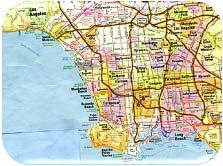
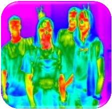


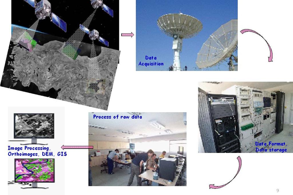
6 APPLICATION AREAS RADAR METEOROLOGY URBAN MANAGEMENT THERMAL SENSING TARIT -Agricultural Crop Motinoring and Estimation System- Aim:Determination of agricultural yield in basis of crop types and estimation of crop yield. Ministry and related departments Satellite Monitoring for Large Areas Monitoring and Reporting Internet Digital camera with GPRS/Vsat modem ITU CSCRS and Image Processing Center Near resampled crop type Sydney, Australia, April

7 Estimation of current Agricultural Yield Synchronous reporting in basis of time and crop type Damage and crop loss reporting after disaster Early warning for the disease growth due to climatic effects and agriculturaldisease Report based desicion support system for agricltural management Background Remote sensing applications to agriculture: crop type and area determination using different classification methods. Crop productivity information (crop type and spatial coverage of that crop) is very important for accurate crop yield estimation Crop productivity can be expressed in terms of vegetation health biomass density From spectral reflectance differences in different bands Spatial coverage of the crop area By shape and specific texture from satellite imagery. Remotely sensed data and analysis can be used to create crop maps. Other studies show that determination of different crop types in their growing stages cannot be performed efficiently with single dated images. Classification of multitemporal images gives identifiable results with added phenologic information Sydney, Australia, April
8 Methodology We used pixel based and object based classification methods to identify the boundaries of agricultural fields, determine the areal distribution of the crops from multitemporal imagery. Accuracy and efficiency of the pixel based and object based classification techniques were compared within different spectral and spatial aspects; using kappa statistics and confusion matrix. STUDY AREA Sanliurfa, population ~ 465,000. South eastern region of Turkey Important province within the Southeastern Anatolia Project (GAP) which is one of the most crucial projects of Turkish Government. GAP project aims to improve productivity and diversify agricultural activities. SanliUrfa has the highest proportion of agricultural production of Turkey: 35% of cotton production, 8% of wheat production and 55% of the peanut production. Huge agricultural fields such as Ceylanpinar, Akcakale and Koruklu are located in SanliUrfa and these fields are under the control and management of the Ministry of Agriculture entities. Sydney, Australia, April

9 Study Area The study area: East Harran Located in the east of Akcakale region, Large agriculture parcels and controlled agricultural activity. Between the seventh and ninth month of the year, only cotton and corn were farmed in this region. The planting and harvesting of the parcels are not stable, so different stages of farming can be seen on the satellite imagery. Study Area Sydney, Australia, April

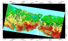
10 Preprocessing and dated SPOT 5, multispectral images (four bands: B1: Green, B2: Red, B3: Near Infrared, B4: Middle Infrared) from High Resolution Geometric (HRG) sensors of the SPOT 5 satellite and have 10 meter spatial resolution. Orthorectification procedure to correct geometric distortions. In this procedure 30 m ASTER Global Digital GDEM digital elevation model (DEM) and ground control points (GCP) collected from 1/25000 scaled maps were used. Orthorectification procedures were resulted with ± 0, 30 and 0, 42 pixel root mean square error (RMSE), respectively. Orthorectified images of; a) dated and b) dated SPOT 5 satellite in 2/3/1 band combination Unsupervised Classification Iterative Self Organizing Data Analysis Technique (ISODATA) was used for unsupervised classification process. 1st, 2nd and 3th bands of SPOT 5 images corresponding to near infrared, red and green wavelength portions were used for this classification. 20 spectral classes were created with 0, 99 convergence threshold. The results were interpreted visually and combined into 6 final classes with recode operation using ground truth information obtained from SanliUrfa Agricultural Research Institute. Unsupervised ISODATA classification results of; a) dated and b) dated SPOT 5 satellite images (Dark Green: Cotton; Green: Corn; Magenta: straw; Brown: empty parcels, tan: Bare soil, white: dry river channels). Sydney, Australia, April
11 Supervised Classification In this study, Maximum Likelihood classification method was used for supervised classification. 40 training sites with known ground truth were used as signatures. The classification of final 6 thematic classes are evaluated in first step with visual interpretation than digitally. Maximum Likelihood supervised classification results of; a) dated and b) dated SPOT 5 satellite images (Dark Green: Cotton; Green: Corn; Magenta: straw; Brown: empty parcels, tan: Bare soil, white: dry river channels). Object Based Classification The basic processing units of object oriented image analysis are segments (also called image objects). During the segmentation process, image is subdivided into segments and then these objects are classified. The scale and heterogeneity criteria control the outcome of the segmentation algorithm. The scale parameter defines the size of the image object, therefore different scale values are used for different data sets and different objects. Heterogeneity criterion is computed using spectral or non spectral layers and this criterion controls the merging decision. Different segmentation parameters were tested and their results were examined visually to find out the best parameter settings for this research. Multi resolution image segmentation with the scale parameter 50 was found appropriate to identify the agriculture parcels The color criterion: 0.7 Shape : 0.3. Compactness and smoothness parameters (that defines heterogeneity criterion): 0.5. Sydney, Australia, April

12 Scale parameter analysis and Image segmentation step An example of segmentation result with unsuitable color and shape parameter Sydney, Australia, April
 for corn; greenh(black) for cotton) Sydney, Australia, 11 16 April 2010")
13 Multiresolution image segmentation at different scales; a) 50, b) 100 and c) 500 Spectral Histograms of image objects taken as samples in Nearest Neighbour Object based Classification (green(blue) for corn; greenh(black) for cotton) Sydney, Australia, April
14 Image objects were extracted as the result of this segmentation process. The defined image objects were compared with ground truth and the verified objects were used as classification samples in the nearest neighbor classification step. Classification samples of a class were selected considering the homogenous distribution of samples in the study area and probability histogram of the class which is generated automatically by adding samples. In the next step, classification process was performed using collected sampling objects. Nearest neighbor object based classification results of; a) dated and b) dated SPOT 5 satellite images (Dark Green: Cotton; Green: Corn; Magenta: straw; Brown: empty parcels, tan: Bare soil, white: dry river channels). Accuracy Assessment Point based accuracy assessment in test areas including cotton, corn, straw, soil, empty parcels and river channels. 100 points/pixels were randomly selected within the test areas and classified value and ground truth value of each pixel were compared. Common points were used for each classification. 20 points for cotton class, 20 points for corn class, 15 points per each other classes. Sydney, Australia, April
15 Dated Unsupervised Classification Classified Data COTTON CORN STRAW EMPTY BARE RIVER Row Total COTTON CORN STRAW EMPTY BARE RIVER Error Matrix Column Total Accuracy Table Class Reference Classified Number Producers Users Name Totals Totals Correct Accuracy Accuracy COTTON ,00% 89,47% CORN ,00% 76,19% STRAW ,00% 92,31% EMPTY ,33% 82,35% BARE ,67% 100,00% RIVER ,67% 76,47% Totals Overall Classification Accuracy = 85.00% Dated Supervised Classification Classified Data COTTON CORN STRAW EMPTY BARE RIVER Row Total COTTON CORN STRAW EMPTY BARE RIVER Error Matrix Column Total Accuracy Table Class Reference Classified Number Producers Users Name Totals Totals Correct Accuracy Accuracy COTTON ,00% 83,33% CORN ,00% 72,73% STRAW ,00% 85,71% EMPTY ,67% 76,47% BARE ,00% 92,31% RIVER ,00% 75,00% Totals Overall Classification Accuracy = 80.00% Sydney, Australia, April
16 Dated Object Based Classification Classified Data COTTON CORN STRAW EMPTY BARE RIVER Row Total COTTON CORN STRAW EMPTY BARE RIVER Error Matrix Column Total Accuracy Table Class Reference Classified Number Producers Users Name Totals Totals Correct Accuracy Accuracy COTTON ,00% 80,95% CORN ,00% 85,00% STRAW ,33% 100,00% EMPTY ,00% 93,75% BARE ,67% 86,67% RIVER ,67% 92,86% Totals Overall Classification Accuracy = 89.00% Dated Unsupervised Classification Classified Data COTTON CORN STRAW EMPTY BARE RIVER Row Total COTTON CORN STRAW EMPTY BARE RIVER Error Matrix Column Total Accuracy Table Class Reference Classified Number Producers Users Name Totals Totals Correct Accuracy Accuracy COTTON ,00% 84,21% CORN ,00% 71,43% STRAW ,33% 93,33% EMPTY ,67% 81,25% BARE ,00% 85,71% RIVER ,67% 86,67% Totals Overall Classification Accuracy = 83.00% Sydney, Australia, April
17 Dated Supervised Classification Classified Data COTTON CORN STRAW EMPTY BARE RIVER Row Total COTTON CORN STRAW EMPTY BARE RIVER Error Matrix Column Total Accuracy Table Class Reference Classified Number Producers Users Name Totals Totals Correct Accuracy Accuracy COTTON ,00% 80,00% CORN ,00% 85,00% STRAW ,33% 78,57% EMPTY ,33% 87,50% BARE ,33% 78,57% RIVER ,67% 81,25% Totals Overall Classification Accuracy = 82.00% Dated Object Based Classification Classified Data COTTON CORN STRAW EMPTY BARE RIVER Row Total COTTON CORN STRAW EMPTY BARE RIVER Error Matrix Column Total Accuracy Table Class Reference Classified Number Producers Users Name Totals Totals Correct Accuracy Accuracy COTTON ,00% 94,74% CORN ,00% 75,00% STRAW ,33% 100,00% EMPTY ,33% 87,50% BARE ,67% 86,67% RIVER ,67% 81,25% Totals Overall Classification Accuracy = 87.00% Sydney, Australia, April
18 Summary Dated Classifications Unsupervised Supervised Object Based Accuracy 85,00% 80,00% 89,00% Kappa Dated Classifications Unsupervised Supervised Object Based Accuracy 83,00% 82,00% 87,00% Kappa RESULTS Classification of remotely sensed data gives valuable information in agricultural activities in terms of crop type identification and crop area identification. Evaluation results with visual interpretation illustrated that all classification techniques reached a reasonable accuracy in crop type determination and spatial locations of the crop types were mostly determined. Object based classification technique results gave more accurate information in determining the agricultural parcels in terms of homogeneity and shape as a result of generating image objects with image segmentation. Sydney, Australia, April
19 RESULTS Pixel based classification techniques failed to determine the borders of agriculture parcels especially in which the parcel held different surface cover having heterogeneous reflectance. On the other hand, each segment created in object based classification has a unique value, so differences of surface patterns inside the segment cannot be designated. The results indicated that, acceptable identification performance of crop areas can be obtained by using both pixel based and object based classification techniques. Object based classification results gave superior results compared to pixel based classification techniques. Sydney, Australia, April
ANALYSIS OF CHANGES IN VEGETATION BIOMASS USING MULTITEMPORAL AND MULTISENSOR SATELLITE DATA
 ANALYSIS OF CHANGES IN VEGETATION BIOMASS USING MULTITEMPORAL AND MULTISENSOR SATELLITE DATA A. Akkartal a*, O. Türüdü a, and F.S. Erbek b a stanbul Technical University, Faculty of Civil Engineering,
THE IMPACTS OF URBANIZATION ON THE SURFACE ALBEDO IN THE YANGTZE RIVER DELTA IN CHINA
 THE IMPACTS OF URBANIZATION ON THE SURFACE ALBEDO IN THE YANGTZE RIVER DELTA IN CHINA 08/24/2011 Mélanie Bourré Motivation Since the 20th century, rapid urbanization of the world population. United Nation
EVALUATING THE ACCURACY OF 2005 MULTITEMPORAL TM AND AWiFS IMAGERY FOR CROPLAND CLASSIFICATION OF NEBRASKA INTRODUCTION
 EVALUATING THE ACCURACY OF 2005 MULTITEMPORAL TM AND AWiFS IMAGERY FOR CROPLAND CLASSIFICATION OF NEBRASKA Robert Seffrin, Statistician US Department of Agriculture National Agricultural Statistics Service
Crop Monitoring in Australia Using Digital Analysis of Landsat Data
 Purdue University Purdue e-pubs LARS Symposia Laboratory for Applications of Remote Sensing 1-1-1981 Crop Monitoring in Australia Using Digital Analysis of Landsat Data Ken W. Dawbin David W. Beach Follow
multi-temporal FORMOSAT-2 images Mapping paddy rice agriculture using Kang-Tsung Chang Shou-Hao Chiang Tzu-How Chu Yi-Shiang Shiu
 Mapping paddy rice agriculture using multi-temporal FORMOSAT-2 images Yi-Shiang Shiu Shou-Hao Chiang Tzu-How Chu Kang-Tsung Chang Department of Geography, National Taiwan University Outline Introduction
Mapping paddy rice agriculture using multi-temporal. FORMOSAT-2 images
 Mapping paddy rice agriculture using multi-temporal FORMOSAT-2 images Y. S. SHIU, S. H.CHIANG, T. H. CHU and K. T. CHANG Department of Geography, National Taiwan University, Taipei, Taiwan Most paddy rice
Role of Remote Sensing in Flood Management
 Role of Remote Sensing in Flood Management Presented by: Victor Veiga (M.Sc Candidate) Supervisors: Dr. Quazi Hassan 1, and Dr. Jianxun He 2 1 Department of Geomatics Engineering, University of Calgary
Image Classification I
 Image Classification I Classification is the process of labeling image pixels using predetermined categorical classes. Components: Image features Classification scheme Signatures Training Classifiers Classification
Crop Growth Monitor System with Coupling of AVHRR and VGT Data 1
 Crop Growth Monitor System with Coupling of AVHRR and VGT Data 1 Wu Bingfng and Liu Chenglin Remote Sensing for Agriculture and Environment Institute of Remote Sensing Application P.O. Box 9718, Beijing
GIS and Remote Sensing Analyses of Forest Plantations in Costa Rica s Atlantic Lowland Area
 GIS and Remote Sensing Analyses of Forest Plantations in Costa Rica s Atlantic Lowland Area Investigator: James Donahey 1 Advisors: Marcia Snyder 2, Ann Russell 1, Lisa Schulte 1 Affiliations: 1 Iowa State
Developing spatial information database for the targeted areas
 Developing spatial information database for the targeted areas 1 Table of Contents Jericho and Al- Auja (Palestine) 1 Background... 3 2 Monitoring the plant biomass using NDVI in Jericho and Al Auja...
Detection of Deforestation in China and South East Asia using GF-1 time-series Data
 Detection of Deforestation in China and South East Asia using GF-1 time-series Data Project No.10549 Dr. Tan Bingxiang, Institute of Forest Resources Information Technique, CAF, Beijing, China Mike Wooding,
Rapid Land Use and Land Cover Database Development
 Rapid Land Use and Land Cover Database Development Utility of the Land Use and Land Cover Database Socio-Economic Climate Change Water Quantity Water Quality 2 Overview of the Mapping Approach Goal: Develop
REMOTE SENSING BASED FOREST MAP OF AUSTRIA AND DERIVED ENVIRONMENTAL INDICATORS
 REMOTE SENSING BASED FOREST MAP OF AUSTRIA AND DERIVED ENVIRONMENTAL INDICATORS Heinz GALLAUN a, Mathias SCHARDT a, Stefanie LINSER b a Joanneum Research, Wastiangasse 6, 8010 Graz, Austria, email: heinz.gallaun@joanneum.at
USING REMOTELY SENSED DATA TO MAP FOREST AGE CLASS BY COVER TYPE IN EAST TEXAS
 USING REMOTELY SENSED DATA TO MAP FOREST AGE CLASS BY COVER TYPE IN EAST TEXAS Daniel Unger 1, I-Kuai Hung, Jeff Williams, James Kroll, Dean Coble, Jason Grogan 1 Corresponding Author: Daniel Unger (unger@sfasu.edu)
2014REDD302_41_JCM_PM_ver01
 Joint Crediting Mechanism Proposed Methodology Form Cover sheet of the Proposed Methodology Form Form for submitting the proposed methodology Host Country Indonesia Name of the methodology proponents Mitsubishi
Collaboration of Space Research Institute NASU-SSAU with EC JRC on satellite monitoring for food security: background and prospects
 Collaboration of Space Research Institute NASU-SSAU with EC JRC on satellite monitoring for food security: background and prospects Prof. Nataliia Kussul 1 Space Research Institute NASU-SSAU, Ukraine Context
LAND COVER CHANGE DUE TO OIL AND GAS EXPLORATION IN THE HAYNESVILLE SHALE REGION FROM 1984 TO 2011
 LAND COVER CHANGE DUE TO OIL AND GAS EXPLORATION IN THE HAYNESVILLE SHALE REGION FROM 1984 TO 2011 D A N I E L U N G E R A P R I L 2 3, 2 0 1 3 Division of Environmental Science Arthur Temple College of
Using Open Data and New Technology To Tackle the Greening of the CAP from a broader perspective
 Using Open Data and New Technology To Tackle the Greening of the CAP from a broader perspective Prague, 21 st of October Marcel Meijer & Jeroen van de Voort Outline Setting the scene Open Data related
Classification of arable land using multitemporal
 Mr. Anser Mehmood Classification of arable land using multitemporal TerraSAR-X data Duration of the Thesis: 6 months Completion: April 2013 Tutor: Dipl.- Geogr. René Pasternak Examiner: Prof. Dr.-Ing.
25 th ACRS 2004 Chiang Mai, Thailand 551
 25 th ACRS 2004 Chiang Mai, Thailand 551 RUBBER AGROFOREST IDENTIFICATION USING OBJECT-BASED CLASSIFICATION IN BUNGO DISTRICT, JAMBI, INDONESIA Andree Ekadinata, Atiek Widayati and Grégoire Vincent World
SPACE MONITORING of SPRING CROPS in KAZAKHSTAN
 SPACE MONITORING of SPRING CROPS in KAZAKHSTAN N. Muratova, U. Sultangazin, A. Terekhov Space Research Institute, Shevchenko str., 15, Almaty, 050010, Kazakhstan, E-mail: nmuratova@mail.ru Abstract The
IV. RESULT AND DISCUSSION
 IV. RESULT AND DISCUSSION The result of forest cover change simulation during 4 years was described. This process is done by using the information of land cover condition obtained from satellite imagery
Estimation of above-ground biomass of mangrove forests using high-resolution satellite data
 Estimation of above-ground biomass of mangrove forests using high-resolution satellite data Yasumasa Hirata 1, Ryuichi Tabuchi 2, Saimon Lihpai 3, Herson Anson 3*, Kiyoshi Fujimoto 4, Shigeo Kuramoto 5,
Forest Boundary Mapping Using Multi-Temporal Satellite Images in Forested Areas of North Iran
 Forest Boundary Mapping Using Multi-Temporal Satellite Images in Forested Areas of North Iran Ali A. DARVISHSEFAT & Farokh POURSHAKOURI, Iran Key words: multi-temporal images, SPOT5, ASTER, forest boundary,
ESTIMATION OF ABOVE GROUND CARBON STOCKS AT LAND-USE SYSTEM IN KUNINGAN REGENCY
 Journal of Forestry and Environment 01 (2018) 7-11 Journal Homepage: https://journal.uniku.ac.id/index.php/forestry-and-environment ESTIMATION OF ABOVE GROUND CARBON STOCKS AT LAND-USE SYSTEM IN KUNINGAN
Operational Monitoring of Alteration in Regional Forest Cover Using Multitemporal Remote Sensing Data ( )
") Operational Monitoring of Alteration in Regional Forest Cover Using Multitemporal Remote Sensing Data (2000-2003) Janet Franklin Doug Stow John Rogan Lisa Levien Chris Fischer Curtis Woodcock Consultant:
Operational Monitoring of Alteration in Regional Forest Cover Using Multitemporal Remote Sensing Data (2000-2003) Janet Franklin Doug Stow John Rogan Lisa Levien Chris Fischer Curtis Woodcock Consultant:
Term Project December 5, 2006 EES 5053: Remote Sensing, Earth and Environmental Science, UTSA
 Term Project December 5, 2006 EES 5053: Remote Sensing, Earth and Environmental Science, UTSA Applying Remote Sensing Techniques to Identify Early Crop Infestation: A Review Abstract: Meaghan Metzler In
REMOTE SENSING AND GEOGRAPHICAL INFORMATION SYSTEMS APPLICATIONS TO DETERMINE GRASSLAND TYPES AND GRAZING SYSTEMS IN HIGHLANDS OF THE EASTERN TURKEY
 SESSION 38-9 REMOTE SENSING AND GEOGRAPHICAL INFORMATION SYSTEMS APPLICATIONS TO DETERMINE GRASSLAND TYPES AND GRAZING SYSTEMS IN HIGHLANDS OF THE EASTERN TURKEY Y. BOZKURT 1, L. BASAYIGIT 1 and I. KAYA
To provide timely, accurate, and useful statistics in service to U.S. agriculture
 NASS MISSION: To provide timely, accurate, and useful statistics in service to U.S. agriculture What does NASS do? Administer USDA s Statistical Estimating Program Conduct the 5-year Census of Agriculture
AGRICULTURAL CROP MAPPING USING OPTICAL AND SAR MULTI- TEMPORAL SEASONAL DATA: A CASE STUDY IN LOMBARDY REGION, ITALY
 AGRICULTURAL CROP MAPPING USING OPTICAL AND SAR MULTI- TEMPORAL SEASONAL DATA: A CASE STUDY IN LOMBARDY REGION, ITALY G. Fontanelli, A. Crema, R. Azar, D. Stroppiana, P. Villa, M. Boschetti Institute for
Intersection of SAR imagery with medium resolution DEM for the estimation of regional water storage changes
 Intersection of SAR imagery with medium resolution DEM for the estimation of regional water storage changes Sonya Spiridonova 1, Karin Hedman 1, Florian Seitz 2 1 Earth Oriented Space Science and Technology
The use of satellite pictures and data provided by drones for the purposes of identification of crops and assessment of plant production
 The use of satellite pictures and data provided by drones for the purposes of identification of crops and assessment of plant production Tomasz Milewski Białobrzeska 11/64, 02-379 Warsaw Central Statistical
XVII th World Congress of the International Commission of Agricultural and Biosystems Engineering (CIGR)
") XVII th World Congress of the International Commission of Agricultural and Biosystems Engineering (CIGR) Hosted by the Canadian Society for Bioengineering (CSBE/SCGAB) Québec City, Canada June 13-17, 2010
XVII th World Congress of the International Commission of Agricultural and Biosystems Engineering (CIGR) Hosted by the Canadian Society for Bioengineering (CSBE/SCGAB) Québec City, Canada June 13-17, 2010
Expert Meeting on Crop Monitoring for Improved Food Security, 17 February 2014, Vientiane, Lao PDR. By: Scientific Context
 Satellite Based Crop Monitoring & Estimation System for Food Security Application in Bangladesh Expert Meeting on Crop Monitoring for Improved Food Security, 17 February 2014, Vientiane, Lao PDR By: Bangladesh
Remote Sensing for Monitoring USA Crop Production: What is the State of the Technology
 Remote Sensing for Monitoring USA Crop Production: What is the State of the Technology Monitoring Food Security Threats from Space - A CELC Seminar Centurion, SA 21 April 2016 David M. Johnson Geographer
the wheat fields is small, and as for fields of puddling and leveling in winter and other fields in similar, the difference is small. It is conclude t
 OBSERVATION OF JAPANESE PADDY RICE FIELDS USING MULTI TEMPORAL AND POLARIMETRIC PALSAR DATA PI No.365 Naoki ISHITSUKA 1, Genya SAITO 2, Fan YANG 3, Chinatsu YONEZAWA 4 and Shigeo OGAWA 5 1 National Institute
A new index for delineating built-up land features in satellite imagery
 International Journal of Remote Sensing Vol. 29, No. 14, 20 July 2008, 4269 4276 Letter A new index for delineating built-up land features in satellite imagery H. XU* College of Environment and Resources,
CROP STATE MONITORING USING SATELLITE REMOTE SENSING IN ROMANIA
 CROP STATE MONITORING USING SATELLITE REMOTE SENSING IN ROMANIA Dr. Gheorghe Stancalie National Meteorological Administration Bucharest, Romania Content Introduction Earth Observation (EO) data Drought
Satellite Earth Observation
 Satellite Earth Observation Services for Ecosystem valuation Prof Nick Veck Head of the CEO s Office Satellite Applications Catapult 17 March 2017 Outline Introduction to Earth observation and ecosystem
Advanced EO system for the Japanese Small Satellite ASNARO
 PSD-ASNR-P-CMTO-ZE-0050-10 SCC11-IV-4 Advanced EO system for the Japanese Small Satellite ASNARO Shuhei Hikosaka, Tetsuo Fukunaga PASCO CORPORATION Toshiaki Ogawa NEC CORPORATION Shoichiro Mihara Institute
Digital Classification of Land Use/ Land Cover by Using Remote Sensing Techniques
 Digital Classification of Land Use/ Land Cover by Using Remote Sensing Techniques Dr. S.S. Manugula Professor, Department of Civil Engineering, Guru Nanak Institutions, Hyderabad, Telangana, India. M Sagar
Improvements in Landsat Pathfinder Methods for Monitoring Tropical Deforestation and Their Extension to Extra-tropical Areas
 Improvements in Landsat Pathfinder Methods for Monitoring Tropical Deforestation and Their Extension to Extra-tropical Areas PI: John R. G. Townshend Department of Geography (and Institute for Advanced
Cropland Mapping with Satellite Data
 Cropland Mapping with Satellite Data Rick Mueller Head/Spatial Analysis Research USDA/National Agricultural Statistics Service Border-Area Water Management Remote Sensing Workshop Agenda Cropland Data
REMOTE SENSING & GIS INTEGRATION FOR MONITORING THE AREAS AFFECTED BY FOREST FIRES: A CASE STUDY IN IZMIR, TURKEY
 REMOTE SENSING & GIS INTEGRATION FOR MONITORING THE AREAS AFFECTED BY FOREST FIRES: A CASE STUDY IN IZMIR, TURKEY E. Çolak 1, A. F. Sunar 2 1 ITU, Civil Engineering Faculty, Geomatics Engineering Graduate
Spatio Temporal Change Analysis of Forest Density in Doodhganga Forest Range, Jammu & Kashmir
 Spatio Temporal Change Analysis of Forest Density in Doodhganga Forest Range, Jammu & Kashmir ABSTRACT Majid Farooq 1, Humayun Rashid 2 1 Image Analyst, J&K State Remote Sensing Centre, Srinagar, J&K,
Urban Monitoring of Spatial Development of Moscow State Region
 State Region Boris Feldman, NIiPI of Urban planning, Moscow, Russia Alexander Antonov, NIiPI of Urban planning, Moscow, Russia Roman Feldman, NIiPI of Urban planning, Moscow, Russia 1. Moscow Oblast According
Antsirabe (Madagascar)
") Antsirabe (Madagascar) JECAM/GEOGLAM Science Meeting Brussels, Belgium 16-17 November, 2015 V.Lebourgeois, E.Vintrou, S.Dupuy, A.Bégué, J.Dusserre, M.Ameline, B.Bellon De La Cruz F.Ramahandry, C.Nativel
Antsirabe (Madagascar) JECAM/GEOGLAM Science Meeting Brussels, Belgium 16-17 November, 2015 V.Lebourgeois, E.Vintrou, S.Dupuy, A.Bégué, J.Dusserre, M.Ameline, B.Bellon De La Cruz F.Ramahandry, C.Nativel
Research Article Impacts of Pond Change on the Regional Sustainability of Water Resources in Taoyuan, Taiwan
 Advances in Meteorology Volume 2013, Article ID 243456, 6 pages http://dx.doi.org/10.1155/2013/243456 Research Article Impacts of Pond Change on the Regional Sustainability of Water Resources in Taoyuan,
Using multi-temporal ALOS PALSAR to investigate flood dynamics in semi-arid wetlands: Murray Darling Basin, Australia.
 Using multi-temporal ALOS PALSAR to investigate flood dynamics in semi-arid wetlands: Murray Darling Basin, Australia. Rachel Melrose, Anthony Milne Horizon Geoscience Consulting and University of New
Current and future research for producing agricultural statistics using remote sensing and GIS technologies at Statistics Canada
 Current and future research for producing agricultural statistics using remote sensing and GIS technologies at Statistics Canada www.statcan.gc.ca Telling Canada s story in numbers Remote Sensing and Geospatial
The NISAR Mission. Paul Siqueira Emerging Technologies and Methods in Earth Observation for Agriculture Monitoring College Park, 2018
 The NISAR Mission Paul Siqueira Emerging Technologies and Methods in Earth Observation for Agriculture Monitoring College Park, 2018 Flyer A one-page paper-flyer is available with more information NISAR
Crop mapping with satellite data
 Crop mapping with satellite data Dr. C.S. Murthy Head, Agricultural Sciences and Applications National Remote Sensing Centre, Hyderabad murthy_cs@nrsc.gov.in, csmurthy09@gmail.com Geospatial Technology
ASSESSING FOREST FUEL MODELS USING LIDAR REMOTE SENSING
 ASSESSING FOREST FUEL MODELS USING LIDAR REMOTE SENSING Muge Mutlu Sorin Popescu Spatial Science Laboratory Department of Forest Science Texas A&M University 1500 Research Parkway, Suite B215 College Station,
Monitoring Forest Change with Remote Sensing
 Monitoring Forest Change with Remote Sensing Curtis Woodcock (curtis@bu.edu) Suchi Gopal Scott Macomber Mary Pax Lenney Boston University (Dept of Geography and Center for Remote Sensing) Conghe Song (UNC,
USING LIDAR AND RAPIDEYE TO PROVIDE
 USING LIDAR AND RAPIDEYE TO PROVIDE ENHANCED AREA AND YIELD DESCRIPTIONS FOR NEW ZEALAND SMALL-SCALE PLANTATIONS Cong (Vega) Xu Dr. Bruce Manley Dr. Justin Morgenroth School of Forestry, University of
APPLICATION OF NATIONAL FOREST INVENTORY FOR REMOTE SENSING CLASSIFICATION OF GROUND LICHEN IN NOTHERN SWEDEN. Sweden -
 ISPRS Archive Vol. XXXVIII, Part 4-8-2-W9, "Core Spatial Databases - Updating, Maintenance and Services from Theory to Practice", Haifa, Israel, 2010 APPLICATION OF NATIONAL FOREST INVENTORY FOR REMOTE
Mapping Hemlocks to Estimate Potential Canopy Gaps Following Hemlock Woolly Adelgid Infestations in the Southern Appalachian Mountains
 Mapping Hemlocks to Estimate Potential Canopy Gaps Following Hemlock Woolly Adelgid Infestations in the Southern Appalachian Mountains Tuula Kantola, Maria Tchakerian, Päivi Lyytikäinen-Saarenmaa, Robert
SOUTHERN INDIANA 2008 FLOODS: DAMAGE ASSESSMENT AND WEB MAPPING
 SOUTHERN INDIANA 2008 FLOODS: DAMAGE ASSESSMENT AND WEB MAPPING Ejaz Hussain KyoHyouk kkim Jie Shan, Associate Professor {ehussain,kim458,jshan}@,j purdue.edu Tel:765-494-2168 School Of Civil Engineering
Multi temporal remote sensing for yield prediction in sugarcane crops
 Multi temporal remote sensing for yield prediction in sugarcane crops Dr Moshiur Rahman and A/P Andrew Robson (Principal Researcher) Precision Agriculture Research Group, University of New England, NSW,
ANALYSIS OF THEMATIC MAPPER SATELLITE DATA FOR INVENTORYING FIELD CROPS IN NEW YORK ABSTRACT
 ANALYSIS OF THEMATIC MAPPER SATELLITE DATA FOR INVENTORYING FIELD CROPS IN NEW YORK Xie viei Southwest Jiaotong University Emei, Sichuan The People's Republic of China WG VII/4 ABSTRACT A July and an August
MAPPING THE PERI-URBAN FOREST OF THESSALONIKI AFTER THE BIG FIRE OF 1997 USING IKONOS IMAGERY
 EARSeL eproceedings 11, 1/2012 44 MAPPING THE PERI-URBAN FOREST OF THESSALONIKI AFTER THE BIG FIRE OF 1997 USING IKONOS IMAGERY Eleftheria K. Vrania, Miltiadis I. Meliadis, Christos G. Karydas, and Ioannis
Pakistan: How SUPARCO Makes Crop Forecasts and Estimates based on integral use of RS data. A joint FAO, UN & SUPARCO publication
 P a k i s t a n S p a c e a n d U p p e r A t m o s p h e r e R e s e a r c h C o m m i s s i o n Pakistan: How SUPARCO Makes Crop Forecasts and Estimates based on integral use of RS data A joint FAO,
Carbon in the Forest Biomass of Russia
 Carbon in the Forest Biomass of Russia Woods Hole Research Center R.A. Houghton Tom Stone Peter Schlesinger David Butman Oregon State University Olga Krankina Warren Cohen Thomas K. Maiersperger Doug Oetter
Taikichiro Mori Memorial Research Grants Graduate Student Researcher Development Grant Report
 Taikichiro Mori Memorial Research Grants Graduate Student Researcher Development Grant Report February 2016 Research Project: Detection and delineation of water bodies using Synthetic Aperture Radar data
2. DEVELOPMENT OF A FOREST MONITORING SYSTEM UTILIZING REMOTE SENSING TECHNOLOGY
 2. DEVELOPMENT OF A FOREST MONITORING SYSTEM UTILIZING REMOTE SENSING TECHNOLOGY 2. Development of a Forest Monitoring System utilizing Remote Sensing Technology 2.1. Outline of Technology Development
Crop Mask for Sugarcane, Rice and Cotton Crops in Punjab & Sindh, Pakistan
 Crop Mask for Sugarcane, Rice and Cotton Crops 2014-15 in Punjab & Sindh, Pakistan ii ii i i ii Table of Contents 1. Introduction... 1 2. Objectives... 1 3. Basic Guidelines... 1 4. Quality Control...
APPLICATION OF MULTISPECTRAL REMOTELY-SENSED IMAGERY IN AGRICULTURE
 PPLITION OF MULTISPETRL REMOTELY-SENSED IMGERY IN GRIULTURE S. Kokhan Dept. of Geoinformation Technologies, National University of Life and Environmental Sciences of Ukraine, 17 Vasylkivska St., 03040
REDDAF. Infosheet. Content. Objective and Concept. November 2012
 November 2012 REDDAF Infosheet Content Objective and Concept Objective and Concept 1 User Requirements 2 Methods Development 2 Service Development 5 Validation and Proof of Concept 6 Capacity Building/Training
COMPARATIVE STUDY OF NDVI AND SAVI VEGETATION INDICES IN ANANTAPUR DISTRICT SEMI-ARID AREAS
 International Journal of Civil Engineering and Technology (IJCIET) Volume 8, Issue 4, April 2017, pp. 559 566 Article ID: IJCIET_08_04_063 Available online at http://www.iaeme.com/ijciet/issues.asp?jtype=ijciet&vtype=8&itype=4
Evaluation of a method of estimating agricultural chemical use
 Environmental Exposure and Health 409 Evaluation of a method of estimating agricultural chemical use F. S. Faruque 1, T. Carithers 2, K. Wilson 3, W. Williams 1, H. Li 1, W. May 2 & J. Olivier 2 1 Department
Mangrove deforestation analysis in Northwestern Madagascar Stage 1 - Analysis of historical deforestation
 Mangrove deforestation analysis in Northwestern Madagascar Stage 1 - Analysis of historical deforestation Frédérique Montfort, Clovis Grinand, Marie Nourtier March 2018 1. Context and study area : The
CropWatch. Bingfang Wu Institute of Remote Sensing and Digital Earth (RADI) Chinese Academy of Sciences
 Chinese Academy of Sciences") CropWatch Bingfang Wu Institute of Remote Sensing and Digital Earth (RADI) Chinese Academy of Sciences Goal 2: Zero Hunger Pledges to end hunger, achieve food security, improve nutrition and promote sustainable
CropWatch Bingfang Wu Institute of Remote Sensing and Digital Earth (RADI) Chinese Academy of Sciences Goal 2: Zero Hunger Pledges to end hunger, achieve food security, improve nutrition and promote sustainable
AStudyonSatellite Images Data for Irrigation Planning Water Requirement
 AStudyonSatellite Images Data for Irrigation Planning Water Requirement Hsin-Ming Huang"; Chyan-Deng Jan 2 ; Yun-Ming wani; & Hui-yeh Chen" 1Ph.D. student, Department ofhydraulic & Ocean Engineering, National
ArcGIS Agricultural Land-Use Maps: The Mississippi Cropland Data Layer Fred L. Shore, Ph.D., Thomas L. Gregory, and Rick Mueller
 ESRI Federal User Conference, 1/31/06-2/02/06, Washington, D.C. ArcGIS Agricultural Land-Use Maps: The Mississippi Cropland Data Layer Fred L. Shore, Ph.D., Thomas L. Gregory, and Rick Mueller Abstract:
Implementation of Forest Canopy Density Model to Monitor Forest Fragmentation in Mt. Simpang and Mt. Tilu Nature Reserves, West Java, Indonesia
 Implementation of Forest Canopy Density Model to Monitor Forest Fragmentation in Mt. Simpang and Mt. Tilu Nature Reserves, West Java, Indonesia Firman HADI, Ketut WIKANTIKA and Irawan SUMARTO, Indonesia
Using Imagery and LiDAR for cost effective mapping and analysis for timber and biomass inventories
 Using Imagery and LiDAR for cost effective mapping and analysis for timber and biomass inventories Mark Meade: CTO Photo Science Mark Milligan: President LandMark Systems May 2011 Presentation Outline
Recent HARVIST Results: Classifying Crops from Remote Sensing Data
 Recent HARVIST Results: Classifying Crops from Remote Sensing Data Kiri Wagstaff and Dominic Mazzoni (kiri.wagstaff@jpl.nasa.gov) Jet Propulsion Laboratory, California Institute of Technology, 4800 Oak
ГЕОЛОГИЯ МЕСТОРОЖДЕНИЙ ПОЛЕЗНЫХ ИСКОПАЕМЫХ
 LE HUNG TRINH (Le Quy Don Technical University) APPLICATION OF REMOTE SENSING TECHNIQUE TO DETECT AND MAP IRON OXIDE, CLAY MINERALS, AND FERROUS MINERALS IN THAI NGUYEN PROVINCE (VIETNAM) This article
IGOL: The Land Theme Integrated Global Observations for Land:
 IGOL: The Land Theme Integrated Global Observations for Land: IGOL Report: Scope Land cover, land cover change, fire Land use, land use change Agricultural production, food security, sustainable agriculture
FOREST COVER MAPPING AND GROWING STOCK ESTIMATION OF INDIA S FORESTS
 FOREST COVER MAPPING AND GROWING STOCK ESTIMATION OF INDIA S FORESTS GOFC-GOLD Workshop On Reducing Emissions from Deforestations 17-19 April 2007 in Santa Cruz, Bolivia Devendra PANDEY Forest Survey of
TARGETING WATERSHEDS FOR RESTORATION ACTIVITIES IN THE CHESAPEAKE BAY WATERSHED. Technical Documentation October 4, 2002
 TARGETING WATERSHEDS FOR RESTORATION ACTIVITIES IN THE CHESAPEAKE BAY WATERSHED Technical Documentation October 4, 2002 Acknowledgements and Disclaimer This project was funded by the Chesapeake Bay Foundation,
PACRIM-2 Clear-fell Mapping Studies in New Zealand
 PACRIM-2 Clear-fell Mapping Studies in New Zealand D. Pairman, S.J. McNeill, D. McNab* and S.E. Belliss Landcare Research PO Box 69, Lincoln 8152, New Zealand. *Fletcher Challenge Forests. Email: pairmand@landcareresearch.co.nz
Monitoring Natural Sal Forest Cover in Modhupur, Bangladesh using Temporal Landsat Imagery during
 Monitoring Natural Sal Forest Cover in Modhupur, Bangladesh using Temporal Landsat Imagery during 1972 2015 Hasan Muhammad Abdullah *, M. Golam Mahboob, Md.Mezanur Rahman, Tofayel Ahmed * Assistant Professor,
FLOOD FORECASTING METHOD BASIS AS FLOOD MONITORING PROGRESS OF MEKONG RIVER
 FLOOD FORECASTING METHOD BASIS AS FLOOD MONITORING PROGRESS OF MEKONG RIVER Guoping CHEN 1,2, Wenzhao RUAN 2*, Junsan ZHAO 2 1 Geomatics Engineering Faculty, Kunming Metallurgy College, NO.388Xuefu Road,
Landsat 5 & 7 Band Combinations
 Landsat 5 & 7 Band Combinations By James W. Quinn Landsat 5 (TM sensor) Wavelength (micrometers) Resolution (meters) Band 1 0.45-0.52 30 Band 2 0.52-0.60
Integrated Agricultural Monitoring and Information System (AGRIMONIS - TARBiL)
") Integrated Agricultural Monitoring and Information System (AGRIMONIS - TARBiL) D Turgay ALTILAR,Assoc.Prof. Istanbul Technical University ITU TARBIL Research and Application Center Dept. of Computer Eng.
Integrated Agricultural Monitoring and Information System (AGRIMONIS - TARBiL) D Turgay ALTILAR,Assoc.Prof. Istanbul Technical University ITU TARBIL Research and Application Center Dept. of Computer Eng.
Remote Sensing Uses in Agriculture at NASS
 Remote Sensing Uses in Agriculture at NASS United States Department of Agriculture (USDA) National Agriculture Statistics Service (NASS) Research and Development Division Geospatial Information Branch
CHANGES ON FLOOD CHARACTERISTICS DUE TO LAND USE CHANGES IN A RIVER BASIN
 U.S.- Italy Research Workshop on the Hydrometeorology, Impacts, and Management of Extreme Floods Perugia (Italy), November 1995 CHANGES ON FLOOD CHARACTERISTICS DUE TO LAND USE CHANGES IN A RIVER BASIN
BACKSCATTER ANALYSIS USING MULTI-TEMPORAL SENTINEL-1 SAR DATA FOR CROP GROWTH OF MAIZE IN KONYA BASIN, TURKEY
 BACKSCATTER ANALYSIS USING MULTI-TEMPORAL SENTINEL-1 SAR DATA FOR CROP GROWTH OF MAIZE IN KONYA BASIN, TURKEY S. Abdikan 1 *, A. Sekertekin 2, M. Ustunern 3, F. Balik Sanli 3, R. Nasirzadehdizaji 3 1 Dept.
The Impact of Stand Identification Through An Object-Oriented Approach For Forest Management Planning*
 The Impact of Stand Identification Through An Object-Oriented Approach For Forest Management Planning* Cliff D. Anderson 1, Donald L. Grebner 2, David L. Evans 3, Ian A. Munn 3, and Keith L. Belli 4 *Approved
Introduction -session Mark Noort Latin America Geospatial Forum, Mexico City, 2014
 G-tech for agriculture Introduction -session Mark Noort Latin America Geospatial Forum, Mexico City, 2014 Scope In relation to crop farming and livestock farming, the term agriculture may be defined as:
Recent increased frequency of drought events in Poyang Lake Basin, China: climate change or anthropogenic effects?
 Hydro-climatology: Variability and Change (Proceedings of symposium J-H02 held during IUGG2011 in Melbourne, Australia, July 2011) (IAHS Publ. 344, 2011). 99 Recent increased frequency of drought events
Controlling area based subsidies with RS and GIS in the EU
 Geoinformation for European-wide Integration, Benes (ed.) 2003 Millpress, Rotterdam, ISBN 90-77017-71-2 Controlling area based subsidies with RS and GIS in the EU Birger Faurholt Pedersen Danish Institute
AN ALGORITHM FOR REMOTE SENSING IMAGE CLASSIFICATION BASED ON ARTIFICIAL IMMUNE B CELL NETWORK
 AN ALGORITHM FOR REMOTE SENSING IMAGE CLASSIFICATION BASED ON ARTIFICIAL IMMUNE B CELL NETWORK Shizhen Xu a, *, Yundong Wu b, c a Insitute of Surveying and Mapping, Information Engineering University 66
Google Earth Engine Image Pre-processing Tool: Examples
 Google Earth Engine Image Pre-processing Tool: Kaspar Hurni, Andreas Heinimann, and Lukas Würsch Centre for Development and Environment (CDE) University of Bern 2017 Example 1: Extraction of an individual
Change vector analysis to categorise land cover change processes using the tasselled cap as biophysical indicator
 Environ Monit Assess (2008) 145:227 235 DOI 10.1007/s10661-007-0031-6 Change vector analysis to categorise land cover change processes using the tasselled cap as biophysical indicator Description: Implementing
Progress Report for COMBINED SATELLITE MAPPING OF SIBERIAN LANDSCAPES: NATURAL AND ANTHROPOGENIC FACTORS AFFECTING CARBON BALANCE
 Progress Report for COMBINED SATELLITE MAPPING OF SIBERIAN LANDSCAPES: NATURAL AND ANTHROPOGENIC FACTORS AFFECTING CARBON BALANCE Submitted to : Dr. Garik Gutman, LCLUC Program Manger Dr. Waleed Ablati,
A Modified Resource Analysis of Very Large Scale PV (VLS-PV) System on the Gobi Desert by a Remote Sensing Approach
 System on the Gobi Desert by a Remote Sensing Approach") A Modified Resource Analysis of Very Large Scale PV (VLS-PV) System on the Gobi Desert by a Remote Sensing Approach Koichiro Sakakibara, Masakazu Ito and Kosuke Kurokawa Tokyo University of Agriculture
A Modified Resource Analysis of Very Large Scale PV (VLS-PV) System on the Gobi Desert by a Remote Sensing Approach Koichiro Sakakibara, Masakazu Ito and Kosuke Kurokawa Tokyo University of Agriculture
REMOTE SENSING NEEDS FOR STATE FORESTRY AGENCIES:
 REMOTE SENSING NEEDS FOR STATE FORESTRY AGENCIES: A VIRGINIA PERSPECTIVE John A. Scrivani Research Forester Virginia Department of Forestry Presented at the LCLUC Science Team Meeting on GOFC and Disturbance,