Report of CCR Rule Stability Analyses AEP Clifty Creek Power Plant Boiler Slag Pond Dam and Landfill Runoff Collection Pond
|
|
|
- Linda Smith
- 5 years ago
- Views:
Transcription

1 Report of CCR Rule Stability Analyses AEP Clifty Creek Power Plant Boiler Slag Pond Dam and Landfill Runoff Collection Pond Madison, Jefferson County, Indiana Prepared for: American Electric Power Columbus, Ohio Prepared by: Stantec Consulting Services Inc. Cincinnati, Ohio February 16, 2016
2 REPORT OF CCR RULE STABILITY ANALYSES AEP CLIFTY CREEK POWER PLANT BOILER SLAG POND DAM AND LANDFILL RUNOFF COLLECTION POND Table of Contents 1.0 INTRODUCTION GEOLOGY OF THE SITE FIELD EXPLORATIONS AND SITE RECONNAISSANCE BOILER SLAG POND DAM Geotechnical Exploration CCR Mandate Site Reconnaissance LANDFILL RUNOFF COLLECTION POND DAM Previous Explorations Geotechnical Exploration Geotechnical Exploration CCR Mandate Site Reconnaissance RESULTS OF EXPLORATIONS BOILER SLAG POND DAM Geotechnical Exploration Boring B Boring B Boring B Boring B Boring B Boring B Piezometers LANDFILL RUNOFF COLLECTION POND Geotechnical Exploration Boring B Boring B Boring B Boring B Geotechnical Exploration LABORATORY TESTING BOILER SLAG POND DAM Consolidated-Undrained Triaxial Compression Testing Permeability Testing Moisture-Density Testing LANDFILL RUNOFF COLLECTION POND Consolidated-Undrained Triaxial Testing Permeability Testing Moisture-Density Testing ENGINEERING ANALYSIS... 16
3 REPORT OF CCR RULE STABILITY ANALYSES AEP CLIFTY CREEK POWER PLANT BOILER SLAG POND DAM AND LANDFILL RUNOFF COLLECTION POND 6.1 BOILER SLAG POND DAM Engineering Analyses Performed in 2015 as Part of CCR Mandate Liquefaction Analysis Seepage Analysis Stability Analysis LANDFILL RUNOFF COLLECTION POND Engineering Analyses Performed in 2015 as Part of CCR Mandate Liquefaction Analysis Seepage Analysis Stability Analysis CONCLUSIONS PE CERTIFICATION GENERAL REFERENCES LIST OF TABLES Table 1 Clifty Creek Facility Geometry... 2 Table 2 Summary of Piezometer Elevations for the Boiler Slag Pond Dam... 9 Table 3 Summary of CU Triaxial Compression Testing for the Boiler Slag Pond Dam Table 4 Summary of Permeability Testing for the Boiler Slag Pond Dam Table 5 Summary of Moisture-Density Testing for the Boiler Slag Pond Dam Table 6 Summary of CU Triaxial Compression Testing for the Landfill Runoff Collection Pond Table 7 Summary of Permeability Testing for the Landfill Runoff Collection Pond Table 8 Summary of Moisture-Density Testing for the Landfill Runoff Collection Pond Table 9 Liquefaction Factor of Safety for the Boiler Slag Pond Dam, CCR Mandate Table 10 Shear Strength Parameters for CCR Mandate Review Table 11 Liquefaction Factor of Safety for the Boiler Slag Pond Dam, CCR Mandate Table 12 Shear Strength Parameters for CCR Mandate Review Table 13 Summary of Computed Factors of Safety for the West Boiler Slag Pond Dam, 2015 CCR Mandate Table 14 Summary of Computed Factors of Safety for the Landfill Runoff Collection Pond Dam, 2015 CCR Mandate... 24
4 REPORT OF CCR RULE STABILITY ANALYSES AEP CLIFTY CREEK POWER PLANT BOILER SLAG POND DAM AND LANDFILL RUNOFF COLLECTION POND EXECUTIVE SUMMARY February 16, 2016 Executive Summary The Clifty Creek Power Station s Boiler Slag Pond Dam, owned and operated by the Indiana and Kentucky Electric Corporation (IKEC), is located in the city of Madison, Indiana along the northern bank of the Ohio River. The Boiler Slag Pond currently serves as a settling facility for sluiced bottom ash produced at the plant. In addition to the process flows from the plant, approximately 510 acres drain to the facility. The pond is formed by natural grade to the north, east, and west; as well as a southern dike that runs along the bank of the Ohio River. The Landfill Runoff Collection Pond serves as a collection pond for the Coal Combustion Byproducts Landfill. The pond is formed by natural grades to the north, east, and west; as well as a southern dam that runs along the bank of the Ohio River. The drainage area of the pond is approximately 443 acres. The Indiana Department of Natural Resources (IDNR) has designated this dam as No , which was registered as a High Hazard Structure in Stantec Consulting Services Inc. (Stantec) was contracted to perform a geotechnical exploration, stability analysis, and liquefaction assessment of the dike for these facilities in 2009 (Landfill Runoff Collection Pond) and in 2010 (Boiler Slag Pond Dam). The intent of the explorations was to develop subsurface data at cross-sections along the dike for the Boiler Slag Pond and the dam for the Landfill Collection Runoff Pond and to perform conventional seepage and stability analyses, assessing the performance of the facilities. The potential for liquefaction was to be evaluated according to simplified published methods. Reports from past geotechnical explorations were used to supplement subsurface data. In response to the Coal Combustion Residual (CCR) rules mandated in the Federal Register on April 17, 2015, AEP contracted Stantec to perform stability analyses for the Boiler Slag Pond Dam and Landfill Runoff Collection Pond to estimate static, seismic, and liquefaction potential factors of safety. According to Section (e)(1)(i) through (iv), the factor of safety assessment CCR rules are: (i) (ii) The calculated static factor of safety under the long-term, maximum storage pool loading condition must equal or exceed The calculated static factor of safety under the maximum surcharge pool loading condition must equal or exceed (iii) The calculated seismic factor of safety must equal or exceed 1.00 (iv) For dikes constructed of soils that have susceptibility to liquefaction, the calculated liquefaction factor of safety must equal or exceed i
5 REPORT OF CCR RULE STABILITY ANALYSES AEP CLIFTY CREEK POWER PLANT BOILER SLAG POND DAM AND LANDFILL RUNOFF COLLECTION POND EXECUTIVE SUMMARY February 16, 2016 The factors of safety obtained during the analyses for static and seismic load cases were greater than those required for Section (e)(1)(i) through (iii). The average factor of safety for each soil horizon that was susceptible to liquefaction was greater than that required in Section (e)(1)(iv). The results of the 2010 analyses can be found in Section for the Boiler Slag Pond Dam and Section for the Landfill Runoff Collection Pond. The results of the 2015 CCR review can be found in Section for the Boiler Slag Pond Dam and Section for the Landfill Runoff Collection Pond. ii
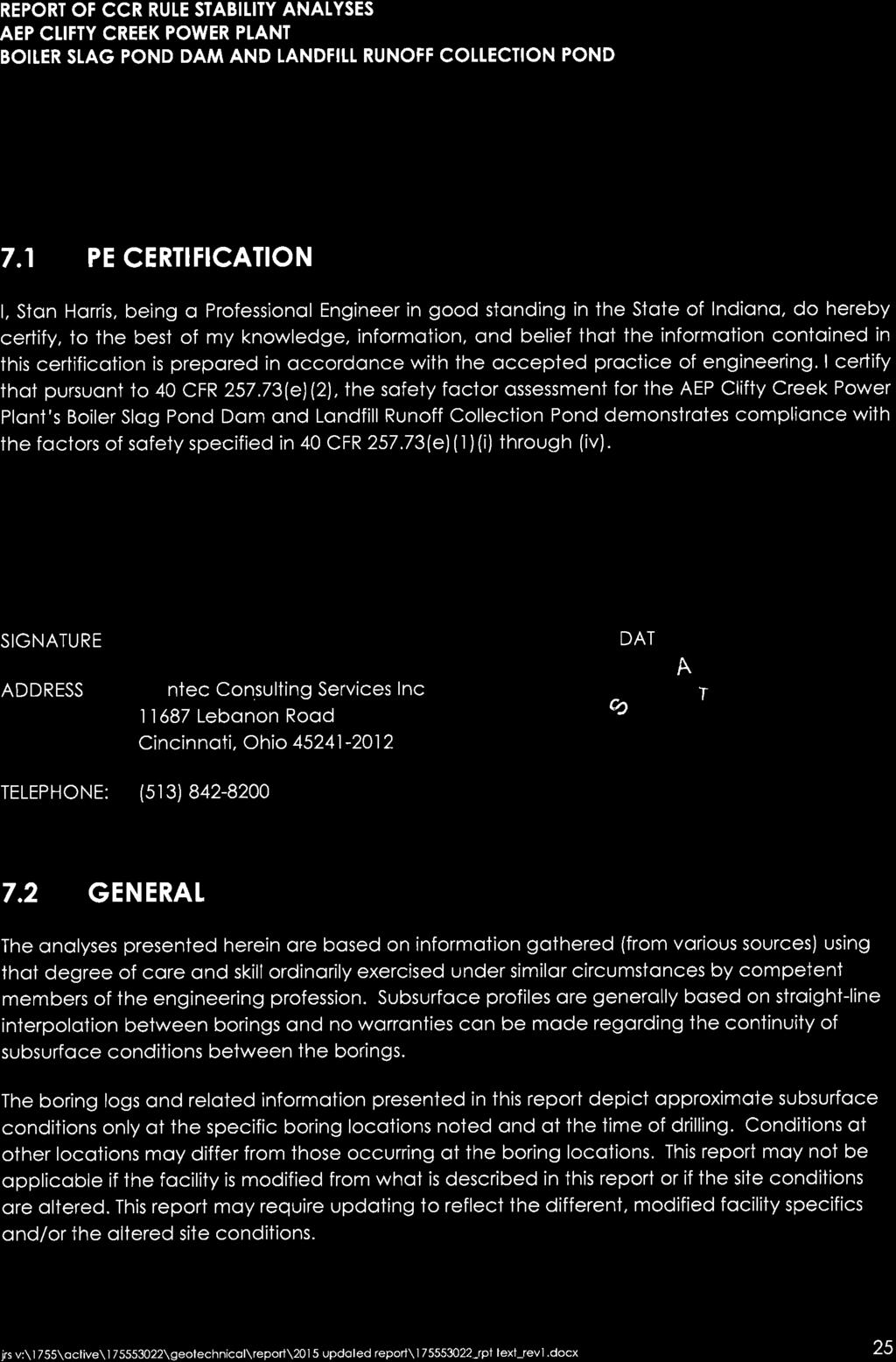
6 REPORT OF CCR RULE STABILITY ANALYSES AEP CLIFTY CREEK POWER PLANT BOILER SLAG POND DAM AND LANDFILL RUNOFF COLLECTION POND INTRODUCTION February 16, INTRODUCTION The Clifty Creek Power Station s Boiler Slag Pond Dam, owned and operated by the Indiana and Kentucky Electric Corporation (IKEC), is located in the city of Madison, Indiana along the northern bank of the Ohio River. The Boiler Slag Pond currently serves as a settling facility for sluiced bottom ash produced at the plant. In addition to the process flows from the plant, approximately 510 acres drain to the facility. The pond is formed by natural grade to the north, east, and west; as well as a southern dike that runs along the bank of the Ohio River. The Landfill Runoff Collection Pond serves as a collection pond for the Coal Combustion Byproducts Landfill. The pond is formed by natural grades to the north, east, and west; as well as a southern dam that runs along the bank of the Ohio River. The drainage area of the pond is approximately 443 acres. The Indiana Department of Natural Resources (IDNR) has designated this dam as No , which was registered as a High Hazard Structure in Stantec Consulting Services Inc. (Stantec) was contracted to perform a geotechnical exploration, stability analysis, and liquefaction assessment of the dike for these facilities in 2009 (Landfill Runoff Collection Pond) and in 2010 (Boiler Slag Pond Dam). The intent of the explorations was to develop subsurface data at cross-sections along the dike for the Boiler Slag Pond and the dam for the Landfill Collection Runoff Pond and to perform conventional seepage and stability analyses, assessing the performance of the facilities. The potential for liquefaction was to be evaluated according to simplified published methods. Reports from past geotechnical explorations were used to supplement subsurface data. In response to the Coal Combustion Residual (CCR) rules mandated in the Federal Register on April 17, 2015, AEP contracted Stantec to perform stability analyses for the Boiler Slag Pond Dam and Landfill Runoff Collection Pond to estimate static, seismic, and liquefaction potential factors of safety. According to Section (e)(1)(i) through (iv) of the CCR rules, the required factors of safety are as follows: (i) (ii) The calculated static factor of safety under the long-term, maximum storage pool loading condition must equal or exceed The calculated static factor of safety under the maximum surcharge pool loading condition must equal or exceed (iii) The calculated seismic factor of safety must equal or exceed 1.00 (iv) For dikes constructed of soils that have susceptibility to liquefaction, the calculated liquefaction factor of safety must equal or exceed Table 1 summarizes the geometric characteristics of the embankments. jrs v:\1755\active\ \geotechnical\report\2015 updated report\ _rpt text_rev1.docx 1
7 REPORT OF CCR RULE STABILITY ANALYSES AEP CLIFTY CREEK POWER PLANT BOILER SLAG POND DAM AND LANDFILL RUNOFF COLLECTION POND GEOLOGY OF THE SITE February 16, 2016 Table 1 Clifty Creek Facility Geometry Facility Section Boiler Slag Pond Section A-A Boiler Slag Pond Section B-B Boiler Slag Pond Section C-C Landfill Runoff Collection Pond Section D-D Landfill Runoff Collection Pond Section E-E Height (feet) Crest Width (feet) Downstream Slope Grade Upstream Slope Grade H:1V* 1.75H:1V* H:1V* 1.5H:1V* H:1V* 2H:1V* H:1V* 3H:1V* H:1V* 4.5H:1V* *Denotes horizontal to vertical ratio 2.0 GEOLOGY OF THE SITE The site lies within the Muscatatuck Regional Slope Physiographic Region of Indiana. This gently sloping plain is made of bedrock that is mostly Devonian in age that has been dissected by streams. Along the Ohio River the uplands immediately to the north are rugged and stand in bold relief to the flood plain. The reaches of each drainageway typically contain accumulations of silt, clay, and sand that make up the flat-lying flood plains. The site topography is steep to moderately sloping toward natural drainage channels. Topographic relief between Clifty Creek Power Plant and the uplands to the north is on the order of 350 feet. Published soils information for the site was obtained from the Soil Survey of Jefferson County, Indiana, (US Department of Agriculture [USDA], Natural Resources Conservation Service [NRCS], 1985). The soil survey indicated the side slopes of Devil s Backbone and the ridge flanks to the north of the site belong to the Eden-Caneyville complex (EgG). These soils are found on steep to very steep slopes ranging from 25 to 60 percent. The Eden-Caneyville complex consists of moderately deep and well-drained soils that formed on slopes facing the Ohio River and on back slopes facing adjacent to tributaries near the river. Mapping of unconsolidated sediments obtained from Regional Geologic Map, Louisville Sheet, Part B (Indiana Department of Natural Resources [IDNR], 1972) indicates the lowland areas adjacent to the Ohio River are predominantly underlain by clay, silt, sand, and gravel deposited as alluvium, lacustrine and outwash deposits. The glacial deposits in the area are of the Illinoian and Wisconsinan Quaternary age and belong to the Atherton Formation. The overlying more recent alluvial deposits belong to the Martinsville Formation. jrs v:\1755\active\ \geotechnical\report\2015 updated report\ _rpt text_rev1.docx 2
8 REPORT OF CCR RULE STABILITY ANALYSES AEP CLIFTY CREEK POWER PLANT BOILER SLAG POND DAM AND LANDFILL RUNOFF COLLECTION POND FIELD EXPLORATIONS AND SITE RECONNAISSANCE February 16, 2016 The Atherton Formation consists of coarse- to fine-grained, well-sorted sediments that were deposited by glacial outwash (sand and gravel deposited by glacial meltwater streams), lake sediments and loess. The Martinsville Formation consists of alluvial sediments of non-glacial origin that have been deposited in modern flood plains along the major drainage ways. This formation varies in thickness from a few inches up to 30 feet near rivers. Available geologic mapping from Bedrock Geology of Indiana (Indiana Geological Survey [IGS] Miscellaneous Map 48, IGS, 1987) shows the site to be underlain by bedrock of the Maquoketa Group. The Maquoketa Group in Indiana is a westward-thinning wedge, 1,000 feet thick in southeastern Indiana and 200 feet thick in northwestern Indiana. Overall, the group consists principally of shale (about 80 percent) and limestone (about 20 percent), although limestone is dominant in some areas. The lower part of the group is almost entirely shale, and the lower part of the shale is dark brown to nearly black. These rocks were deposited during the Upper Ordovician Period. 3.0 FIELD EXPLORATIONS AND SITE RECONNAISSANCE The borings for the 2009 and 2010 geotechnical exploration were advanced using 3¼-inch inside-diameter hollow-stem augers powered by a truck-mounted drill rig. Standard penetration tests (SPTs) were performed at 2.5-foot intervals in accordance with ASTM D Undisturbed Shelby tube samples were performed at selected intervals to obtain samples for consolidatedundrained (CU) triaxial compression (ASTM D 4767) and permeability testing (ASTM D ). Sample depths and recovery amounts are presented on the boring logs. Additionally, disturbed bag samples were collected from auger cuttings obtained from the boreholes. A Stantec geotechnical engineer directed the drill crews, logged the subsurface materials encountered during the exploration and collected soil samples. During field logging, particular attention was given to each material s color, texture, moisture content, and consistency or relative density. Following the field explorations, the Shelby tubes and bag samples were transported to Stantec s (or certified vendor s) laboratory for testing. Natural moisture content and unit weight testing were performed on samples extruded from the tubes. Testing consisting of sieve and hydrometer analyses (ASTM D 422) and Atterberg limits (ASTM D 4318) was performed on representative samples in order to classify the soil according the Unified Soil Classification System (USCS). Consolidated undrained triaxial compression tests (ASTM D 4767) and falling head permeability tests (ASTM D 5084) were also performed on Shelby tube samples. Standard Proctor moisture-density testing (ASTM D 698) was performed on disturbed soil bag samples collected from the auger cuttings. jrs v:\1755\active\ \geotechnical\report\2015 updated report\ _rpt text_rev1.docx 3
9 REPORT OF CCR RULE STABILITY ANALYSES AEP CLIFTY CREEK POWER PLANT BOILER SLAG POND DAM AND LANDFILL RUNOFF COLLECTION POND FIELD EXPLORATIONS AND SITE RECONNAISSANCE February 16, BOILER SLAG POND DAM Geotechnical Exploration Stantec advanced six borings at the dike of the Boiler Slag Pond Dam near the locations requested by AEP. The boring locations are shown in Appendix A. Borings B-1, B-3, and B-5 were positioned along the crest of the dike and Borings B-2, B-4, and B-6 were located along the downstream toe. Upon completion of drilling, one-inch diameter standpipe piezometers were installed in four of the borings (Borings B-1, B-3, B-4, and B-5). In these, ten-foot long sections of polyvinyl chloride (PVC) well screen were placed in the borehole with the bottoms at approximate depths ranging from 30 to 40 feet. PVC riser tubing extended to the tops of the piezometers. Flush-mount well covers were installed along the crest of the dike (Borings B-1, B-3, and B-5) and an above-ground steel tube cover was used at the toe of the downstream slope (Boring B-4). Refer to Appendix C for piezometer installation details CCR Mandate Site Reconnaissance Representatives from Stantec visited the Boiler Slag Pond Dam for a site reconnaissance on August 25, The purpose of this visit was to confirm that physical conditions at the pond, such as geometry of the embankment, pool elevations, etc. had not changed since the completion of the analysis in The crest and exterior slopes of the pond were walked by Stantec personnel, while the interior slopes were observed from the crest. Evidence of alterations to the pond since 2010 were not observed during the reconnaissance. 3.2 LANDFILL RUNOFF COLLECTION POND DAM Previous Explorations Two historical exploration reports were used to develop subsurface profiles and engineering parameters for the onsite material. The Fly Ash Dam Raising Feasibility Report (AEP, 1985) was implemented to obtain geotechnical properties of the dams, dikes, and foundation material to perform a feasibility assessment of raising the dams by 30 feet. Approximately 22 borings with SPT sampling and 11 Cone Penetrometer Test (CPT) borings were performed for this study. This report was used to develop a subsurface profile of the dam and estimate soil properties and shear strength parameters. The Hydrogeologic Study Report (Applied Geology and Environmental Science, Inc., 2006) summarized the piezometers and field permeability testing performed by various firms. This report was used to develop initial phreatic surfaces for the stability analyses, and the field jrs v:\1755\active\ \geotechnical\report\2015 updated report\ _rpt text_rev1.docx 4
10 REPORT OF CCR RULE STABILITY ANALYSES AEP CLIFTY CREEK POWER PLANT BOILER SLAG POND DAM AND LANDFILL RUNOFF COLLECTION POND RESULTS OF EXPLORATIONS February 16, 2016 permeability testing data were reviewed to assist in selecting hydraulic conductivity values for soil horizons in the seepage analysis. A review of the existing data by Stantec revealed a lack of laboratory testing necessary to develop drained (long-term) shear strength parameters. Standard Proctor moisture-density testing was recommended to compare with in-situ total unit weights to estimate the apparent degree of compaction used during construction. The review of the existing data resulted in the additional exploration explained in Section Geotechnical Exploration Stantec advanced four additional borings along the southern dam on November 11 and 19, 2009 to collect undisturbed Shelby tube and disturbed bag samples for laboratory testing. The boring locations are shown in Appendix A. Borings B-7 and B-9 were positioned along the crest of the dam, and Borings B-8 and B-10 were located along the downstream toe of the dam embankment. The borings were numbered in sequence with the six borings drilled at the Boiler Slag Pond Dam, also advanced late in Geotechnical Exploration An additional boring (B-12) was advanced on July 6-7, 2015 to confirm subsurface conditions. This boring was placed on the crest of the dam, between the two cross-sections. The location of the boring can be seen on the site plan in Appendix A. Standard Penetration Test samples were collected at five-foot intervals. These samples were taken to a Stantec laboratory for natural moisture content, hydrometer analyses, and Atterberg limits testing CCR Mandate Site Reconnaissance Representatives from Stantec visited the Landfill Runoff Collection Pond for a site reconnaissance on August 25, The purpose of this visit was to confirm that physical conditions at the pond, such as geometry of the embankment, pool elevations, etc. had not changed since the completion of the analysis in The crest and exterior slopes of the pond were walked by Stantec personnel, while the interior slopes were observed from the crest. Evidence ot alterations to the pond since 2010 were not observed during the reconnaissance. 4.0 RESULTS OF EXPLORATIONS Logs of borings are provided in Appendix B and shown graphically on stability analysis cross sections in Appendix I for the 2009 and 2010 explorations. Results of natural moisture content tests and SPTs are provided on the logs adjacent to the appropriate sample. Summaries of engineering classification tests are provided in Appendix D. jrs v:\1755\active\ \geotechnical\report\2015 updated report\ _rpt text_rev1.docx 5
11 REPORT OF CCR RULE STABILITY ANALYSES AEP CLIFTY CREEK POWER PLANT BOILER SLAG POND DAM AND LANDFILL RUNOFF COLLECTION POND RESULTS OF EXPLORATIONS February 16, BOILER SLAG POND DAM Geotechnical Exploration Boring B-1 Boring B-1 was on the crest along cross-section A-A of the Boiler Slag Pond Dam. The surface elevation of this boring was feet. Lean clay with sand was observed from the surface of the boring to a depth of 67.5 feet (Elevation feet). From the surface of the boring to a depth of 37.5 feet (Elevation feet), this material was described as light yellowish brown with light gray, damp to moist, and medium stiff to stiff. Natural moisture contents ranged from 15 to 23 percent and SPT N-values varied from 7 to 15 blows per foot (bpf). A liquid limit of 32 percent and a plasticity index of 13 percent were determined for a sample from this horizon. This sample was classified as CL, lean clay with sand, according to the Unified Soil Classification System (USCS) and A-6 (10) according to the Association of American State and Highway Transportation Officials (AASHTO) system. The average total unit weight of undisturbed samples was 131 pounds per cubic foot (pcf). From a depth of 37.5 to 67.5 feet (Elevation to feet), the lean clay with sand was described as light yellowish brown with light gray, moist to wet, and very soft to medium stiff. Natural moisture contents ranged from 20 to 37 percent and SPT N-values varied from 2 to 7 blows per foot. A liquid limit of 28 percent and a plasticity index of 12 percent were determined for this soil. A Shelby tube sample yielded a total unit weight of 129 pounds per cubic foot. A representative sample from this layer classified as CL, lean clay with sand, according to the USCS and A-6 (8) according to the AASHTO system. Bedrock, described as weathered gray shale, was encountered at a depth of 67.5 feet (Elevation feet) and was augered to a boring termination depth of 71.5 feet (Elevation feet). Groundwater was observed during the drilling at a depth of 40.0 feet (Elevation feet) during drilling Boring B-2 Boring B-2 was advanced at the downstream toe along the same cross-section as Boring B-1 at a surface elevation of feet. From the surface of the boring to a depth of 51.5 feet (Elevation feet), lean clay with sand was observed. The top 30 feet of this deposit was described as light yellowish brown with gray, moist to wet, and soft to very stiff. Moisture contents ranged from 17 to 32 percent and SPT N- values varied from 2 to 19 bpf, with an average of 7 blows per foot. The average total unit weight of the soil was 124 pounds per cubic foot. jrs v:\1755\active\ \geotechnical\report\2015 updated report\ _rpt text_rev1.docx 6
12 REPORT OF CCR RULE STABILITY ANALYSES AEP CLIFTY CREEK POWER PLANT BOILER SLAG POND DAM AND LANDFILL RUNOFF COLLECTION POND RESULTS OF EXPLORATIONS February 16, 2016 The lower 21.5 feet of the lean clay with sand was described as gray, moist to wet, and soft to medium stiff. Natural moisture contents ranged from 25 to 35 percent and SPT N-values varied from 2 to 6 blows per foot. A liquid limit of 33 percent and plasticity index of 18 percent was determined for this material. A representative sample of this soil classified as CL, lean clay with sand according to the USCS and A-6 (13) according to the AASHTO system. Total unit weights of 117 and 121 pcf were determined for Shelby tube samples. From a depth of 51.5 to 55.5 feet (Elevation to feet), well-graded gravel with silt and sand was observed. Bedrock was encountered below this material, described as shale, gray, hard, and medium bedded. Groundwater was observed at a depth of 22.5 feet (Elevation feet) during drilling Boring B-3 Boring B-3 was positioned on the crest of the dike along cross-section B-B. The surface elevation of the boring was feet. Lean clay with sand, described as light yellowish brown with light gray, was observed from the boring surface to a depth of 37.5 feet (Elevation feet). The soil was further described as damp to moist and medium-stiff to very stiff. Moisture contents ranged from 15 to 22 percent and SPT N-values varied from 8 to 17 blows per foot. The average total unit weight was 131 pounds per cubic foot. Gray lean clay with sand was observed below the upper soil horizon to the termination depth of 71.5 feet (Elevation feet). This soil was described as moist and soft to very stiff. Moisture contents ranged from 20 to 40 percent and SPT N-values varied from 2 to 18 bpf, with an average of 6 blows per foot. The average total unit weight was 126 pounds per cubic foot. Groundwater was observed at a depth of 40.0 feet (Elevation feet) during drilling. Bedrock was not encountered Boring B-4 Boring B-4 was located along the downstream toe of the dike, downhill from Boring B-3, at a surface elevation of feet. Brown to dark gray lean clay with sand was observed from the surface of the boring to a depth of 15.0 feet (Elevation feet). The soil was described as damp to moist and medium stiff to very stiff. Natural moisture contents ranged from 14 to 22 percent and SPT N-values varied from 7 to 16 blows per foot. Gray lean clay with sand was encountered below the upper soil horizon to a depth of 57.5 feet (Elevation feet) and was described as moist to wet and soft to stiff. Moisture contents jrs v:\1755\active\ \geotechnical\report\2015 updated report\ _rpt text_rev1.docx 7
13 REPORT OF CCR RULE STABILITY ANALYSES AEP CLIFTY CREEK POWER PLANT BOILER SLAG POND DAM AND LANDFILL RUNOFF COLLECTION POND RESULTS OF EXPLORATIONS February 16, 2016 varied from 21 to 35 percent and SPT N-values varied from 3 to 9 blows per foot. A representative sample yielded a liquid limit of 25 percent and a plasticity index of 8 percent. This material classified as CL, lean clay with sand, according to the USCS and A-4 (4) according to the AASHTO system. Underlying the lean clay with sand, well-graded gravel with silt and sand was observed to a termination depth of 71.5 feet (Elevation feet). This material was described as gray, wet, and dense to very dense. Moisture contents ranged from 9 to 13 percent and SPT N-values varied from 39 to over 50 blows per foot. A representative sample of this material tested as nonplastic and classified as GW-GM, well-graded gravel with silt and sand, according to the USCS and A-1-a (1) according to the AASHTO system. Bedrock was not encountered in the boring. Groundwater was observed at a depth of 22.5 feet (Elevation feet) during drilling Boring B-5 Boring B-5 was advanced from the crest of the dike on cross-section C-C. The surface elevation was feet. Lean clay with sand was observed from the surface of Boring B-5 to a depth of 40.0 feet (Elevation feet). The soil was described as light yellowish brown with light gray, damp to moist, and medium stiff to very stiff. Natural moisture contents ranged from 15 to 25 percent and SPT N-values varied from 6 to 19 blows per foot. The average total unit weight of the soil was 128 pounds per cubic foot. Additional lean clay with sand was encountered below the uppermost layer to a depth of 47.5 feet (Elevation feet). This material was described as gray, moist to wet, and soft. Natural moisture contents ranged from 23 to 25 percent and SPT N-values varied between 3 and 4 blows per foot. The total unit weight was 119 pounds per cubic foot. Below the lean clay with sand, sandy silt was observed to the termination depth of 71.5 feet (397.2 feet). The sandy silt was described as light yellowish brown to gray, wet, and soft to stiff. Moisture contents ranged from 22 to 30 and SPT N-values varied from 2 to 13 bpf, with an average of 7 blows per foot. A representative sample from this horizon tested as non-plastic and classified as ML, sandy silt, according to the USCS and A-4 (0) according to the AASHTO system. Bedrock was not encountered in the boring. Groundwater was encountered at a depth of 45.0 feet (Elevation feet) during drilling. jrs v:\1755\active\ \geotechnical\report\2015 updated report\ _rpt text_rev1.docx 8
14 REPORT OF CCR RULE STABILITY ANALYSES AEP CLIFTY CREEK POWER PLANT BOILER SLAG POND DAM AND LANDFILL RUNOFF COLLECTION POND RESULTS OF EXPLORATIONS February 16, Boring B-6 Boring B-6 was advanced from a surface elevation of feet near the southeast toe of slope below Boring B-5. Lean clay with sand was encountered from the surface to a depth of 27.5 feet (Elevation feet). This material was described as brown to gray, damp to moist, and very soft to very stiff. Natural moisture contents ranged from 16 to 32 percent and SPT N-values varied from 0 to 18 bpf, with an average of 6 blows per foot. The average total unit weight was 117 pounds per cubic foot. Sandy silt was observed below the lean clay with sand to the boring termination depth of 71.5 feet (Elevation feet). This soil was described as gray, moist to wet, and very soft to stiff. Moisture contents ranged from 27 to 40 percent and SPT N-values varied from 1 to 11 bpf, with an average of 5 blows per foot. The total unit weight was 117 pounds per cubic foot. Bedrock was not encountered in the boring. Groundwater was observed at a depth of 30.0 feet (Elevation feet) during drilling Piezometers Piezometers were installed on the crest in Borings B-1, B-3, and B-5, and at the downstream toe in Boring B-4. Details of piezometers installations are shown in Appendix C. Ten-foot long piezometers screens were installed with the tips at approximate depths of 40 feet along the crest and 30 feet at the downstream toe of slope. Table 2 summarizes the installations and first two readings performed on the piezometers. Table 2 Summary of Piezometer Elevations for the Boiler Slag Pond Dam Boring No. Top of Piezometer (feet) Tip of Piezometer (feet) Piezometric Reading on 11/13/09 (feet) Piezometric Reading on 02/01/10 (feet) B B B B jrs v:\1755\active\ \geotechnical\report\2015 updated report\ _rpt text_rev1.docx 9
15 REPORT OF CCR RULE STABILITY ANALYSES AEP CLIFTY CREEK POWER PLANT BOILER SLAG POND DAM AND LANDFILL RUNOFF COLLECTION POND RESULTS OF EXPLORATIONS February 16, LANDFILL RUNOFF COLLECTION POND Geotechnical Exploration Boring B-7 Boring B-7 was advanced from the crest of the dam along cross-section D-D. The surface elevation of the boring was feet. Approximately 0.5 feet of asphalt pavement and gravel base was observed at the surface of the boring. Below the pavement and gravel base, lean clay was observed to a boring termination depth of 29.0 feet (Elevation feet). The lean clay was described as yellow and light gray, moist, and stiff. Three undisturbed Shelby tube samples were obtained from a depth of 23.0 to 29.0 feet (Elevation to feet). Natural moisture contents of those samples ranged from 18 to 24 percent, and total unit weights varied from 128 to 133 pounds per cubic foot. A representative sample yielded a liquid limit of 28 percent and a plasticity index of 8. This sample classified as CL, lean clay, according to the USCS and A-4 (7) according to the AASHTO system. Neither bedrock nor groundwater was encountered during drilling Boring B-8 Boring B-8 was located at the toe of slope downstream of Boring B-7. The surface elevation of the boring was feet. From the surface of the boring to a depth of 16.0 feet (Elevation feet), the soil was visually described as yellow and light gray, damp to moist, silty clay. Below the silty clay, lean clay was encountered to a depth of 29.0 feet (Elevation feet). The lean clay was described as yellowish brown to light gray and moist. Two undisturbed Shelby tube samples were taken from this horizon at depths of between 25.0 and 29.0 feet (Elevation to feet). Natural moisture contents ranged from 24 to 27 percent, and total unit weights ranged from 124 to 130 pounds per cubic foot. A representative sample of this material yielded a liquid limit of 38 percent and a plasticity index of 17 percent. The sample classified as CL, lean clay according to the USCS and A-6 (15) according to the AASHTO system. Soil described as lean clay with sand was observed beneath the lean clay to the boring termination depth of 31.0 feet (Elevation feet). The lean clay with sand was further described as yellowish brown and light gray and moist. Shelby tube samples yielded moisture contents of 22 and 24 percent and total unit weights of 126 and 129 pounds per cubic foot. This soil had a liquid limit of 45 percent and a plasticity index of 25 percent. The soil classified as CL, lean clay with sand according to the USCS and A-7-6 (20) according to the AASHTO system. Neither bedrock nor groundwater was encountered during drilling. jrs v:\1755\active\ \geotechnical\report\2015 updated report\ _rpt text_rev1.docx 10
16 REPORT OF CCR RULE STABILITY ANALYSES AEP CLIFTY CREEK POWER PLANT BOILER SLAG POND DAM AND LANDFILL RUNOFF COLLECTION POND RESULTS OF EXPLORATIONS February 16, Boring B-9 Boring B-9 was advanced along the crest of cross-section E-E at a surface elevation of feet. Asphalt pavement and gravel base was observed at the surface of the boring to a depth of 0.5 feet. Lean clay was encountered below the pavement to the boring termination depth of 22.0 feet (Elevation feet). The lean clay was described as yellow to light gray and damp to moist. Three undisturbed Shelby tube samples were obtained from a depth of 16.0 to 22.0 feet (Elevation to feet). Natural moisture contents ranged from 17 to 23 percent, and total unit weights varied from 119 to 135 pounds per cubic foot. A sample of this material yielded a liquid limit of 39 percent and a plasticity index of 19 percent. This sample classified as CL, lean clay, according to the USCS and A-6 (17) according to the AASHTO system. Neither bedrock nor groundwater was encountered during drilling Boring B-10 Boring B-10 was positioned near the toe below Boring B-9. The surface elevation was feet. Silty clay with sand was observed from the surface of the boring to a depth of 13.2 feet (Elevation feet) and from a depth of 16.0 feet to the termination depth of 18.0 feet (Elevation to feet). This soil was described as yellow to light gray and damp to moist. Two undisturbed Shelby tube samples were taken and natural moisture contents ranged from 21 to 28 percent. Total unit weights of the samples ranged from 116 to 124 pounds per cubic foot. A representative sample of this material yielded a liquid limit of 28 percent and a plasticity index of 7 percent. The sample classified as CL-ML, silty clay with sand according to the USCS and A-4 (5) according to the AASHTO system. From a depth of 13.2 to 16.0 feet (Elevation to feet) a layer of silty sand was encountered and describe as gray-brown and damp to moist. One Shelby tube sample was taken from this layer. A representative sample of this soil classified as non-plastic SM, silty sand, according to the USCS and A-2-4 (0) according to the AASHTO system Geotechnical Exploration Boring B-12 was advanced on the crest of the dam between the analysis cross-sections. The ground surface elevation of the boring was estimated to be feet. A layer of asphalt with gravel base was encountered at the surface of the boring to a depth of 0.4 feet (Elevation feet). Beneath the asphalt and gravel base, lean clay with sand was encountered to a depth of 40.0 feet (Elevation feet). This material was described as gray, damp, and medium stiff to stiff. jrs v:\1755\active\ \geotechnical\report\2015 updated report\ _rpt text_rev1.docx 11
17 REPORT OF CCR RULE STABILITY ANALYSES AEP CLIFTY CREEK POWER PLANT BOILER SLAG POND DAM AND LANDFILL RUNOFF COLLECTION POND LABORATORY TESTING February 16, 2016 The natural moisture contents ranged from 18 to 28 percent and the SPT N-values varied from 7 to 15 blows per foot. The liquid limit of this material ranged from 31 to 43 percent and the plasticity index varied from 13 to 22 percent. The material classified as CL, lean clay with sand, according to the USCS and A-6 (7) or A-7-6 (15) according to the AASHTO system. Silty clay with sand was observed beneath the lean clay with sand to a depth of 50.0 feet (Elevation feet). This material was described as brown, moist, and medium stiff to very stiff. The natural moisture contents ranged from 16 to 19 percent and the SPT N-values varied from 8 to 16 blows per foot. A representative sample of this material yielded a liquid limit of 26 percent and a plasticity index of 7 percent. The material classified as CL-ML, silty clay with sand, according to the USCS and A-4 (4) according to the AASHTO system. Cohesionless material was encountered beneath the silty clay with sand to the depth of 90.0 feet (Elevation feet). This material was silt, silt with sand, silty sand, or sand; and was described as brown or gray, damp to wet, and loose to medium dense. The natural moisture contents ranged from 15 to 28 percent and the SPT N-values varied from 6 to 28 blows per foot. Samples from these materials tested as non-plastic. The material classified as ML (sandy silt, silt, or silt with sand) or SM (silty sand) according to the USCS and A-4 (0) according to the AASHTO system. Beneath the cohesionless material, lean clay was encountered to the boring termination depth of feet (402.4 feet). This material was described as gray, moist, and medium stiff to very stiff. The natural moisture content ranged from 23 to 27 percent and the SPT N-values varied from 8 to 19 blows per foot. A representative sample from this material yielded a liquid limit of 42 percent and a plasticity index of 23 percent. The sample classified as CL, lean clay, according to the USCS and A-7-6 (20) according to the AASHTO system. 5.0 LABORATORY TESTING Laboratory tests in addition to the natural moisture content, classification tests, and unit weight tests mentioned in Section 4 were conducted on samples taken from the Boiler Slag Pond Dam (2010 Geotechnical Exploration) and Landfill Runoff Collection Pond (2009 Geotechnical Exploration). The results from the additional testing are summarized in the following sections. 5.1 BOILER SLAG POND DAM Consolidated-Undrained Triaxial Compression Testing Three consolidated-undrained (CU) triaxial compression tests were performed on undisturbed samples collected from the borings. These tests were performed in accordance with ASTM D jrs v:\1755\active\ \geotechnical\report\2015 updated report\ _rpt text_rev1.docx 12
18 REPORT OF CCR RULE STABILITY ANALYSES AEP CLIFTY CREEK POWER PLANT BOILER SLAG POND DAM AND LANDFILL RUNOFF COLLECTION POND LABORATORY TESTING February 16, , and detailed results of the tests are provided in Appendix E. The samples were described as lean clay with sand. Table 3 shows a summary of the CU triaxial tests performed. Table 3 Summary of CU Triaxial Compression Testing for the Boiler Slag Pond Dam Boring Nos. Depth (feet) B-3, B B-2, B-4 B-1, B Soil Description Lean Clay with Sand Lean Clay with Sand Lean Clay with Sand Material Effective Cohesion, c (psf) Effective Angle of Internal Friction, φ (deg.) Embankment Foundation Foundation Permeability Testing Four permeability tests (ASTM D 5084, Falling-Head, Method C, Rising Tailwater) were performed on undisturbed samples. Detailed data sheets showing the results of the tests are provided in Appendix F. Vertical hydraulic conductivities ranged from 8.7x10⁻⁹ to 1.6x10⁻⁶ centimeters per second. The samples were described as lean clay with sand. Table 4 summarizes the results of the permeability tests. Table 4 Summary of Permeability Testing for the Boiler Slag Pond Dam Boring No. Depth, feet Soil Description Material Vertical Hydraulic Conductivity, cm/second B Lean Clay with Sand Embankment 1.44x10⁻⁷ B Lean Clay with Sand Foundation 8.70x10⁻⁹ B Lean Clay with Sand Embankment 1.58x10⁻⁶ B Lean Clay with Sand Foundation 2.01x Moisture-Density Testing Three standard Proctor moisture-density tests (ASTM D 698) were performed on bag samples taken from auger cuttings. The data sheets for these tests are provided in Appendix G. jrs v:\1755\active\ \geotechnical\report\2015 updated report\ _rpt text_rev1.docx 13
19 REPORT OF CCR RULE STABILITY ANALYSES AEP CLIFTY CREEK POWER PLANT BOILER SLAG POND DAM AND LANDFILL RUNOFF COLLECTION POND LABORATORY TESTING February 16, 2016 Maximum dry densities ranged from to pcf and optimum moisture contents varied from 13.4 to 15.8 percent. The samples were described as lean clay with sand. Table 5 summarizes the results of the tests. Table 5 Summary of Moisture-Density Testing for the Boiler Slag Pond Dam Boring No. Depth, feet Material B /- 2.0 Embankment B /- 2.0 Embankment Soil Description Lean Clay with Sand Lean Clay with Sand Maximum Dry Density, pcf Optimum Moisture Content, % These moisture-density tests were performed to compare with natural moisture contents and unit weights of the soils. Within the embankment soils, natural moisture contents ranged from 15 to 25 percent with an average of 19 percent. Dry densities of the embankment soil ranged from 106 to 115 pcf, with an average of 110 pounds per cubic foot. The results of these tests indicate that the average natural moisture content of the embankment soil is 3 to 5 percent above optimum moisture and that the average percent compaction of the embankment soil is on the order of 94 to 97 percent of the standard Proctor maximum density. 5.2 LANDFILL RUNOFF COLLECTION POND Consolidated-Undrained Triaxial Testing Four CU triaxial compression tests were performed on undisturbed samples collected from the borings. These tests were performed in accordance with ASTM D 4767, and detailed results of the tests are provided in Appendix E. The samples were described as lean clay, lean clay with sand, or sandy clay. Table 6 shows a summary of the CU triaxial tests performed. jrs v:\1755\active\ \geotechnical\report\2015 updated report\ _rpt text_rev1.docx 14
20 REPORT OF CCR RULE STABILITY ANALYSES AEP CLIFTY CREEK POWER PLANT BOILER SLAG POND DAM AND LANDFILL RUNOFF COLLECTION POND LABORATORY TESTING February 16, 2016 Table 6 Summary of CU Triaxial Compression Testing for the Landfill Runoff Collection Pond Boring No. B-7 B-8 B-9 B-10 Depth (feet) Soil Description Material Effective Cohesion, c (psf) Effective Angle of Internal Friction, φ (deg.) Lean Clay Embankment Lean Clay with Sand Foundation Lean Clay Embankment Sandy Clay Foundation Permeability Testing Four permeability tests (ASTM D 5084, Falling-Head, Method C, Rising Tailwater) were performed on undisturbed samples. Detailed data sheets showing the results of the tests are provided in Appendix F. Vertical hydraulic conductivities ranged from 3.4x10⁻⁸ to 1.4x10⁻⁷ centimeters per second. The samples were described as lean clay, lean clay with sand, or silt. Table 7 summarizes the results of the permeability tests. Table 7 Summary of Permeability Testing for the Landfill Runoff Collection Pond Boring No. Depth, feet Material Soil Description Vertical Hydraulic Conductivity, cm/second B Embankment Lean Clay 8.4x10⁻⁸ B Foundation Silt 3.4x10⁻⁸ B Embankment Lean Clay 6.2x10⁻⁸ B Foundation Lean Clay with Sand 1.4x Moisture-Density Testing One standard Proctor moisture-density test (ASTM D 698) was performed on a bag sample of embankment soil taken from auger cuttings. The data sheet for this test is provided in Appendix jrs v:\1755\active\ \geotechnical\report\2015 updated report\ _rpt text_rev1.docx 15
21 REPORT OF CCR RULE STABILITY ANALYSES AEP CLIFTY CREEK POWER PLANT BOILER SLAG POND DAM AND LANDFILL RUNOFF COLLECTION POND ENGINEERING ANALYSIS February 16, 2016 G. The maximum dry density was pcf and the optimum moisture content was 16.9 percent. The sample was described as lean clay. Table 8 summarizes the results of the tests. Table 8 Summary of Moisture-Density Testing for the Landfill Runoff Collection Pond Boring No. Depth, feet Material Soil Description Maximum Dry Density, pcf Optimum Moisture Content, % B /- 2.0 Embankment Lean Clay The moisture-density test was performed to compare with in-situ natural moisture contents and unit weights of the soils. Within the embankment soils, natural moisture contents varied from 17 to 24 percent with an average of 20 percent. Dry densities of the embankment soil ranged from 99 to 114 pounds per cubic foot, with an average of 108 pounds per cubic foot. The results of these tests indicate that the average natural moisture content of the embankment soil is about 3 percent above optimum moisture and that the average percent compaction of the embankment soil is approximately 98 percent of the standard Proctor maximum density. 6.0 ENGINEERING ANALYSIS 6.1 BOILER SLAG POND DAM Based on the review of available information, results of the geotechnical exploration and results of laboratory testing, Stantec performed engineering analyses of the Boiler Slag Pond Dam in This included liquefaction, seepage, and slope stability analysis of three cross sections. The procedures used and the results of the analyses are presented in the following paragraphs. The results of the liquefaction analysis are shown in Appendix H, and the cross section drawings showing the results of the seepage and stability analyses are provided in Appendix I. Appendix J provides an explanation of derivations of shear strength, seepage, and liquefaction analysis parameters Engineering Analyses Performed in 2015 as Part of CCR Mandate Liquefaction Analysis The liquefaction analysis conducted in 2010 was revisited as part of the CCR Mandate. The details for this analysis are contained in Appendix H. Similar to the analysis performed in 2010, a screening process was used to determine if the cohesive material encountered in the borings has the potential for liquefaction. The screening process was conducted for four samples which had liquid limits below 37 percent. According to the Seed et al and Bray and Sancio plots jrs v:\1755\active\ \geotechnical\report\2015 updated report\ _rpt text_rev1.docx 16
22 REPORT OF CCR RULE STABILITY ANALYSES AEP CLIFTY CREEK POWER PLANT BOILER SLAG POND DAM AND LANDFILL RUNOFF COLLECTION POND ENGINEERING ANALYSIS February 16, 2016 supplied in Appendix H, one sample could be labeled as susceptible to liquefaction and another could be labeled as moderately susceptible to liquefaction. The remaining cohesionless material encountered in the critical cross-sections was tested for liquefaction as a coarse grained analysis similar to the one conducted in According to the CCR Mandate, for dikes constructed of soils that have a susceptibility to liquefaction, the calculated factor of safety must equal or exceed Test data from Borings B-1 and B-2, representative of cross-section A-A, Boring Nos. B-3 and B-4, representative of cross-section B-B, and B-5 and B-6, representative of cross-section C-C was used. Soil characteristics (grain size, plasticity, etc.) from SPT and Shelby tube samples were summarized to assess liquefaction potential. The copies of the spreadsheets used for the calculations appear in Appendix H and provide the soil, test data, and calculations used in the assessment. It was assumed during the screening process for potential liquefaction that the steady-state water elevation consistent with that developed during the stability analysis would be used as the groundwater elevation. Unsaturated soils above this elevation were considered not liquefiable. Also the dike embankment materials, consisting of engineered fill, were not considered liquefiable. Factors of safety against liquefaction were estimated for soil layers predicted to be potentially liquefiable during the screening process. As a result of recent industry publications that attempted to update certain correlations that had larger uncertainty that are used in the calculations for the factor of safety, slight differences in the factors of safety were obtained than those reported in Inputs such as depth, material properties, seismic accelerations, etc. have not been altered. Ranges and averages of these factors of safety for the potentially liquefiable soil layers are summarized in Table 9. Table 9 Liquefaction Factor of Safety for the Boiler Slag Pond Dam, CCR Mandate Boring No. Depth (feet) Elevation (feet) Unified Soil Classification Liquefaction FS, Range Liquefaction FS, Average B GW-GM B GW-GM B ML B ML The range of factors of safety for each soil horizon represents factors of safety calculated from each individual corrected N-value at that specific depth and overburden pressure. Due to the variable and somewhat unreliable nature associated with the SPT, it is recommended that the jrs v:\1755\active\ \geotechnical\report\2015 updated report\ _rpt text_rev1.docx 17
23 REPORT OF CCR RULE STABILITY ANALYSES AEP CLIFTY CREEK POWER PLANT BOILER SLAG POND DAM AND LANDFILL RUNOFF COLLECTION POND ENGINEERING ANALYSIS February 16, 2016 liquefaction factors of safety be evaluated according to the average values shown in Table 9. The average liquefaction factors of safety against liquefaction ranged from 1.73 to and are considered acceptable Seepage Analysis The seepage analysis conducted in 2010 was reviewed as part of the CCR Mandate. The seepage models used in the SEEP/W product were calibrated to recent piezometric data and visual field operations. Changes to the material properties developed in Appendix J of this report were not deemed necessary. The 2010 analysis used a normal pool elevation of 442 feet to establish the piezometric line. During the 2015 site reconnaissance with AEP personnel, it was learned that the normal pool elevation is currently 448 feet and is not expected to change. As a result, a piezometric line has been adjusted for the current normal pool elevation of 448 feet, and has been used during the CCR Mandate review. The seepage analysis conducted at the critical cross-sections of A-A, B- B, and C-C were reviewed. The results of the seepage analysis were used to revise the stability cross-sections Stability Analysis The stability analysis conducted in 2010 was reviewed as part of the CCR Mandate, using the results of the seepage analysis review in Section Similar to 2010, SLOPE/W was the software used during the analysis. The drained shear strength parameters developed in 2010, located in Appendix J, were maintained for the updated analysis. Undrained shear strength parameters were not derived in These parameters were determined by CU test data for the Embankment Fill and Lean Clay with Sand. Undrained shear strength parameters for cohesionless materials were taken to be identical to the drained shear strength parameters. Table 10 summarizes the drained and undrained shear strength parameters used in the analysis. jrs v:\1755\active\ \geotechnical\report\2015 updated report\ _rpt text_rev1.docx 18
24 REPORT OF CCR RULE STABILITY ANALYSES AEP CLIFTY CREEK POWER PLANT BOILER SLAG POND DAM AND LANDFILL RUNOFF COLLECTION POND ENGINEERING ANALYSIS February 16, 2016 Table 10 Shear Strength Parameters for CCR Mandate Review Drained Shear Strengths Undrained Shear Strengths Material Unit Weight (pcf) φ' (deg.) Effective Cohesion (psf) φ (deg.) Cohesion (psf) Embankment Lean Clay with Sand ,200 Gravel with Silt and Sand Bottom Ash Silty Sand The upstream and downstream slopes of each cross-section were analyzed, incorporating the auto locate and entry/exit search routines to locate the critical slip surface. Once the potential failure surface with the lowest factor of safety was identified, the optimization routine was run. When the surface slope is composed of a material with low effective cohesion, an infinite slope failure (shallow sliding parallel to the surface) will be critical. A minimum failure depth of ten feet was specified for each section, to eliminate the evaluation of surficial sloughing and erosional types of instability. For this review, SLOPE/W was used to investigate one normal pool elevation, considered the maximum steady-state pool, and one PMF pool elevation: Current normal pool level of 448 feet. 50 Percent PMF pool level of feet, applied as a steady-state load condition within SLOPE/W. Using the drained and undrained strength parameters listed in Table 10, the existing dam was analyzed at the three critical cross sections selected for the CCR review. The undrained materials strengths were used in the seismic analyses. A summary of the factors of safety are presented in Table 13 at the end of this section and printouts of the GeoStudio runs are presented in Appendix I. jrs v:\1755\active\ \geotechnical\report\2015 updated report\ _rpt text_rev1.docx 19
25 REPORT OF CCR RULE STABILITY ANALYSES AEP CLIFTY CREEK POWER PLANT BOILER SLAG POND DAM AND LANDFILL RUNOFF COLLECTION POND ENGINEERING ANALYSIS February 16, LANDFILL RUNOFF COLLECTION POND Based on the review of available information, results of geotechnical exploration and results of laboratory testing, Stantec performed engineering analyses of the Landfill Runoff Collection Pond in This included liquefaction, seepage, and slope stability analysis of two cross sections. The procedures used and the results of the analyses are presented in the following paragraphs. The results of the liquefaction analysis are shown in Appendix H, and the cross section drawings showing the results of the seepage and stability analyses are provided in Appendix I. Appendix J provides an explanation of derivations of shear strength, seepage, and liquefaction analysis parameters Engineering Analyses Performed in 2015 as Part of CCR Mandate Liquefaction Analysis The liquefaction analysis conducted in 2010 as part of the 2009 geotechnical exploration was revisited as part of the CCR Mandate. The details for this analysis are contained in Appendix H. Similar to the analysis performed in 2010, a screening process was used to determine if the cohesive material encountered in the borings has the potential for liquefaction. The screening process was conducted for nine samples, four of which had liquid limits below 37 percent. According to the Seed et al and Bray and Sancio plots supplied in Appendix H, none of the samples are considered susceptible to liquefaction. The remaining cohesionless material encountered in the critical cross-sections was tested for liquefaction as a coarse grained analysis similar to the one conducted in According to the CCR Mandate, for dikes constructed of soils that have a susceptibility to liquefaction, the calculated factor of safety must equal or exceed Test data from historic Borings SS2-1 and SS2-4, representative of cross-section D-D and historic Borings SI-1, SS3-1, and SS3-4, representative of cross-section E-E, were used. Soil characteristics (grain size, plasticity, etc.) from SPT and Shelby tube samples were summarized to assess liquefaction potential. The copies of the spreadsheets used for the calculations appear in Appendix H and provide the soil, test data, and calculations used in the assessment. It was assumed during the screening process for potential liquefaction that the steady-state water elevation consistent with that developed during the stability analysis would be used as the groundwater elevation. Unsaturated soils above this elevation were considered not liquefiable. Also the dike embankment materials, consisting of engineered fill, were not considered liquefiable. Factors of safety against liquefaction were estimated for soil layers predicted to be potentially liquefiable during the screening process. As a result of recent industry publications that attempted to update certain correlations that had larger uncertainty that are used in the jrs v:\1755\active\ \geotechnical\report\2015 updated report\ _rpt text_rev1.docx 20
26 REPORT OF CCR RULE STABILITY ANALYSES AEP CLIFTY CREEK POWER PLANT BOILER SLAG POND DAM AND LANDFILL RUNOFF COLLECTION POND ENGINEERING ANALYSIS February 16, 2016 calculations for the factor of safety, slight differences in the factors of safety were obtained than those reported in Inputs such as depth, material properties, seismic accelerations, etc. have not been altered. Ranges and averages of these factors of safety for the potentially liquefiable soil layers are summarized in Table 11. Table 11 Liquefaction Factor of Safety for the Boiler Slag Pond Dam, CCR Mandate Boring No. Depth (feet) Elevation (feet) Unified Soil Classification Liquefaction FS, Range Liquefaction FS, Average SI ML SI SC SI SM SI ML * 4.87 SS ML SS SM SS SM SS GC SS ML SS SP SS SC SS SP SS SM SS SP SS SM SS ML SS SM SS SC SS ML *Typical range is , typical average is 3.16 jrs v:\1755\active\ \geotechnical\report\2015 updated report\ _rpt text_rev1.docx 21
27 REPORT OF CCR RULE STABILITY ANALYSES AEP CLIFTY CREEK POWER PLANT BOILER SLAG POND DAM AND LANDFILL RUNOFF COLLECTION POND ENGINEERING ANALYSIS February 16, Seepage Analysis The seepage analysis conducted in 2010 as a part of the 2009 geotechnical exploration was reviewed as part of the CCR Mandate. The seepage models used in the SEEP/W product were calibrated to recent piezometric data and visual field operations. Changes to the material properties developed in Appendix J of this report and the piezometric lines developed were not deemed necessary. The seepage analysis conducted at the critical cross-sections of D-D and E-E were reviewed. The results of the seepage analysis were used to revise the stability cross-sections Stability Analysis The stability analysis conducted in 2010 was reviewed as part of the CCR Mandate, using the results of the seepage analysis review in Section Similar to 2010, SLOPE/W was the software used during the analysis. The drained shear strength parameters developed in 2010, located in Appendix J, were maintained for the updated analysis. Undrained shear strength parameters were not derived in These parameters were determined by CU test data for the Embankment and Lean Clay with Sand. The undrained shear strength parameters for the silty clay with sand layer were taken from established typical value tables. Undrained shear strength parameters for cohesionless materials were taken to be identical to the drained shear strength parameters. Table 12 summarizes the drained and undrained shear strength parameters used in the analysis. Table 12 Shear Strength Parameters for CCR Mandate Review Drained Shear Strengths Undrained Shear Strengths Material Unit Weight (pcf) φ' (deg.) Effective Cohesion (psf) φ (deg.) Cohesion (psf) Embankment ,400 Lean Clay with Sand ,200 Sandy Silt Silty Sand Clayey Gravel with Sand Fly Ash Silty Clay with Sand ,000 jrs v:\1755\active\ \geotechnical\report\2015 updated report\ _rpt text_rev1.docx 22
28 REPORT OF CCR RULE STABILITY ANALYSES AEP CLIFTY CREEK POWER PLANT BOILER SLAG POND DAM AND LANDFILL RUNOFF COLLECTION POND ENGINEERING ANALYSIS February 16, 2016 The upstream and downstream slopes of each cross-section were analyzed, incorporating the auto locate and entry/exit search routines to locate the critical slip surface. Once the potential failure surface with the lowest factor of safety was identified, the optimization routine was run. When the surface slope is composed of a material with low effective cohesion, an infinite slope failure (shallow sliding parallel to the surface) will be critical. Failure was defined as any slip surface that begins in the crest with a reasonable depth of failure. A minimum failure depth was specified for each section, to eliminate the evaluation of surficial sloughing and erosional types of instability. For this review, SLOPE/W was used to investigate one normal pool elevation and one PMF pool elevation: Current normal pool level of 485 feet. PMF pool level of feet, applied as a surcharge load within SLOPE/W. Using the drained and undrained strength parameters listed in Table 12, the existing dam was analyzed at the three critical cross sections selected for the CCR review. The undrained shear strength parameters were used in the seismic analyses. A summary of the factors of safety are presented in Table 14 at the end of this section and printouts of the GeoStudio runs are presented in Appendix I. jrs v:\1755\active\ \geotechnical\report\2015 updated report\ _rpt text_rev1.docx 23
29 REPORT OF CCR RULE STABILITY ANALYSES AEP CLIFTY CREEK POWER PLANT BOILER SLAG POND DAM AND LANDFILL RUNOFF COLLECTION POND ENGINEERING ANALYSIS February 16, 2016 Table 13 Summary of Computed Factors of Safety for the West Boiler Slag Pond Dam, 2015 CCR Mandate Headwater Pool Drainage Incipient Motion Normal Pool Elevation (448 feet) Downstream Seismic Load Case Acceptance Criteria Factor of Safety A-A' B-B' C-C' Normal Pool Elevation (448 feet) Upstream Drained No 50% PMF Elevation(462.8 feet) Downstream % PMF Elevation (462.8 feet) Upstream Normal Pool Elevation (448 feet) Downstream Undrained Yes Normal Pool Elevation (448 feet) Upstream Table 14 Summary of Computed Factors of Safety for the Landfill Runoff Collection Pond Dam, 2015 CCR Mandate Headwater Pool Drainage Incipient Motion Normal Pool Elevation (485 feet) Downstream Seismic Load Case Acceptance Criteria D-D' Factor of Safety Normal Pool Elevation (485 feet) Upstream Drained No PMF Elevation Surcharge (501.4 feet) Downstream E-E' PMF Elevation Surcharge (501.4 feet) Upstream Normal Pool Elevation (485 feet) Downstream Undrained Yes Normal Pool Elevation (485 feet) Upstream jrs v:\1755\active\ \geotechnical\report\2015 updated report\ _rpt text_rev1.docx 24
30
GEOTECHNICAL INVESTIGATION PROPOSED OUTFALL LOCATION CITY OF MORGAN S POINT DRAINAGE HARRIS COUNTY, TEXAS REPORT NO
 GEOTECHNICAL INVESTIGATION PROPOSED OUTFALL LOCATION CITY OF MORGAN S POINT DRAINAGE HARRIS COUNTY, TEXAS REPORT NO. 1140198001 Reported to: SIRRUS ENGINEERS, INC. Houston, Texas Submitted by: GEOTEST
April 7, Webster Street Sub-Surface Stormwater Storage System Bid No Bid Date: 4/13/17 ADDENDUM NO 1
 PUBLIC WORKS DEPARTMENT David A. Jones, P.E., Director April 7, 2017 Webster Street Sub-Surface Stormwater Storage System Bid No. 2017-022 Bid Date: 4/13/17 ADDENDUM NO 1 Please make the following changes
STRUCTURAL STABILITY ASSESSMENT. Bremo Power Station CCR Surface Impoundment: North Ash Pond STRUCTURAL STABILITY ASSESSMENT
 STRUCTURAL STABILITY ASSESSMENT STRUCTURAL STABILITY ASSESSMENT Bremo Power Station CCR Surface Impoundment: North Ash Pond ~,Dominion Submitted To: Bremo Power Station 1038 Bremo Bluff Road Bremo Bluff,
June i TABLE OF CONTENTS
 June 2005 - i - 05-526 TABLE OF CONTENTS SECTION PAGE 1.0 INTRODUCTION... 1 1.1 Purpose of the Investigation... 1 1.2 Description of the Project and Scope of Work... 1 1.3 Site Geology... 1 1.4 Site Description
GEOTECHNICAL INVESTIGATION I-15 SIGN BRIDGES LAS VEGAS EA JANUARY
 GEOTECHNICAL INVESTIGATION I-15 SIGN BRIDGES LAS VEGAS EA 73171 JANUARY 06 MATERIALS DIVISION STATE OF NEVADA DEPARTMENT OF TRANSPORTATION MATERIALS DIVISION GEOTECHNICAL SECTION GEOTECHNICAL REPORT I-15
INITIAL SAFETY FACTOR ASSESSMENT EXISTING CCR IMPOUNDMENTS CCR Rule Section (e)
") INITIAL SAFETY FACTOR ASSESSMENT EXISTING CCR IMPOUNDMENTS CCR Rule Section 257.73(e) ASBURY POWER PLANT 21133 Uphill Lane Asbury, Missouri 64832 October 17, 2016 EMPIRE DISTRICT ELECTRIC COMPANY Prepared
INITIAL SAFETY FACTOR ASSESSMENT EXISTING CCR IMPOUNDMENTS CCR Rule Section 257.73(e) ASBURY POWER PLANT 21133 Uphill Lane Asbury, Missouri 64832 October 17, 2016 EMPIRE DISTRICT ELECTRIC COMPANY Prepared
EXECUTIVE SUMMARY. August 2016 ES
 August 2016 ES-1 1657212 EXECUTIVE SUMMARY Golder Associates Inc. (Golder) has prepared this report for Westar Energy (Westar) to summarize the results of Golder s slope stability evaluation of the bottom
GEOTECHNICAL ENGINEERING REPORT. KU Parking Lot 300E Southeast of Lied Center Lawrence, Kansas. Project No. D16G1696. KU No. Lz_n/11062.
 GEOTECHNICAL ENGINEERING REPORT KU Parking Lot 300E Southeast of Lied Center Lawrence, Kansas April 1, 2016 Prepared for: University of Kansas Bartlett & West Prepared by: GeoSource, LLC April 1, 2016
 FIGURES Printed By: aday Print Date: 3/23/2011 12:48:08 PM File Name: \\geodesign.local\files\jobs\m-r\penskeauto\penskeauto-1\penskeauto-1-01\figures\cad\penskeauto-1-01-vm01.dwg Layout: FIGURE 1 VICINITY
Fly Ash Reservoir II Dam Initial Safety Factor Assessment. Cardinal Power Plant Brilliant, Ohio S&ME Project No A
 Fly Ash Reservoir II Dam Initial Safety Factor Assessment Cardinal Power Plant Brilliant, Ohio S&ME Project No. 7217-15-006A Prepared for: American Electric Power 1 Riverside Plaza, 22 nd Floor Columbus,
 Appendix A - Vicinity Map Vicinity Map: Palm Beach Gardens City Hall Additions, 000 N Military Trail, Palm Beach Gardens, FL Proposed Location of Police Dept. Attached Addition Proposed Location of New
HISTORY OF CONSTRUCTION 40 CFR (c)(1)(i)-(xii) PLANT MCDONOUGH ASH POND 1 (AP-1) GEORGIA POWER COMPANY
(1)(i)-(xii) PLANT MCDONOUGH ASH POND 1 (AP-1) GEORGIA POWER COMPANY") HISTORY OF CONSTRUCTION 40 CFR 257.73(c)(1)(i)-(xii) PLANT MCDONOUGH ASH POND 1 (AP-1) GEORGIA POWER COMPANY (i) Site Name and Ownership Information: Site Name: Site Location: Site Address: Owner: Address:
HISTORY OF CONSTRUCTION 40 CFR 257.73(c)(1)(i)-(xii) PLANT MCDONOUGH ASH POND 1 (AP-1) GEORGIA POWER COMPANY (i) Site Name and Ownership Information: Site Name: Site Location: Site Address: Owner: Address:
Results of Onsite Percolation Testing Ellis Commons Senior Housing Development APN City of Perris, California
 Lansing Companies 12671 High Bluff Drive, Suite 150 San Diego, California 92130 April 18, 2017 Project No. 11607.001 Attention: Subject: References: Mr. Casey Malone Results of Onsite Percolation Testing
CONTRACT 5E-2 APPENDIX A - TEST HOLE LOGS DYREGROV ROBINSON INC. PORTAGE AVE WINSTON DR BOURKEVALE CAVELL PARKSIDE DR ASSINIBOINE AVE
 APPENDIX A - TEST HOLE LOGS PORTAGE AVE TH -9 CONTRACT E- DR DR BOURKEVALE CAVELL WINSTON DR PARKSIDE DR ASSINIBOINE AVE AUTHORIZED BY: DATE: CONSULTING GEOTECHNICAL ENGINEERS AUTHORIZED /0/ CLIENT DRAWING
McElroy s Run Impoundment Structural Stability Assessment Report
 Allegheny Energy Supply Company, LLC A FirstEnergy Company Pleasants Power Station Pleasants County, West Virginia October 2016 Prepared for: Allegheny Energy Supply Company, LLC A FirstEnergy Company
GEOTECHNICAL REPORT US 93 WILDLIFE UNDERCROSSINGS North of Wells, Nevada E.A July 2009
 GEOTECHNICAL REPORT US 93 WILDLIFE UNDERCROSSINGS North of Wells, Nevada E.A. 73523 July 2009 MATERIALS DIVISION STATE OF NEVADA DEPARTMENT OF TRANSPORTATION MATERIALS DIVISION GEOTECHNICAL SECTION GEOTECHNICAL
AMERICAN ELECTRIC POWER (SWEPCO)
") 2016 DAM & DIKE INSPECTION REPORT ASH PONDS GERS-16-163 WELSH POWER PLANT AMERICAN ELECTRIC POWER (SWEPCO) CASON, TEXAS NATIONAL INVENTORY NO. TX4357 PREPARED BY GEOTECHNICAL ENGINEERING AEP SERVICE CORPORATION
2016 DAM & DIKE INSPECTION REPORT ASH PONDS GERS-16-163 WELSH POWER PLANT AMERICAN ELECTRIC POWER (SWEPCO) CASON, TEXAS NATIONAL INVENTORY NO. TX4357 PREPARED BY GEOTECHNICAL ENGINEERING AEP SERVICE CORPORATION
Initial Safety Factor Assessment, Ponds M5 and M7, Reid Gardner Generating Station
 TECHNICAL MEMORANDUM, Reid Gardner Generating Station PREPARED FOR: PREPARED BY: REVIEWED BY: NV Energy John Barker/CH2M Dean Harris/CH2M DATE: August 2, 26 CH2M PROJECT NUMBER: 659..5 APPROVED BY: Nathan
Geotechnical Engineering Report
 Geotechnical Engineering Report Turner Turnpike Widening Milepost 203 to 210 Drainage Structure Pipe Jacking Creek County, Oklahoma June 1, 2016 Terracon Project No. 04155197 Prepared for: Garver, LLC
0 Issued for Information RSG/ JAL/ JCP/
 Plant Scherer Ash Pond and Retention Pond Slope Stability Project/Plant: Plant Scherer Ash Pond and Retention Pond Title/Subject: Slope Stability Analyses of Ash Pond Dike Purpose/Objective: Analyze slope
May 2, Mr. Tim Kurmaskie, AIA ARCHITECT KURMASKIE ASSOCIATES, INC Washington Street Raleigh, NC
 Mr. Tim Kurmaskie, AIA ARCHITECT KURMASKIE ASSOCIATES, INC. 1030 Washington Street Raleigh, NC 27605-1258 May 2, 2017 Re: Report of Subsurface Investigation Westfield Rehabilitation & Health Care Additions
GEOTECHNICAL ENGINEERING REPORT
 GEOTECHNICAL ENGINEERING REPORT PROJECT MINECRAFT ACCESS ROAD BOYDTON PLANK ROAD DINWIDDIE COUNTY, VIRGINIA JOB NUMBER: 37775.003 PREPARED FOR: DINWIDDIE COUNTY PO BOX 70 DINWIDDIE COUNTY, STATE 23841
Geotechnical Engineering Report
 Geotechnical Engineering Report Pavement Subgrade Survey State Highway 125 over Hudson Creek Ottawa County, Oklahoma September 23, 21 Terracon Project No. 415121 Prepared for: Guy Engineering Services,
Site Location. Figure 1: Site Location Map US-24 and I-275 Interchange Ash Township, Monroe County, Michigan
 Site Location 0606 1771 North Dixie Highway Monroe, Michigan 48162 Tel: 734-289-2200 Fax: 734-289-2345 www.manniksmithgroup.com Figure 1: Site Location Map US-24 and I-275 Interchange Ash Township, Monroe
SUBSURFACE INVESTIGATION & GEOTECHNICAL RECOMMENDATIONS PROPOSED MONOPOLE CELL TOWER INDIANAPOLIS, INDIANA A&W PROJECT NO: 15IN0464
 SUBSURFACE INVESTIGATION & GEOTECHNICAL RECOMMENDATIONS PROPOSED MONOPOLE CELL TOWER INDIANAPOLIS, INDIANA A&W PROJECT NO: 15IN0464 PREPARED FOR: AAA DEVELOPMENT AND CONSULTING, INC GREENFIELD, INDIANA
GEOTECHNICAL INVESTIGATION MDACC GUHN ROAD FLOOD MITIGATION PROJECT 5610 GUHN ROAD HOUSTON, TEXAS REPORT NO
 GEOTECHNICAL INVESTIGATION MDACC GUHN ROAD FLOOD MITIGATION PROJECT 5610 GUHN ROAD HOUSTON, TEXAS REPORT NO. 1140189301 Reported to: URS CORPORATION Houston, Texas Reported by: GEOTEST ENGINEERING, INC.
EXHIBIT G GEOTECHNICAL REPORT (DRAFT)
") EXHIBIT G GEOTECHNICAL REPORT (DRAFT) APPENDIX 1 PROJECT SITE 'B' B-1 B-2 I-2 B-3 B-4 B-5 I-1 PROJECT LOCATION LEGEND B-1 = APPROXIMATE BORING LOCATION I-1 = APPROXIMATE INFILTRATION
EXHIBIT G GEOTECHNICAL REPORT (DRAFT) APPENDIX 1 PROJECT SITE 'B' B-1 B-2 I-2 B-3 B-4 B-5 I-1 PROJECT LOCATION LEGEND B-1 = APPROXIMATE BORING LOCATION I-1 = APPROXIMATE INFILTRATION
Ardaman & Associates, Inc. Geotechnical, Environmental and Materials Consultants
 SUBSURFACE SOIL EXPLORATION ANALYSIS AND RECOMMENDATIONS PROPOSED WEIRS AT STATIONS 130+00 AND 16+00 DRAINAGE IMPROVEMENTS TO THE FOUR CORNERS MSBU HENDRY COUNTY, FLORIDA Ardaman & Associates, Inc. Geotechnical,
Subsurface Investigation Report. Proposed New 1-Story Building 6447 Grand Avenue Gurnee, Illinois
 AGI Project No. -11 Subsurface Investigation Report For the Proposed New 1-Story Building 6447 Grand Avenue Gurnee, Illinois Prepared for Mr. Steve Panko Key Development Partners, LLC North State Street,
AMERICAN ELECTRIC POWER (SWEPCO)
") 2015 DAM & DIKE INSPECTION REPORT ASH PONDS GERS-15-034 WELSH POWER PLANT AMERICAN ELECTRIC POWER (SWEPCO) CASON, TEXAS NATIONAL INVENTORY NO. TX4357 PREPARED BY GEOTECHNICAL ENGINEERING AEP SERVICE CORPORATION
2015 DAM & DIKE INSPECTION REPORT ASH PONDS GERS-15-034 WELSH POWER PLANT AMERICAN ELECTRIC POWER (SWEPCO) CASON, TEXAS NATIONAL INVENTORY NO. TX4357 PREPARED BY GEOTECHNICAL ENGINEERING AEP SERVICE CORPORATION
Typical Subsurface Profile. November 28, 2016
 November 28, 2016 RSCCD Facility Planning, District Construction and Support Services 2323 N. Broadway, Suite 112, Santa Ana, CA 92706 Attn: Re: Ms. Allison Coburn Facilities Project Manager P: (714) 480-7530
GEOTECHNICAL REPORT US 95 WIDENING ANN ROAD
 GEOTECHNICAL REPORT US 95 WIDENING ANN ROAD to KYLE CANYON ROAD Package 2 E.A. 73627 January 212 MATERIALS DIVISION STATE OF NEVADA DEPARTMENT OF TRANSPORTATION MATERIALS DIVISION GEOTECHNICAL SECTION
0 Issued for Information JAJ/ JCP/ JCP/
 Project/Plant: Plant McManus Title/Subject: Factor of Safety Assessment for CCR Rule Purpose/Objective: Analyze Factor of Safety of the Ash Pond Dike System or Equipment Tag Numbers: NA Contents Engineering
GEOTECHNICAL REPORT B-1942
 GEOTECHNICAL REPORT TUSCARORA BRIDGE REPLACEMENT B-1942 E.A. 73561 March 2011 MATERIALS DIVISION STATE OF NEVADA DEPARTMENT OF TRANSPORTATION MATERIALS DIVISION GEOTECHNICAL SECTION GEOTECHNICAL REPORT
STRUCTURAL STABILITY ASSESSMENT
 STRUCTURAL STABILITY ASSESSMENT CFR 257.73(d) East and West Bottom Ash Pond Pirkey Plant Hallsville, Texas October, 2016 Prepared for: Southwest Electric Power Company (SWEPCO) - Pirkey Plant Hallsville,
Geotechnical Engineering Report Proposed Communications Tower Spain Park Site Hoover, Alabama
 Geotechnical Engineering Report Proposed Communications Tower Spain Park Site Hoover, Alabama July 24, 2014 Terracon Project No. E1145095 Prepared for: The City Of Hoover Hoover, Alabama Prepared by: Terracon
Applied GeoScience, Inc Hammond Dr., Suite 6 Schaumburg, Illinois
 AGI Project No. 13-276 Subsurface Investigation Report For the Proposed New Retail Center 9601 South Pulaski Road Evergreen Park, Illinois Prepared for Mr. Feras Sweis FHS Design + Build LLC 2010 West
ADDENDUM NO. 1. PROJECT NAME: Bostic Pelt Road NRCS Drainage Improvements PRI PROJECT NO: Wakulla Co ITB#
 ADDENDUM NO. 1 DATE: January 22, 214 TO: Prospective Bidders via individual e-mails FROM: Alan Wise, P.E. PROJECT NAME: Bostic Pelt Road NRCS Drainage Improvements PRI PROJECT NO: 23.15 ---- Wakulla Co
Geotechnical Engineering Report
 Geotechnical Engineering Report Turner Turnpike Widening Milepost 210 to 218 Drainage Structure Pipe Jacking Creek County, Oklahoma July 1, 2016 Terracon Project No. 04165017 Prepared for: Benham Tulsa,
Geotechnical Engineering Report
 The Residence at Yukon Hills Cornwell Drive and Vandament Avenue Yukon, Oklahoma May 20, 2016 Terracon Project No. 03165108 Prepared for: Jones Gillam Renz Architects, Inc. Salina, Kansas Prepared by:
GEOTECHNICAL SUBSURFACE DATA REPORT
 GEOTECHNICAL SUBSURFACE DATA REPORT SC-41 REPLACEMENT BRIDGE OVER MAIDEN DOWN SWAMP MARION COUNTY, SOUTH CAROLINA PREPARED FOR Mr. Joshua Meetze, E.I.T. RPG-2 GDS South Carolina Department of Transportation
GEOTECHNICAL EXPLORATION FOR PROPOSED PAVEMENT IMPROVEMENTS, SIERRA MIDDLE SCHOOL, 4950 CENTRAL AVENUE, CITY OF RIVERSIDE, CALIFORNIA.
 GEOTECHNICAL EXPLORATION FOR PROPOSED PAVEMENT IMPROVEMENTS, SIERRA MIDDLE SCHOOL, 4950 CENTRAL AVENUE, CITY OF RIVERSIDE, CALIFORNIA Prepared for: RIVERSIDE UNIFIED SCHOOL DISTRICT 3070 Washington Street
Geotechnical Investigation Long Timber Brewing Building Highway 99 and Kelly Street Monroe, Oregon TABLE OF CONTENTS
 Highway 99 and Kelly Street TABLE OF CONTENTS PROJECT INFORMATION... 1 FIELD EXPLORATION... 1 SITE CONDITIONS... 2 Surface Conditions:... 2 Subsurface Conditions:... 2 FILL.... 2 Topsoil.... 2 Clay Alluvium....
Subsurface Investigations PDCA Professor s Driven Pile Institute. Loren R. Anderson Utah State University June 25, 2015
 Subsurface Investigations PDCA Professor s Driven Pile Institute Loren R. Anderson Utah State University June 25, 2015 Ralph B. Peck (1962) Subsurface engineering is an art; soil mechanics is an engineering
ORLANDO SANFORD INTERNATIONAL AIRPORT OUTPARCEL 6 SANFORD, FLORIDA
 PRELIMINARY GEOTECHNICAL STUDY ORLANDO SANFORD INTERNATIONAL AIRPORT OUTPARCEL 6 SANFORD, FLORIDA November 9, 2015 Prepared For: Ms. Diane H. Crews, A.A.E. Sanford Airport Authority 1200 Red Cleveland
Geotechnical Data Report
 Geotechnical Data Report Proposed Prairie Lane HDD Cores D7-A and D7-B Wayne County, Ohio February 14, 2015 Terracon Project No. N4149328 Prepared for: Project Consulting Services, Inc. Prepared by: Terracon
REPORT OF GEOTECHNICAL EXPLORATION AND ENGINEERING ANALYSIS
 FIGURE 3 Geotechnical Report (2) REPORT OF GEOTECHNICAL EXPLORATION AND ENGINEERING ANALYSIS RIVER TOWER RESTORATION RIVER TOWER PARK TAMPA, FLORIDA AREHNA PROJECT NO. B-13-002 February 22, 2013 Prepared
ORLANDO SANFORD INTERNATIONAL AIRPORT OUTPARCEL 1 SANFORD, FLORIDA
 PRELIMINARY GEOTECHNICAL STUDY ORLANDO SANFORD INTERNATIONAL AIRPORT OUTPARCEL 1 SANFORD, FLORIDA November 9, 2015 Prepared For: Ms. Diane H. Crews, A.A.E. Sanford Airport Authority 1200 Red Cleveland
Geotechnical Data Report
 Geotechnical Data Report Proposed State Road 52 HDD Cores E2-D and E2-E Washtenaw County, Michigan May 29, 2015 Terracon Project No. N4149328 Prepared for: Project Consulting Services, Inc. Prepared by:
Case History: Value Engineering of Driven H-Piles for Slope Stability on the Missouri River
 DEEP FOUNDATIONS 207 Case History: Value Engineering of Driven H-Piles for Slope Stability on the Missouri River W. Robert Thompson, III, 1 M.ASCE, P.E., Jeffrey R. Hill, 2 M.ASCE, P.E., and J. Erik Loehr,
PRELIMINARY GEOTECHNICAL INVESTIGATION UCCS ACADEMIC OFFICE BUILDING COLORADO SPRINGS, COLORADO
 PRELIMINARY GEOTECHNICAL INVESTIGATION UCCS COLORADO SPRINGS COLORADO Prepared for: UNIVERSITY OF COLORADO AT COLORADO SPRINGS Facilities Services 1420 Austin Bluffs Parkway Colorado Springs Colorado 80918
Geotechnical Exploration and Evaluation Report
 Geotechnical Exploration and Evaluation Report Nassau Reclaimed Water Main From Radio Avenue to Harts Road Nassau County, Florida CSI Geo Project No.: 71-17-329-04 Client Project No.: JEA 09302-049-01
How & Where does infiltration work? Context: Summary of Geologic History Constraints/benefits for different geologic units
 Associated Earth Sciences, Inc. Associated Earth Sciences, Inc. Presented by: Matthew A. Miller, PE April 23, 2013 How & Where does infiltration work? Context: Summary of Geologic History Constraints/benefits
Earth Mechanics, Inc. Geotechnical & Earthquake Engineering
 DATE: August 31, 2000 Earth Mechanics, Inc. Geotechnical & Earthquake Engineering TECHNICAL MEMORANDUM EMI PROJECT NO: 99-136 PREPARED FOR: COPIES: PREPARED BY: Tayfun Saglam / Parsons Brinckerhoff Juan
Coal Combustion Residuals Unit Structural Stability Assessment
 Coal Combustion Residuals Unit Structural Stability Assessment Virginia Electric and Power Company Chesterfield Power Station Upper (East) Pond Chesterfield County, Virginia GAI Project Number: C1500035.00
DEPARTMENT OF TRANSPORTATION DIVISION: MATERIALS REPORT COVER SHEET. Revised Soil Survey Report November 24, 2015 Matthew G. Moore, P.E.
 LD-0 /12/09 DEPARTMENT OF TRANSPORTATION DIVISION: MATERIALS REPORT COVER SHEET Revised Soil Survey Report November 2, 201 Matthew G. Moore, P.E. VDOT (Division) or Company Name Insert Location, Virginia
GEOTECHNICAL STUDY PROPOSED CONCRETE ROADWAY TIKI ISLAND COMMUNITY GALVESTON COUNTY, TEXAS PROJECT NO E
 GEOTECHNICAL STUDY PROPOSED CONCRETE ROADWAY TIKI ISLAND COMMUNITY GALVESTON COUNTY, TEXAS PROJECT NO. 15-945E TO VILLAGE OF TIKI ISLAND TIKI ISLAND, TEXAS BY SERVICING TEXAS, LOUISIANA, NEW MEXICO, OKLAHOMA
GEOTECHNICAL ENGINEERING REPORT
 GEOTECHNICAL ENGINEERING REPORT 58.6 ROAD (KIMBALL CREEK) 58.9 ROAD TO 58.7 ROAD MESA COUNTY, COLORADO February 9, 2018 Prepared By: Prepared For: Mr. Eric Krch, P.E. SGM, Inc. 744 Horizon Court, Suite
TECHNICAL MEMORANDUM
 TECHNICAL MEMORANDUM SOIL SAMPLING, TESTING AND LOGGING ULOP GEOTECHNICAL EVALUATION STAR BEND SETBACK LEVEE Sutter County, California Prepared by: BLACKBURN CONSULTING 2491 Boatman Avenue West Sacramento,
LEGEND ODOT CLASS. A-1-b GRAVEL AND/OR STONE FRAGS. WITH SAND A-3. A-3a COARSE AND FINE SAND. A-4a. A-4b. A-6a. A-6b TOTAL VISUAL VISUAL
 PROJECT THE PROJECT CONSISTS OF CONSTRUCTING TWIN STRUCTURES FOR PROPOSED SR OVER SLOCUM AVENUE (TR-). THE TWO STRUCTURES ARE THREE-SPAN STRUCTURES USING SPI-THROUGH SLOPES AT THE ABUTMENTS. AN MSE WA
LOCATION RESTRICTIONS SEISMIC IMPACT ZONES BASIN 6
 LOCATION RESTRICTIONS SEISMIC IMPACT ZONES BASIN 6 U.S. EPA Coal Combustion Residuals Rule Brunner Island Steam Electric Station East Manchester Township, York County, Pennsylvania PREPARED FOR: BRUNNER
HISTORY OF CONSTRUCTION 40 CFR (c)(1)(i)-(xii) PLANT MCDONOUGH ASH POND 2 (AP-2) GEORGIA POWER COMPANY
(1)(i)-(xii) PLANT MCDONOUGH ASH POND 2 (AP-2) GEORGIA POWER COMPANY") HISTORY OF CONSTRUCTION 40 CFR 257.73(c)(1)(i)-(xii) PLANT MCDONOUGH ASH POND 2 (AP-2) GEORGIA POWER COMPANY (i) Site Name and Ownership Information: Site Name: Site Location: Site Address: Owner: Address:
HISTORY OF CONSTRUCTION 40 CFR 257.73(c)(1)(i)-(xii) PLANT MCDONOUGH ASH POND 2 (AP-2) GEORGIA POWER COMPANY (i) Site Name and Ownership Information: Site Name: Site Location: Site Address: Owner: Address:
GEOTECHNICAL REPORT CARSON FREEWAY CLEARVIEW DRIVE GRADE SEPARATION CARSON CITY EA DECEMBER
 GEOTECHNICAL REPORT CARSON FREEWAY CLEARVIEW DRIVE GRADE SEPARATION CARSON CITY EA 72781 DECEMBER 2003 MATERIALS DIVISION STATE OF NEVADA DEPARTMENT OF TRANSPORTATION MATERIALS DIVISION GEOTECHNICAL SECTION
Subsurface Environmental Investigation
 Subsurface Environmental Investigation Lake Development East Lake and 21 st Avenue South February 23, 201 Terracon Project No. MP14738A Prepared for: Minneapolis Public Schools Prepared by: Terracon Consultants,
4. GEOTECHNICAL FIELD INVESTIGATION SUMMARY
 Rev. 0 Date: AUGUST 18, 2012 Project.: COUVA CHILDREN S HOSPITAL - COUVA, TRINIDAD Page 29 Title: EISL-412-DD-TR-2012 PRELIMINARY GEOTECHNICAL FEASIBILITY REPORT 4. GEOTECHNICAL FIELD INVESTIGATION SUMMARY
GEOTECHNICAL INVESTIGATION ADDENDUM Pavement Improvements for Imperial Avenue, Wake Avenue, and Danenberg Drive, El Centro, California
 Mr. Victor Garcia The Holt Group 1601 N. Imperial Ave. El Centro, California 92243 September 28, 2017 Project No. EC595 SUBJECT: REFERENCE: GEOTECHNICAL INVESTIGATION ADDENDUM Pavement Improvements for
August 15, 2006 (Revised) July 3, 2006 Project No A
 July 3, 2006 Project No A") August 15, 2006 (Revised) July 3, 2006 Project No. 01-05-0854-101A Mr. David Reed, P.E. Protean Design Group 100 East Pine Street, Suite 306 Orlando, Florida 32801 Preliminary Soil Survey Report Polk Parkway
August 15, 2006 (Revised) July 3, 2006 Project No. 01-05-0854-101A Mr. David Reed, P.E. Protean Design Group 100 East Pine Street, Suite 306 Orlando, Florida 32801 Preliminary Soil Survey Report Polk Parkway
APPENDIX A DRAINAGE STUDY PHASE 2 ALTERNATIVE IMPROVEMENTS CRYSTAL LAKE ALTERNATIVE 4C IMPROVEMENTS LAKEWOOD PIRATELAND SWASH HORRY COUNTY, SC
 DRAINAGE STUDY PHASE ALTERNATIVE IMPROVEMENTS CRYSTAL LAKE ALTERNATIVE C IMPROVEMENTS ` FOR: LAKEWOOD PIRATELAND SWASH HORRY COUNTY, SC APPENDIX A J-.000 Prepared by: Savannah, GA Charleston, SC Myrtle
PRELIMINARY ENGINEERING DESIGN MEMORANDUM WATER TREATMENT PLANT FLOOD WALL TO PROTECT BACKWASH SETTLING BASIN CITY OF NEW BUFFALO, MI
 PRELIMINARY ENGINEERING DESIGN MEMORANDUM WATER TREATMENT PLANT FLOOD WALL TO PROTECT BACKWASH SETTLING BASIN CITY OF NEW BUFFALO, MI City of New Buffalo, MI Preliminary Engineering Design Memorandum Water
SAFETY FACTOR ASSESSMENT REPORT
 SAFETY FACTOR ASSESSMENT REPORT PONDS 1&2,JRWHITING PLANT ERIE,MICHIGAN OCTOBER 14, 2016 PREPARED FOR: CONSUMERS ENERGY COMPANY Safety Factor Assessment Report Ponds 1 and 2 JR Whiting Plant TABLE OF CONTENTS
August 3, 2018 TTL Project No Supplemental Test Borings Cleveland Bulk Terminal Cleveland, Ohio
 1915 North 12 th Street Toledo, OH 43604-5305 T 419-324-2222 F 419-241-1808 www.ttlassoc.com August 3, 2018 TTL Project No. 1706701 Mr. Vito Melilli Coastal Engineer KS Associates, Inc. 260 Burns Road,
Geotechnical Engineering Report
 Geotechnical Engineering Report Parking Lot Evaluation & Physical Plant Additions Rogers State University Claremore, Oklahoma May 20, 2015 Terracon Project No. 04155080 Prepared for: Rogers State University
Report Issued: September 21, 2016 Revision 0
 ALLIANT ENERGY Wisconsin Power and Light Company Edgewater Generating Station CCR SURFACE IMPOUNDMENT SAFETY FACTOR ASSESSMENT Report Issued: September 21, 2016 Revision 0 EXECUTIVE SUMMARY This Safety
GEOTECHNICAL EXPLORATION REPORT
 GEOTECHNICAL EXPLORATION REPORT LITTLE MIAMI WWTP STORM DRAIN REALIGNMENT CINCINNATI, HAMILTON COUNTY, OHIO MSDGC PROJECT NO. 10270180 PREPARED FOR: METROPOLITAN SEWER DISTRICT OF GREATER CINCINNATI 1600
Chapter 21 GEOTECHNICAL REPORTS
 Chapter 21 GEOTECHNICAL REPORTS Final SCDOT GEOTECHNICAL DESIGN MANUAL June 2010 Table of Contents Section Page 21.1 Introduction... 21-1 21.2 Geotechnical Base Line Report... 21-1 21.3 Bridge Geotechnical
Geotechnical Engineering Report
 Geotechnical Engineering Report Proposed Retaining Wall 44ARW-1 Interstate 235 between N.W. 50th Street and Interstate 44 Oklahoma City, Oklahoma May 8, 2014 Terracon Project No. 03145071 Prepared for:
Earth Mechanics, Inc. Geotechnical & Earthquake Engineering
 Earth Mechanics, Inc. Geotechnical & Earthquake Engineering TECHNICAL MEMORANDUM DATE: June 3, 2009 EMI PROJECT NO: 01-143 TO: COPY: FROM: SUBJECT: John Chun, P.E. / Port of Long Beach (POLB) Jorge Castillo
REPORT OF GEOTECHNICAL EXPLORATION WEST MARJORY AVENUE TAMPA, FLORIDA
 REPORT OF GEOTECHNICAL EXPLORATION WEST MARJORY AVENUE TAMPA, FLORIDA AREHNA PROJECT NO. B-15-008 March 11, 2015 Prepared For: City of Tampa Stormwater Division 306 W. Jackson Street, 6N Tampa, Florida
GEOTECHNICAL ENGINEERING REPORT
 GEOTECHNICAL ENGINEERING REPORT Project: NW Bucklin Hill at Silverdale Way NW Project Number: 12023 Prepared for: Barber Development P.O. Box 473 Redmond, WA 98073 Prepared by: South Sound Geotechnical
EEI PROJECT NUMBER 5891G-NC PREPARED FOR: HILCO LTD 1435 US HIGHWAY 285 N KINSTON, NC SUBMITTED BY: MATTHEW C. KIRCHNER, E.I.
 SUMMARY REPORT OF GEOTECHNICAL SUBSURFACE EXPLORATION AND ENGINEERING EVALUATION PROPOSED PINEY GROVE NURSING & REHABILIATION CENTER EXPANSION 728 PINEY GROVE RD KERNERSVILLE, NORTH CAROLINA EEI PROJECT
NIPSCO MICHIGAN CITY GENERATING STATION, MICHIGAN CITY, LA PORTE COUNTY, INDIANA PRIMARY 2 HISTORY OF CONSTRUCTION
 April 11, 2018 Project No. 1787453 Mr. Joseph E. Kutch Coal Combustion Residuals Program Manager Northern Indiana Public Service Company 2755 Raystone Drive Valparaiso, IN 46383 RE: NIPSCO MICHIGAN CITY
Civil Geotechnical Surveying
 Civil Geotechnical Surveying Mr. David Burnett Cabarrus County Schools 4425 Old Airport Road Charlotte, North Carolina 28025 May 16, 2017 Reference: Geotechnical Engineering Evaluation Future PLC Site
GEOTECHNICAL REPORT US 93 WILDLIFE OVERCROSSING At HD SUMMIT North of Wells, Nevada E.A December 2009
 GEOTECHNICAL REPORT US 93 WILDLIFE OVERCROSSING At HD SUMMIT North of Wells, Nevada E.A. 73524 December 2009 MATERIALS DIVISION STATE OF NEVADA DEPARTMENT OF TRANSPORTATION MATERIALS DIVISION GEOTECHNICAL
mtec REPORT OF GEOTECHNICAL EXPLORATION FTFA Construct Bin Wall at HERD Eglin AFB, Florida
 mtec REPORT OF GEOTECHNICAL EXPLORATION FTFA 14-3001 - Construct Bin Wall at HERD Eglin AFB, Florida MTEC Project Number 2014-101 November 10, 2014 Revised: January 5, 2015 Prepared For: Peterson Engineering,
Final Summary Report Structural Integrity Assessment Combined Waste Treatment Pond Four Corners Power Plant Fruitland, New Mexico
 Submitted to Arizona Public Service Generation Engineering P.O. Box 53999 Phoenix, AZ 85072 Submitted by AECOM 7720 North 16 th Street Suite 100 Phoenix, AZ 85020 August 26, 2016 Final Summary Report Structural
PROJECT INFORMATION... 1 SITE AND SUBSURFACE CONDITIONS... 2 EVALUATION AND RECOMMENDATIONS... 4 CONSTRUCTION CONSIDERATIONS... 5
 TABLE OF CONTENTS Page No. PROJECT INFORMATION... 1 Project Authorization... 1 Project Description... 1 Purpose and Scope of Services... 1 SITE AND SUBSURFACE CONDITIONS... 2 Site Location and Description...
Sacramento Modesto Roseville Pleasanton. Jeff Black, PE Blackwater Consulting Engineers, Inc. 605 Standiford Ave., Suite N Modesto, CA 95350
 Sacramento Modesto Roseville Pleasanton December, 01 File Number: 1-19.1 Jeff Black, PE Blackwater Consulting Engineers, Inc. 605 Standiford Ave., Suite N Modesto, CA 9550 Subject: Mr. Black, GEOTECHNICAL
Ground Modification Applications for Bio-Fuel Plants Raymond J. Franz, P.E. Roselle, IL
 Geotechnics and Supplying Future Energy Needs: Ground Modification Applications for Bio-Fuel Plants Raymond J. Franz, P.E. Roselle, IL Bio-Fuel Facilities Current and future energy needs demand consideration
VICINITY MAP AND SITE MAP. Page 1 of 9
 INTRODUCTION... 2 1. Background Information of West Bottom Ash Pond (BAP)... 2 1.1 Facility Location Description...2 1.2 Description of West BAP CCR Unit...2 1.2.1 Embankment Configuration...2 1.2.2 Construction
1. Introduction Site Information Site Characteristics Hydrogeologic Setting... 2
 Table of Contents 1. Introduction... 1 1.1 Site Information... 1 1.2 Site Characteristics... 1 1.3 Hydrogeologic Setting... 2 2. Closure Plan... 5 2.1 Closure Description... 5 2.2 Closure Timeframe...
Page 4 Blythe Municipal Airport Project County of Riverside, California December 7, 2015 CTE Job No G
 Geotechnical Investigation Page 4 Blythe Municipal Airport Project County of Riverside, California December 7, 2015 CTE Job No. 40-3264G Laboratory CBR Tests Laboratory CBR tests were performed on samples
Report Issued: September 19, 2016 Revision 0
 ALLIANT ENERGY Wisconsin Power and Light Company Columbia Energy Center CCR SURFACE IMPOUNDMENT SAFETY FACTOR ASSESSMENT Report Issued: September 19, 2016 Revision 0 EXECUTIVE SUMMARY This Safety Factor
Mr. Michael Malone CPS Energy 145 Navarro Street San Antonio, Texas Project No
 Environmental Resources Management January 13, 2017 Mr. Michael Malone 145 Navarro Street San Antonio, Texas 78205 Project No. 0352436 CityCentre Four 840 West Sam Houston Parkway North, Suite 600 Houston,
Geotechnical Engineering Study Report
 Geotechnical Engineering Study Report The report has been prepared for use in developing an overall design concept. Paragraphs, statements, test results, boring logs, diagrams, etc., should not be taken
Code No: RR Set No. 1
 Code No: RR320101 Set No. 1 III B.Tech Supplimentary Examinations, Aug/Sep 2008 GEOTECHNICAL ENGINEERING (Civil Engineering) Time: 3 hours Max Marks: 80 Answer any FIVE Questions All Questions carry equal
HISTORY OF CONSTRUCTION
 HISTORY OF CONSTRUCTION CFR 257.73(c)(1) Bottom Ash Pond Complex Cardinal Plant Brilliant, Ohio September, 2016 Prepared for: Cardinal Operating Company Cardinal Plant Brilliant, Ohio Prepared by: Geotechnical
REPORT OF SUBSURFACE EXPLORATION. Burn and Rescue Facility Spartanburg County Emergency Services Academy Duncan, SC GeoTrack Project No.
 3620 Pelham Road, PMB #292 Phone: 8643290013 Greenville, SC 296155044 FAX: 8643290014 REPORT OF SUBSURFACE EXPLORATION Burn and Rescue Facility Spartanburg County Emergency Services Academy Duncan, SC
A Case Study: Foundation Design in Liquefiable Site
 RESEARCH ARTICLE OPEN ACCESS A Case Study: Foundation Design in Liquefiable Site Tahar Ayadat* *(Department of Civil Engineering, College of Engineering, PMU University, P.O. Box 1664, Al-Khobar, 31952,
HISTORY OF CONSTRUCTION 40 CFR (c)(1)(i)-(xii) PLANT WANSLEY ASH POND (AP-1) GEORGIA POWER COMPANY. Carrollton, Georgia 30116
(1)(i)-(xii) PLANT WANSLEY ASH POND (AP-1) GEORGIA POWER COMPANY. Carrollton, Georgia 30116") (i) Site Name and Ownership Information: HISTORY OF CONSTRUCTION 40 CFR 257.73(c)(1)(i)-(xii) PLANT WANSLEY ASH POND (AP-1) GEORGIA POWER COMPANY Site Name: Site Location: Site Address: Owner: Owner Address:
(i) Site Name and Ownership Information: HISTORY OF CONSTRUCTION 40 CFR 257.73(c)(1)(i)-(xii) PLANT WANSLEY ASH POND (AP-1) GEORGIA POWER COMPANY Site Name: Site Location: Site Address: Owner: Owner Address:
WILLMER ENGINEERING INC. Willmer Project No Prepared for. Clark Patterson Lee Suwanee, Georgia. Prepared by
 SOIL SURVEY REPORT (Revised March 6, 2013) New Hospital Connector Road GDOT Project No. CSSTP-0006-00(276), PI No. 0006276 Duluth, Gwinnett County, Georgia WILLMER ENGINEERING INC. Willmer Project No.