H.3 Water Balance Study
|
|
|
- Mildred Gibbs
- 5 years ago
- Views:
Transcription
1 Sector H: Water Resources Development and Management H.3 Water Balance Study H.3.1 Water Resources Potential H Surface Water Resources Potential (1) General Water resources potential in a quasi-natural condition is firstly evaluated using the simulated runoff. The usable water in a stable manner through a year is often limited and is basically determined by the low flow regime in dry season. The regulation of flow by storage dams would increase the usable flow in a stable manner drastically. The usable water volume by the existing and proposed storage dams is then evaluated, considering rather simple water balance for the storage sites. The increment of the usable water volume in a stable manner is regarded as the increase of surface water potential by the storage dams. (2) Surface Water Resources Potential in Quasi-Natural Flow Condition As one of criteria to represent surface water potential, a dependable flow has long been employed in NWRB. The dependable flow is defined as the flow, which possesses the probability of exceedence of 80% in a flow duration curve under a quasi-natural flow condition. In addition to this criterion, the following criteria are also considered in the present study. Probable annual average discharge Probable minimum monthly discharge The annual average discharge represents the possible maximum water volume to be utilized in a stable manner when there is enough storage capacity to fully regulate the flow condition. On the other hand, the minimum monthly discharge represents the possible water volume to be utilized in a stable manner through a year in a quasi-natural flow condition without regulation of the flow. In the present study, based on the simulated runoff for the last 50 years ( ) described in Sector Report A: Topography and Meteo-hydrology, the surface water potential in a quasi-natural flow condition is evaluated. The simulated runoff is monthly basis. The dependable flow is approximated by the computed one by the simulated monthly discharge as a first order approximation. The probable annual average discharge and the probable minimum monthly discharge are also computed by the simulated monthly discharge. Table H summarizes the estimated surface water resources potential at representative control points as well as the total in the study area. The control points have been set at the boundary of the delineated water balance catchment, referring confluence of major tributaries, major intake points and major storage dams (see Annex-F H.3.1.1). The control points are shown in Annex-T H and Annex-F H The surface water resources potential at other control points is listed in Annex-T H Table H Summary of Surface Water Resources Potential in Quasi-Natural Condition Probable Annual Average Probable Minimum Monthly Dependable Control Point* Discharge Discharge flow 1/2years 1/5years 1/10years 1/2years 1/5years 1/10years P1 (Pampanga River) (m 3 /s) A1 (Angat River) (m 3 /s) S1 (Pasac River) (m 3 /s) Total in the study area (m 3 /s) Total in the study area 12,588 9,350 8,471 1,646 1,186 1,029 2,537 (MCM/year) Note: The control points are as shown in Annex-T H and Annex-F H H-28
2 Sector H: Water Resources Development and Management (3) Existing Large Storage Dams There exist the following two large storage dams in the study area. Angat storage dam (V eff =894MCM) Pantabangan storage dam (V eff =2,775MCM) The details for these existing storage dams are described in Chapter H.2.3. (4) Proposed Large Storage Dams The following proposed storage dams are considered as candidate sites for future water resources development with at least a pre-feasibility study. Bayabas storage dam (V eff =144MCM) Maasim storage dam (V eff =95MCM) Balintingon storage dam (V eff =488MCM) Gumain storage dam (V eff =99MCM) Balog-Balog storage dam (V eff =575MCM) The details for these proposed storage dams are described in Chapter H.2.3. (5) Surface Water Resources Potential with Existing and Proposed Large Storage Dams The incremental surface water resources potential by the existing and proposed large storage dams is evaluated by analyzing water balance at the storage dam sites as below. (a) The inflow and storage capacity is firstly given. By changing the constant demand through a year, temporal change in storage volume is then computed. Number of occurrence of zero storage during the simulated period is counted to check the safety level for satisfying the given demand. (b) Duration of the simulation is 50 years ( ). (c) The inflow is given by combination of the observed and generated ones. When the observed inflow is available, it is used. The generated runoff for the storage dam sites by the calibrated rainfall-runoff model described in Sector Report A: Topography and Meteo-hydrology is supplemented to the observed data. (d) The inflow by trans-basin water transfer is given as follows. The monthly inflow pattern is assumed using the available observed data. The same pattern is applied for each year. The expected additional inflow by completing the remained intakes in Umiray-Angat trans-basin scheme is estimated by area ratio between the catchment for the existing intake and that for the remained intakes. (e) The loss is taken into account for the water balance of the storage dams. The loss for the existing storage dams is estimated by the observed water balance data. For the proposed storage dams, the unit loss (loss per water surface area) is assumed to be same as the one in Angat storage dam. The results of the evaluation are summarized in the following tables. H-29
")
3 Sector H: Water Resources Development and Management Table H Surface Water Resources Potential for Existing Storage Dams Potential Potential with safety level of with safety level of Average Inflow Existing storage dam 1/5years 1/10years (80% reliability) (90% reliability) (m 3 /s) (MCM/year) (m 3 /s) (MCM/year) (m 3 /s) (MCM/year) Angat , , ,558 Angat + Umiray (existing) , , ,905 Angat + Umiray (existing +Sumag) , , ,971 Pantabangan (incl.aurola trans-basin) , , ,116 Pantabangan (incl.aurola trans-basin) + Casecnan , , ,861 Table H Surface Water Resources Potential for Proposed Storage Dams Potential Potential with safety level of with safety level of Average Inflow Proposed storage dam 1/5years 1/10years (80% reliability) (90% reliability) (m 3 /s) (MCM/year) (m 3 /s) (MCM/year) (m 3 /s) (MCM/year) Bayabas Maasim Balintingon Gumain Balog-Balog The surface water resources potential with increment by the storage dams at the representative control points as well as the total in the study area is summarized in Table H In the table, the water resources potential that is equivalent to 80% reliability is shown as one of representative parameters. The surface water resources potential at other control points is listed in Annex-T H and shown in Annex-F H Table H Summary of Surface Water Resources Potential (Equivalent to 80% Reliability) with Existing and Proposed Storage Dams Control Points* Qausi-natural** with Existing storage dams w/o trans-basin with Existing storage dams with trans-basin with Existing storage dams + Proposed storage dams P1 (Pampanga River) (m 3 /s) A1 (Angat River) (m 3 /s) S1 (Pasac River) (m 3 /s) T2 (Tarlac River) (m 3 /s)*** Total in the study area (m 3 /s) Total in the study area (MCM/year) 2,652 4,728 5,842 7,178 Note: * The control points are as shown in Annex-T H and Annex-F H ** Water resources potential in quasi-natural condition is assumed to be represented by the estimated dependable flow. *** Water resources potential in Tarlac River is included in computing the total in the study area. It should be noted that the potential is evaluated by assuming constant demand through a year and no return flow from used water. It can be used for over viewing how much water volume could be approximately usable in a stable manner. Detail water balance with considering the demand pattern in a year and the return flow is further discussed in Chapter H.3.3. H-30
4 Sector H: Water Resources Development and Management H Groundwater Resources Potential (1) General NWRC has examined the groundwater resources potential in a nationwide scale in ). The aquifer condition was investigated for each province, and both safe yield and mining yield have been determined. According to the unpublished report by NWRC in 1982, the safe and mining yields were defined and determined as follows. Safe yield is possible abstraction volume in unit time with sustainable manner in terms of groundwater aquifer. In the report, it is determined under the assumption that the safe yield is equal to total inflow to groundwater aquifer. In the provinces of Bulacan, Pampanga, Nueva Ecija and Tarlac, the total inflow was calculated as 23% of long-term average annual total precipitation. It should be noted that even when the abstraction of groundwater is less than the safe yields, surface flow in a river channel could be affected somehow. Mining yield is safe yield plus abstraction volume in unit time with consuming the existing water in aquifers. The existing volume of water in aquifers was determined by geological survey. According to the Implementing Rules and Regulations of the Philippines Water Code, fifty-year (50- year) groundwater mining is allowed (Section 46). This means that the periods of exhaustion of the aquifers could be 50 years and the corresponding amount of water to be withdrawn is the groundwater mining yield. The water use permits have been issued basically based on the above-mentioned safe and mining yields in NWRB. The area in the province is divided into several sub-areas by type of aquifers as shown in Annex-F H For each sub-area, the safe and mining yield has been determined. Table H summarizes the safe and mining yields by NWRC in 1982 for provinces of Bulacan, Pampanga, Nueva Ecija and Tarlac. It should be noted that the annual total precipitation used for the calculation seems to be 3,000mm/year and this is obviously too large as the average precipitation in Pampanga river basin. The safe yield could be about 2/3 of the estimated values by NWRC if the average precipitation of 2,100mm/year is used with same recharge rate of 23%. Table H Safe and Mining Yields by NWRC Province Category Sub-area Bulacan Pampanga Nueva Ecija Tarlac Safe Yield *1 (mm/year) Mining Yield *1 (mm/year) (Mining Yield - Safe Yield) *1 (mm/year) Estimated ratio of restricted area for groundwater usage in terms of aquifer condition *2 A , B C 3 No sufficient data S SWEA No evaluation *3 A , B (No category) C 2 No sufficient data S SWEA No evaluation *4 A , B C A , B C 3 No sufficient data Note: SWEA = Salt-Water Encroached Area Source: *1 - NWRC, Unpublished documents, 1982 (Unit is converted to mm/year by JICA Study Team), *2 - Estimated by JICA Study Team based on the safe yield determined by NWRC *3 - It is assumed that the aquifer condition is similar to that in Sub-area 1 of the province of Bulacan *4 - It is assumed that the aquifer condition is similar to that in Sub-area 1 of the province of Pampanga H-31
5 Sector H: Water Resources Development and Management Considering the sustainable usage of groundwater, the groundwater resources potential should be less than the safe yield defined in the above. The mining yield should be restricted to be minimal to avoid consuming water in aquifers. In the present study, the safe yield is firstly evaluated by expected recharge volume of groundwater. Then, the following constraints for groundwater abstraction are also considered when the groundwater resources potential is evaluated. Restriction by general aquifer condition (productivity of aquifer) Restriction by water quality (saltwater intrusion etc.) and others (2) Recharge of Groundwater There are basically two methods to estimate recharge of groundwater as follows. Water Balance Method Empirical Method The water balance method usually requires detailed meteorological, hydrological and hydrogeological data. On the other hand, the empirical method requires much less data, assuming empirical recharge rate. In the empirical method, previous experiences on water balance studies and/or investigations are utilized. Examples of recharge rate against annual total precipitation in previous studies are shown in Table H Table H Empirical Groundwater Recharge Rate Recharge rate Natural Condition Source 10% Alluvium, Tertiary, - Groundwater in the Philippines (1980) Older rocks - Framework Plans of 41 Major River Basins ( ) % Alluvium. Fine The Groundwater Development in Metro Manila, 1992 (computer material simulation) 3.9% Alluvium Fine material The Groundwater Development in Cavite Province, % Alluvium, Tertiary, M/P Study on Water Resources Management in ROP, Final Report, Older rocks Vol. III-1, Supporting Report (Groundwater), JICA Study % Alluvium. Lahar Groundwater Flow and Recharge in Lahar Disaster Area, Pasig-Potrero and Porac River Basins, by S. Hiraide, J.D. Rondal etal, % Alluvium Groundwater Evaluation & Well Inventory of Concepcion Tarlac, by Rick Rodollc. Luis & Clarissa G. Villanueva MGB-III Apr. 14, % Alluvium Unpublished Report for Groundwater Potential in the provinces of Bulacan, Pampanga, Nueva Ecija, Tarlac by NWRB, % Temperate climate JICA study. Bulgaria, Mongolia 10-20% Mediterranean climate 8%: Tailand Recharging to groundwater from paddy field by K. Yamamoto, Tokyo Paddy field 23%: Japan University. In the present study, the long-term rainfall-runoff simulation discussed in Sector Report A: Topography and Meteo-hydrology would be utilized for estimating recharge of groundwater, which is somehow between the empirical method and water balance method. The estimated annual total recharge for each sub-basin is presented in Table H The recharge rate against annual total precipitation is also shown in the table. The estimated recharge rate for each sub-basin ranges from 5 to 27%. The average recharge rate for the entire study area is estimated at 12%. It is in general reasonable compared to the past applied empirical recharge rate in several different studies and documents. The sub-basins located mostly in flat area, in which good aquifers exist, tends to have smaller recharge rate. Considering that there are many uncertain factors in estimating the recharge of groundwater, it is proposed to apply two criteria for estimating the recharge of groundwater in the present study as follows; 1) the average recharge rate of 12%, and 2) the most conservative recharge rate of 5%. The estimated recharge of groundwater for each city/municipality is presented in Annex-T H H-32
6 Sub-basin Table H Area (km 2 ) Sector H: Water Resources Development and Management Estimated Annual Total Recharge for Each Sub-Basin Annual Total Annual Total Annual Total Annual Total Precipitation Runoff Recharge PET (mm/y) (mm/year) (mm/year) (mm/year) Recharge Rate (%) PAM ,750 1, PAM02 1,517 1,838 1, PAM ,530 1, PAM ,752 1, PAM ,049 1,262 1, PAN ,222 1,186 1, RCH01 2,895 1,960 1,354 1, PEN ,678 1,256 1, COR ,494 1,197 1, ANG ,818 1, ANG ,453 1,308 1, ANG ,430 1,173 3, PAS01 1,234 2,126 1, Total 10,435 2,187 1,315 1, Note: Data show average values in (3) Restrictions of Groundwater Abstraction (a) Restriction by general aquifer condition (productivity of aquifer) In the unpublished documents on the estimation of safe and mining yields by NWRC, a territory of province is divided into several sub-areas based upon the condition of aquifers, which reflects the hydrogeological conditions. The estimated safe yield is different for each sub-area, presumably reflecting the hydrogeological condition in each sub-area. From the difference of the safe yield for each sub-basin, the ratio of the restricted area for groundwater usage in terms of general aquifer condition is estimated and shown in Table H The ratio for each municipality and city is also calculated and presented in Annex-T H This ratio is employed for estimation of the groundwater resources potential. (b) Restriction by water quality (saltwater intrusion etc.) and others As have discussed in Sector Report F: Water-related Environmental Management, the area with salinity intrusion extends widely in the coastal zone in the provinces of Bulacan and Pampanga. In the unpublished documents on the estimation of safe and mining yields by NWRC, the salt-water encroached area was identified and the safe and mining yields were not evaluated in such area. This means that the groundwater resources potential is restricted there. The possible land-subsidence area also extends in the province of Pampanga based on available information as discussed in Sector Report A: Topography and Meteo-hydrology. It almost coincides with the possible salinity water affected area. It is recommended that the usage of the groundwater in such area be restricted also to avoid further land-subsidence. In the present study, the salt-water encroached area identified by NWRC is tentatively regarded as the restricted area for groundwater usage in terms of the possible salinity water intrusion for the discussion of groundwater resources potential. The ratio of the restricted area in terms of salinity water intrusion for each municipality and city, based on the salt-water encroached area identified by NWRC, is presented in Annex-T H This ratio is employed when the restricted area for groundwater usage in terms of the possible salinity water intrusion is taken into account for the evaluation of groundwater resources potential. H-33
7 Sector H: Water Resources Development and Management (4) Groundwater Resources Potential The groundwater resources potential is basically evaluated by the recharge of groundwater from view point of sustainable usage. In addition, the restrictions of the groundwater abstraction are considered. The followings are defined in the present study. GWP Groundwater resources potential without considering restricted area by possible salt-water intrusion, which can be estimated as follows. GWP GWR 1 R a where GWR = recharge of groundwater, R a = ratio of restricted area for groundwater usage in terms of general aquifer condition. SWE Part of groundwater resources potential which may be affected by possible salt-water intrusion, which can be estimated as follows. SWE GWR R S where GWR = recharge of groundwater, R s = ratio of restricted area for groundwater usage in terms of possible salt-water intrusion. Because it is difficult to know the groundwater recharge rate, it is decided to set two different criteria for the GWP and SWE. GWP-H & SWE-H GWP & SWE for which groundwater recharge rate is assumed to be 12% of average annual precipitation. The 12% is the average value in the entire study area based on the result of rainfall-runoff model in the present study. GWP-L & SWE-L GWP & SWE for which groundwater recharge rate is assumed to be 5% of average annual precipitation. The 5% is the minimum value in the entire study area based on the result of rainfall-runoff model in the present study. The estimated groundwater resources potential is summarized in Table H The estimated groundwater resources potential for each municipality and city is shown in Annex-T H Table H Summary of Estimated Groundwater Resources Potential GWP-H (MCM/year) GWP-L (MCM/year) SWE-H (MCM/year) SWE-L (MCM/year) Bulacan Nueva Ecija Pampanga Tarlac Total 1, Note: Inside the study area only H.3.2 Water Demand Projection H General In the present section, the present water demand and future water demand at 2025 are estimated based on the available information collected during the course of the study. The projected water demand at 2025 would be utilized for discussing possible future water balance in the study area as a basis for formulating the IWRM plan in the study area. H-34
8 Sector H: Water Resources Development and Management In order to simplify the water demand projection, the water demand projection has been conducted for the following categories. Municipal water demand Industrial water demand Irrigation water demand Other water demands The category of the municipal water demand in the present study basically includes the following type of water use defined by Water Code; domestic, municipal. The commercial and light industrial water demand, which may be provided by water providers and may not be granted as industrial purpose in the water permit issued by NWRB, is included in the category of the municipal water demand. The category of the industrial water demand is assumed to consist of the water demands by the industries which have own production wells or intake facilities and are thereby separated from the category of the municipal water demand. After evaluating the future water balance, it could be necessary to be provided by bulk water supply system, however. The water demand for the power generation in the study area is rather passive demand, because the water use for the hydropower generation in the study area is allowed only when other beneficial water uses require the release of water or NWRB agrees the release of water case by case. The water demand projection for the power generation is not conducted. The category of the other water demands in the present study consists of the following type of water use defined by Water Code; fisheries, livestock, recreational and other purposes. The fisheries and livestock water demands are separately estimated. The water demands for recreational and other purposes are included in the municipal water demand as a fixed percentage of it for simplicity. The water demand projection has been conducted for spatially separated units with certain scale in order to examine the water balance in the study area. For the water demand with groundwater sources, the municipality and/or city is selected as the minimum unit for the water demand projection, because the current main user of groundwater resources is public water providers whose unit is basically municipality and/or city. For the water demand with surface water, the water balance catchment shown in Annex-F H is selected as the unit, considering the surface water movement with current and future possible major abstraction points as well as natural drainage system. H Municipal Water Demand MWSS has projected that any additional water volume other than the present granted water supply volume (46m 3 /s) would be no longer required to the water source in the study area. However, the proposed Bulacan Treated Bulk Water Supply Project assumes abstraction of 2.7m 3 /s and the most possible water source of it is from Angat-Umiray system. The future municipal water demand from Angat-Umiray system is expected to be 48.7m 3 /s in total. On the other hand, the municipal water demand to the groundwater in the study area would increase due to population growth, rise in living standard, increment of economic products and other various socio-economic factors. Accordingly the municipal use within the study area is the major concern on the water demand projection and, its demand projection was made based on the present and future population, service ratio, unit water demand and unaccounted water demand. The details for municipal water demand projection is described in Sector Report D: Municipal Water Supply, Sanitation and Sewerage System Management. The main assumptions and parameters used are as follows. Population Population growth projection by NSCB is applied. Service Ratio and Served Population H-35
9 Sector H: Water Resources Development and Management Based on the target set until 2025, service ratio and served population for Level 1, 2, 3 water supply system is estimated. Unit Water Demand The unit water demand is set as shown in the following table. Table H Present and Projected Unit Water Demand (unit: liter/day/person) Present as of 2008 Projected in 2015 Projected in 2025 Level 3 Level 2 Level 1 Level 3 Level 2 Level 1 Level 3 Level 2 Level 1 Urban Rural Unaccounted Water and Others The unaccounted water is assumed as shown in the following table. Table H Unaccounted Water (unit: %) Present as of 2008 Projected in 2015 Projected in 2025 Level 3 Level 2 Level 1 Level 3 Level 2 Level 1 Level 3 Level 2 Level 1 Urban & Rural The non-domestic water use such as commercial, light industrial, recreational and other purposes water demand was, further, assumed at 10% of the municipal demand for Level 3 water supply systems. Then, the total is expressed as the municipal water demand in the present study. The estimated municipal water demand is shown in Annex-T H and summarized as below: Table H Summary of Present and Projected Municipal Water Demand in the Study Area Province Present as of 2008 Projected in 2015 Projected in 2025 Bulacan Urban 124, , ,368 (m 3 /day) Rural 42,594 51,905 67,501 Neva Ecija Urban 119, , ,175 (m 3 /day) Rural 59,097 68,605 83,373 Pampanga Urban 206, , ,190 (m 3 /day) Rural 45,004 53,209 65,928 Tarlac (m 3 Urban 29,123 34,588 43,806 /day) Rural 15,041 18,001 22,500 Total (m 3 Urban 480, , ,998 /day) Rural 161, , ,301 Total (m 3 /day) 641, ,982 1,024,841 Total (m 3 /s) Total (MCM/year) Note: Inside the study area only H Industrial Water Demand The industrial water demand is preliminary estimated based on the granted water permit as follows. The present water demand is assumed to be equal to the currently granted water quantity. The future water demand is projected by assuming that the increasing rate of the demand is proportional to the increasing rate of GRDP of industrial sector in Region III. The proportional coefficient is assumed to be 0.132, based on the relationship between the average increasing rate for the total water right for industrial water use in Philippines and that for GDP of industrial sector in Philippines in the last five years, according to the statistical data by H-36
10 Sector H: Water Resources Development and Management NSCB 33). It is also observed that the annual increasing rate of the GRDP of industrial sector in Region III in the last five years is 9.0%/year in average, according to the statistical data by NSCB. The increasing rate of industrial water demand is therefore set at 1.2%/year. The estimated industrial water demand in the study area is summarized in the following table. The water demand by spatially separated units for surface water and groundwater are presented in Annex-T H and H.3.2.3, respectively. H Table H Summary of Estimated Industrial Water Demand Water Sources Present Water Demand (2008) Future Water Demand (2025) (m 3 /s) (MCM/year) (m 3 /s) (MCM/year) Surface water Groundwater Total Irrigation Water Demand The irrigation water demand has been preliminarily estimated for the water balance analysis of Pampanga river basin both for existing and future firm-up service area. For NISs whose water source is surface water, the data on the firm-up service area are taken from information given by NIA, and the water demands have been estimated at their intake points, while the estimated water demands for CISs whose water source is surface water are summed up in the water balance catchment shown in Annex-F H The irrigation water demands are determined on the average at monthly basis. The details for irrigation water demand estimation is described in Sector Report C: Agricultural and Fishery Water Management. (1) Present Irrigation Water Demand The existing NISs whose water source is surface water are schematically shown in Annex-F H The estimated net diversion water demands at each intake point are summarized in Table H Table H Estimated Net Diversion Water Demands for Existing NISs Irrigation System Intake Point River Net Diversion Water Requirement (m 3 /s) Jan. Feb. Mar. Apr. May Jun. Jul. Aug Sep Oct. Nov. Dec UPRIIS, Div-I Talavera Dam Talavera UPRIIS, Div-I,II, V Rizal Dam Pampanga UPRIIS, Div-III, IV Bongabon Dam Pampanga Aulo Aulo SRIP Aulo UPRIIS, Div-IV Penaranda Dam Penaranda PDRIS Cong Dadong Dam Pampanga AMRIS Bustos Dam Angat TASMORIS Tarlac Dam Tarlac TASMORIS Smoris Dam O'Donnel Porac-Gumain Porac Dam Porac Porac-Gumain Solib Dam Porac Porac-Gumain Gumain Dam Gumain Source : JICA Study Team The estimated water demand for the existing CISs and small scale irrigations under BSWM in each water balance catchment is shown in Annex-T H.3.2.4, and is summarized in Table H Table H Estimated Total Water Demands for Existing CISs and Small Scale Irrigations Diversion Water Requirement (m 3 /s) Jan. Feb. Mar. Apr. May Jun. Jul. Aug Sep Oct. Nov. Dec Total Water Demand Source : JICA Study Team H-37
11 Sector H: Water Resources Development and Management (2) Projected Irrigation Water Demand The projected future NISs, whose water source is surface water in addition to the existing NISs, is schematically shown in Annex-F H The estimated net diversion water demand at each intake point for the future NISs are summarized in Table H Table H Estimated Net Diversion Water Demands for Projected Future NISs Irrigation System Intake Point River Net Diversion Water Requirement (m 3 /s) Jan. Feb. Mar. Apr. May Jun. Jul. Aug Sep Oct. Nov. Dec UPRIIS, Div-I Talavera Dam Talavera UPRIIS, Div-I,II, V Rizal Dam Pampanga UPRIIS, Div-III Bongabon Dam Pampanga Aulo Aulo SRIP Aulo Balintingon Balintingon Dam Penaranda UPRIIS, Div-IV Penaranda Dam Penaranda PDRIS Cong Dadong Dam Pampanga AMRIS Bustos Dam Angat BBMP Balog-Balog Dam Tarlac Porac-Gumain Gumain Dam Gumain The estimated water demand for the projected future CISs and small scale irrigations under BSWM in each water balance catchment is shown in Annex-T H.3.2.5, and is summarized in Table H Table H Estimated Total Water Demands for Projected Future CISs and Small Scale Irrigations Diversion Water Requirement (m 3 /s) Jan. Feb. Mar. Apr. May Jun. Jul. Aug Sep Oct. Nov. Dec Total Water Demand Source : JICA Study Team (3) Irrigation Water Demand for Groundwater Source The following table summarizes the present and future irrigation water demand for groundwater source in total in the study area. The water demand by each municipality or city is listed in Annex-T H Table H Estimated Present and Future Irrigation Water Demand for Groundwater Source in the Study Area Average Water Requirement (m 3 /s) Present Total (2008) Future Total (2025) Source : JICA Study Team H Other Water Demands (1) Fisheries Water Demand The water demand for fisheries is estimated as follows. The unit water demand for fisheries which is used as standard criterion or procedure for water permit grant in NWRB is employed. Assuming that there is minimal prawn cultivation, the unit water demand of liter/s/ha is applied. The area of fish pond as well as the ratio of freshwater fish pond at present for each city/municipality is given by BFAR Region III. It is assumed that the area of fish pond will be kept in future. H-38
12 Sector H: Water Resources Development and Management The estimated water demand for fisheries in total in the study area is shown in the following table. The water demand by each water balance catchment is presented in Annex-T H In the water balance study, water demand only for fresh water would be considered. Table H Estimated Fisheries Water Demand in the Study Area Present condition (2008) Future condition (2025) Fish pond Area Brackish water (km 2 ) Fresh water Water demand Brackish water (m 3 /s) Fresh water Total water demand (m 3 /s) Total water demand (MCM/year) (2) Livestock Water Demand The water demand for livestock is estimated as follows. The unit water demand for livestock which is used as standard criterion or procedure for water permit grant in NWRB ( liter/s/head for cattle and swine, liter/s/head for poultry) is employed. City/Municipality data for number of livestock are used for the present water demand. The increasing rate in number of livestock is assumed to be proportional to the increasing rate of the GRDP for agricultural sector in Region III. The proportional coefficient is assumed to be for livestock and for poultry, respectively, based on the relationship between the average increasing rate for the total number of livestock and poultry in Philippines and that for GDP of agricultural sector in Philippines in the last five years, according to the statistical data by NSCB. It is also observed that the annual increasing rate of the GRDP of agricultural sector in Region III in the last five years is 8.2%/year in average, according to the statistical data by NSCB. The increasing rate in the number is therefore set at 2.3%/year for livestock and 1.2% for poultry, respectively. The estimated water demand for livestock in total in the study area is shown in the following table. The water demand for each municipality and city is presented in Annex-T H Table H Estimated Livestock Water Demand in the Study Area Present condition (2008) Future condition (2025) Total number of livestock (head) 1,075,245 1,582,681 Total number of poultry (head) 22,166,976 27,150,334 Water demand (m 3 /s) Water demand (MCM/year) (3) Recreational and Other Purposes Water Demands According to the granted water use permit in the study area, these water demands are expected to be less than 5% of the actual municipal water demands. The recreational and other purposes water demands are counted as a part of the additional 10% of the municipal demand for Level 3 water supply. H Minimum Stream Flow Requirement (1) General Aside from the water demand shown in the previous sections, the minimum stream flow should be kept with higher priority in order to protect the environment of the water body H-39
13 Sector H: Water Resources Development and Management and/or by the other specific reasons. In this section, the required minimum stream flow is discussed as one of water demands. According to the Water Code of the Philippines, 1978 and its Amended Implementing Rules and Regulations, 2005, it is understood that NWRB is a responsible agency to determine the minimum stream flow when it is judged to be established. (2) Category on Methods for Determining Minimum Stream Flow In general, the method to determine the minimum stream flow could be largely categorized as follows. Hydrological Method It is relatively simple method to determine minimum flow requirement from statistical characteristics of hydrological data. It is usually employed in a master plan level planning and/or in a preliminary study for the consequent detail study. Habitat Method Habitat condition for organisms in a river system is analyzed and necessary minimum flow as one of indispensable habitat conditions is clarified. This is relatively complicated method and requires more data and detail investigation on the organisms. It may be employed when the minimum stream flow should be determined with great care by some reasons. For example, when a conflict between environmental conservation for some species and an impact by water usage in a particular proposed project is severe, a detail study with the habitat method may be required for discussion among stakeholders. In the present study, the overall situation in a basin-wide level would be discussed as a part of water resources management study. In this sense, rather simple method to employ hydrological data could be appropriate. It has been thus decided to employ the hydrological method to discuss the minimum stream flow in the present study. It should be noted that the minimum stream flow discussed in the present study could be used as a guide for the overall water resources planning and management. It may require more detail study before a particular project is actually implemented, however. (3) Estimation of Minimum Stream Flow There are many criteria for determining the minimum stream flow using hydrological method. The most famous one is the Tenant method 33) which empirically categorizes habitat condition by percentage of long-term averaged annual mean flow. According to the Tenant Method, when river discharge becomes lower than 10% of mean annual average flow, the habitat condition in a river is deteriorated very much, which should be avoided. In the Tenant method, the minimum stream flow is thereby set at 10% of mean annual average flow. However, if one applies the original Tenant method in the study area, the minimum stream flow requirement becomes almost same order of the dependable flow, which means that only limited volume of water could be utilized in a drought condition. The original Tenant method could be applied for the environment with less precipitation and less discharge fluctuation, and may not be appropriate for Pampanga river basin, considering the balance between river environment and usage of water. As shown in Table H , NWRB showed its criteria on the minimum stream flow as 10% of the dependable flow. The dependable flow is the discharge in which probability of exceedance is 80% in a flow duration curve with a quasi-natural flow condition. In the present study, this criterion is applied for estimating the minimum stream flow requirement. H-40
14 H Table H Resolution Resolution No September 24, th Board Meeting Policy of Granting the Volume of Water for Applications for Domestic Use based on the Capacity of the Well and Requiring a Minimum of Dependable Flow to be Released at All Times for the Environmental Requirement Sector H: Water Resources Development and Management Minimum Stream Flow Requirement Described in Resolution No Description RESOLVED, AS IT IS HEREBY RESOLVED, to grant the volume of water applied for domestic use only based on the capacity of the well. RESOLVED FURTHER, to require a minimum 10% of the dependable flow to be released at all times for the environmental requirement and protection of fisheries downstream at the point of diversion in any river system. Note: According to NWRB, the dependable flow is usually determined as the discharge in which the probability of exceedance is 80% in a flow duration curve with quasi-natural condition. Source: NWRB, Resolution No , September 24, 2001 Table H shows the estimated minimum stream flow at representative control points of the river system in Pampanga river basin. The quasi-natural flow condition simulated by the rainfall-runoff model is used for estimation of the minimum stream flow. The simulated runoff is monthly basis. The dependable flow is approximated by the computed one by the simulated monthly discharge as a first order approximation. The estimated minimum stream flow at other control points are presented in Annex-T H Table H Estimated Minimum Stream Flow Requirement at Representative Control Points Control Point Estimated Minimum Flow Requirement (10% of dependable flow) (m 3 /s) (MCM/year) P1 (Pampanga River) A1 (Angat River) S1 (Pasac River) Summary of Whole Water Demand The whole water demands in the entire study area for the present condition and the future projected condition are summarized as shown in the following table. Table H Estimated Whole Water Demand in the Entire Study Area Unit Present Water Demand (2008) Future Water Demand (2025) SW GW Total SW GW Total Municipal (m 3 /s) Industrial MWSS + Bulacan Irrigation Fisheries (Brackish water) Fisheries (Fresh water) Livestock Total excl. Fisheries(Brackish) (m 3 /s) Total Total excl. Fisheries(Brackish) (MCM/ 5, ,511 7, ,602 Total year) 5, ,075 7, ,166 Note: SW=Surface water, GW=Groundwater H-41
15 Sector H: Water Resources Development and Management H.3.3 Water Demand Supply Balance H Balance of Demand and Potential for Groundwater The water demand for groundwater is firstly categorized by possible water sources as shown in the following table, in order to examine the balance of demand and potential for groundwater. Table H Categorization of Water Demand for Groundwater Water Demand Water Source Note DG1 Municipal Level 2&3 GW (mainly deep) GW resources which may be affected by salt-water Industrial or SW intrusion is assumed to be not usable. DG2 Municipal Level 1 GW Total groundwater resources potential is assumed to be Irrigation (mainly shallow) usable. Livestock The main concern on groundwater balance is if the present and future level 2 and 3 municipal and industrial water supply, which could abstract a large volume of groundwater, may affect sustainability of groundwater sources. The sustainably usable groundwater against the demand of DG1, GWP _DG1, is determined by the following equation, considering both the usage of groundwater except for level 2 and 3 municipal and industrial water supply and the possible salt-water intrusion. GWP DG GWP max DG2, SWE _ 1 where SWE = Part of groundwater resources potential which may be affected by possible salt-water intrusion. The demand of DG1 is then compared with GWP _DG1. When DG1 is larger than GWP _DG1, the groundwater condition would be at risk. The present and future risk on groundwater usage is evaluated as shown in the following table, considering the possible range of groundwater recharge. Table H Evaluation of Present and Future Risk for Groundwater Usage Condition Evaluation DG1 < GWP-L DG1 No risk GWP-L DG1 < DG1 < GWP-H DG1 At risk GWP-H DG1 < DG1 At high risk Note: GWP-L: GWP for which groundwater recharge rate is assumed to be 5% of average annual precipitation. GWP-H: GWP for which groundwater recharge rate is assumed to be 12% of average annual precipitation. The results of the evaluation are demonstrated in Annex-T H and Annex-F H and H In summary, the followings are noted. It is evaluated that, at present, among seventy six (76) municipalities/cities inside the study area in provinces of Bulacan, Nueva Ecija, Pampanga and Tarlac, nine (9) municipalities/cities are at high risk and eleven (11) are at risk. Many municipalities/cities located at low-land area in Bulacan as well as Angels, San-Fernando in Pampanga are at high risk. In future (2025), it is expected that eighteen (18) municipalities/cities in provinces of Bulacan and Pampanga be at high risk and twelve (12) including Tarlac and Cabanatuan be at risk. For the time being, groundwater could be abstracted by utilizing mining yield even if the demand exceeds the potential. However, it should be minimized considering the sustainability of aquifer and groundwater resources. At least, it is necessary to consider the conversion of groundwater source to another source, such as surface water, in the place where the groundwater usage is currently at high risk or is expected to be at high risk in future. The recommended measures are as follows. H-42
16 Sector H: Water Resources Development and Management 1) Case 1: DG1 is larger than GWP-H _DG1 Expected excess water volume in 2025 to be converted to either residual groundwater source at adjacent municipality/city or surface water source. Regulation on the usage of groundwater should be considered. Periodical intensive groundwater monitoring is required. 2) Case 2: DG1 is larger than GWP-L _DG1 Periodical intensive groundwater monitoring is required. If it will be judged that groundwater level will continue to lower, the conversion of groundwater source to either residual groundwater source at adjacent municipality/city or surface water should be considered. The following table summarizes the total deficit of sustainable local groundwater source by provinces, considering the above-mentioned recommended measures. Annex-T H shows the deficit by municipality/city. The development of either residual groundwater source at adjacent municipality/city or surface water source should be considered for this volume of water. Table H Deficit of Sustainable Local Groundwater Source Present (2008) (MCM/year) Future (2025) (MCM/year) Demand for Level 2&3 Demand for Level 2&3 Deficit and Industrial use and Industrial use Deficit Bulacan Nueva Ecija Pampanga Tarlac Total Note: Inside the study area only H Water Balance for Surface Water (1) General In order to examine the water balance for surface water in the study area in detail, MODSIM model, which has been developed in Colorado State University, is introduced in the present study. The MODSIM is freely available from the web-site of Colorado State University 27). This model supports the water allocation considering priorities among several multi-sector water users with Graphical User Interface. Firstly, the model is setup by considering the existing and future possible water usage and water resources development facilities. Secondly, the water balance in the present condition is examined. The water balance in the future condition with projected future water demand and proposed storage dams is then preliminary investigated. Based on the results of the water balance study, future direction of the water resources development and management is explored. (2) Model Setting The model has been set for the entire study area and related trans-basin catchment. The model network consists of nodes and links. There are several kinds of nodes as follows. The non-storage nodes which represent the actual river network and trans-basin water transfer, and they are connected by the links. The nodes are positioned basically on the most downstream point of a water balance catchment except for the case that the node represents inflow from a catchment. H-43
17 Sector H: Water Resources Development and Management The reservoir nodes are placed at the existing and proposed storage dam sites. Some hydropower plants are also represented by the reservoir node with zero storage volume. The consumptive demand nodes represent water users who require water for their consumptive use. The nodes are connected to the representative intake points. The flow through demand nodes represents minimum flow requirement at specific points. The network sink nodes are placed at the most downstream of the river systems. The model river networks for the present condition and future possible condition are presented in Annex-F H and Fifty nine (59) non-storage nodes, nine (9) reservoir nodes, fifty (50) consumptive demand nodes, fourteen (14) flow through demand nodes and four (4) network sink nodes in total are used in the model for the present condition. Major points of the model setting are described as below. At the non-storage nodes, time series of inflow in quasi-natural condition is given. The simulated runoff using the rainfall-runoff model is used for the inflow except for the inflow to storage dams and the volume of trans-basin water transfer. The inflow to the storage dams and the volume of trans-basin water transfer is given by the same method described in Chapter H.3.1.1, which is a combination of the observed inflow and the simulated runoff. At the reservoir nodes, live storage volume and storage target volume are specified. The storage target volumes for the existing storage dams are given based on the seasonal change of the upper storage limit of conservation volume considering the storage for flood control. For the proposed storage dams, the storage target volumes are tentatively set to the live storage volumes through a year. The water demand for several water users are given at the consummative demand nodes. The water user who abstract significant volume of water at an intake point, such as major NIS systems, is represented by single demand node. Other water users are summed up in a water balance catchment, and the total is represented by single consummative demand node. The list of the consummative demand nodes are presented in Annex-T H The return flow from the consummative demand nodes are considered in the present study. The excess water distributed to irrigation field is usually infiltrated and is drained through drainage channels. Some volume of the drained water could be re-used in the irrigation system, and the remained would return to the river downstream. The observed flow at HMS343 (Arayat) indicates that there are considerable volume of return flow after Pantabangan storage dam started its operation in 1974 as have discussed in Sector Report A: Topography and Meteo-hydrology. The fraction of the return flow from the irrigation area is set at 20% in the present study, by comparing the simulated and the observed discharges at around HMS343 for the existing condition, and by referring the Casecnan project 24). The delay of return flow is assumed to be approximated by the following exponential type response function. R t t 1 exp T r where R(t) = return flow rate, t = lag time, T r = time constant for delay. In the present study, T r is set at 30days, considering the parameters used in the rainfall-runoff model as well as the comparison between the simulated and the observed discharges at around HMS343. The return flow from other water users are assumed to be 50% with T r = 30days. The location of return flow for each consummative demand node is shown in Annex-T H H-44
18 Sector H: Water Resources Development and Management At the flow through demand nodes, the minimum stream flow requirement estimated in Chapter H is given. The flow through demand nodes are set at the major intake points. The list of the flow through nodes is shown in Annex-T H In the MODSIM model, the priority among water users and target storages of storage dams can be specified. The priority set in the simulation is shown in Annex-T H The MODSIM model can also specify the conditional priority with responding hydrological condition as well as storage condition of storage dams. This option makes it possible to simulate the water balance with cooperative operation between two reservoirs as well as restriction in water release due to reservoir condition, which has been utilized for the water balance related to Angat storage dam. In Angat storage dam, the model has been set that no water would be supplied to AMRIS when the water level of the reservoir becomes lower than 180m above mean sea level for the present water balance. (3) Water Balance in Present Condition The water balance simulation for the present (2008) water demand has been conducted against the inflow with 50 years ( ). The present water demand described in Chapter H.3.2 is given in the simulation. Based on the simulated results, the followings are noted. (a) Water supply for UPRIIS by Pantabangan storage dam No shortage occurs in 50 years. It is judged that the existing water supply capacity is large enough against the existing irrigation water demand in UPRISS. (b) Water supply for PDRIS Water supply shortage occurs twice in 50years. It is judged that the existing water supply capacity by the Pampanga River is large enough against the existing irrigation water demand in PDRIS. The water is supplied by tributary catchment and return flow from irrigation area. (c) Water supply for MWSS and AMRIS by Angat storage dam (i) Case 1 Conditions No lower rule curve is considered. The restriction of release for storage volume lower than 180m AMSL is removed. Results Safety level of AMRIS = 1/4years (14 shortages in 50 years) Safety level of MWSS = 1/4years (12 shortages in 50 years) (ii) Case 2 Conditions No lower rule curve is considered. The restriction of release for storage volume lower than 180m AMSL is not removed. Results Safety level of AMRIS = less than 1/2years (31 shortages in 50 years) Safety level of MWSS = 1/10years (5 shortages in 50 years) H-45
19 Sector H: Water Resources Development and Management It is confirmed that the reliability of water supply for both AMRIS and MWSS is less than 1/5years safety level (equivalent to 80% reliability) even if the restriction of release for storage volume lower than 180m AMSL is removed. (d) Water supply for CISs and Other Agricultural Use such as Fresh Water Aquaculture In general, the water to be abstracted in dry season is quite limited. In the dry season, the water shortage occurs every year in many CISs which utilizes local flow. Annex-F H shows the average demand and deficit of CISs and other agricultural use such as fresh water aquaculture in 50 years. (e) Average flow pattern in Pampanga River The change of flow pattern from the quasi-natural condition at the upstream of Cong Dadong dam (around HMS343) is presented in Annex-F H Although the average discharge decreases due to consummative use of water in the basin, the discharge in the dry season increases because of return flow from irrigation area. This has been indicated in the observed data. The simulation model has been calibrated to reproduce the observed tendency. The increase of the discharge in dry season would be beneficial for the water users in the downstream area. (4) Water Balance in Projected Future Condition The water balance simulation for the projected future water demand in 2025 has been conducted against the inflow with 50 years ( ). The projected future water demand described in Chapter H.3.2 is given in the simulation. There are several possible water resources development projects with storage dams. The water balance with such possible storage dams is examined except for the Anga-Umiray system. The water balance for the different alternatives for the recovery of reliability of water supply in the Angat-Umiray system would be discussed separately in the next sub-section. Based on the simulated results, the followings are noted. (a) Water supply for UPRIIS by Pantabangan storage dam system The UPRIIS irrigation area will be expanded by 20,321ha in Division V. It is confirmed by the simulation that the safety level of the water supply would be kept at 1/5years (80% reliability) without additional water resources development. (b) Proposed Balintingon storage dam It has been proposed that Balintingon storage dam would supply irrigation water to newly developing area of 14,900ha and supplementary to UPRISS Division IV. In the simulation, it is assumed that the entire live storage volume would be used for irrigation water supply. The simulated results show that the safety level not only for the newly developing area but also for the entire UPRISS area would be more than 1/5years. (c) Water supply for PDRIS There would be no change in water demand condition in PDRIS. The safety level would be kept at more than 1/5years. (d) Water supply for MWSS and AMRIS by Angat storage dam in near future The reliability of water supply in Angat-Umiray system in near future is evaluated under the following conditions. Municipal water demand at Ipo dam = 48.7m 3 /s (46m 3 /s for MWSS and 2.7m 3 /s for Bulacan) Water demand of AMRIS =19.2m 3 /s in annual average (no change) Sumag intake is completed. H-46
20 There is no change in the upper rule curve. The simulated results are as follows. (i) Case 1 Sector H: Water Resources Development and Management Conditions No lower rule curve is considered. The restriction of release for storage volume lower than 180m AMSL is removed. Results Safety level of AMRIS = 1/4years (14 shortages in 50 years) Safety level of MWSS = 1/4years (13 shortages in 50 years) (ii) Case 2 Conditions No lower rule curve is considered. The restriction of release for storage volume lower than 180m AMSL is not removed. Results Safety level of AMRIS = less than 1/2years (31 shortages in 50 years) Safety level of MWSS = 1/10years (5 shortages in 50 years) It can be concluded that no significant change from the present condition on the reliability of water supply would be expected even if Bulacan starts its abstraction of 2.7m 3 /s from Ipo dam after the completion of the Sumag intake. However, there will still be water shortage in almost every two years. (e) Proposed Balog-Balog storage dam There is the proposed Balog-Balog storage dam in Tarlac River, which may benefit irrigation area of 39,150ha located within the study area. The released water is planned to be conveyed to the study area by trans-basin canals. In the simulation, it is assumed that the entire live storage volume would be used for irrigation water supply. The simulated results show that the safety level for supplying water to the entire irrigation area would be more than 1/5years. (f) Proposed Gumain storage dam The Gumain storage dam has been proposed to expand the irrigation area in Gumain River. The planed irrigation area is 16,750ha. In the simulation, it is assumed that the entire live storage volume of the proposed dam would be used for irrigation water supply. In the simulation, it is assumed that the entire live storage volume would be used for irrigation water supply. The simulated results show that the safety level for supplying water to the entire irrigation area would be more than 1/5years. The Feasibility study for Gumain storage dam was conducted before the Pinatubo eruption. The situation of the proposed dam site could have been changed. Another pre-f/s or F/S level study may be necessary to be considered to reflect the possible change in the proposed dam site as well as the change in socio-economical situation. Because there is a risk for utilizing groundwater in the province of Pampanga as discussed in the previous chapter, the possibility of utilizing the water for municipal and industrial purpose should also be investigated. (g) Water supply for CISs and Other Agricultural Use such as Fresh Water Aquaculture H-47
21 Sector H: Water Resources Development and Management The condition of water shortage does not change in general in the projected future condition. (5) Possibility of Abstraction from Pampanga River as Alternate Source of Groundwater As have discussed in the previous chapter, the groundwater usage at many municipalities/cities, especially in Bulacan and Pampanga is at high risk. The deficit of the sustainable local groundwater source in the future condition in 2025 is estimated at about 1.6m 3 /s in Bulacan and 2.1m 3 /s in Pampanga (inside the study area only). As a preliminary assessment, the possibility of abstraction of 2.1m 3 /s for the usage in the province of Pampanga at around Cong Dadong dam in Pampanga River, as one of possible source of surface water, is checked using the simulation model. The result shows that the abstraction of 2.1m 3 /s is possible with keeping the safety level of PDRIS more than 1/5years. (6) Water Balance by Alternatives on Recovery of Reliability of Water Supply in Angat-Umiray System As discussed in Chapter H.4.4, there are several options to recover the reliability of water supply in Angat-Umiray system. In the present study, four options are selected as shown in the following table. Case Option A-1: Bayabas Option B-1: Balintingon Option B-2: Upgrading AMRIS Option C-1: Laiban Table H Selected Options Unit Cost Maximum Quantity (pesos/m 3 ) (Annual Average)(m 3 /s) Description An option to increase water resources potential in Angat-Umiray system The stored water in the proposed Bayabas storage dam will be provided to AMRIS when water level of the Angat storage dam is low. 2.9 One of options to decrease irrigation water demand at 8.6 (for gravity distribution of Bustos dam. irrigation water in The part of stored water in the proposed Balintingon AMRIS) storage dam will be conveyed to AMRIS. One of options to decrease irrigation water demand at Bustos dam More efficient water use for irrigation in AMRIS will be expected through concrete lining of main canals together with several non-structural measures. An option to reduce MWSS water demand at Ipo dam. 8.5 (21) Reduction of MWSS water demand from Ipo dam by other water sources outside Pampanga river basin such as Laiban dam. (a) All selected options in Pampanga river basin By application of all selected options in Pampanga river basin, municipal water supply would increase to 51.3m 3 /s with safety level of 1/10years and AMRIS irrigation area will be maintained at 26,000 hectares during dry season with safety level of 1/5years, as shown in Table H The additional 2.6m 3 /s can be used for future municipal water supply. H-48
22 Table H Case ALL Selected Options in Pampanga Sector H: Water Resources Development and Management Summary of Available Municipal Water Supply with All Selected Options in Pampanga River Basin Combination of Options Annual Average Water Demand (m 3 /s) Municipal from Ipo AMRIS from Bustos Upgrading AMRIS + Bayabas 1) + Balintingon (2.9m 3 /s) 2) Restriction of Water Release in Angat Dam When WL<180m, no release for AMRIS. Safety Level Municipal AMRIS Safety Level OK or NG 1/10years 1/5years OK Remarks: 1) Coordinated operation is necessary. When WL<184m, Bayabas releases for AMRIS. 2) 4,000ha of 26,000ha in AMRIS is supplied by Balintingon. New irrigation area from Balintingon storage dam is 10,000ha (14,900ha in original plan). (b) Proposed Balintingon storage dam When the target is to recover the reliability of water supply as shown below, it is not necessary to implement all options. Table H Case ALT-1 ALT-2 ALT-3 ALT-4 Municipal water demand =48.7m 3 /s (46m 3 /s for MWSS and 2.7m 3 /s for Bulacan) Irrigation area in AMRIS =26,000ha (dry season), 20,355ha (wet season) The alternatives for the recovery of the reliability of water supply have been prepared by combining the options including options outside Pampanga river basin. The attained safety levels, necessary condition of water release in Angat storage dam for each alternative are summarized in Table H Combination of Options Summary of Attained Safety Levels, Necessary Conditions of Water Release in Angat Storage Dam Annual Average Water Demand (m 3 /s) Municipal from Ipo AMRIS from Bustos Upgrading AMRIS + Bayabas 1) Upgrading AMRIS + Balintingon (2.9m 3 /s) 2) Laiban(0.5m 3 /s) Upgrading AMRIS + Laiban (3.1m 3 /s) Laiban (4.0m 3 /s) Restriction of Water Release in Angat Dam When WL<180m, no release for AMRIS. Restriction of 180m above mean sea level should be removed. Restriction of 180m above mean sea level should be removed. Restriction of 180m above mean sea level should be removed. Safety Level Municipal AMRIS Safety Level OK or NG 1/10years 1/5years OK 1/10years 1/5years OK 1/10years 1/5years OK 1/10years 1/5years OK Remarks: 1) Coordinated operation is necessary. When WL<184m, Bayabas releases for AMRIS. 2) 4,000ha of 26,000ha in AMRIS is supplied by Balintingon. New irrigation area from Balintingon storage dam is 10,000ha (14,900ha in original plan). H-49
23 Sector H: Water Resources Development and Management H.4 Plan for Water Resources Development, Allocation and Distribution H.4.1 Problems and Issues on Water Resources Development, Allocation and Distribution Problems and issues on water resources development, allocation and distribution are identified mainly from inter-sector point of view, referring the IWRM Plan Framework 2). The following three methodologies have been utilized for the identification. Study on water supply - demand balance Verification of the results of the water balance study through interviews to related agencies Problems and issues discussed during stakeholder meetings The identified main problems and issues are summarized as follows. H Sustainable Water Source for Municipal Water Supply The water source of municipal water supply in Pampanga river basin currently relies on groundwater source. The results of water balance between groundwater potential and demand shows that the expected water demand is more than groundwater potential in some cities and municipalities, especially in lower Pampanga river basin. This is mainly because of rapid increase of population and may be associated with salt-water intrusion and land-subsidence. The main concern on groundwater source is if the present and future level 2 and 3 municipal and industrial water supply, which could abstract a large volume of groundwater, may affect sustainability of groundwater sources. The sustainably usable groundwater (referred to as GWP _DG1 ) against the demand of level 2 and 3 municipal and industrial water use (referred to as DG1) is determined considering both the usage of groundwater except for level 2 and 3 municipal and industrial water supply and the possible salt-water intrusion. The present and future risk on groundwater usage is then evaluated as shown in the following table, considering the possible range of groundwater recharge. Table H Evaluation of Present and Future Risk for Groundwater Usage Condition Evaluation DG1 < GWP-L DG1 No risk GWP-L DG1 < DG1 < GWP-H DG1 At risk GWP-H DG1 < DG1 At high risk Note: GWP-L: GWP for which groundwater recharge rate is assumed to be 5% of average annual precipitation. GWP-H: GWP for which groundwater recharge rate is assumed to be 12% of average annual precipitation. The followings are noted from the evaluation. It is evaluated that, at present, among seventy six (76) municipalities/cities inside the study area in provinces of Bulacan, Nueva Ecija, Pampanga and Tarlac, nine (9) municipalities/cities are at high risk and eleven (11) are at risk. Many municipalities/cities located at low-land area in Bulacan as well as Angels, San-Fernando in Pampanga are at high risk. In future (2025), it is expected that eighteen (18) municipalities/cities in provinces of Bulacan and Pampanga be at high risk and twelve (12) including Tarlac and Cabanatuan be at risk. In some WDs in Bulacan province, the deterioration of water quality has already exceeded the tolerable level for drinking purpose due to salt-water intrusion. In these WDs, it is necessary to convert groundwater source to either residual groundwater source at adjacent municipality/city or surface water source as soon as possible. In fact, the bulk water supply project in Bulacan was proposed more than 10 years ago, but has not yet been implemented. H-50
24 Sector H: Water Resources Development and Management For other areas, no clear tendency which shows deterioration of water quality has been observed in general. Therefore, for the time being, groundwater could be abstracted by utilizing mining yield even if the demand exceeds the potential. However, it should be minimized considering the sustainability of aquifer and groundwater resources. At least, it is necessary to consider the possibility of conversion of groundwater source to another source, such as residual groundwater source at adjacent municipality/city and surface water, in the place where the groundwater usage is at high risk. Periodical intensive groundwater monitoring is also required. If it will be judged that there is continuous lowering of the groundwater level in a place where the groundwater usage is at risk, then conversion of source from groundwater to residual groundwater or surface water of the adjacent municipality/city is also possible. According to Cabanatuan WD, the groundwater level tends to be lowering in their production wells. If the tendency continues, other water source should be explored and developed. The deficit of sustainable groundwater source in 2025 for municipal water supply in the place where the groundwater usage is currently at high risk or is expected to be at high risk in future (only in the study area) is estimated as follows. Bulacan: 49.8MCM/year Nueva Ecija: No deficit Pampanga: 67.1MCM/year Tarlac: 1.5MCM/year The development of either residual groundwater source at adjacent municipality/city or surface water source should be considered for this volume of water. H Securing Necessary Water Sources for Expansion of Large Irrigation System In order to support regional economic growth and job opportunity, expansion of irrigation area in Pampanga river basin is one of fundamental strategies in agricultural sector. The expansion of irrigation system requires additional water source. There are three proposed water resources development projects including the construction of large storage dam as follows. Balintingon Reservoir Multipurpose Project (BRMP): Irrigation area = 14,900ha Balog-Balog Multipurpose Project Phase 2: Irrigation area = 39,150ha Gumain Reservoir Project: Irrigation area =16,750ha Based on the water balance study in the present study, these storage dams could supply enough water with 1/5years safety level (80% reliability) for the planned cropping pattern in the target irrigation areas. However, the existing F/S for Gumain storage dam should be re-studied, considering the possibility of supplying water for a part of future municipal water use in Pampanga as well as the effect of Pinatubo eruption on the proposed dam site. H Inadequate Reliability of Water Supply in Angat-Umiray System As discussed in Chapter H.2.5 in detail, the present reliability of water supply in Angat-Umiray system is inadequate for both irrigation and municipal water supply. The main causes of the problems and issues are identified as shown below, based on analysis of the related documents and discussions with the concerned agencies as well as the water balance study. (1) Increase of Water Allocation to Municipal Water Use without Adequate Water Resources Development Due to rapid increase in municipal water demand in Metro Manila and late implementation of new water resources development, conditional reallocation of water from irrigation use of AMRIS to municipal use of Metro Manila residents was implemented through series of resolutions without any compensation to NIA. Even after the new water source from Umiray H-51
25 Sector H: Water Resources Development and Management River became available by completion of Umiray-Angat trans-basin project, the transferred water was not returned to AMRIS due to further increase of municipal water demand. It should be realized that the water resources are already insufficient to supply both the irrigation water demand of NIA-AMRIS and municipal water demand of MWSS. New water resources development is really necessary just to recover the reliability of the water supply for the present water demand. Otherwise, proper compensation should be considered for the water users who receive less water and more economical loss. (2) Existence of Water Use Permits without Proper Amendment and/or Modification by Issuing Resolutions The original water use permits have been amended and/or modified by issuing resolutions. By this, the increase of allocation to municipal water use could have been realized. However, there exists sometimes no official document to clarify if a particular resolution is an amendment of a particular water use permit or not. There is no official document to specify the amendment and/or modification which is supposed to be filed together with the water use permit. The water charge is still on the basis of the original water use permit. The process of issuing a resolution is also not transparent, compared to the official process of issuing water use permit. With this situation, water use permit seems to be invalid. This is not a proper water governance, even though the needs of municipal water in Metro Manila has been emergent. (3) Unclear Definition Used in Resolutions such as Unutilized Irrigation Water The resolution to specify the reallocation of water use of 15m 3 /s from AMRIS uses the term unutilized irrigation water. However, the definition of this term is not clear so that water user such as MWSS and NIA have different interpretation. (4) Water Use Permit which Does Not Represent Actual Water Demand for Irrigation Water Use The current practice in granting water permit for irrigation use is to base from the maximum allowable flow in a year. However, the actual water demand for irrigation varies monthly or even weekly depending on farming activities. Therefore the actual amount of water used in cropping seasons within a year is not actually the amount granted in the water permit. This is not really a problem if the water source supplies for irrigation only. Water governance is difficult for a multipurpose water source such as Angat storage dam. In Angat-Umiray system, the water permit granted to NIA is 40m 3 /s throughout the year at Bustos Dam, but the actual water demand is an annual average of very much less than 40 m 3 /s. The discussion on reallocation of irrigation water to other purposes must consider the right amount of water required for farming activities and proper compensation which should be a part of agreement among the stakeholders. (5) Unregulated Peak Hydropower Generation There are times that peak releases by Angat hydropower plant were not coordinated with NIA-AMRIS though reservoir operation is always a part of discussion during TWG meetings. If the capacity of the existing Bustos Dam and Ipo Dam is not enough to re-regulate the fluctuating release, the released water cannot be effectively utilized for other purpose such as irrigation and municipal water uses. According to NWRB, there is no regulation on the peak release from Angat hydropower plant, although it has been sometimes discussed during TWG for operation of Angat storage dam. Countermeasures such as exemption from the provision of EPIRA and proper regulation should be considered to maximize the utilization of the limited water resources potential in Angat-Umiray system. H-52
26 Sector H: Water Resources Development and Management (6) Implementation of Operation Rule which is not Approved and Unclear Responsibility on It To discuss the available storage volume for municipal and irrigation water uses in Angat storage dam, it is necessary to fix the necessary storage volume for preventing over-topping of extreme flood as well as flood control volume. These volumes are usually examined during the planning stage of the dam reservoir and should be authorized by relevant agencies as a flood operation rule. In case of Angat storage dam, the Flood Operation Rule prepared in 1984 has not yet been approved but has been used as a practical guide. Because of this, the study for improving water supply such as AWSOP sometimes assumed the different flood control volume so that more water use could be available. This may lead to misunderstanding among the stakeholders. H Expected Increase of Conflict among Water Users, Especially between Municipal and Irrigation Water Users Increase of conflict among water users, especially between municipal and irrigation water users are easily expected. Necessity of more surface water for both municipal and irrigation water supply in future is expected as shown in the problems and issues in Chapter H and H In Pampanga river basin, a large amount of water use permits for irrigation water use has already been granted to NIA. If one needs to develop new water resources with storage dams, the existing water use permits should be adjusted considering the actual water use for irrigation. Otherwise, there will be no available water for additional water permits in the future. Uncertainty on water resources due to possible climate change in future may also cause the increase of the conflict. The bitter experience on conflict between municipal and irrigation water use in Angat-Umiray system should not be repeated in other areas in Pampanga river basin. The improvement of water governance based on the problems and issues in Angat-Umiray system should be seriously considered to cope with the expected conflict. H.4.2 Projects as Components of Proposed IWRM Plan H Purpose of Water Resources Development, Allocation and Distribution The water resource development, allocation and distribution discussed in this subsection aims at supporting the achievement of goals especially for two sectors, namely (a) agriculture/irrigation and fishery and (b) municipal water supply, sanitation and sewerage. Of programs/projects for water resources development in the two sectors, those for agriculture/irrigation and fishery may make lower economic contributions as compared with those for municipal water supply. In the IWRM Plan for Pampanga river basin, however, preservation of the present agricultural productivities is given priority over the economic contribution considering the importance to secure the job opportunities in the agricultural sector and the agricultural productivity. In line with this basic consideration, the policy of water resources development, allocation and distribution is oriented to the equal importance of both goals in the two sectors. H Increase of Capacity of Hydropower Generation as Secondary Purpose of Water Resources Development It is not necessary to install new hydropower plants in Pampanga river basin in a proactive manner, in order to achieve the target of the energy independence specified in National Energy Plan, ). The hydropower sector targets a cumulative installed capacity of 2,509.8MW in the Luzon grid in 2014 from hydropower resources as one of renewable energy sources. Additional 300MW is necessary to be installed by hydropower resources in the Luzon grid. However, the additional installation of 300MW would be achieved by the indicative hydropower plants outside Pampanga river basin according to National Energy Plan, There are also many other indicative hydropower plants outside Pampanga river basin for further increase of installed capacity for the Luzon grid. Considering this, the increase of capacity of hydropower generation in Pampanga river basin would be treated as a secondary purpose when water resources development with large storage dam for irrigation water use and/or municipal water use is proposed. H-53
27 Sector H: Water Resources Development and Management H Projects as the Countermeasures against the Problems and Issues on Water Resources Development, Allocation and Distribution Based on the problems and issues on water resources development allocation and distribution shown in Chapter H.4.1, necessary measures and corresponding projects have been identified. The on-going and proposed projects have been identified, referring the related reports and documents which are collected from water related agencies. The conceptual projects have also been identified by the study team, considering the necessary measures. Table H shows the identified projects related to the problems and issues on water resources development, allocation and distribution. Almost all of the projects belong to a specific sector. However, inter-sector projects for water resources management, which are expected to be mainly implemented by NWRB, are also proposed and listed herein. The code of the inter-sector project is specified like IS-*-*. The list of the inter-sector project is shown in Table H (refer to the detailed project profiles shown in Annex-T H and the location of project in Annex-F H.4.2.1). The identified projects are largely categorized by four groups, corresponding to the problems and issues. The outline of the projects is described below. H-54

28 Sector H: Water Resources Development and Management Table H On-going, Proposed and Conceptual Projects related to Problems and Issues on Water Resources Development, Allocation and Distribution Goals: No goals are set. Main purpose of Water Resources Development, Allocation and Distribution is to support and ensure the achievement of goals of each of water related sectors. Problems and Issues / Causes Countermeasures Projects Sector* 1. Sustainable Water Source for Municipal Water Supply Expected water demand is more than groundwater potential in some cities/ municipalities - Rapid increase of water demand - Salt-water intrusion - Possible land- subsidence 1.1 Development of Bulk Water Supply MW-P-02: Sumag River Diversion Project MW-P-03: Bulacan Treated Bulk Water Supply Project MW-P-04: Metro Clark Bulk Surface Water Project MW-C-05: Extended Bulacan Bulk Water Supply Project MW-C-06: Pampanga Bulk Water Supply Project MWS MWS MWS MWS MWS 1.2 Establishment of Groundwater Monitoring IS-C-01:Establishment of Comprehensive Groundwater Monitoring in Pampanga River Basin IS 2. Securing Necessary Water Sources for Expansion of Large Irrigation System Expansion of irrigation system requires additional water source 2.1 Water Resources Development by Large Storage Dam AI-P-01: Balintingon Reservoir Multipurpose Project (BRMP) AI-P-02: Balog-Balog Multipurpose Project Phase 2 AI-P-09: Gumain Reservoir Project AIF AIF AIF 3. Inadequate Reliability of Water Supply in Angat-Umiray System Increase of water allocation to municipal water use without adequate water resources development Existence of water use permit without proper amendment and/or modification by issuing resolutions Unclear definition used in resolutions such as unutilized irrigation water Water use permit which does not represent actual water demand for irrigation water use Unregulated peak hydropower generation Implementation of Operation Rule which is not Approved and Unclear Responsibility on It 4. Expected Increase of Conflict among Water Users, especially between Municipal and Irrigation Water Users Necessity of more surface water for both municipal and irrigation water supply in future Existing large amount of water use permits for irrigation water use Uncertainty on water resources due to possible climate change in future 3.1 Rehabilitation to Sustain Current Water Supply Capacity in Angat-Umiray System 3.2 Water Resources Development and Management for Recovery of Reliability 4.1 Enhancement of Surface Water Monitoring 4.2 Improvement of Methodology of Water Allocation and Water Permitting System 4.3 Adaptation to Uncertainty on Water Resources due to Possible Climate Change in Future 4.4 Improvement of Dam Operation for Dam Safety and Flood Control MW-G-01: Angat Water Utilization and Aquaduct Improvement Project (AWUAIP) Phase 2 MW-P-01: Rehabilitation of Umiray-Macua Facilities AI-P-11: Rehabilitation of AMRIS IS-C-02: Project for Recovery of Reliability of Water Supply in Angat-Umiray System IS-C-04: Capacity Development of NWRB and Relevant Agencies on Water Allocation and Distribution IS-C-03: Enhancement of Monitoring System for Surface Water in Pampanga River Basin IS-C-04: Capacity Development of NWRB and Relevant Agencies on Water Allocation and Distribution AI-C-02: Introduction of Water Saving Irrigation Technology FL-G-04: Flood Forecasting and Warning System Capacity Building Project upon Dam Release in the Philippines Note: * MWS - Municipal Water Supply, Sanitation and Sewerage, AIF - Agriculture/Irrigation and Fishery, FL - Flood and Sediment Disaster Management, IS Inter-sector for Water Resources Management MWS MWS AIF IS IS IS IS AIF FL H-55
29 Sector H: Water Resources Development and Management Table H List of On-going, Proposed and Conceptual Programs and Projects for Inter-Sector for Water Resources Management No. Code Title of Project Implementing Agency Status 1 IS-C-01 Establishment of Comprehensive Groundwater Monitoring in NWRB/ Pampanga River Basin Others Conceptual 2 IS-C-02 NWRB/NIA/ Project for Recovery of Reliability of Water Supply in Angat-Umiray MWSS/NPC System Bulacan Gov. Conceptual 3 IS-C-03 Enhancement of Monitoring System for Surface Water in Pampanga NWRB/ River Basin Others Conceptual 4 IS-C-04 Capacity Development of NWRB and Relevant Agencies on Water NWRB/ Allocation and Distribution Others Conceptual H Projects to Support Sustainable Water Source for Municipal Water Supply There are two types of projects to support sustainable water source for municipal water supply; (1) Development of bulk water supply, and (2) Establishment of groundwater monitoring. (1) Development of Bulk Water Supply In order to reduce the load on the groundwater source at high risk for its sustainability, surface water source or residual groundwater source at adjacent municipalities is developed and conveyed to WDs as a bulk water supply. The following projects are identified. MW-P-02: Sumag River Diversion Project MW-P-03: Bulacan Treated Bulk Water Supply Project MW-P-04: Metro Clark Bulk Surface Water Project MW-C-05: Extended Bulacan Bulk Water Supply Project MW-C-06: Pampanga Bulk Water Supply Project The contents of these projects are described in Sector Report D: Municipal Water Supply, Sanitation and Sewerage System Management. (2) Establishment of Groundwater Monitoring In order to grasps the actual condition of groundwater condition in Pampanga river basin, it is necessary to establish groundwater monitoring system. (a) IS-C-01: Establishment of Comprehensive Groundwater Monitoring in Pampanga River Basin This conceptual project is proposed to step-wisely develop the comprehensive monitoring system on the water level/quality of the groundwater as well as the land subsidence in the lower reaches of the study area so as to execute the proper groundwater resources management. The contents of the project are described in Chapter H H Projects to Secure Necessary Water Sources for Expansion of Large Irrigation System The following three water resources development projects including construction of large storage dam has been proposed in the study area. AI-P-01: Balintingon Reservoir Multipurpose Project (BRMP) AI-P-02: Balog-Balog Multipurpose Project Phase 2 AI-P-09: Gumain Reservoir Project H-56
30 Sector H: Water Resources Development and Management The contents of these projects are described in Sector Report C: Agricultural and Fishery Water Management. The total installed capacity of hydropower plant by the projects AI-P-01 and AI-P-02 has been proposed to be 73.5MW. H Projects to Improve Inadequate Reliability of Water Supply in Angat- Umiray System There are two types of projects to improve inadequate reliability of water supply in Angat-Umiray system; (1) Rehabilitation to Sustain Current Water Supply Capacity in Angat-Umiray System, and (2) Water Resources Development and Management for Recovery of Reliability. (1) Rehabilitation to Sustain Current Water Supply Capacity in Angat-Umiray System The following three projects are identified for the rehabilitation to sustain current water supply capacity in Angat-Umiray system. MW-G-01: Angat Water Utilization and Aquaduct Improvement Project (AWUAIP) Phase 2 MW-P-01: Rehabilitation of Umiray-Macua Facilities AI-P-10: Rehabilitation of AMRIS The contents of the projects MW-G-01, MW-P-01 are described in Sector Report D: Municipal Water Supply, Sanitation and Sewerage System Management. The contents of the project AI-P-10 is described in Sector Report C: Agricultural and Fishery Water Management. (2) Water Resources Development and Management for Recovery of Reliability (a) IS-C-02: Project for Recovery of Reliability of Water Supply in Angat-Umiray System It is evaluated that the present reliability of water supply in Angat-Umiray system is not enough for both Municipal water supply for MWSS and irrigation water supply for AMRIS. To address this problem, the conceptual project for Recovery of Reliability of Water Supply in Angat-Umiray System is proposed. The project would include both new water resources development and reduction of water demand. The alternative study on this project is conducted in Chapter H.4.4 in order to discuss the direction of the project. (b) IS-C-04: Capacity Development of NWRB and Relevant Agencies on Water Allocation and Distribution In order to cope with the future incremental potential conflicts among water users, it is indispensable to improve the methodology of water allocation as well as water permitting system. From this point of view, this conceptual project is proposed to execute the capacity development of NWRB and relevant agencies on water allocation and distribution. The contents of the project are described in Chapter H H Projects to Prepare for Expected Increase of Conflict among Water Users, especially between Municipal and Irrigation Water Users Four necessary non-structural measures are considered for the expected increase of conflict among water users, especially between municipal and irrigation water user; (1) Enhancement of Surface Water Monitoring, (2) Improvement of Methodology of Water Allocation and Water Permitting System, (3) Adaptation to Uncertainty on Water Resources due to Possible Climate Change in Future, and (4) Improvement of Dam Operation for Dam Safety and Flood Control. H-57
31 Sector H: Water Resources Development and Management (1) Enhancement of Surface Water Monitoring (a) IS-C-03: Enhancement of Monitoring System for Surface Water in Pampanga River The usage of surface water will increase and become more complicated, because of very complicated water movement by abstraction for irrigation and municipal use and their return flow. To utilize the limited water resources more efficiently and effectively, it is vital to monitor the actual condition of water movement by natural and artificial drainage system. The conceptual project for Enhancement Monitoring System for Surface Water in Pampanga river basin is proposed to realize the inter-sector surface monitoring system by enhancing the existing monitoring system by each sector and agency. The contents of the project are described in Chapter H (2) Improvement of Methodology of Water Allocation and Water Permitting System The following project is proposed. IS-C-04: Capacity Development of NWRB and Relevant Agencies on Water Allocation and Distribution This is not only a project to improve inadequate reliability of water supply in Angat-Umiray system, but also a project to prepare for the expected increase of conflict among water users in the entire Pampanga river basin on the basis of the experience in Angat-Umiray system. The contents of the project are described in Chapter H (3) Adaptation to Uncertainty on Water Resources due to Possible Climate Change in Future The following project is proposed. AI-C-02: Introduction of Water Saving Irrigation Technology This project is included in the projects for Agriculture/Irrigation and Fishery. The contents of the project are described in Sector Report C: Agricultural and Fishery Water Management. It is expected that a standard methodology for future planning on reduction of water demand by the WST will be established in order to prepare for occurrence of drought due to climate change. (4) Improvement of Dam Operation for Dam Safety and Flood Control The following project is proposed. FL-G-04: Flood Forecasting and Warning System Capacity Building Project upon Dam Release in the Philippines This project is included in the projects for Management for Flood and Sediment Disaster Problems. The contents of the project are described in Sector Report E: Flood and Sediment Disaster Management. In the project, institutional matter related to authorization of the flood operation rule is also one of important issues. H.4.3 Project Component for the Conceptual Projects H IS-C-01: Establishment of Comprehensive Groundwater Monitoring in Pampanga River Basin It is recommended that periodical intensive groundwater monitoring for the municipalities and cities whose groundwater usage is at risk. There is also inferred land subsidence in the lower reach of the study area based on some previous studies, which should be verified in detail. Considering these, the conceptual projects for Establishment of Comprehensive Groundwater Resources Monitoring in Pampanga River Basin is proposed in the present study. H-58
32 (1) Proposed Activities The projects should include the following activities. (a) Establishment of monitoring wells and observation Sector H: Water Resources Development and Management Proper locations and density of monitoring wells to capture the lowering of groundwater level and salt-water intrusion in a basin scale, especially for lower reach of Pampanga river basin, should be selected. Monitoring wells for sole use should be installed. Monitoring network for land subsidence in lower reach of the study area should be installed, utilizing the installed monitoring wells. Database and their management system should be established. Water level and water quality in the monitoring wells should be periodically monitored by WDs, LGUs etc. The monitoring results should be stored in one database and shared by stakeholders. (b) Groundwater resource management (2) Project Cost Groundwater resource management by NWRB and/or river basin organization based on the periodically monitored data, which may include the policy establishment for groundwater regulation and so on, should be implemented. The initial investment cost is roughly estimated by assuming the following. It is assumed that the average density of monitoring wells is 1monitoring well/30km 2 in average. The monitoring wells would be installed in plane area with 5,400km 2, which requires about 180 monitoring wells. It is assumed that the cost for developing a monitoring well is 1.5Mil. Pesos/well, which results in 270Mil. Pesos for installing the monitoring wells. It is further assumed that 10% of the cost for installation of monitoring wells is required for establishing the data management system as well as monitoring network for land subsidence. The estimated initial investment cost is 297Mil. Pesos. The O&M cost is roughly estimated by assuming the following. Annual maintenance cost for the installed monitoring wells and data management system is assumed to be 0.5% of the initial investment cost. The cost for observation by observer is assumed to be 12,000pesos/well/year, which requires 2.2Mil. Pesos/year for operation of the monitoring. The estimated annual O&M cost is 3.7Mil. Pesos/year. (3) Proposed Implementation Schedule It is proposed that the installation of monitoring wells would be gradually expanded during 15years. The lower Pampanga area should be firstly covered by the monitoring wells. H IS-C-02: Project for Recovery of Reliability of Water Supply in Angat-Umiray System This project is discussed in details in Chapter H.4.4. H-59
33 Sector H: Water Resources Development and Management H IS-C-03: Enhancement of Monitoring System for Surface Water in Pampanga River The usage of surface water will increase and become more complicated, because of very complicated water movement by abstraction for irrigation and municipal use and their return flow. To utilize the limited water resources more efficiently and effectively, it is vital to monitor the actual condition of water movement by natural and artificial drainage system. The conceptual project for Enhancement Monitoring System for Surface Water in Pampanga River Basin is proposed to realize the inter-sector surface monitoring system by enhancing the existing monitoring system by each sector and agency. (1) Proposed Activities The projects should include the following activities. (a) Establishment of monitoring networks Proper and important monitoring locations for capturing the actual movement of surface water in the basin should be selected. The monitoring points may include the existing hydrometric stations, large storage dams and major intakes. Tentatively recommended monitoring locations are shown in Annex-F H At the selected monitoring stations, the strengthening of monitoring method such as automatic observation and transfer of data should be introduced. Database and their management system should be established. The schematic diagram of data acquisition and sharing for the proposed surface water monitoring system is shown in Figure H and the recommended measures are summarized in Table H Monitoring results should be stored in one database and shared by stakeholders. (b) Surface water resource management Surface water resource management by NWRB and/or river basin organization based on the monitored data should be conducted. The monitored data may be utilized for controlling water use permit. PAGASA Meteo St. Rainfall Telemetry Server PAGASA Flood Warning System Inflow, Outflow (by each purpose), water level Real time Storage dam Local database Manual Input of data by operator PAGASA Gauge St. Water level Inflow, Outflow (intake and release to D.S.), water level Dam Intake by NIA or MWSS Operation and Observation by gate keeper Surface Water Monitoring System Main Server WWW NWRB MWSS NIA NPC BRS NIA or MWSS Local Office Manual Input of data by operator Local database Water level Rainfall Automatic HMS (Key st. only) Note: Solid line: existing, Doted line: proposed Figure H Schematic Diagram of Data Acquisition and Sharing for Proposed Surface Water Monitoring System H-60
34 Table H Item Main data storage and database management system Storage dam Dam-Intake by NIA and MWSS HMS (Key st. only) PAGASA flood warning system (2) Project Cost Sector H: Water Resources Development and Management Recommended Measures for Enhancement of Surface Water Monitoring System Quantity Recommended measures Umiray- Pampanga Main Total Angat & Pasac - Establishing main database and data transfer system - Software and system development for database management system - Establishing local database and data transfer system Inflow, Outflow (by each purpose and/or each pipe/spillway etc.), Water level of storage dam - Establishing local database and data transfer system Inflow, Outflow (Intake vol., release vol. to downstream), Water level of dam - Assessment of existing data and site conditions - Installation of automatic gauge(water level and rainfall) and cable facilities for discharge measurement - Establishing data transfer system Water level, Rainfall - Discharge measurement and establishment of H-Q curve - Establishing data transfer system (optional) Water level, Rainfall 2 (AMRIS, MWSS) The initial investment cost is roughly estimated by assuming the following (UPRIIS, PDRIS, TASMORIS, Porac-Gumain) Unit cost for installation of automatic gauge station and cable facilities for discharge measurement with data transfer facilities = 5.0Mil.Pesos/st. Unit cost for installation of local database and data transfer facilities = 0.25Mil.Pesos/st. Unit cost for installation of main database and data transfer facilities = 0.50Mil.Pesos/st. The cost for software and system development is assumed to be 25% of the installation cost for the facilities. The estimated initial investment cost is 10Mil. Pesos. The O&M cost is roughly estimated by assuming the following. Annual maintenance cost for the installed facilities is assumed to be 0.5% of the initial investment cost. Unit cost for data transfer = 0.075Mil.Pesos/st./year Unit cost for observer for HMS = 0.012Mil.Pesos/st./year Unit cost for operator for data input and transfer = 0.12Mil.Pesos/st./year Unit cost for discharge measurement = 0.05Mil.Pesos/ st./year The estimated annual O&M cost is 2.0Mil. Pesos/year (3) Proposed Implementation Schedule It is proposed that the project be implemented firstly in Umiray-Angat system as a pilot project. Then, the remaining area in Pampanga river basin should be covered by the project after getting the lesson and learned from the pilot project. 6 H-61
35 Sector H: Water Resources Development and Management (4) Advantage and Disadvantage of the Project (a) Advantage The monitored data may be utilized for controlling water use permit. The accumulated monitoring data will benefit significantly for the preparation of the next river basin management planning so as to grade-up the spiral of IWRM process. (b) Disadvantage Additional budget and human resources will be required for implementation of the project, especially for O&M of the project. H IS-C-04: Capacity Development of NWRB and Relevant Agencies on Water Allocation and Distribution To recover the inadequate reliability of water supply in Angat-Umiray system, it is indispensible to improve water allocation including refinement of water use permit. The capacity development of NWRB and Relevant Agencies on Water Allocation and Distribution is proposed as one of conceptual projects, in order to improve the water governance by NWRB. The operation of hydropower plant should be well balanced for other functions of the storage dam such as flood control, water use for irrigation and municipal water supply. The proper regulation of operation of hydropower plant is also one of the topics to be dealt with in the project. The project is also to prepare for the expected increase of conflict among water users in the entire Pampanga river basin and even in the entire country in long-term on the basis of the experience in Angat-Umiray system. Two phases are considered for implementation for total 5years. In the 1 st phase, Angat-Umiray system will be mainly dealt with as a pilot area. Based on the experience in 1 st phase, 2 nd phase will be implemented for the entire Pampanga river basin or nation-wide activity. (1) Expected Outputs The expected outputs of the project are as follows. (2) Project Activities Improvement of water permitting system, especially for irrigation water use, in Angat-Umiray system, Enhanced Capacity of NWRB and relevant agencies on operation of water allocation and its monitoring in Angat-Umiray system, Identification of critical area for water conflict in the nationwide considering possible future climate change, Preparation of framework for application of the refined methodology for water allocation and water permitting system to the identified critical areas, and Recommendation on improvement of institution and legislation, through the activities on the project. The necessary project activities are proposed as follows. (a) Strengthened capacity of NWRB on water allocation and water permitting system in Angat-Umiray system Review on the existing water permitting system including the methodology and practice on its amendment, Clarification and evaluation of water demand in Angat-Umiray system, especially for irrigation water demand, Clarification of existing water resources development plan and evaluation of water H-62
36 Sector H: Water Resources Development and Management resource potential including water balance simulation in Angat-Umiray system, Examination of appropriate water use permit for irrigation water use considering actual irrigation activities, Proposal of refined methodology on water allocation and water permitting system including the methodology on amendment and modification on the existing water use permit, Stakeholder consultation on the proposed methodology on water allocation and water permitting system, and Preparation of a draft guideline for the refined methodology on water allocation and water permitting system through the activities in Angat-Umiray system. (b) Enhanced capacity of NWRB and relevant agencies on operation of water allocation and its monitoring in Angat-Umiray system Review on existing meteo-hydrological data, monitoring data as well as the existing monitoring system in Angat-Umiray system, Installation of necessary measuring devices and simple information communication system for monitoring and effective control of water allocation in Angat-Umiray system, Preparation of database for storing and sharing the monitored data in Angat-Umiray system, Monitoring of meteo-hydrological condition and water use by stakeholders and information sharing among stakeholders on the monitored data in Angat-Umiray system, Water balance simulation for examination on operation rule of the reservoir in Angat-Umiray system, Preparation of general operation rule of the reservoir in Angat-Umiray system, considering the existing water resources potential and water demand, Implementation of real-time water allocation through technical working group (TWG) based on the general operation rule and the monitored data in Angat-Umiray system, and Preparation of a draft guideline for operation of water allocation and its monitoring through the activities in Angat-Umiray system. (c) Developed capacity of NWRB on identification of critical area for water conflict in the nationwide considering possible future climate change Review on existing water use permit and water resources in the nationwide, Study on vulnerability of water resources due to possible future climate change in the nationwide, Identification on critical areas for water conflict in the nationwide based on the existing water use permit, the expected future water demand and water resources potential, and Stakeholder consultation on the critical areas for water conflict in the nationwide. (d) Developed capacity of NWRB to implement the proposed new methodology on water allocation and water permitting system in the nationwide Application of the refined methodology for water allocation and water permitting system to some of the critical areas, Preparation of the revised guideline for the refined methodology on water allocation and water permitting system for the nationwide, Stakeholder consultation on the revised guideline, Preparation of roadmap for improvement of water allocation and water permitting system in the nationwide, and IEC on the water permitting system including the refined methodology in the nationwide. (e) Recommendation on improvement of institution and legislation, through the activities on the project Review on existing law and legislation related to water use permit, Clarification on the on-going activities on revising Water Code, H-63
37 Sector H: Water Resources Development and Management Identification on necessary improvement of law and legislation for refinement of water allocation and water permitting system, Identification of necessary improvement of organizational framework on operation of water allocation, and Recommendation on improvement of institution and legislation. (3) Project Proponent Main C/P agency: NWRB Main agencies to be involved: NIA, MWSS, NPC, Relevant LGUs (4) Necessary Input and Budget Input on technical assistance by foreign expert team for 5years should be considered. The necessary budget is tentatively estimated at 300Mil. Pesos (60Mil.Pesos/year). H.4.4 Preliminary Study on Alternative Approaches to Specific Issues on Water Resources Development, Allocation and Distribution H General As described in Sector Report J: Guideline for Formulation of IWRM Plan, the IWRM Plan shall take the following fundamental rules: The feasibility study shall be included as a part of the project and undertaken before commencement of the physical project works. The outline of the project features together with the project investment cost required shall be provisionally assumed talking the conceptual alternative approaches into account, and The preliminary study on the particular project(s) may be carried out to assume the most-likely optimum plan, when the project(s) is judged to prominently influential to the entire IWRM Plan and at the same time, the basic information for the preliminary study are available. Based on the rules, the preliminary study on Project for Recovery of Reliability of Water Supply in Angat-Umiray System (IS-C-02) is conducted in the present study. H Background and Purpose of Proposed Project To achieve the goals for sector for agriculture/irrigation and fishery and sector for municipal water supply, sanitation and sewerage, there is sometimes conflict between the sectors. The reduced cost for water supply is an important theme for both improving water supply quality and increasing necessary water supply capacity. The surface water resources in Pampanga river basin has already been widely utilized for irrigation. Because the less costly options are usually developed earlier, the remaining options are getting costly and costly. Therefore, the reallocation of the irrigation water, which uses less costly water source, to municipal water is usually the best option in terms of the reduced cost for municipal water supply by surface water source. However, the reduction of irrigation area with the reallocation of irrigation water use is completely opposite direction of the goal for agriculture/irrigation sector. The irrigation water for AMRIS was conditionally reallocated to municipal water use for Metro Manila in It has caused a severe conflict between municipal water users and irrigation water users. Recently, the water shortage happens in almost every two years in Angat-Umiray system. It has been clarified that the main cause of the conflict is the increase of water allocation to municipal water use without adequate water resources development. New water resources development is really necessary just to recover the reliability of the water supply for the present water demand. There are also several issues on the water allocation as shown in Chapter H (Details on complicated situation of the water allocation is described in Chapter H.2.5). Bulacan Treated Bulk Water Supply Project is proposed to address the deterioration of groundwater water quality due to salt-water intrusion in Bulacan. The project will deliver the treated surface H-64
38 Sector H: Water Resources Development and Management water to WDs in Bulacan. The most possible water source of the project is Angat-Umiray system, based on the MOU among MWSS, LWUA and Bulacan Government in On the other hand, the most promising water resources development in Angat-Umiray system in the near future is Sumag River Diversion Project. The results of water balance simulation show that no significant change from the present condition on the reliability of water supply would be expected even if Bulacan starts its abstraction of 2.7m 3 /s from Ipo Dam after the completion of the Sumag intake. However, there will still be water shortage in almost every two years in Angat-Umiray system. The reliability of water supply for both municipal water use and irrigation water use in Angat-Umiray system should be recovered as soon as possible, to secure reliable drinking water source for people in Metro Manila and Bulacan as well as to secure the irrigation product and associated income for famers in AMRIS. This section discusses the future direction of recovery of reliability of water supply in Angat-Umiray system with several possible options and alternatives by their combination. The bitter experience on the conflict in Angat-Umiray system should not be repeated in other areas in Pampanga river basin. To deal with the existing problems in Angat-Umiray system will be good lessons and learned for preparing the expected increase of the conflict on water allocation in Pampanga river basin. H Preliminary Study on Project for Recovery of Reliability of Water Supply in Angat-Umiray System (IS-C-02) (1) Basic Concept The basic concept for the project is set as follows. (a) Target To recover the reliability of water supply for both MWSS and AMRIS To prepare surface water source for Bulacan Treated Bulk Water Supply Project with reasonable reliability (b) Strategy for Irrigation (i) Irrigation Area in AMRIS (ii) To achieve the goal of agricultural/irrigation sector in Pampanga river basin, it is required to expand irrigation area as much as possible. On the other hand, to secure reliable water source for bulk water supply for Bulacan is also important to achieve the goal in the sector of municipal water supply. However, the water resource in Angat-Umiray system is quite limited. Considering these conditions, the strategy on dealing with the irrigation area in AMRIS for the project is set as follows. The current irrigation area in AMRIS should not be reduced unless there is special intention by NIA to reduce it. All efforts within its on-firm activities should be made to reduce the irrigation water demand but maintaining the current irrigation area and yield. Conveyance by Pumps for Irrigation Water It is usually costly to utilize pumps for delivery of irrigation water, which causes high operation and maintenance cost and high irrigation service fee for farmers. The conveyance of irrigation water by pumps should be avoided. (c) Planning Conditions (i) Target reliability of water supply Municipal water supply1/10years H-65
39 Sector H: Water Resources Development and Management (ii) (iii) (iv) (v) Irrigation water supply1/5years Discharge data for checking reliability of water supply Duration of simulation: 50years ( ) Unit of time step: monthly Inflow to Angat storage dam: Observed inflow ( ) and simulated runoff ( ) Discharge in tributary: simulated runoff Inflow from Umiray-Angat trans-basin tunnel: Average monthly inflow during and for existing condition, Incremental inflow by Sumag intake is given considering its catchment area. Flood operation rule It is assumed that there will be no change in flood control volume as well as flood operation rule. Municipal water demand The following municipal water demand is assumed. Municipal water demand for MWSS = 46m 3 /s Municipal water demand for Bulacan Treated Bulk Water Supply= 2.7m 3 /s Irrigation water demand The current irrigation area of AMRIS should be assessed based on the latest information such as landuse map and CLUP. However, at this moment, the following irrigation area shown by NIA is used as the current irrigation area for the present alternative study. 26,000ha in dry season and 20,355ha in wet season Diversion water requirement for the current irrigation area in AMRIS should be determined by discussion with NIA. At this moment of the study, unfortunately, the study team could not obtain the proposed diversion water requirement with considering effective rainfall by NIA. Therefore, the following diversion water requirement estimated by the study team is tentatively employed for the present alternative study. Table H Diversion Water Requirement in AMRIS for Alternative Study Jan. Feb. Mar. Apr. May Jun. Jul. Aug. Sep. Oct. Nov. Dec Ave. DWR (m 3 /s) Source : JICA Study Team (vi) (vii) Environmental flow 10% of dependable flow in quasi-natural condition is secured as a first priority at the following locations. Release point from main turbine of Angat hydropower plant in Angat River Downstream of Bustos Dam in Angat River Downstream of proposed Bayabas storage dam in Bayabas River Condition of water resources facilities before the implementation of project It is assumed that the current water resources facilities such as Angat storage dam, Umiray-Angat trans-basin tunnel, Umiray intake, Ipo Dam and Bustos Dam will H-66
40 (2) Right and Responsibility Sector H: Water Resources Development and Management be kept in good condition. It is also assumed that Sumag intake in Umiray River will be completed. According to Article.22 of Water Code, the study team considers that there is the following right and responsibility on Angat-Umiray system. First applicant has higher priority in normal condition. 1 st priority: NIA, 2 nd priority: Municipal (MWSS & Bulacan) except for Umiray-Angat trans-basin scheme 1 st priority: Municipal (MWSS & Bulacan) for Umiray-Angat trans-basin scheme In case of emergency, municipal water has highest priority 1 st priority: Municipal (MWSS & Bulacan), 2 nd : NIA When water shortage is recurrent, the appropriator for municipal water use (if it is later applicant) has to prepare alternate water source. MWSS has to prepare the alternate water source to recover the reliability of water supply for the current demand. Bulacan has to prepare additional water source to augment the reliability of water supply. According to Article.20 of Water Code, the study team considers that there is the following responsibility on irrigation water use. The granted water should be utilized only for beneficial use in the right amount. AMRIS has to determine the right amount of water demand (diversion water requirement) for irrigation purpose. The water demand without effective rainfall is not the right amount. Only the right amount should be secured as the first applicant. (3) Possible Options for Recovery of Reliability of Water Supply and Screening There are three categories of possible options for recovery of reliability of water supply in Angat-Umiray system. Two categories are options in Pampanga river basin, and another is option outside Pampanga river basin. The possible options are shown in Table H Among the possible options, four (4) options are selected for further alternative study, considering the basic strategy shown in Chapter 4.4.3(1) (b) in the present study. The details for each possible option are described below. H-67
41 Sector H: Water Resources Development and Management Options in Pampanga River Basin Options outside Pampanga River Basin Source : JICA Study Team Table H Possible Options Category Option Selection A: Options to Increase Water Resources Potential A-1: Bayabas storage dam Selected in Angat-Umiray System B: Options to Decrease Irrigation Water Demand at Bustos Dam C: Options to Reduce MWSS Water Demand at Ipo Dam (a) Option A-1: Bayabas storage dam B-1: Balintingon storage dam and conveyance to AMRIS B-2: Conveyance excess water from UPRIIS to AMRIS B-3: Upgrading and improvement of irrigation facilities and water management of AMRIS B-4: Direct abstraction of surface water of Pampanga River at around Apalit and conveyance by pumps to AMRIS B-5. Water saving technology (WST) C-1: Reduction of MWSS water demand from Ipo Dam by other water sources outside Pampanga river basin such as Laiban Dam Selected Selected Selected The construction of Bayabas storage dam in Bayabas River, a tributary of Angat River, with 110m in height and 144MCM in effective storage volume, was originally proposed in World Bank project 14) in This is only possible option to increase water resources potential in Angat-Umiray system (see Figure H.4.4.1). Bayabas storage dam could be utilized to supply irrigation water to AMRIS only when the water level in the Angat storage dam is very low and in critical condition. The water resources potential in Bayabas storage dam itself is about 3m 3 /s. However, coordination on releases from the two dams is essential to mitigate the effect of restricted releases from Angat storage dam to AMRIS at water level lower than 180 m above mean sea water level in Angat storage dam. According to the previous World Bank project in 1994 with pre-f/s level study, it is necessary to provide irrigation water to irrigation area of about 500ha along corridor of Bayabas River, prior to supplying irrigation water to AMRIS. The latest geological study for the proposed Bayabas Dam site and its watershed, which was conducted by MGB together with provincial government of Bulacan, revealed that there is a potential risk of severe erosion at just upstream area of the proposed dam site 35). The severe erosion is being observed in the Buhai housing project area, which could be mainly because of unregulated site development by the project. The latest geological study proposed to relocate the dam site to upstream area, although it may bring about significant reduction of the storage volume. In the present study, however, it is assumed that the originally proposed dam site could be still usable and/or almost same storage volume could be kept even if the dam site is relocated. To utilize this option, proper institutional arrangement would be required. Water use permit has been granted to the Bulacan government in 2004 at this site, so it is necessary to review the water use permits granted to different stakeholders such us NIA, MWSS and Bulacan and the first water right given to NIA at Bustos dam located at the downstream of the proposed Bayabas Dam in order to avoid water use conflicts. H-68
42 Sector H: Water Resources Development and Management Maasim River Proposed Maasim storage dam PAM0202 ANG0203 Bustos dam Bayabas River Coordinated operation 500ha irrigation area ANG0202 along corridor Poposed Bayabas storage dam +3m 3 /s N W E Angat storage dam S 0 4 km Ipo dam ANG0204 Figure H Proposed Bayabas Storage Dam (b) Option B-1: Balintingon storage dam and conveyance to AMRIS This option was proposed to convey the stored water in the proposed Balintingon storage dam, with 138m in height and 488MCM in effective storage volume, to upper Maasim diversion dam in Maasim River to mitigate the water shortage in AMRIS. It was confirmed that this option would be technically possible by the previous study by CALENERGY 36) in 2006 (see Figure 5.2.2). In the study, the following three options for conveyance were examined: 1) Rehabilitation and expansion of existing UPRIIS division-4 CX-3 canal from Peneranda diversion dam. 2) New construction of cut& cover canal from proposed diversion dam, 3) New construction of tunnel from proposed diversion dam. Among this, rehabilitation and expansion of existing UPRIIS division-4 CX-3 canal was recommended because of the lowest cost. However, according to NIA, it is actually difficult to connect the existing CX-3 canal to upper Massim diversion dam. The present study recommends the construction of cut and cover canal to convey water from UPRIIS to upper Maasim Dam. To utilize the water in Peneranda River, in which Balintingon storage dam is proposed to be constructed, proper institutional arrangement on how to deal with the existing water use permit granted to NIA at Penaranda Dam and expected newly applied water use permit for Balintingon storage dam would be one of important issues. The total water use permit granted at Peñaranda Dam is 27m 3 /s which is almost equal to annual average discharge in the dam. This shows that there will be no water available for the Balintingon storage dam if 27m 3 /s is granted throughout the year at Peñaranda dam. UPRIIS division-4 has already existing water use permit in Peñaranda River, which should be first prioritized over other users. It is estimated that with the existing actual water use by UPRIIS division-4, the maximum available water for allocation for other users is only about 8.5 m 3 /s in annual average. From upper Maasim diversion dam in Maasim River, only 4,000ha can be supplied by gravity, according to NIA. In this case, 2.9m 3 /s in annual average would be conveyed to AMRIS and be supplied to 4,000ha in AMRIS. The remained 22,000ha in AMRIS would be supplied from Bustos Dam. H-69
43 Sector H: Water Resources Development and Management Pampanga River New irrigation area by Balintingondam (Original plan =14,900ha) (10,000ha when 2.9m 3 /s is conveyed to AMRIS) PEN0101 Papaya River PEN0102 Penaranda River Penaranda dam 2.9m 3 /s in annual average for 4,000ha in AMRIS To Upper Maasim Diversion dam PAM0201 W N S E Proposed diversion dam Proposed Balintingon storage dam 0 4 km Cut&cover canal +8.5m 3 /s PEN0103 Sumacbao River Figure H Proposed Balintingon Storage Dam and Conveyance to AMRIS Balintingon storage dam was originally proposed for increasing new irrigation area as one of the proposed projects in agriculture/irrigation sector (Code: AI-P-01), which means that there would be potential conflict between the original ideas to increase new irrigation area and the idea to mitigate the shortage of water in Angat-Umiray system. In case that 2.9m 3 /s in annual average would be conveyed to AMRIS, the new irrigation area by Balintingon storage dam would be reduced to 10,000ha, although the original plan is 14,900ha. The reduction of new irrigation area is opposite direction to achieve the goal in agricultural sector. Considering these conditions, it could be difficult to realize this option. Proper institutional arrangement is necessary. (c) Option B-2: Conveyance excess water from UPRIIS to AMRIS This option is similar to Option B-1. Instead of getting water from the proposed Balintingon storage dam, the excess water from UPRIIS of about 1.5m 3 /s will be conveyed to lower Maasim Dam in Maasim River to irrigate 2,000 hectares in AMRIS. The remaining 24,000 hectares will be irrigated from Bustos dam. However, the excess water will be available only when the expansion of new irrigation area in UPRIIS division-5 will be canceled or reduced. To cancel and/or reduce the development of new irrigation area in UPRIIS division-5 is not realistic, because the diversion facilities such as new canal called as Super diversion canal, which was optimized and designed assuming full development of the new irrigation area, has already been completed by the Casecan Project Phase-1. Reduction of the irrigation area contradicts the goal of the agricultural sector, and considering the investment by the Casecnan Project Phase 1, the present study does not recommend this option. This option can be considered as only temporary measure to lessen the effect of irrigation water shortage in AMRIS for the mean time that the Casecnan Project Phase 2 is not yet implemented. (d) Option B-3: Upgrading and improvement of irrigation facilities and water management of AMRIS This option is to upgrade the main canals in AMRIS by concrete lining in order to reduce the conveyance loss in the canals. By the concrete lining of the main canals, 5% of diversion water requirement would be reduced by preventing leakage from canals. H-70
44 Sector H: Water Resources Development and Management In this case, water demand in AMRIS is reduced by an annual average of 1.0m 3 /s. It should be noted that this option was initially proposed as one of conceptual projects in agriculture/irrigation sector. The following activities should be included. Concrete lining of main canals Improvement of water control facilities, Provision of water discharge measurement device and control system Real time monitoring and communication system with Angat dam Capacity building of the irrigators associations (e) Option B-4: Direct abstraction of surface water of Pampanga River at around Apalit and conveyance by pumps to AMRIS (f) This option was considered by MWSS as one of possible options for alternate source of Angat-Umiray system. The water is abstracted at around Apalit in Pampanga River and it is conveyed to AMRIS by pumps. This option, however, requires huge amount of energy for pumping, causing extremely high operation and maintenance cost. In addition, it has been estimated that the possible water volume to be directly abstracted from Pampanga River at around Cong Dadong dam with 1/5years safety level for all water users in the downstream reach in driest month in a drought year is just less than 2.5m 3 /s, based on the water balance study presented in Chapter H Referring the strategy for irrigation shown in Chapter H.4.4.3(1) (b), this option is not selected for further alternative study. Option B-5: Water saving technology (WST) Department of Agriculture Administrative Order No Guidelines for the Adaptation of Water Saving Technologies (WST) in Irrigated Rice Production Systems in the Philippines enhances water saving technology (WST) for preparing to uncertainty on water resources due to possible climate change in future. According to it, 15-35% reduction of irrigation water allocation could be saved without significant yield reduction. In the agriculture/irrigation sector, Introduction of Water Saving Irrigation Technology (Code: AI-C-02) has been proposed as one of conceptual projects. However, the WST is still experimental and the effect on reduction of total diversion water requirement in a scale of entire irrigation system has not yet been clearly measured. Therefore, there is a high risk of reduction of irrigation product (equivalent to reduction of the irrigation area) at this moment, when one assumes the reduction of diversion water requirement as one of planning options. Referring the strategy for irrigation shown in Chapter H.4.3.3(1) (b), this option is not selected for further alternative study. This option could be used as one of self-defending measures by AMRIS to lessen the risk of water shortage for irrigation water supply, until a standard methodology for future planning on reduction of water demand by the WST will be established (g) Option C-1: Reduction of MWSS water demand from Ipo Dam by other water sources outside Pampanga river basin such as Laiban Dam According to the master plan for water supply in Metro Manila in ), Laiban Dam and Kanan No.2 Dam will be constructed by 2015 and 2021, respectively. These dams will be basically utilized for future increase of water demand in Metro Manila. The water demand estimated in the master plan assumed the projected non-revenue water ratio as shown in Table H The physical losses ratio was assumed to be 85% of the non-revenue water ratio, and the total system water demand at water source was estimated by adding the physical losses to the total water demand. H-71
45 Sector H: Water Resources Development and Management Table H Projected Non Revenue Ratio in MWSS Master Plan in NRW Ratio (%) Physical Losses Ratio (%) Source: MWSS Master Plan in 2005 According to the annual report on 2008 of Manila Water Company Inc. 37), one of the concessionaries, the non-revenue water ratio in its service area was already reduced to less than 20% in 2008 by its remarkable effort. It is less than the projected one for 2025 in the master plan in If Manilad Water Service Inc., another concessionaire, will be able to perform with the similar way, the non-revenue water ratio in Metro Manila will be at least 20% in 2025, which is 10% less than the predicted one. Considering the expected lower non-revenue water ratio in future, some excess water may appear after Laiban Dam and/or Kanan No.2 Dam will be completed. When the non-revenue water ratio is 10% less, about 6-7m 3 /s of excess water after the completion of Laiban Dam can be expected. In this case, MWSS may be able to reduce the demand from Ipo Dam. The Laiban Dam project is supposed to be implemented by BOT scheme with San Miguel Company. However, MWSS terminated the negotiations for the joint venture proposal of San Miguel Company on March 4, At this moment, it is very unclear what will be the long-term water source for MWSS service area, especially for The other possible options are Kaliwa low dam, Agos Dam and Kanan No.2 Dam, based on the master plan in However, it is expect that any new water source development may not catch up with the expected demand in 2015, if Laiban Dam will not be implemented as it is planned. This is not only simply the problem for Angat-Umiray system but also the crucial issues on drinking water supply for people in Metro Manila in future. According to MWSS, as of October 2010, MWSS is still exploring the revised future water demand-supply plan for its service area. Although there are many uncertainties on the Option C-1, at this moment of the study, it is assumed that Laiban Dam represents the Option C-1 for further discussion. (4) Comparison of Selected Options The cost for raw water is roughly estimated for selected options, referring the previous studies. The cost includes the development and O&M cost for storage and conveyance and does not include the cost for water treatment. The cost is converted to annual cost, assuming the interst rate of 10% and project life time of 50 years. Table H shows the cost for each option. The unit cost for Option B-3: Upgrading AMRIS is the cheapest. The unit cost for other options is almost same with 7-8.5pesos/m 3. Option Option A-1: Bayabas Unit Cost (pesos/m 3 ) Table H Water quantity (m 3 /s) Cost for Selected Options Annual cost (mil pesos/ year) Water quantity (MCM/year) Remarks Annualized cost for construction and O&M O&M cost =0.5% of construction cost Cost for rehabilitation of degradated slopes is not included. Annualized cost for construction and O&M O&M cost =0.5% of construction cost Annualized cost for construction and O&M US$1,000/ha x 26,000ha is assumed. O&M cost =0.5% of construction cost Annualized cost for construction and O&M O&M cost =0.5% of construction cost Option B-1: Balintingon ,294 Option B-3: Upgrading AMRIS Option C-1: Laiban ,653 Note: 1) Price level is converted to ) To calculate annual cost, discount rate of 10% and 50 years project duration are assumed. H-72
 Socio-Environment Institutional Arrangement ) (m 3 /s) Water use permit has been Resettlement is granted")
46 Case Option A-1: Bayabas Option B-1: Balintingon Option B-2: Upgrading AMRIS Option C-1: Laiban Sector H: Water Resources Development and Management Table H Comparison among Selected Options Maximum Quantity Unit Cost (pesos/m 3 (Annual Average) Socio-Environment Institutional Arrangement ) (m 3 /s) Water use permit has been Resettlement is granted to Bulacan Gov. minimal It is necessary to review the Environmental flow water use permit granted to could be concern. NIA, Bulacan and MWSS (for gravity distribution of irrigation water in AMRIS) (21) Number of Resettlement is order of 1,000 families. No significant problem Technical Viability Geological condition must be investigated carefully. Proper arrangement with exiting water use permit at Conveyance Penaranda Dam is required. method should Conveyance of water to be carefully AMRIS requires agreement of studied more. Nueva Ecija and Bulacan. No significant problem Resettlement The proposed BOT scheme (4,300 families) is with San Miguel Company a big issue for was canceled on March 4, implementation of Laiban Dam. No significant problem No significant problem Table H summarizes the comparison among options from several different points of view. The most economical and less problematic option is Option B-3: Upgrading AMRIS. However, the maximum quantity of this option is quite limited. The Option A-1: Bayabas has less problem in socio-environment. However, technical viability and necessary institutional arrangement are negative aspects. Both Option B-1: Balintingon and Option C-1: Laiban have negative aspects in socio-environment due to large number of resettlement. (5) All Selected Options in Pampanga River Basin Based on the water balance study, by application of all selected options in Pampanga river basin, municipal water supply would increase to 51.3m 3 /s and AMRIS irrigation area will be maintained at 26,000 hectares during dry season. The additional 2.6m 3 /s can be used for future municipal water supply. The annual cost for implementing all available options in Pampanga is estimated at 1,626 mil pesos/year. Table H shows the summary of available municipal water supply when all selected options in Pampanga river basin is applied. H-73
47 Sector H: Water Resources Development and Management Table H Case Combination of Options Summary of Available Municipal Water Supply with All Selected Options in Pampanga River Basin Annual Average Water Demand (m 3 /s) Municipal from Ipo AMRIS from Bustos Existing Near Future with Sumag ALL Selected Options in Pampanga Upgrading AMRIS + Bayabas 1) + Balintingon (2.9m 3 /s) 2) Restriction of Water Release in Angat Dam When WL<180m, no release for AMRIS. When WL<180m, no release for AMRIS. When WL<180m, no release for AMRIS. Safety Level Municipal AMRIS Safety Level OK or NG Annual Cost 3) (Mil pesos /year) 1/10years <1/2years NG - 1/10years <1/2years NG - 1/10years 1/5years OK 1,626 Remarks: 1) Coordinated operation is necessary. When WL<184m, Bayabas releases for AMRIS. 2) 4,000ha of 26,000ha in AMRIS is supplied by Balintingon. New irrigation area from Balintingon storage dam is 10,000ha (14,900ha in original plan). 3) To calculate the annual cost, discount rate of 10% and project life of 50 years is assumed. (6) Alternatives When the target is to recover the reliability of water supply as shown below, it is not necessary to implement all options. Municipal water demand =48.7m 3 /s (46m 3 /s for MWSS and 2.7m 3 /s for Bulacan) Irrigation area in AMRIS =26,000ha (dry season), 20,355ha (wet season) The alternatives for the recovery of the reliability of water supply have been prepared by combining the options including options outside Pampanga river basin. Except for the alternative with Option A-1: Bayabas, if the restriction of water release when water level is less than 180m above mean sea level is not removed, much higher investment is required. Therefore, the alternatives without the Option A-1: Bayabas assumes a precondition that the restriction of water release when water level is less than 180m above mean sea level is removed. This precondition would be possible to be accepted after the water source outside Pampanga river basin such as Laiban Dam will be completed, because two different water sources can mitigate the risk of shortage of municipal water during severe drought condition. Otherwise, it may be risky to share all storage volume less than 180m above mean sea level by municipal water use and irrigation water use. Alternative-1 Option B-3: Upgrading AMRIS + Option A-1: Bayabas Alternative-2 Option B-3: Upgrading AMRIS + Option B-1: Balintingon (2.9m 3 /s) + Option C-1: Laiban (0.5m 3 /s) Alternative-3 Option B-3: Upgrading AMRIS + Option C-1: Laiban (3.1m 3 /s) Alternative-4 Option C-1: Laiban (4.0m 3 /s) only H-74
48 Sector H: Water Resources Development and Management The attained safety levels, necessary condition of water release in Angat storage dam as well as necessary annual cost for each alternative are summarized in Table H The attained safety levels have been checked based on the water balance study. Table H Case ALT-1 ALT-2 ALT-3 ALT-4 Combination of Options Summary of Attained Safety Levels, Necessary Conditions of Water Release in Angat Storage Dam as well as Necessary Annual Cost Annual Average Water Demand (m 3 /s) Municipal from Ipo AMRIS from Bustos Upgrading AMRIS + Bayabas 1) Upgrading AMRIS + Balintingon (2.9m 3 /s) 2) Laiban (0.5m 3 /s) Upgrading AMRIS + Laiban (3.1m 3 /s) Laiban (4.0m 3 /s) Restriction of Water Release in Angat Dam When WL<180m, no release for AMRIS. Restriction of 180m above mean sea level should be removed. Restriction of 180m above mean sea level should be removed. Restriction of 180m above mean sea level should be removed. Safety Level Municipal AMRIS Safety Level OK or NG Annual Cost 3) (Mil pesos /year) 1/10years 1/5years OK 843 1/10years 1/5years OK 1,085 1/10years 1/5years OK 1,002 1/10years 1/5years OK 1,077 Remarks: 1) Coordinated operation is necessary. When WL<184m, Bayabas releases for AMRIS. 2) 4,000ha of 26,000ha in AMRIS is supplied by Balintingon. New irrigation area from Balintingon storage dam is 10,000ha (14,900ha in original plan). 3) To calculate the annual cost, discount rate of 10% and project life of 50 years is assumed. (7) Effect on Hydropower Generation The effect on hydropower generation is checked for the alternatives, using the results of the water balance simulation. The followings are assumed for estimating hydropower generation. When water level is higher than flood operation rule curve (212m in dry season, 210m in wet season) 1 st priority: Main turbine (Assumed capacity = 150m 3 /s) 2 nd priority: Auxiliary turbine (Assumed capacity = 50m 3 /s) 3 rd priority: Lower tunnel or Spillway When water level is lower than flood operation rule curve (212m in dry season, 210m in wet season) Release is based on water requirement by NIA and MWSS For release to MWSS, priority is given to auxiliary turbine. The estimated impact on hydropower generation is summarized in Table H It is observed that in all cases, hydropower generation will increase from the present condition. In general, the more municipal water demand at Ipo Dam is reduced, the more hydropower is generated. The incremental benefit from hydropower generation in Alternative-3 and 4 is almost equivalent to the annual cost for Option B-3: Upgrading AMRIS. H-75
 /year) /year) year)")
49 Sector H: Water Resources Development and Management Case Table H Impact on Hydropower Generation Mean Water Volume Mean Generated Energy Combination of Main Aux Total Main Aux Total Options (Mil m 3 (Mil m 3 (Mil m 3 (GWh/ (GWh (GWh /year) /year) /year) year) /year) /year) Benefit 3) (Mil pesos /year) Incremental Benefit (Mil pesos /year) Existing ,285 2, ,828 0 Near Future with Sumag ALT-1 ALT-2 ALT-3 ALT ,367 2, , Upgrading AMRIS + Bayabas 1) 815 1,428 2, , Upgrading AMRIS + Balintingon (2.9m 3 /s) 2) + Laiban (0.5m 3 /s) Upgrading AMRIS + Laiban (3.1 m 3 /s) Laiban (4.0 m 3 /s) 902 1,370 2, , ,352 2, , ,275 2, , Remarks: 1) Coordinated operation is necessary. When WL<184m, Bayabas releases for AMRIS. 2) 4,000ha of 26,000ha in AMRIS is supplied by Balintingon. New irrigation area from Balintingon storage dam is 10,000ha (14,900ha in original plan). 3) 7pesos /kwh is assumed. (8) Evaluation of Alternatives To evaluate the alternatives, the comparisons among options shown in Chapter (4) as well as the impact on hydropower generation have been referred. The overall evaluation on alternatives is presented in Table H All alternatives have some difficulties in institutional arrangement. Alternative-2 which includes the Option B-1: Balintingon and Option C-1: Laiban has many negative aspects compared to other alternatives. Therefore, this alternative is not recommended at this moment for the recovery of the reliability of water supply in Angat-Umiray system. Alternative-1 is the least cost option. However, there are negative aspects in institutional arrangement and technical viability. Alterentaive-3 and 4 have advantages on incremental benefit by hydropower generation and technical viability. However, the negative socio-environmental impact and difficulty in institutional arrangement due to the cancelation of San Miguel Company on BOT scheme to implement Laiban Dam project is severe disadvantage for these alternatives. At this moment of the study, the study team conditionally recommends Alternative-1, based on the overall evaluation. The technical variability of Alterenative-1 will have to be clarified by further study and proper institutional arrangement should be considered for implementation of this alternative. H-76

 Upgrading AMRIS + Laiban (3.")
50 Case ALT-1 ALT-2 ALT-3 Combination of Options Annual Cost (Mil pesos /year) Table H Incremental Benefit by Hydropower Generation Sector H: Water Resources Development and Management Overall Evaluation on Alternatives Negative Socio- Environ. Impact Difficulty in Institutional Arrangement Upgrading AMRIS Bayabas 1) 843 Fair Mid High Upgrading AMRIS + Balintingon (2.9m 3 /s) 2) 1,085 Fair High High + Laiban (0.5m 3 /s) Upgrading AMRIS + Laiban (3.1m 3 /s) Technical Viability Low (need additional study) Low (need additional study) Necessity of Sharing Storage Volume less than 180m above mean sea level by AMRIS and Municipal Water Users No Necessary 1,002 High High High High Necessary Total Conditionally Recommended Laiban ALT-4 (4.2m 3 1,077 High High High High Necessary /s) Remarks: 1) Coordinated operation is necessary. When WL<184m, Bayabas releases for AMRIS. 2) 4,000ha of 26,000ha in AMRIS is supplied by Balintingon. New irrigation area from Balintingon storage dam is 10,000ha (14,900ha in original plan). 3) To calculate the annual cost, discount rate of 10% and project life of 50 years is assumed. (9) Recommendation Based on the preliminary study, the study team tentatively recommends conducting the following feasibility study as a next step. Feasibility Study on Recovery of Reliability of Water Supply in Angat-Umiray System Scopes Study on irrigation water demand in AMRIS F/S level engineering study on the following options Bayabas storage dam Upgrading and improvement of irrigation facilities and water management of AMRIS Confirmation on the followings Progress of water resources development outside Pampanga river basin such as Laiban Dam project Progress of other water resources and irrigation development projects in Pampanga river basin Municipal water demand and necessary surface water volume for Bulacan Province toward 2025 Water balance study including revision of rule curves Institutional arrangement for project implementation EIA study Selection of best alternative H-77
51 Sector H: Water Resources Development and Management Project evaluation Preparation of implementation plan Main C/P agency: NWRB Main agencies to be involved: NIA, MWSS, NPC, Bulacan Government As shown in the problems and issues in water resources development, allocation and distribution, it is judged that the water governance in Angat-Umiray system should be improved, in parallel with the implementation of the project for Recovery of Reliability of Water Supply in Angat-Umiray System. The Capacity Development of NWRB and Relevant Agencies on Water Allocation and Distribution (Code: IS-C-04) is proposed to prepare for expected increase of conflict among water users, especially between municipal and irrigation water users. At this moment of the study, the study team tentatively recommends that the initial stage of the capacity development be conducted in Angat-Umiray system as a pilot area. H-78
52 Sector H: Water Resources Development and Management References 1) NEDA: Medium-Term Philippine Development Plan, , ) NWRB: IWRM Plan Framework in Philippines, ) NWRB, Water Code of the Philippines, ) NWRB, Water Code of the Philippines and the Amended Implementing Rules and Regulations, ) NWRB: Resolution No , March 22, ) NWRB: Resolution No.0-0, August 25, ) NWRB: Resolution No , January 21, ) NWRB/JICA:Dams in the Philippines, ) ADB, MWSS: Umiray-Angat Transbasin Study, Feasibility Study, Main Report Vol.1, ) NIA-UPRIIS: Pantabangan Dam, Briefing Kit. 11) NWRB/JICA: Master Plan Study on Water Resources Management in the Republic of the Philippines, Final Report, Vol III-1, Supporting Report, Part-D, ) NWRB: Survey/Inventory on Water Impounding Reservoirs, ) Prov. Gov. Nueva Ecija: Pre-Feasibility Study Report of Water Impounding Projects in the Province of Nueva Ecija, ) NIA/NWRB/World Bank: Water Resources Development Project, Draft Final Report, Task5, Pre-feasibility study for additional water supply to AMRIS main report, ) NIA: Balintingon Reservoir Multipurpose Project, Feasibility Study, Vol. I, Main Report, ) CALENERGY: Balintingon Multipurpose Project, Prefeasibility Study Report, ) NIA/JICA: Feasibility Study Report on the Gumain River Irrigation Project, ) NIA:Balog-Balog Multipurpose Project, Feasibility Study, Main Report, ) CDC: Clark Special Economic Zone Water Resources Study, Final Report, ) DOE: National Energy Plan, ) GOP: Republic Act No.9136, An Act Ordaining Reforms in the Electric Power Industry, Amending for the Purpose Certain Laws and for Other Purposes, ) DOE: Power Sector Situationer, ) NPC: The Angat Hydroelectric Power Plant, ) ADB, MWSS: Umiray-Angat Transbasin Study, Feasibility Study, Appendix B-Reservoir Operation, ) NIA: Definitive Development Plan, Irrigation Component of the Casecnan Multipurpose Irrigation and Power Project (CMIPP-IC) under the Central Luzon Irrigation Project (CLIP), Appendix-I, Meteorology and Hydrology, ) NIA: Definitive Development Plan, Irrigation Component of the Casecnan Multipurpose Irrigation and Power Project (CMIPP-IC) under the Central Luzon Irrigation Project (CLIP), Main Report, ) 28) PAGASA/NIA/NPC: Flood Operation Rule (Draft) for Angat Dam, ) MWSS: Replay to the request of data and information to JICA Study Team, ) MWSS: Umiray-Angat Transbasin Tunnel Rehabilitation Project, Phase 2, Main Report, ) MWSS, SKM: Water Supply, Sewage, and Sanitation Master Plan for Metro Manila, Volume1 Summary, Final Report, ) NWRC: Unpublished documents, ) NSCB: Gross Regional Domestic Product, Base Year1985, , ) Tennant,D: Instream flow regimens for fish, wildlife, recreation and related environmental resources Fisheries,Vol.1, pp.6-10, ) MGB-Region III/Provincial Government of Bulacan: Report on the Geological Assessment of the Proposed Bayabas Dam Project in Brgy. Bayabas, Dona Remedios Trinidad (DRT), Bulacan, ) CALENERGY: Balintingon Multipurpose Project, Prefeasibility Study Report, ) Manila Water Company Inc.: 2008 Annual Report, H-79
53
54 Annex-Tables
55
56 Surface Water (Unit =m 3 /s) Annex-T H Water Permits for Each Sub-Basin Sub-Basin Domestic/ Municipal MWSS Irrigation NIA Power generation Fisheries Livestock Industrial Recreation Other purpose Total excl. Power generation Total PAM PAM PAM PAM PAM PAN RCH PEN COR ANG ANG ANG PAS UMIRAY AURORA CASECNAN TARLAC Total (1.5%) (12.6%) (8.3%) (77.6%) (0.0%) (0.0%) (0.0%) (0.0%) (0.0%) (100.0%) Groundwater (Unit =m 3 /s) Sub-Basin Domestic/ Municipal MWSS Irrigation NIA Power generation Fisheries Livestock Industrial Recreation Other purpose Total excl. Power generation Total PAM PAM PAM PAM PAM PAN RCH PEN COR ANG ANG ANG PAS Total (48.5%) (0.0%) (14.3%) (18.2%) (0.2%) (0.2%) (14.7%) (0.9%) (2.9%) (100.0%) based on NWRB HT-1
57 Annex-T H.2.2.2(1/2) Water Permits for Each Municipality/City Surface Water (Unit =m 3 /s) CityMun Province Area inside Total Area the study area (km 2 ) (km 2 ) Ratio Domestic/ Municipal MWSS Irrigation NIA Power generation Fisheries Livestock Industrial Recreation Other purpose Total excl. Power generation Total Angat Bulacan Baliuag Bulacan Bulacan Bulacan Bustos Bulacan Calumpit Bulacan Dona Remedios Trinidad Bulacan Guiguinto Bulacan Hagonoy Bulacan Malolos City Bulacan Norzagaray Bulacan Pandi Bulacan Paombong Bulacan Plaridel Bulacan Pulilan Bulacan San Ildefonso Bulacan San M iguel Bulacan San Rafael Bulacan Santa M aria Bulacan Aliaga Nueva Ecija Bongabon Nueva Ecija Cabanatuan City Nueva Ecija Cabiao Nueva Ecija Carranglan Nueva Ecija Gabaldon Nueva Ecija Gapan Nueva Ecija Gen Mamerto Natividad Nueva Ecija General Tinio Nueva Ecija Guimba Nueva Ecija Jaen Nueva Ecija Laur Nueva Ecija Licab Nueva Ecija Llanera Nueva Ecija Lupao Nueva Ecija Science City Of Munoz Nueva Ecija Palayan City Nueva Ecija Pantabangan Nueva Ecija Penaranda Nueva Ecija Quezon Nueva Ecija Rizal Nueva Ecija San Antonio Nueva Ecija San Isidro Nueva Ecija San Jose City Nueva Ecija San Leonardo Nueva Ecija Santa Rosa Nueva Ecija Santo Domingo Nueva Ecija Talavera Nueva Ecija Talugtug Nueva Ecija Zaragosa Nueva Ecija Angeles City Pampanga Apalit Pampanga Arayat Pampanga Bacolor Pampanga Candaba Pampanga Floridablanca Pampanga Guagua Pampanga Lubao Pampanga M abalacat Pampanga M acabebe Pampanga Magalang Pampanga Masantol Pampanga Mexico Pampanga Minalin Pampanga Porac Pampanga City Of San Fernando Pampanga San Luis Pampanga San Simon Pampanga Santa Ana Pampanga Santa Rita Pampanga Santo Tomas Pampanga Sasmuan Pampanga Bamban Tarlac Capas Tarlac Concepcion Tarlac La Paz Tarlac Tarlac City Tarlac Victoria Tarlac Alfonso Castada Nueva Vizcaya General Nakar Quezon Total based on NWRB HT-2
58 Annex-T H.2.2.2(2/2) Water Permits for Each Municipality/City Groundwater (Unit =m 3 /s) CityMun Province Area inside Total Area the study area (km 2 ) (km 2 ) Ratio Domestic/ Municipal MWSS Irrigation NIA Power generation Fisheries Livestock Industrial Recreation Other purpose Total excl. Power generation Total Angat Bulacan Baliuag Bulacan Bulacan Bulacan Bustos Bulacan Calumpit Bulacan Dona Remedios Trinidad Bulacan Guiguinto Bulacan Hagonoy Bulacan Malolos City Bulacan Norzagaray Bulacan Pandi Bulacan Paombong Bulacan Plaridel Bulacan Pulilan Bulacan San Ildefonso Bulacan San Miguel Bulacan San Rafael Bulacan Santa Maria Bulacan Aliaga Nueva Ecija Bongabon Nueva Ecija Cabanatuan City Nueva Ecija Cabiao Nueva Ecija Carranglan Nueva Ecija Gabaldon Nueva Ecija Gapan Nueva Ecija Gen Mamerto Natividad Nueva Ecija General Tinio Nueva Ecija Guimba Nueva Ecija Jaen Nueva Ecija Laur Nueva Ecija Licab Nueva Ecija Llanera Nueva Ecija Lupao Nueva Ecija Science City Of Munoz Nueva Ecija Palayan City Nueva Ecija Pantabangan Nueva Ecija Penaranda Nueva Ecija Quezon Nueva Ecija Rizal Nueva Ecija San Antonio Nueva Ecija San Isidro Nueva Ecija San Jose City Nueva Ecija San Leonardo Nueva Ecija Santa Rosa Nueva Ecija Santo Domingo Nueva Ecija Talavera Nueva Ecija Talugtug Nueva Ecija Zaragosa Nueva Ecija Angeles City Pampanga Apalit Pampanga Arayat Pampanga Bacolor Pampanga Candaba Pampanga Floridablanca Pampanga Guagua Pampanga Lubao Pampanga Mabalacat Pampanga Macabebe Pampanga Magalang Pampanga Masantol Pampanga Mexico Pampanga Minalin Pampanga Porac Pampanga City Of San Fernando Pampanga San Luis Pampanga San Simon Pampanga Santa Ana Pampanga Santa Rita Pampanga Santo Tomas Pampanga Sasmuan Pampanga Bamban Tarlac Capas Tarlac Concepcion Tarlac La Paz Tarlac Tarlac City Tarlac Victoria Tarlac Alfonso Castada Nueva Vizcaya General Nakar Quezon Total based on NWRB HT-3
59 Annex-T H H-V-A relationship for Angat and Pantabangan Storage Dams Elevation (m) Volume (MCM) Angat Storage Dam Veff (MCM) Area (km2) Utility Rate_Main (m3/kwh) Utility Rate_Aux (m3/kwh) , , Pantabangan Storage Dam Elevation (m) Volume (MCM) Veff (MCM) Area (km2) , , , , , , , , , HT-4
60 Annex-T H Identified Possible Large Storage Dam Sites in Previous Studies Drainage Gross Location Dam Purpose Res. Code Site River Province area height Agency Status Volume Latitude Longitude (km 2 (m) ) (MCM) I P FC M&I 01 BAYABAS BAYABAS BULACAN X NWRB/NIA pre F/S completed 02 SALAPANGAN SALAPANGAN BULACAN N/A X X CLCVA 03 MAASIM MAASIM BULACAN X NWRB/NIA pre F/S completed 04 BARDIAS # 1 BULU BULACAN N/A X X CLCVA 05 MT. BISCAL BULU BULACAN N/A X X X CLCVA 06 MADLUM MADLUM BULACAN N/A X X X CLCVA 07 BALINTINGON SUMACBAO NUEVA ECIJA X X NIA F/S completed 08 ANTIPAS ANTIPAS NUEVA ECIJA X X Prov. Gov. Nueva Ecija Studied in Ref-1 09 BUGNAM BUGNAM NUEVA ECIJA N/A X X NIA 10 SANTOR SANTOR NUEVA ECIJA X X 11 LOWER CABU CABU NUEVA ECIJA X X Prov. Gov. Nueva Ecija Prov. Gov. Nueva Ecija Studied in Ref-1 Studied in Ref-1 12 PAPAYA CHICO NUEVA ECIJA N/A X X X NIA 13 MARINAT MARINAT NUEVA ECIJA N/A X X X CLVCA 14 KALAANAN DIGMALA NUEVA ECIJA N/A X X X NIA 15 CANAAN BANCO NUEVA ECIJA N/A X X NIA 16 UP MARINGALO MARINGALO NUEVA ECIJA N/A X X NIA 17 MARINGALO TALAVERA NUEVA ECIJA N/A X X NIA 18 SULA BULSA TARLAC N/A X X NIA 19 BALOG-BALOG BULSA TARLAC X X X NIA F/S completed 20 O'DONNEL BANGAT TARLAC N/A X X NIA 21 O'DONNEL #1 O'DONNEL TARLAC N/A X X CLCVA 22 SAN NICOLAS MARIMLA TARLAC N/A X X CLCVA 23 BAMBAN MALAGO TARLAC N/A X X CLCVA 24 DOLORES BAMBAN TARLAC N/A X X X CLCVA 25 GUMAIN GUMAIN PAMPANGA X CLCVA F/S completed 26 PENARANDA PENARANDA NUEVA ECIJA N/A X X 27 BACAO BACAO NUEVA ECIJA N/A X X 28 DANGLAN DANGLAN NUEVA ECIJA N/A 47 6 X X Purpose: I = Irrigation, P = Hydroposer, FC = Flood control, M&I = Municipal and Industrial Agency: NIA=National Irrigation Administration, CLCVA = Central Luzon Cagayan Valley Authority Ref-1: Pre-Feasubility Study Report of Water Impaounding Projects in the Province of Nueva Ecija, 1994 Prov. Gov. Nueva Ecija Prov. Gov. Nueva Ecija Prov. Gov. Nueva Ecija Studied in Ref-1 Studied in Ref-1 Studied in Ref-1 Source: - NWRB/JICA: Master Plan Study on Water Resources Management in the Republic of the Philippines, Final Report, Vol III-1, Supporting Report, Part-D, NWRB: Survey/Inventory on Water Impounding Reservoirs, Prov. Gov. Nueva Ecija: Pre-Feasibility Study Report of Water Impounding Projects in the Province of Nueva Ecija, 1994 HT-5
61 Annex-T H H-V-A relationship for Proposed Storage Dams Proposed Bayabas Storage Dam Elevation (m) Volume (MCM) Veff (MCM) Area (km2) Proposed Maasim Storage Dam Elevation (m) Volume (MCM) Veff (MCM) Area (km2) Proposed Balintingon Storage Dam Elevation (m) Volume (MCM) Veff (MCM) Area (km2) Proposed Gumain Storage Dam Elevation (m) Volume (MCM) Veff (MCM) Area (km2) Proposed Balog-Balog Storage Dam Elevation (m) Volume (MCM) Veff (MCM) Area (km2) HT-6
62 Annex-T H List of Exiting Power Plants for Luzon Grid Plant Capacity (MW) Location Installed Dependable Mun/City Proponent Owner Type of Contract Original Year Commissioned Coal Pagbilao Unit Pagbilao, Quezon TeaM Energy NPC-IPP BOT-ECA 3/7/1996 Pagbilao Unit Pagbilao, Quezon TeaM Energy NPC-IPP BOT-ECA 5/26/1996 Calaca Calaca, Batangas Calaca Holdco Inc. NON-NPC 9/5/1984 Calaca Calaca, Batangas Calaca Holdco Inc. NON-NPC 6/5/1995 Masinloc I Masinloc, Zambales AES Transpower Pte. Ltd NON-NPC 6/18/1998 Masinloc II Masinloc, Zambales AES Transpower Pte. Ltd NON-NPC 12/1/1998 Sual I Sual, Pangasinan TeaM Energy NPC-IPP BOT-ECA 10/23/1999 Sual II Sual, Pangasinan TeaM Energy NPC-IPP BOT-ECA 10/5/1999 Quezon Power Mauban, Quezon Quezon Power Phils. NON-NPC 5/1/2000 APEC Mabalacat, Pampanga Asia Pacific Energy Corp. NON-NPC 7/1/2006 Diesel Enron Subic Olongapo, Zambales Enron Power Corp. (USA) NPC-IPP BOT-ECA 2/22/1994 Duracom Unit 1 & Navotas, Metro Manila First Private Power Corp. NON-NPC 9/1/1995 East Asia Diesel (Duracom Unit 3 & 4) Navotas, Metro Manila East Asia Diesel Power Corp. NON-NPC 9/1/1995 Angeles PI DPP Angeles City Angeles Electric Corporation NON-NPC 12/5/1994 FPPC- Bauang Dsl Bauang, La Union First Private Power Corp. NPC-IPP BOT-ECA 8/30/1994 FCVC DPP Cabanatuan City Cabanatuan Electric Corp. NON-NPC 1/15/1996 Tarlac Electric Capas, Tarlac Tarlac Electric Inc. NON-NPC 6/17/1905 Trans Asia Power La Union Trans Asia Power NON-NPC Magellan Cogen (CEPZA) Rosario, Cavite Magellan Cogen Utilities NON-NPC 7/1/1995 1/1/1997 Natural Gas San Antonio Echague, Isabela Non-NPC NON-NPC 7/1/1994 Sta. Rita Natural Gas Sta. Rita, Batangas First Gas Power Corp NON-NPC 6/ /2001 Ilijan Ilijan, Batangas City KEPCO (Ilijan) NPC-IPP BOT-ECA/GSPA 6/5/2002 First Gas B (San Lorenzo) Sta. Rita, Batangas First Gas Power Corp NON-NPC 9/1/2002 Gas Turbine Hopewell GT Navotas, Metro Manila Mirant (Navotas) Corp. NPC BOT-ECA 8/16/1990 3/18/1993 Limay CCGT Limay, Bataan ABB/Marubeni/Kawasaki Consortium NPC-IPP BTO-OMR 5/14/1993, 12/10/1994 Geothermal MakBan Calauan, Laguna NPC NPC 4/26/1979 MakBan Calauan, Laguna NPC NPC 7/25/1979 MakBan Calauan, Laguna NPC NPC 4/22/1980 MakBan Calauan, Laguna NPC NPC 6/25/1980 MakBan Calauan, Laguna NPC NPC 6/5/1984 MakBan Calauan, Laguna NPC NPC 9/10/1984 MakBan 7 (D) Calauan, Laguna NPC NPC 10/16/1995 MakBan 8(D) Calauan, Laguna NPC NPC 11/12/1995 MakBan 9(E) Calauan, Laguna NPC NPC 5/22/1996 Makban 10(E) Calauan, Laguna NPC NPC 5/27/1996 Bac Man I Bacon, Sorsogon NPC NPC 9/10/1993 Bac Man I Bacon, Sorsogon NPC NPC 12/12/993 Bac Man II Bacon, Sorsogon NPC NPC 3/15/1994 Bac Man II (Botong) Bacon, Sorsogon NPC NPC 3/17/1998 Tiwi Tiwi, Albay NPC NPC 1/11/1979 Tiwi Tiwi, Albay NPC NPC 5/25/1979 Tiwi Tiwi, Albay NPC NPC 1/8/1980 Tiwi Tiwi, Albay NPC NPC 4/1/1980 Tiwi Tiwi, Albay NPC NPC 12/20/1981 Tiwi Tiwi, Albay NPC NPC 3/16/1984 MakBan Ormat Bitin, Bay Laguna Ormat Inc. USA NON-NPC BTO 2/28/1994 Manito Albay Non-NPC NON-NPC 10/1/1998 Manito Albay Non-NPC NON-NPC 10/1/1998 Hydro 2, , Large Hydroelectric Plants 2, , San Roque San Manuel,Pangasinan San Roque Corporation NPC-IPP BOT-PPA 5/1/2003 HEDCOR Banengbeng,Benguet Hydro Electric Dev't. Corp. (Phils.) NPC-IPP BOO-EPSA 1/1/1993 Kalayaan 1 & Kalayaan, Laguna Electric Power Development Co. NPC-IPP BROT-PPA 8/13/1982 4/25/1982 Kalayaan 3 & Kalayaan, Laguna Electric Power Development Co. NPC-IPP BROT-PPA 5/1/2004 Magat Ramon, Isabela SN Aboitiz Power, Inc. NON-NPC Privatized Dec 14, /14/ /24/1983 Caliraya Lumban, Laguna Electric Power Development Co. NPC-IPP BROT-PPA 1942 / 1947 / 1950 Botocan Kalayaan,Laguna Electric Power Development Co. NPC-IPP BROT-PPA Angat Norzagaray, Bulacan NPC NPC 10/16/1967 6/16/1986 Pantabangan-Masiway Pantabangan, Nueva Ecija First Gen Hydro Power Corp. NON-NPC privatized Sep 8, /1/1977 5/1/1977, 2/27/1981 Ambuklao 75 0 Bokud, Benguet SN Aboitiz Power, Inc. NON-NPC 12/23/1956 Binga Itogon, Benguet SN Aboitiz Power, Inc. NON-NPC 1/19/1960 Bakun Alilem, Ilocos Sur HEDCOR (Bakun) NPC-IPP BOT-PPA 2/6/ /10/2000 Casecnan Pantabangan, Nueva Ecija NIA Philippines NPC-IPP BOT-PPA 4/5/2002 Small Hydroelectric Plants Cawayan Guinlajon, Sorsogon SORECO II NON-NPC Privatized June /1/2002 Buhi-Barit Buhi, Camarines Sur People's Energy Inc. NON-NPC Privatized Jan /1/1957 NIA-Baligatan 6 6 Benguet NON-NPC NON-NPC 1979 NMHC Bakun, Benguet NMHC NPC-IPP BOO-EPSA 1/1/1993 Aqua Grande Pagudpod,Ilocos Norte INEC Non-NPC 1983 Amburayan Supiden,La Union LUELCO Non-NPC 1991 Dawara Suyo,Ilocos Sur ISECO Non-NPC 1981 Bachelor Natividad,Pangasinan PANELCO III Non-NPC 1983 Philex Itogon,Benguet Philex Mining Corp. Non-NPC 1988 Club John Hay Baguio City Non-NPC Magat A&B Ramon, Isabela ISELCO I Non-NPC 1984, 1985 Tumauini Tumauini,Isabela ISELCO II Non-NPC 1992 Dulangan Oriental Mindoro ORMECO Non-NP 1990 Balugbog Nagcarlan,Laguna Phil. Power Dev.Co. Non-NPC 1930 Palapaquin Sn Pablo,Laguna Phil. Power Dev.Co. Non-NPC 1930 San Juan River Kalayaan,Laguna Kalayaan Ice Plant Non-NPC Inarihan Naga,Camarines Sur Bicol Hydropower Corp. Non-NPC 1998 Yabo Pili,Camarines Sur PROSAMAPI Coop. Non-NPC Oil Thermal Malaya Pililla, Rizal NPC NPC-IPP ROM-ECA 9/15/1995 Malaya Pililla, Rizal NPC NPC-IPP ROM-ECA 9/15/1995 Wind North Wind Power Bangui Bay,Ilocos Norte North Wind Power Dev.Corp. NON-NPC June 2005 TOTAL LUZON 12, , Source: Power Sector Situationer, 2007 HT-7
63 Annex-T H Indicative Hydropower Development Projects Region Project Location Potential Capacity (MW) Year Available CAR Pasil HEP Kalinga Talubin MHP Mt. Province Can-eo MHP Mt. Province Agbulu HEP* Apayao Nalatang HEP* Benguet Binongan HEP* Abra I Upper Agno MHP* Pangasinan II Adalam HEP Quirino Diduyon HEP* Quirino Abuan HEP* Isabela Ilaguen HEP* Isabela III Dinalugan MHP Aurora Debutunan MHP Aurora IV-A Kanan HEP* Infanta, Quezon IV-B Batang-Batang MHP Palawan Langogan MHP* Palawan Babuyan Island MHP* Palawan Catuiran HEP* Mindoro Oriental Aglubang HEP* Mindoro Oriental Cabinbin MHP* Palawan V Kapipian MHP Catanduanes Colasi MHP* Camarines Dugui MHP* Catanduanes Cawayan II MHP* Sorsogon Hitoma MHP* Catanduanes VI Igbolo MHP* Iloilo Timbaban HEP* Aklan Villasiga HEP* Antique VII Pacuan HEP Negros Oriental Siaton MHP* Negros Oriental Okoy HEP* Negros Oriental Sicopong HEP* Negros Oriental VIII Bugtong MHP* Samar Amandaraga MHP* Eastern Samar IX Lower Dapitan MHP Zamboanga Norte Salug Daku 1 MHP* Zamboanga Sur Salug Daku 2 MHP Zamboanga Sur Middle Dapitan MHP Zamboanga Norte Salug Daku 3 MHP Zamboanga Sur Salug Daku 4 MHP Zamboanga Sur Upper Dapitan MHP Zamboanga Norte Ingin MHP* Zamboanga Norte X Tuasan MHP Camiguin Larangan MHP Misamis Occidental Culaman MHP Bukidnon Odiongan 3 MHP* Misamis Oriental Cabulig MHP* Misamis Oriental Tagoloan HEP* Bukidnon Impasugong HEP Bukidnon Odiongan 2 MHP* Misamis Oriental Liangan HEP Lanao Norte Bulanog Batang HEP* Bukidnon Agus III HEP* Lanao Norte/Sur Note: * with feasibility study Source: National Energy Plan, 2006 HT-8
64 Annex-T H Explanation of the Control Points Control Point Drainage Area (km 2 ) Most Downstream Catchment River System Description P PAM01 Pampanga Main Residual catchment which is directly drained to Manila Bay P PAM0201 Pampanga Main Calumpit P PAM0203 Pampanga Main Cong Dadong diversion dam P PAM03 Pampanga Main Pampanga river before confluence with Rio Chico river P PAM0401 Pampanga Main Pampanga river before confluence with Peneranda river P PAM0402 Pampanga Main Bongabong diversion dam P PAM0501 Pampanga Main Pampanga river before confluence with Coronell river P PAM0502 Pampanga Main Rizal diversion dam P PAM0503 Pampanga Main Masiway dam P PAN01 Pampanga Main Pantabangan storage dam P PAM0202 Pampanga Main Proposed site for Massim storage dam P RCH0101 Pampanga Main Rio Chico river before confluence with Pampanga river P RCH0103 Pampanga Main Talavera river before confluence with Baliwag river P RCH0104 Pampanga Main Talavera diversion dam P RCH0102 Pampanga Main Baliwag river before confluence with Talavera river P PEN0101 Pampanga Main Penaranda river before confluence with Pampanga river P PEN0102 Pampanga Main Penaranda diversion dam P PEN0103 Pampanga Main Proposed diversion dam at downstream of proposed Balintingon storage dam P COR01 Pampanga Main Coronell river before confluence with Pampanga river A ANG01 Angat Residual catchment which is directly drained to Manila Bay A ANG0201 Angat Downstream end of the Angat River, A ANG0202 Angat Bustos diversion dam A ANG0204 Angat Ipo dam A ANG03 Angat Angat Storage dam A ANG0203 Angat Proposed site for Bayabas storage dam S PAS0101 Pasac Residual catchment which is directly drained to Manila Bay S PAS0102 & PAS0104 Pasac Pasac river after confluence with Gumain river S PAS0103 Pasac Pasac river after confluence of Abacan river and San Fernando river S PAS0104 Pasac Guagua river after confluence with Gumain river S PAS0105 Pasac Gumain river after confluence with Porac river S PAS0106 Pasac Porac diversion dam S PAS0107 Pasac Gumain diversion dam S PAS0108 Pasac Proposed site for Gumain storgae dam R T_AUR Trans-basin Diversion point of Aurola trans-basin C T_CAS Trans-basin Diversion point of Casecnan trans-basin T T_TAL01 Trans-basin Smoris diverion dam T T_TAL02 Trans-basin Bulsa diverison dam T T_TAL03 Trans-basin Proposed site for Balog-Balog storage dam U1_ T_UMI01 Trans-basin Diversion point for Umiray-Angat Trans-basin U1_2 5.9 T_UMI02 Trans-basin Diversion point for Umiray-Angat Trans-basin (not yet completed) U1_ T_UMI03 Trans-basin Diversion point for Umiray-Angat Trans-basin (not yet completed) HT-9
65 Annex-T H Surface Water Resources Potential in Quasi-Natural Condition Control Point Drainage Area (km 2 ) Probable Annual Average Discharge (m 3 /s) Probable Minimum Monthly Discharge (m 3 /s) Dependable flow (m 3 /s) 1/2 1/5 1/10 1/2 1/5 1/10 P P1 7, P2 6, P3 3, P4 2, P5 2, P6 1, P P P P P11 2, P P P P P P P A >0.01 > A A A A A S S1 1, S S S S S S R T T T HT-10
66 Annex-T H Surface Water Resources Potential (Equivalent to 80% Reliability) with Existing and Proposed Storage Dams at Control Points Control Point Drainage Area (km 2 ) Qausi-Natural (m 3 /s) with Existing storage dams w/o trans-basin (m 3 /s) with Existing storage dams w/ trans-basin (m 3 /s) with Existing storage dams + Proposed storage dams (m 3 /s) P P1 7, P2 6, P3 3, P4 2, P5 2, P6 1, P P P P P11 2, P P P P P P P A A A A A A S S1 1, S S S S S S T T T HT-11
67 CityMun Province Total Area (km 2 ) Area inside the Study Area (km 2 ) Annex-T H Groundwater Resources Potential Ratio Annual Total Precipitation (mm/y) Annual Total PET (mm/y) Annual Total Rech._H (mm/y) Annual Total Rech._L (mm/y) Sub- Area 1 (km 2 ) Sub- Area 2 (km 2 ) Saltwater Encroached Area (km 2 ) (mm/y) (MCM/y) (mm/y) (MCM/y) (mm/y) (MCM/y) (mm/y) (MCM/y) Angat Bulacan ,897 1, Baliuag Bulacan ,660 1, Bulacan Bulacan ,906 1, Bustos Bulacan ,746 1, Calumpit Bulacan ,723 1, Dona Remedios Trinidad Bulacan ,511 1, Guiguinto Bulacan ,928 1, Hagonoy Bulacan ,764 1, Malolos City Bulacan ,833 1, Norzagaray Bulacan ,306 1, Pandi Bulacan ,876 1, Paombong Bulacan ,785 1, Plaridel Bulacan ,831 1, Pulilan Bulacan ,748 1, San Ildefonso Bulacan ,785 1, San Miguel Bulacan ,781 1, San Rafael Bulacan ,720 1, Santa Maria Bulacan ,987 1, Aliaga Nueva Ecija ,676 1, Bongabon Nueva Ecija ,102 1, Cabanatuan City Nueva Ecija ,764 1, Cabiao Nueva Ecija ,505 1, Carranglan Nueva Ecija ,309 1, Gabaldon Nueva Ecija ,354 1, Gapan Nueva Ecija ,709 1, Gen Mamerto Natividad Nueva Ecija ,641 1, General Tinio Nueva Ecija ,637 1, Guimba Nueva Ecija ,702 1, Jaen Nueva Ecija ,524 1, Laur Nueva Ecija ,858 1, Licab Nueva Ecija ,526 1, Llanera Nueva Ecija ,744 1, Lupao Nueva Ecija ,028 1, Science City Of Munoz Nueva Ecija ,915 1, Palayan City Nueva Ecija ,656 1, Pantabangan Nueva Ecija ,990 1, Penaranda Nueva Ecija ,700 1, Quezon Nueva Ecija ,658 1, Rizal Nueva Ecija ,677 1, San Antonio Nueva Ecija ,573 1, San Isidro Nueva Ecija ,496 1, San Jose City Nueva Ecija ,900 1, San Leonardo Nueva Ecija ,605 1, Santa Rosa Nueva Ecija ,688 1, Santo Domingo Nueva Ecija ,793 1, Talavera Nueva Ecija ,849 1, Talugtug Nueva Ecija ,890 1, Zaragosa Nueva Ecija ,471 1, Angeles City Pampanga ,212 1, Apalit Pampanga ,667 1, Arayat Pampanga ,703 1, Bacolor Pampanga ,905 1, Candaba Pampanga ,424 1, Floridablanca Pampanga ,278 1, Guagua Pampanga ,771 1, Lubao Pampanga ,761 1, Mabalacat Pampanga ,403 1, Macabebe Pampanga ,693 1, Magalang Pampanga ,033 1, Masantol Pampanga ,712 1, Mexico Pampanga ,892 1, Minalin Pampanga ,683 1, Porac Pampanga ,660 1, City Of San Fernando Pampanga ,935 1, San Luis Pampanga ,507 1, San Simon Pampanga ,615 1, Santa Ana Pampanga ,594 1, Santa Rita Pampanga ,858 1, Santo Tomas Pampanga ,740 1, Sasmuan Pampanga ,663 1, Bamban Tarlac ,714 1, Capas Tarlac ,626 1, Concepcion Tarlac ,888 1, La Paz Tarlac ,559 1, Tarlac City Tarlac ,920 1, Victoria Tarlac ,687 1, Total Sub- Area 3 (km 2 ) Ratio of Restricted Area by Aquifer Conidtion Ratio of Restricted Aeea by Salt-water Intrusion GWP_H GWP_L SWE_H SWE_L HT-12
68 Annex-T H Present and Projected Municipal Water Demand by City/Municipality in the Study Area (unit: m 3 /day) HT-13 Water Demand (m 3 /day) Urban Rural Urban Rural Urban Rural Province City / Municipality Total Total Total Level 3 Level 2 Level 1 SubTotal Level 3 Level 2 Level 1 SubTotal Level 3 Level 2 Level 1 SubTotal Level 3 Level 2 Level 1 SubTotal Level 3 Level 2 Level 1 SubTotal Level 3 Level 2 Level 1 SubTotal Angat 2, ,589 1, ,191 2,989 5,578 3, ,087 2, ,528 3,662 6,750 3, ,907 2, ,082 4,787 8,694 Baliuag 14, ,782 18, ,423 20, ,725 24, ,345 40, , ,025 Bulacan , ,346 1, , ,614 1, , ,068 2,353 Bustos 1, ,359 1, ,122 3,480 1, ,620 1, ,565 4,185 2, ,050 2, ,310 5,360 Calumpit 18, , ,598 22, , ,634 28, , ,640 Doña Remedios Trinidad , ,860 2, , ,400 3, , ,318 4,318 Guiguinto , , ,727 Hagonoy 21, , ,653 28, , ,005 36, , ,903 Bulacan Malolos City 20, ,331 27, ,492 29, ,550 36, ,741 65, , ,179 Norzagaray 5, ,900 4, ,421 6,317 12,217 7, ,035 5, ,823 7,635 14,670 8, ,902 7, ,484 9,851 18,752 Pandi Paombong 1, ,952 6, ,374 8,326 2, ,327 7, ,593 9,920 2, ,945 9, ,662 12,606 Plaridel 7, ,023 8, ,739 10, , ,359 16, , ,491 Pulilan ,045 5, ,652 2, ,732 8, ,417 24, , ,839 San Ildefonso 2, ,843 2, ,320 5,596 8,439 3, ,390 2, ,261 6,962 10,352 4, ,289 3, ,805 9,229 13,519 San Miguel 5, ,541 5, ,812 9,621 15,162 6, ,607 6, ,893 11,786 18,394 8, ,360 8, ,665 15,404 23,765 San Rafael 1, ,733 2, ,251 5,353 7,086 2, ,067 2, ,173 6,667 8,734 2, ,615 3, ,685 8,847 11,462 Santa Maria Aliaga 2, ,701 4, ,422 3, ,713 5, ,159 1,159 6,852 10, , ,452 1,452 11,976 Bongabon ,178 1,010 2,420 4,609 5, ,309 1,133 2,908 5,350 6, ,526 1,331 3,643 6,501 7,283 Cabanatuan City 36, ,318 39, ,408 45, ,175 47, ,861 60, , ,172 1,173 61,888 Cabiao 2, ,076 5, ,829 4, ,360 7, ,842 16, , ,506 Carranglan , , ,018 1,018 2,270 3, , ,275 1,275 4,878 Gabaldon ,122 2, , ,283 3,116 3, , , ,536 4,599 Gapan 4, ,406 7, ,397 1,686 8,834 6, ,781 9, ,679 2,002 11,512 16, , ,103 2,483 19,240 Gen Mamerto Natividad 1, , ,280 1,333 2,621 1, , ,538 1,598 3,147 1, , ,926 1,997 3,846 General Tinio 2, , ,913 3, , ,010 1,178 4,806 4, , ,265 1,462 6,436 Guimba 2, , ,446 2,466 4,691 2, , ,939 2,961 5,480 2, , ,683 3,708 6,639 Jaen 2, , ,100 2,167 5,152 3, , ,523 2,599 6,278 5, , ,161 3,250 8,530 Laur 1, , ,235 2,675 1, , ,051 1,455 3,226 2, , ,317 1,791 3,987 Licab ,172 2,159 1, , ,001 1,377 2,480 1, , ,255 1,693 2,975 Llanera ,369 1,450 1, ,645 1,736 2,433 1, , ,061 2,168 3,520 Nueva Lupao ,596 1,596 1, ,918 1,918 2, ,403 2,403 2,917 Ecija Science City of Munoz 5, , ,531 2,827 8,516 6, , ,839 3,284 9,635 7, ,390 1, ,304 3,994 11,383 Palayan City 2, , ,302 3,373 2, , ,189 1,538 3,850 2, , ,490 1,898 4,588 Pantabangan , ,765 1, , ,995 1, , ,363 2,363 Penaranda , ,433 3, , ,847 3, , ,522 4,522 Quezon ,269 1,269 1, ,525 1,525 2,304 2, , ,910 1,910 4,154 Rizal ,309 2,326 2, ,774 2,794 3,384 1, , ,476 3,499 5,187 San Antonio 2, , ,328 2,530 5,486 3, , ,797 3,024 6,631 4, , ,505 3,771 8,460 San Isidro 3, ,567 5, ,089 4, ,617 6, ,503 11, , ,123 San Jose City 9, ,499 11, ,622 21,121 10, ,603 12, ,913 23,516 12, ,338 15, ,054 27,392 San Leonardo 3, , ,013 5,785 4, ,094 6, ,186 7,501 9, , ,452 10,650 Santa Rosa , ,519 5,622 5, , ,825 6,386 6, , ,287 7,605 8,006 Santo Domingo ,985 2, ,379 1, ,105 3, ,500 9, , ,060 Talavera 8, ,214 11, ,877 11, ,124 14, ,876 23, , ,475 Talugtug ,130 Zaragosa , ,012 1,206 2,877 1, , ,216 1,434 3,717 4, , ,523 1,780 6,200 Angeles City 50, ,136 53, ,659 63, ,456 65, ,200 80, , ,091 Apalit 11, ,150 14, ,073 15, ,864 17, ,406 24, , ,778 Arayat 0 0 1,257 1, ,976 4,976 6, ,355 1, ,036 6,036 7,836 5, , ,649 7,649 12,888 Bacolor 1, , ,301 1, , ,059 2,810 2, , ,125 1,328 3,566 Candaba 2, , ,000 4,982 7,179 2, ,476 1, ,853 5,955 8,431 2, ,915 1, ,150 7,450 10,364 Floridablanca 5, ,205 4, ,314 10,519 5, ,866 5, ,035 11,901 6, ,904 5, ,258 7,204 14,108 Guagua 11, ,620 14, ,351 15, ,415 17, ,892 26, , ,558 Lubao 5, ,372 7, ,291 4,316 11,479 7, ,265 8, ,206 5,234 14,165 13, , ,597 6,630 20,044 Mabalacat 30, ,359 32, ,490 38, ,395 39, ,584 49, , ,803 Macabebe 1, ,558 7, ,940 9,499 1, ,756 7, ,140 8,993 10,749 2, ,067 9, ,445 10,704 12,772 Pampanga Magalang 0 0 4,176 4, ,539 1,539 5,715 1, ,503 5, ,867 1,867 7,849 17, , ,366 2,366 19,775 Masantol ,803 1,803 2, ,025 1, ,188 2,188 3,549 3, , ,772 2,772 6,734 Mexico 5, ,850 7, ,148 4,148 11,668 7, ,779 9, ,032 5,032 14,495 15, , ,377 6,377 21,610 Minalin 2, , ,119 1,674 4,483 3, , ,358 1,980 5,146 3, , ,720 2,455 6,181 Porac 3, ,153 5, ,960 2,386 8,370 5, ,547 8, ,378 2,860 10,978 14, , ,013 3,586 18,389 City of San Fernando 24,788 3,689 5,688 34, ,446 33,659 4,126 7,973 45, ,090 67, , ,769 San Luis 0 0 1,593 1, ,091 1,091 2, ,718 2, ,324 1,324 3,606 6, , ,677 1,677 8,320 San Simon 3, ,127 1, ,136 2,646 5,774 3, ,525 1, ,379 3,072 6,597 4, ,148 1, ,747 3,744 7,892 Santa Ana 589 2,083 1,394 4, ,066 1,741 2,330 3,053 7, ,123 12, , ,671 Santa Rita 1, ,874 3, ,034 2, ,977 4, ,079 9, , ,352 Santo Tomas 4, , ,611 6, , ,921 9, , ,643 Sasmuan ,019 1,019 1, ,236 1,236 1,812 1, , ,567 1,567 3,243 Bamban 1, ,267 2, ,021 2, ,308 3, ,905 6, , ,599 Capas 1, ,107 1, ,214 2,663 3,770 1, ,240 1, ,465 3,081 4,321 1, ,449 1, ,843 3,735 5,184 Tarlac Concepcion 8, , ,626 4,626 12,876 9, , ,579 5,579 15,085 11, , ,020 7,020 18,129 La Paz 1, , ,536 2,536 4,364 2, , ,059 3,059 5,282 2, , ,849 3,849 6,723 Tarlac City 11, ,534 14, ,844 2,844 17,166 15, ,270 17, ,430 3,430 21,121 25, , ,316 4,316 30,180 Victoria 1, , ,861 1,947 2,966 1, , ,245 2,340 3,482 1, , ,824 2,936 4,271 Total 392,474 8,659 79, ,160 65,666 6,939 89, , , ,224 9,658 80, ,438 75,283 7, , , , , ,963 91,444 9, , ,277 1,139,240 Bulacan 106, , ,914 28, ,015 42, , , , ,497 33, ,988 51, , , ,214 42, ,507 67, ,691 Nueva Ecija 94,375 2,340 22, ,317 21,084 6,169 31,844 59, , ,018 2,592 23, ,735 23,425 6,918 38,262 68, , , ,541 27,309 8,126 47,937 83, ,913 Pampanga 166,626 6,319 33, ,806 14, ,748 45, , ,447 7,066 35, ,012 16, ,088 53, , , ,623 19,160 1,035 45,732 65, ,551 Tarlac 25, ,081 29,123 1, ,506 15,041 44,164 31, ,698 35,194 1, ,289 18,001 53,195 49, ,585 2, ,496 22,500 72,085 Total 392,474 8,659 79, ,160 65,666 6,939 89, , , ,224 9,658 80, ,438 75,283 7, , , , , ,963 91,444 9, , ,277 1,139,240
69 Annex-T H Present and Projected Industrial Water Demand for Surface Water Source Water Balance Catchment Industrial Water Demand (2008) Industrial Water Demand (2025) (m 3 /s) (MCM/y) (m 3 /s) (MCM/y) ANG ANG ANG ANG ANG ANG COR PAM PAM PAM PAM PAM PAM PAM PAM PAM PAM PAN PAS PAS PAS PAS PAS PAS PAS PAS PEN PEN PEN RCH RCH RCH RCH Total HT-14
70 Annex-T H Present and Projected Industrial Water Demand for Groundwater Source CityMun Province Area inside the study area (km 2 ) Industrial Water Demand (2008) Industrial Water Demand (2025) (m 3 /s) (MCM/y) (m 3 /s) (MCM/y) Angat Bulacan Baliuag Bulacan Bulacan Bulacan Bustos Bulacan Calumpit Bulacan Dona Remedios Trinidad Bulacan Guiguinto Bulacan Hagonoy Bulacan Malolos City Bulacan Norzagaray Bulacan Pandi Bulacan Paombong Bulacan Plaridel Bulacan Pulilan Bulacan San Ildefonso Bulacan San Miguel Bulacan San Rafael Bulacan Santa Maria Bulacan Aliaga Nueva Ecija Bongabon Nueva Ecija Cabanatuan City Nueva Ecija Cabiao Nueva Ecija Carranglan Nueva Ecija Gabaldon Nueva Ecija Gapan Nueva Ecija Gen Mamerto Natividad Nueva Ecija General Tinio Nueva Ecija Guimba Nueva Ecija Jaen Nueva Ecija Laur Nueva Ecija Licab Nueva Ecija Llanera Nueva Ecija Lupao Nueva Ecija Science City Of Munoz Nueva Ecija Palayan City Nueva Ecija Pantabangan Nueva Ecija Penaranda Nueva Ecija Quezon Nueva Ecija Rizal Nueva Ecija San Antonio Nueva Ecija San Isidro Nueva Ecija San Jose City Nueva Ecija San Leonardo Nueva Ecija Santa Rosa Nueva Ecija Santo Domingo Nueva Ecija Talavera Nueva Ecija Talugtug Nueva Ecija Zaragosa Nueva Ecija Angeles City Pampanga Apalit Pampanga Arayat Pampanga Bacolor Pampanga Candaba Pampanga Floridablanca Pampanga Guagua Pampanga Lubao Pampanga Mabalacat Pampanga Macabebe Pampanga Magalang Pampanga Masantol Pampanga Mexico Pampanga Minalin Pampanga Porac Pampanga City Of San Fernando Pampanga San Luis Pampanga San Simon Pampanga Santa Ana Pampanga Santa Rita Pampanga Santo Tomas Pampanga Sasmuan Pampanga Bamban Tarlac Capas Tarlac Concepcion Tarlac La Paz Tarlac Tarlac City Tarlac Victoria Tarlac Total Total Area (km 2 ) Ratio HT-15
71 Annex-T H Estimated Diversion Water Demands for Existing CISs and Small Scale Irrigations Water Balance Diversion Water Requirement (m 3 /s) River Catchment Jan. Feb. Mar. Apr. May Jun. Jul. Aug Sep Oct. Nov. Dec ANG ANG ANG0202 Angat R Other River ANG ANG ANG COR PAM01 PAM0201 Pampanga R Other River Pampanga R Other River PAM PAM PAM PAM0401 PAM0402 Pampanga R Other River Pampanga R Other River PAM PAM PAM PAN PAS PAS0102 Pampanga R Other River PAS PAS PAS PAS PAS PAS PEN PEN0102 Penaranda R Other River PEN RCH RCH RCH0103 Talavera R Other River RCH Source :Estimated by the Study Team HT-16
72 Annex-T H Estimated Diversion Water Demand for Projected Future CISs and Small Scale Irrigations Water Balance Diversion Water Requirement (m 3 /s) River Catchment Jan. Feb. Mar. Apr. May Jun. Jul. Aug Sep Oct. Nov. Dec ANG ANG ANG0202 Angat R Other River ANG ANG ANG COR PAM01 Pampanga R Other River PAM0201 Pampanga R Other River PAM PAM PAM PAM0401 Pampanga R Other River Pampanga R PAM0402 Other River PAM PAM PAM PAN01A PAS PAS0102 Pampanga R Other River PAS PAS PAS PAS PAS PAS PEN PEN0102 Penaranda R Other River PEN RCH RCH RCH0103 Talavera R Other River RCH Source :Estimated by the Study Team HT-17
73 Annex-T H Estimated Irrigation Water Demand for Groundwater Source by Municipality/City CityMun Province Total Area (km 2 ) Area inside the StudyArea (km 2 ) Ratio Others Water Use Permit (m 3 /s) NIA Water Use Permit (m 3 /s) Demand Others (2008) (m 3 /s) Demand NIA (2008) (m3/s) New Area (2025) (ha) Demand_ New Area (2025) (m3/s) Demand (2008) Demand (2025) (m 3 /s) (MCM/y) (m 3 /s) (MCM/y) Angat Bulacan Baliuag Bulacan Bulacan Bulacan Bustos Bulacan Calumpit Bulacan Dona Remedios Trinidad Bulacan Guiguinto Bulacan Hagonoy Bulacan Malolos City Bulacan Norzagaray Bulacan Pandi Bulacan Paombong Bulacan Plaridel Bulacan Pulilan Bulacan San Ildefonso Bulacan San Miguel Bulacan San Rafael Bulacan Santa Maria Bulacan Aliaga Nueva Ecija Bongabon Nueva Ecija Cabanatuan City Nueva Ecija Cabiao Nueva Ecija Carranglan Nueva Ecija Gabaldon Nueva Ecija Gapan Nueva Ecija Gen Mamerto Natividad Nueva Ecija General Tinio Nueva Ecija Guimba Nueva Ecija Jaen Nueva Ecija Laur Nueva Ecija Licab Nueva Ecija Llanera Nueva Ecija Lupao Nueva Ecija Science City Of Munoz Nueva Ecija Palayan City Nueva Ecija Pantabangan Nueva Ecija , Penaranda Nueva Ecija Quezon Nueva Ecija Rizal Nueva Ecija San Antonio Nueva Ecija San Isidro Nueva Ecija San Jose City Nueva Ecija San Leonardo Nueva Ecija Santa Rosa Nueva Ecija Santo Domingo Nueva Ecija Talavera Nueva Ecija Talugtug Nueva Ecija Zaragosa Nueva Ecija Angeles City Pampanga Apalit Pampanga Arayat Pampanga Bacolor Pampanga Candaba Pampanga Floridablanca Pampanga Guagua Pampanga Lubao Pampanga Mabalacat Pampanga Macabebe Pampanga Magalang Pampanga Masantol Pampanga Mexico Pampanga Minalin Pampanga Porac Pampanga City Of San Fernando Pampanga San Luis Pampanga San Simon Pampanga Santa Ana Pampanga Santa Rita Pampanga Santo Tomas Pampanga Sasmuan Pampanga Bamban Tarlac Capas Tarlac Concepcion Tarlac La Paz Tarlac Tarlac City Tarlac Victoria Tarlac Total , HT-18
74 Annex-T H Estimated Fisheries Water Demand by Water Balance Catchment Present Total Water Demand Present Fresh Water Demand Future Total Water Demand Future Fresh Water Demand Water Balance Catchment Present Net Fish Pond Area (km 2 ) Future Net Fish Pond Area (km 2 ) Percentage of Freshwater Fishpond (%) (m 3 /s) (MCM/y) (m 3 /s) (MCM/y) (m 3 /s) (MCM/y) (m 3 /s) (MCM/y) ANG ANG ANG ANG ANG ANG PAM PAM PAM PAM PAM PAM PAM PAM PAM PAM PAN RCH RCH RCH RCH PEN PEN PEN COR PAS PAS PAS PAS PAS PAS PAS PAS Total HT-19
75 Annex-T H Estimated Livestock Water Demand by City/Municipality CityMun Province Total Area (km 2 ) Area inside the study area (km 2 ) Ratio Ratio of Commer. _Cattle / Carabao Ratio of Commer. _Others Ratio of Commer. _Poultry Cattle / Carabao (2008) (head) Others (2008) (head) Poultry (2008) (head) Cattle / Carabao (2025) (head) Others (2025) (head) Poultry (2025) (head) Water Demand (2008) (m 3 /s) Water Demand (2008) (MCM/y) Water Demand (2025) (m 3 /s) Water Demand (2025) (MCM/y) Angat Bulacan ,280 64, ,141 4,828 94, , Baliuag Bulacan ,105 37,112 26,350 1,627 54,626 32, Bulacan Bulacan , , Bustos Bulacan , , , , Calumpit Bulacan , ,143 1,128 1, , Dona Remedios Trinidad Bulacan ,286 2,481 28,276 1,892 3,652 34, Guiguinto Bulacan , , Hagonoy Bulacan ,174 33, ,672 40, Malolos City Bulacan ,993 1,165 1, , Norzagaray Bulacan ,225 19, ,424 3,276 28, , Pandi Bulacan ,830 18, ,165 22, Paombong Bulacan ,392 18, ,993 22, Plaridel Bulacan ,253 7,024 57,580 1,844 10,338 70, Pulilan Bulacan , ,204 1,115 22, , San Ildefonso Bulacan ,833 86,865 1,073,211 11, ,859 1,314, San Miguel Bulacan , , ,983 14, , , San Rafael Bulacan ,549 37, ,870 11,111 55, , Santa Maria Bulacan ,702 14, ,505 17, Aliaga Nueva Ecija ,194 3, ,695 3,229 5, , Bongabon Nueva Ecija ,634 8,328 38,397 2,405 12,258 47, Cabanatuan City Nueva Ecija ,846 13, ,451 5,660 19,768 1,019, Cabiao Nueva Ecija , ,366 1,239 4,801 1,028, Carranglan Nueva Ecija ,206 4,207 94,247 6,191 6, , Gabaldon Nueva Ecija ,492 5,183 48,813 3,667 7,630 59, Gapan Nueva Ecija ,368 11, ,026 3,485 17, , Gen Mamerto Natividad Nueva Ecija ,143 9,449 64,011 1,682 13,908 78, General Tinio Nueva Ecija ,819 6, ,290 8,565 9, , Guimba Nueva Ecija ,184 6,902 97,582 4,686 10, , Jaen Nueva Ecija ,258 8, ,475 1,852 13, , Laur Nueva Ecija ,633 2,143 51,949 2,404 3,154 63, Licab Nueva Ecija ,768 2, ,881 2,603 4, , Llanera Nueva Ecija ,037 5, ,124 2,999 7, , Lupao Nueva Ecija ,733 5,750 62,656 4,022 8,464 76, Science City Of Munoz Nueva Ecija ,465 7, ,216 3,629 11, , Palayan City Nueva Ecija ,012 4, ,368 1,489 6, , Pantabangan Nueva Ecija ,296 2,875 67,883 4,852 4,232 83, Penaranda Nueva Ecija ,120 5, ,726 3,121 8, , Quezon Nueva Ecija ,600 4, ,729 2,355 6, , Rizal Nueva Ecija ,726 5, ,330 4,013 8, , San Antonio Nueva Ecija ,652 6, ,919 2,432 10, , San Isidro Nueva Ecija ,081 2, ,472 1,591 4, , San Jose City Nueva Ecija ,755 9, ,280 11,414 14, , San Leonardo Nueva Ecija ,138 7, ,102 1,675 10, , Santa Rosa Nueva Ecija ,377 6, ,486 6,443 10, , Santo Domingo Nueva Ecija ,365 4, ,542 2,009 6, , Talavera Nueva Ecija ,582 9, ,738 5,272 14, , Talugtug Nueva Ecija ,332 2,276 85,920 1,961 3, , Zaragosa Nueva Ecija ,877 5,839 72,894 2,763 8,594 89, Angeles City Pampanga Apalit Pampanga , , , , Arayat Pampanga ,447 3, ,013 2,129 5, , Bacolor Pampanga , , , , Candaba Pampanga , ,741 1,043 13, , Floridablanca Pampanga ,508 5, ,197 2,219 7, , Guagua Pampanga , ,602 1,308 14, , Lubao Pampanga ,710 8, ,408 2,518 12,524 1,110, Mabalacat Pampanga ,550 2, ,368 2,281 3, , Macabebe Pampanga ,345 39, ,452 48, Magalang Pampanga ,452 12,319 1,452,004 2,137 18,132 1,778, Masantol Pampanga ,906 28, ,806 34, Mexico Pampanga ,899 7, ,203 2,796 10, , Minalin Pampanga ,932 1,790, ,259 2,192, Porac Pampanga ,462 32, ,829 2,153 47, , City Of San Fernando Pampanga , , ,230 1,186, San Luis Pampanga , , , , San Simon Pampanga , , , , Santa Ana Pampanga ,067 2, ,778 1,571 3, , Santa Rita Pampanga , , , , Santo Tomas Pampanga , , , , Sasmuan Pampanga , ,077 7, Bamban Tarlac Capas Tarlac ,368 19,776 71,743 3,486 29,109 87, Concepcion Tarlac ,629 21, ,380 6,813 32, , La Paz Tarlac ,109 10, ,301 4,577 16, , Tarlac City Tarlac ,076 55, ,554 3,056 82, , Victoria Tarlac ,224 24, ,294 4,745 36, , Total 144, ,696 22,166, ,765 1,369,915 27,150, HT-20
76 Annex-T H Estimated Minimum Stream Flow Requirement at Control Points Control Point Drainage Area (km 2 ) Minimum Stream Flow Requirement (m 3 /s) P P P P P P P P P P P P P P P P P P P A A A A A A S S S S S S S S R T T T HT-21
77 Annex-T H Evaluation of Water Usage Condition for Groundwater Source CityMun Province Total Area (km 2 ) Area inside the Study Area (km 2 ) Ratio GWP_H GWP_L SWE_H SWE_L Demand for other uses in 2008 GWP_H for Level 2&3 and Industrial use in 2008 GWP_L for Level 2&3 and Industrial use in 2008 Demand for Level 2&3 and Industrial use in 2008 Demand for other uses in 2025 GWP_H for Level 2&3 and Industrial use in 2025 GWP_L for Level 2&3 and Industrial use in 2025 Demand for Level 2&3 and Industrial use in 2025 Evaluation in 2008 Evaluation in 2025 (MCM/y) (MCM/y) (MCM/y) (MCM/y) (MCM/y) (MCM/y) (MCM/y) (MCM/y) (MCM/y) (MCM/y) (MCM/y) (MCM/y) Angat Bulacan Baliuag Bulacan R HR Bulacan Bulacan HR HR Bustos Bulacan R Calumpit Bulacan HR HR Dona Remedios Trinidad Bulacan Guiguinto Bulacan HR HR Hagonoy Bulacan HR HR Malolos City Bulacan HR HR Norzagaray Bulacan R Pandi Bulacan R R Paombong Bulacan HR HR Plaridel Bulacan R HR Pulilan Bulacan R San Ildefonso Bulacan San Miguel Bulacan San Rafael Bulacan Santa Maria Bulacan R HR Aliaga Nueva Ecija Bongabon Nueva Ecija Cabanatuan City Nueva Ecija R Cabiao Nueva Ecija Carranglan Nueva Ecija Gabaldon Nueva Ecija Gapan Nueva Ecija Gen Mamerto Natividad Nueva Ecija General Tinio Nueva Ecija Guimba Nueva Ecija Jaen Nueva Ecija Laur Nueva Ecija Licab Nueva Ecija Llanera Nueva Ecija Lupao Nueva Ecija Science City Of Munoz Nueva Ecija Palayan City Nueva Ecija Pantabangan Nueva Ecija R Penaranda Nueva Ecija Quezon Nueva Ecija Rizal Nueva Ecija San Antonio Nueva Ecija San Isidro Nueva Ecija San Jose City Nueva Ecija San Leonardo Nueva Ecija Santa Rosa Nueva Ecija Santo Domingo Nueva Ecija Talavera Nueva Ecija Talugtug Nueva Ecija Zaragosa Nueva Ecija Angeles City Pampanga HR HR Apalit Pampanga R HR Arayat Pampanga Bacolor Pampanga Candaba Pampanga Floridablanca Pampanga Guagua Pampanga R R Lubao Pampanga Mabalacat Pampanga R HR Macabebe Pampanga HR HR Magalang Pampanga Masantol Pampanga HR Mexico Pampanga Minalin Pampanga R R Porac Pampanga City Of San Fernando Pampanga HR HR San Luis Pampanga San Simon Pampanga Santa Ana Pampanga R Santa Rita Pampanga R Santo Tomas Pampanga R HR Sasmuan Pampanga HR Bamban Tarlac R HR Capas Tarlac R Concepcion Tarlac La Paz Tarlac Tarlac City Tarlac R R Victoria Tarlac Total 10,990 9,890 1, , , R=At Risk, HR=At high risk HT-22
78 Annex-T H Deficit of Sustainable Local Groundwater Source by Municipality/City CityMun Province Total Area (km 2 ) Area inside the Study Area (km 2 ) Ratio GWP_H for Level 2&3 and Industrial use in 2008 GWP_L for Level 2&3 and Industrial use in 2008 Demand for Level 2&3 and Industrial use in 2008 Deficit in 2008 GWP_H for Level 2&3 and Industrial use in 2025 GWP_L for Level 2&3 and Industrial use in 2025 Demand for Level 2&3 and Industrial use in 2025 Deficit in 2025 (MCM/y) (MCM/y) (MCM/y) (MCM/y) (MCM/y) (MCM/y) (MCM/y) (MCM/y) Angat Bulacan Baliuag Bulacan Bulacan Bulacan Bustos Bulacan Calumpit Bulacan Dona Remedios Trinidad Bulacan Guiguinto Bulacan Hagonoy Bulacan Malolos City Bulacan Norzagaray Bulacan Pandi Bulacan Paombong Bulacan Plaridel Bulacan Pulilan Bulacan San Ildefonso Bulacan San Miguel Bulacan San Rafael Bulacan Santa Maria Bulacan Aliaga Nueva Ecija Bongabon Nueva Ecija Cabanatuan City Nueva Ecija Cabiao Nueva Ecija Carranglan Nueva Ecija Gabaldon Nueva Ecija Gapan Nueva Ecija Gen Mamerto Natividad Nueva Ecija General Tinio Nueva Ecija Guimba Nueva Ecija Jaen Nueva Ecija Laur Nueva Ecija Licab Nueva Ecija Llanera Nueva Ecija Lupao Nueva Ecija Science City Of Munoz Nueva Ecija Palayan City Nueva Ecija Pantabangan Nueva Ecija Penaranda Nueva Ecija Quezon Nueva Ecija Rizal Nueva Ecija San Antonio Nueva Ecija San Isidro Nueva Ecija San Jose City Nueva Ecija San Leonardo Nueva Ecija Santa Rosa Nueva Ecija Santo Domingo Nueva Ecija Talavera Nueva Ecija Talugtug Nueva Ecija Zaragosa Nueva Ecija Angeles City Pampanga Apalit Pampanga Arayat Pampanga Bacolor Pampanga Candaba Pampanga Floridablanca Pampanga Guagua Pampanga Lubao Pampanga Mabalacat Pampanga Macabebe Pampanga Magalang Pampanga Masantol Pampanga Mexico Pampanga Minalin Pampanga Porac Pampanga City Of San Fernando Pampanga San Luis Pampanga San Simon Pampanga Santa Ana Pampanga Santa Rita Pampanga Santo Tomas Pampanga Sasmuan Pampanga Bamban Tarlac Capas Tarlac Concepcion Tarlac La Paz Tarlac Tarlac City Tarlac Victoria Tarlac Total 10,990 9, HT-23
79 Annex-T H List of Consummative, Flow through and Reservoir Nodes in MODSIM Modeling Consumative/ Flow through/ Reservoir Nodes Descripition Type Location of return flow Priority Present condition Priority Future Condition A_ANG03 Total demand for CISs and aquaculture in ANG03 C U_Ang A_ANG0204 Total demand for CISs and aquaculture in ANG0204 C Ipo A_ANG0203 Total demand for CISs and aquaculture in ANG0203 C U_Bay A_ANG0202 Total demand for CISs and aquaculture in ANG0202 C Bustos A_ANG0201 Total demand for CISs and aquaculture in ANG0201 C A E_Ang Minimum stream flow requirement at release point of main pipe from Angat dam F Municipal Demand for Municipal water use through Ipo dam (basically for MWSS. for future condition, demand for municipal use for the province of Bulacan is included.) C (No return) I_ANG0202R Total demand for industrial water use by abstraction from Angat river in ANG0202 C Bustos A_ANG0202R Total demand for CISs and aquaculture by abstraction from Angat river in ANG0202 C Bustos E_Bay Minimum stream flow requirement at control point A5 F Bay_C Total demand for new irrigation area along Bayabas river C A-B N/A 210 E_Bus Minimum stream flow requirement at control point A2 (Bustos dam) F NIS_AMRIS Demand for AMRIC C P A_ANG0201R Total demand for CISs and aquaculture by abstraction from Angat river in ANG0201 C A Bayabas Dam Proposed Bayabas storage dam R Angat Dam Angat storage dam R 500 (WL>180m) 200 (WL<180m) 500 (WL>180m) 200 (WL<180m) with Bayabas Dam 300 (WL<184m) A_ANG01R Total demand for CISs and aquaculture by abstraction from Angat river in ANG01 C (No return) A_PAN01 Total demand for CISs and aquaculture in PAN01 C U_Pan A_PAM0502 Total demand for CISs and aquaculture in PAM0502 C Rizal A_PAM0501 Total demand for CISs and aquaculture in PAM0501 C P-C A_COR01 Total demand for CISs and aquaculture in COR01 C P-C A_PEN0102 Total demand for CISs and aquaculture in PEN0102 C Penaranda A_PAM0401 Total demand for CISs and aquaculture in PAM0401 C P-P A_PAM0201 Total demand for CISs and aquaculture in PAM0201 C P A_RCH0104 Total demand for CISs and aquaculture in RCH0104 C Talavera A_RCH0103 Total demand for CISs and aquaculture in RCH0103 C T-B A_RCH0102 Total demand for CISs and aquaculture in RCH0102 C T-B A_RCH0101 Total demand for CISs and aquaculture in RCH0101 C P-R E_Tal Minimum stream flow requirement at control point P13 (Talavera dam) F NIS_Talavera Demand for UPRIIS (net DWR at Talavera dam) C T-B A_RCH0103R Total demand for CISs and aquaculture by abstraction from RioChico river in RCH0103 C T-B A_RCH0101R Total demand for CISs and aquaculture by abstraction from RioChico river in RCH0101 C P-R E_Riz Minimum stream flow requirement at control point P7 (Rizal dam) F NIS_Rizal Demand for UPRIIS (net DWR at Rizal dam) C P-P (48.9%), T-B(42.0%), P-R(9.1%) for existing P-P (36.7%), T-B(31.5%), P-R(6.8%) for future A_PAM0501R Total demand for CISs and aquaculture by abstraction from Pampanga river in PAM0501 C P-C A_PAM0402R Total demand for CISs and aquaculture by abstraction from Pampanga river in PAM0402 C P-P E_Bon Minimum stream flow requirement at control point P5 (Bongabon dam) F NIS_Bongabon Demand for UPRIIS (net DWR at Bongabon dam) C P1 (36.6%), P-R(63.4%) A_PAM0401R Total demand for CISs and aquaculture by abstraction from Pampanga river in PAM0401 C P-P E_Pen Minimum stream flow requirement at control point P16 (Peneranda dam) F NIS_Penaranda Demand for UPRIIS (net DWR at Penaranda dam) C P A_PAEN0101R Total demand for CISs and aquaculture by abstraction from Penaranda river in PEN0101 C P-P A_PAM03R Total demand for CISs and aquaculture by abstraction from Pampanga river in PAM03 C P-R A_PAM0203R Total demand for CISs and aquaculture by abstraction from Pampanga river in PAM0203 C CongDadong Pantabangan Dam Pantabangan storage dam R E_Maa Minimum stream flow requirement at control point P10 F Maasim Dam Proposed Maasim storage dam R E_Bal Minimum stream flow requirement at control point P17 F NIS_Balintingon Demand for New Balintingon Irrigation Syatem C P1 N/A 1660 Balintingon Dam Proposed Balintinogon dam R E_Con Minimum stream flow requirement at control point P2 (Cong Dadong dam) F A_PAM0201R Total demand for CISs and aquaculture by abstraction from Pampanga river in PAM0202 C P I_PAM0201R Total demand for industrial water use by abstraction from Pampanga river in PAM0202 C P NIS_PDRIS Demand for PDRIS C S A_PAM01R Total demand for CISs and aquaculture by abstraction from Pampanga river in PAM01 C (No return) A_PAS0102R Total demand for CISs and aquaculture by abstraction from Pampanga river in PAS0102 C S E_Smo Minimum stream flow requirement at control point T1 (Smoris dam) F E_Bul Minimum stream flow requirement at control point T2 (Bulsa dam) F NIS_TASMORIS Demand for TASMORIS C P-R (56.4%), T-B (23.4%) Balog-Balog Dam Proposed Balog-Balog storage dam R A_PAS0108 Total demand for CISs and aquaculture in PAS0108 C U_Gum A_PAS0106 Total demand for CISs and aquaculture in PAS0106 C Porac A_PAS0104 Total demand for CISs and aquaculture in PAS0104 C S A_PAS0103 Total demand for CISs and aquaculture in PAS0103 C S A_PAS0102 Total demand for CISs and aquaculture in PAS0102 C S E_Por Minimum stream flow requirement at control point S5 (Porac dam) F NIS_Porac Demand for Porac Iriigation Syastem C G-G (90.8%), P-G (9.2%) 3110 N/A E_Gum Minimum stream flow requirement at control point S6 (Gumain dam) F NIS_Gumain Demand for Gumain Iriigation Syastem C (No return) A_PAS0107R Total demand for CISs and aquaculture by abstraction from Gumain river in PAS0107 C (No return) A_PAS0105R Total demand for CISs and aquaculture by abstraction from Gumain river in PAS0105 C (No return) A_PAS0101R Total demand for CISs and aquaculture by abstraction from Pasac river in PAS0101 C (No return) Gumain Dam Proposed Gumain storgae dam R Masiway Dam Masiway dam R HPP_Cas Hydropower plant for inflow from Casecnan R Note: Smaller number in the column to show priority has higher priority. HT-24
80 Annex-T H (1/4) Project Profile for Inter-Sector for Water Resources Management Project Code IS-C-01 Project Title Establishment of Comprehensive Groundwater Monitoring in Pampanga River Basin Status of Project Conceptual Objective Area Entire Pampanga river basin Implementing Agency NWRB / Others Objectives Establishment of groundwater monitoring system to address sustainable water source for municipal water supply Estimated by Project Proponent Estimated by Study Team for Project Cost (Million Pesos) (N/A) 297 as of 2009 EIRR (N/A) Expected Source of Fund (N/A) Expected Implementation Schedule (N/A) Project Description - It is recommended that periodical intensive groundwater monitoring for the municipalities and cities whose groundwater usage is at risk. There is also inferred land subsidence in the lower reach of the study area based on some previous studies, which should be verified in detail. Considering these, the conceptual projects for Establishment of Comprehensive Groundwater Resources Monitoring in Pampanga River Basin is proposed in the present study. - The projects should include the following activities. 1) Establishment of monitoring wells and observation Proper locations and density of monitoring wells to capture the lowering of groundwater level and salt-water intrusion in a basin scale, especially for lower reach of Pampanga river basin, should be selected. Monitoring wells for sole use should be installed (1 monitoring well/30km 2 in average). Monitoring network for land subsidence in lower reach of the study area should be installed, utilizing the installed monitoring wells. Database and their management system should be established. Water level and water quality in the monitoring wells should be periodically monitored by WDs, LGUs etc. The monitoring results should be stored in one database and shared by stakeholders. 2) Groundwater resource management Groundwater resource management by NWRB and/or river basin organization based on the periodically monitored data, which may include the policy establishment for groundwater regulation and so on, should be implemented. - It is proposed that the installation of monitoring wells would be gradually expanded during 15years. The lower Pampanga area should be firstly covered by the monitoring wells. Remarks - The monitoring wells would be installed in strategic location based on geology within the river basin (totally about 5,400km 2 mainly in plain are), which requires about 180 monitoring wells. - It is assumed that the cost for developing a monitoring well is 1.5 mil pesos/well, which results in 270 mil pesos for installing the monitoring wells. It is further assumed that 10% of the cost for installation of monitoring wells is required for establishing the data management system as well as monitoring network for land subsidence. - The estimated initial investment cost is 297 mil. pesos. - Annual maintenance cost for the installed monitoring wells and data management system is assumed to be 0.5% of the initial investment cost. - The cost for observation by observer is assumed to be 12,000pesos/well/year, which requires 2.2mil. pesos/year for operation of the monitoring. - The estimated annual O&M cost is 3.7 mil. pesos/year. Required Action to Upgrade to a Proposed Project for Implementation - Basic project components should be studied. Source of Information HT-25
81 Annex-T H (2/4) Project Profile for Inter-Sector for Water Resources Management Project Code IS-C-02 Project Title Project for Recovery of Reliability of Water Supply in Angat-Umiray System Status of Project Conceptual Objective Area Bulacan Province and Metro Manila Implementing Agency NWRB / NIA/ MWSS/ NPC / Bulacan Government Objectives Recovery of reliability of water supply in Angat-Umiray system Estimated by Project Proponent Estimated by Study Team for Project Cost (Million Pesos) (N/A) 7,966 as of 2009 EIRR (N/A) Expected Source of Fund (N/A) Expected Implementation Schedule (N/A) Project Description - It is evaluated that the present reliability of water supply in Angat-Umiray system is not enough for both Municipal water supply for MWSS and irrigation water supply for AMRIS. To address this problem, the conceptual project for Recovery of Reliability of Water Supply in Angat-Umiray System is proposed. The project would include both new water resources development and reduction of water demand. - The preliminary study to discuss the future direction of the project has identified the following alternatives. Alternative-1: Upgrading AMRIS + Bayabas dam Alternative-2: Upgrading AMRIS + Balintingon dam (2.9m 3 /s) + Laiban dam (0.5m 3 /s) Alternative-3: Upgrading AMRIS + Laiban dam (3.1m 3 /s) Alternative-4: Laiban dam (4.0m 3 /s) only - The study team conditionally recommends Alternative-1, based on the overall evaluation. The technical variability of Alterenative-1 will have to be clarified by further study and proper institutional arrangement should be considered for implementation of this alternative. - Remarks Required Action to Upgrade to a Proposed Project for Implementation - F/S level study would be required. Source of Information - HT-26
82 Annex-T H (3/4) Project Profile for Inter-Sector for Water Resources Management Project Code IS-C-03 Project Title Enhancement of Monitoring System for Surface Water in Pampanga River Basin Status of Project Conceptual Objective Area Entire Pampanga river basin Implementing Agency NWRB / Others Objectives Establishment of Inter-sector surface water monitoring system to prepare for future expected increase of conflict among water users, especially between municipal and irrigation water users Estimated by Project Proponent Estimated by Study Team for Project Cost (Million Pesos) (N/A) 10 as of 2009 EIRR (N/A) Expected Source of Fund (N/A) Expected Implementation Schedule (N/A) Project Description - The usage of surface water will increase and become more complicated, because of very complicated water movement by abstraction for irrigation and municipal use and their return flow. To utilize the limited water resources more efficiently and effectively, it is vital to monitor the actual condition of water movement by natural and artificial drainage system. The conceptual project for Enhancement Monitoring System for Surface Water in Pampanga River Basin is proposed to realize the inter-sector surface monitoring system by enhancing the existing monitoring system by each sector and agency. - The projects should include the following activities. 1) Establishment of monitoring networks Proper and important monitoring locations for capturing the actual movement of surface water in the basin should be selected. The monitoring points may include the existing hydrometric stations, large storage dams and major intakes. At the selected monitoring stations, the strengthening of monitoring method such as automatic observation and transfer of data should be introduced. Database and their management system should be established. Monitoring results should be stored in one database and shared by stakeholders. 2) Surface water resource management by NWRB and/or river basin organization based on the monitored data should be conducted. The monitored data may be utilized for controlling water use permit. The accumulated monitoring data will benefit significantly for the preparation of the next river basin management planning so as to grade-up the spiral of IWRM process. - Recommended measures Establishing main database and data transfer system: 1 Establishing local database and data transfer system for storage dams: 2 Establishing local database and data transfer system for dam-intake: 6 Installation of automatic gauge(water level and rainfall), cable facilities for discharge measurement and establishing data transfer system at HMS: 1 Establishing data transfer system with PAGASA flood warning system (optional): 1 Software and system development: 1 - It is proposed that the project be implemented firstly in Umiray-Angat system as a pilot project. Then, the remaining area in Pampanga river basin should be covered by the project after getting the lesson and learned from the pilot project. Remarks - Unit cost for installation of automatic gauge station and cable facilities for discharge measurement with data transfer facilities = 5.0mil.pesos/st. - Unit cost for installation of local database and data transfer facilities = 0.25mil.pesos/st. - Unit cost for installation of main database and data transfer facilities = 0.50mil.pesos/st. - The cost for software and system development is assumed to be 25% of the installation cost for the facilities. - The estimated initial investment cost is 10mil. pesos. - Annual maintenance cost for the installed facilities is assumed to be 0.5% of the initial investment cost. - Unit cost for data transfer = 0.075mil.pesos/st./year - Unit cost for observer for HMS = 0.012mil.pesos/st./year - Unit cost for operator for data input and transfer = 0.12mil.pesos/st./year - Unit cost for discharge measurement = 0.05mil.pesos/st./year - The estimated annual O&M cost is 2.0mil. pesos/year. Required Action to Upgrade to a Proposed Project for Implementation - Basic project components should be determined. Source of Information - HT-27
83 Annex-T H (4/4) Project Profile for Inter-Sector for Water Resources Management Project Code IS-C-04 Project Title Capacity Development of NWRB and Relevant Agencies on Water Allocation and Distribution Status of Project Conceptual Objective Area Angat-Umiray system (1 st phase) Entire Pampanga river basin or Nation-wide (2 nd phase) Implementing Agency NWRB / Others Objectives Capacity development for water allocation and distribution to prepare for future expected increase of conflict among water users, especially between municipal and irrigation water users Estimated by Project Proponent Estimated by Study Team for Project Cost (Million Pesos) (N/A) 300 as of 2009 EIRR (N/A) Expected Source of Fund (N/A) Expected Implementation Schedule (N/A) Project Description - To recover the inadequate reliability of water supply in Angat-Umiray system, it is indispensible to improve water allocation including refinement of water use permit. The capacity development of NWRB and Relevant Agencies on Water Allocation and Distribution is proposed as one of conceptual projects, in order to improve the water governance by NWRB. - The operation of hydropower plant should be well balanced for other functions of the storage dam such as flood control, water use for irrigation and municipal water supply. The proper regulation of operation of hydropower plant is also one of the topics to be dealt with in the project. - The project is also to prepare for the expected increase of conflict among water users in the entire Pampanga river basin and even in the entire country in long-term on the basis of the experience in Angat-Umiray system. - The expected outputs of the project are as follows. 1) Improvement of water permitting system, especially for irrigation water use, in Angat-Umiray system, 2) Enhanced Capacity of NWRB and relevant agencies on operation of water allocation and its monitoring in Angat-Umiray system, 3) Identification of critical area for water conflict in the nationwide considering possible future climate change, 4) Preparation of framework for application of the refined methodology for water allocation and water permitting system to the identified critical areas, and 5) Recommendation on improvement of institution and legislation, through the activities on the project. Remarks - Two phases are considered for implementation for total 5years. In the 1 st phase, Angat-Umiray system will be mainly dealt with as a pilot area. Based on the experience in 1 st phase, 2 nd phase will be implemented for the entire Pampanga river basin or nation-wide activity. - For the project cost, input on technical assistance by foreign expert team (60 mil.pesos/year) for 5years is considered. Required Action to Upgrade to a Proposed Project for Implementation - TOR for the T.A. should be determined. Source of Information - HT-28
84 Annex-Figures
85

86 Annex-F H Location of Water Permits for Surface Water HF-1


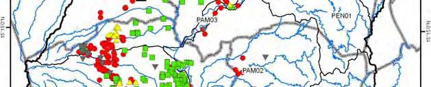
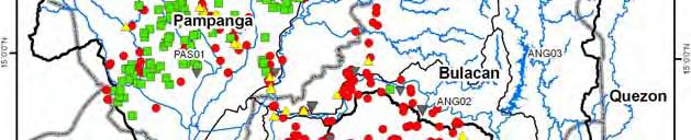
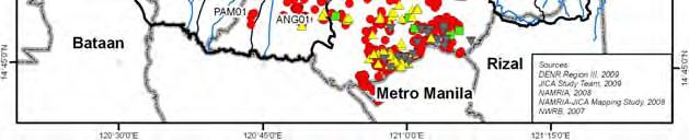
87 Annex-F H Location of Water Permits for Groundwater HF-2
88 Angat storage dam Effective storage volume = 850MCM Angat Inflow 1) Self-catchment Qin=59.3m 3 /s (1,869MCM/y) (observed average in ) 2) Umiray trans-basin Qin=11.7m 3 /s(370mcm/y) (observed average in , ) ANG0203 Catchment of Angat storage dam A=546km 2 Umiray R. Intake3-Sumag R. (not yet completed) Intake2-Alia R. (not yet completed) Main tunnel Intake1-Umiray R. To Bustos dam ANG03 A 3 T_UMI03 T_UMI02 A 2 Angat R. A 1 To MWSS Ipo dam ANG0204 T_UMI01 Catchment of diversion point of Umiray trans-basin A=161km 2 A 1=130km 2 A 2=6km 2 A 3=25km 2 W N E S 0 5 km Angat dam Surcharge volume EL 219m (V eff =894MCM) Flood control volume 42MCM EL 210m (Wet season) (V eff =696MCM) Conservation volume 490MCM (Domestic & Irrigation & Power) 156MCM EL 180m (lower limit of operation of main power unit) (Veff=206MCM) EL 212m (Dry season) (V eff =738MCM) 532MCM 206MCM EL 160m (Veff=0MCM) H=131m Supplied either by main turbine or through Ipo dam Supplied only through Ipo dam Dead volume Annex-F H Location and Dimension of Angat Storage Dam HF-3
89 Catchment of diversion point of Casecnan trans-basin A=570km 2 Abaca Casecnan R. CH0104 Catchment of Pantabangan storage dam + Masiway dam A=869km 2 Pantabangan storage dam Effective storage volume = 2,775MCM PAN01 T_CAS Denip Pantabangan Inflow 1) Self-catchment +Aurola trans-basin Qin=38.4m 3 /s (1,195MCM/y) (observed average in ) 2) Casecnan trans-basin Qin=23.8m 3 /s(752mcm/y) (observed average in ) N Masiway dam PAM0503 Catchment of diversion point of Aurola trans-basin A=68km 2 T_AUR W Aurola trans-basin channel S E 0 5 km PAM0502 Diayo Canili Aguang R. Pampanga R. PAM0501 Rizal dam To Bongabon dam Pantabangan dam Surcharge volume EL 230m (V eff =2,775MCM) 688MCM Flood control volume 330MCM EL 216m (Wet season) EL 221m (Dry season) (V eff =2,087MCM) (V eff =1,757MCM) Conservation volume (Irrigation & Power) 1,757MCM 2,087MCM H=107m EL 170m (Veff=0MCM) Dead volume (225MCM) Annex-F H Location and Dimension of Pantabangan Storage Dam HF-4

90 Annex-F H Location of Identified Possible Large Storage Dam Sites HF-5

91 Annex-F H Location of Proposed Large Storage Dam Sites HF-6
Distribution of Elevation Zones in the Study Area ANF-2-1
 Annex-Figures Annex-F 2.1.1 Distribution of Elevation Zones in the Study Area ANF-2-1 Annex-F 2.1.2 Distribution of Slope Category in the Study Area ANF-2-2 Annex-F 2.2.1 Principal Sub-basins in the Study
Institutional Challenges, Scientific Opportunities
 Managing Urban Climate Risks: Institutional Challenges, Scientific Opportunities Shiv Someshwar and Esther Conrad IRI/Earth Institute, Columbia University Mihir Bhatt All India Disaster Mitigation Institute,
Application of a Basin Scale Hydrological Model for Characterizing flow and Drought Trend
 Application of a Basin Scale Hydrological Model for Characterizing flow and Drought Trend 20 July 2012 International SWAT conference, Delhi INDIA TIPAPORN HOMDEE 1 Ph.D candidate Prof. KOBKIAT PONGPUT
Summary of Preparatory Study for Development Study (M/P)
") Summary of Preparatory Study for Development Study (M/P) 1. Title of the Cooperation Project The Study on Integrated Water Resources Management for Poverty Alleviation and Economic Development in the Pampanga
Summary of Preparatory Study for Development Study (M/P) 1. Title of the Cooperation Project The Study on Integrated Water Resources Management for Poverty Alleviation and Economic Development in the Pampanga
WATER RESOURCES IN THE PHILIPPINES: Status, Challenges and Opportunities
 WATER RESOURCES IN THE PHILIPPINES: Status, Challenges and Opportunities SCPW Joy Nostalgia Hotel Manila March 20, 2019 DR. SEVILLO D. DAVID, JR., Executive Director ENGR. SUSAN P. ABAÑO, OIC, Policy and
Inside of forest (for example) Research Flow
 Research Flow") Study on Relationship between Watershed Hydrology and Lake Water Environment by the Soil and Water Assessment Tool (SWAT) Shimane University Hiroaki SOMURA Watershed degradation + Global warming Background
Study on Relationship between Watershed Hydrology and Lake Water Environment by the Soil and Water Assessment Tool (SWAT) Shimane University Hiroaki SOMURA Watershed degradation + Global warming Background
RESERVOIR HYDROLOGIC ROUTING FOR WATER BALANCE OF AL-BURULLUS WETLAND, EGYPT
 RESERVOIR HYDROLOGIC ROUTING FOR WATER BALANCE OF AL-BURULLUS WETLAND, EGYPT Ibrahim Abdelmagid El-Shinnawy Associate Prof., Environment and Climate Research Institute (ECRI) National Water Research Center
Annex C. Hydrological Investigation
 Annex C Hydrological Investigation Annex C hydrological invesigation Annex C HYDROLOGICAL INVESTIGATION Table of Contents Page C1 C2 C3 C4 Hydrological Investigation Carried out in the Feasibility Study
Agricultural Production Forecasting Using Planning Distribution Model (PDM):A Case Study of the Nam Oon Project
:A Case Study of the Nam Oon Project") Kasetsart J. (Nat. Sci.) 35 : 344-353 (2001) Agricultural Production Forecasting Using Planning Distribution Model (PDM):A Case Study of the Nam Oon Project Preeyaphorn Kosa and Kobkiat Pongput ABSTRACT
Kasetsart J. (Nat. Sci.) 35 : 344-353 (2001) Agricultural Production Forecasting Using Planning Distribution Model (PDM):A Case Study of the Nam Oon Project Preeyaphorn Kosa and Kobkiat Pongput ABSTRACT
CENTRAL ASSINIBOINE INTEGRATED WATERSHED MANAGEMENT PLAN SURFACE WATER HYDROLOGY REPORT
 CENTRAL ASSINIBOINE INTEGRATED WATERSHED MANAGEMENT PLAN SURFACE WATER HYDROLOGY REPORT Planning Area Boundary: The Central Assiniboine planning area covers the reach of the Assiniboine River from just
Section V: Water Accounting and Water Supply Reliability
 Section V: Accounting and Supply Reliability A. Quantifying the Supplier s Supplies 1. Agricultural Supplier Quantities Table 38 shows typical water diversions from the CA Aqueduct during the representative
Englishman River Program Status Update Prepared For: Drinking Water and Watershed Protection Technical Advisory Committee February 14, 2012
 Englishman River Program Status Update Prepared For: Drinking Water and Watershed Protection Technical Advisory Committee February 14, 2012 Prepared By: Mike Squire, AScT AWS / ERWS Program Manager Program
Intro to sustainable hydropower and environmental flows
 Environmental Flows Workshop Ankara 21 November 2013 Intro to sustainable hydropower and environmental flows Key Issues, intro to methods Dr. Jian-hua Meng, WWF International Environmental Flows Workshop
July 31, 2012
 www.knightpiesold.com July 31, 212 Mr. Scott Jones Vice President Engineering Taseko Mines Limited 15th Floor, 14 West Georgia Street Vancouver, BC V6E 4H8 File No.:VA11-266/25-A.1 Cont. No.:VA12-743 Dear
Section V: Water Accounting and Water Supply Reliability
 Section V: Water Accounting and Water Reliability A. Quantifying the Water Supplier s Water Supplies 1. Agricultural Water Supplier Water Quantities Table 41 shows typical water diversions from the CA
A Case Study on Integrated Urban Water Modelling using Aquacycle NTUA, 2007
 A Case Study on Integrated Urban Water Modelling using Aquacycle NTUA, 2007 Contents Motivation Input Data Requirements Case Study - Greater Athens Area Model calibration and validation Formulation and
Mekong Climate Change and Adaptation Initiative and the Mekong River Commission
 The real threat: climate change impacts in Lower Mekong Basin Mekong Climate Change and Adaptation Initiative and the Mekong River Commission By Jeremy Bird Chief Executive Officer Mekong River Commission
Assessment of impacts of climate change on runoff: River Nzoia catchment, Kenya. Githui F. W, Bauwens W. and Mutua F.
 Assessment of impacts of climate change on runoff: River Nzoia catchment, Kenya by Githui F. W, Bauwens W. and Mutua F. Objective To investigate the impact of climate change on runoff of Nzoia river catchment
Reservoirs performances under climate variability: a case study
 526 Evolving Water Resources Systems: Understanding, Predicting and Managing Water Society Interactions Proceedings of ICWRS24, Bologna, Italy, June 24 (IAHS Publ. 364, 24). Reservoirs performances under
Lecture 9A: Drainage Basins
 GEOG415 Lecture 9A: Drainage Basins 9-1 Drainage basin (watershed, catchment) -Drains surfacewater to a common outlet Drainage divide - how is it defined? Scale effects? - Represents a hydrologic cycle
21 st Century Management Solutions for Water Supply and Demand
 21 st Century Management Solutions for Water Supply and Demand AWRA Annual Conference November 9, 2017 Bill Szafranski Roger Wolvington Abstract Water supply planning in the Western US is critical for
Understanding potential conflicts among sectors due spatial and seasonal water use and availability in Bali, Indonesia
 UNESCO-JASTIP Joint Symposium on Intra-Regional Water Security and Disaster Management 15-16 November 2017, Quezon City, Philippines Understanding potential conflicts among sectors due spatial and seasonal
Water Availability and Use Science Program. WestFAST September 24, 2015
 Water Availability and Use Science Program WestFAST September 24, 2015 WAUSP Objective To place technical information and tools in the hands of stakeholders, allowing them to answer questions they face
Section V: Water Accounting and Water Supply Reliability
 Section V: Accounting and Supply Reliability A. Quantifying the Supplier s Supplies 1. Agricultural Supplier Quantities Table 46 illustrate the District s water. The District routinely transfers and/or
From Upstream to Downstream:
 From Upstream to Downstream: Integrating Climate Change Considerations into Basin Wide Planning for the Mekong River Jeremy Bird Chief Executive Officer Mekong River Commission 1 Outline Basin context
GCI Survey---Lake Winnipeg Watershed
 IISD-GWSP Conference. Winnipeg May 1-4, 2012 Water-Energy-Food Nexus GCI Survey---Lake Winnipeg Watershed A. A. WARKENTIN Hydrometeorologist GCI Survey Lake Winnipeg Watershed PRESENTATION OUTLINE WATERSHED
CALSIM II Sacramento River Basin Hydrology Enhancements
 CALSIM II Sacramento River Basin Hydrology Enhancements Andy Draper Walter Bourez - Montgomery Watson Harza - MBK Engineers February 26, 2004 Current representation Problems Solutions Work completed Possible
olumbia River Treaty The Columbia by Steve Oliver, Vice President, Generation Asset Management, Bonneville Power Administration 16 Oct
 The Columbia by Steve Oliver, Vice President, Generation Asset Management, Bonneville Power Administration 16 Oct 2006 1 Presentation Outline Geography of the Pacific Northwest Bonneville Power Administration
Conjunctive management of surface and groundwater under severe drought: A case study in southern Iran
 Conjunctive management of surface and groundwater under severe drought: A case study in southern Iran Davoodreza Arab, Hamid Sohrabi, Milad Hooshyar, and Aliasghar Elyasi * * Corresponding author, water
Irrigation modeling in Prairie Ronde Township, Kalamazoo County. SW Michigan Water Resources Council meeting May 15, 2012
 Irrigation modeling in Prairie Ronde Township, Kalamazoo County SW Michigan Water Resources Council meeting May 15, 2012 Development of a Groundwater Flow Model INFLOWS Areal recharge from precipitation
Hydrology and Water Management. Dr. Mujahid Khan, UET Peshawar
 Hydrology and Water Management Dr. Mujahid Khan, UET Peshawar Course Outline Hydrologic Cycle and its Processes Water Balance Approach Estimation and Analysis of Precipitation Data Infiltration and Runoff
Management of Water Resources in Cyprus
 Management of Water Resources in Cyprus CHARLES DEMETRIOU Hydrologist Water Development Department Ministry of Agriculture, Natural Resources & Environment 9 July, 2012 OUTLINE Mission of the Water Development
An Investigation into the 2012 drought on Apalachicola River. Steve Leitman, Bill Pine and Greg Kiker
 An Investigation into the 2012 drought on Apalachicola River Steve Leitman, Bill Pine and Greg Kiker Apalachicola-Chattahoochee-Flint (ACF) River basin 20,400 sq. mi. One of the most actively disputed
Susan P. Abano Engineer IV Policy and Program Division
 National Water Resources Board Integrated Water Resources Management Susan P. Abano Engineer IV Policy and Program Division National Water Resources Board Outline Philippines Water Resources Situationer
GSP Coordinating Committee
 GSP Coordinating Committee Coordinating Committee Meeting August 27, 2018 Merced Irrigation-Urban GSA Merced Subbasin GSA Turner Island Water District GSA-1 Agenda 1. Call to Order 2. Approval of Minutes
John H. Kerr Dam and Reservoir Virginia and North Carolina (Section 216)
") John H. Kerr Dam and Reservoir Virginia and North Carolina (Section 216) Wilmington District, Corps of Engineers Stakeholder Update Presentation January 24, 2014 Authorized under Section 216 of Public
John H. Kerr Dam and Reservoir Virginia and North Carolina (Section 216) Wilmington District, Corps of Engineers Stakeholder Update Presentation January 24, 2014 Authorized under Section 216 of Public
National Water Resources Master Plan 2013 Executive Summary
 Federal Ministry of Water Resources (FMWR) Japan International Cooperation Agency (JICA) The Project for Review and Update of Volume 1 National Water Resources Master Plan 2013 Executive Summary Rural
Wetland Water Balance Linking hydrogeological processes to ecological effect
 Wetland Water Balance Linking hydrogeological processes to ecological effect Don Ross & David Gasca Outline Background Wetland-scale processes Water balance approach Hydrogeological inputs & ecological
Development of Semenyih Dam Storage Prediction Model
 Development of Semenyih Dam Storage Prediction Model Yong Siew Fang 1 & Yuhainis Kamardin 2 1, 2 G&P Water & Maritime Sdn Bhd Introduction Semenyih Dam is a regulating storage system to regulate the river
July, International SWAT Conference & Workshops
 Analysis of the impact of water conservation measures on the hydrological response of a medium-sized watershed July, 212 212 International SWAT Conference & Workshops ANALYSIS OF THE IMPACT OF WATER CONSERVATION
Impact of snow melt on the hydrologic and water resources systems, Lebanon
 Snow cover dynamics and snow hydrology of the Lebanese Mountain Chains Using an integrated remote sensing and hydrologic modeling approach Impact of snow melt on the hydrologic and water resources systems,
river modelling keeping low flows in mind
 Incorporating surfacegroundwater interactions into river modelling keeping low flows in mind David Rassam 11 February 2013 CSIRO LAND WATER; WATER FOR A HEALTHY COUNTRY FLAGSHIP Outline of presentation
Water Resources. Inland freshwater (rivers, lakes, and groundwater) Marine (bay, coastal, and oceanic waters) Rainwater
 Marine (bay, coastal, and oceanic waters) Rainwater") Water Resources Inland freshwater (rivers, lakes, and groundwater) Marine (bay, coastal, and oceanic waters) Rainwater The country is endowed with abundant water resources. It experiences an average annual
Water Resources Inland freshwater (rivers, lakes, and groundwater) Marine (bay, coastal, and oceanic waters) Rainwater The country is endowed with abundant water resources. It experiences an average annual
Mekong Climate Change and Adaptation Initiative of the Mekong River Commission
 Mekong Climate Change and Adaptation Initiative of the Mekong River Commission H. E. Mr. Kol Vathana Mekong River Commission; Deputy Secretary General Cambodia National Mekong Committee Mekong is one of
NAP-GSP REGIONAL TRAINING WORKSHOP FOR ASIA Mainstreaming Climate Change Adaptation into Water Resources Seoul, September 2017
 NAP-GSP REGIONAL TRAINING WORKSHOP FOR ASIA Mainstreaming Climate Change Adaptation into Water Resources Seoul, 13-16 September 2017 Session 2 Climate and hydrological Information and Services Hydrological
BAEN 673 / February 18, 2016 Hydrologic Processes
 BAEN 673 / February 18, 2016 Hydrologic Processes Assignment: HW#7 Next class lecture in AEPM 104 Today s topics SWAT exercise #2 The SWAT model review paper Hydrologic processes The Hydrologic Processes
Reservoir on the Rio Boba
 Reservoir on the Rio Boba Michael J. Burns II Guillermo Bustamante J. James Peterson Executive Summary The National Institute of Water Resources in the Dominican Republic (INDRHI) plans to construct a
Climate change impacts on water resources in the Upper Po basin
 limate change impacts on water resources in the Upper Po basin Giovanni Ravazzani, Marco Mancini, hiara orbari, Alessandro eppi, Laura Boscarello, Giulia Ercolani Department of ivil and Environmental Engineering
ewater Source Australia s National Hydrological Modelling Platform
 ewater Source Australia s National Hydrological Modelling Platform Guiding Principles for Modelling Adaptive Complexity. Matching models, data and outcomes (e.g. as study becomes more complex, use more
San Antonio Water System Mitchell Lake Constructed Wetlands Below the Dam Preliminary Hydrologic Analysis
 San Antonio Water System enhancement. This recommendation was based on limited water quality data provided by SAWS and using a free-water surface constructed wetland with approximately 112 acres of wetted
Watershed Management Area Recommendations for NJ Water Policy
 Watershed Management Area Recommendations for NJ Water Policy Presenters: William Kibler, Director of Policy, Raritan Headwaters Association Bob Kecskes, Freelance Environmental Consultant, retired NJDEP
What we are looking for through utilizing the global earth observation. 14 January 2012 Japan International Cooperation Agency (JICA) Yusuke AMANO
 Yusuke AMANO") What we are looking for through utilizing the global earth observation 14 January 2012 Japan International Cooperation Agency (JICA) Yusuke AMANO 1 Outline To clarify what sort of data are to be monitored
What we are looking for through utilizing the global earth observation 14 January 2012 Japan International Cooperation Agency (JICA) Yusuke AMANO 1 Outline To clarify what sort of data are to be monitored
Hydrological Modelling of Narmada basin in Central India using Soil and Water Assessment Tool (SWAT)
") Hydrological Modelling of Narmada basin in Central India using Soil and Water Assessment Tool (SWAT) T. Thomas, N. C. Ghosh, K. P. Sudheer National Institute of Hydrology, Roorkee (A Govt. of India Society
Hydrological Modelling of Narmada basin in Central India using Soil and Water Assessment Tool (SWAT) T. Thomas, N. C. Ghosh, K. P. Sudheer National Institute of Hydrology, Roorkee (A Govt. of India Society
Hydrology Overview of Lake Taupo and the Waikato River as it relates to the Waikato Hydro Scheme (WHS) (Ohakuri Site Visit)
 (Ohakuri Site Visit)") Hydrology Overview of Lake Taupo and the Waikato River as it relates to the Waikato Hydro Scheme (WHS) (Ohakuri Site Visit) Lake Taupo From 1905 to 1941 Lake Taupo was an unmanaged natural Lake. With the
Hydrology Overview of Lake Taupo and the Waikato River as it relates to the Waikato Hydro Scheme (WHS) (Ohakuri Site Visit) Lake Taupo From 1905 to 1941 Lake Taupo was an unmanaged natural Lake. With the
Climate Variability and Climate Change Seeking the Meaning for Water Resources Management. Neil Ward
 Climate Variability and Climate Change Seeking the Meaning for Water Resources Management Neil Ward International Research Institute for Climate and Society (IRI), The Earth Institute at Columbia University,
MRC's role in relation to planning and implementation of mainstream dams and its strategic assessment framework
 MRC's role in relation to planning and implementation of mainstream dams and its strategic assessment framework Jeremy Bird, Chief Executive Officer MRC Secretariat 1 Average flow in Kratie 1960-2004 Flow
GSP Development Update
 GSP Development Update Merced Irrigation-Urban GSA Merced Irrigation District Turner Island Water District GSA Joint Board of Directors Meeting December 4, 2018 Agenda 1. GSP Development Overview 2. Water
AGRAR. Augmenting Groundwater Resources by Artificial Recharge. ICARDA, Aleppo, Syria nd November 2006
 AGRAR Augmenting Groundwater Resources by Artificial Recharge UNESCO G-WADI MEETING ON WATER HARVESTING ICARDA, Aleppo, Syria 20 22 nd November 2006 Project objectives BGS approached by DFID in 2000 to
NBI strategic water resources analysis Phase I findings
 NBI strategic water resources analysis Phase I findings Abdulkarim H Seid NBI Secretariat The NBI Strategic Water Resources Analysis Key question: how to meet demands for water, food and energy upstream
IWRM And Water Planning in Gurara River Basin Engr. Abdul-Qadir D. Aliyu
 IWRM And Water Planning in Gurara River Basin Engr. Abdul-Qadir D. Aliyu National Water Resources Institute, Kaduna Nigeria. Outline Introduction IWRM Water Planning and Allocation Background Study Area
Groundwater Governance in the Zhengzhou region, China
 Groundwater Governance in the Zhengzhou region, China Menggui JIN School of Environmental Studies China University of Geosciences Wuhan, Hubei 430074, China Email: mgjin@cug.edu.cn 1 Background of Zhengzhou
NC Water Resources Planning April 4, Tom Fransen. North Carolina Division of Water Resources 1
 NC Water Resources Planning April 4, 2011 Tom Fransen North Carolina Division of Water Resources 1 Water links us to our neighbor in a way more profound and complex than any other. -John Thorson 1/18/2011
Hydrological And Water Quality Modeling For Alternative Scenarios In A Semi-arid Catchment
 Hydrological And Water Quality Modeling For Alternative Scenarios In A Semi-arid Catchment AZIZ ABOUABDILLAH, ANTONIO LO PORTO METIER Final Conference: Brussels, Belgium-4-6 November 2009 Outline Problem
WASA Quiz Review. Chapter 2
 WASA Quiz Review Chapter 2 Question#1 What is surface runoff? part of the water cycle that flows over land as surface water instead of being absorbed into groundwater or evaporating Question #2 What are
1 THE USGS MODULAR MODELING SYSTEM MODEL OF THE UPPER COSUMNES RIVER
 1 THE USGS MODULAR MODELING SYSTEM MODEL OF THE UPPER COSUMNES RIVER 1.1 Introduction The Hydrologic Model of the Upper Cosumnes River Basin (HMCRB) under the USGS Modular Modeling System (MMS) uses a
Predicting Unmet Irrigation Demands due to Climate Change An integrated Approach in WEAP
 Predicting Unmet Irrigation Demands due to Climate Change An integrated Approach in WEAP Marc Haering Emad Al-Karablieh, Amer Salman University of Jordan G-Wadi International Session 5: Risks Assessment
Chapter 1 Introduction
 Engineering Hydrology Chapter 1 Introduction 2016-2017 Hydrologic Cycle Hydrologic Cycle Processes Processes Precipitation Atmospheric water Evaporation Infiltration Surface Runoff Land Surface Soil water
The Impact of Climate Change on a Humid, Equatorial Catchment in Uganda.
 The Impact of Climate Change on a Humid, Equatorial Catchment in Uganda. Lucinda Mileham, Dr Richard Taylor, Dr Martin Todd Department of Geography University College London Changing Climate Africa has
Distribution Restriction Statement Approved for public release; distribution is unlimited.
 CECW-EH-Y Regulation No. 1110-2-1464 Department of the Army U.S. Army Corps of Engineers Washington, DC 20314-1000 Engineering and Design HYDROLOGIC ANALYSIS OF WATERSHED RUNOFF Distribution Restriction
Water Resources in Korea
 Water Resources in Korea Average yearly precipitation: 1,245 mm (1.4 times higher than the world average) Per capita annual precipitation: 2,591 m³ (1/8 of the world average) 1.4 times higher than the
Lower Tuolumne River Water Temperature Modeling Final Study Plan
 Lower Final Study Plan Prepared for Turlock Irrigation District 333 East Canal Drive Turlock CA 95380 and Modesto Irrigation District 1231 11th St Modesto, CA 95354 Prepared by 2855 Telegraph Ave. Suite
Impact of Climate Change on Water Resources of a Semi-arid Basin- Jordan
 Impact of Climate Change on Water Resources of a Semi-arid Basin- Jordan Prof. Fayez Abdulla Civil Engineering Department Jordan University of Science & Technology Presented at the Water in an Arid Land,
DWR s Sustainable Groundwater Management Implementation Groundwater Sustainability Plan (GSP) & Alternative (Alt) Emergency Regulations
 & Alternative (Alt) Emergency Regulations") DWR s Sustainable Groundwater Management Groundwater Plan (GSP) & (Alt) Emergency Regulations Advisory Group Meetings December 17, 2015 1 Presentation Overview Background Regulation Considerations Next
DWR s Sustainable Groundwater Management Groundwater Plan (GSP) & (Alt) Emergency Regulations Advisory Group Meetings December 17, 2015 1 Presentation Overview Background Regulation Considerations Next
Jordan River TMDL Update
 Jordan River TMDL Update 2010 Watershed Symposium August 4 th, 2010 Hilary N. Arens Utah Division of Water Quality Jordan River TMDL Outline What is a TMDL and what is the Jordan impaired for? Evaluation
SUPPORTING REPORT E. Integrated River Basin Analysis Model
 SUPPORTING REPORT E Integrated River Basin Analysis Model Table of Contents Table of Contents... i List of Tables... ii List of Figures... ii List of Annexes... xi E INTEGRATED RIVER BASIN ANALYSIS MODEL...
Solutions towards hydrological challenges in Africa in support of hydropower developments Ms. Catherine Blersch, Civil Engineer, Aurecon, South
 Solutions towards hydrological challenges in Africa in support of hydropower developments Ms. Catherine Blersch, Civil Engineer, Aurecon, South Africa Dr Verno Jonker, Civil Engineer, Aurecon, South Africa
Proposal for application of FHM in Lao PDR: Case of Nam Ngum River Basin
 Proposal for application of FHM in Lao PDR: Case of Nam Ngum River Basin I. Nam Ngum River and Its Basin Nam Ngum River Basin is of vital importance to the Lao PDR, it is considered as the food house of
CHAPTER FIVE Runoff. Engineering Hydrology (ECIV 4323) Instructors: Dr. Yunes Mogheir Dr. Ramadan Al Khatib. Overland flow interflow
 Instructors: Dr. Yunes Mogheir Dr. Ramadan Al Khatib. Overland flow interflow") Engineering Hydrology (ECIV 4323) CHAPTER FIVE Runoff Instructors: Dr. Yunes Mogheir Dr. Ramadan Al Khatib Overland flow interflow Base flow Saturated overland flow ١ ٢ 5.1 Introduction To Runoff Runoff
Engineering Hydrology (ECIV 4323) CHAPTER FIVE Runoff Instructors: Dr. Yunes Mogheir Dr. Ramadan Al Khatib Overland flow interflow Base flow Saturated overland flow ١ ٢ 5.1 Introduction To Runoff Runoff
Water Resources on PEI: an overview and brief discussion of challenges
 Water Resources on PEI: an overview and brief discussion of challenges Components: Components and links Atmospheric water Surface water (including glacial water) Groundwater Links: Precipitation (atm(
ICELANDIC RIVER / WASHOW BAY CREEK INTEGRATED WATERSHED MANAGEMENT PLAN STATE OF THE WATERSHED REPORT CONTRIBUTION SURFACE WATER HYDROLOGY REPORT
 ICELANDIC RIVER / WASHOW BAY CREEK INTEGRATED WATERSHED MANAGEMENT PLAN STATE OF THE WATERSHED REPORT CONTRIBUTION SURFACE WATER HYDROLOGY REPORT Disclaimer: The hydrologic conditions presented in this
Effect of Conjunctive Use of Water for Paddy Field Irrigation on Groundwater Budget in an Alluvial Fan ABSTRACT
 1 Effect of Conjunctive Use of Water for Paddy Field Irrigation on Groundwater Budget in an Alluvial Fan Ali M. Elhassan (1), A. Goto (2), M. Mizutani (2) (1) New Mexico Interstate Stream Commission, P.
An Introduction to Environmental Flows
 An Introduction to Environmental Flows The natural flow regime Flow alteration Environmental flows defined Scaling up Eloise Kendy, Ph.D. IUCN workshop Kathmandu, Nepal 5 August 2011 Jefferson River, Montana
Hydrology in Western Colorado: Planning for Resilience
 Hydrology in Western Colorado: Planning for Resilience 2016 Water Course February 18, 2016 Dr. Gigi A. Richard Director, Hutchins Water Center at CMU Professor, Geology Coordinator, Civil Engineering Partnership
CE394K GIS IN WATER RESOURCES TERM PROJECT REPORT
 CE394K GIS IN WATER RESOURCES TERM PROJECT REPORT WATER BALANCE FOR THE LOWER COLORADO RIVER AUTHORITY: AN INVESTIGATION INTO THE ROLE OF MUNICIPAL WATER DEMAND BRUK BERHANU ENVIRONMENTAL AND WATER RESOURCES
EVALUATION OF HYDROLOGIC AND WATER RESOURCES RESPONSE TO METEOROLOGICAL DROUGHT IN THESSALY, GREECE
 EVALUATION OF HYDROLOGIC AND WATER RESOURCES RESPONSE TO METEOROLOGICAL DROUGHT IN THESSALY, GREECE A. LOUKAS*, AND L. VASILIADES Laboratory of Hydrology and Water Systems Analysis,, Volos, Greece *E-mail:
Evaluation of Sustainable Water Demand in a Coastal Environment using WEAP Model
 Proceedings of the Environmental Management Conference,, Nigeria, 2011 Evaluation of Sustainable Water Demand in a Coastal Environment using WEAP Model Ojekunle Z. O. 1*, Ojo K. O. 1, Idowu O. A. 1, Martins
Rainwater Management. Dr. Iftikhar Ahmad. College of Earth and. University of The Punjab Lahore
 Rainwater Management in Major Cities of Punjab Dr. Iftikhar Ahmad College of Earth and Environmental Sciences. University of The Punjab Lahore Need For Rainfall Harvesting in Urban Areas of Punjab Groundwater
List of Appendices APPENDIX A: WY 2000 LAKE MICHIGAN DIVERSION ACCOUNTING REPORT APPENDIX B: WY 2001 LAKE MICHIGAN DIVERSION ACCOUNTING REPORT
 EXECUTIVE SUMMARY This document is the Water Year (WY) 2000 Annual Report of the Chicago District, U. S. Army Corps of Engineers activities in the monitoring and review of the accounting of Lake Michigan
Climate change Adriatic coast Emilia- Romagna (Italy): wet and dry seasons more distinct.
: wet and dry seasons more distinct.") DISCONTINUOUS RECHARGE OF FRESH WATER LENSES ALONG THE ADRIATIC COAST, ITALY Pauline Mollema and Marco Antonellini, University of Bologna (Italy) Gualbert Oude Essink, Deltares (Netherlands) Climate change
DISCONTINUOUS RECHARGE OF FRESH WATER LENSES ALONG THE ADRIATIC COAST, ITALY Pauline Mollema and Marco Antonellini, University of Bologna (Italy) Gualbert Oude Essink, Deltares (Netherlands) Climate change
global science solutions
 global science solutions Tim Martin: Riverside Technology, inc. Fort Collins, Colorado, USA 2.4: Water Security Information and Tools to Support Global Water Security International Symposium on Synergistic
Nam Sebangfay. Name: Sebangfay Serial No.: Lao 5 Location: Khammouane Province N 17 o E 105 o Basin Area: km 2
 Nam Sebangfay Map of River Table of Basic Data Name: Sebangfay Serial No.: Lao 5 Location: Khammouane Province N 17 o 29 48 E 105 o 25 42 Basin Area: 8 560 km 2 Length of the main stream: 190 km Origin:
Ex-Post Evaluation of Japanese ODA Loan Central Luzon Irrigation Project
 The Republic of the Philippines Ex-Post Evaluation of Japanese ODA Loan Central Luzon Irrigation Project External Evaluator: Haruko Awano, IC Net Limited 0. Summary This project was conducted to increase
ANNUAL PLATTE RIVER SURFACE WATER FLOW SUMMARY
 ANNUAL PLATTE RIVER SURFACE WATER FLOW SUMMARY 4/3/213 Platte River Recovery Implementation Program 213 ANNUAL SURFACE WATER FLOW SUMMARY DRAFT Prepared by staff of the Platte River Recovery Implementation
CHAPTER ONE : INTRODUCTION
 CHAPTER ONE : INTRODUCTION WHAT IS THE HYDROLOGY? The Hydrology means the science of water. It is the science that deals with the occurrence, circulation and distribution of water of the earth and earth
AGENDA DATE: November 14, 2018
 ALAMEDA COUNTY FLOOD CONTROL AND WATER CONSERVATION DISTRICT, ZONE 7 100 NORTH CANYONS PARKWAY, LIVERMORE, CA 94551 PHONE (925) 454-5000 FAX (925) 454-5727 ORIGINATING SECTION: INTEGRATED PLANNING CONTACT:
Participating States A.P. Chhattisgarh. M.P. Maharashtra Karnataka Kerala Orissa Tamil Nadu
 for Integrated Water Resources Development & Management Workshop Integrated Water Resources Management Applications Defining i Scope Under Hydrology Project, Phase-III June 18, 2014 Participating Central
Water Supply Reallocation Workshop
 Water Supply Reallocation Workshop Determining Yield and Storage Requirement June 2, 2009 Tulsa, OK James Hathorn, Jr Redistribution of Water The function of a reservoir system is to redistribute the natural
Water planning and climate change: actionable intelligence yet?
 Water planning and climate change: actionable intelligence yet? Christopher Milly, USGS U.S. Department of the Interior U.S. Geological Survey What is Actionable Intelligence? Information about water in
Establishing Environmental Flows for California Streams. Eric Stein Southern California Coastal Water Research Project
 Establishing Environmental Flows for California Streams Eric Stein Southern California Coastal Water Research Project What Do We Know About the Status of Flows Statewide? First comprehensive study recently
Rashid Ali Khan, FAO (Ret.) Gurgaon, Haryana
 Gurgaon, Haryana") Sustainability and Water Conservation mentioned in the draft strategic plan of DDWS was not provided adequate coverage, though important for improving the supply. In view of the unpredictable rainfall,
Sustainability and Water Conservation mentioned in the draft strategic plan of DDWS was not provided adequate coverage, though important for improving the supply. In view of the unpredictable rainfall,