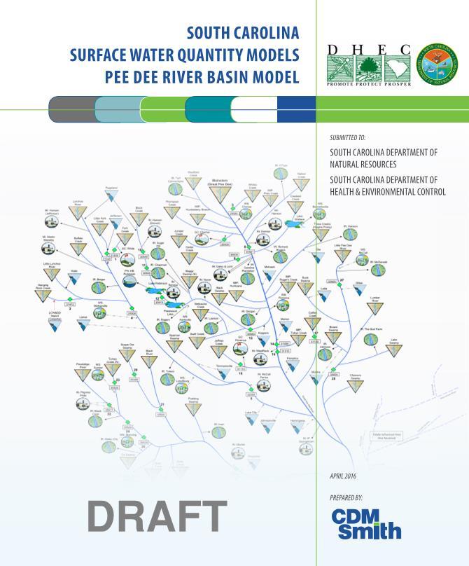
South Carolina Surface Water Quantity Modeling Project
|
|
|
- Evangeline Kelley
- 5 years ago
- Views:
Transcription

1 South Carolina Surface Water Quantity Modeling Project Kirk Westphal, PE Pee Dee Basin Meeting No. 2 Introduction to the Draft Model May 2, 2016 John Boyer, PE, BCEE Tim Cox, Ph.D., PE
2 Presentation Outline Project Background and Status Model Calibration/Verification Calibration/Verification Philosophy and Approach Calibration Results and Discussion Overview and Demonstration of Pee Dee Basin Model
3 Project Purpose Build surface water quantity models capable of: Accounting for inflows and outflows from a basin Accurately simulating streamflows and reservoir levels over the historical inflow record Conducting What if scenarios to evaluate future water demands, management strategies and system performance.
4 The Simplified Water Allocation Model is A water accounting tool Calculates physically and legally available water Traces water through a natural stream network, simulating withdrawals, discharges, storage, and hydroelectric operations Not a precipitation-runoff model (e.g., HEC-HMS) Not a hydraulic model (e.g. HEC-RAS) Not a water quality model (e.g., QUAL2K) Not an optimization model Not a groundwater flow model (e.g., MODFLOW)

5 Task 2 Task 1 Project Status Pee Dee Basin Data Collection - Streamflow, M&I and ag withdrawals, discharges, precipitation, reservoir operations, interconnections, facility operation dates, etc. Stakeholder Input Data Analysis - Gap filling and record extension Unimpaired Flow Development - Daily mean UIFs Basin Schematic - Model framework development Model Calibration - Reproduce actual conditions Baseline Model - Simulate current conditions Stakeholder Input Meeting #1 Stakeholder Input Meeting #2
6 Overall Project Status Saluda Edisto Broad Pee Dee Catawba-Wat. Santee Savannah Salkehatchie 1. Data Collection, Organization and Analysis 2. Model Framework Development 3. Unimpaired Flow Development 4. Model Development and Calibration 5. Baseline Model Development and Documentation 6. Training
7 Calibration Model Calibration vs. Baseline Model Purpose: Confirm models ability to accurately simulate river basin flows and storage amounts Uses recent withdrawal, discharge and flow records Baseline Model Purpose: Evaluate water availability under future conditions Uses entire record of flow and most current withdrawals and discharges
8 Pee Dee Basin SWAM Framework


9 Modeling Report and Other Documents
10 Pee Dee River Basin MODEL CALIBRATION/VERIFICATION
11 Calibration Objectives 1. Extend hydrologic inputs (headwater UIFs) spatially to adequately represent entire basin hydrology by parameterizing reach hydrologic inputs 2. Refine initial parameter estimates, as appropriate E.g. reservoir operating rules, %Consumptive Use assumptions, return flow locations 3. Gain confidence in the model as a predictive tool by demonstrating its ability to adequately replicate past hydrologic conditions, operations, and water use without being overly prescriptive
12 Potential Sources of Model Error and Uncertainty Gaged flow data (± 20%) Gaged reservoir levels (±?%) Basin climate and hydrologic variability Reported withdrawal data Consumptive use percentages Return flow locations (outdoor use) Return flow lag times (if applicable, e.g. outdoor use) Reservoir operations (operator decision making) Reach hydrology: gains, losses, local runoff and inflow
13 Calibration/Validation General Approach hindcast period; monthly timestep Includes droughts in both early and late 2000 s Comparison to gaged (measured) flow data only operations and impairments are implicit in that data Assess performance at (subject to gage data availability): multiple mainstem locations all tributary confluence locations major reservoirs (where levels/storage are available) Multiple model performance metrics, including: timeseries plots (monthly and daily variability) annual and monthly means (water balance and seasonality) percentile plots (extremes and frequency)
14 Calibration/Validation Locations
15 Pee Dee River at Pee Dee USGS Gage
16 Monthly Flow Comparison
17 Annual Average Flow Comparison

18 Monthly Mean Flow Comparison
19 Monthly Flow Percentiles Comparison
20 Cumulative Flow Comparison

21 Daily Flow Comparison
22 Annual 7 Day Low Flows 7Q10 Comparison GAGE ID-> MODEL ID-> PEE DEE RIVER AT PEE DEE GAGE PDE14 Modeled 993 Measured 1,189 % Diff. 16%
23 SWAM Calibration/Validation Summary For most sites, modeled mean flow values, averaged over the full period of record, are within within 1% of measured mean flows ID Station Modeled (cfs) Measured (cfs) % Difference Years to compare PDE41 CHINNERS SWAMP NEAR AYNOR % 6 PDE10 BLACK CREEK BELOW CHESTERFIELD % 9 PDE24.25 POCOTALIGO IVER NR SUMTER & MANNING % 4 PDE21 BLACK RIVER NEAR GABLE % 10 PDE05 LYNCHES RIVER AT EFFINGHAM % 31 PDE28 LITTLE PEE DEE AT GALIVANTS FERRY 2,553 2, % 31 PDE04 LYNCHES RIVER NEAR BISHOPVILLE % 12 PDE23 TURKEY CREEK (HWY 521) AT SUMTER % 3 PDE06 WHITES CREEK NEAR WALLACE % 13 PDE02 LITTLE FORK CREEK AT JEFFERSON % 16 PDE17 CATFISH CANAL AT SELLERS % 31 PDE13 BLACK CREEK NEAR QUINBY % 13 PDE26 BLACK RIVER AT KINGSTREE % 31 PDE11 BLACK CREEK NEAR MCBEE % 31 PDE20 SCAPE ORE SWAMP NEAR BISHOPVILLE % 21 PDE14 PEE DEE RIVER AT PEEDEE 9,097 9, % 31 PDE03 HANGING ROCK CREEK NR KERSHAW % 21 PDE12 BLACK CREEK NEAR HARTSVILLE % 31 PDE16 JEFFRIES CREEK ABOVE FLORENCE % 4 PDE08 PEE DEE RIVER NR BENNETTSVILLE 7,416 7, % 24 PDE15 PEE DEE RIVER BELOW PEE DEE 7,990 7, % 18 PDE22 POCOTALIGO RIVER AT SUMTER % 4 PDE01 FORK CREEK AT JEFFERSON % 15 >5% difference 5% or less diff. 1% or less difference 5% or less diff. >5% difference
24 SWAM Calibration/Validation Summary Monthly mean flows percentile deviations are all generally within 10-20% with no clear bias Modeled low flow values (as represented by 7Q10 flows) are within: 8% and 16% on the Great Pee Dee River; 2% to11% on Black Creek 15% to 33% on the Lynches River The model adequately hindcasts delivered water supply for each water user in the model (no significant shortfalls).
25 Pee Dee River Basin BASELINE MODEL AND USES
26 Baseline Model Will represent current demands and operations combined with an extended period of estimated hydrology Most demands reflect averages Estimated hydrology from 1929 to 2013 Inactive users are not included Users on tidally-influenced areas are not included The baseline model serves as the starting point for future predictive simulations
27 The Models Can Be Used To Determine surface water availability Predict where and when future water shortages would occur Test alternative water management strategies, new operating rules, and what-if scenarios Evaluate the impacts of future withdrawals on instream flow needs Evaluate interbasin transfers Support development of Drought Management Plans Compare managed flows to natural flows Consolidate hydrologic data


28 Example Use Adding a New User Add a new M&I permittee on the Lynches River Demand = 20 mgd Consumptive Use = 50% (return to Lynches River) Is there enough water to support the new user? Does the new withdrawal cause shortages for downstream users?

29 Add an Industrial Water User Object from the Palette
30 Add an Industrial Water User Object from the Palette

31 Add the New User in the Water User Dialogue

32 Specify Water Use

33 Specify Source and Withdrawal Location

34 Specify Source the Return Location

35 Run the Model Scenario

36 Build a Shortage Plot for the New User

37 Build a Shortage Plot for the New User

38 Build a Shortage Plot for the New User

39 Shortages are Also Listed in the Node Output Table

40 Reduce the New Users Total Water User to 10 mgd

41 Rerun the Model Scenario

42 Dynamic Shortage Plots Update Automatically

43 Check for Shortages for Downstream Users
44 Station 1 (Tim) Demonstrations and Q&A Evaluate an increase in Ag User demands Station 2 (John) Evaluate a proposed new municipal water supply withdrawal Station 3 (Kirk) Evaluate new industrial user and compare against instream flow requirements
45 Pee Dee River Basin THANK YOU
South Carolina Surface Water Quantity Modeling Project
 South Carolina Surface Water Quantity Modeling Project Kirk Westphal, PE John Boyer, PE, BCEE Broad Basin Meeting No. 2 Introduction to the Draft Model May 18, 2016 Presentation Outline Project Background
Update of the State Water Plan
 Update of the State Plan Groundwater Stakeholder Meeting North Charleston, S.C. November 28, 2017 Joe Gellici - Hydrologist Land, and Conservation Division S.C. Department of Natural Resources Overview
NC Water Resources Planning April 4, Tom Fransen. North Carolina Division of Water Resources 1
 NC Water Resources Planning April 4, 2011 Tom Fransen North Carolina Division of Water Resources 1 Water links us to our neighbor in a way more profound and complex than any other. -John Thorson 1/18/2011
Hydrologic Calibration:
 Hydrologic Calibration: UPDATE OF EFFECTIVE HYDROLOGY FOR MARYS CREEK October 2010 Agenda Background Hydrologic model Calibrated rainfall Hydrologic calibration 100 year discharges, Existing Conditions
AN ANALYTICAL APPROACH FOR EVALUATING THE INFUENCE OF UNCERTAINTY IN UNIMPAIRED FLOW DEVELOPMENT
 AN ANALYTICAL APPROACH FOR EVALUATING THE INFUENCE OF UNCERTAINTY IN UNIMPAIRED FLOW DEVELOPMENT Yi Zhang 1 and Owen McKeon 2 AUTHORS: 1 Basin Analysis Program, Environmental Protection Division, Georgia
The Commission Finds:
 CERTIFICATE AUTHORIZING THE CITIES OF CONCORD AND KANNAPOLIS TO TRANSFER WATER FROM THE CATAWBA RIVER AND YADKIN RIVER BASINS TO THE ROCKY RIVER BASIN UNDER THE PROVISIONS OF G.S. 143-215.22I In November
Water Supply Reallocation Workshop
 Water Supply Reallocation Workshop Determining Yield and Storage Requirement June 2, 2009 Tulsa, OK James Hathorn, Jr Redistribution of Water The function of a reservoir system is to redistribute the natural
Camp Far West Hydroelectric Project Relicensing
 Camp Far West Hydroelectric Project Relicensing Water Operations Model FERC Project No. 2997 July 16, 2018 Overview Project and South Sutter Water District overview Operations model Overview Model Updates
Bucks Creek Hydroelectric Project FERC Project No. 619
 PACIFIC GAS AND ELECTRIC COMPANY Bucks Creek Hydroelectric Project FERC Project No. 619 DRAFT Data for Study Plans WR-S3 and WR-S4 October 2015 PACIFIC GAS AND ELECTRIC COMPANY AND THE CITY OF SANTA CLARA
Hydrologic, Hydraulic, and Ecological Modeling Issues and Implementation for the Blind River Fresh Water Diversion Project
 Hydrologic, Hydraulic, and Ecological Modeling Issues and Implementation for the Blind River Fresh Water Diversion Project Restore America s Estuary Conference November 16, 2010 Michael Morgan, P.E. CFM
SECTION III: WATERSHED TECHNICAL ANALYSIS
 Trout Creek Watershed Stormwater Management Plan SECTION III: WATERSHED TECHNICAL ANALYSIS A. Watershed Modeling An initial step this study of the Trout Creek watershed was the selection of a stormwater
Unify efforts to address water resources for the Big Sky area and surrounding zone of influence in three co-equal water resources focus areas:
 EXECUTIVE SUMMARY The Big Sky Sustainable Water Solutions Forum (Water Forum) is a community-based, collaborative approach building a unified vision for future Big Sky water resources management to maintain
South Carolina Water Plan Update
 South Carolina Water Plan Update Ken Rentiers Deputy Director Land, Water and Conservation Division S.C. Department of Natural Resources South Carolina Water Plan Symposium Columbia, South Carolina May
Arkansas Basin Roundtable: Basin Implementation Plan Section 3:Basin Operations & Hydrologic Modeling
 Arkansas Basin Roundtable: Basin Implementation Plan Section 3:Basin Operations & Hydrologic Modeling March 12, 2014 Outline Project Tasks Basin Implementation Plan (Section 3) Basin Operations Report
Hood River Basin Study
 Hood River Basin Study Agenda 1). Goals 2). Partners 3). Study Overview 4). Recommendations Goals Evaluate: 1. Current and future water demands 2. Water conservation opportunities 3. Groundwater resources
Appendix C. Demonstration Model
 Appendix C Demonstration Model Connecticut River Partnership Demonstration hydrologic/dam operations models Overview The Nature Conservancy, together with partners, has identified an altered flow regime
Table ES1. Review of Pebble Limited Partnership s (PLP s) Environmental Baseline Document (EBD): Hydrologic characterization
 Environmental Baseline Document (EBD): Hydrologic characterization") Executive Summary Table ES1. Review of Pebble Limited Partnership s (PLP s) Environmental Baseline Document (EBD): Hydrologic characterization Basic issue Does PLP have sufficient hydrologic data and an
Executive Summary Table ES1. Review of Pebble Limited Partnership s (PLP s) Environmental Baseline Document (EBD): Hydrologic characterization Basic issue Does PLP have sufficient hydrologic data and an
Glades Reservoir Draft Environmental Impact Statement
 Glades Reservoir Draft Environmental Impact Statement Chapter 4 Environmental Consequences October 2015 4 ENVIRONMENTAL CONSEQUENCES 4.1 INTRODUCTION 4-1 4.1.1 Types and Definitions of Impacts 4-1 4.1.2
Draft Environmental Impact Statement Lake Ralph Hall Regional Water Supply Reservoir Project Volume II
 US Army Corps of Engineers Fort Worth District October 2018 Draft Environmental Impact Statement Lake Ralph Hall Regional Water Supply Reservoir Project Volume II Lake Ralph Hall Volume II- Appendices
Hood River Basin Study
 Hood River Basin Study Agenda 1). Goals 2). Partners 3). Study Overview 4). Recommendations Goals Evaluate: 1. Current and future water demands 2. Water conservation opportunities 3. Groundwater resources
Project Water Quality
 Project Water Quality Yadkin-Pee Dee Hydroelectric Project No. 2206 Water Resources Working Group May 7, 2003 Surveys of Existing Resources! Reservoirs (monthly sampling) " Lake Tillery (2000, 2002) "
Appendix VI: Illustrative example
 Central Valley Hydrology Study (CVHS) Appendix VI: Illustrative example November 5, 2009 US Army Corps of Engineers, Sacramento District Prepared by: David Ford Consulting Engineers, Inc. Table of contents
APPENDIX I RESSIM VERIFICATION SUMMARY
 APPENDIX I RESSIM VERIFICATION SUMMARY Appendix I ResSim Verification Summary The United States Army Corps of Engineers (USACE) has developed a computer model to characterize current conditions and operations
South Platte Decision Support System Alluvial Groundwater Model Update Documentation
 EXECUTIVE SUMMARY Prepared for The Colorado Water Conservation Board and Division of Water Resources South Platte Decision Support System Alluvial Groundwater Model Update Documentation June 2017 All cover
PROPOSAL LEVEL 2 TUCANNON RIVER TEMPERATURE ASSESSMENT MIDDLE SNAKE WATERSHED (WRIA 35) INTRODUCTION
 INTRODUCTION") To: WRIA 35 Planning Committee Memo From: Jory Oppenheimer Project: WRIA 35 Level II Water Quality CC: Ben Floyd, HDR/EES Date: May 18, 2005 Job No: 22592 PROPOSAL LEVEL 2 TUCANNON RIVER TEMPERATURE ASSESSMENT
To: WRIA 35 Planning Committee Memo From: Jory Oppenheimer Project: WRIA 35 Level II Water Quality CC: Ben Floyd, HDR/EES Date: May 18, 2005 Job No: 22592 PROPOSAL LEVEL 2 TUCANNON RIVER TEMPERATURE ASSESSMENT
1 THE USGS MODULAR MODELING SYSTEM MODEL OF THE UPPER COSUMNES RIVER
 1 THE USGS MODULAR MODELING SYSTEM MODEL OF THE UPPER COSUMNES RIVER 1.1 Introduction The Hydrologic Model of the Upper Cosumnes River Basin (HMCRB) under the USGS Modular Modeling System (MMS) uses a
Cape Fear River Water Supply Evaluation
 Cape Fear River Water Supply Evaluation March 30, 2016 Division of Water Resources Cape Fear River WaterSupply Evaluation Todays goal: Review the Draft Cape Fear River Water Supply Evaluation Review the
Yuba River Development Project FERC Project No. 2246
 TECHNICAL MEMORANDUM 2-2 Water Balance/ Operations Model November 2012 2012, Yuba County Water Agency All Rights Reserved TECHNICAL MEMORANDUM 2-2 EXECUTIVE SUMMARY In 2011 and 2012, the Yuba County Water
Evaluating the use of DHI software MIKE Basin to optimize the water use in Malaprabha catchment area in Karnataka, India.
 Evaluating the use of DHI software MIKE Basin to optimize the water use in Malaprabha catchment area in Karnataka, India. Technical Brief 1 Technical Briefs are short summaries of models used in the project
Wyoming Water Development Commission Michael K. Purcell, Director 6920 Yellowtail Rd, Cheyenne, WY All Results DRAFT Subject to Change
 Progress Report Wind-Bighorn Basin Plan Update Wind-Bighorn Basin Advisory Group November 12, 2009 Wyoming Water Development Commission Michael K. Purcell, Director 6920 Yellowtail Rd, Cheyenne, WY 82002
Relicensing Study 3.8.1
 Relicensing Study 3.8.1 Evaluate the Impact of Current and Potential Future Modes of Operation on Flow, Water Elevation and Hydropower Generation Study Report Northfield Mountain Pumped Storage Project
Groundwater Resources Program Regional Groundwater Evaluation
 Groundwater Resources Program Regional Groundwater Evaluation Appalachian Plateaus Aquifer System Kurt McCoy, David Nelms Mark Kozar Richard Yager David Ladd USGS Virginia Water Science Center USGS West
Comments on NFSEG v1.1 Case 007h for Peer Review Panel Consideration. April 18, 2018
 Comments on NFSEG v1.1 Case 007h for Peer Review Panel Consideration April 18, 2018 Introduction NFUCG composed of 8 utilities in northeast Florida Integral to the fabric of our communities Provide high-quality,
USGS Water Science and monitoring in the Carson River Basin
 USGS Water Science and monitoring in the Carson River Basin Kip K. Allander; Supervisory Hydrologist; NV Water Science Center kalland@usgs.gov Joint Water Workshop Churchill and Lyon County Commissioners
May 3, 2011 BUILDING STRONG BUILDING STRONG ALBUQUERQUE DISTRICT. US Army Corps of Engineers. US Army Corps of Engineers
 Upper Rio Grande Water Operations Model Present t& Future Work May 3, 2011 US Army Corps of Engineers US Army Corps of Engineers BUILDING STRONG ALBUQUERQUE DISTRICT URGWOM Website http://www.spa.usace.army.mil/urgwom/default.asp
Reservoir Drought Operations
 Reservoir Drought Operations Kevin J. Landwehr, P.E., D.WRE Chief, Hydrology and Hydraulics Branch 4 March 2013 Purpose Awareness of Drought Contingency Plans 2012/13 Reservoir Operations Drought Management
Stanley J. Woodcock, Michael Thiemann, and Larry E. Brazil Riverside Technology, inc., Fort Collins, Colorado
 7.5 FRASER RIVER EXTENDED STREAMFLOW PREDICTION SYSTEM Stanley J. Woodcock, Michael Thiemann, and Larry E. Brazil Riverside Technology, inc., Fort Collins, Colorado Esther Vincent and Andy Pineda * Northern
Hypothetical Flood Computation for a Stream System
 US Army Corps of Engineers Hydrologic Engineering Center Hypothetical Flood Computation for a Stream System December 1968 Approved for Public Release. Distribution Unlimited. TP-12 REPORT DOCUMENTATION
Daily River Operations Model (DROM) River Operations Center (ROC) Lower Colorado River Authority (LCRA)
 River Operations Center (ROC) Lower Colorado River Authority (LCRA)") Daily River Operations Model (DROM) River Operations Center (ROC) Lower Colorado River Authority (LCRA) Steve Setzer, Kevin Wheeler, and John Carron February 10, 2010 Outline Colorado River Background
Daily River Operations Model (DROM) River Operations Center (ROC) Lower Colorado River Authority (LCRA) Steve Setzer, Kevin Wheeler, and John Carron February 10, 2010 Outline Colorado River Background
TECHNICAL MEMORANDUM Summerhill Rd Texarkana, Texas fax
 TECHNICAL MEMORANDUM 5930 Summerhill Rd Texarkana, Texas 75503 903 838 8533 fax 903 832 4700 TO: Becky Griffith, Jon Jarvis FROM Spandana Tummuri SUBJECT: Technical Memorandum on IP Analysis PROJECT: Sulphur
The Corning Primary Aquifer -One of 18. NYSDEC Primary Aquifers in New York
 The Corning Primary Aquifer -One of 18 NYSDEC Primary Aquifers in New York NYSDEC Primary and Principal Aquifers PRIMARY AQUIFERS (18) Highly productive aquifers presently being utilized by major municipal
Outline. Regional Overview Mine Study Area. Transportation Corridor Study Area. Streamflow Low Flow Peak Flow Snow Small Pools.
 Environmental Baseline Document Surface Water Hydrology Agency Meetings, January 31 to February 3, 2012 Anchorage, Alaska Jaime Cathcart, P.Eng., Ph.D. Outline 2 Regional Overview Mine Study Area Streamflow
Prepared for: Alameda Creek Fisheries Workgroup - Flows Subcommittee. Prepared by:
 DRAFT TECHNICAL MEMORANDUM OVERVIEW OF METHODS, MODELS, AND RESULTS TO DEVELOP UNIMPAIRED, IMPAIRED, and FUTURE FLOW AND TEMPERATURE ESTIMATES ALONG LOWER ALAMEDA CREEK FOR HYDROLOGIC YEARS 1996-29 Prepared
Alternative Approaches to Water Resource System Simulation
 US Army Corps of Engineers Hydrologic Engineering Center Alternative Approaches to Water Resource System Simulation May 1972 Approved for Public Release. Distribution Unlimited. TP-32 REPORT DOCUMENTATION
Model objectives. Main features. Water Evaluation And Planning (WEAP)
") Water Evaluation And Planning (WEAP) Model objectives WEAP ( Water Evaluation And Planning system) is a userfriendly software tool that fully integrates water supply, demand, water quality and ecological
Water Evaluation And Planning (WEAP) Model objectives WEAP ( Water Evaluation And Planning system) is a userfriendly software tool that fully integrates water supply, demand, water quality and ecological
DES MOINES RIVER RESERVOIRS WATER CONTROL PLAN UPDATES IOWA ASCE WATER RESOURCES DESIGN CONFERENCE
 DES MOINES RIVER RESERVOIRS WATER CONTROL PLAN UPDATES 237 237 237 217 217 217 200 200 200 0 0 0 163 163 163 131 132 122 80 119 27 252 174.59 110 135 120 112 92 56 IOWA ASCE WATER RESOURCES DESIGN CONFERENCE
CUMULATIVE IMPACT ANALYSIS: A SIMPLE MODEL FOR LOCAL GOVERNMENT RESERVOIRS AND WITHDRAWALS IN GEORGIA
 CUMULATIVE IMPACT ANALYSIS: A SIMPLE MODEL FOR LOCAL GOVERNMENT RESERVOIRS AND WITHDRAWALS IN GEORGIA Nolton G. Johnson AUTHOR: Chief, Water Resources Branch, Georgia Environmental Protection Division,
Unimpaired Flows vs. Natural Flows to the Sacramento San Joaquin Delta: What s the Difference?
 Unimpaired Flows vs. Natural Flows to the Sacramento San Joaquin Delta: What s the Difference? California Water and Environmental Modeling Forum Folsom, California March 9-11, 2015 Tariq Kadir and Guobiao
TRUCKEE BASIN STUDY. Reclamation Mid-Pacific Region. Truckee Meadows Water Authority. April 15, 2015 Reno, NV BOARD Agenda Item 6
 TRUCKEE BASIN STUDY Reclamation Mid-Pacific Region Truckee Meadows Water Authority April 15, 2015 Reno, NV x Page 1 of 22 Basin Studies - Mandated Elements P.L. 111-11 The SecureWater Act: Each Basin Study
Beaverhead- Jefferson Temperature Document Watershed Advisory Group Meeting May 28, 2014
 Beaverhead- Jefferson Temperature Document Watershed Advisory Group Meeting May 28, 2014 Kristy Fortman Montana DEQ Why do we write TMDLs? Water quality planning tool and Clean Water Act requires states
NALMS 19 th Annual Southeastern Lakes Management Conference May 5, Ed Bruce, P.E. Senior Engineer, Duke Energy
 NALMS 19 th Annual Southeastern Lakes Management Conference May 5, 2010 Ed Bruce, P.E. Senior Engineer, Duke Energy 1 Catawba-Wateree Basin Nantahala Area 2 Nantahala Area Tuckasegee River Basin East Fork
Water Supply Planning in North Carolina. Water / Wastewater Infrastructure Study Commission December 14, 2009
 Water Supply Planning in North Carolina Water / Wastewater Infrastructure Study Commission December 14, 2009 Data + Modeling & Analysis = Plans LWSP Info Registration Data Agricultural Survey Data Water
Computer Determination of Flow Through Bridges
 US Army Corps of Engineers Hydrologic Engineering Center Computer Determination of Flow Through Bridges July 1970 Approved for Public Release. Distribution Unlimited. TP-20 REPORT DOCUMENTATION PAGE Form
Climate Change and Drought Scenarios for Water Supply Planning
 Climate Change and Drought Scenarios for Water Supply Planning Analyses of the sensitivity of water availability (surface water and groundwater) and water demand to climate change and drought will be conducted
Riverware Modeling in the Deschutes Basin: An Integrated Basin Scale Opportunity Assessment
 Riverware Modeling in the Deschutes Basin: An Integrated Basin Scale Opportunity Assessment SARA NIEHUS, MARSHALL RICHMOND, SIMON GEERLOFS Pacific Northwest National Laboratory Richland, WA August 28,
Modeling Water Temperature in Grant Creek
 Modeling Water Temperature in Grant Creek Agency Review Draft Do not cite or distribute Prepared for: U.S. Environmental Protection Agency, Region 8 Montana Operations Office 10 West 15 th Street, Suite
Interbasin Transfer Petition for the Cities of Concord and Kannapolis
 Interbasin Transfer Petition for the Cities of Concord and Kannapolis Prepared for North Carolina Environmental Management Commission November 2004 4824 Parkway Plaza Boulevard Suite 200 Charlotte, NC
Existing Land Use USACE Fountain Creek Watershed Study Watershed Management Plan, Pueblo
 Existing Land Use USACE Fountain Creek Watershed Study Watershed Management Plan, 2009 Pueblo N Future Land Use (2025) USACE Fountain Creek Watershed Study Watershed Management Plan, 2009 Pueblo N Project
Hydrology Forecasting using SWAT Hydrologic Models for the 2014 California Drought
 Hydrology Forecasting using SWAT Hydrologic Models for the 2014 California Drought Guobiao Huang and Francis Chung Bay-Delta Office CA Department of Water Resources CWEMF Annual Meeting March 10, 2015
Creating a Flood Forecasting System for the San Diego River Watershed
 Creating a Flood Forecasting System for the San Diego River Watershed Rand Allan County of San Diego Flood Control Martin J. Teal, P.E., P.H., D.WRE WEST Consultants inc. OUTLINE San Diego River Watershed
HEC-RAS 2D Modeling in Support of Ascension Parish Levee Certification
 HEC-RAS 2D Modeling in Support of Ascension Parish Levee Certification OFMA 2017 Annual Conference September 19, 2017 Presented by: Jeff Doudrick, PE, ENV SP Project Manager HNTB Corporation Agenda Project
Distribution Restriction Statement Approved for public release; distribution is unlimited.
 CECW-EH-Y Regulation No. 1110-2-1464 Department of the Army U.S. Army Corps of Engineers Washington, DC 20314-1000 Engineering and Design HYDROLOGIC ANALYSIS OF WATERSHED RUNOFF Distribution Restriction
Pilot Study for Storage Requirements for Low Flow Augmentation
 US Army Corps of Engineers Hydrologic Engineering Center Pilot Study for Storage Requirements for Low Flow Augmentation April 1968 Approved for Public Release. Distribution Unlimited. TP-7 REPORT DOCUMENTATION
Santa Ana River Watershed Hydrology Projections
 Santa Ana River Watershed Hydrology Projections February 2, 2012, Fountain Valley, CA Water Resources Planning and Operations Support Group Technical Service Center, Denver, Colorado Hydrology Projections
Suspended Sediment Discharges in Streams
 US Army Corps of Engineers Hydrologic Engineering Center Suspended Sediment Discharges in Streams April 1969 Approved for Public Release. Distribution Unlimited. TP-19 REPORT DOCUMENTATION PAGE Form Approved
A Finite Difference Method for Analyzing Liquid Flow in Variably Saturated Porous Media
 US Army Corps of Engineers Hydrologic Engineering Center A Finite Difference Method for Analyzing Liquid Flow in Variably Saturated Porous Media April 1970 Approved for Public Release. Distribution Unlimited.
Simulation of Daily Streamflow
 US Army Corps of Engineers Hydrologic Engineering Center Simulation of Daily Streamflow April 1968 Approved for Public Release. Distribution Unlimited. TP-6 REPORT DOCUMENTATION PAGE Form Approved OMB
Project Summary: - Hydrologic Models. - LiDAR Based - 10 Synthetic Events - No Historic Events - 100yr Runoff is Largest - Assumes Even Rainfall
 Project Summary: - Hydrologic Models Phase 2 Underway Nearly Completed (Park/Pembina EOY) - LiDAR Based - 10 Synthetic Events - No Historic Events - 100yr Runoff is Largest - Assumes Even Rainfall Phase
Hydrostatistics Principles of Application
 US Army Corps of Engineers Hydrologic Engineering Center Hydrostatistics Principles of Application July 1969 Approved for Public Release. Distribution Unlimited. TP-15 REPORT DOCUMENTATION PAGE Form Approved
Assessing the Risk of 100-year Freshwater Floods in the Lamprey River Watershed of New Hampshire Resulting from Changes in Climate and Land Use
 Assessing the Risk of 100-year Freshwater Floods in the Lamprey River Watershed of New Hampshire Resulting from Changes in Climate and Land Use Presented by: Ann Scholz, PE, CPSWQ Advisor: Dr. Robert Roseen,
TABLE OF CONTENTS. 1.0 Background Watershed Description Hydrology - HEC-HMS Models Hydraulics - HEC-RAS Models...
 TABLE OF CONTENTS 1.0 Background... 1 2.0 Watershed Description... 1 3.0 Hydrology - HEC-HMS Models... 2 3.1 Hydrologic Approach... 2 3.2 Drainage Areas... 2 3.3 Curve Numbers... 2 3.4 Lag Times... 3 3.5
Hood River Basin Study
 Hood River Basin Study U.S. Department of the Interior Bureau of Reclamation Pacific Northwest Region Boise, Idaho November 2015 MISSION OF THE U.S. DEPARTMENT OF THE INTERIOR Protecting America's Great
Beaverhead- Jefferson Temperature Document. Kristy Fortman Montana DEQ
 Beaverhead- Jefferson Temperature Document Kristy Fortman Montana DEQ Why do we write TMDLs? Water quality planning tool and Clean Water Act requires states to assess water quality Agriculture: Irrigation
2
 1 2 3 4 5 6 The program is designed for surface water hydrology simulation. It includes components for representing precipitation, evaporation, and snowmelt; the atmospheric conditions over a watershed.
SCOTT RIVER HYDROLOGY AND INTEGRATED SURFACE WATER / GROUNDWATER MODELING
 SCOTT RIVER HYDROLOGY AND INTEGRATED SURFACE WATER / GROUNDWATER MODELING 1.0 Study Goals and Objectives The overall goal of the Scott River hydrology and integrated surface water / groundwater modeling
APPENDIX A. Nutrient Trading Criteria Specific for the Chesapeake Bay Watershed
 Purpose: APPENDIX A Nutrient Trading Criteria Specific for the Chesapeake Bay Watershed The purpose of Appendix A is to provide additional program specific information regarding the use and incorporation
National Water Census Apalachicola Chattahoochee Flint River Basin Focus Area Study
 National Water Census Apalachicola Chattahoochee Flint River Basin Focus Area Study Jacob LaFontaine, Hydrologist USGS South Atlantic Water Science Center October 24, 2014 The USGS National Water Census
SECTION IV WATERSHED TECHNICAL ANALYSIS
 A. Watershed Modeling SECTION IV WATERSHED TECHNICAL ANALYSIS An initial step in the preparation of this stormwater management plan was the selection of a stormwater simulation model to be utilized. It
Humboldt River Capture Study
 Humboldt River Capture Study In cooperation with Nevada Division of Water Resources Kip K. Allander; Supervisory Hydrologist; USGS NV Water Science Center Greg M. Pohll; Research Professor; Desert Research
Low Inflow Protocol for the Yadkin & Yadkin-Pee Dee River Hydroelectric Projects
 Low Inflow Protocol for the Yadkin & Yadkin-Pee Dee River Hydroelectric Projects GOAL The fundamental goal of this Low Inflow Protocol (LIP) is to take staged actions in the Yadkin- Pee Dee River Basin
Surface Water Availability in Kane County
 Surface Water Availability in Kane County H. Vernon Knapp, P.E. Illinois State Water Survey Illinois Department of Natural Resources What Factors Most Affect Low Flows and Surface Water Availability for
Colorado River Basin Water Supply and Demand Study. Leslie Meyers Coconino Plateau Water Advisory Council Strategic Planning Retreat April 26, 2013
 Colorado River Basin Water Supply and Demand Study Leslie Meyers Coconino Plateau Water Advisory Council Strategic Planning Retreat April 26, 2013 Colorado River Basin Water Supply and Demand Study Study
GISHYDRO: Developing Discharges and Watershed Parameters
 GISHYDRO: Developing Discharges and Watershed Parameters A Case Study with Baltimore City Watersheds by Mathini Sreetharan, Ph.D., P.E., CFM, Dewberry, VA Kim Dunn, P.E., CFM, Dewberry, PA Baltimore City
Integrating HEC HMS generated flow hydrographs with FLO-2D. Nanda Meduri, PE, PMP, CFM Seth Lawler Venkata Dinakar Nimmala, CFM
 Integrating HEC HMS generated flow hydrographs with FLO-2D Nanda Meduri, PE, PMP, CFM Seth Lawler Venkata Dinakar Nimmala, CFM Focus of this Presentation Introduction Methodology Challenges & Solutions
Reservoir Operations Analysis in the
 Reservoir Operations Analysis in the Matthew Cox and Desiree Tullos Biological and Ecological Engineering Oregon State University Overview 1. A request for input 2. WW2100 Overview 3. Operations Modeling
COUNTY OF KANE. Kishwaukee River Headwaters Study Stakeholder Meeting Monday, February 26, :30 am Hampshire Village Hall
 COUNTY OF KANE ENVIRONMENTAL AND BUILDING MANAGEMENT Timothy Harbaugh, P.E., DEE Director County Government Center 719 Batavia Avenue Geneva, IL 60134 www.co.kane.il.us Environmental Management: (630)
Using the Waste Load Allocation Model (WLAM) to Develop Effluent Limitations and Waste Discharge Requirements
 to Develop Effluent Limitations and Waste Discharge Requirements") Using the Waste Load Allocation Model (WLAM) to Develop Effluent Limitations and Waste Discharge Requirements Background The Regional Water Quality Control Board establishes water quality objectives to
Using the Waste Load Allocation Model (WLAM) to Develop Effluent Limitations and Waste Discharge Requirements Background The Regional Water Quality Control Board establishes water quality objectives to
The Instream Flow Incremental Methodology
 The Instream Flow Incremental Methodology Introduction to IFIM Scientific support for complex management decisions involving water use and impacts to aquatic systems requires a better understanding of
Chicago Waterways Tail Water Conditions Modeling
 MEMORANDUM Chicago Waterways Tail Water Conditions Modeling TO: FROM: Tim Coleman, Phil Bonn, CH2MHILL Marion Kessy, FLUIDCLARITY DATE: June 1, 2008 PROJECT NUMBER: FCL 7000 Purpose This memorandum is
PANAMA CANAL RESERVOIR WATER QUALITY EVALUATION STUDY
 PANAMA CANAL RESERVOIR WATER QUALITY EVALUATION STUDY Billy E. Johnson, PhD, PE Research Civil Engineer Engineer Research and Development Center U.S. Army Corps of Engineers Vicksburg, MS. USA Barry W.
Center for Advanced Decision Support for Water and Environmental Systems (CADSWES)
") Center for Advanced Decision Support for Water and Environmental Systems (CADSWES) Modeling Rivers, Reservoirs, Hydropower, Regulation, Consumptive Use, Water Allocation, Water Accounting, Flood Management,
Center for Advanced Decision Support for Water and Environmental Systems (CADSWES) Modeling Rivers, Reservoirs, Hydropower, Regulation, Consumptive Use, Water Allocation, Water Accounting, Flood Management,
A WEAP Model of the Kinneret Basin
 A WEAP Model of the Kinneret Basin Illy Sivan 1, Yigal Salingar 1 and Alon Rimmer 2 This is an English translation of the article that originally appeared in Sivan, I., Y. Salingar, and A. Rimmer, A WEAP
Risk. Management Center
 Risk Hydro-Metrologic Modeling Tools for Water Management and Analysis Management Center US Army Corps of Engineers William Charley Hydrologic Engineering Center Institute for Water Resources June 2016
New York City s Operations Support Tool: Motivation, Use Cases, and Components
 New York City s Operations Support Tool: Motivation, Use Cases, and Components AWRA Annual Conference Tysons VA November 4, 2014 Grantley Pyke, PE, Hazen and Sawyer James Porter, PhD, NYCDEP NYC Water
MANAGING FRESHWATER INFLOWS TO ESTUARIES
 MANAGING FRESHWATER INFLOWS TO ESTUARIES The preparation of this document was made possible through support provided by the Office of Natural Resources Management, Bureau for Economic Growth, Agriculture
SAN BERNARD RIVER WATER QUALITY MODEL UPDATE. August 18, 2011
 SAN BERNARD RIVER WATER QUALITY MODEL UPDATE August 18, 2011 Agenda Model Set-up Watershed model Watershed delineations Generate model input files & establish coefficients Receiving Water model Establish
Baseline Hydrologic Analyses for South Fork Battle Creek
 Baseline Hydrologic Analyses for South Fork Battle Creek Report Prepared for Rugraw, LLC Redding, CA Upstream View of Proposed Diversion Site 28 Table of Contents 1. Introduction...1 2. Available Data...3
A Federal Family Comes Together Association of State Floodplain Managers Conference
 A Federal Family Comes Together 2016 Association of State Floodplain Managers Conference Region 6 by the Numbers 5 States 5 USGS Offices 6 USACE Districts 6 HUC2 Regions 40 HUC4 Subregions 403 HUC8 Watersheds
A Hydrologic Study of the. Ryerson Creek Watershed
 A Hydrologic Study of the Ryerson Creek Watershed Dave Fongers Hydrologic Studies Unit Land and Water Management Division Michigan Department of Environmental Quality May 8, 2002 Table of Contents Summary...2
ORIGINAL EFFECTIVE DATE
 APPROVED AMENDMENTS: Effective date Briefing Note Summary of Changes: /Approval March 1, 2014 January 2014 New policy June 15, 2015 June 15, 2015 Administrative changes, additional detail for greater clarity