LAND COVER EFFECTS ON WATERSHED HYDROLOGIC MEMORY. Jason P. Julian Robert H. Gardner
|
|
|
- Charleen Griffith
- 6 years ago
- Views:
Transcription


1 LAND COVER EFFECTS ON WATERSHED HYDROLOGIC MEMORY Jason P. Julian Robert H. Gardner Oct 14, 2013

2 Watershed Hydrologic Memory Runoff = Precip ET Soil Moisture Groundwater Daily Discharge (m 3 /s)


3


4
5 Runoff affected by Morphometric variables Area (A) Stream order (O HS ) Drainage density (D d ) Mean channel slope (S c ) Basin shape (R f ) Geologic variables Silt-clay percentage (SC%) Hydrologic variables Reservoir storage percentage (RS%) Precipitation effectiveness ratio (R pe ) Land-cover variables Percent water-wetland (%WW) Percent urban (%UR) Percent forest (%FO) Percent agriculture (%AG) Soil depth to bedrock (Z br )

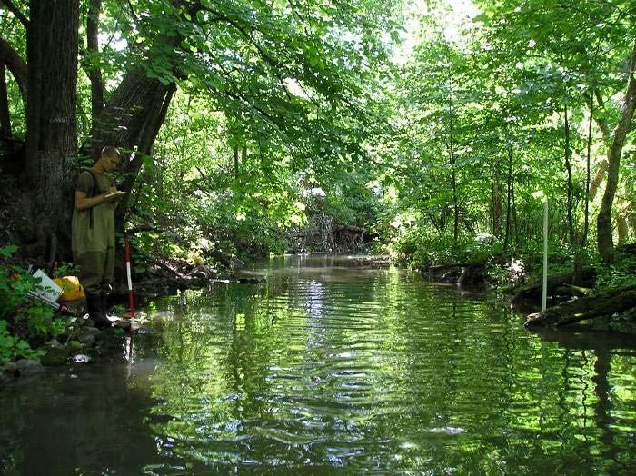
6 Eastern Piedmont 87 watersheds Similar morphometry Pear- or oval-shaped Dendritic drainage Moderate relief neither topographic or subsurface controls dominate Similar geology Thick clay-rich soils Deeply weathered bedrock Similar climate Mid-latitude, humid subtropical No dry season Many flow gages with long continuous daily records

7 Urban Agriculture Forest Grassland Barren Wetland Water Urban
8 Runoff affected by Morphometric variables Area (A) Stream order (O HS ) Drainage density (D d ) Mean channel slope (S c ) Basin form ratio (R f ) Geologic variables Silt-clay percentage (SC%) Hydrologic variables Reservoir storage percentage (RS%) Precipitation effectiveness ratio (R pe ) Land-cover variables Percent water-wetland (%WW) Percent urban (%UR) Percent forest (%FO) Percent agriculture (%AG) Depth to bedrock (Z br )
9 What about stationarity with respect to climate? We use the same 40-y ( ) records for all watersheds Which period or frequency will you analyze? All of them
10 yearly monthly decadal IIIIIIIIIIIIIIIIIIIIIIIIIIIIIIIIIIIIIIIIIIIIIIIIIIIIIIIIIIIIIIIIIIIIIIIIIIIIIIIIIIIIIIIIIIIIIII daily
11 Power Spectral Analysis (think temporal correlation using a moving window) -4 P a annual peak spectral power (or variance) β lf (long-term memory) P cp β hf (short-term memory) cross point P d -12 decadal yearly monthly frequency weekly daily
12 Rainfall - (white-noise) Runoff - (red-noise) cross-point Short-term memory Long-term memory f cp = 5.6 ± 0.6 -β hf = 0.42 ± β lf = 0.02 ± 0.02 f cp = 6.0 ± 1.3 -β hf = 1.84 ± β lf = 0.45 ± 0.16
13 Do landscape attributes dictate a catchment s hydrologic memory? Spectral Variable Best landscape predictor (r) Stepwise model r 2 (α = 0.05) Daily power, P d %Wetland (-0.49) 0.57 Annual power, P a %Wetland (0.41) 0.21* Spectral slope, -β 0 %Wetland (0.57) 0.62 Cross point power, P cp %Urban (0.50) 0.39 Cross point frequency, f cp Slope (-0.32) 0.20* Long-term memory, -β lf %Urban (-0.47) 0.43 Short-term memory, -β hf %Wetland (0.55) 0.58 * Low correlation


14 Runoff Variance Density Annual power, P a Daily power, P d Cross-point power, P cp Density Density Cross point frequency, f cp Watershed Memory Spectral slope, -β 0 Low-frequency slope, -β lf High-frequency slope, -β hf
15 r = Pd r = 0.67 cp = 11% Pcp r = 0.68 cp = 13% r = cp = 14% -βlf Daily Power Cross-point power Long-term memory Urban Thresholds r = r = 0.37 Urban coverage, %UR Stream biota studies with 10-15% threshold Paul and Meyer, 2001, Ann Rev Ecology, Evolution, and Systematics Utz et al., 2009, Ecological Indicators Roy et al., 2003, Freshwater Biology

16 r = Pd r = 0.67 cp = 11% Pcp r = 0.68 cp = 13% r = cp = 14% -βlf Daily Power Cross-point power Long-term memory Urban Thresholds r = r = 0.37 Urban coverage, %UR Affects hydrologic drought?
17 Longitudinal Spatial Patterns in Spectral Variables Stream Order adapted from Vannote et al., 1980

18 Runoff variance Precipitation Runoff memory
19 A matrix for characterizing Hydrologic Signatures? Low frequency P a Climateinfluenced Landscapeinfluenced -β lf High frequency f cp -β hf
20 Land Cover Effects on Runoff Land cover can have considerable and predictable effects on runoff patterns (aka watershed memory) 10-15% urban threshold above which urban coverage becomes the dominant control on runoff patterns Downstream threshold (after 3 rd -order) where watershed processes become dominant over precipitation in determining runoff patterns in Eastern Piedmont Matrix for hydrologic signatures: [climate vs. landscape effects] [low vs. high frequency events]
21

22 Questions?
BAEN 673 / February 18, 2016 Hydrologic Processes
 BAEN 673 / February 18, 2016 Hydrologic Processes Assignment: HW#7 Next class lecture in AEPM 104 Today s topics SWAT exercise #2 The SWAT model review paper Hydrologic processes The Hydrologic Processes
EFFECTS OF WATERSHED TOPOGRAPHY, SOILS, LAND USE, AND CLIMATE ON BASEFLOW HYDROLOGY IN HUMID REGIONS: A REVIEW
 PROGRESS IN PHYSICAL GEOGRAPHY EFFECTS OF WATERSHED TOPOGRAPHY, SOILS, LAND USE, AND CLIMATE ON BASEFLOW HYDROLOGY IN HUMID REGIONS: A REVIEW KATIE PRICE 2011 Presented by: Jordan Martin Article Overview
Overview of the Surface Hydrology of Hawai i Watersheds. Ali Fares Associate Professor of Hydrology NREM-CTAHR
 Overview of the Surface Hydrology of Hawai i Watersheds Ali Fares Associate Professor of Hydrology NREM-CTAHR 5/23/2008 Watershed Hydrology Lab 1 What is Hydrology? Hydrology is the water science that
Introduction. Welcome to the Belgium Study Abroad Program. Courses:
 Introduction Welcome to the Belgium Study Abroad Program Courses: AGSM 335: Soil and Water Management BAEN 460: Principals of Environmental Hydrology BAEN 460 / AGSM 335 Combined lecture and HW sessions
Water Balance Methodology
 Water Balance Methodology Integrating the Site with the Watershed and the Stream March 2012 An initiative under the umbrella of the Water Sustainability Action Plan for British Columbia Water Balance Methodology
The Texas A&M University and U.S. Bureau of Reclamation Hydrologic Modeling Inventory (HMI) Questionnaire
 Questionnaire") The Texas A&M University and U.S. Bureau of Reclamation Hydrologic Modeling Inventory (HMI) Questionnaire May 4, 2010 Name of Model, Date, Version Number Dynamic Watershed Simulation Model (DWSM) 2002
The Texas A&M University and U.S. Bureau of Reclamation Hydrologic Modeling Inventory (HMI) Questionnaire May 4, 2010 Name of Model, Date, Version Number Dynamic Watershed Simulation Model (DWSM) 2002
Watersheds and the Hydrologic Cycle
 Watersheds and the Hydrologic Cycle The Global Hydrologic Cycle Water Cycle in Florida Florida Water Facts Surface Area = 170,452 km 2 Average Rainfall = 140 cm (55 ) Total Annual Rain = 238 billion m
Lecture 9A: Drainage Basins
 GEOG415 Lecture 9A: Drainage Basins 9-1 Drainage basin (watershed, catchment) -Drains surfacewater to a common outlet Drainage divide - how is it defined? Scale effects? - Represents a hydrologic cycle
From the cornbeltto the north woods; understanding the response of Minnesota. Chris Lenhart Research Assistant Professor BBE Department
 From the cornbeltto the north woods; understanding the response of Minnesota watersheds to climate change Chris Lenhart Research Assistant Professor BBE Department 1. Background Differential response of
Hydrologic Modeling with the Distributed-Hydrology- Soils- Vegetation Model (DHSVM)
") Hydrologic Modeling with the Distributed-Hydrology- Soils- Vegetation Model (DHSVM) DHSVM was developed by researchers at the University of Washington and the Pacific Northwest National Lab 200 Simulated
Hydrologic Modeling with the Distributed-Hydrology- Soils- Vegetation Model (DHSVM) DHSVM was developed by researchers at the University of Washington and the Pacific Northwest National Lab 200 Simulated
Background Information on the. Peace River Basin
 Background Information on the Peace River Basin Resource Conservation & Development Department August 24 Background Physiography The Peace River drainage basin occupies large parts of Polk, Hardee, DeSoto,
Hydrologic cycle, runoff process
 Hydrologic cycle, runoff process Motivation of hydrological modelling What happens at the catchment and in the stream when it rains? How does the increased/decreased runoff affect (not only) the landowners
TECHNICAL MEMORANDUM. SUBJECT: Determination of watershed historic peak flow rates as the basis for detention basin design
 TECHNICAL MEMORANDUM FROM: Ken MacKenzie and Ryan Taylor SUBJECT: Determination of watershed historic peak flow rates as the basis for detention basin design DATE: June 7, 2012 The purpose of this memorandum
WMS Tools For Computing Hydrologic Modeling Parameters
 WMS Tools For Computing Hydrologic Modeling Parameters Lesson 9 9-1 Objectives Use the drainage coverage as a basis for geometric parameters as well as overlaying coverages to compute important hydrologic
1. Introduction. Keywords Groundwater, Vulbnerability, Aquifer, Aquitard, Vadose zone. Alsharifa Hind Mohammad
 World Environment 2014, 4(1): 22-32 DOI: 10.5923/j.env.20140401.03 New Groundwater Vulnerability Index for the Main Aquifers in Central Catchment Area in Jordan and Validation of the Results Using NO 3
Runoff and soil loss. (Quantification and modeling of watershed discharge and sediment yield) Kassa Tadele (Dr.Ing) Arba Minch University
 Kassa Tadele (Dr.Ing) Arba Minch University") Runoff and soil loss (Quantification and modeling of watershed discharge and sediment yield) Kassa Tadele (Dr.Ing) Arba Minch University Part I. Runoff Contents 1. Fundamental Concepts 2. Generation of
Runoff and soil loss (Quantification and modeling of watershed discharge and sediment yield) Kassa Tadele (Dr.Ing) Arba Minch University Part I. Runoff Contents 1. Fundamental Concepts 2. Generation of
Predicting Unmet Irrigation Demands due to Climate Change An integrated Approach in WEAP
 Predicting Unmet Irrigation Demands due to Climate Change An integrated Approach in WEAP Marc Haering Emad Al-Karablieh, Amer Salman University of Jordan G-Wadi International Session 5: Risks Assessment
Urbanization effects on the hydrology of the Atlanta area, Georgia (USA)
") 14/06/01 Impact of Human Activity on Groundwater Dynamics (Proceedings of a symposium held during the Sixth IAHS Scientific Assembly at Maastricht, The Netherlands, July 2001). IAHS Publ. no. 269, 2001.
14/06/01 Impact of Human Activity on Groundwater Dynamics (Proceedings of a symposium held during the Sixth IAHS Scientific Assembly at Maastricht, The Netherlands, July 2001). IAHS Publ. no. 269, 2001.
CHAPTER FIVE Runoff. Engineering Hydrology (ECIV 4323) Instructors: Dr. Yunes Mogheir Dr. Ramadan Al Khatib. Overland flow interflow
 Instructors: Dr. Yunes Mogheir Dr. Ramadan Al Khatib. Overland flow interflow") Engineering Hydrology (ECIV 4323) CHAPTER FIVE Runoff Instructors: Dr. Yunes Mogheir Dr. Ramadan Al Khatib Overland flow interflow Base flow Saturated overland flow ١ ٢ 5.1 Introduction To Runoff Runoff
Engineering Hydrology (ECIV 4323) CHAPTER FIVE Runoff Instructors: Dr. Yunes Mogheir Dr. Ramadan Al Khatib Overland flow interflow Base flow Saturated overland flow ١ ٢ 5.1 Introduction To Runoff Runoff
Basic Hydrology Runoff Curve Numbers
 Basic Hydrology Runoff Curve Numbers By: Paul Schiariti, P.E., CPESC Mercer County Soil Conservation District The SCS Runoff Curve Number The RCN (Runoff Curve Number) method was originally established
Effect of Land Surface on Runoff Generation
 Effect of Land Surface on Runoff Generation Context: Hydrologic Cycle Runoff vs Infiltration Infiltration: Process by which water on the ground surface enters the soil Runoff: Water (from rain, snowmelt,
HYDROLOGIC IMPACTS OF DRAINAGE SYSTEMS. Submitted to: Iowa Economic Development Authority 200 East Grand Avenue Des Moines, Iowa 50309
 HYDROLOGIC IMPACTS OF DRAINAGE SYSTEMS By Kristie Franz 1, Nandita Basu 2, William Simpkins 1, Matt Helmers 3, Özlem Acar 1, Becca Scheler 2, Brandon Sloan 2, Alexander Morrison 1, Larry Weber 2, Rick
RIO GRANDE HEADWATERS RESPONSE TO CLIMATE AND FOREST CHANGE
 RIO GRANDE HEADWATERS RESPONSE TO CLIMATE AND FOREST CHANGE Melissa Valentin, PE, PhD Student and Terri Hogue, PhD, Professor Department of Civil and Environmental Engineering Colorado School of Mines,
Effects of Prescribed Burning on Stream Water Quantity, Quality, and fuel loads in a Small Piedmont Watershed in North Carolina
 Effects of Prescribed Burning on Stream Water Quantity, Quality, and fuel loads in a Small Piedmont Watershed in North Carolina Matthew Haunsperger Johnny Boggs, Ge Sun, Michael Gavazzi USDA Forest Service
Hydrology Review, New paradigms, and Challenges
 Hydrology Review, New paradigms, and Challenges Intent quick introduction with emphasis on aspects related to watershed hydrochemistry and new paradigms Watershed / Catchment Definition Portion of landscape
The Fourth Assessment of the Intergovernmental
 Hydrologic Characterization of the Koshi Basin and the Impact of Climate Change Luna Bharati, Pabitra Gurung and Priyantha Jayakody Luna Bharati Pabitra Gurung Priyantha Jayakody Abstract: Assessment of
Rainfall, Runoff and Peak Flows: Calibration of Hydrologic Design Methods for the Kansas City Area
 Rainfall, Runoff and Peak Flows: Calibration of Hydrologic Design Methods for the Kansas City Area Bruce McEnroe, Bryan Young, Ricardo Gamarra and Ryan Pohl Department of Civil, Environmental, and Architectural
SOIL AND THE HYDROLOGIC CYCLE
 GEOLOGY 408/508 SOIL AND THE HYDROLOGIC CYCLE CHAPTER 6 Brady & Weil, Rev. 14th ed. THE HYDROLOGIC CYCLE (FIGURE 6.2) WATER BALANCE EQUATION Watershed - an area of land drained by a single stream system
Runoff Processes. Daene C. McKinney
 CE 374 K Hydrology Runoff Processes Daene C. McKinney Watershed Watershed Area draining to a stream Streamflow generated by water entering surface channels Affected by Physical, vegetative, and climatic
Watershed Hydrology. a) Water Balance Studies in Small Experimental Watersheds
 Water Balance Studies in Small Experimental Watersheds") Watershed Hydrology a) Water Balance Studies in Small Experimental Watersheds In order to characterize the geometry of the regolith as well as the directions of the fractures or fissures in the protolith,
Watershed Hydrology a) Water Balance Studies in Small Experimental Watersheds In order to characterize the geometry of the regolith as well as the directions of the fractures or fissures in the protolith,
AMERICAN INSTITUTE OF HYDROLOGY EDUCATIONAL CRITERIA
 AMERICAN INSTITUTE OF HYDROLOGY EDUCATIONAL CRITERIA AIH FORM011A Rev. 11/21/17 BASIC REQUIREMENTS Completion of a full course of study leading to a bachelor's or higher degree at an accredited college
M.L. Kavvas, Z. Q. Chen, M. Anderson, L. Liang, N. Ohara Hydrologic Research Laboratory, Civil and Environmental Engineering, UC Davis
 Assessment of the Restoration Activities on Water Balance and Water Quality at Last Chance Creek Watershed Using Watershed Environmental Hydrology (WEHY) Model M.L. Kavvas, Z. Q. Chen, M. Anderson, L.
Simulation of Rainfall-Runoff Using WEAP Model (Case Study: Qaraso Basin)
") AGRICULTURAL COMMUNICATIONS, 2014, 2(4): 63-68. Simulation of Rainfall-Runoff Using WEAP Model (Case Study: Qaraso Basin) BEHROOZ YAGHOBI*, SAEID SHABANLOU AND FARIBORZ YOSEFVAND Department of Water Engineering,
AGRICULTURAL COMMUNICATIONS, 2014, 2(4): 63-68. Simulation of Rainfall-Runoff Using WEAP Model (Case Study: Qaraso Basin) BEHROOZ YAGHOBI*, SAEID SHABANLOU AND FARIBORZ YOSEFVAND Department of Water Engineering,
Comparison of Recharge Estimation Methods Used in Minnesota
 Comparison of Recharge Estimation Methods Used in Minnesota by Geoffrey Delin, Richard Healy, David Lorenz, and John Nimmo Minnesota Ground Water Association Spring Conference Methods for Solving Complex
USING ARCSWAT TO EVALUATE EFFECTS OF LAND USE CHANGE ON WATER QUALITY. Adam Gold Geog 591
 USING ARCSWAT TO EVALUATE EFFECTS OF LAND USE CHANGE ON WATER QUALITY Adam Gold Geog 591 Introduction The Soil and Water Assessment Tool (SWAT) is a hydrologic transport model with an objective to predict
Hydrology and Water Management. Dr. Mujahid Khan, UET Peshawar
 Hydrology and Water Management Dr. Mujahid Khan, UET Peshawar Course Outline Hydrologic Cycle and its Processes Water Balance Approach Estimation and Analysis of Precipitation Data Infiltration and Runoff
Underlying any discussion of the long-term
 UNIVERSITIES COUNCIL ON WATER RESOURCES, ISSUE 126, PAGES 48-53, NOVEMBER 2003 Respecting the Drainage Divide: A Perspective on Hydroclimatological Change and Scale Katherine K. Hirschboeck University
Definitions 3/16/2010. GG22A: GEOSPHERE & HYDROSPHERE Hydrology
 GG22A: GEOSPHERE & HYDROSPHERE Hydrology Definitions Streamflow volume of water in a river passing a defined point over a specific time period = VxA discharge m 3 s -1 Runoff excess precipitation - precipitation
GUIDE TO THE DEVELOPMENT OF A MINING AND RECLAMATION PLAN IN NEW BRUNSWICK
 PROVINCE OF NEW BRUNSWICK DEPARTMENT OF ENERGY AND RESOURCE DEVELOPMENT Minerals and Petroleum Development Branch GUIDE TO THE DEVELOPMENT OF A MINING AND RECLAMATION PLAN IN NEW BRUNSWICK Guide to the
Hydrological And Water Quality Modeling For Alternative Scenarios In A Semi-arid Catchment
 Hydrological And Water Quality Modeling For Alternative Scenarios In A Semi-arid Catchment AZIZ ABOUABDILLAH, ANTONIO LO PORTO METIER Final Conference: Brussels, Belgium-4-6 November 2009 Outline Problem
1.6 Influence of Human Activities and Land use Changes on Hydrologic Cycle
 1.6 Influence of Human Activities and Land use Changes on Hydrologic Cycle Watersheds are subjected to many types of changes, major or minor, for various reasons. Some of these are natural changes and
Alternative Approaches to Water Resource System Simulation
 US Army Corps of Engineers Hydrologic Engineering Center Alternative Approaches to Water Resource System Simulation May 1972 Approved for Public Release. Distribution Unlimited. TP-32 REPORT DOCUMENTATION
Suspended Sediment Discharges in Streams
 US Army Corps of Engineers Hydrologic Engineering Center Suspended Sediment Discharges in Streams April 1969 Approved for Public Release. Distribution Unlimited. TP-19 REPORT DOCUMENTATION PAGE Form Approved
Module 3. Lecture 4: Introduction to unit hydrograph
 Lecture 4: Introduction to unit hydrograph (UH) The unit hydrograph is the unit pulse response function of a linear hydrologic system. First proposed by Sherman (1932), the unit hydrograph (originally
TECHNICAL NOTE: ESTIMATION OF FRESH WATER INFLOW TO BAYS FROM GAGED AND UNGAGED WATERSHEDS. T. Lee, R. Srinivasan, J. Moon, N.
 TECHNICAL NOTE: ESTIMATION OF FRESH WATER INFLOW TO BAYS FROM GAGED AND UNGAGED WATERSHEDS T. Lee, R. Srinivasan, J. Moon, N. Omani ABSTRACT. The long term estimation of fresh water inflow to coastal bays
July, International SWAT Conference & Workshops
 Analysis of the impact of water conservation measures on the hydrological response of a medium-sized watershed July, 212 212 International SWAT Conference & Workshops ANALYSIS OF THE IMPACT OF WATER CONSERVATION
Lecture 1 Integrated water resources management and wetlands
 Wetlands and Poverty Reduction Project (WPRP) Training module on Wetlands and Water Resources Management Lecture 1 Integrated water resources management and wetlands 1 Water resources and use The hydrological
Hypothetical Flood Computation for a Stream System
 US Army Corps of Engineers Hydrologic Engineering Center Hypothetical Flood Computation for a Stream System December 1968 Approved for Public Release. Distribution Unlimited. TP-12 REPORT DOCUMENTATION
Norman Maclean Snowmelt Flow rate Storm flows fs (c flow m a tre S
 Eventually, all things merge into one, and a river runs through it. Norman Maclean Understanding Streamflow ADEQ SW Short Course June 13, 213 Phoenix, AZ Hydrographs Discharge (Q) USGS flow data & plots
GIS Applications in Water Resources Engineering
 King Fahd University of Petroleum & Minerals City & Regional Planning Department Introduction to Geographic Information Systems Term Paper Presentation GIS Applications in Water Resources Engineering Prepared
Simple toolbox for worldwide topography based soils reclassification for initialization of SWAT
 Simple toolbox for worldwide topography based soils reclassification for initialization of SWAT Daniel R. Fuka, Charlotte MacAlister, Solomon Seyoum, Todd Walter, Zachary Easton Cornell University IWMI
2
 1 2 3 4 5 Context Our basin has diverse landscapes from the forested Cascade Mountains, the agricultural Willamette Valley, to the densely populated cities of Eugene, Salem, and Portland. Water flows through
Flood forecasting model based on geographical information system
 doi:10.5194/piahs-368-192-2015 192 Remote Sensing and GIS for Hydrology and Water Resources (IAHS Publ. 368, 2015) (Proceedings RSHS14 and ICGRHWE14, Guangzhou, China, August 2014). Flood forecasting model
The surface water hydrology of the site has been logically divided into six phases of monitoring, analyses, and investigation as outlined below:
 SURFACE WATER HYDROLOGY The surface water hydrology of the site has been logically divided into six phases of monitoring, analyses, and investigation as outlined below: Sample Station Locations and Descriptions
Hydrological Observatory description
 RIVER PÄRNU, ESTONIA Location The Pärnu river catchment area is situated in Western Estonia and drains 6,900 km² to the Bay of Pärnu, which is northern part of the Gulf of Riga. It is one of the longest
Alternative Futures for the City of La Paz, Mexico
 O N T H E G R O U N D Alternative Futures for the City of La Paz, Mexico Caroline Dragoo University of Arizona and Robert Faris Harvard University La Paz, Mexico is working hard not to turn into Cabo San
History of Model Development at Temple, Texas. J. R. Williams and J. G. Arnold
 History of Model Development at Temple, Texas J. R. Williams and J. G. Arnold INTRODUCTION Then Model development at Temple A long history (1937-present) Many scientists participating in: Data collection
Prediction for Natural Recharging In Langat Basin and Ukm Campus as Case Study
 Prediction for Natural Recharging In Langat Basin and Ukm Campus as Case Study 1 Mohaad Fawzi Al Ajlouni, 2 Rakmi Abd Rahman, 3 Abdul Ghani Rafek, 4 Mazlin Mokhtar, 5 Noor Ezlin Ahmad Basri 1, 5 Department
Integrating Knowledge for Decision-making in the Pantanal Wetland Area. Celso Marcatto and Rob Jongman
 Integrating Knowledge for Decision-making in the Pantanal Wetland Area Celso Marcatto and Rob Jongman The Pantanal Pantanal Savannah wetland of 320.000km 2 Situated in Brazil, Bolivia and Paraguay The
SNAMP water research. Topics covered
 SNAMP water research SNAMP water team UC Merced Topics covered Objectives, goals & overview What & why the water component of SNAMP Pre-treatment Observations Water Quality Water Quantity Modeling & Scenarios:
Pennsylvania Stormwater Best Management Practices Manual. Chapter 3. Stormwater Management Principles and Recommended Control Guidelines
 Pennsylvania Stormwater Best Management Practices Manual Chapter 3 Stormwater Management Principles and Recommended Control Guidelines 363-0300-002 / December 30, 2006 Chapter 3 Stormwater Management Principles
Event and Continuous Hydrological Modeling with HEC- HMS: A Review Study
 Event and Continuous Hydrological Modeling with HEC- HMS: A Review Study Sonu Duhan *, Mohit Kumar # * M.E (Water Resources Engineering) Civil Engineering Student, PEC University Of Technology, Chandigarh,
Culvert Sizing procedures for the 100-Year Peak Flow
 CULVERT SIZING PROCEDURES FOR THE 100-YEAR PEAK FLOW 343 APPENDIX A: Culvert Sizing procedures for the 100-Year Peak Flow A. INTRODUCTION Several methods have been developed for estimating the peak flood
Review of the Hydrologic Cycle & Streamflow Generation
 Quantitative Elements of Physical Hydrology Review of the Hydrologic Cycle & Streamflow Generation (Review) Contact information: Jack Hermance Environmental Geophysics/Hydrology Department of Geological
2.3 Water Budget Data In Ontario
 2.3 Water Budget Data In Ontario Water budget data available for Ontario includes meteorologic data, hydrometric data and groundwater data. Geological and physiographical data provide information to describe
DRAINAGE PLAN OF NAU S EASTBURN EDUCATION AND GAMMAGE BUILDINGS FINAL PROPOSAL
 MAY 10, 2016 DRAINAGE PLAN OF NAU S EASTBURN EDUCATION AND GAMMAGE BUILDINGS FINAL PROPOSAL Connor Klein, Jiangnan Yi, Yuzhi Zhang, Yi Yang NORTHERN ARIZONA UNIVERSITY NAU Water Buffalo Engineering Table
Application of a Basin Scale Hydrological Model for Characterizing flow and Drought Trend
 Application of a Basin Scale Hydrological Model for Characterizing flow and Drought Trend 20 July 2012 International SWAT conference, Delhi INDIA TIPAPORN HOMDEE 1 Ph.D candidate Prof. KOBKIAT PONGPUT
Understanding Earth Fifth Edition
 Understanding Earth Fifth Edition Grotzinger Jordan Press Siever Chapter 17: THE HYDROLOGIC CYCLE AND GROUNDWATER Lecturer: H Mohammadzadeh Assistant professors, Department of Geology, FUM Copyright 2007
Peak discharge computation
 Ia/P 4 Peak Dischage Method Graphical Peak Discharge Method This chapter presents the Graphical Peak Discharge method for computing peak discharge from rural and urban areas. The Graphical method was developed
离子膜电渗析分离碱性料液 答辩人 :XXX. Valuation of ecosystem services: Projects in Southwest China
 Valuation of ecosystem services: Projects in Southwest China 离子膜电渗析分离碱性料液 Reporter: Tang Zhonglin 答辩人 :XXX University of Chinese Academy of Sciences Chengdu Institute of biology, CAS E-mail:tangzl@cib.ac.cn
Hydrologic Cycle. Water Availabilty. Surface Water. Groundwater
 Hydrologic Cycle Hydrologic ydoogccyce cycle Surface Water Groundwater Water Availabilty 1 Hydrologic Cycle Constant movement of water above, on, and, below the earth s surface (Heath) Endless circulation
ERTH 519 Watershed Hydrology
 1 ERTH 519 Watershed Hydrology Course Description, Goals, and Learner Outcomes Participants will increase their understanding of watershed hydrology and the relation to water quality and water quantity.
Watershed Characterization, Monitoring and Measurements
 Watershed Characterization, Monitoring and Measurements Intent - highlight key approaches to watershed monitoring using the Fair Hill Study watershed as an example Watershed characterization and monitoring
CEE6400 Physical Hydrology
 CEE6400 Physical Hydrology Midterm Review Learning Objectives (what you should be able to do) Hydrologic data, the hydrologic cycle and water balance (HW 1) Work with hydrologic data, quantify uncertainty
ENVS 435: Watershed Management. 3 Credits INSTR.: Dr. R.M. Bajracharya
 ENVS 435: Watershed Management 3 Credits INSTR.: Dr. R.M. Bajracharya Unit 1: Introduction - Watershed Concepts Definitions of watershed The elevated line separating the head streams which are tributaries
MoRE Results and Modifications
 MoRE Results and Modifications Stephan Fuchs, Stephan Hilgert, Tatyana Rogozina, Ramona Wander Simon Höllering, Jürgen Ihringer und Ulrike Scherer INSTITUTE FOR WATER AND RIVER BASIN MANAGEMENT, DEPARTMENT
CHAPTER 13 OUTLINE The Hydrologic Cycle and Groundwater. Hydrologic cycle. Hydrologic cycle cont.
 CHAPTER 13 OUTLINE The Hydrologic Cycle and Groundwater Does not contain complete lecture notes. To be used to help organize lecture notes and home/test studies. Hydrologic cycle The hydrologic cycle is
M.L. Kavvas, Z. Q. Chen, M. Anderson, L. Liang, N. Ohara Hydrologic Research Laboratory, Civil and Environmental Engineering, UC Davis
 Assessment of the Restoration Activities on Water Balance and Water Quality at Last Chance Creek Watershed Using Watershed Environmental Hydrology (WEHY) Model M.L. Kavvas, Z. Q. Chen, M. Anderson, L.
 Good Morning! Bruce Gilman Department of Environmental Conservation and Horticulture Finger Lakes Community College 3325 Marvin Sands Drive Canandaigua, New York 14424 585-785- 1255 gilmanba@flcc.edu Northern
Issue paper: Aquifer Water Balance
 Issue paper: Aquifer Water Balance 1. Introduction And Background 1.1. Purpose and Scope The population in Kitsap County has grown rapidly in recent years and is expected to increase substantially in the
STRAWMAN OUTLINE March 21, 2008 ISWS/ISGS REPORT ON THE OPPORTUNITIES AND CHALLENGES OF MEETING WATER DEMAND IN NORTH-EAST ILLINOIS
 STRAWMAN OUTLINE March 21, 2008 ISWS/ISGS REPORT ON THE OPPORTUNITIES AND CHALLENGES OF MEETING WATER DEMAND IN NORTH-EAST ILLINOIS REPORT TO BE DELIVERED TO THE RWSPG BY SEPTEMBER 30, 2008 Table of Contents
Review of State and Federal Stormwater Regulations November 2007
 Review of State and Federal Stormwater Regulations November 2007 By: James T. Spaulding, PE, CPESC Joseph M. Ducharme, Jr., PE TTG ENVIRONMENTAL CONSULTANTS, LLC 27 LOCKE ROAD, CONCORD, NH 03301-5301 TELEPHONE:
Application of SWAT Model in land-use. change in the Nile River Basin: A Review
 Application of SWAT Model in land-use change in the Nile River Basin: A Review By: Marwa Ali, Okke Batelaan and Willy Bauwens 15-6-2011 Application of SWAT Model in land-use 1 change in the Nile River
Rainfall - runoff: Unit Hydrograph. Manuel Gómez Valentín E.T.S. Ing. Caminos, Canales y Puertos de Barcelona
 Rainfall - runoff: Unit Hydrograph Manuel Gómez Valentín E.T.S. ng. Caminos, Canales y Puertos de Barcelona Options in many commercial codes,, HMS and others HMS Menu Transform method, User specified,
Working with the Water Balance
 Working with the Water Balance Forest Hydrology and Land Use Change Paul K. Barten, Ph.D. Professor of Forestry and Hydrology Department of Environmental Conservation www.forest-to-faucet.org The Living
Measuring discharge. Climatological and hydrological field work
 Measuring discharge Climatological and hydrological field work 1. Background Discharge (or surface runoff Q s) refers to the horizontal water flow occurring at the surface in rivers and streams. It does
Stormwater Management Standards for Pennsylvania. Another. A presentation from The Other Side of the Table
 Stormwater Management Standards for Pennsylvania Another A presentation from The Other Side of the Table What we ve been taught: Watershed Hydrologic Process Actual infiltration and watershed runoff processes
Afternoon Lecture Outline
 Afternoon Lecture Outline 1. Northern Prairies watershed hydrology 2. Solute mass balance in lakes and ponds 3. Simple mass balance simulation using MS Excel 4. Effects of sediment-water exchange on lake
Trends in Illinois River Streamflow and Flooding
 Trends in Illinois River Streamflow and Flooding H. Vernon Knapp, Interim Director Center for Watershed Science Illinois State Water Survey Institute of Natural Resource Sustainability University of Illinois
Understanding the Impact of Drought on Crop Yield in South and North Carolina
 Understanding the Impact of Drought on Crop Yield in South and North Carolina Junyu Lu, Gregory J. Carbone Department of Geography, University of South Carolina, Columbia Introduction Social& economical
Current Methods for Flood Frequency Analysis
 Current Methods for Flood Frequency Analysis US Army Corps of Engineers Beth Faber, PhD, PE USACE, Hydrologic Engineering Center Workshop on Non-Stationarity, Hydrologic Frequency Analysis, and Water Management
GLY 155 Introduction to Physical Geology, W. Altermann. Grotzinger Jordan. Understanding Earth. Sixth Edition
 Grotzinger Jordan Understanding Earth Sixth Edition Chapter 17: THE HYDROLOGIC CYCLE AND GROUNDWATER 2011 by W. H. Freeman and Company Chapter 17 The Hydrologic Cycle and Groundwater 1 About the Hydrologic
Vulnerability of hydrological ecosystem services to climatic extremes in a Mediterranean river basin
 Vulnerability of hydrological ecosystem services to climatic extremes in a Mediterranean river basin Marta Terrado, Vicenç Acuña, Driss Ennaanay, Heather Tallis, Sergi Sabater CLIMATIC EXTREMES AND HYDROLOGICAL
URBAN FLOODING: HEC-HMS
 1.0 Introduction URBAN FLOODING: HEC-HMS -Sunil Kumar, Director, NWA All major ancient civilisations were developed in the river valleys because river served as source of water, food, transportation and
The Influence of Sediment Bays on Reducing Incoming Sediment in Holmes Lake: Lincoln, Nebraska
 University of Nebraska - Lincoln DigitalCommons@University of Nebraska - Lincoln Environmental Studies Undergraduate Student Theses Environmental Studies Program Fall 12-2010 The Influence of Sediment
Climate-driven changes in rearing habitats of juvenile Chinook salmon in the Kenai watershed. Courtney Pegus, Mark Wipfli, and Daniel Rinella
 Climate-driven changes in rearing habitats of juvenile Chinook salmon in the Kenai watershed Courtney Pegus, Mark Wipfli, and Daniel Rinella The Big Picture Climatic changes and consequences Climate change
Assessment of Watershed Soundness by Water Balance Using SWAT Model for Han River Basin, South Korea
 2015 International SWAT Conference & Workshops October 12-16, 2015 Purdue University, USA SESSION A3: HYDROLOGY Room: Stewart 278 2015 International SWAT Conference Assessment of Watershed Soundness by
Lecture 11: Water Flow; Soils and the Hydrologic Cycle
 Lecture 11: Water Flow; Soils and the Hydrologic Cycle Water Flow in Soils Types of Water Flow in Soil Saturated flow: Soil pores completely filled with water; controlled by the hydrostatic potential After
Hydrology 101. Impacts of the Urban Environment. Nokomis Knolls Pond Summer June 2008
 Hydrology 101 Nokomis Knolls Pond Summer 2002 Impacts of the Urban Environment Hydrologic Cycle; What is it? Geography, Topography, Geology, Land Cover and Climate determine the Amount and Behavior of
Afternoon Lecture Outline. Northern Prairie Hydrology
 Afternoon Lecture Outline 1. Northern Prairies watershed hydrology 2. Solute mass balance in lakes and ponds 3. Simple mass balance simulation using MS Excel 4. Effects of sediment-water exchange on lake