Roadway Data Extraction Technical Assistance Program (RDETAP) Traffic Safety Conference College Station, June 2016
|
|
|
- Lilian Dixon
- 6 years ago
- Views:
Transcription


1 Roadway Data Extraction Technical Assistance Program (RDETAP) Traffic Safety Conference College Station, June 2016
2 Overview Project motivation and objectives MIRE-MIS Program RDETAP Project Overview of Data Extraction Tool Summary of TxDOT proof-of-concept Overview of pilot studies Live demo of Data Extraction Tool using WSDOT roadway inventory data Q&A 2
3 Project Motivation Highway safety data are vital to making sound decisions on the safe design and operation of roadways MAP-21 Guidance State safety data systems must support performance measures Collection, integration, improvement, and analysis of safety data Required identification of Fundamental Data Elements, a subset of MIRE elements Bottom line: access to a reliable inventory of roadway features and crash data will help agencies develop strategies that address deficiencies, using a focused and organized approach 3
4 MIRE Model Inventory of Roadway Elements Roadway Segment Intersection Intersection Leg Ramp Interchange Horizontal Curve Vertical Grade Segment Identifier Route Number Route/street Name Federal Aid/ Route Type Rural/Urban Designation Surface Type Begin Point Segment Descriptor End Point Segment Descriptor Segment Length Direction of Inventory Functional Class Median Type Unique Junction Identifier Location Identifier for Road 1 Crossing Point Location Identifier for Road 2 Crossing Point Intersection/Junction Geometry Intersection/Junction Traffic Control AADT [for Each Intersecting Road] AADT Year [for Each Intersecting Road] Unique Approach Identifier Intersection Identifier Unique Approach Identifier Approach AADT Quantity Approach AADT Year Date Approach Mode Type Approach Directional Flow Type Approach Through Lane Quantity Approach Left Turn Lane Type Approach Traffic Control Type Unique Ramp Identifier Location Identifier for Roadway at Beginning Ramp Terminal Location Identifier for Roadway at Ending Ramp Terminal Ramp Length Roadway Type at Beginning Ramp Terminal Roadway Type at Ending Ramp Terminal Ramp AADT Unique Interchange Identifier Road1 Crossing Point Location Identifier Road2 Crossing Point Location Identifier Additional Road Crossing Point Location Identifier Interchange Type Interchange Lighting Type Interchange Entering Traffic Volume Quantity Horizontal Curve ID Horizontal Curve Feature Type Horizontal Curve Degree Measurement Horizontal Curve Length Measurement Curve Superelevation Measurement Horizontal Transition Curve Type Horizontal Curve Deflection Angle Horizontal Curve Direction Type Grade Identifier Vertical Alignment Feature Type Gradient Percent Grade Length Measurement Vertical Curve Length Measurement 4
5 Fundamental Data Elements Non-Local Paved Roads Roadway Segment Intersection Interchange/Ramp Segment Identifier Route Number Route/street Name Federal Aid/ Route Type Rural/Urban Designation Surface Type Begin Point Segment Descriptor End Point Segment Descriptor Segment Length Direction of Inventory Functional Class Median Type Access Control One/Two-Way Operations Number of Through Lanes Location Identifier for Roadway at Beginning Ramp Terminal Location Identifier for Roadway at Ending Ramp Terminal Average Annual Daily Traffic AADT Year Type of Governmental Ownership Unique Junction Identifier Location Identifier for Road 1 Crossing Point Location Identifier for Road 2 Crossing Point Intersection/Junction Geometry Intersection/Junction Traffic Control AADT [for Each Intersecting Road] AADT Year [for Each Intersecting Road] Unique Approach Identifier Guidance on State Safety Data Systems, Table 1, dated April 14, Unique Interchange Identifier Location Identifier for Roadway at Beginning Ramp Terminal Ramp Length Roadway Type at Beginning Ramp Terminal Roadway Type at Ending Ramp Terminal Interchange Type Ramp AADT Year of Ramp AADT Functional Class Type of Governmental Ownership 5
6 MIRE-MIS MIRE Management Information System Development of two prototype data extraction tools: Tool 1 Runs on ArcGIS platform Scope is intersections and related intersection legs Tool 2 Requires proprietary software Incorporates intersection, traffic, geometry, route, speed limit, and turning movements data 6
7 MIRE-MIS OVERVIEW OF DATA EXTRACTION TOOL 7
8 Tool Purpose Process and integrate roadway inventory data from multiple, diverse sources Attach non-spatial attribute data to spatial roadway elements Intersections Intersection legs (intersection approach) Roadway segments Ramps Store data in geodatabase Export data for safety analysis 8


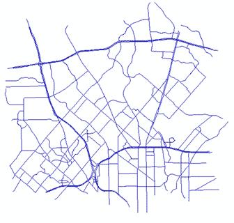
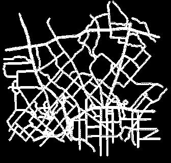


9 MIRE-MIS IHSDM Sources: FHWA, Google Street View, Utah DOT, TxDOT, WSDOT 9
10 Inputs and Outputs Input: GIS Data Layers Roadway network Roadway inventory Asset nodes MPO boundaries District boundaries County boundaries Local roadway data Output: Data for SafetyAnalyst Intersections Intersection legs Ramps Segments 10


11 Inputs and Outputs 11

12 Tool Components ArcGIS custom toolbar 6 ArcGIS ArcToolBox models ArcGIS custom data entry interfaces 12

13 Toolbar Buttons Edit intersection or leg (Manually) create intersection from node Delete intersection Export intersection and leg data Update all intersections and legs Update new intersections and legs 13
14 MIRE-MIS TXDOT PROOF-OF-CONCEPT 14
15 TxDOT Proof-of-Concept Can tools be adapted to data from other states? Objectives Use tool to generate intersection legs and attach spatial and non-spatial data to intersections and intersection legs Use TxDOT layers as-is adapt models and templates to TxDOT datasets and naming convention adapt attribute names and datatypes remove NH specific code, datasets, and hardcoded values 15
16 Data Processing Overview Roadway Inventory Roadway Nodes Other Data Initial Intersections Processed Intersections Tool 1 Processed Intersection Legs SafetyAnalyst 16
17 TxDOT Tool Adaptation TxDOT Roadway Inventory Sample Roadway Nodes Manual/QA Sample Initial Intersections Processed Intersections Generic Tool TxDOT Other Data Processed Intersection Legs SafetyAnalyst 17
18 Tool Adaptation: Data Inputs Use TxDOT input feature classes Roadway Inventory TxDOT Roadways MPO Boundaries County District Create new input feature classes Asset Nodes Intersections 18
19 TxDOT Preliminary Data Processing 19


20 TxDOT Preliminary Data Processing 1.Create sample roadway node feature class using TxDOT Roadways All crossing and intersecting roadway features regardless of functional classifications 2.Create sample initial intersection feature class Physical intersections on all state roads (state-state and statelocal) Manual process 20
 1.a. Optional (add county name to intersection layer) 21")
21 TxDOT ArcGIS Models Modified existing 6 models Added two new models 0. Prep roadway (add unique ID attribute to Roadway Inventory layer) 1.a. Optional (add county name to intersection layer) 21


22 TxDOT Proof-of-Concept Intersection Legs Intersections Asset Nodes TxDOT Roadway Inventory Texas Roadways 22
23 MIRE-MIS PILOT STUDIES 23
24 Pilot Studies Pilot implementation at WSDOT Focus on FDEs plus additional state data Focus on intersections, intersection legs, and ramps Pilot implementation at MODOT Focus on FDEs Focus on intersections, intersection legs, and ramps Special interest in local data integration 24
25 Process Adapt tool to create generic version for implementation at other states Created MIRE data model Developed extensive documentation Conduct implementation meetings Modify tools, submit, collect feedback 25
26 WSDOT Implementation Start: August 2015, End: June 2016 Main issues Multiple intersection data layers, multiple intersection features per intersection Spatial inaccuracies of intersection features Continuous routes, breaking at intersection needed Determination of major/minor route 26
27 WSDOT Implementation Tool upgrades Compatibility with non-breaking routes at intersections Calculation of intersection offset Calculation of intersection skew angle Compatibility with divided highways (highways represented by two route features instead of one) 27
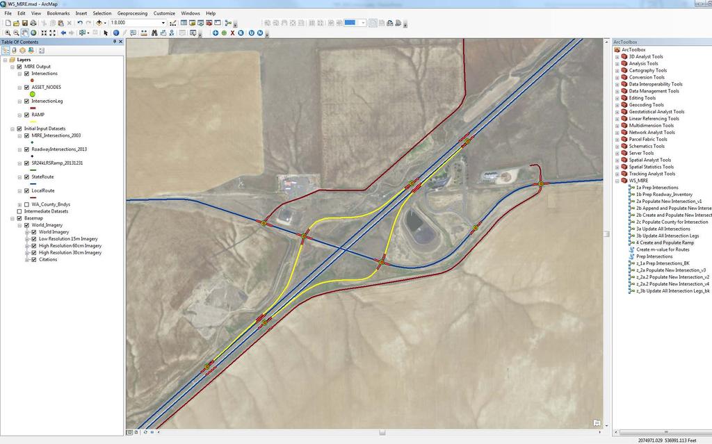
28 WSDOT Implementation 28
29 RDETAP Future Steps Complete MODOT pilot implementation Complete additional pilot implementation at state DOT Develop and distribute two guides Programmer guide focused on implementation User guide focused on tool usage and features Consider potential tool enhancements Interchange, horizontal curve, vertical grade 29
30 RDETAP Team Contact Information Role Name Agency Phone FHWA COTM Bob Pollack FHWA (202) PI Edgar Kraus TTI (210) Task Manager Brett Graves Leidos (703) Additional Team Members TTI: Jerry Le CTRE: Omar Smadi, Zachary Hans Leidos: Brian Chandler 30
31 Thank You! 31
Roadway Data Extraction Technical Assistance Program (RDETAP)
") Roadway Data Extraction Technical Assistance Program (RDETAP) 41 st International Forum on Traffic Records and Highway Information Systems October 2015 Overview Project motivation and objectives MIRE MIS
Roadway Data Extraction Technical Assistance Program (RDETAP) 41 st International Forum on Traffic Records and Highway Information Systems October 2015 Overview Project motivation and objectives MIRE MIS
Assembling MIRE Data. The Vermont Experience. Vermont Agency of Transportation (VTrans) Mapping Section
 Mapping Section") Assembling MIRE Data The Vermont Experience A look into the development of GIS-based intersection data Vermont Agency of Transportation (VTrans) Mapping Section March 20, 2018 Embarking on the Task of
Assembling MIRE Data The Vermont Experience A look into the development of GIS-based intersection data Vermont Agency of Transportation (VTrans) Mapping Section March 20, 2018 Embarking on the Task of
Model Inventory of Roadway Elements (MIRE) GIS-T Annual Conference March 30, Robert Pollack FHWA
 GIS-T Annual Conference March 30, Robert Pollack FHWA") Model Inventory of Roadway Elements (MIRE) GIS-T Annual Conference March 30, 2011 Robert Pollack FHWA What is MIRE? Model Inventory of Roadway Elements Listing of roadway and traffic elements critical
Model Inventory of Roadway Elements (MIRE) GIS-T Annual Conference March 30, 2011 Robert Pollack FHWA What is MIRE? Model Inventory of Roadway Elements Listing of roadway and traffic elements critical
RIDOT S Statewide Roadway and Asset Data Collection Project
 RIDOT S Statewide Roadway and Asset Data Collection Project GIS-T Conference 2017 Shane White Rhode Island DOT; Daniel Behnke DTS Accent image here Primary Image here RDIP Technical Assistance Started
RIDOT S Statewide Roadway and Asset Data Collection Project
 RIDOT S Statewide Roadway and Asset Data Collection Project ESRI User Conference 2017 Rafiq Basaria, DTS; Daniel Behnke DTS, Shane White, RIDOT Accent image here Primary Image here What is MIRE? Recommended
USING GIS TO DEVELOP AN INTERSECTION INVENTORY FOR SAFETY
 USING GIS TO DEVELOP AN INTERSECTION INVENTORY FOR SAFETY Nancy X. Lefler (corresponding author) Vanasse Hangen Brustlin, Inc. Fayetteville Street, Suite 0 Raleigh, NC 0 Phone: -- Fax: --0 nxlefler@vhb.com
Interactive Highway Safety Design Model (IHSDM) AASHTO Subcommittee on Design July 21, 2009
 AASHTO Subcommittee on Design July 21, 2009") Interactive Highway Safety Design Model (IHSDM) AASHTO Subcommittee on Design July 21, 2009 Agenda Overview Module Discussions Typical Applications Relationship to HSM Status and Future Plan Additional
Interactive Highway Safety Design Model (IHSDM) AASHTO Subcommittee on Design July 21, 2009 Agenda Overview Module Discussions Typical Applications Relationship to HSM Status and Future Plan Additional
An Introduction to the. Safety Manual
 An Introduction to the Highway Safety Manual An Introduction to the HIGHWAY SAFETY MANUAL Table of Contents Section 1: HSM Overview... 1 What is the Highway Safety Manual?... 1 How is the HSM Applied?...
The sections below include examples of HSM implementation activities undertaken by various transportation agencies.
 NCHRP 17-50 TECHNICAL BRIEFINGS This series of technical briefings provide a reference for highway agencies that are interested in initiating the implementation of the American Association of State Highway
TRAFFIC SAFETY EVALUATION. Using the Highway Safety Manual and the Interactive Highway Safety Design Model. I 15 Dry Lakes Design Exception
 TRAFFIC SAFETY EVALUATION Using the Highway Safety Manual and the Interactive Highway Safety Design Model I 15 Dry Lakes Design Exception Prepared for: Nevada Department of Transportation Safety Engineering
Status of Highway Safety Manual Implementation. October 2015
 Status of Highway Safety Manual Implementation October 2015 Agenda NCHRP Project 17-50 Overview Project Objective Panel members and support states Project Deliverables to Date Status of HSM Implementation
GIS-BASED NON-SIGNALIZED INTERSECTION DATA INVENTORY TOOL TO IMPROVE TRAFFIC SAFETY
 Simandl, Graettinger, Smith, Barnett 0 0 0 GIS-BASED NON-SIGNALIZED INTERSECTION DATA INVENTORY TOOL TO IMPROVE TRAFFIC SAFETY Jenna K. Simandl*, Andrew J. Graettinger, Randy K. Smith, Timothy E. Barnett
Esri Roads and Highways An Introduction. Nathan Easley Rahul Rakshit
 Esri Roads and Highways An Introduction Nathan Easley Rahul Rakshit Roads and Highways Linear Referencing for the Transportation Enterprise GIS-enabled LRS platform LRS management LRS editing & maintenance
Interactive Highway Safety Design Model (IHSDM) Traffic Records Forum Biloxi, MS October 28,
 Traffic Records Forum Biloxi, MS October 28,") Interactive Highway Safety Design Model (IHSDM) Traffic Records Forum Biloxi, MS October 28, 2012 1 Agenda Welcome and Introductions IHSDM A Quantitative Approach to Evaluating Highway Safety IHSDM Workflow
Interactive Highway Safety Design Model (IHSDM) Traffic Records Forum Biloxi, MS October 28, 2012 1 Agenda Welcome and Introductions IHSDM A Quantitative Approach to Evaluating Highway Safety IHSDM Workflow
FDOT State Safety Office History, Accomplishments & Planned FHWA Funded Efforts. Presenters: Kathryn Waters & Joseph Santos July 29, 2015
 FDOT State Safety Office History, Accomplishments & Planned FHWA Funded Efforts Presenters: Kathryn Waters & Joseph Santos July 29, 2015 Welcome & Introductions Name Organization Your Role & Responsibility
LOCATION AND DESIGN DIVISION
 VIRGINIA DEPARTMENT OF TRANSPORTATION LOCATION AND DESIGN DIVISION INSTRUCTIONAL AND INFORMATIONAL MEMORANDUM GENERAL SUBJECT: Design Exceptions / Waivers SPECIFIC SUBJECT: Design Exception Request Form
OPEN DATA & PROJECT TRACKER. Michael Chamberlain TPP, Data Management
 OPEN DATA & PROJECT TRACKER Michael Chamberlain TPP, Data Management October 11, 017 Table of contents 1 People 3 Attributes 4 3 Locations 5 4 Systems 6 5 Reports 7-8 6 Applications 8-13 7 Closing 14 Data
REQUIREMENTS WEBINAR FEBRUARY 20, :00 2:30 P.M.
 ENHANCED NATIONAL HIGHWAY SYSTEM AND REQUIREMENTS WEBINAR FEBRUARY 20, 2013 1:00 2:30 P.M. Webinar Housekeeping Tips There is a designated time at the end of the presentation for questions and answers.
SafetyAnalyst: The Georgia Experience
 SafetyAnalyst: The Georgia Experience Priyanka Alluri Graduate Research Assistant Jennifer Ogle, Ph.D. Assistant Professor Department of Civil Engineering Clemson University, Clemson, SC July 26, 2010
Data-Driven Safety Analysis (DDSA) Implementing Safety Innovations Every Day Counts 3
 Implementing Safety Innovations Every Day Counts 3") Data-Driven Safety Analysis (DDSA) Implementing Safety Innovations Every Day Counts 3 Efficiency through technology and collaboration DDSA Presentation Overview Systemic Approach Overview Predictive Approach
Data-Driven Safety Analysis (DDSA) Implementing Safety Innovations Every Day Counts 3 Efficiency through technology and collaboration DDSA Presentation Overview Systemic Approach Overview Predictive Approach
LOCATED IN WASHINGTON COUNTY LAND AREA: 8.75 SQ. MI. POPULATION: 14, C/L MILES ODOT DISTRICT 10 CONTAINS 5 STATE ROUTES 1ST SETTLEMENT IN THE
 LOCATED IN WASHINGTON COUNTY LAND AREA: 8.75 SQ. MI. POPULATION: 14,085 88 C/L MILES ODOT DISTRICT 10 CONTAINS 5 STATE ROUTES 1ST SETTLEMENT IN THE NORTHWEST TERRITORY WOOD-WIRT-WASHINGTON INTERSTATE PLANNING
GIS USE IN PAVEMENT MARKING AND SIGN MANAGEMENT: AN INTEGRATED APPROACH
 GIS USE IN PAVEMENT MARKING AND SIGN MANAGEMENT: AN INTEGRATED APPROACH Omar Smadi 1, Zachary Hans 2, and Neal Hawkins 3 ABSTRACT Geographic information system (GIS) technology is a key component of all
WELCOME. Public Meeting for I-35 / I-44 Interchange. October 6, 2015
 WELCOME Public Meeting for I-35 / I-44 Interchange October 6, 2015 TEAM INTRODUCTIONS PURPOSE OF THIS MEETING is to present the alternative alignments for the I-35/I-44 and I-35/NE 63rd Street Interchanges
Geometric Design: Past, Present, and Future
 A2A02: Committee on Geometric Design Chairman: Daniel B. Fambro Geometric Design: Past, Present, and Future DANIEL B. FAMBRO, Texas A&M University JOHN C. COLLINGS, Delcan Corporation ROBERT DELLA VEDOVA,
Process to Identify High Priority Corridors for Access Management Near Large Urban Areas in Iowa Using Spatial Data
 Process to Identify High Priority Corridors for Access Management Near Large Urban Areas in Iowa Using Spatial Data David J. Plazak and Reginald R. Souleyrette Center for Transportation Research and Education
Performance Based Practical Design (PBPD)
") Performance Based Practical Design (PBPD) 2016 ODOT D08 LPA Day John R. Kasich, Ohio Governor Jerry Wray, ODOT Director PBPD PBPD Presenter Katherine DeStefano, P. E. District 08 Design Engineer ODOT D08
Performance Based Practical Design (PBPD) 2016 ODOT D08 LPA Day John R. Kasich, Ohio Governor Jerry Wray, ODOT Director PBPD PBPD Presenter Katherine DeStefano, P. E. District 08 Design Engineer ODOT D08
HSM APPLICATION USING IHSDM (I-12 TO BUSH) April Renard, P.E. LADOTD Highway Safety
 April Renard, P.E. LADOTD Highway Safety") HSM APPLICATION USING IHSDM (I-12 TO BUSH) April Renard, P.E. LADOTD Highway Safety PROJECT OVERVIEW Alternative N-S corridor to I-12 Louisiana Revised Statute 47:820.2B(e) 4-lane arterial Limited access
HSM APPLICATION USING IHSDM (I-12 TO BUSH) April Renard, P.E. LADOTD Highway Safety PROJECT OVERVIEW Alternative N-S corridor to I-12 Louisiana Revised Statute 47:820.2B(e) 4-lane arterial Limited access
Role and Application of Accident Modification Factors (AMFs) within the Highway Design Process
 within the Highway Design Process") TRB06-1126 Role and Application of Accident Modification Factors (AMFs) within the Highway Design Process by Dominique Lord Department of Civil Engineering & Center for Transportation Safety Texas Transportation
TRB06-1126 Role and Application of Accident Modification Factors (AMFs) within the Highway Design Process by Dominique Lord Department of Civil Engineering & Center for Transportation Safety Texas Transportation
2017 Highway Safety Improvement Program Call
 2017 Highway Safety Improvement Program Call The Highway Safety Improvement Program (HSIP) is for highway safety projects that eliminate or reduce the number of fatalities and serious injuries on all public
PERFORMANCE BASED PRACTICAL DESIGN
 PERFORMANCE BASED PRACTICAL DESIGN DOT S FACE INCREASING CHALLENGES ENGINEERING CULTURE We learned from those who taught us how and why we follow the standards There are valid reasons that tell us we now
SafetyAnalyst. Introduction
 SafetyAnalyst Introduction The SafetyAnalyst software was developed as a cooperative effort between FHWA and participating state and local agencies and was transferred to AASHTO in 2010. SafetyAnalyst
Metropolitan Planning Organization Safety Performance Measures Fact Sheet
 waco mpo Metropolitan Planning Organization Safety Performance Measures Fact Sheet Safety Performance Measures The Safety Performance Management Measures regulation supports the Highway Safety Improvement
Final Report 2014 Addendum
 Final Report 2014 Addendum Supplemental ADA Transition Plan Inventory of Public ROW Facilities Prepared by: August 2014 Table of Contents Executive Summary...1 Introduction...2 Inventory Methodology...2
Wall Asset Management Implementation at Colorado Department of Transportation. Bryant Walters, Collins Engineers Mark Vessely, Shannon & Wilson
 Wall Asset Management Implementation at Colorado Department of Transportation Bryant Walters, Collins Engineers Mark Vessely, Shannon & Wilson Colorado DOT Wall Asset Management Program Development Coding
Engineering Design Services for Safety Improvements along CR 476 from the Hernando County Line to US 301 (SR 35) Sumter County, Florida
 Sumter County, Florida") Engineering Design Services for Safety Improvements along CR 476 from the Hernando County Line to US 301 (SR 35) Sumter County, Florida November 7, 2014 SUBMITTED BY: Dewberry Bowyer-Singleton 520 South
Engineering Design Services for Safety Improvements along CR 476 from the Hernando County Line to US 301 (SR 35) Sumter County, Florida November 7, 2014 SUBMITTED BY: Dewberry Bowyer-Singleton 520 South
TRANSPORTATION RESEARCH BOARD. Spatial Modeling for Highway Performance Monitoring System Data: Part 1. Tuesday, February 27, :00-4:00 PM ET
 TRANSPORTATION RESEARCH BOARD Spatial Modeling for Highway Performance Monitoring System Data: Part 1 Tuesday, February 27, 2018 2:00-4:00 PM ET The Transportation Research Board has met the standards
Conclusions & Lessons Learned
 What is a DDI Recommended Practices Traffic Operations Analysis Geometric Design FHWA Review Conclusions & Lessons Learned It s not about you, it s about the public Developed by Access Utah County
Utilizing Transportation Data for Low Cost Safety Improvements
 Utilizing Transportation Data for Low Cost Safety Improvements Samuel Sturtz Transportation Planner Iowa Department of Transportation samuel.sturtz@dot.iowa.gov Photo Credits: Ken West- Kenneth G. West
Presented by John Hudler Geospatial Group Leader Office of Transportation Data Georgia Department of Transportation
 Presented by John Hudler Geospatial Group Leader Office of Transportation Data Georgia Department of Transportation Collection, Quality Assurance and Reporting of the States roadway and transportation
All Roads Do Not End at the State Line: Methodologies for Enabling Geodata Sharing Across Boundaries
 All Roads Do Not End at the State Line: Methodologies for Enabling Geodata Sharing Across Boundaries presented to 22 nd Geospatial Information Systems for Transportation Symposium presented by Julie Chizmas,
A three-stage process was implemented in order to develop and evaluate the project concepts and provide recommendations for the project.
 MEMORANDUM TO: FROM: Highway 36/Rice Street PMT Mark Benson DATE: March 23, 2009 RE: Selection of a Preferred Alternative SEH No. 105803 The purpose of this memorandum is to document the process for selecting
CHAPTER 4 GRADE SEPARATIONS AND INTERCHANGES
 CHAPTER 4 GRADE SEPARATIONS AND INTERCHANGES 4.0 INTRODUCTION The ability to accommodate high volumes of intersecting traffic safely and efficiently through the arrangement of one or more interconnecting
Building West Virginia DOT s Geospatial Capabilities:
 Building West Virginia DOT s Geospatial Capabilities: GIS Web Portal And Straight-line Diagram Application Current Status, Upcoming Enhancements, and Integration Marshall Burgess, WVDOT Don Kiel, GeoDecisions
Adaptation of HERS-ST Models for the South Carolina Interactive Interstate Management System
 Adaptation of HERS-ST Models for the South Carolina Interactive Interstate Management System presented to the Transportation Research Board HERS Modeling and Data Integration Conference presented by William
By Andrew Lindsay Government of Manitoba Manitoba Infrastructure and Transportation (MIT) Highway Planning and Design
 Highway Planning and Design") By Andrew Lindsay Government of Manitoba Manitoba Infrastructure and Transportation (MIT) Highway Planning and Design Information on the Province of Manitoba Brief history of MIT s linear referencing system
By Andrew Lindsay Government of Manitoba Manitoba Infrastructure and Transportation (MIT) Highway Planning and Design Information on the Province of Manitoba Brief history of MIT s linear referencing system
TxDOT s NEW ACCESS MANAGEMENT PROGRAM. Bill Frawley Texas Transportation Institute Access Management Conference August 31, 2004
 TxDOT s NEW ACCESS MANAGEMENT PROGRAM Bill Frawley Texas Transportation Institute Access Management Conference August 31, 2004 BRIEF HISTORY 2001 - Frontage Road Policy 2002 Access Management Program
South Carolina DOT Data Driven Intersection Safety Improvements
 South Carolina DOT Data Driven Intersection Safety Improvements Intersection Safety Data Nationwide: 21 % of all fatalities occur at or near intersections, as well as 52 % of all injuries 45 % of all
Annual CSAH Needs Update for 2017
 Annual CSAH Needs Update for 2017 MnDOT - State Aid for Local Transportation CSAH Needs Unit These instructions provide guidance for updating CSAH Needs segments and project data using the SANeeds system.
NYSDOT Roadway Inventory. Both On and Off the State System
 NYSDOT Roadway Inventory Both On and Off the State System 1 2 NYSDOT Highway Data Services Bureau Highway Data Traffic Monitoring Pavement Data Inventory of public roads, incl. LHI Systems designations
Updating Virginia s Statewide Functional. Brad Shelton, VDOT Chris Detmer, VDOT Ben Mannell, VDOT
 Updating Virginia s Statewide Functional Classification System Brad Shelton, VDOT Chris Detmer, VDOT Ben Mannell, VDOT July 18, 2013 What is Functional Classification Use of Functional Classification Today
The Role of PMS in the DOTD Decision Making Process
 The Role of PMS in the DOTD Decision Making Process Christophe N. Fillastre, P.E. CE Louisiana Department of Transportation and Development Section 21, Management Systems and Data Collection Pavement Management
Annual CSAH Needs Update for 2018
 Annual CSAH Needs Update for 2018 MnDOT - State Aid for Local Transportation CSAH Needs Unit These instructions provide guidance for updating CSAH Needs segment and project data using the SANeeds system.
Evaluating Design Alternatives using Crash Prediction Methods from the Highway Safety Manual
 Evaluating Design Alternatives using Crash Prediction Methods from the Highway Safety Manual Andrew Ooms November 2012 Outline Safety Overview Current practices Safety Fundamentals Introduction the Highway
US 14 EIS (New Ulm to N. Mankato) Interchange and Intersection Type Comparison
 Interchange and Intersection Type Comparison") T E C H N I C A L M E M O R A N D U M US 14 EIS (New Ulm to N. Mankato) Interchange and Intersection Type Comparison PREPARED FOR: Mn/DOT District 7 PREPARED BY: CH2M HILL DATE: March 27, 2007 This technical
T E C H N I C A L M E M O R A N D U M US 14 EIS (New Ulm to N. Mankato) Interchange and Intersection Type Comparison PREPARED FOR: Mn/DOT District 7 PREPARED BY: CH2M HILL DATE: March 27, 2007 This technical
500 Interchange Design
 500 Interchange Design Table of Contents 501 Interchange Design... 5-1 July 2015 501.1 General... 5-1 501.2 Interchange Type... 5-1 501.2.1 General... 5-1 502 Interchange Design Considerations... 5-2 502.1
AASHTO Transportation Safety Information Management System (TSIMS) Phase 1 Summary
 Phase 1 Summary") AASHTO Transportation Safety Information Management System (TSIMS) Phase 1 Summary Presented by: Hank Mycko Litton PRC, Manager of TSIMS System Architecture & Design TSIMS Goals Create a nationally recognized
AASHTO Transportation Safety Information Management System (TSIMS) Phase 1 Summary Presented by: Hank Mycko Litton PRC, Manager of TSIMS System Architecture & Design TSIMS Goals Create a nationally recognized
Esri Roads and Highways An Introduction
 Esri International User Conference San Diego, California Technical Workshops July 24, 2012 Esri Roads and Highways An Introduction William Isley Majunu Seran Agenda Product Overview Desktop - Demo: Network
Between existing Interstate 70 in St. Louis, MO to west of the IL 203 Interchange on existing I-55/70 in Madison, IL
 American Association of State Highway and Transportation Officials An Application from the State Highway or Transportation Department of Illinois for: Elimination of a U.S. (Interstate) Route Establishment
State Highway 10A Improvements (from the SH-10 junction extending 6.18 miles east to the SH-100 junction, Muskogee and Sequoyah Counties, Oklahoma)
") (from the SH-10 junction extending 6.18 miles east to the SH-100 junction, Muskogee and Sequoyah Counties, Oklahoma) Open House January 31, 2017 Open House Purpose Explain purpose and need for SH-10A improvements
(from the SH-10 junction extending 6.18 miles east to the SH-100 junction, Muskogee and Sequoyah Counties, Oklahoma) Open House January 31, 2017 Open House Purpose Explain purpose and need for SH-10A improvements
NCHRP Report 687 Guidelines for Ramp and Interchange Spacing
 Updates on NCHRP-Funded Geometric Design Research Projects NCHRP Report 687 Guidelines for Ramp and Interchange Spacing Brian L. Ray, PE Kittelson & Associates, Inc Portland, Oregon bray@ kittelson.com
STATEWIDE TRAFFIC ANALYSIS AND REPORTING SYSTEM (STARS II)
") STATEWIDE TRAFFIC ANALYSIS AND REPORTING SYSTEM (STARS II) Transportation Planning and Programming Division (TPP) June 15th-17th, 2016 Planning Data & Analysis March 31, 2016 Overview: Why is STARS II
STATEWIDE TRAFFIC ANALYSIS AND REPORTING SYSTEM (STARS II) Transportation Planning and Programming Division (TPP) June 15th-17th, 2016 Planning Data & Analysis March 31, 2016 Overview: Why is STARS II
Using ArcGIS Online to Support Transportation Engineering. ESRI Southeast User Conference May 2, 2016 Daniel R. Mellott, GISP Sain Associates
 Using ArcGIS Online to Support Transportation Engineering ESRI Southeast User Conference May 2, 2016 Daniel R. Mellott, GISP Sain Associates Presentation Overview Horizontal Curve History Project Obstacles
Highway Safety Manual Implementation. Priscilla Tobias, P.E. State Safety Engineer Illinois Department of Transportation
 Highway Safety Manual Implementation Priscilla Tobias, P.E. State Safety Engineer Illinois Department of Transportation HSM Lead State Peer to Peer Workshop Highlights Illinois HSM Implementation HSM Lead
500 Interchange Design
 500 Interchange Design Table of Contents 501 Interchange Design... 1 501.1 General... 1 501.2 Interchange Type... 1 501.2.1 General... 1 502 Interchange Design Considerations... 2 502.1 Determination of
One Maryland One Centerline. GIS-T 2014 May 7, 2014
 One Maryland One Centerline GIS-T 2014 May 7, 2014 Current Road Centerlines in Maryland SHA maintains a statewide centerline Supports HPMS program Represents state and local roads Capturing dual carriageways
Project Title: Using Truck GPS Data for Freight Performance Analysis in the Twin Cities Metro Area Prepared by: Chen-Fu Liao (PI) Task Due: 12/31/2013
 Task Due: 12/31/2013") Project Title: Using Truck GPS Data for Freight Performance Analysis in the Twin Cities Metro Area Prepared by: Chen-Fu Liao (PI) Task Due: 12/31/2013 TASK #5: IDENTIFY FREIGHT NODE, FREIGHT SIGNIFICANT
Project Title: Using Truck GPS Data for Freight Performance Analysis in the Twin Cities Metro Area Prepared by: Chen-Fu Liao (PI) Task Due: 12/31/2013 TASK #5: IDENTIFY FREIGHT NODE, FREIGHT SIGNIFICANT
Crash Analysis Tools 5/12/2011. Overview. Crash Reporting. Crash Data Crash Analysis High Crash Location Prioritization
 Ohio Department of Transportation John R. Kasich, Governor Jerry Wray, Director Tools Derek A. Troyer, P.E. Transportation Engineer Division of Planning Office of Systems Planning & Program Management
Introduction. Performance Measurement. Pg. 01
 Pg. 01 Introduction The Alamo Area recognizes the importance of transportation performance tracking, goal setting and measurement to provide greater accountability and transparency and to achieve a more
Upgrading The Tennessee DOT TRIMS Application To A New GIS Platform
 Upgrading The Tennessee DOT TRIMS Application To A New GIS Platform Presented by: Rick Hammond, GISP March 26, 2007 Project Steps Develop a T-DOT Migration Plan Did not recommend a TRIMS Replacement Does
Urban Street Safety, Operation, and Reliability
 Urban Street Safety, Operation, and Reliability March 2012 Overview Background Urban Street Operation Urban Street Safety Combined Operation and Safety Evaluation Reliability Evaluation 2 1 Background
100 Design Controls and Exceptions
 100 Design Controls and Exceptions Table of Contents 100 Introduction... 1 101 Functional Classification... 1 101.1 General... 1 101.2 Urban & Rural... 1 101.3 Classification Used In ODOT Design Criteria...
APPENDIX D. Glossary D-1
 APPENDIX D Glossary D-1 Glossary of Transportation Planning Terms ANNUAL AVERAGE DAILY TRAFFIC (AADT): The total number of vehicles passing a given location on a roadway over the course of one year, divided
NCHRP 3-88 Guidelines for Ramp and Interchange Spacing
 Session 312 Updates on NCHRP-Funded Geometric Design Research Projects NCHRP 3-88 Guidelines for Ramp and Interchange Spacing Brian L. Ray, PE Kittelson & Associates, Inc Portland, Oregon bray@ kittelson.com
Roundabouts at Interchanges and High Speed Approaches
 Roundabouts at Interchanges and High Speed Approaches Jay VonAhsen, P.E. GHD, the home of Ourston Roundabout Engineering 972-331-5922 roundaboutresources.org TexITE Meeting Fort Worth, September 23, 2016
New Analytical Tools for Safety Management of Urban and Suburban Arterials. Douglas W. Harwood Midwest Research Institute Kansas City, MO
 New Analytical Tools for Safety Management of Urban and Suburban Arterials Douglas W. Harwood Midwest Research Institute Kansas City, MO Key Developments New and better organized information on countermeasure
FEDERAL HIGHWAY ADMINISTRATION ALL PUBLIC ROAD GEOSPATIAL REPRESENTATIVE STUDY
 FEDERAL HIGHWAY ADMINISTRATION ALL PUBLIC ROAD GEOSPATIAL REPRESENTATIVE STUDY Project Overview Project Introduction On August 7, 2012, FHWA announced that the HPMS is expanding the requirement for State
Washington State DOT: Pavement and Bridge Performance NPRM Comments for federal docket,
 MAP-21 NPRM for National Performance Management Measures; Assessing Pavement Condition for the National Highway Performance Program and Bridge Condition for the National Highway Performance Program The
KENTUCKY TRANSPORTATION CENTER
 Research Report KTC-10-16/FR181-10-1F KENTUCKY TRANSPORTATION CENTER KENNEDY INTERCHANGE CRASH STUDY OUR MISSION We provide services to the transportation community through research, technology transfer
Utilization of ArcPad and Mobile Technology to Update Street Signs in Local Government
 2004 ESRI International User Conference San Diego, California Utilization of ArcPad and Mobile Technology to Update Street Signs in Local Government Martin County, Florida Abstract Submission: Paper #1259
Traffic Solutions. MUTCD Compliance Dates & Systematic Upgrades. John Nisbet State Traffic Engineer. Lynn Peterson Secretary of Transportation
 Traffic Solutions MUTCD Compliance Dates & Systematic Upgrades Rick Mowlds State Sign Engineer Lynn Peterson Secretary of Transportation John Nisbet State Traffic Engineer Road & Street Maintenance Supervisors
Transportation Connectivity, Accessibility and Economic Opportunity Study
 COMMERCE CORRIDOR Transportation Connectivity, Accessibility and Economic Opportunity Study Richmond Regional Transportation Planning Organization Citizens Transportation Advisory Committee 9/15/2016 Photo:
FINAL PROJECT PRIORITIZATION PLAN FOR THE NM 599 CORRIDOR
 FINAL PROJECT PRIORITIZATION PLAN FOR THE NM 599 CORRIDOR PROJECT NO. WIP-599-1(102) CONTROL NO. D5SF2 APRIL 2010 Prepared for: New Mexico Department of Transportation Northern Design Bureau P.O. Box 1149
Safety Performance Management Targets. Transportation Policy Board January 11, 2018
 Safety Performance Management Targets Transportation Policy Board January 11, 218 Federal Requirements - Background MAP-21/FAST Act established new emphasis on performance and outcome based planning Required
Land Use and Transportation Modeling for Regional Problem Solving
 Land Use and Transportation Modeling for Regional Problem Solving Brian Gregor ODOT Transportation Planning Analysis Unit 11/13/07 Summary This report presents the results of transportation and land use
100 Introduction Functional Classification Traffic Data Terrain & Locale Design & Legal Speed...
 Table of Contents 100 Introduction... 1 101 Functional Classification... 1 101.1 General...1 101.2 Urban & Rural...1 101.3 Classification Used in ODOT Design Criteria...1 102 Traffic Data... 2 102.1 General...2
STRUCTURE AND BRIDGE DIVISION
 Sheet 1 of 8 VIRGINIA DEPARTMENT OF TRANSPORTATION STRUCTURE AND BRIDGE DIVISION INSTRUCTIONAL AND INFORMATIONAL MEMORANDUM GENERAL SUBJECT: State of Good Repair Bridge Project Selection and Eligible Work
APPLICATION FOR PUBLIC INFRASTRUCTURE PERMIT
 APPLICATION FOR PUBLIC INFRASTRUCTURE PERMIT Engineering Division 550 Landa Street New Braunfels, Texas 78130 (830) 221-4020 1. Subdivision Plat Name: Location Description/ Nearest Intersection: Acreage:
Application of Road Safety Audits to Urban Streets
 Application of Road Safety Audits to Urban Streets ABSTRACT EUGENE M. WILSON Professor Civil Engineering Dept. University of Wyoming Laramie, WY 82071 MARTIN E. LIPINSKI Professor Department of Civil Engineering
Table of Contents PERMIAN BASIN MPO TIP 2
 Table of Contents Permian Basin MPO Membership and Structure... 3 Mission Statement... 3 Vision Statement... 3 Transportation Improvement Program (TIP)... 4 Year of Expenditure (YOE) Trends... 4 Total
TEXAS FREIGHT MOBILITY PLAN. Greater Houston Freight Committee Kick-Off Meeting
 TEXAS FREIGHT MOBILITY PLAN Greater Houston Freight Committee Kick-Off Meeting July 11, 2016 Overview of Texas Freight Mobility Plan The Freight Plan is TxDOT's first multimodal transportation plan that
Are We Prepared for the Energy Movements? JEANNIE BECKETT THE BECKETT GROUP ENERGY EXPORT PERMITTING IN THE NW JUNE SEA-TAC CONFERENCE CENTER
 Are We Prepared for the Energy Movements? JEANNIE BECKETT THE BECKETT GROUP ENERGY EXPORT PERMITTING IN THE NW JUNE 16 2014 SEA-TAC CONFERENCE CENTER Topics Capacity existing infrastructure Further rail/port
report final Decennial Model Update Executive Summary Contra Costa Transportation Authority Cambridge Systematics, Inc.
 final report prepared for Contra Costa Transportation Authority prepared by with Dowling Associates Caliper Corporation June 2003 Table of Contents 1.0 Introduction... ES-1 2.0 Data Development... ES-5
MPO Member Communities:
 MPO Member Communities: The MPO is federally required to update its long-range transportation plan every five years. Efforts are currently underway to develop a new plan: Mobilizing Tomorrow. Mobilizing
Automated Statewide Highway Intersection Safety Data Collection and Evaluation Strategy
 Automated Statewide Highway Intersection Safety Data Collection and Evaluation Strategy Fan Yang, Ph.D. Candidate Department of Civil and Environmental Engineering, University of Wisconsin-Madison, Madison,
RESOLUTION NO
 RESOLUTION NO. 2018-12 RESOLUTION OF THE SOUTHEASTERN WISCONSIN REGIONAL PLANNING COMMISSION AMENDING THE TRANSPORTATION IMPROVEMENT PROGRAM FOR SOUTHEASTERN WISCONSIN: 2017-2020 WHEREAS, the Southeastern
EXHIBIT A SCOPE OF SERVICES INTERCHANGE JUSTIFICATION REPORT (IJR) FOR INTERSTATE 75 AT OVERPASS ROAD
 FOR INTERSTATE 75 AT OVERPASS ROAD") Scope of Services 12/08/2008 EXHIBIT A SCOPE OF SERVICES INTERCHANGE JUSTIFICATION REPORT (IJR) FOR INTERSTATE 75 AT OVERPASS ROAD TABLE OF CONTENTS Section Pace I. 0 PROJECT DESCRIPTION........................,............................................................
Scope of Services 12/08/2008 EXHIBIT A SCOPE OF SERVICES INTERCHANGE JUSTIFICATION REPORT (IJR) FOR INTERSTATE 75 AT OVERPASS ROAD TABLE OF CONTENTS Section Pace I. 0 PROJECT DESCRIPTION........................,............................................................
Automated Permitting and Routing for OS/OW. GIS-T, 2010 Session Jay Adams - Oklahoma DOT
 Automated Permitting and Routing for OS/OW GIS-T, 2010 Session 4.3.1 Jay Adams - Oklahoma DOT Agenda Business Problem Project Background and Goals High-Level Needs Project Approach Expected Benefits Solution
PERFORMANCE-BASED ANALYSIS OF GEOMETRIC DESIGN OF HIGHWAYS AND STREETS SUPPLEMENTAL RESEARCH MATERIALS REPORT
 Project No. 15-34A PERFORMANCE-BASED ANALYSIS OF GEOMETRIC DESIGN OF HIGHWAYS AND STREETS SUPPLEMENTAL RESEARCH MATERIALS REPORT Prepared for: National Cooperative Highway Research Program Transportation
Transportation Model Report
 1. Introduction The traffic impacts of the future developments in the IL130/High Cross Road corridor for different scenarios were analyzed using a Travel Demand Model (TDM). A four step modeling process
Appendix B. Benefit-Cost Technical Memorandum
 Appendix B Benefit-Cost Technical Memorandum This Page Left Blank Intentionally MEMORANDUM TO: FROM: Michael Kalnbach MnDOT District 1 Project Manager Graham Johnson, PE DATE: September 2, 2014 RE: TH