AG-LAND Investment Brokers 275 Sale Lane Red Bluff, CA Fax Corning Eucalyptus Farm
|
|
|
- Juliet Lawrence
- 6 years ago
- Views:
Transcription


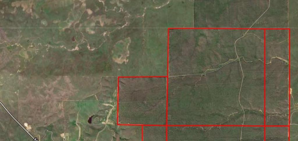
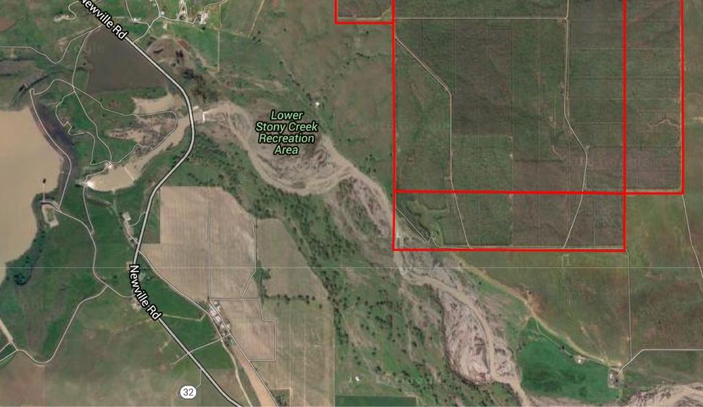
1 AG-LAND Investment Brokers 275 Sale Lane Red Bluff, CA Fax Corning Eucalyptus Farm Tehama County,, California

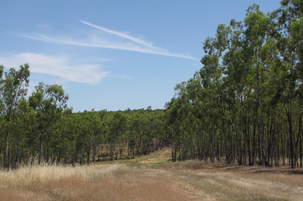
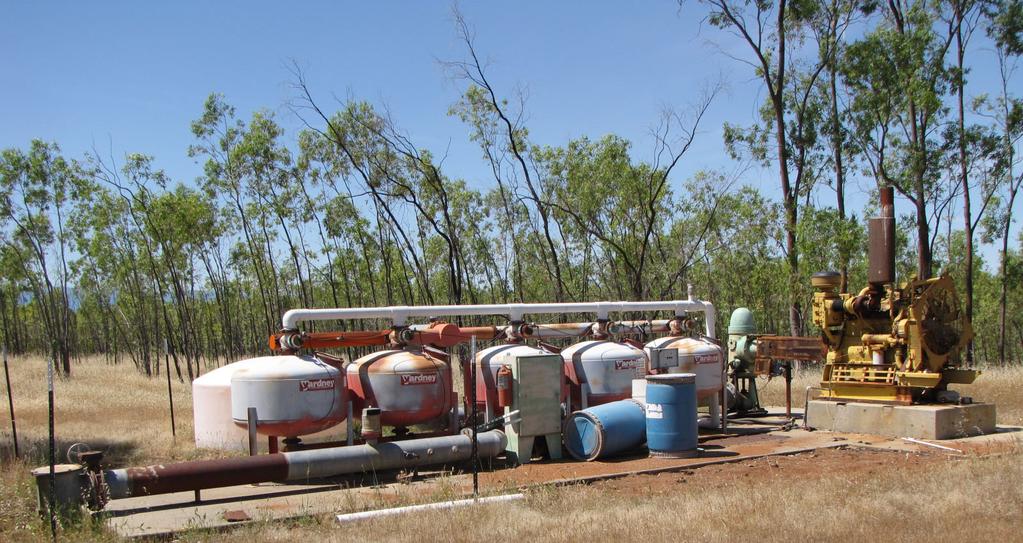
2 1 of 6 deep irrigation wells


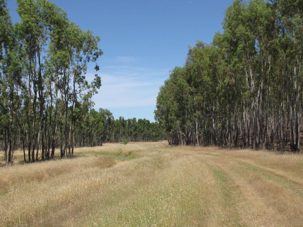
3 Drip tubing rolled at the edge of the field


4 Black Butte Reservoir to the west
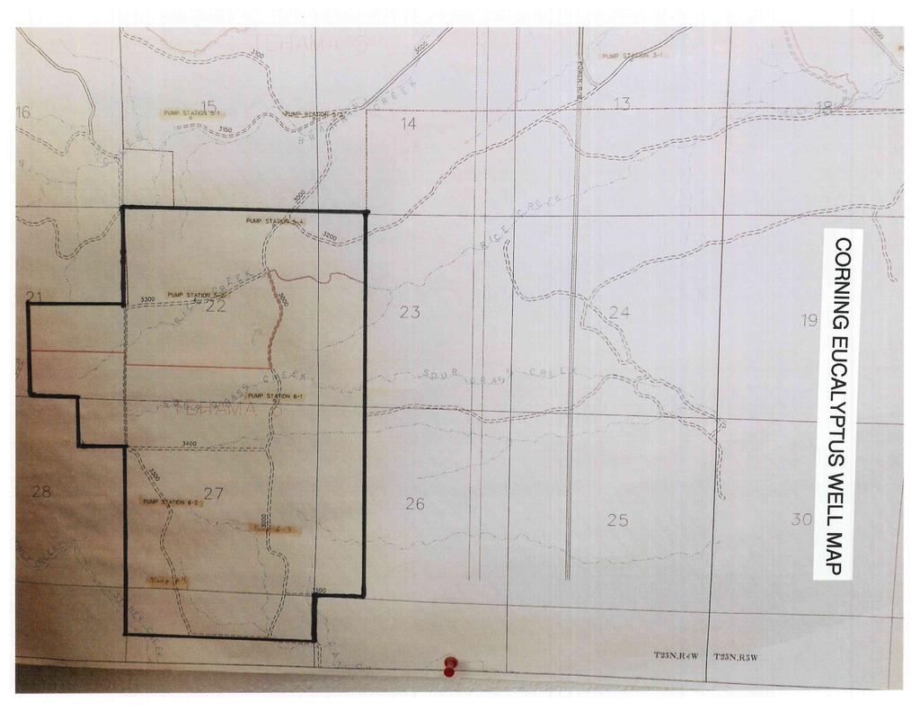
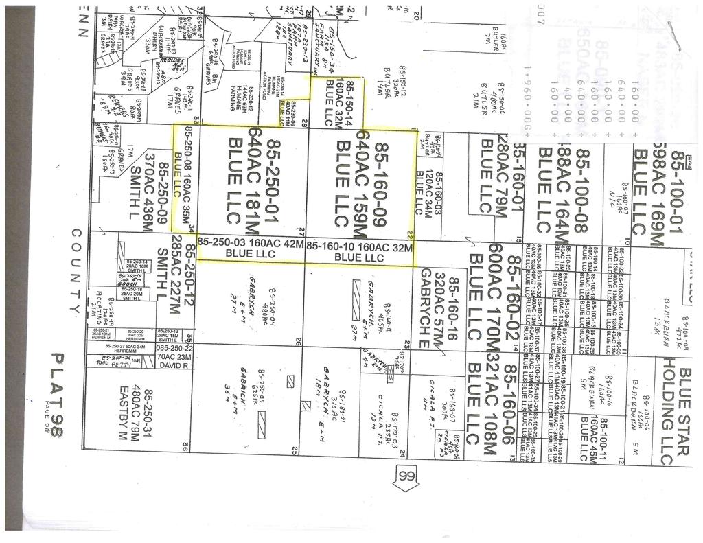
5 AG-LAND INVESTMENT BROKERS 275 Sale Lane, Suite 2 / P. O. Box 896 Red Bluff, CA office / fax Eucalyptus Farm Corning, CA Property: 1,960 +/- acres planted to Eucalyptus trees. 6 deep irrigation wells powered by diesel engines. Originally planted in 1993 or 1994 to be chipped for the high quality paper market. Recently, the trees have been chipped for cogeneration or harvested for firewood. The water, soils and location combine to make this land suitable for development of almonds, pistachios or prunes. Location: 5 +/- miles (S) Corning and 3 +/- miles (W) of Interstate 5. Deeded access to be provided through Seller s other lands beginning from Seller s headquarters at Sour Grass Road, Corning, CA Topography: Slightly sloping to undulating. Elevation ranges from 400 to 450. Several seasonal streams meander through the property allowing the land to drain well. Irrigation: 6 irrigation wells (16 casing) with diesel engines, gearheads, filtration and fuel tanks within concrete containment. The wells are completed to 600 or deeper. In July of 2015, 5 of 6 wells were tested for productivity. Results indicate flows ranging from 1,100 gpm to 1,900 gpm depending on the well. The trees were originally irrigated using above ground drip and buried mainlines. Many irrigation maps are available to allow some of the buried mainlines to be re-used. Leases: The property has been leased for winter cattle grazing but is not currently leased. The property is not currently leased for hunting. Zoning: AG-2; Agriculture, 40 acre minimum parcel size. The property is also enrolled in the Agricultural Preserve aka the Williamson Act. Tehama County Assessor Parcel Numbers , &10, , , 03 & 08. Current property taxes are $5,682 per year. Comments: Interesting opportunity to purchase 1,960 +/- acres with existing agricultural wells, motors, pumps and filter stations. The new owner can remove the eucalyptus and plant almonds, pistachios, or prunes. Listing Price: $18,620,000, approximately $9,500 per acre. The information contained herein is from sources deemed reliable, however, accuracy is not guaranteed. AG-LAND Investment Brokers assumes no liability as to errors, omissions or future operating and investment results. Buyer assumes responsibility to perform their own investigation and due diligence. This offering is subject to prior sale, price change or withdrawal from market without notice.
6 AG-LAND INVESTMENT BROKERS 275 Sale Lane, Suite 2 / P. O. Box 896 Red Bluff, CA office / fax Contact Info: Please contact the Listing Brokers, Bert Owens or Sam Mudd. Bert Owens, California Brokers License Number , office / , cell bert.owens@aglandbrokers.com, website Sam Mudd, California Brokers Number , office / , cell sam.mudd@aglandbrokers.com, website The information contained herein is from sources deemed reliable, however, accuracy is not guaranteed. AG-LAND Investment Brokers assumes no liability as to errors, omissions or future operating and investment results. Buyer assumes responsibility to perform their own investigation and due diligence. This offering is subject to prior sale, price change or withdrawal from market without notice.
7
8
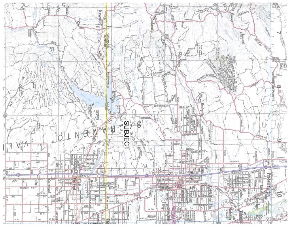
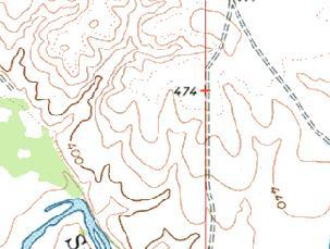
9 122 19' " W ' " W ' " W ' " W ' " W ' " W ' " N ' " N ' " N ' " N ' " N ' " N ' " N ' " N ' " N ' " N ' " N ' " W ' " W ' " W Copyright (C) 2015 MyTopo, TomTom ' " W ' " W ' " N ' " W SCALE 1: Feet


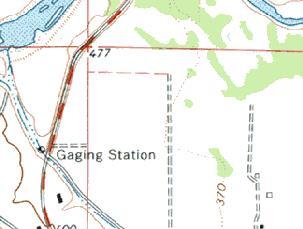
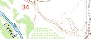
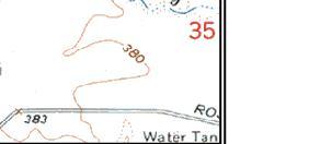
10 122 18' " W ' " W ' " W ' " W ' " W ' " N ' " N ' " N ' " N ' " N ' " N ' " N ' " N W ' " N ' " N W Copyright (C) 2008, MyTopo, TomTom ' " W ' " W ' " W ' " W ' " W SCALE 1: Feet

11 122 19' 19'' W Irrigated Capability Class Tehama County, California (Blue Star LLC) ' 55'' W 39 50' 47'' N ' 47'' N ' 21'' N ' 21'' N ' 19'' W N Map Scale: 1:22,000 if printed on A portrait (8.5" x 11") sheet. Meters Feet Map projection: Web Mercator Corner coordinates: WGS84 Edge tics: UTM Zone 10N WGS ' 55'' W Natural Resources Conservation Service Web Soil Survey National Cooperative Soil Survey 5/2/2016 Page 1 of 4
12 Irrigated Capability Class Tehama County, California (Blue Star LLC) MAP LEGEND MAP INFORMATION Area of Interest (AOI) Area of Interest (AOI) Soils Soil Rating Polygons Capability Class - I Capability Class - II Capability Class - III Capability Class - IV Capability Class - V Capability Class - VI Capability Class - VII Capability Class - VIII Not rated or not available Soil Rating Lines Capability Class - I Capability Class - II Capability Class - III Capability Class - IV Capability Class - V Capability Class - VI Capability Class - VII Capability Class - VIII Not rated or not available Soil Rating Points Capability Class - I Capability Class - II Capability Class - III Capability Class - IV Capability Class - V Capability Class - VI Capability Class - VII Capability Class - VIII Not rated or not available Water Features Streams and Canals Transportation Rails Interstate Highways US Routes Major Roads Local Roads Background Aerial Photography The soil surveys that comprise your AOI were mapped at 1:20,000. Please rely on the bar scale on each map sheet for map measurements. Source of Map: Natural Resources Conservation Service Web Soil Survey URL: Coordinate System: Web Mercator (EPSG:3857) Maps from the Web Soil Survey are based on the Web Mercator projection, which preserves direction and shape but distorts distance and area. A projection that preserves area, such as the Albers equal-area conic projection, should be used if more accurate calculations of distance or area are required. This product is generated from the USDA-NRCS certified data as of the version date(s) listed below. Soil Survey Area: Tehama County, California Survey Area Data: Version 9, Sep 18, 2015 Soil map units are labeled (as space allows) for map scales 1:50,000 or larger. Date(s) aerial images were photographed: Jun 12, 2010 Feb 17, 2012 The orthophoto or other base map on which the soil lines were compiled and digitized probably differs from the background imagery displayed on these maps. As a result, some minor shifting of map unit boundaries may be evident. Natural Resources Conservation Service Web Soil Survey National Cooperative Soil Survey 5/2/2016 Page 2 of 4
13 Irrigated Capability Class Tehama County, California Blue Star LLC Irrigated Capability Class Ay Irrigated Capability Class Summary by Map Unit Tehama County, California (CA645) Map unit symbol Map unit name Rating Acres in AOI Percent of AOI Arbuckle gravelly loam, clayey substratum, channeled CwA Corning gravelly loam, 0 to 3 percent slopes CxB2 CyB Corning-Newville gravelly loams, 3 to 10 percent slopes, eroded Corning-Redding gravelly loams, 0 to 5 percent slopes % % 4 1, % % Czx Cortina complex % NrB2 Newville gravelly loam, 3 to 10 percent slopes, eroded NrD2 NrE2 Newville gravelly loam, 10 to 30 percent slopes, eroded Newville gravelly loam, 30 to 50 percent slopes, eroded % % % Rr Riverwash % Totals for Area of Interest 2, % Natural Resources Conservation Service Web Soil Survey National Cooperative Soil Survey 5/2/2016 Page 3 of 4
14 Irrigated Capability Class Tehama County, California Blue Star LLC Description Land capability classification shows, in a general way, the suitability of soils for most kinds of field crops. Crops that require special management are excluded. The soils are grouped according to their limitations for field crops, the risk of damage if they are used for crops, and the way they respond to management. The criteria used in grouping the soils do not include major and generally expensive landforming that would change slope, depth, or other characteristics of the soils, nor do they include possible but unlikely major reclamation projects. Capability classification is not a substitute for interpretations that show suitability and limitations of groups of soils for rangeland, for woodland, or for engineering purposes. In the capability system, soils are generally grouped at three levels-capability class, subclass, and unit. Only class and subclass are included in this data set. Capability classes, the broadest groups, are designated by the numbers 1 through 8. The numbers indicate progressively greater limitations and narrower choices for practical use. The classes are defined as follows: Class 1 soils have few limitations that restrict their use. Class 2 soils have moderate limitations that reduce the choice of plants or that require moderate conservation practices. Class 3 soils have severe limitations that reduce the choice of plants or that require special conservation practices, or both. Class 4 soils have very severe limitations that reduce the choice of plants or that require very careful management, or both. Class 5 soils are subject to little or no erosion but have other limitations, impractical to remove, that restrict their use mainly to pasture, rangeland, forestland, or wildlife habitat. Class 6 soils have severe limitations that make them generally unsuitable for cultivation and that restrict their use mainly to pasture, rangeland, forestland, or wildlife habitat. Class 7 soils have very severe limitations that make them unsuitable for cultivation and that restrict their use mainly to grazing, forestland, or wildlife habitat. Class 8 soils and miscellaneous areas have limitations that preclude commercial plant production and that restrict their use to recreational purposes, wildlife habitat, watershed, or esthetic purposes. Rating Options Aggregation Method: Dominant Condition Component Percent Cutoff: None Specified Tie-break Rule: Higher Natural Resources Conservation Service Web Soil Survey National Cooperative Soil Survey 5/2/2016 Page 4 of 4
15
16
AG-LAND Investment Brokers 275 Sale Lane Red Bluff, CA Fax Paradox Seed Mother Orchard Red Bluff, CA
 AG-LAND Investment Brokers 275 Sale Lane Red Bluff, CA 96080 530-529-4400 Fax 530-527-5042 Paradox Seed Mother Orchard Red Bluff, CA AG-LAND INVESTMENT BROKERS 275 Sale Lane / P. O. Box 896 Red Bluff,
Mule Ranch - Dorris, CA 1,234 +/- acres, Siskiyou County
 AG-LAND Investment Brokers 275 Sale Lane Red Bluff, CA 96080 530-529-4400 Fax 530-527-5042 Mule Ranch - Dorris, CA 1,234 +/- acres, Siskiyou County AG-LAND INVESTMENT BROKERS 275 Sale Lane / P. O. Box
Loam Ridge Almond Orchard
 AG-LAND Investment Brokers 645 Antelope Blvd., Suite 17 PO Box 896 Red Bluff, CA 96080 530-529-4400 Fax 530-527-5042 Loam Ridge Almond Orchard Contact: AG-LAND Investment Brokers Prepared by FSA Date:
Dye Creek Orchards Los Molinos, California
 AG-LAND INVESTMENT BROKERS 275Sale Lane / P. O. Box 896 Red Bluff, CA 96080 530.529.4400 office / 530.527.5042 fax Dye Creek Orchards Los Molinos, California Listing Price: $1,950,000. Seller financing
Dairyville Irrigated Pasture & Home. Los Molinos, CA
 Dairyville Irrigated Pasture & Home Los Molinos, CA AG-LAND INVESTMENT BROKERS 275 Sale Lane, Suite 2 / P. O. Box 896 Red Bluff, CA 96080 530.529.4400 office / 530.527.5042 fax 68 th Avenue Irrigated Pasture
Pinheiro Ranch 55+/- Acres Orchard Development Ground Orland, CA. Presented By:
 Pinheiro Ranch 55+/- Acres Orchard Development Ground Orland, CA Presented By: Pinheiro Ranch 55+/- Acres Orchard Development Ground Orland, CA Location: This property is located on the SE corner of Road
Owens Reeds Creek Ranch. Red Bluff, CA
 Owens Reeds Creek Ranch Red Bluff, CA Owens Reeds Creek Ranch Red Bluff, CA AG-LAND INVESTMENT BROKERS 275 Sale Lane, Suite 2 / P. O. Box 896 Red Bluff, CA 96080 530.529.4400 office / 530.527.5042 fax
Central Glenn County, CA
 AG-LAND Investment Brokers 275 Sale Lane Red Bluff, CA 96080 530-529-4400 Fax 530-527-5042 AAA&D Almond Orchard 145 +/- Acres Producing Central Glenn County, CA AG-LAND INVESTMENT BROKERS 275 Sale
AG-LAND Investment Brokers. 275 Sale Lane Red Bluff, CA Fax Northcutt Ranch. Red Bluff, CA
 AG-LAND Investment Brokers 275 Sale Lane Red Bluff, CA 96080 530-529-4400 Fax 530-527-5042 Northcutt Ranch Red Bluff, CA AG-LAND INVESTMENT BROKERS 275 Sale Lane, Suite 2 / P. O. Box 896 Red Bluff,
Gonsalves Ranch, 756 +/- Total Acres Red Bluff, California
 AG-LAND INVESTMENT BROKERS 275 Sale Lane, Suite 2 / P. O. Box 896 Red Bluff, CA 96080 530.529.4400 office / 530.527.5042 fax Gonsalves Ranch, 756 +/- Total Acres Red Bluff, California Listing Price: $675,000.
Capay District Home, Farmland, Shop Orland, CA
 AG-LAND Investment Brokers 275 Sale Lane Red Bluff, CA 96080 530-529-4400 Fax 530-527-5042 Capay District Home, Farmland, Shop Orland, CA Tehama County, California AG-LAND INVESTMENT BROKERS 275 Sale
Herger Ranch /- Acres Madison, CA. Presented By:
 Herger Ranch 326.33+/- Acres Madison, CA Presented By: Herger Ranch 326.33+/- Acres Madison, CA Location: This ranch is located on the NW corner of Highway 16 and Road 89 in Madison, CA. The property stretches
Web Soil Survey National Cooperative Soil Survey
 99 52' 37'' W Yields of Irrigated Crops (Component): Cotton lint (Lbs) Haskell County, Texas 99 51' 40'' W 33 21' 4'' N 418500 418600 418700 418800 418900 419000 419100 419200 419300 419400 419500 419600
Soil Map Lewis County, Kentucky (Denham Farm, Sand Hill/Trinity, Lewis Co., KY) Web Soil Survey National Cooperative Soil Survey
 Web Soil Survey National Cooperative Soil Survey") 83 37' 43'' W (Denham Farm, Sand Hill/Trinity, Lewis Co., KY) 83 36' 18'' W 38 40' 37'' N 271500 271700 271900 272100 272300 272500 272700 272900 273100 273300 38 40' 37'' N 38 39' 54'' N 4282900 4283100
83 37' 43'' W (Denham Farm, Sand Hill/Trinity, Lewis Co., KY) 83 36' 18'' W 38 40' 37'' N 271500 271700 271900 272100 272300 272500 272700 272900 273100 273300 38 40' 37'' N 38 39' 54'' N 4282900 4283100
Web Soil Survey National Cooperative Soil Survey
 289300 289700 290100 290500 83 12' 5'' W 83 13' 37'' W Farmland Classification Ben Hill and Irwin Counties, Georgia 290900 291300 31 46' 8'' N 3514000 3514000 3514400 3514400 3514800 3514800 3515200 3515200
Alapaha Tract. Alapaha Tract. Berrien County GA Acres Par LL 320 LD 5. Date: 6/6/2017. TractName
 The 996 Planted Slash was st thinned in 0 TractName Alapaha inch equals 74 miles in = 44,786 ft 0 0 60 Miles :,77,40 The 996 Planted Slash was st thinned in 0 TractName Alapaha inch equals miles in = 6,7
The glenlivet farm and refuge An agricultural and recreational investment opportunity.
 offered for sale The glenlivet farm and refuge An agricultural and recreational investment opportunity. 3,106 (+/- sq. ft.) lodge situated on a 304 (+/-) acre farm/waterfowl refuge Arkansas County, Arkansas
Soil Map Lowndes County, Alabama (McEvoy_Gordonsville)
") 524700 525000 525300 525600 525900 526200 3568000 3568000 3567700 3567700 3567400 3567400 3567100 3567100 3566800 3566800 3566500 3566500 3566200 3566200 3565900 3565900 524700 525000 525300 525600 Map
524700 525000 525300 525600 525900 526200 3568000 3568000 3567700 3567700 3567400 3567400 3567100 3567100 3566800 3566800 3566500 3566500 3566200 3566200 3565900 3565900 524700 525000 525300 525600 Map
THE CITY OF THE VILLAGE PLANNED UNIT DEVELOPMENT DESIGN STATEMENT FOR MULFORD ESTATES
 THE CITY OF THE VILLAGE PLANNED UNIT DEVELOPMENT DESIGN STATEMENT FOR MULFORD ESTATES Revised August 18, 2016, August 10, 2016, September 19,2016 Prepared By: Isch and Associates, Inc. 14848 Bristol Park
REFERENCE MAPS FEMA FIRM MAP NRCS SOILS MAP
 REFERENCE MAPS FEMA FIRM MAP NRCS SOILS MAP Hydrologic Soil Group-Hillsborough County, Florida (Independence Parkway) 27' 58' 56" 27" 58' 57" 2r 58' 32" 27" 58' 33" Map Scale: 1:5,290 if printed on A size
Stormwater Analysis Report
 Stormwater Analysis Report Solar Panel Array Temple Street (Rt. 14) West Boylston, MA February 24, 216 SITE Prepared for: West Boylston Municipal Lighting Plant 4 Crescent Street West Boylston, MA 1583
FOR SALE. 1,237.33± Acres, Wasco Kern County, California. CA BRE # Exclusively Presented By: Pearson Realty
 FOR SALE Wasco Almonds & Farmland Opportunity 1,237.33± Acres, Wasco Kern County, California Access to district & well water Quality soils & well water to work with 747.13± acres of almonds, 595.52± acres
Custom Soil Resource Report for Columbus County, North Carolina
 United States Department of Agriculture Natural Resources Conservation Service A product of the National Cooperative Soil Survey, a joint effort of the United States Department of Agriculture and other
Drainage Letter for Falcon High School Building Expansion
 August 11, 2017 El Paso County Planning and Community Development Department 2880 International Circle, Suite 110 Colorado Springs, CO 80910 ATTN: RE: Mr. Jeff Rice Drainage Letter for Falcon High School
INVEST IN WATER - INVEST IN NEBRASKA. Offered exclusively by:
 SANDHILLS FARM & RANCH 3924.49 +/- ACRES LOGAN COUNTY, NE INVEST IN WATER - INVEST IN NEBRASKA REDUCED Offered exclusively by: AGSTAR LAND BROKERS, LLC RICHARD DAWSON, BROKER & LISTING AGENT MOBILE: (308)
SW KANSAS IRRIGATION. 4,114 +/- Acres Kearny County, KS $19,335,800. Farm, Ranch & Recreational Real Estate. Presented By:
 4,114 +/- Acres Kearny County, KS $19,335,800 Presented By: Farm, Ranch & Recreational Real Estate For more details on this property, contact us today! SUMMARY: This hard to find irrigated farm property
STORMWATER MANAGEMENT REPORT FOR THE BORGATA OUTDOOR EVENT AREA POOL ADDITION
 STORMWATER MANAGEMENT REPORT FOR THE BORGATA OUTDOOR EVENT AREA POOL ADDITION City of Atlantic City, Atlantic County, New Jersey Prepared For: Marina District Development Company, LLC One Borgata Way Atlantic
Rocking W Ranch Millsap, Texas
 Rocking W Ranch Millsap, Texas Approximately 1 hour west of DFW International Airport Interstate Frontage Full professional equine facilities Brazos River frontage with significant water rights Mineral
Site Description. CCR Rule Initial Inflow Design Flood Control System Plan (cont.) 2
 2") Site Description Kentucky Utilities Company (KU) owns and operates Ghent Gypsum Stack, a CCR surface impoundment, at the Ghent Generating Station in Carroll County, Kentucky. The impoundment is permitted
Site Description Kentucky Utilities Company (KU) owns and operates Ghent Gypsum Stack, a CCR surface impoundment, at the Ghent Generating Station in Carroll County, Kentucky. The impoundment is permitted
Land Evaluation and Site Assessment Model
 Land Evaluation and Site Assessment Model Citizens Imperial Solar, LLC Project Imperial County, CA June 6, 2018 This page is intentionally blank. Land Evaluation and Site Assessment Model Citizens Imperial
Bicycle and pedestrian circulation is scored as follows:
 4. Bicycle and Pedestrian Circulation The mode split for walking and bicycling in the unincorporated areas of County are each less than one percent, which is less than half of the walking and biking mode
FOR SALE. FOR SALE /- Acres of Prime Almonds in LTRID and Saucelito Irrigation District. Morgan Houchin Tech Ag Financial Group, Inc.
 FOR SALE FOR SALE - 235.72 +/- Acres of Prime Almonds Morgan Houchin P.O. Box 98 Buttonwillow, CA 93206 Neither the Seller, nor makes any representations or warranties, either expressed or implied as to
Matre Forestry Consulting, Inc Lafayette Plaza Dr Suite 204 Albany GA Office (229) Fax (229)
 Fax (229)") Matre Forestry Consulting, Inc. 2549 Lafayette Plaza Dr Suite 204 Albany GA 31707 Office (229) 639 4973 Fax (229) 255 2910 www.matreforestry.com Re: Webster GA 135 Dear Interested Parties, Matre Forestry
Matre Forestry Consulting, Inc. 2549 Lafayette Plaza Dr Suite 204 Albany GA 31707 Office (229) 639 4973 Fax (229) 255 2910 www.matreforestry.com Re: Webster GA 135 Dear Interested Parties, Matre Forestry
Rocking R Ranch / Woodland, CA
 ±88.98 Acres Asking Price: $1,600,000 32640 County Road 19, Woodland, CA 95695 APN 025-280-001 Property Highlights y Country Hilltop Manor w/spectacular Coast Range Views y Classic 3 BR/2 BA Two-Story
Appendix M Land Evaluation and Site Assessment (Calipatria I, Midway I and Midway II)
") Appendix M Land Evaluation and Site Assessment (Calipatria I, Midway I and Midway II) LESA ASSESSMENT CALIPATRIA SOLAR FARM I PROJECT AREA CALIPATRIA SOLAR FARM I PROJECT (Section 10 (portion), T12S, R14E,
Appendix M Land Evaluation and Site Assessment (Calipatria I, Midway I and Midway II) LESA ASSESSMENT CALIPATRIA SOLAR FARM I PROJECT AREA CALIPATRIA SOLAR FARM I PROJECT (Section 10 (portion), T12S, R14E,
PHYSICAL SOIL PROPERTIES
 PHYSICAL SOIL PROPERTIES Physical Soil Properties Santa Cruz County, California Scotts Valley Target Physical Soil Properties This table shows estimates of some physical characteristics and features that
LESA ASSESSMENT MOUNT SIGNAL SOLAR FARM I PROJECT AREA
 LESA ASSESSMENT MOUNT SIGNAL SOLAR FARM I PROJECT AREA MOUNT SIGNAL SOLAR FARM I PROJECT (SW/4 Section 16, S/2 Section 15, NE/4 Section 14 (portion), N/2 Section 13 (portion) and SE/4 Section 13, T17S,
OUTDOOR PROPERTIES. Monroe Land & Livestock
 OUTDOOR PROPERTIES of Monroe Land & Livestock INTRODUCTION Monroe Land and Livestock is an opportunity to own an incredible income generating property. Encompassing 2300+/- total deeded acres, this hay
APPENDIX E. LESA Models
 APPENDIX E LESA Models LESA ASSESSMENT CALEXICO SOLAR FARM I PHASE A PROJECT AREA CALEXICO SOLAR FARM I PHASE A PROJECT (SW/4 Section 13, S/2 Section 14, S/2 NE/4 Section 15, NW/4 Section 15, T17S, R13E,
4.11 AGRICULTURAL RESOURCES INTRODUCTION ENVIRONMENTAL SETTING. Regional. Project Site Setting
 4.11 AGRICULTURAL RESOURCES 4.11.1 INTRODUCTION This section addresses the potential for the Proposed Project to impact the agricultural resources in and around the Proposed Project location. Following
Nonirrigated Yields by Map Unit
 Ar: Arents Urban land 8s 800 85 35 50 Ca: Calhoun Henry 3w 3w 400 --- 25 30 Co: Calloway 700 90 38 35 Cs: Collins 800 110 40 40 DuB: 600 75 35 40 DuB3: 575 70 30 --- DuC3: 500 60 20 --- DuD3: EuE: Eustis
Nonirrigated Yields by Map Unit
 Ar: Arents Urban land 8s Ca: Calhoun Henry 3w 3w --- --- --- --- 5.0 Co: Calloway --- 9.0 --- 8.5 6.5 Cs: Collins DuB: DuB3: DuC3: DuD3: --- --- 5.0 --- --- EuE: Eustis 7s --- --- --- --- --- Fa: Falaya
offered for sale WAYNE FARM An Agricultural and Recreational Investment Opportunity offered by
 offered for sale WAYNE FARM An Agricultural and Recreational Investment Opportunity 780.93 (+/-) Total Acres Pulaski County, Arkansas offered by Licensed in Arkansas, Louisiana, Mississippi, Tennessee
Jordan Maassen Sales Associate Cell Phone:
 Red Willow County Dryland and Range A high producing farm and grassland property just South of Indianola Email: Jordan@lashleyland.com Property Highlights List Price $1,675,000 Location 1.5 miles South
Custom Soil Resource Report for Polk County, Wisconsin
 United States Department of Agriculture Natural Resources Conservation Service A product of the National Cooperative Soil Survey, a joint effort of the United States Department of Agriculture and other
East Angela Farm ANGELA, MONTANA. Hunting Ranching Fly Fishing Conservation
 East Angela Farm ANGELA, MONTANA Hunting Ranching Fly Fishing Conservation East Angela Far m ANGELA, MONTANA Introduction: East Angela Farm is an agricultural farm and ranch in eastern Montana. Located
Harding Real Estate Vacant Acres Thompson Rd., Wonder Lake, IL. Presented By: Randy Erwin, Broker Associate Natalie Torres, Broker Associate
 Harding Real Estate 193.93 Vacant Acres Thompson Rd., Wonder Lake, IL Presented By: Randy Erwin, Broker Associate Natalie Torres, Broker Associate Harding Real Estate 1710 South Eastwood Dr. Woodstock,
Appendix D. Land Evaluation Site Assessment System
 Appendix D Land Evaluation Site Assessment System Town of Dewey Comprehensive Plan 2009 PORTAGE COUNTY S LAND EVALUATION SITE ASSESSMENT SYSTEM A tool to help local communities understand the agricultural
Berkshire Hathaway Home Services Vacant Acres Halsted Rd. Rockford, IL 61114
 Berkshire Hathaway Home Services 36.13 Vacant Acres Halsted Rd. Rockford, IL 61114 Offered by Randy Erwin & Natalie Torres Broker Associates Berkshire Hathaway Home Services 1710 South Eastwood Dr. Woodstock,
LINTZ FARM BURT COUNTY
 LA N D F O R S A L E LINTZ FARM BURT COUNTY offered in four separate parcels Location: Legal Description: Located in the Missouri River Valley in northeast Burt County, approximately 8 miles northeast
TEXAS SOUTH PLAINS IRRIGATED FARM
 TEXAS SOUTH PLAINS IRRIGATED FARM 1,075± Acres of Irrigated Farmland Price Reduced! PROPERTY OVERVIEW THESE 1,075± ACRES OF IRRIGATED FARMLAND ARE LOCATED THREE MILES NORTH OF AMHERST, TEXAS. The property
L A N D F O R S A L E. Hayes Center Farm. 3,270 acres located in Hayes County, Nebraska
 L A N D F O R S A L E Hayes Center Farm 3,270 acres located in Hayes County, Nebraska Pivot Irrigated Cropland, Dryland Cropland, & Rangeland Offered in 3 separate parcels Contact: Brian Reynolds; Listing
Panhandle Green Valley Ranch
 Panhandle Green Valley Ranch A well maintained combination ranch and farm with 2,898± acres in Kimball County, Nebraska. Property Highlights List Price $2,600,000 Location/Background The Panhandle Green
SALZMAN FARM & RANCH
 SALZMAN FARM & RANCH Cochise County, Arizona 8,381 Fee Acres Offered by: J ack Doughty, Three Rivers Ag Investments LOCATION The Salzman Farm and Ranch sits at the north end of the White Water Draw of
UNDIVIDED ONE-HALF INTEREST IN A ± ACRE PARCEL
 FOR SALE UNDIVIDED ONE-HALF INTEREST IN A ADJACENT TO THE SACRAMENTO INTERNATIONAL AIRPORT, SACRAMENTO, CA 95835 CONTACT US RANDY GRIMSMAN Senior Vice President Lic. 00857338 +1 916 446 8745 randall.grimsman@cbre.com
Civil Engineering Land Surveying Wetland Science
 Civil Engineering Land Surveying Wetland Science July 5, 2017 Town of Littleton Conservation Commission c/o Amy Green, Conservation Coordinator Shattuck Street Municipal Building 37 Shattuck Street Littleton,
STORMWATER POLLUTION PREVENTION PLAN (SWPPP)
") SIEMENS INDUSTRY, INC. STORMWATER POLLUTION PREVENTION PLAN (SWPPP) COLUMBIA UNIVERSITY/SUN EDISON REMOTE METERING SOLAR ENERGY PROJECT JOHNSON FARM, 121 JOHNSON ROAD CHESTER, NEW YORK 10918 TAX LOT SECTION
SIEMENS INDUSTRY, INC. STORMWATER POLLUTION PREVENTION PLAN (SWPPP) COLUMBIA UNIVERSITY/SUN EDISON REMOTE METERING SOLAR ENERGY PROJECT JOHNSON FARM, 121 JOHNSON ROAD CHESTER, NEW YORK 10918 TAX LOT SECTION
McPherson & Hooker Counties, Nebraska
 McPherson & Hooker Counties, Nebraska Offered Exclusively By: NORTH PLATTE OFFICE P.O. Box 1166 I-80 & US Hwy 83 North Platte, NE 69103 www.agriaffiliates.com (308) 534-9240 Fax (308) 534-9244 Information
McPherson & Hooker Counties, Nebraska
 McPherson & Hooker Counties, Nebraska Offered Exclusively By: NORTH PLATTE OFFICE P.O. Box 1166 I-80 & US Hwy 83 North Platte, NE 69103 www.agriaffiliates.com (308) 534-9240 Fax (308) 534-9244 Information
FOR SALE. Contact: Panola & Quitman Counties, Miss. Total Size Location. Description. Cropland Soils Improvements
 Spring Hill Farm 1,221.08 +/- ac. Panola & Quitman Counties, Miss. Total Size Location Description Cropland Soils Improvements 1,221.08+/- tax ac.; 1,223.21+/- FSA farmland ac.; 1,138.74+/- FSA cropland
Goertz Farm Phillips County Malta, Montana
 Goertz Farm Phillips County Malta, Montana Clifton M. Berglee, D.V.M. (Listing Broker) 406-860-7319 cell cberglee@montwyowest.com Phone: (406) 628-2341 (office) Website: montwyowest.com P.O. Box 578, Laurel,
APPENDIX I LESA MODELS
 APPENDIX I LESA MODELS LESA ASSESSMENT SEVILLE 4 SOLAR PROJECT HORIZONTAL SINGLE-AXIS TRACKING ARRAY (T16S, R12E, S25, SBB&M) IMPERIAL COUNTY, CALIFORNIA July 2017 EMA Report No. 2375-01 Prepared for:
70 ACRES - RILEY COUNTY, KS
 Buyers, Sellers & Land Connected PRICE: $241,500 ACRES: 70 COUNTY: RILEY STATE: KANSAS Secluded Mountain-Like Views Over Tuttle Creek Lake in Riley County, Kansas This one of a kind secluded property gives
LESA ASSESSMENT LAUREL SOLAR PROJECT (T16S, R12E, S26, SBB&M)
") LESA ASSESSMENT LAUREL SOLAR PROJECT (T16S, R12E, S26, SBB&M) IMPERIAL COUNTY, CALIFORNIA May 2017 EMA Report No. 2377-01 Prepared for: 90FI 8me LLC 111 Woodmere Road, Suite 250 Folsom, CA 95630 ENVIRONMENTAL
LESA ASSESSMENT LAUREL SOLAR PROJECT (T16S, R12E, S26, SBB&M) IMPERIAL COUNTY, CALIFORNIA May 2017 EMA Report No. 2377-01 Prepared for: 90FI 8me LLC 111 Woodmere Road, Suite 250 Folsom, CA 95630 ENVIRONMENTAL
HARVEST PARK/ZIEGLER MIXED USE LOT 2 CITY OF FORT COLLINS, CO
 EROSION CONTROL REPORT / STORMWATER MANAGEMENT PLAN FOR HARVEST PARK/ZIEGLER MIXED USE LOT 2 CITY OF FORT COLLINS, CO Prepared by: Interwest Consulting Group 1218 West Ash, Suite C Windsor, Colorado 80550
Custom Soil Resource Report for Colquitt and Cook Counties, Georgia
 United States Department of Agriculture Natural Resources Conservation Service A product of the National Cooperative Soil Survey, a joint effort of the United States Department of Agriculture and other
Custom Soil Resource Report for Isle of Wight County, Virginia, Southampton County, Virginia, and Surry County, Virginia
 United States Department of Agriculture Natural Resources Conservation Service A product of the National Cooperative Soil Survey, a joint effort of the United States Department of Agriculture and other
145 ACRES - WABUANSEE COUNTY, KS
 Buyers, Sellers & Land Connected PRICE: $295,000 ACRES: 145 COUNTY: WABAUNSEE STATE: KANSAS Mix-Use Grazing Pasture and CRP in Northeast Wabaunsee County A perfect mix-use 145 acre tract adjoining the
HEADQUARTERS WEST LTD. FARM, RANCH, AGRIBUSINESS REAL ESTATE SALES & SERVICES
 Offered For Sale HUNT VALLEY RANCH Apache County, Arizona Exclusively Listed By: Traegen Knight Headquarters West, Ltd. P.O. Box 1980 St. Johns, Arizona 85936 Ph. 928 524-3740 Fx. 928 563-7004 Hunt Valley
HEADQUARTERS WEST LTD. FARM, RANCH, AGRIBUSINESS REAL ESTATE SALES & SERVICES
 Offered For Sale GOLD TRAP RANCH Coconino County, Arizona Exclusively Listed By: Traegen Knight Headquarters West, Ltd. P.O. Box 1980 St. Johns, Arizona 85936 Ph. 928 524-3740 Fx. 928 563-7004 Gold Trap
Hyde County Cropland Retreat /- Deeded Acres
 Hyde County Cropland Retreat 426.67+/- Deeded Acres Signature Property Todd Schuetzle Broker Cell: 605-280-3115 todd@placetohunt.com Graham Schuetzle Broker Associate Cell: 605-220-4014 dakotalandco@gmail.com
Maricopa Table Grapes & Open Ground Bakersfield, California
 Kern County, CA Southlake Exitus I Exitus II Maricopa Native/Grazing Exclusively Presented By: CALIFORNIA S LARGEST AG BROKERAGE FIRM CA BRE #00020875 Property Overview DESCRIPTION A total of 872.00± acres
Custom Soil Resource Report for Ocean County, New Jersey
 United States Department of Agriculture Natural Resources Conservation Service A product of the National Cooperative Soil Survey, a joint effort of the United States Department of Agriculture and other
27.7 ACRES CASS COUNTY, MO
 Buyers, Sellers & Land Connected 2. ACRES CASS COUNTY, MO PRICE: $20,500 ACRES: 2. COUNTY: Cass STATE: Missouri For More Information contact: STEVE MOTT, Land Broker 16.1.201 SteveMott@MidwestLandGroup.com
2700 Acre Little River Ranch & Feedlot Milam County, Cameron, TX
 2700 Acre Little River Ranch & Feedlot Milam County, Cameron, TX Brokered By: Property Tech Realty Table of Contents Table of Contents Page 2 Disclaimer Page 2 Property Description Page 3 Property Information
FOR SALE 286± ACRES AMELIA, VIRGINIA
 23002 LATITUDE & LONGITUDE 37.254186, -77.524036 Winchester Front Royal 15 Leesburg 495 Washington 66 Chantilly Arlington Falls Church Fairfax Alexandria Springfield Manassas Warrenton 301 13 11 Dale City
Quality agland located southwest of North Platte, Nebraska! Available for purchase as a turnkey operation or as individual tracts.
 FOR SALE 19,518± acres lincoln county, nebraska L-1200832 Quality agland located southwest of North Platte, Nebraska! Available for purchase as a turnkey operation or as individual tracts. www.farmersnational.com
Custom Soil Resource Report for Wright County, Minnesota
 United States Department of Agriculture Natural Resources Conservation Service A product of the National Cooperative Soil Survey, a joint effort of the United States Department of Agriculture and other
4.2 Agriculture and Forestry Resources
 The purpose of this Section is to identify existing agriculture and forest resources within the Project area, analyze potential agriculture and forest resources associated with the development of the proposed
Custom Soil Resource Report for St. Lucie County, Florida
 United States Department of Agriculture Natural Resources Conservation Service A product of the National Cooperative Soil Survey, a joint effort of the United States Department of Agriculture and other
Location: Property Description: Recreational Amenity: Legal Description: Acres: indicates a total of tax assessed acres.
 LA N D Location: Property Description: Recreational Amenity: Legal Description: F O R S A L E Located on the scenic Platte River and within the Central Flyway of Migratory Waterfowl. (From the I-80 Exit
FOR SALE 190± ACRES SUSSEX, VIRGINIA
 LATITUDE & LONGITUDE 37.061033, -77.224922 Winchester Front Royal 15 Leesburg 495 Washington 66 Chantilly Arlington Falls Church Fairfax Alexandria Springfield Manassas Warrenton 301 13 11 Dale City Waldorf
2,946+/- Acres Pratt and Kiowa Counties, Kansas Monday, February 1, :00 PM CDT (Storm Date Monday, February 8, 2016)
") LAND AUCTION Serving Auction Refreshments sponsored by American Ag Credit America s Landowners Since 1929 L-1600171 2,946+/- Acres Pratt and Kiowa Counties, Kansas Monday, February 1, 2016 2:00 PM CDT
LAND AUCTION Serving Auction Refreshments sponsored by American Ag Credit America s Landowners Since 1929 L-1600171 2,946+/- Acres Pratt and Kiowa Counties, Kansas Monday, February 1, 2016 2:00 PM CDT
$49,000,000 TULARE 22 PISTACHIOS. 1,509.21± acres. E xclus iv ely Pr esen t e d by : ($32,468 per acre) CA BRE#
 CA BRE#") TULARE 22 PISTACHIOS E xclus iv ely Pr esen t e d by : Tu l a r e C o u n t y, C A $49,000,000 ($32,468 per acre) CA BRE# 00020875 www.pearsonrealty.com Location The property is located East of Highway
TULARE 22 PISTACHIOS E xclus iv ely Pr esen t e d by : Tu l a r e C o u n t y, C A $49,000,000 ($32,468 per acre) CA BRE# 00020875 www.pearsonrealty.com Location The property is located East of Highway
423 Acres in Erath County
 Dickerson Real Estate 254-485-3621 PaulaDonaho@gmail.com Property Address Off FM1188 Stephenville, Texas 76401 Property Description Peaceful and scenic Recreational/Working Ranch just north of Stephenville,
ALBERTSON RANCH LAKEVIEW, OR
 64347 HARNEY AVE CRANE, OR 880 DEEDED ACRES 322.5+/- ACRES WATER RIGHTS APPROX. 250 ACRES IRRIGATED ALFALFA/ GRASS ALBERTSON RANCH LAKEVIEW, OR SHOP, BARN, MACHINE SHED, CORRALS 2 PIVOTS, 3 WHEEL LINES
FOR SALE. Arvin-Rancho Rd. Farmland Opportunity ± acres, Kern County, California. CA BRE #
 FOR SALE Arvin-Rancho Rd. Farmland Opportunity David Rd Edison Rd Rancho Rd Site 1 Site 2 Offsite well 371.37± acres, Kern County, California District and Well Water Strong Soils Located in White Wolf
Soil Report for University Heights Woodland Property
 Soil Report for University Heights Woodland Property Contact Person: Joseph W. Dixon, District Conservationist United States Department of Agriculture 51 Escort Lane Southwest Iowa City, Iowa 52240 (319)
Custom Soil Resource Report for Dallam County, Texas
 United States Department of Agriculture Natural Resources Conservation Service A product of the National Cooperative Soil Survey, a joint effort of the United States Department of Agriculture and other
CRUMP RANCH ADEL, OR $5,950, CASH REDUCED!! ACRES 2, PRIMARY WATER RIGHTS BEAUTIFUL MEADOWS BLM and STATE LEASES THREE HOMES
 64347 HARNEY AVE CRANE, OR 97732 3910.30 ACRES 2,771.09 PRIMARY WATER RIGHTS BEAUTIFUL MEADOWS BLM and STATE LEASES THREE HOMES CRUMP RANCH ADEL, OR 900 HEAD FEEDLOT SHOP HAY SHED COMMODITY BUILDING FEEDLOT
Custom Soil Resource Report for Douglas County, Washington
 United States Department of Agriculture Natural Resources Conservation Service A product of the National Cooperative Soil Survey, a joint effort of the United States Department of Agriculture and other
L A N D A U C T I O N
 LAND AUCTION +/- 132.82 Acres of Flandreau and Union Township, Moody County, SD Land Situated Near Flandreau, SD - Inclusive of a Mixture of Cropland, Hayland and Established Pasture We will offer the
10, Contiguous Acres Merced, Fresno, and San Benito Counties Narbaitz Cattle Ranch
 Merced, Fresno, and San Benito Counties EXCLUSIVELY PRESENTED BY: Morris Garcia License 00834407 (559) 994-7453 Cell Sarah Donaldson License 01897016 (559) 479-6582 Cell Sarah.mgc@att.net 1959 Gateway
Emmett Ranch 194. Gem County, Idaho. Executive Summary Provided by: Garren Apple (208)
") Emmett Ranch 194 Gem County, Idaho Executive Summary Provided by: Garren Apple (208) 546-1194 www.agproconsulting.net EMMETT FARM 194 Gem County - Idaho Location - Description: Access: Features: Water
Emmett Ranch 194 Gem County, Idaho Executive Summary Provided by: Garren Apple (208) 546-1194 www.agproconsulting.net EMMETT FARM 194 Gem County - Idaho Location - Description: Access: Features: Water
2 Okanogan County Regional Setting
 1 1 1 1 1 1 1 1 0 1 0 1 Okanogan County Regional Setting.1 Okanogan County Profile Okanogan County is in North Central Washington State. The county borders Canada in the North and the southern and eastern
SMITH CANYON FARM PASCO, WA
 SMITH CANYON FARM PASCO, WA SALES BROCHURE BROKER: Robert M. Tippett and Charles Laird Tippett Company of Washington 2815 St. Andrews Loop Pasco WA 99302 Office: 509.545.3355 charles@tippettcompany.com
Location: Description: Acrage: Total Ranch Postin Unit Muskrat Open BLM Unit
 Location: The ranch is located in West Central Wyoming, approximately 20 miles east of Riverton, WY off Hwy 136 and 95 miles west of Casper. The ranch runs from an elevation of 5600ft up to 7400 feet at
Land For Sale ACREAGE:
 Land For Sale ACREAGE: 526.85 Acres, m/l LOCATION: Burt County, NE Property Key Features Combination High-Quality, Income-Producing Cropland and Recreational Land 329.04 Acres Planted to Cropland 296.4
Custom Soil Resource Report for St. Lucie County, Florida Gopherbroke Farms
 United States Department of Agriculture Natural Resources Conservation Service A product of the National Cooperative Soil Survey, a joint effort of the United States Department of Agriculture and other
Waller Ranch SANTA MARIA VALLEY, CALIFORNIA. West Side Santa Maria Berry Ground. 39± Useable Acres ($64,000± per acre) Available for $2,503,000
 Available for $2,503,000") Waller Ranch SANTA MARIA VALLEY, CALIFORNIA West Side Santa Maria Berry Ground 39± Useable Acres ($64,000± per acre) Available for $2,503,000 Presented by: Rincon corporation WALLER Ranch, Santa Maria
Waller Ranch SANTA MARIA VALLEY, CALIFORNIA West Side Santa Maria Berry Ground 39± Useable Acres ($64,000± per acre) Available for $2,503,000 Presented by: Rincon corporation WALLER Ranch, Santa Maria