The TIGER Water Observation Information System
|
|
|
- Elvin May
- 5 years ago
- Views:
Transcription


1 Funded by the European Space Agency s (ESA) Strategic Initiative and run within the Data User Element programme The TIGER Water Observation Information System
2 AGENDA Objectives / Background The Water Observation and Information System - WOIS WOIS Products Project Implementation One-Stop-Water Observation Shop 2
 Enable more")
3 Objectives / Background OBJECTIVES ESA launched TIGER-NET as part of the TIGER initiative to develop and demonstrate a African, user-driven WOIS to exploit the observations of current and future EO satellite systems Specifications and development in direct collaboration with African Water authorities corresponding to information needs for Integrated Water Resource Management (IWRM) Enable more comprehensive observational capacity through generation of multi-source integration platform 3

4 Objectives / Background AIMS Development of Water Observation and Information System (WOIS) for monitoring, assessing and inventorying water resources in a cost-effective manner by satellite observation, with focus on operational Sentinel data. Implementation, capacity building and training of African water authorities to fully exploit the observation capacity offered. 4
 Existing cycle 1 Users Department of Water Affairs, Zambia METTELSAT, DRC* Zambezi Watercourse Commission (ZAMCOM)*")
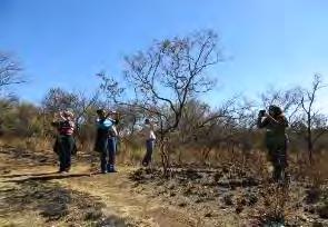
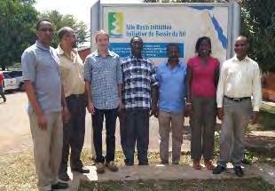
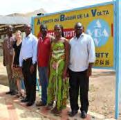
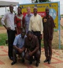
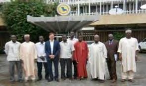
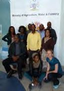
5 CHAMPION USER ORGANIZATIONS 1 st project Cycle ( ) Objectives / Background Nile Basin Initiative Lake Chad Basin Commission Volta Basin Authority Department of Water Affairs, South Africa Department of Water Affairs, Namibia 2nd project Cycle ( ) Existing cycle 1 Users Department of Water Affairs, Zambia METTELSAT, DRC* Zambezi Watercourse Commission (ZAMCOM)* 5


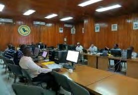

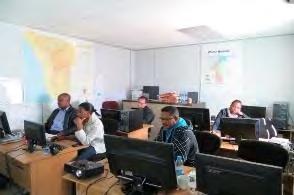

6 THE APPROACH Objectives / Background Intensive user consolidation in terms of Analysis of existing Capacities, Application/Operational Use and specific System Requirements Iterative Implementation Process: Definition > Testing > Validation > Selection > Development > Installation > Training > Demonstration Productions & Validation > Training > Adaption for operational usage > Expert Training x 2 (Apr.12-Mar.15) 6

7 Introduction / Background USER SYSTEM REQUIREMENTS Cost and license free Open Source Easy transferable Easy to operate Capable of retrieving, storing and processing EO satellite data as well as integrate in-situ data producing EO based water related information products integrating hydrologcial modeling functions supporting decisions based on full GIS framework mapping and reporting functionality integrating and linking to existing user systems scaling up for future applications and demands 7
 Water body mapping (small/large, shoreline changes, wetlands) Water quality monitoring (lake surface temperature, chlorophyll and sediment load) Hydrological monitoring")
8 Introduction / Background USER APPLICATION REQUIREMENTS Earth Observation Capacity to support/enable following applications: High to medium land cover, change and degradation mapping (incl. vegetation indices) Water body mapping (small/large, shoreline changes, wetlands) Water quality monitoring (lake surface temperature, chlorophyll and sediment load) Hydrological monitoring (precipitation, evapotranspiration, soil moisture, water level) Hydrological modelling (scenario analysis and operational forecasting) Flood monitoring, historical and vulnerability assessment Erosion potential mapping Urban sanitation planning support GIS Mapping basedata collection with read-to-map templates Product Scales 8


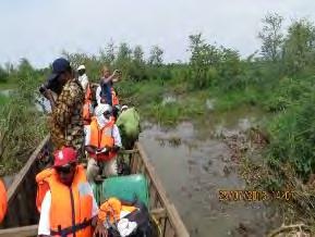
9 USER REQUIREMENT End-to-end capacity Eg. Flood Forecasting, Monitoring and Assessment Introduction / Background Provide operational capacity to forecast and monitor floods, perform flood vulnerability assessments and establish information / summary reports (Map and Tabular) for Flood Bulletins and Risk Management. Base map data Operational Precipitation and Soil Moisture Satellite Data Operational Hydrological Model Operational Radar Satellite based Flood Mapping High resolution Land Cover and Vulnerability Mapping Monitoring/Reporting/Management/Intervention 9


10 Introduction / Background USER REQUIREMENT End-to-end capacity Eg.Basin Characterization Provide operational capacity to establish water related information / summary reports (Map and Tabular) per sub-watershed for IWRM. Base map data Hydrological network Land cover, seasonal and longterm map of changes Drought condition and water stress anomaly... other operational EO products (precipitation, etc.) Monitoring/Reporting/Management/Intervention 10
11 AGENDA Objectives / Background The Water Observation and Information System 11


12 Water Observation and Information System WOIS Architecture System Design corresponding to user requirements Multi-datasources and capacities require dedicated softwares for dedicated tasks The Solution Unite all relevant open source software packages Easy to modify Free distribution More functionality Better performance Easy to transfer 12
13 Water Observation and Information System WOIS Architecture System Design corresponding to user requirements Multi-datasources and capacities requires dedicated softwares for dedicated tasks The Solution Unite all relevant open source software packages Easy to modify Free distribution More functionality Better performance Easy to transfer WOIS 13


 Framework")

14 Water Observation and Information System Comprehensive platform Extensive geoprocessing framework +300 functions (raster and vector) Framework for seamlessly incorporating new algorithms and models Can be integrated in existing IT infrastructures WOIS 14


15 Water Observation and Information System WOIS Development Status Library of 42 customized workflows for importing, processing and analyzing optical and radar EO data in support of water management Step-by-step guidance for the end-to-end processing of the product portfolio and other relevant EO processing/gis tasks Automated retrieval and processing of EO data needed for of user requested information products Each tested and validated for a number of regions 15
16 AGENDA Introduction / Background Water Observation and Information System WOIS Products 16


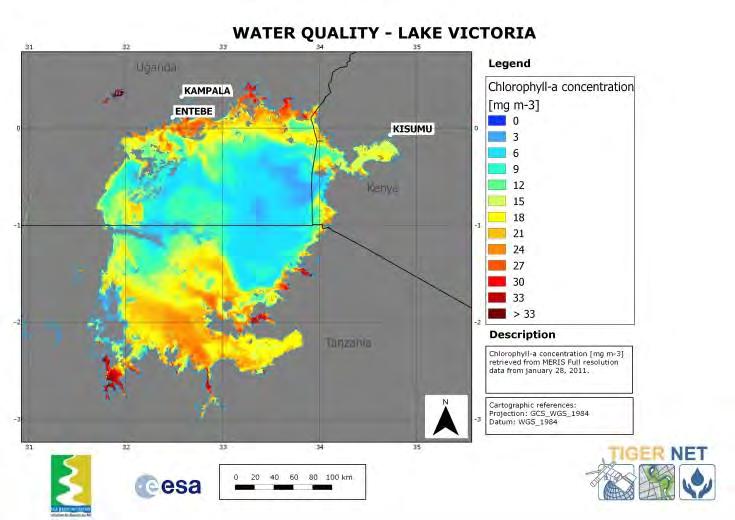
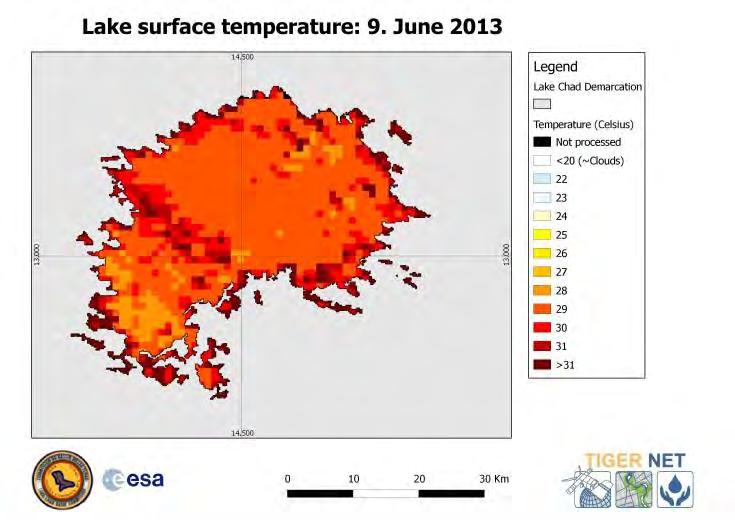
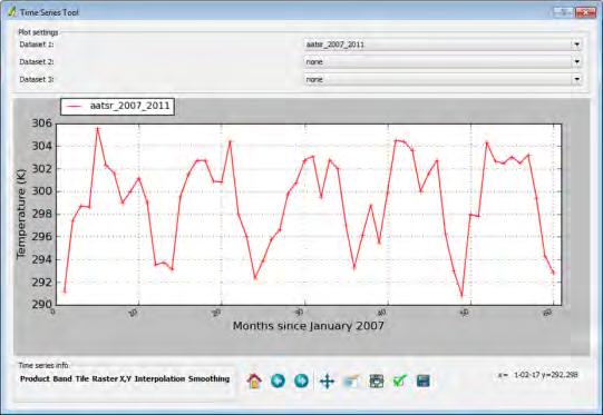
17 Water quality and water surface temperature WOIS Products Water quality information Water surface temperature


18 Assessment of land degradation processes Land degradation hot-spots WOIS Products


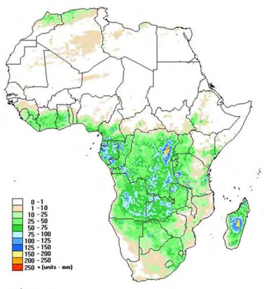
19 WOIS Products Full basin mapping of the state and change in land cover/ land use, high resolution for regions Land Cover Change Monitoring in km² per class Seasonal Vegetation Dynamics Analysis
 mapping")


![972579 Seasonal change 2007 Class Area [km²] Long-term](/docs-images/82/86420633/images/20-9.jpg "change 2007-2008 Class Area [km²] Open water 4077.")
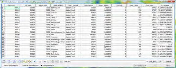
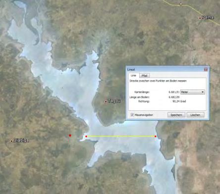
20 WOIS Products Water bodies mapping Lake surface extent mapping Area statistics Small Water Body (SWB) mapping SWB ID AREA PERIMETER Long-term and seasonal variations of wetlands Seasonal change analysis Class Area [km²] Decrease of small water bodies 0.49 Constant small water bodies 4.16 Increase of small water bodies 2.93 Localization of SWBs SWB ID XCOORD YCOORD Seasonal change 2007 Class Area [km²] Long-term change Class Area [km²] Open water Flooded vegetation Open water Flooded vegetation


")

 Sudan Khartum")
21 WOIS Products Flood monitoring Lake Tana, Ethiopia Fogera and Dembia floodplains 18th August 2013 Dynamic Flood Mapping (RADARSAT-2) RADARSAT-2 backscatter Flood map Historical Flood Mapping (Envisat, ASAR WS) Sudan Khartum city surroundings 20th August 2006

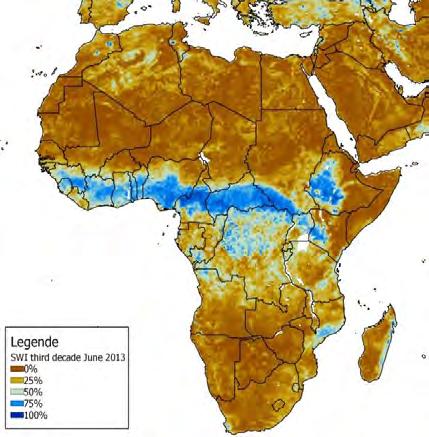
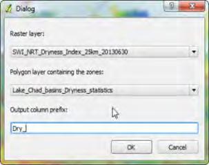
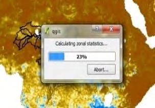


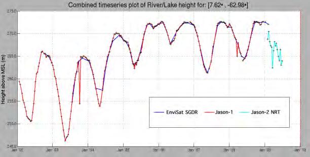
22 WOIS Products Hydrological characterisation Evapotranspiration Soil Moisture & derived Indicators Lake Water Levels Rainfall Zonal statistics


23 WOIS Products Hydrological modelling Scenario (eg.dam construction) Simulations Historic, Real-Time and Forecast Water Discharge


24 WOIS Products Erosion Potential Indicator


25 WOIS Products Water supply and sanitation support Very High Resolution Planning Basemap City Block Water Demand Modelling
26 AGENDA Introduction / Background Water Observation and Information System WOIS Products Project Implementation 26


, Austria")
, University of Copenhagen,")

27 Project Implementation KEY SERVICE PROVIDERS GeoVille Information Systems GmbH, Austria (PRIME) DHI Geographic Resource Analysis & Science A/S, (Partner) Support Institute of Photogrammetry & Remote Sensing, Vienna University of Technology (TU Vienna), Austria Department of International Health (ISIM), University of Copenhagen, Denmark Dept. of Environmental Engineering, (DTU ENV) Technical University of Denmark, Denmark 27
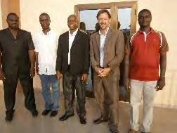
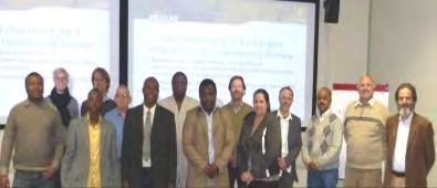
28 Project Implementation USER FEEDBACK First year of system developments, installations, trainings and demonstrations concluded Performance, stability and user friendliness of the prototype system have been acknowledged by all users The WOIS is a good system since it combines various components all arranged in a common interface - NBI Workflows are clear and easy steps to follow - NBI The WOIS has very high applicability and impact for IWRM capacity foreseen - LCBC
29 OUTLOOK Project Implementation Software Updates with the latest components (eg.qgis v2.0) Adaptation of processing chains for full support of Sentinel data Increase degree of automatization and efficiency Adaptations in response to new and current user requirements Capacity Building and Training (72 days 2014) Fund raising support to reach sustainability Coordination with existing initiatives and roll-out to other countries and regions in Africa 29


30 Further information Project website available under TIGER-NET Water Portal as universal access point for more detailed information on the WOIS demonstration cases with the African Water authorities
The TIGER Water Observation Information System
 Funded by the European Space Agency s (ESA) Strategic Initiative and run within the Data User Element programme The TIGER Water Observation Information System 5th African Water Week, 28th May 2014, Dakar,
WOIS MONITORING SOLUTIONS FOR WATER MANAGEMENT
 WOIS MONITORING SOLUTIONS FOR WATER MANAGEMENT The TIGER Water Observation and Information System (WOIS) was funded by the European Space Agency (ESA) Data User Element THE WATER OBSERVATION AND INFORMATION
THE TIGER INITIATIVE. Looking After Water in Africa
 THE TIGER INITIATIVE Looking After Water in Africa In 2002, responding to the urgent need for action in Africa stressed by the Johannesburg World Summit on Sustainable Development (WSSD), the European
Use of Earth Observation Data for Water Resources Management by the Nile Basin Initiative. - Tigernet Project
 Use of Earth Observation Data for Water Resources Management by the Nile Basin Initiative. - Tigernet Project By Milly Mbuliro GIS/ Remote Sensing Specialist Nile Basin Initiative Secretariat 25-27 March,
Earth observations for water resource management: Current practice and examples
 Earth observations for water resource management: Current practice and examples NEW OPPORTUNITIES IN SATELLITE AND AIRBORNE REMOTE SENSING: Hydrological and Environmental Applications DTU Environment Lyngby
WMO s Expectations on Application of Satellite Information in Hydrology and Water Resources
 WMO World Meteorological Organization weather, climate and water WMO s Expectations on Application of Satellite Information in Hydrology and Water Resources Julius Wellens-Mensah E-Mail: jwellens-mensah@wmo.int
The Need for an Integrated EO Strategy and Requirements to address the WEF - Nexus
 Workshop on Earth Observation and Water-Energy-Food Nexus 25-27 March 2014, in Rome, Italy The Need for an Integrated EO Strategy and Requirements to address the WEF - Nexus John Latham (FAO) Senior Land
Water targets and indicators of the the SDGs Peter Koefoed Bjornsen Director of UNEP-DHI Partnership Centre on Water and Environment
 UNEP-DHI Water Webinar series Approaching the SDGs through Innovation in Water Management Water targets and indicators of the the SDGs Peter Koefoed Bjornsen Director of UNEP-DHI Partnership Centre on
BUILDING EXPOSURE MAPS OF URBAN INFRASTRUCTURE AND CROP FIELDS IN THE MEKONG RIVER BASIN
 BUILDING EXPOSURE MAPS OF URBAN INFRASTRUCTURE AND CROP FIELDS IN THE MEKONG RIVER BASIN E. Haas (1), J. Weichselbaum (1), U. Gangkofner (1), J. Militzer (1), A. Walli (1) (1) GeoVille, Sparkassenplatz
CRYOLAND Copernicus Snow and Land Ice Service. SUMMARY OF ACHIEVEMENTS IN 1st, 2nd, 3rd and 4th PERIOD
 CRYOLAND Copernicus Snow and Land Ice Service SUMMARY OF ACHIEVEMENTS IN 1st, 2nd, 3rd and 4th PERIOD Author: Thomas Nagler / ENVEO, Project Coordinator USER REQUIREMENTS AND USER SUPPORT, PRODUCT AND
Earth Observation in support for project identification/preparation
 Asian Water Forum Oct. 5th 2018 Asian Development Bank Manila, Philippines Earth Observation in support for project identification/preparation Christian Tottrup, DHI GRAS EO4SD -> Background Water plays
CGIAR Research Program on Water, Land and Ecosystems: Use of remote sensing and GIS tools in the irrigation commands to assist planning and management
 CGIAR Research Program on Water, Land and Ecosystems: Use of remote sensing and GIS tools in the irrigation commands to assist planning and management Summary Remote sensing (RS) and geographic information
A CLOUD-BASED SYSTEM FOR HIGH RESOLUTION SOIL MOISTURE MONITORING OVER AUSTRIA
 A CLOUD-BASED SYSTEM FOR HIGH RESOLUTION SOIL MOISTURE MONITORING OVER AUSTRIA Mariette Vreugdenhil, Wolfgang Wagner, Franz Schmid, Ingo Schnetzer, Günter Blöschl, Juraj Parajka, Jürgen Komma, Christian
Pooling the data into intersectoral governance for incountry
 Using Big Data and Earth Observations for SDG 6 monitoring World Water Week 2018 August 29 Stockholm, Sweden Pooling the data into intersectoral governance for incountry implementation Christian Tottrup,
River and Lake Level data from Radar Altimetry in Support of the Tiger Initiative
 River and Lake Level data from Radar Altimetry in Support of the Tiger Initiative Benveniste, J 1 ; Berry,, P 2 ; Milagro-Perez, M.P 3 ;; Serpe, D 3 ; 1 ESA; 2 De Montfort Univ.; (1) ESRIN, European Space
NASA s Contribution to Water Research, Applications, and Capacity Building in Africa
 NASA s Contribution to Water Research, Applications, and Capacity Building in Africa Nancy D. Searby 1, David Toll 2, Rick Lawford 3, 1 NASA HQ Earth Sciences Division Applied Sciences Program 2 NASA GSFC
EO Information Services in support of
 EO Information Services in support of Building Exposure Maps of Urban Infrastructure and Crop Fields in the Mekong River Basin Christian Hoffmann, GeoVille group World Bank HQ, Washington DC Date : 11
Nile Basin Decision Support System (NB DSS)
") Introduction to the Nile Basin Decision Support System (NB DSS) Abdulkarim H Seid NBI Secretariat The Nile Basin Rwanda urundi Egypt Sudan South Sudan DR Congo Ethiopia Uganda Kenya Tanzania Basic Facts:
Introduction to the Nile Basin Decision Support System (NB DSS) Abdulkarim H Seid NBI Secretariat The Nile Basin Rwanda urundi Egypt Sudan South Sudan DR Congo Ethiopia Uganda Kenya Tanzania Basic Facts:
How Earth Observation can Support Agrometeorological Services?
 How Earth Observation can Support Agrometeorological Services? Wolfgang Wagner wolfgang.wagner@geo.tuwien.ac.at Department of Geodesy and Geoinformation (GEO) Vienna University of Technology (TU Wien)
SANSA EO -VALUE ADDED PRODUCTS
 SANSA EO -VALUE ADDED PRODUCTS Current and Future Products Willard Mapurisa, Dr. P. Mhangara, Oupa Malahlela, Bruno Meyer 2013 SPOT 5 Mosaic Launch 05/09/2013 Innovation Hub Contents Value of Satellite
Sentinels for Agriculture Global, Operational, Open, Reliable
 Sentinels for Agriculture Global, Operational, Open, Reliable Benjamin Koetz European Space Agency Earth Observation Directorate ESA UNCLASSIFIED - For Official Use Sentinel-2B Launch Tonight, 7 th of
Joint Experiment for Crop Assessment and Monitoring GEOGLAM Implementation Meeting Washington D.C. February 21, 2013
 Joint Experiment for Crop Assessment and Monitoring GEOGLAM Implementation Meeting Washington D.C. February 21, 2013 Ian Jarvis JECAM Sub-Task Lead Earth Observation Service, Agriculture and Agri-Food
Service: status & evolution
 The Copernicus Global Land Service: status & evolution R. Lacaze HYGEOS on behalf the GIO - Global Land consortium What is Copernicus? The European system for monitoring i the Earth The European response
Sentinel-2 Agriculture project : Preparing Sentinel2 exploitation for agriculture monitoring
 Sentinel-2 Agriculture project : Preparing Sentinel2 exploitation for agriculture monitoring Defourny Pierre, Bontemps Sophie, CaraCozmin, Dedieu Gerard, Hagolle Olivier, Inglada Jordi, Thierry Rabaute,
Disaster Early Warning and Response Activities at RCMRD Tesfaye Korme (Ph.D), Regional Centre for Mapping of Resources for Development
, Regional Centre for Mapping of Resources for Development") Satellite Earth Observation & Disaster Risks Disaster Early Warning and Response Activities at RCMRD Tesfaye Korme (Ph.D), Regional Centre for Mapping of Resources for Development RCMRD and its member
Satellite Earth Observation & Disaster Risks Disaster Early Warning and Response Activities at RCMRD Tesfaye Korme (Ph.D), Regional Centre for Mapping of Resources for Development RCMRD and its member
THE FLOOD FORECASTİNG AND PRECİPİTATİON MEASUREMENT BY USİNG RADAR SYSTEM TEFER PROJECT İN TURKEY. Hikmet EROĞLU* Meteorological Engineer
 THE FLOOD FORECASTİNG AND PRECİPİTATİON MEASUREMENT BY USİNG RADAR SYSTEM TEFER PROJECT İN TURKEY Hikmet EROĞLU* Meteorological Engineer THE FLOOD FORECASTİNG AND PRECİPİTATİON MEASUREMENT BY USİNG RADAR
Climate change and development agendas in the African RBOs
 RAOB / ANBO FIVE YEAR PROGRAMMATIC ACTION PLAN (2015-2019) FOR SITWA/ANBO SUPPORT SERVICES TO STRENGTHEN THE Climate change and development agendas in the African RBOs Klas Sandstrom, PhD NIRAS Natura
WORKSHOP ESA/CLIMATE CHANGE INITIATIVE (CCI+)
") WORKSHOP ESA/CLIMATE CHANGE INITIATIVE (CCI+) 19 th July 2016 Angelica Tarpanelli, Luca Brocca, Christian Massari, Luca Ciabatta, Stefania Camici, Silvia Barbetta, Tommaso Moramarco http://hydrology.irpi.cnr.it
WORKSHOP ESA/CLIMATE CHANGE INITIATIVE (CCI+) 19 th July 2016 Angelica Tarpanelli, Luca Brocca, Christian Massari, Luca Ciabatta, Stefania Camici, Silvia Barbetta, Tommaso Moramarco http://hydrology.irpi.cnr.it
ESA s Earth Observation Programmes - Activities related to GEWEX
 ESA s Earth Observation Programmes - Activities related to GEWEX GEWEX SSG 6. 9. March 2017 Sanya, China Michael Rast ESA-ESRIN Changing Meteo Copernicus Science Meteorological Missions ESA develops prototype
Note that the Server provides ArcGIS9 applications with Spatial Analyst and 3D Analyst extensions and ArcHydro tools.
 Remote Software This document briefly presents the hydrological and hydraulic modeling software available on the University of Nice Server with Remote Desktop Connection. Note that the Server provides
geoland GEOLAND Overview of Interacting parts and future plans Integrated GMES Project on Landcover and Vegetation
 Integrated GMES Project on Landcover and Vegetation GEOLAND Overview of Interacting parts and future plans Marc Leroy Jean-Christophe Calvet Marek Tinz Kees van Diepen Etienne Bartholomé Co-funded by the
Introduction to the WMO Global Hydrological Status and Outlook System (HydroSOS) Alan Jenkins Centre for Ecology & Hydrology (UK)
 Alan Jenkins Centre for Ecology & Hydrology (UK)") Introduction to the WMO Global Hydrological Status and Outlook System (HydroSOS) Alan Jenkins Centre for Ecology & Hydrology (UK) Resolution 8 (CHy-15) Decides: 1) To initiate the WMO Global Hydrological
Introduction to the WMO Global Hydrological Status and Outlook System (HydroSOS) Alan Jenkins Centre for Ecology & Hydrology (UK) Resolution 8 (CHy-15) Decides: 1) To initiate the WMO Global Hydrological
Use of satellite data for drought and flood management (Technical presentation)
") Flood and Drought Webinar #1 Use of satellite data for drought and flood management (Technical presentation) Facilitator: Gareth James Lloyd Senior Advisor UNEP-DHI Partnership Technical support: Maija
Flood and Drought Webinar #1 Use of satellite data for drought and flood management (Technical presentation) Facilitator: Gareth James Lloyd Senior Advisor UNEP-DHI Partnership Technical support: Maija
Water, Energy and Food Security Nexus to Cope with the Climate Change
 Water, Energy and Food Security Nexus to Cope with the Climate Change Tokyo International Conference on African Development June 2013 Side-Event - Resilience under climate change: perspectives for Water,
ENTRO Capacity Building and Internship Program
 Nile Basin Initiative (NBI) Eastern Nile Technical Regional Office (ENTRO) ENTRO Capacity Building and Internship Program Azeb Mersha September, 2016 Central Asia Water Future Forum & Expo Almaty, Kazakhstan
EU-Africa collaboration on Space applications for Africa
 EU-Africa collaboration on Space applications for Africa Background Maputo Declaration: African policy makers request EC to open its GMES initiative to Africa (Oct 2006) Build on existing EO activities
Reducing flood devastation in the Nile Basin
 102253 BRIEFING NOTE 7 Reducing flood devastation in the Nile Basin A regional cooperation effort coordinated by the Nile Basin Initiative (NBI) has created a credible system that links multiple stakeholders
G l o b a l L a n d S e r v i c e
 G l o b a l L a n d S e r v i c e Mark Dowell European Commission JRC mark.dowell@ec.europa.eu http://land.copernicus.eu/global 2 M a n d a t e o f C o p e r n i c u s L a n d M o n i t o r i n g S e r
global science solutions
 global science solutions Tim Martin: Riverside Technology, inc. Fort Collins, Colorado, USA 2.4: Water Security Information and Tools to Support Global Water Security International Symposium on Synergistic
EO Information Services. Zambezi River Basin Mapping
 EO Information Services in support of Zambezi River Basin Mapping Corné van der Sande, NEO BV Nick van de Giesen, TUDelft Kathrin Poser & Steef Peters Water Insight BV End User Workshop February 10, 2012
SENSOR PERFORMANCES, PRODUCT AND ALGORITHM THE EVOLUTION OF QUALITY ASSURANCE TOWARD GMES
 SENSOR PERFORMANCES, PRODUCT AND ALGORITHM THE EVOLUTION OF QUALITY ASSURANCE TOWARD GMES Lecomte Pascal European Space Agency, Via Galileo Galilei, 00044 Frascati, Italy, pascal.lecomte@esa.int ABSTRACT
Assessment land degradation using optical remote sensing and GIS in Saloum estuary, Senegal
 UNIVERSITY CHEIKH ANTA DIOP OF DAKAR GEOLOGY DEPARTEMENT Assessment land degradation using optical remote sensing and GIS in Saloum estuary, Senegal N.M. DIENG, S. FAYE, J. DINIS, M. CAETANO, M. PAINHO
GIS Framework to Evaluate Impact of Climate Change on Water Resources
 GIS Framework to Evaluate Impact of Climate Change on Water Resources Dr. Nagraj S. Patil A. K. Gosain, Professor Civil Engineering Department I. I. T. Delhi Objectives of the Study To Develop portal to
Using Earth Observations for Integrated Water Resources Management
 Using Earth Observations for Integrated Water Resources Management Sustainability in the Water-Energy-Food Nexus Bonn, 19-20 May 2014 Douglas Cripe GEO Secretariat Richard Lawford Morgan State University
ESA Thematic Exploitation Platforms and the Forestry Thematic Exploitation Platform (Forestry-TEP)
") ESA Thematic Exploitation Platforms and the Forestry Thematic Exploitation Platform (Forestry-TEP) Copernicus Training and Information Session November 22, 2016 Tuomas Häme, Renne Tergujeff VTT Technical
ESA Thematic Exploitation Platforms and the Forestry Thematic Exploitation Platform (Forestry-TEP) Copernicus Training and Information Session November 22, 2016 Tuomas Häme, Renne Tergujeff VTT Technical
CTCN assistance in Ghana
 CTCN assistance in Ghana Improving Resiliency of Crops to Drought through Strengthened Early Warning within Ghana Technology specification report (activity 1.3) Methodology for validation and testing (activity
JECAM and the Manitoba Super Site
 JECAM and the Manitoba Super Site GEO-DRI Drought Monitoring Workshop May 10 & 11, 2010 Grant Wiseman, M.Sc. AAFC, AESB, Winnipeg, Canada grant.wiseman@agr.gc.ca Joint Experiments on Crop Assessment and
Summary of the socio-economic impact of Copernicus in the EU
 Summary of the socio-economic impact of Copernicus in the EU ESA Since the entry into service of Copernicus first satellite, Sentinel-1A, in 2014, the impacts of the programme are witnessed beyond the
International Research Center on El Niño CIIFEN
 International Research Center on El Niño CIIFEN www.ciifen.org GIS Technology for Making Decision in Agrometeorology: Early Warning Systems in Andean Region and its impacts in the agriculture development
EO opportunities and challenges for achieving SDG 6.6
 EO opportunities and challenges for achieving SDG 6.6 Marc Paganini, European Space Agency (ESA) Sharing experiences on indicator 6.6.1 on freshwater related ecosystems, and exploring opportunities for
The GEO Global Agricultural Monitoring (GEOGLAM) Initiative
 Initiative") The GEO Global Agricultural Monitoring (GEOGLAM) Initiative Chris Justice GEOGLAM Global Co-Lead The Center for Agricultural Monitoring Research, Department of Geographical Sciences, GEOGLAM Launched by
The GEO Global Agricultural Monitoring (GEOGLAM) Initiative Chris Justice GEOGLAM Global Co-Lead The Center for Agricultural Monitoring Research, Department of Geographical Sciences, GEOGLAM Launched by
The Nile Basin DSS. Grenzübergreifendes Managementsystem für Wasserressourcen im Einzugsgebiet des Nils
 The Nile Basin DSS Grenzübergreifendes Managementsystem für Wasserressourcen im Einzugsgebiet des Nils A transboundary DSS for water resources management in the Nile River Basin DHI Group Presentation
GEO: Understand Trends, Forecast Changes, Support Informed Decisions
 GEO: Understand Trends, Forecast Changes, Support Informed Decisions José Achache Director GEO Secretariat The Earth is a complex system of systems requiring data from many observation systems Global In-situ
Diego Fernández Prieto European Space Agency
 Diego Fernández Prieto European Space Agency Diego.Fernandez@esa.int Background In 2006, ESA has published The Changing Earth, which represents the main new driver for the ESA EO Science Strategy. The
Flood and Drought Webinar #3 February 28 th, 2017 Drought early warning and assessment, experiences from Africa
 Flood and Drought Webinar #3 February 28 th, 2017 Drought early warning and assessment, experiences from Africa Facilitator: Gareth James Lloyd Senior Advisor UNEP-DHI Partnership Technical support: Maija
Information Requirements for Decision-Making in African IWRM: the CEOS TIGER Initiative: An Exploration of the role of space data
 Information Requirements for Decision-Making in African IWRM: the CEOS TIGER Initiative: An Exploration of the role of space data Jim Williams, ESA TIGER Coordinator, mountararat@btinternet.com Abstract
WHEN SPACE MEETS AGRICULTURE
 WHEN SPACE MEETS AGRICULTURE Image from ESA Sentinel 14-15 November 2016 Matera, Italy Join the conversation #WSMA16 What can Copernicus do for farmers and for the European Agricultural Policy Catharina
Hydrology and Hydraulic Modeling for Flash Floods Risk Assessment and Mapping
 Hydrology and Hydraulic Modeling for Flash Floods Risk Assessment and Mapping A Methodology Proposal Konstantinos Papatheodorou Eleni A. Tzanou Konstantinos Ntouros Flash Flood Assessment From Regional
Analyzing the Changes to the Hydrologic Cycle. with the Implementation of LID Techniques in Korea
 Analyzing the Changes to the Hydrologic Cycle with the Implementation of LID Techniques in Korea Jung Min Lee Contents 1 Introduction 2 Change of New City Paradigm on Korea 3 Case Study 4 The Effects of
Satellite Monitoring of Water Quality in Lake Manzalah, Egypt. Real-Time Water Quality Monitoring Workshop June St.
 Satellite Monitoring of Water Quality in Lake Manzalah, Egypt Real-Time Water Quality Monitoring Workshop June 16-17 2009 St. John s, Canada Motivation Lakes are vital component of Egypt s water resources
Hydrological Feedbacks in Tropical African Wetlands
 Hydrological Feedbacks in Tropical African Wetlands Simon Dadson University of Oxford (simon.dadson@ouce.ox.ac.uk) Key challenges Linking across scales: can we predict the hydrological response to climate
Taikichiro Mori Memorial Research Grants Graduate Student Researcher Development Grant Report
 Taikichiro Mori Memorial Research Grants Graduate Student Researcher Development Grant Report February 2016 Research Project: Detection and delineation of water bodies using Synthetic Aperture Radar data
Rudo Sanyanga Africa Program Director International Rivers South Africa
 Rudo Sanyanga Africa Program Director International Rivers South Africa Assessing Risks, Uncertainty and Consequences of Hydro-dependent Systems on the Zambezi River Basin Overview of the Zambezi Hydrology
3/1/18 USING RADAR FOR WETLAND MAPPING IMPORTANCE OF SOIL MOISTURE TRADITIONAL METHODS TO MEASURE SOIL MOISTURE. Feel method Electrical resistance
 3/1/18 USING RADAR FOR WETLAND MAPPING SOIL MOISTURE AND WETLAND CLASSIFICATION Slides modified from a presentation by Charlotte Gabrielsen for this class. Southeast Arizona: Winter wet period From C.
Water, forests and climate
 Water, forests and climate Roger Bales, UC Merced 1. Water & fire 2. Water & forest management 3. Securing the future 1. Water & fire issues to consider Forest structure Wildfire Water yield Snowpack storage
Satellite Earth Observation
 Satellite Earth Observation Services for Ecosystem valuation Prof Nick Veck Head of the CEO s Office Satellite Applications Catapult 17 March 2017 Outline Introduction to Earth observation and ecosystem
CRYOSPHERE & HYDROLOGY
 CRYOSPHERE & HYDROLOGY M.Menenti, X. LI, J. WANG, H. Vereecken, Jiren LI, M. Mancini, Q.LIU, L.JIA, Jing LI, C.Kuenzer, S. HUANG, H.Yesou, J.WEN, Y. Kerr, X. CHENG, N. Gourmelen, C. KE, R.Ludwig, H. LIN,
Tennessee Technological University
 Understanding Surface Water Flow and Tennessee Storage Changes Technological using Satellites: Emerging Opportunities for Bangladesh Faisal Hossain Department of Civil and Environmental Engineering nological
WATER CYCLE VARIABLES
 WATER CYCLE VARIABLES ISSUE: THE PROPOSAL FOR A WORKSHOP FOR THE EVALUATION OF HIGH RESOLUTION GLOBAL PRECIPITATION PRODUCTS HAS NOT RECEIVED FULL FINANCIAL SUPPORT. CONCLUSION: THE ALTERNATIVES PROPOSED
Building climate resilience
 Public Disclosure Authorized Public Disclosure Authorized Public Disclosure Authorized THE NILE STORY BRIEFING NOTE 3 102249 Building climate resilience Climate change is a critical issue facing the countries
AN INTEGRATED FRAMEWORK FOR EFFECTIVE ADAPTATION TO CLIMATE CHANGE IMPACTS ON WATER RESOURCES
 AN INTEGRATED FRAMEWORK FOR EFFECTIVE ADAPTATION TO CLIMATE CHANGE IMPACTS ON WATER RESOURCES A. K. Gosain, Professor & Head Civil Engineering Department Indian Institute of Technology Delhi: gosain@civil.iitd.ac.in
UCS#4: Soil moisture assessment over Africa
 UCS#4: Soil moisture assessment over Africa S. Horion, H. Nieto*, T. Tagesson, R. Fensholt * Institute for Sustainable Agriculture CSIC, Córdoba, Spain Rationale and objectives Accurate estimates of soil
LiDAR/SAR-based mapping of savannahs forests in Southern Africa
 Joint GFOI / GOFC-GOLD / CONABIO / SilvaCarbon R&D Expert and Capacity Building workshop on: Regional solutions to forest type stratification and characterising the forest state for national forest monitoring
Chart 2 > Vortrag > Autor Dokumentname > Datum
 www.dlr.de Chart 1 > Vortrag > Autor Dokumentname > Datum www.dlr.de Chart 2 > Vortrag > Autor Dokumentname > Datum www.dlr.de Chart 3 > Vortrag > Autor Dokumentname > Datum www.dlr.de Chart 4 > Vortrag
MODULE 8 LECTURE NOTES 5 REMOTE SENSING APPLICATIONS IN DROUGHT ASSESSMENT
 MODULE 8 LECTURE NOTES 5 REMOTE SENSING APPLICATIONS IN DROUGHT ASSESSMENT 1. Introduction Drought is a phenomenon of long-term moisture deficiency. It may be meteorological, agricultural or hydrologic
Global Water Initiative Team Project
 Global Water Initiative Team Project International Space University International, Intercultural, interdisciplinary (3Is) since 1987 UNCOPUOS Scientific and Technical Subcommittee 3 February 2015 GLOBAL
Zambezi River Basin Challenges and Issues
 Zambezi River Basin Challenges and Issues GEO-UNESCO Joint Workshop on Earth Observation and Capacity Development for IWRM at River Basins in Africa : 12-14 January 2012, Nairobi, Kenya. Zvikomborero MANYANGADZE
Drought Indicators for the SADC
 Drought Indicators for the SADC Bruce Eady DHI-SA Annual Conference Coping with Drought: Adaptions to Water Stress in the Face of Climate Change Agenda Introduction Satellite Data Drought and Flood Portal
Date: Author: Doc Title. 20/08/14 Jimmy Slaughter Copernicus Services. Copernicus Services
 Date: Author: Doc Title 20/08/14 Jimmy Slaughter Copernicus Services Copernicus Services Table of Contents Introduction... 3 What Will Copernicus Do?... 3 2.1 Land Monitoring... 3 2.2 Marine Monitoring...
Names and coordinates of meteorological stations (a map showing the location of these stations is included in the text)
") Table of Contents Appendix A: Key to Meteorological Data Table 1- Table 2- Table 3- Table 4- Table 5- Table 6- Table 7- Table 8- Table 9- Table 10 a - Table 10 b - Table 11 a - Table 11 b - Table 11 c
Table of Contents Appendix A: Key to Meteorological Data Table 1- Table 2- Table 3- Table 4- Table 5- Table 6- Table 7- Table 8- Table 9- Table 10 a - Table 10 b - Table 11 a - Table 11 b - Table 11 c
Integrating and Visualizing Earth Observation Data for the SDGs Mike Gill
 7 th Meeting of the Interagency and Expert Group on Sustainable Development Goal Indicators Vienna, Austria 12 April, 2018 Integrating and Visualizing Earth Observation Data for the SDGs Mike Gill GEO
GEOGLAM, Michel Deshayes, GEO, GEOGLAM Coordinator for the Agricultural Community of Practice
 GEOGLAM, Global Agricultural Monitoring Michel Deshayes, GEO, GEOGLAM Coordinator for the Agricultural Community of Practice GEO, Group on Earth Observations Created in 2005, to develop a coordinated and
Crop Monitoring for Food Security from Space
 San Diego, 18-22 February 2010 AAAS Annual Meeting 1 Crop Monitoring for Food Security from Space Felix Rembold Joint Research Centre (JRC) The European Commission s Research-Based Policy Support Organisation
Early Warning Systems in Eastern
 Early Warning Systems in Eastern and Southern Africa: by Erick Khamala Senior Remote Sensing Officer RCMRD ekhamala@rcmrd.org Our Products and Services Training: i Geoinformation and IT applications,
What we are looking for through utilizing the global earth observation. 14 January 2012 Japan International Cooperation Agency (JICA) Yusuke AMANO
 Yusuke AMANO") What we are looking for through utilizing the global earth observation 14 January 2012 Japan International Cooperation Agency (JICA) Yusuke AMANO 1 Outline To clarify what sort of data are to be monitored
What we are looking for through utilizing the global earth observation 14 January 2012 Japan International Cooperation Agency (JICA) Yusuke AMANO 1 Outline To clarify what sort of data are to be monitored
Mission. Selected Accomplishments from Walnut Gulch. Facilities. To develop knowledge and technology to conserve water and soil in semi-arid lands
 USDA-ARS Southwest Watershed Research Center Mission Sound Science for Watershed Decisions To develop knowledge and technology to conserve water and soil in semi-arid lands ARS Watershed Locations Selected
NASA International Water Activities Towards Water Security
 National Aeronautics & NASA International Water Activities Towards Water Security David Toll Hydrological Sciences NASA/GSFC NASA Water Resources Support Bradley Doorn NASA Manager Nancy Searby NASA Capacity
NASA - A Partner in Disaster Risk Reduction for Public Safety
 Plenary Presentation NASA - A Partner in Disaster Risk Reduction for Public Safety Jordan Bell, Disaster Applications Coordinator, NASA Applied Sciences Disasters Program NASA - A Partner in Disaster Risk
Asia-RiCE 2016 Implementation Report
 Asia-RiCE 2016 Implementation Report Asia-RiCE has been organised to develop the rice crop estimation and monitoring component for the GEO Global Agricultural Monitoring (GEOGLAM) initiative. GEOGLAM aims
ENVISAT ASAR GM SOIL MOISTURE FOR APPLICATIONS IN AFRICA AND AUSTRALIA
 ENVISAT ASAR GM SOIL MOISTURE FOR APPLICATIONS IN AFRICA AND AUSTRALIA A. Bartsch, M. Doubkova, and W. Wagner Institute of Photogrammetry and Remote Sensing, Vienna University of Technology, Gusshausstrasse
Hydrology, Earth Observation and Modelling Exploration
 Hydrology, Earth Observation and Modelling Exploration Jamie Hannaford, Centre for Ecology and Hydrology Satellite Applications Catapult Soil Moisture Workshop, 25 th January 2017 The consortium Background
Integration methods for forest degradation assessment and change monitoring
 VTT TECHNICAL RESEARCH CENTRE OF FINLAND LTD Joint GFOI / GOFC-GOLD / CONABIO / SilvaCarbon R&D Expert and Capacity Building workshop on: Regional solutions to forest type stratification and characterising
Status of GSE - GMES Services Element
 Status of GSE - GMES Services Element Luigi Fusco ESA/ESRIN HALO Workshop, ECMWF, 16-17 November 2004 overview Introduction GSE as part of GMES 1. GSE consolidation phase 2. GSE and the Initial Services
GEOINFORMATION TECHOLOGY FOR HARZAD MONITORING AND DISATER RISK REDUCTION. Hussein O. Farah, PhD
 GEOINFORMATION TECHOLOGY FOR HARZAD MONITORING AND DISATER RISK REDUCTION Hussein O. Farah, PhD Regional Centre for Mapping of Resources for Development Kasarani Road, P.O.Box 632-00618 Nairobi, Kenya
GEOGLAM international cooperation activities
 GEOGLAM international cooperation activities Chris Justice Center for Global Agricultural Monitoring and Research Dept. of Geographical Sciences University of Maryland GEO: an International Coordinating
Polar Space Task Group Permafrost Review of Requirements, Achievements and Expected Data
 Polar Permafrost Review of Requirements, Achievements and Expected Data Annett Bartsch Central Institute for Meteorology and Geodynamics, Vienna, Austria PSTG 6, ESTEC, Sept., 2016 Developments since last
Results from the Land & Environment Crop & Drought. projects in Dragon-3. Chaired by S. Pignatti & F. Jinlong
 Results from the Land & Environment Crop & Drought projects in Dragon-3 Chaired by S. Pignatti & F. Jinlong Project 10367: Desertification Monitoring and Assessment Committed products optimal indicators
Kopernikus Land Monitoring Service - Global Component. Espen Volden GMES Bureau
 Kopernikus Land Monitoring Service - Global Component Espen Volden GMES Bureau GMES -> KOPERNIKUS Started in 1998 2008 a milestone: (pre-)operational services GMES Forum Lille 16-17/9 2008 Name change
EO4SD EARTH OBSERVATION FOR SUSTAINABLE DEVELOPMENT
 LARGE-SCALE EXPLOITATION OF SATELLITE DATA IN SUPPORT OF INTERNATIONAL DEVELOPMENT EO4SD EARTH OBSERVATION FOR SUSTAINABLE DEVELOPMENT Agriculture and Rural Development Bolivia and Paraguay Agriculture