THE WATER IS RISING SCALABLE, RELIABLE, AND RELEVANT INFORMATION SUPPORTING FIRST RESPONDERS. May 3, 2017
|
|
|
- Damian Franklin
- 6 years ago
- Views:
Transcription

1 THE WATER IS RISING SCALABLE, RELIABLE, AND RELEVANT INFORMATION SUPPORTING FIRST RESPONDERS May 3, 2017 Association of State Floodplain Managers 2017 Conference Jim Keith, PE, CFM Walter P Moore Andy Yung, PE, CFM Walter P Moore Stephanie Griffin, PE, CFM City of Grand Prairie

2 The Water Is Rising Scalable, Reliable, and Relevant Information Supporting First Responders Presentation Overview Introduction Grand Prairie Project Overview Next Steps 2


3 Introduction What is a Flood Warning System? 3

4 Introduction Each Community has unique risks and needs So you have all these gages, what can you do with them? System must convey risk to life and property Provide Decision Support - If you can t utilize and react to real time information, the only thing you provide is data to confirm what happened. 4
5 Project Overview City engaged Walter P Moore and UT Arlington Phased approach Objective: To provide a flood warning / forecasting system that will permit City Emergency Managers to identify areas of inundation and allow the timely dispatch of first responders to these areas to close roads, evacuate, shelter-in-place, and/or begin rescue operations. In other words, if it rains X inches, how high will the water get here, and when? 5
6 Project Overview Real-Time Rainfall Rainfall vs. W.S. Elevs. + Critical Elevation s Mapping Dispatch 6
7 W.S. Elev. Precipitation Grand Prairie Flood Warning System Project Overview T peak T crit Critical Elevation 7

8 Project Overview Phase 1 Five Pilot Watch Points 8
9 Focus is Implementation and Decision Support Integrating with existing hardware & software System is a tool that does not replace human interaction Should enhance decision making and add lead time Must meet needs of both primary users and first responders Phased approach with scalable system architecture 9
10 Initiated Project with Half-Day Workshop City Staff and Project Team - Stormwater Ops, Public Works/Streets, Fire, Police, Emergency Management Listening session - Understand current operations & protocols - What are needs of FWS users? - What are needs of first responders? Identified data needs & opportunities for integration with current systems Manage expectations 10
 June Now 6110 6120 6130 6140 6000 6080 6100 6306 6150 6160 6170 6030 6040 6050 6060 6500 6520")
11 Rainfall Gage Availability Fish Creek Cottonwood Creek Mountain Creek Outside watershed Sensor 2010 Sep 2015 April Nov Number (Hermine) June Now

12 Water Level Sensor Availability Sensor Number 2010 Sep (Hermine) 2015 April - June 2015 Nov Now Fish Creek Cottonwood Creek Mountain Creek 6113/


13 Hydrologic & Hydrometeorologic Analysis Evaluating watershed response times - Various depths, durations, and frequencies Evaluating movement of storms over watersheds 13
14 Hydraulic Analysis & Mapping Keep it simple! No need for real-time dynamic modeling. Based on existing steady state HEC-RAS models Developing stage vs. discharge rating curves at control points Developing staged inundation mapping Mapping will be called up by the system 14
15 Hydraulic Analysis & Mapping 15
16 Hydraulic Analysis & Mapping 16
17 Hydraulic Analysis & Mapping 17
18 Hydraulic Analysis & Mapping 18

19 Hydraulic Analysis & Mapping 19
20 Flood Warning System Software Development Bring above components together Output data in various formats (GIS, database, web) Web-based mobile platform Initially restricted access to City personnel Will serve data directly to EM/dispatch systems System redundancy & security 20
21 Challenges and Next Steps City installing automated low water crossing gates - Cottonwood Carrier Pkwy - No precedent, will work closely after install on system integration Timing - Difficult to get more than 2 hours lead time. Accurate forecasting is still a long way off Phase 1 scheduled to complete October 2017 System will be tested internally prior to going live 21
22 Conclusion Summary and Conclusions Flood Warning means different things to different communities Focus on Integration and Decision Support Keep system simple for reliability Design system to be flexible & scalable Output relevant information for users & first responders 22


23 Scalable, Reliable, and Relevant Information Supporting First Responders Any Questions? 23
Bexar County Flood Warning System. Curtis Beitel, PE, CFM, Anthony Henry and Wayne Tschirhart, PE, PMP
 Bexar County Flood Warning System Curtis Beitel, PE, CFM, Anthony Henry and Wayne Tschirhart, PE, PMP Software Overview 2 Processes Hydrometric DB Event Manager Automatic Low = Every 6 hours High = Every
FLOOD WARNING - PREPAREDNESS PROGRAMS
 Hydrologic Engineering Center Workshop on FLOOD WARNING - PREPAREDNESS PROGRAMS Davis, California Hydrologic Engineering Center WORKSHOP OBJECTIVES The Flood Warning - Preparedness Program (FW-P), sponsored
A Hydrologic Study of the. Ryerson Creek Watershed
 A Hydrologic Study of the Ryerson Creek Watershed Dave Fongers Hydrologic Studies Unit Land and Water Management Division Michigan Department of Environmental Quality May 8, 2002 Table of Contents Summary...2
Stormwater: Too Simple?
 Stormwater: Too Simple? Getting Closer to Advertised Level of Service Brandon Klenzendorf, Ph.D., P.E. 13 December 2017 - CWEA Fall Seminar Introduction Traditional approaches to solving stormwater problems
Countermeasures against urban flood in Beijing. Urban flood inundation warning and flood hazard mapping in China
 Countermeasures against urban flood in Beijing Fen Yang Beijing Institute of Water (BIW), China Urban flood inundation warning and flood hazard mapping in China Wang Jing China Institute of Water Resources
SOUTHEAST TEXAS CONTINUING EDUCATION
 EXAM No. 118 FLOOD - RUNOFF ANALYSIS 1. Information gained from flood - runoff analysis includes which one: A. Stage, discharge, volume. B. Measure depth, volume. C. Velocity, depth, storm occurrence.
Brian Rast, PE, CFM, PMP Lead Silver Jackets Coordinator, Kansas and Missouri Kris Lander, PE, CFM Hydrologist. June 4, 2015
 Presentation to the Association of State Floodplain Managers Interagency Partnering for Flood Forecast Inundation Maps Brian Rast, PE, CFM, PMP Lead Silver Jackets Coordinator, Kansas and Missouri Kris
Integrating HEC HMS generated flow hydrographs with FLO-2D. Nanda Meduri, PE, PMP, CFM Seth Lawler Venkata Dinakar Nimmala, CFM
 Integrating HEC HMS generated flow hydrographs with FLO-2D Nanda Meduri, PE, PMP, CFM Seth Lawler Venkata Dinakar Nimmala, CFM Focus of this Presentation Introduction Methodology Challenges & Solutions
Title Advanced Hydraulic Modeling to Support Emergency Action Plans
 Title Advanced Hydraulic Modeling to Support Emergency Action Plans Abstract Freese and Nichols, Inc. (FNI) developed an Emergency Action Plan (EAP) for a Levee Improvement District (LID) located in a
The Drought of the Century to the Flood of the Century
 The Drought of the Century to the Flood of the Century Julia J. Hunt, P.E., TRA Jerry Cotter, P.E., USACE Trinity River Authority Mission Our mission is to promote conservation, reclamation, protection,
DRAFT. Jacob Torres, P.E.; Nick Fang, Ph.D., P.E.
 \ Memorandum SSPEED Center at Rice University Department of Civil & Environmental Engineering 6100 Main MS-317 Houston, Texas 77005-1827 sspeed.rice.edu tel: 713-348-4977 To Andy Yung, P.E. CFM; Lane Lease,
The South Carolina Extreme Rainfall Analysis-Understanding the Storm and Implications for Dam Safety
 The South Carolina Extreme Rainfall Analysis-Understanding the Storm and Implications for Dam Safety Bill Kappel Applied Weather Associates Joe Bellini, PE, PH, D.WRE, CFM Aterra Solutions Dam Safety Conference,
Watersheds, Hydrology and Flooding
 Watersheds, Hydrology and Flooding Greg Karlovits, P.E., CFM Hydrologist US Army Corps of Engineers Rock Island District US Army Corps of Engineers Outline of Topics Before lunch: Watersheds and basics
Outlet Structure Modeling
 Watershed Modeling using HEC-RAS Outlet Structure Modeling Jeff Wickenkamp, P.E., CFM, D.WRE Patrick Lach, P.E. Hey and Associates, Inc. Water Resources, Wetlands and Ecology Outline of Presentation Why
Climate and Land Use Consequences to 100-Year Flooding
 Climate and Land Use Consequences to 100-Year Flooding Robert Roseen D.WRE, PE, PhD, Ann Scholz, PE, CPSWQ, Thomas Ballestero, PhD, PE, PH, UNH Stormwater Center Nebraska Post- Construction Stormwater
City of Katy Flood Protection Study (Meeting 3 of 3) October 23, 2017
 October 23, 2017") City of Katy Flood Protection Study (Meeting 3 of 3) October 23, 2017 Phasing of Meetings April Meeting May Meeting October Review of Tax Day Storm Event and Immediate Actions Taken By City Review of Coordination
City of Katy Flood Protection Study (Meeting 3 of 3) October 23, 2017 Phasing of Meetings April Meeting May Meeting October Review of Tax Day Storm Event and Immediate Actions Taken By City Review of Coordination
Introduction to Hydrology, Part 2. Notes, Handouts
 Introduction to Hydrology, Part 2 Notes, Handouts Precipitation Much of hydrology deals with precipitation How much? How frequently/infrequently? What form? How quickly? Seasonal variation? Drought frequency?
PA of NY&NJ - TETERBORO AIRPORT RUNWAY 6-24 Engineered Material Arresting System (EMAS) UNSTEADY-STATE FLOODPLAIN ANALYSIS
 UNSTEADY-STATE FLOODPLAIN ANALYSIS") 1 NEW JERSEY ASSOCIATION FOR FLOODPLAIN MANAGEMENT PRESENTATION FOR THE 10 TH ANNUAL CONFERENCE PA of NY&NJ - TETERBORO AIRPORT RUNWAY 6-24 Engineered Material Arresting System (EMAS) UNSTEADY-STATE FLOODPLAIN
1 NEW JERSEY ASSOCIATION FOR FLOODPLAIN MANAGEMENT PRESENTATION FOR THE 10 TH ANNUAL CONFERENCE PA of NY&NJ - TETERBORO AIRPORT RUNWAY 6-24 Engineered Material Arresting System (EMAS) UNSTEADY-STATE FLOODPLAIN
Alternatives for Willow Creek Flood Mitigation Study
 Alternatives for Willow Creek Flood Mitigation Study Presented by: Anil Tangirala, PE, CFM, ENV SP ms consultants, inc. June 22, 2016 Presentation Overview Introduction Project Background Willow Creek
Project Summary: - Hydrologic Models. - LiDAR Based - 10 Synthetic Events - No Historic Events - 100yr Runoff is Largest - Assumes Even Rainfall
 Project Summary: - Hydrologic Models Phase 2 Underway Nearly Completed (Park/Pembina EOY) - LiDAR Based - 10 Synthetic Events - No Historic Events - 100yr Runoff is Largest - Assumes Even Rainfall Phase
CLIMATE CHANGE ADAPTATION AND RISK REDUCTION TECHNOLOGY AND STRATEGIES TO IMPROVE COMMUNITY RESILENCE (CARTS) PROJECT DRAFT TERMS OF REFERENCE
 PROJECT DRAFT TERMS OF REFERENCE") CLIMATE CHANGE ADAPTATION AND RISK REDUCTION TECHNOLOGY AND STRATEGIES TO IMPROVE COMMUNITY RESILENCE (CARTS) PROJECT DRAFT TERMS OF REFERENCE CONSULTANCY SERVICES FOR THE PREPARATION OF A FLOODWATER CONTROL
CLIMATE CHANGE ADAPTATION AND RISK REDUCTION TECHNOLOGY AND STRATEGIES TO IMPROVE COMMUNITY RESILENCE (CARTS) PROJECT DRAFT TERMS OF REFERENCE CONSULTANCY SERVICES FOR THE PREPARATION OF A FLOODWATER CONTROL
Hydrologic Calibration:
 Hydrologic Calibration: UPDATE OF EFFECTIVE HYDROLOGY FOR MARYS CREEK October 2010 Agenda Background Hydrologic model Calibrated rainfall Hydrologic calibration 100 year discharges, Existing Conditions
ENVIRONMENTAL ENGINEERING LAND SURVEYING
 ENVIRONMENTAL ENGINEERING LAND SURVEYING Inflow Design Flood Control System Plan Scrubber Solids Pond No. 3 Sherburne County Generating Plant Introduction This report presents documentation and certification
NAP-GSP REGIONAL TRAINING WORKSHOP FOR ASIA Mainstreaming Climate Change Adaptation into Water Resources Seoul, September 2017
 NAP-GSP REGIONAL TRAINING WORKSHOP FOR ASIA Mainstreaming Climate Change Adaptation into Water Resources Seoul, 13-16 September 2017 Session 2 Climate and hydrological Information and Services Hydrological
Suspended Sediment Discharges in Streams
 US Army Corps of Engineers Hydrologic Engineering Center Suspended Sediment Discharges in Streams April 1969 Approved for Public Release. Distribution Unlimited. TP-19 REPORT DOCUMENTATION PAGE Form Approved
Estimating the 100-year Peak Flow for Ungagged Middle Creek Watershed in Northern California, USA
 American Journal of Water Resources, 2014, Vol. 2, No. 4, 99-105 Available online at http://pubs.sciepub.com/ajwr/2/4/3 Science and Education Publishing DOI:10.12691/ajwr-2-4-3 Estimating the 100-year
MUD CREEK WATERSHED STUDY PUBLIC MEETING NOVEMBER 7, 2013
 MUD CREEK WATERSHED STUDY PUBLIC MEETING NOVEMBER 7, 2013 AGENDA Purpose of Study Hydrology Hydraulics Floodplain Mapping Floodplain Management Options PURPOSE OF STUDY Upstream Development Near I-80 Bondurant
TOWN LINE BROOK URBAN WATERSHED STUDY MODELING INCREMENTAL IMPROVEMENTS
 TOWN LINE BROOK URBAN WATERSHED STUDY MODELING INCREMENTAL IMPROVEMENTS Marcus M. Quigley, P.E., Project Engineer, GeoSyntec Consultants Steven P. Roy, Associate, GeoSyntec Consultants Lawrence Gil, North
6/4/2014. Murweh Shire, Queensland CHARLEVILLE FLOOD MANAGEMENT MOVING BEYOND MITIGATION
 Neil Polglase David Murray Murweh Shire, Queensland May 2014 CHARLEVILLE FLOOD MANAGEMENT MOVING BEYOND MITIGATION Emergency Management System Land area of 43,905 km2 Population Murweh Shire 4,910 Town
City of San Jose Storm Sewer Master Plan
 City of San Jose Storm Sewer Master Plan Anne Symonds, PE and Mira Chokshi, PE 2016 Pacific Water Conference AWWA Hawaii Section HWEA February 4, 2016 Agenda Introduction and Goals of the Project Background
Flood Inundation Mapping of Tadi River
 Flood Inundation Mapping of Tadi River CE 547 GIS in Water Resource Engineering Final Report Submitted By: Aayush Piya May 5, 2017 Contents 1 Motivation & Background... 3 2 Introduction... 3 3 Objective...
PWD s Systematic Watershed-wide Approach to Stormwater Mgmt.
 PWD s Systematic Watershed-wide Approach to Stormwater Mgmt. Jeffrey Featherstone, PhD Director, Center for Sustainable Communities, Temple University Paul DeBarry, PE, PH, GISP, D.WRE Director, Geospatial
5/25/2017. Overview. Flood Risk Study Components HYDROLOGIC MODEL (HEC-HMS) CALIBRATION FOR FLOOD RISK STUDIES. Hydraulics. Outcome or Impacts
 CALIBRATION FOR FLOOD RISK STUDIES. Hydraulics. Outcome or Impacts") HYDROLOGIC MODEL (HEC-HMS) CALIBRATION FOR FLOOD RISK STUDIES C. Landon Erickson, P.E.,CFM Water Resources Engineer USACE, Fort Worth District April 27 th, 2017 US Army Corps of Engineers Overview Flood
HYDROLOGIC MODEL (HEC-HMS) CALIBRATION FOR FLOOD RISK STUDIES C. Landon Erickson, P.E.,CFM Water Resources Engineer USACE, Fort Worth District April 27 th, 2017 US Army Corps of Engineers Overview Flood
New Castle County, DE. Floodplain Regulations
 New Castle County, DE Floodplain Regulations John J. Gysling, PE CFM Department of Land Use New Castle County, DE February 26, 2009 Today s Presentation Floodplain Protection and Uses Terms and Definitions
Climate Change Impacts on Joint Riverine and Coastal Flooding on Calleguas Creek in Ventura County, CA
 Climate Change Impacts on Joint Riverine and Coastal Flooding on Calleguas Creek in Ventura County, CA James Gregory, James Jackson (ESA) Lily Verdone (TNC) FMA, September 8, 2016 Project Overview Coastal
San Luis Obispo Creek Watershed Hydrologic Model Inputs
 Jeff Werst San Luis Obispo County Department of Public Works 1050 Monterey Street San Luis Obispo CA 93408 December 14, 2007 Subject: San Luis Obispo Creek Watershed Hydrology and Hydraulic Model Dear
Enabling Distributed Hydrologic Prediction through Radar Detection of Rainfall
 Enabling Distributed Hydrologic Prediction through Radar Detection of Rainfall Baxter E. Vieux Ph.D., P.E. Professor, School of Civil Engineering and Environmental Science, University of Oklahoma Vieux
WHEN DISASTER STRIKES, AGAIN
 WHEN DISASTER STRIKES, AGAIN Maria Cox Lamm, CFM Ed Dickson, PE, CFM May 3, 2017 Flood Mitigation Program Protecting Lives, Protecting Property Floodplain Management, Mapping, and Mitigation www.dnr.sc.gov/flood
Cokato Lake (86-263) Wright County. Hydrologic Investigation
 Wright County. Hydrologic Investigation") Cokato Lake (86-263) Wright County Hydrologic Investigation April 14, 2005 Cokato Lake (86-263) Wright County Hydrologic Investigation April 14, 2005 Problem Statement In recent years, heavy rainfall has
Cokato Lake (86-263) Wright County Hydrologic Investigation April 14, 2005 Cokato Lake (86-263) Wright County Hydrologic Investigation April 14, 2005 Problem Statement In recent years, heavy rainfall has
Dewayne Smith, P.E. Hydro Engineering Solutions, LLC
 23 rd Annual Nonpoint Source Conference 24 January 2012 City of Hoover Cost Effective Tools for MS4 Permit Compliance By: Dewayne Smith, P.E. Hydro Engineering Solutions, LLC City of Hoover Incorporated
IIoT Transformation of Cincinnati MSD Collection System
 IIoT Transformation of Cincinnati MSD Collection System Presenters Ed Heyob, CDM Smith Automation Engineer Kim Brown, JPWWTP Supervisor II Ed Heyob CDM Smith Automation Engineer heyobes@cdmsmith.com Existing
INFLOW DESIGN FLOOD CONTROL SYSTEM PLAN 40 C.F.R. PART PLANT DANIEL ASH POND B MISSISSIPPI POWER COMPANY
 INFLOW DESIGN FLOOD CONTROL SYSTEM PLAN 40 C.F.R. PART 257.82 PLANT DANIEL ASH POND B MISSISSIPPI POWER COMPANY EPA s Disposal of Coal Combustion Residuals from Electric Utilities Final Rule (40 C.F.R.
INFLOW DESIGN FLOOD CONTROL SYSTEM PLAN 40 C.F.R. PART PLANT YATES ASH POND B (AP-B ) GEORGIA POWER COMPANY
 GEORGIA POWER COMPANY") INFLOW DESIGN FLOOD CONTROL SYSTEM PLAN 40 C.F.R. PART 257.82 PLANT YATES ASH POND B (AP-B ) GEORGIA POWER COMPANY EPA s Disposal of Coal Combustion Residuals from Electric Utilities Final Rule (40 C.F.R.
INFLOW DESIGN FLOOD CONTROL SYSTEM PLAN 40 C.F.R. PART 257.82 PLANT YATES ASH POND B (AP-B ) GEORGIA POWER COMPANY EPA s Disposal of Coal Combustion Residuals from Electric Utilities Final Rule (40 C.F.R.
Upper San Jacinto River Regional Watershed Flood Mitigation Plan Preliminary Scope of Services. July 2, 2018
 INTRODUCTION BACKGROUND Upper San Jacinto River Regional Watershed Flood Mitigation Plan Preliminary Scope of Services In August 2017, Hurricane Harvey struck the Texas coast, bringing a historic amount
Rainfall, Runoff and Peak Flows: Calibration of Hydrologic Design Methods for the Kansas City Area
 Rainfall, Runoff and Peak Flows: Calibration of Hydrologic Design Methods for the Kansas City Area Bruce McEnroe, Bryan Young, Ricardo Gamarra and Ryan Pohl Department of Civil, Environmental, and Architectural
BMP Design Aids. w w w. t r a n s p o r t a t i o n. o h i o. g o v. Equations / Programs
 BMP Design Aids 1 Equations / Programs Outlet Discharge Equations Hydrograph and Pond Routing Programs USGS StreamStats 2 Ohio Department of Transportation 1 Training Intent Introduction and overview of
Bridge Replacement Project. Preliminary Hydraulic Study. Lincoln, California BRLS-5089 (021) BRIDGE 19C Mcbean Park Drive at Auburn Ravine
 BRIDGE 19C Mcbean Park Drive at Auburn Ravine") Bridge Replacement Project Preliminary Hydraulic Study Lincoln, California BRLS-5089 (021) BRIDGE 19C 0059 Mcbean Park Drive at Auburn Ravine Prepared By: Prepared By: Date 11/25/2014 Thomas S. Plummer
Bridge Replacement Project Preliminary Hydraulic Study Lincoln, California BRLS-5089 (021) BRIDGE 19C 0059 Mcbean Park Drive at Auburn Ravine Prepared By: Prepared By: Date 11/25/2014 Thomas S. Plummer
Water Budget III: Stream Flow P = Q + ET + G + ΔS
 Water Budget III: Stream Flow P = Q + ET + G + ΔS Why Measure Streamflow? Water supply planning How much water can we take out (without harming ecosystems we want to protect) Flood protection How much
Water Budget III: Stream Flow P = Q + ET + G + ΔS
 Water Budget III: Stream Flow P = Q + ET + G + ΔS Why Measure Streamflow? Water supply planning How much water can we take out (without harming ecosystems we want to protect) Flood protection How much
Click to edit section Click to edit section Click to edit section
 Pietermaritzburg - December 25, 1995 154 dead 4,000 displaced Damages > $40 Million Greg Lovett /www.palmbeachpost.com Palm Beach County - January 10, 2014 >10-22 Inches of Rain in 24 Hours Required Rapid
Water Budget III: Stream Flow P = Q + ET + G + ΔS
 Water Budget III: Stream Flow P = Q + ET + G + ΔS Why Measure Streamflow? Water supply planning How much water can we take out (without harming ecosystems we want to protect) Flood protection How much
Water Budget III: Stream Flow P = Q + ET + G + ΔS
 Water Budget III: Stream Flow P = Q + ET + G + ΔS Why Measure Streamflow? Water supply planning How much water can we take out (without harming ecosystems we want to protect) Flood protection How much
Stormwater Review Part 2. Rainfall and Runoff. Tom Seybert, PE and Andy Bennett, PE. Pennsylvania Surveyors Conference 2019
 Stormwater Review Part 2 Rainfall and Runoff Tom Seybert, PE and Andy Bennett, PE Pennsylvania Surveyors Conference 2019 1 Topics Covered 1. Rainfall characteristics and sources 2. Watershed characteristics
6/9/2014. An overview of the upcoming 25th anniversary of the highly visible, multijurisdictional, Outline of Presentation
 A 25-Year History The Impact of the Trinity River Corridor Development Certificate (CDC) Program Texas Floodplain Managers Association, Spring Conference, May 30, 2014, Irving, TX Presented By: Edith Marvin,
Technical Assistance for Action Advancement: Indiana Success Stories. Session J4: Mitigation Project Successes 2 ASFPM Conference June 23, 2016
 Technical Assistance for Action Advancement: Indiana Success Stories Session J4: Mitigation Project Successes 2 ASFPM Conference June 23, 2016 Presentation Outline Overview Map Mod vs. Risk MAP Phased
3.3 Acceptable Downstream Conditions
 iswm TM Criteria Manual - = Not typically used or able to meet design criterion. 1 = The application and performance of proprietary commercial devices and systems must be provided by the manufacturer and
COUNTY OF KANE. Kishwaukee River Headwaters Study Stakeholder Meeting Monday, February 26, :30 am Hampshire Village Hall
 COUNTY OF KANE ENVIRONMENTAL AND BUILDING MANAGEMENT Timothy Harbaugh, P.E., DEE Director County Government Center 719 Batavia Avenue Geneva, IL 60134 www.co.kane.il.us Environmental Management: (630)
Pilot Study for Storage Requirements for Low Flow Augmentation
 US Army Corps of Engineers Hydrologic Engineering Center Pilot Study for Storage Requirements for Low Flow Augmentation April 1968 Approved for Public Release. Distribution Unlimited. TP-7 REPORT DOCUMENTATION
Atlas 14: The New Rainfall Atlas
 Atlas 14: The New Rainfall Atlas Olmsted County Environmental Commission Trends Subcommittee September 17, 2014 Presenter: Art Kalmes, PE, CFM Vice President Barr Engineering Co. akalmes@barr.com 952-832-2990
Application the SWAT model for Extreme Urban Flash Floods in Seoul
 Application the SWAT model for Extreme Urban Flash Floods in Seoul 18 July 2013 International SWAT Conference, Toulouse, France Hyung Kyung Joh / Researcher / Weather Information Service Engine Division
Sawmill Brook Culvert and Green Infrastructure Analysis
 Sawmill Brook Culvert and Green Infrastructure Analysis Looking at Impacts of Climate Change in Both a Coastal and Riverine Environment Mary Reilly, Grants Administrator Town of Manchester-by-the-Sea Massachusetts
CALCASIEU PARISH ENGLISH BAYOU BASIN STORMWATER MASTER PLAN. NTB Associates, Inc. Solving Tomorrow's Problems Today...
 CALCASIEU PARISH ENGLISH BAYOU BASIN STORMWATER MASTER PLAN Prepared by: Solving Tomorrow's Problems Today... PROJECT TEAM Calcasieu Parish Division of Engineering & Public Works URS Corporation Prime
ENVIRONMENTAL ENGINEERING LAND SURVEYING
 ENVIRONMENTAL ENGINEERING LAND SURVEYING Inflow Design Flood Control System Plan Bottom Ash Pond Sherburne County Generating Plant Introduction This report presents documentation and certification of the
Enabling Distributed Hydrologic Prediction through Radar Detection of Rainfall
 Engineering Conferences International ECI Digital Archives Fifty Years Of Watershed Modeling - Past, Present And Future Proceedings 2012 Enabling Distributed Hydrologic Prediction through Radar Detection
CLAY STREET BRIDGE REPLACEMENT
 HYDROLOGY /HYDRAULICS REPORT. EL DORADO COUNTY CLAY STREET BRIDGE REPLACEMENT Prepared by: Joseph Domenichelli Domenichelli & Associates 1107 Investment Blvd., Suite 145 El Dorado Hills, California 95762
Dynamic Inundation Mapping for Emergency Planning and Disaster Response
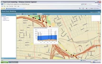
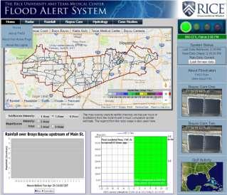
 Dynamic Inundation Mapping for Emergency Planning and Disaster Response Ross Gordon, LEED AP October 29, 2008 Presentation Overview Introduce MIKE FLOOD Rice / TMC Case Study Emergency Planning Disaster
Sediment Transport in the North Fork Stillaguamish River
 Sediment Transport in the North Fork Stillaguamish River Report Prepared for Seattle University Center for Environmental Justice and Sustainability Laboratory Report Prepared By Alex Buescher Steven Millett
INFLOW DESIGN FLOOD CONTROL SYSTEM PLAN 40 C.F.R. PART PLANT YATES ASH POND 3 (AP-3) GEORGIA POWER COMPANY
 GEORGIA POWER COMPANY") INFLOW DESIGN FLOOD CONTROL SYSTEM PLAN 40 C.F.R. PART 257.82 PLANT YATES ASH POND 3 (AP-3) GEORGIA POWER COMPANY EPA s Disposal of Coal Combustion Residuals from Electric Utilities Final Rule (40 C.F.R.
INFLOW DESIGN FLOOD CONTROL SYSTEM PLAN 40 C.F.R. PART 257.82 PLANT YATES ASH POND 3 (AP-3) GEORGIA POWER COMPANY EPA s Disposal of Coal Combustion Residuals from Electric Utilities Final Rule (40 C.F.R.
Mapping and Legal Implications of Future Flooding in the Lamprey River Watershed of New Hampshire Due to Changes in Land Use and Climate
 Mapping and Legal Implications of Future Flooding in the Lamprey River Watershed of New Hampshire Due to Changes in Land Use and Climate 2012 NH Water & Watershed Conference Cameron Wake & Fay Rubin, EOS,
INFLOW DESIGN FLOOD CONTROL SYSTEM PLAN PLANT GREENE COUNTY ASH POND ALABMA POWER COMPANY
 INFLOW DESIGN FLOOD CONTROL SYSTEM PLAN PLANT GREENE COUNTY ASH POND ALABMA POWER COMPANY Section 257.82 of EPA s regulations requires the owner or operator of an existing or new CCR surface impoundment
Creating a Flood Forecasting System for the San Diego River Watershed
 Creating a Flood Forecasting System for the San Diego River Watershed Rand Allan County of San Diego Flood Control Martin J. Teal, P.E., P.H., D.WRE WEST Consultants inc. OUTLINE San Diego River Watershed
Climate and Land Use Consequences to 100-Year Flooding
 Climate and Land Use Consequences to 100-Year Flooding Robert Roseen D.WRE, PE, PhD, Ann Scholz, PE, CPSWQ, Thomas Ballestero, PhD, PE, PH, UNH Stormwater Center Nebraska Post- Construction Stormwater
A Federal Family Comes Together Association of State Floodplain Managers Conference
 A Federal Family Comes Together 2016 Association of State Floodplain Managers Conference Region 6 by the Numbers 5 States 5 USGS Offices 6 USACE Districts 6 HUC2 Regions 40 HUC4 Subregions 403 HUC8 Watersheds
FLOOD Analysis And Development of Groundwater Recharge and Discharge Estimate Maps using GIS
 FLOOD Analysis And Development of Groundwater Recharge and Discharge Estimate Maps using GIS Dr. Ghulam Nabi Assistant Professor Center of Excellence in Water Resources Engineering, g University of Engineering
HYDROLOGIC & HYDRAULIC ASPECTS of the Walnut Street Bridge over the Schuylkill River Philadelphia, PA
 HYDROLOGIC & HYDRAULIC ASPECTS of the Walnut Street Bridge over the Schuylkill River Philadelphia, PA J. Richard Weggel CAEE201 Lectures 30 April & 2 May 2007 HYDROLOGY (Natural Science) Study of the waters
San Antonio Water System Mitchell Lake Constructed Wetlands Below the Dam Preliminary Hydrologic Analysis
 San Antonio Water System enhancement. This recommendation was based on limited water quality data provided by SAWS and using a free-water surface constructed wetland with approximately 112 acres of wetted
Flood Management of. Han River Flood Control Office. Dr. Sung, Ji Youn. Water Resources Information Center
 Flood Management of Han River Flood Control Office Dr. Sung, Ji Youn Water Resources Information Center Water Resources in Korea 0% Runoff June~Sep. 43% Total Water 129 (100%) (unit : billion m3 ) Loss
Alternative Approaches to Water Resource System Simulation
 US Army Corps of Engineers Hydrologic Engineering Center Alternative Approaches to Water Resource System Simulation May 1972 Approved for Public Release. Distribution Unlimited. TP-32 REPORT DOCUMENTATION
Vulnerability of Infrastructure due to Climate Change
 1 Vulnerability of Infrastructure due to Climate Change A Case Study of London, Ontario Elisabeth Bowering and Angela Peck M. E. Sc. Candidates Slobodan P. Simonovic, Professor The University of Western
Development of Stage-Discharge Ratings for Site 2240 Bear Creek at Cold Spring
 Development of Stage-Discharge Ratings for Site 2240 Bear Creek at Cold Spring Prepared for: Urban Drainage and Flood Control District 2480 W. 26 th Avenue Suite 156-B Denver, CO 80211 May 19, 2006 (Rev
The Beckett s Run Experience. Fort Wayne, Indiana
 The Beckett s Run Experience Fort Wayne, Indiana Introductions Charlie Cochran City of Fort Wayne, Wet Weather Storm & Sewer Engineering Jason Durr, PE Christopher B. Burke Engineering, LLC 2 A Little
Modernization of High Hazard Dams in Austin, Texas. TFMA Spring Conference May 23, 2007
 Modernization of High Hazard Dams in Austin, Texas TFMA Spring Conference May 23, 2007 Modernization of High Hazard Dams in Austin, Texas City of Austin Glen Taffinder, P.E. Stormwater Pond Dam Safety
Nationwide study of the benefits of green infrastructure (GI) for flood loss avoidance in the United States
 for flood loss avoidance in the United States") Atkins Lectures Nationwide study of the benefits of green infrastructure (GI) for flood loss avoidance in the United States 2013 International Low Impact Development Symposium, Minnesota, USA Daniel Medina,
Atkins Lectures Nationwide study of the benefits of green infrastructure (GI) for flood loss avoidance in the United States 2013 International Low Impact Development Symposium, Minnesota, USA Daniel Medina,
Little Bear Brook Flood Hazard Assessment and Redevelopment Area Regional Stormwater Management Analysis. Progress Meeting
 Little Bear Brook Flood Hazard Assessment and Redevelopment Area Regional Stormwater Management Analysis Progress Meeting June 30, 2014 Princeton Hydro, LLC and SWM Consulting, LLC Project Team West Windsor
RAINFALL RUNOFF MODELLING AND INUNDATION ANALYSIS OF BAGMATI RIVER AT TERAI REGION OF NEPAL
 RAINFALL RUNOFF MODELLING AND INUNDATION ANALYSIS OF BAGMATI RIVER AT TERAI REGION OF NEPAL Baral MITRA Supervisor: Prof. A.W. Jayawardena** MEE07179 ABSTRACT Climatic variability, unplanned land use pattern
Computer Determination of Flow Through Bridges
 US Army Corps of Engineers Hydrologic Engineering Center Computer Determination of Flow Through Bridges July 1970 Approved for Public Release. Distribution Unlimited. TP-20 REPORT DOCUMENTATION PAGE Form
Simulation of Daily Streamflow
 US Army Corps of Engineers Hydrologic Engineering Center Simulation of Daily Streamflow April 1968 Approved for Public Release. Distribution Unlimited. TP-6 REPORT DOCUMENTATION PAGE Form Approved OMB
Current Water Management Practices for Kerr Reservoir
 Current Water Management Practices for Kerr Reservoir Ashley Hatchell Water Management Lake Gaston Association Monthly Meeting 03 February 2016 US Army Corps of Engineers Outline and Goals for Today s
Chehalis Basin Strategy Causes of Extreme Flooding. October 11, 2016 Policy Workshop
 Chehalis Basin Strategy Causes of Extreme Flooding October 11, 2016 Policy Workshop Agenda Hydrology o Precipitation o Flow Climate Change Effects Land Use o Channel straightening and incision o Riparian
Hydrostatistics Principles of Application
 US Army Corps of Engineers Hydrologic Engineering Center Hydrostatistics Principles of Application July 1969 Approved for Public Release. Distribution Unlimited. TP-15 REPORT DOCUMENTATION PAGE Form Approved
INFLOW DESIGN FLOOD CONTROL SYSTEM PLAN PLANT BARRY ASH POND ALABAMA POWER COMPANY
 INFLOW DESIGN FLOOD CONTROL SYSTEM PLAN PLANT BARRY ASH POND ALABAMA POWER COMPANY Section 257.82 of EPA s regulations requires the owner or operator of an existing or new CCR surface impoundment or any
Application of the SWAT Hydrologic Model for Urban Stormwater Management
 UT Arlington, June 5 th, 2015 Application of the SWAT Hydrologic Model for Urban Stormwater Management Jaehak Jeong, PhD, PE Assistant Professor Texas A&M AgriLife Research Texas A&M University Roger Glick,
5/25/2017. Overview. Project Background Information. Project Background Information Modeling Approach Model Development Results Next Steps
 City of Corpus Christi Downtown 2D Mapping Effort Brandon Hilbrich, PE, CFM Jake Fisher, PE, CFM Curtis Beitel, PE, CFM 2016 HDR, Inc., all rights reserved. Overview Project Background Information Modeling
Hypothetical Flood Computation for a Stream System
 US Army Corps of Engineers Hydrologic Engineering Center Hypothetical Flood Computation for a Stream System December 1968 Approved for Public Release. Distribution Unlimited. TP-12 REPORT DOCUMENTATION
INFLOW DESIGN FLOOD CONTROL SYSTEM PLAN 40 C.F.R. PART PLANT BOWEN ASH POND 1 (AP-1) GEORGIA POWER COMPANY
 GEORGIA POWER COMPANY") INFLOW DESIGN FLOOD CONTROL SYSTEM PLAN 40 C.F.R. PART 257.82 PLANT BOWEN ASH POND 1 (AP-1) GEORGIA POWER COMPANY EPA s Disposal of Coal Combustion Residuals from Electric Utilities Final Rule (40 C.F.R.
INFLOW DESIGN FLOOD CONTROL SYSTEM PLAN 40 C.F.R. PART 257.82 PLANT BOWEN ASH POND 1 (AP-1) GEORGIA POWER COMPANY EPA s Disposal of Coal Combustion Residuals from Electric Utilities Final Rule (40 C.F.R.
SECTION IV WATERSHED TECHNICAL ANALYSIS
 A. Watershed Modeling SECTION IV WATERSHED TECHNICAL ANALYSIS An initial step in the preparation of this stormwater management plan was the selection of a stormwater simulation model to be utilized. It
Coordinated Hazard Assessment and Mapping Program
 Coordinated Hazard Assessment and Mapping Program Mississippi River flood, 1993 A PREDICTABLE DISASTER Floods are the most common natural disaster in Illinois, accounting for well over 90% of declared
GISHYDRO: Developing Discharges and Watershed Parameters
 GISHYDRO: Developing Discharges and Watershed Parameters A Case Study with Baltimore City Watersheds by Mathini Sreetharan, Ph.D., P.E., CFM, Dewberry, VA Kim Dunn, P.E., CFM, Dewberry, PA Baltimore City
Climate Change in the Columbia Basin. Stephanie Smith Manager of Hydrology, BC Hydro
 Climate Change in the Columbia Basin Stephanie Smith Manager of Hydrology, BC Hydro June 20, 2017 Outline Climate change in the Columbia River basin What has happened? What could happen? What can we do