Ontario Ministry of the Environment and Climate Change - Record of Site Condition #
|
|
|
- Loreen Pitts
- 6 years ago
- Views:
Transcription
1 Ontario Ministry of the Environment and Climate Change - Record of Site Condition # Record of Site Condition Under Part XV.1 of the Environment Protection Act Summary Record of Site Condition Number Date Filed to Environmental Site Registry 2015/06/18 Certification Date 2013/11/04 Current Property Use Commercial Intended Property Use Residential Certificate of Property Use Number No CPU Applicable Site Condition Standards** Full Depth Generic Site Conditions Standard, with Potable Ground Water, Coarse Textured Soil, for Residential property use Property Municipal Address 7 BECKWITH STREET, CARLETON PLACE, ON, K7C 2T1 Notice to Readers Concerning Due Diligence This record of site condition has been filed in the Environmental Site Registry to which the public has access and which contains a notice advising users of the Environmental Site Registry who have dealings with any property to consider conducting their own due diligence with respect to the environmental condition of the property, in addition to reviewing information in the Environmental Site Registry. Contents of this Record of Site Condition This record of site condition consists (RSC) of this document which is available to be printed directly from the Environmental Site Registry as well as all supporting documentation indicated in this RSC to have been submitted in electronic format to the Ministry of the Environment and Climate Change. Filed Record of Site Condition # on 2015/06/18 1 of 18
2 PART 1: PROPERTY OWNERSHIP, PROPERTY INFORMATION AND OWNER'S CERTIFICATIONS Information about the owner who is submitting or authorizing the submission of the RSC Owner Name Authorized Person Mailing Address Postal Code THE CORPORATION OF THE TOWN OF CARLETON PLACE PAUL KNOWLES 175 BRIDGE STREET, CARLETON PLACE ONTARIO, CANADA K2C 2V8 Phone (613) Fax Address Filed Record of Site Condition # on 2015/06/18 2 of 18
3 RSC Property Location Information Municipal Address(es) Municipality Legal Description Assessment Roll Number(s) Property Identifier Number(s) 7 BECKWITH STREET, CARLETON PLACE, ON K7C 2T1 Carleton Place See Attached Lawyer s Letter (LT) RSC Property Geographical References Coordinate System UTM Datum NAD 83 Zone 18 Easting 410, Northing 4,998, RSC Property Use Information The following types of property uses are defined by the Regulation: Agricultural or other use, Commercial use, Community use, Industrial use, Institutional use, Parkland use, and Residential use. Current Property Use Intended Property Use Certificate of Property Use has been issued under section of the EPA Commercial Residential No Filed Record of Site Condition # on 2015/06/18 3 of 18
4 Please See the Signed Statements of Property Owner, or Agent, or Receiver at the End of this RSC The rest of this page has been left intentionally blank Filed Record of Site Condition # on 2015/06/18 4 of 18
5 PART 2: LIST OF REPORTS, SUMMARY OF SITE CONDITIONS AND QUALIFIED PERSON S STATEMENTS AND CERTIFICATIONS Qualified Person's Information Name Type of Licence Under Professional Engineers Act CARLOS P DA SILVA Licence Licence Number QP Employer Name Mailing Address PATERSON GROUP INC. 154 COLONNADE ROAD, OTTAWA ONTARIO, K2E 7J5 CANADA Phone (613) Fax (613) Address carlosd@patersongroup.ca Municipal Information Local or Single-Tier Municipality Upper-Tier Municipality Carleton Place Lanark Ministry of the Environment and Climate Change District Office District Office District Office Address Ottawa District Office 2430 Don Reid Drive, Ottawa ON K1H 1E1 Filed Record of Site Condition # on 2015/06/18 5 of 18
6 Phase One Environmental Site Assessment Report Document used as the phase one environmental site assessment report and updates in submitting the RSC for filing The date the last work on all of the records review, interviews and site reconnaissance components of the phase one environmental site assessment was done (refer to clause 28(1)(a) of O. Reg. 153/04) (YYYY/MM/DD) Type of Report Report Title Date of Report (YYYY/MM/DD) Author of Report Name of Consulting Company P1 ESA P1 ESA Update Phase I Environmental Site Assessment, Vacant Parcel of Land (Parcel A), 7 Beckwith Street, Carleton Place, Ontario Phase I Environmental Site Assessment Update, 7 Beckwith Street, Carleton Place, Ontario Karyn Munch PATERSON GROUP INC Dan Arnott PATERSON GROUP INC. Reports and Other Documents Related to the Phase One Environmental Site Assessment Reports and other documents relied upon in certifying the information set out in section 10 of Schedule A or otherwise used in conducting the phase one environmental site assessment Report Title Phase I Environmental Site Assessment, Canadian Tire Store #18, 7 Beckwith Street, Carleton Place, ON Date of Report (YYYY/MM/DD) Author of Report Name of Consulting Company Robb Hudson Winchurch Environmental Inc. Filed Record of Site Condition # on 2015/06/18 6 of 18
7 Phase Two Environmental Site Assessment Report Document used as the phase two environmental site assessment report and updates in submitting the RSC for filing The date the last work on all of the planning of the site investigation and conducting the site investigation components of the phase two environmental site assessment was done (refer to clause 33.5(1)(a) of O. Reg. 153/04) (YYYY/MM/DD) Type of Report Report Title Date of Report (YYYY/MM/DD) Author of Report Name of Consulting Company P2 ESA P2 ESA Update Phase II Environmental Site Assessment, Vacant Parcel of Land, 7 Beckwith Street - Parcel A, Carleton Place, Ontario Supplemental Phase II ESA, 7 Beckwith Street, Carleton Place, Ontario Karyn Munch PATERSON GROUP INC Daniel Arnott PATERSON GROUP INC. Reports and Other Documents Related to the Phase Two Environmental Site Assessment Reports and other documents relied upon in making any certifications in the RSC for the purposes of Part IV of Schedule A or otherwise used in conducting the phase two environmental site assessment Report Title Phase II Environmental Site Assessment, Canadian Tire Store #18, 7 Beckwith Street, Carleton Place, ON Service Centre Decommissioning, Environmental Site Inspection, Former CT Store #18, 7 Beckwith Street, Carleton Place, Ontario Date of Report (YYYY/MM/DD) Author of Report Supplemental Phase II ESA, Northern Portion of the Site, 7 Beckwith Street Austin Sweezey Name of Consulting Company Robb Hudson Winchurch Environmental Inc Paul Southard Winchurch Environmental Inc. SNC-Lavalin Environment Filed Record of Site Condition # on 2015/06/18 7 of 18
8 Environmental Condition Section 41 applies? Section 43.1 applies? No Yes Site Condition Information Certification date (YYYY/MM/DD) 2013/11/04 Total area of RSC property (in hectares) Number of any previously filed RSC that applies to any part of the RSC property Number of any previously filed Transition Notice that applies to any part of the RSC property Soil Texture Assessment/Restoration Approach Site investigation includes the investigation, sampling and analysis of ground water? Is there soil present that is sufficient to investigate, sample and analyze soil on, in or under the property in accordance with s. 6, Schedule E of O.Reg. 153/04? Site investigation includes the investigation, sampling and analysis of soil on, in or under the property which is used in the RSC? Name of the laboratory used to analyze any samples collected of soil, ground water or sediment Ground water condition (potable, non-potable) Coarse Full Depth Generic Yes Yes Yes PARACEL LABORATORIES Potable Applicable Site Condition Standard TABLE 6 Filed Record of Site Condition # on 2015/06/18 8 of 18
9 Table 1 Maximum Contaminant Concentrations Compared to Applicable Site Condition Standards Measured Concentration for Contaminants in Soil Contaminant Name Maximum Concentration Applicable Site Condition Standard Unit of Measure 1 Benzene < µg/g 2 Ethylbenzene < µg/g 3 Toluene < µg/g 4 Xylene Mixture < µg/g 5 Acetone < µg/g 6 Bromomethane < µg/g 7 Carbon Tetrachloride < µg/g 8 Chlorobenzene < µg/g 9 Chloroform < µg/g 10 Dichlorobenzene, 1,2- < µg/g 11 Dichlorobenzene, 1,3- < µg/g 12 Dichlorobenzene, 1,4- < µg/g 13 Dichlorodifluoromethane < µg/g 14 Dichloroethane, 1,1- < µg/g 15 Dichloroethane, 1,2- < µg/g 16 Dichloroethylene, 1,1- < µg/g 17 Dichloroethylene, 1,2-cis- < µg/g 18 Dichloroethylene, 1,2-trans- < µg/g 19 Dichloropropane, 1, µg/g 20 Dichloropropene,1, µg/g 21 Ethylene dibromide < µg/g 22 Hexane (n) < µg/g 23 Methyl Ethyl Ketone < µg/g 24 Methyl Isobutyl Ketone < µg/g 25 Methyl tert-butyl Ether (MTBE) < µg/g 26 Methylene Chloride < µg/g 27 Styrene < µg/g 28 Tetrachloroethane, 1,1,1,2- < µg/g 29 Tetrachloroethane, 1,1,2,2- < µg/g 30 Tetrachloroethylene < µg/g 31 Trichloroethane, 1,1,1- < µg/g 32 Trichloroethane, 1,1,2- < µg/g 33 Trichloroethylene < µg/g 34 Trichlorofluoromethane < µg/g 35 Vinyl Chloride < µg/g...continued on next page Filed Record of Site Condition # on 2015/06/18 9 of 18
10 Table 1 Maximum Contaminant Concentrations Compared to Applicable Site Condition Standards Measured Concentration for Contaminants in Soil Continued from previous page... Contaminant Name Maximum Concentration Applicable Site Condition Standard Unit of Measure 36 Antimony < µg/g 37 Arsenic 3 18 µg/g 38 Selenium < µg/g 39 Barium µg/g 40 Beryllium 1 4 µg/g 41 Boron (total) µg/g 42 Cadmium < µg/g 43 Chromium Total µg/g 44 Cobalt µg/g 45 Copper µg/g 46 Lead µg/g 47 Molybdenum µg/g 48 Nickel µg/g 49 Silver < µg/g 50 Thallium < 1 1 µg/g 51 Uranium < 1 23 µg/g 52 Vanadium µg/g 53 Zinc µg/g 54 Acenaphthene < µg/g 55 Acenaphthylene < µg/g 56 Anthracene < µg/g 57 Benz[a]anthracene µg/g 58 Benzo[a]pyrene µg/g 59 Benzo[b]fluoranthene µg/g 60 Benzo[ghi]perylene µg/g 61 Benzo[k]fluoranthene µg/g 62 Chrysene µg/g 63 Dibenz[a h]anthracene < µg/g 64 Fluoranthene µg/g 65 Fluorene < µg/g 66 Indeno[1 2 3-cd]pyrene < µg/g 67 Methlynaphthalene, 2-(1-) *** < µg/g 68 Naphthalene µg/g 69 Phenanthrene µg/g 70 Pyrene µg/g Filed Record of Site Condition # on 2015/06/18 10 of 18
11 Table 1 Maximum Contaminant Concentrations Compared to Applicable Site Condition Standards (Continued) Ground Water Contaminant Name Maximum Concentration Applicable Site Condition Standard Unit of Measure 1 Benzene < µg/l 2 Ethylbenzene < µg/l 3 Toluene < µg/l 4 Xylene Mixture < µg/l 5 Acetone < µg/l 6 Bromomethane < µg/l 7 Carbon Tetrachloride < µg/l 8 Chlorobenzene < µg/l 9 Chloroform 2 2 µg/l 10 Dichlorobenzene, 1,2- < µg/l 11 Dichlorobenzene, 1,3- < µg/l 12 Dichlorobenzene, 1,4- < µg/l 13 Dichlorodifluoromethane < µg/l 14 Dichloroethane, 1,1- < µg/l 15 Dichloroethane, 1,2- < µg/l 16 Dichloroethylene, 1,1- < µg/l 17 Dichloroethylene, 1,2-cis- < µg/l 18 Dichloroethylene, 1,2-trans- < µg/l 19 Dichloropropane, 1,2- < µg/l 20 Dichloropropene,1,3- < µg/l 21 Ethylene dibromide < µg/l 22 Hexane (n) < 1 5 µg/l 23 Methyl Ethyl Ketone < µg/l 24 Methyl Isobutyl Ketone < µg/l 25 Methyl tert-butyl Ether (MTBE) < 2 15 µg/l 26 Methylene Chloride < 5 26 µg/l 27 Styrene < µg/l 28 Tetrachloroethane, 1,1,1,2- < µg/l 29 Tetrachloroethane, 1,1,2,2- < µg/l 30 Tetrachloroethylene < µg/l 31 Trichloroethane, 1,1,1- < µg/l 32 Trichloroethane, 1,1,2- < µg/l 33 Trichloroethylene < µg/l 34 Trichlorofluoromethane < µg/l 35 Vinyl Chloride < µg/l...continued on next page Filed Record of Site Condition # on 2015/06/18 11 of 18
12 Table 1 Maximum Contaminant Concentrations Compared to Applicable Site Condition Standards (Continued) Ground Water Continued from previous page... Contaminant Name Maximum Concentration Applicable Site Condition Standard Unit of Measure 36 Sodium 182, µg/l 37 Chromium VI < µg/l 38 Mercury < µg/l 39 Antimony < µg/l 40 Arsenic < 1 25 µg/l 41 Selenium < 1 10 µg/l 42 Barium µg/l 43 Beryllium < µg/l 44 Boron (total) µg/l 45 Cadmium < µg/l 46 Chromium Total < 1 50 µg/l 47 Cobalt < µg/l 48 Copper < µg/l 49 Lead < µg/l 50 Molybdenum µg/l 51 Nickel µg/l 52 Silver < µg/l 53 Thallium < µg/l 54 Uranium µg/l 55 Vanadium < µg/l 56 Zinc µg/l Filed Record of Site Condition # on 2015/06/18 12 of 18
13 Remedial Action and Mitigation Remediated Soils Estimated quantities of the soil, if any, originating at and remaining on the RSC property that have been remediated, at a location either on or off the property, to reduce the concentration of contaminants in the soil. Indicate the remediation process or processes used and the estimated amount of soil remediated by each identified process. Soil Remediation Process Estimated Quantity of Soil (in-ground volume in m³) Description of Remediation Description of any action taken to reduce the concentration of contaminants (including soil removals) on, in or under the RSC property. Soil or Sediment Removed and Not Returned Estimated quantities of soil or sediment, if any, removed from and not returned to the RSC property. Estimated Quantity of Soil (in-ground volume in m³) 46.0 Estimated Quantity of Sediment (in-ground volume in m³) Soil Brought to the Property Estimated quantity of the soil, if any, being brought from another property to and deposited at the RSC property, not including any soil that may have originated at but been remediated off the RSC property and that is identified in section 28 of Schedule A. Estimated Quantity of Soil Brought to the Property (in-ground volume in m³) Filed Record of Site Condition # on 2015/06/18 13 of 18
14 Ground Water Control or Treatment Measures Ground water control or treatment measures that were required for the RSC property prior to the certification date for the purpose of submitting the RSC for filing. Ground water control or treatment measures that are required for the RSC property after the certification date. Estimated volume of ground water, if any, removed from and not returned to the RSC property. Estimated Volume of Ground Water (in litres) Filed Record of Site Condition # on 2015/06/18 14 of 18
15 Other Activities Including Risk Management Measures Constructed works that prior to the certification date for the purpose of submitting the RSC for filing, were required to control or otherwise mitigate the release or movement of known existing contaminants at the RSC property. Constructed works that after the certification date, are required to control or otherwise mitigate the release or movement of known existing contaminants at the RSC property. Monitoring or Maintenance Soil Management Measures Soil monitoring requirements or any requirements for care, maintenance or replacement or any monitoring or control works for known existing contaminants, if any, on the RSC property, after the certification date. Ground Water Management Measures Ground water monitoring requirements or requirements for care, maintenance or replacement of any monitoring or control works or known existing contaminants, if any, on the RSC property, after the certification date. Remediated or Removed Soil, Sediment or Ground Water From Near Property Boundary Has any soil, sediment or ground water at the RSC property that is or was located within 3 metres of the RSC property boundary been remediated or removed for the purpose of remediation? Yes Filed Record of Site Condition # on 2015/06/18 15 of 18
16 Qualified Person s Statements and Certifications As the qualified person, I certify that: A phase one environmental site assessment of the RSC property, which includes the evaluation of the information gathered from a records review, site reconnaissance, interviews, a report and any updates required, has been conducted in accordance with the regulation by or under the supervision of a qualified person as required by the regulation. A phase two environmental site assessment of the RSC property, which includes the evaluation of the information gathered from planning and conducting a site investigation, a report, and any updates required, has been conducted in accordance with the regulation by or under the supervision of a qualified person as required by the regulation. The information represents the site conditions at the sampling points at the time of sampling only and the conditions between and beyond the sampling points may vary. As of 2013/11/04, in my opinion, based on the phase one environmental site assessment and the phase two environmental site assessment, and any confirmatory sampling, there is no evidence of any contaminants in the soil, ground water or sediment on, in or under the RSC property that would interfere with the type of property use to which the RSC property will be put, as specified in the RSC. Ground water sampling has been conducted in accordance with the regulation by or under the supervision of a qualified person as required by the regulation. As of 2013/11/04, in my opinion, based on the phase one and phase two environmental site assessments and any confirmatory sampling, the RSC property meets the applicable full depth generic site condition standards prescribed by section 36 of the regulation for all contaminants prescribed by the regulation in relation to the type of property use for which this RSC is filed, except for those contaminants (if any) specified in this RSC at Table 2, Maximum Contaminant Concentrations Compared to Standards Specified in a Risk Assessment. As of 2013/11/04, the maximum known concentration of each contaminant in soil, sediment and ground water at the RSC property for which sampling and analysis has been performed is specified in this RSC at Table 1, Maximum Contaminant Concentrations Compared to Applicable Site Condition Standards. I am a qualified person and have the qualifications required by section 5 of the regulation. I have in place an insurance policy that satisfies the requirements of section 7 of the regulation. I acknowledge that the RSC will be submitted for filing in the Environmental Site Registry, that records of site condition that are filed in the Registry are available for examination by the public and that the Registry contains a notice advising users of the Registry who have dealings with any property to consider conducting their own due diligence with respect to the environmental condition of the property, in addition to reviewing information in the Registry. The opinions expressed in this RSC are engineering or scientific opinions made in accordance with generally accepted principles and practices as recognized by members of the environmental engineering or science profession or discipline practising at the same time and in the same or similar location. I do not hold and have not held and my employer PATERSON GROUP INC. does not hold and has not held a direct or indirect interest in the RSC property or any property which includes the RSC property and was the subject of a phase one or two environmental site assessment or risk assessment upon which this record of site condition is based To the best of my knowledge, the certifications and statements in this part of the RSC are true as of 2013/11/04. By signing this RSC, I make no express or implied warranties or guarantees. By checking the boxes above, and entering my membership/licence number in this submission, I, CARLOS P DA SILVA, a qualified person as defined in section 5 of O. Reg. 153/04 am, on 2015/05/01: a) signing this record of site condition submission as a qualified person; and b) making all certifications required as a qualified person for this record of site condition. I Agree Filed Record of Site Condition # on 2015/06/18 16 of 18
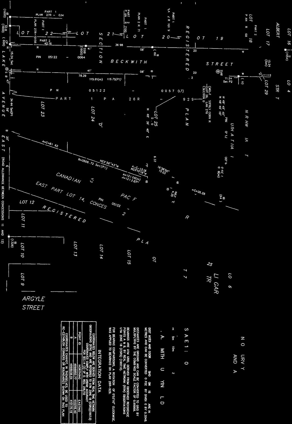
17 Additional Documentation Provided by Property Owner or Agent The following documents have been submitted to the Ministry of the Environment and Climate Change as part of the record of site condition Lawyer s letter consisting of a legal description of the property Copy of any deed(s), transfer(s) or other document(s) by which the RSC property was acquired A Current plan of Survey Area(s) of Potential Environmental Concern Table of Current and Past Uses of the Phase One Property Phase 2 Conceptual Site Model Owner or agent certification statements Filed Record of Site Condition # on 2015/06/18 17 of 18
18 As an owner: 1. I acknowledge that the RSC will be submitted for filing in the Environmental Site Registry, that records of site condition that are filed in the Registry are available for examination by the public and that the Registry contains a notice advising users of the Registry who have dealings with any property to consider conducting their own due diligence with respect to the environmental condition of the property, in addition to reviewing information in the Registry. 2. I have conducted reasonable inquiries to obtain all information relevant to this RSC, including information from the other current owners of the RSC property named in this part of the RSC and I, Paul Knowles, have obtained all information relevant to this RSC of which I am aware. 3. I have disclosed all information referred to in paragraph 2 to any qualified person named in this RSC. 4. To my knowledge, the statements made in this part of the RSC are true as of April 27, I have ensured that access to the entire property, including the phase one property, any phase two property and the RSC property, has been afforded to the qualified person and to persons supervised by the qualified person, for purposes of conducting the site reconnaissance. Name of Owner: The Corporation of the Town of Carleton Place Signature: Date Signed: April 27, 2015 Name of Person Signing: Paul Knowles I, Paul Knowles, am authorized to and hereby do bind The Corporation of the Town of Carleton Place. Filed Record of Site Condition # on 2015/06/18 18 of 18


19
20
21
22
23


24
25 TABLE OF AREAS OF POTENTIAL ENVIRONMENTAL CONCERN Area of Potential Environmental Concern Location of Area of Potential Environmental Concern on RSC Property Potentially Contaminating Activity Location of PCA (on-site or off-site) Contaminants of Potential Concern Media Potentially Impacted (Groundwater, soil, and/or sediment) APEC #1: Western portion of the site Fill material (including former lumber storage) - Item 30, Column A, Table 2, O.Reg. 153/04 - "Importation of Fill Material of Unknown Quality" On-site Metals, PAHs, PHCs, VOCs Soil and Groundwater APEC #2 Eastern portion of the property Former CPR line to the east of the subject site - Item 46, Column A, Table 2, O.Reg. 153/04 - "Rail Yards, Tracks and Spurs". Off-site Metals, PAHs, PHCs. Soil and Groundwater APEC #3 Southern portion of the subject property Watermain break along Beckwith Street - no specific item under Table 2 - potential for chloroform impacts from municipal drinking water. Off-site VOCs Groundwater APEC #4 Southern portion of the subject property Historical presence of automotive service garage on adjacent property to south - Item 27, Column A, Table 2, O.Reg. 153/04 - "Garages, etc." Off-site VOCs, PHCs F1-F4 Groundwater APEC #5 APEC #6 Southern portion of the subject property Southern portion of the subject property Historical presence of waste oil storage tank on adjacent property to the south - Item 28, Column A, Table 2, O.Reg. 153/04 - "Gasoline and Associated Products Storage in Fixed Tanks" Historical presence of inground hydraulic hoist on adjacent property to the south - no specific item under Table 2. Off-site BTEX, PHCs F1-Groundwater F4 Off-site BTEX, PHCs F1-Groundwater F4 APEC #7 Southern portion of the subject property Historical presence of oilwater separator on adjacent property to the south - no specific item under Table 2. Off-site BTEX, PHCs F1-Groundwater F4 APEC #8 Southern portion of the subject property Historical presence of battery refilling operation on adjacent property to the south - Item 6, Column A, Table 2, O.Reg. 153/04 - "Battery Manufacturing, Recycling, and Bulk Storage" Off-site BTEX, PHCs F1-Groundwater F4
26 TABLE OF CURRENT AND PAST USES OF THE PHASE I PROPERTY Year Name of Owner Description of Property Use Prior to to 1894 Crown Mr. William Murphy Vacant, undeveloped land possibly used for the storage of lumber to 1905 Mr. William Neelin 1905 to 1943 Mr. Charles Burgess Vacant land, with the exception of a possible storage structure and stored lumber. Property Use Commercial Commercial Other Observations from Aerial Photographs, Fire According to the Town, the subject parcel of land was historically vacant, undeveloped land, possibly used for the storage of lumber. According to the 1919 FIP, the subject land is vacant, undeveloped land that is scattered with lumber and shingles. Two small structures were depicted on the adjacent parcel of land to the south (also 7 Beckwith Street). The structures were situated immediately north of Lake Avenue. The larger of the two structures was identified as a building supply shop while the smaller structure was identified as lumber storage. In the 1926 aerial, a small storage structure may be present on the eastern portion of the subject parcel of land. Due to the scale of the photo it is difficult to confirm to 1967 Mr. Donald McDougall and Ms. Mona McDougall Storage of lumber on otherwise vacant, undeveloped land. Commercial Possible structure previously observed in 1926 photo, on eastern portion of subject parcel, is no longer present in 1946 photo (revised 1950) FIP does not indicate any changes to the subject parcel of land or the adjacent parcel to the south, which also comprises 7 Beckwith Street to 1974 Mr. Thomas Lewis Williams and Ms. Emma Marion Williams Vacant, undeveloped land. Commercial The subject parcel of land appears to be vacant and grass covered in a 1973 aerial photograph. The larger of the previously noted structures remains on the adjacent parcel to the south. patersongroup
27 TABLE OF CURRENT AND PAST USES OF THE PHASE I PROPERTY Year Name of Owner Description of Property Use 1974 to 1979 D.K.Coyles Limited Paved parking lot (some time between 1973 and 1985) on the subject parcel of land. The adjacent parcel of land to the south was occupied by a Canadian Tire store and service centre. Property Use Commercial Other Observations from Aerial Photographs, Fire A 1985 aerial photograph shows that the subject land was paved and used as a parking lot associated with a commercial business (Canadian Tire) on the adjacent parcel of land to the south. Based on a previous Phase I-ESA report (1997), CT leased the land from 1975 through 1979 at which time they purchased the entirety of 7 Beckwith Street. When CT took occupancy of the site a significant addition was made to the small structure originally located along Lake Avenue East. Although not apparent in the aerial photograph, a service garage was located within the southernmost portion of the CT building approximately 45 m south of the subject parcel of land to 2008 Canadian Tire Corporation Limited Paved parking lot and Garden Centre associated with the Canadian Tire store and service centre on the adjacent land to the south. Commercial A 2005 aerials shows a northern addition to the Canadian Tire building on the adjacent land to the south. This addition is situated on the subject parcel of land. Based on previous reports, the addition housed a garden centre. No land use change was observed in the 1994 or 2002 aerial photograph to present The Town of Carleton Place Parking lot. Commercial Based on a 2012 aerial, the Canadian Tire building which occupied the southern portion of the subject parcel of land and the adjacent land to the south, has been demolished. patersongroup
28 patersongroup consulting engineers memorandum to: The Town of Carleton Place - Mr. Wayne Fraser - wfraser@carletonplace.ca re: Conceptual Site Model - Narrative Component Record of Site Condition - 7 Beckwith Street, Carleton Place, Ontario date: April 24, 2015 file: PE3005-MEMO.03R CSM from: Dan Arnott Further to your request and authorization, Paterson Group (Paterson) prepared a narrative description of the Conceptual Site Model for the RSC property, addressed 7 Beckwith Street, in the Town of Carleton Place, Ontario. 1.0 Enclosed Information This narrative is to be read in conjunction with the following drawings: Drawing PE3005-1R2 - Site Plan Drawing PE3005-2R2 - Surrounding Land Use Drawing PE3005-3R2 - Test Hole Location Plan Drawing PE3005-4R2 - Analytical Testing Plan - Soil Drawing PE3005-5R2 - Analytical Testing Plan - Groundwater Drawing PE3005-6R2 - Cross-Section A-A - Soil Results Drawing PE3005-7R - Cross-Section B-B - Soil Results Drawing PE3005-8R - Cross-Section A-A - Groundwater Results Drawing PE3005-9R - Cross-Section B-B - Groundwater Results Drawing PE R - Groundwater Contour Plan - September 2010 Drawing PE R - Groundwater Contour Plan - May 2014 Drawing PE Site Remediation Plan Drawing PE Confirmatory Sampling Plan Drawing PE Contaminant Transport 2.0 Site Description The Phase II-ESA conceptual site model has been prepared for the northern parcel, Parcel A, of the land municipally addressed as 7 Beckwith Street, in the Town of Carleton Place. The subject parcel of land, for which a generic Phase I-II ESA Record of Site Condition (RSC) will be filed, was severed from the larger parcel in May of patersongroup
29 Mr. Wayne Fraser Page 2 File: PE3005-MEMO.03 CSM Areas of Potential Environmental Concern As per Column A of Table 2 outlined in Ontario Regulation 153/04, potentially contaminating activities identified on the Phase I-ESA property or within the Phase I- ESA study area that are considered to have resulted in areas of potential environmental concern, include the following: Battery Manufacturing, Recycling and Bulk Storage (Item 6) Garages (Item 27) Gasoline and Associated Products Storage in Fixed Tanks (Item 28) Importation of Fill Material of Unknown Quality (Item 30) Rail Yards, Tracks and Spurs (Item 46) Fill material was previously identified across the subject site during previous subsurface investigations conducted by others. The fill material and to a lesser extent, the historical storage of lumber and shingles (APEC 1) are considered to represent a potential concern to the soil and groundwater across the subject property. The proximity of the former rail line on the adjacent property to the east (APEC 2) is considered to represent a potential area of concern on the eastern portion of the subject site. A former Canadian Tire (CT) store was previously located on the subject site and adjacent parcel of land to the south. The CT garden centre was situated on the subject property, while a retail store and an automotive service centre were located on the adjacent land. The service centre was located within the southernmost portion of the former structure, approximately 45 m south of the subject site. Previous Phase I and Phase II ESAs were conducted for the larger parcel of land addressed 7 Beckwith Street, between December 1997 and September The original Phase I ESA by Winchurch Environmental identified several potentially contaminating activities associated with the operations of an automotive service garage on the Canadian Tire property, including car battery refilling (Item 6; APEC 8), the presence of an aboveground waste oil storage tank (Item 28; APEC 5), the presence of an oil-water separator and the former presence of an underground hydraulic hoist (no specific items; APECs 6 and 7 respectively), as well as general garage operations (Item 27; APEC 4). Based on these activities, several subsurface investigations were completed. patersongroup
30 Mr. Wayne Fraser Page 3 File: PE3005-MEMO.03 CSM Based on these investigations, soil and groundwater contamination exceeding the current applicable MOECC Table 6 standards was identified on the central and southern portions of the property. In particular, tetrachloroethylene (PCE) at concentrations indicative of free-phase product, were identified along the southern property limit near Lake Street East, approximately 60 m from the south boundary of the RSC Property. These concentrations are considered to be associated with solvents or degreasers used in automotive service garage operation. Based on the most recent SNC (2010) report reviewed as part of this assessment, a municipal water main leak was detected by the Town and repaired in early October of The leak was located just west of the site, adjacent to 32 Beckwith Street. The break was reported to have been repaired in October of The watermain leak is considered to have posed an area of potential environmental concern (APEC 3) to the western portion of the subject site, based on the presence of chloroform (chlorination by-product) in municipally-treated water at concentrations exceeding MOECC standards. The aforementioned APECs are identified in red on Drawing PE3005-1R - Site Plan Other PCAs within 250 m of the Subject Property In addition to the aforementioned PCAs which have resulted in APECs to the subject site, 11 additional existing and historical PCAs were identified within the Phase I ESA study area. The PCAs, as per Column A of Table 2, include: Garages and Maintenance and Repair of Rail Cars, Marine Vehicles and Aviation Vehicles (Item 27) Gasoline and Associated Products Stored in Fixed Tanks (Item 28) Ink Manufacturing, Process, and Bulk Storage (Item 31) Wood Treating and Preservative Facility and Bulk Storage of Treated and Preserved Wood Products (Item 59) Operation of Dry Cleaning Equipment (where chemicals are used) (Item 37) Existing PCAs observed at the time of the Phase I ESA site visit include: Retail fuel outlets at 19 Moore Street and 6 Bridge Street, to the south and southwest of the subject site A dry cleaning business at 27 Bridge Street, southwest of the site An apparent former automotive service garage associated with the Baker Funeral Home, west of Moore Street and Lansdowne Avenue, two properties south of Lake Avenue East. patersongroup
31 Mr. Wayne Fraser Page 4 File: PE3005-MEMO.03 CSM Historical PCAs include the following: A former planing mill and sash and door factory located at Lake Avenue East and 19 Moore Street, to the south of the subject site, across Lake Avenue East Former printers at 61 Bridge Street and 73 Bridge Street, to the northwest of the site A former retail fuel outlet and a former garage at 2 Lake Avenue West and 5 Bridge Street, southwest and northwest of the subject site A former junk warehouse at 20 Bridge Street, to the southwest of the site A former Imperial Oil property to the north of the site at 42 Albert Street The potentially contaminating activities noted above are not considered to pose a concern to the subject property based on their distances from the property of at least 50 m and/or their orientations with respect to the topography and hydraulic gradient at the subject site. The aforementioned PCAs are identified in green on Drawing PE Surrounding Land Use Plan. Contaminants of Concern Potential contaminants of concern (COCs) associated with APECs 1, 2, 3 and 4 include petroleum hydrocarbons (PHCs), polycyclic aromatic hydrocarbons (PAHs), volatile organic compounds (VOCs - particularly chlorinated solvents and chloroform) and metals. Based on the findings of the previous investigation (2010), metal parameters in the fill and chloroform in the groundwater, were present in concentrations exceeding the current MOECC Table 6 standards. Potential COCs investigated during the current investigation include inorganics (APEC 1) and PAHs (APEC 4) in the soil, and VOCs (APEC 2/3) in the groundwater. Subsurface Structures and Utilities Buried storm sewer services are present on the subject property and extend east onto the subject site from the adjacent lot to the south and Beckwith Street. An associated catch basin is located on the southeastern portion of the property. Otherwise, there are no subsurface structures or utilities on the subject property. The approximate locations of the existing underground utilities are shown on Drawing PE3005-1R - Conceptual Site Model. patersongroup
32 Mr. Wayne Fraser Page 5 File: PE3005-MEMO.03 CSM Several metal parameters exceeding the MOECC Table 6 standards, were identified in the fill material at two (2) locations on the subject property. Based on their locations with respect to the buried services in combination with the non-leaching nature of metals, the services are not considered to have had the potential to affect contaminant transport on the subject site. 3.0 Environmental Investigations Previous Subsurface Investigation Conducted by SNC-Lavalin in 2010 Soil Results SNC-Lavalin Environmental Inc. (SNC) conducted a Phase II-ESA for the subject parcel of land in Based on a previous investigation conducted by Malroz Engineering (Malroz) in 2006, there was no indication of significant groundwater contamination on the northern portion of 7 Beckwith Street. The purpose of the SNC report was to further assess the soil and groundwater conditions beneath this parcel. As shown on Drawing PE3005-3R2 - Test Hole Location Plan, SNC drilled twelve boreholes across the site. Two of the twelve boreholes were completed with monitoring well installations in the overburden (BH/MW10-9) and within the bedrock (BH/MW10-1), to access the groundwater table. A third monitoring well, previously completed by others was also present on site at the time of the 2010 investigation. MW-08-21A/B is a nested well consisting of a shallow well and a deep well nested in a single casing, both of which were installed within the bedrock. These wells are shown as a single borehole symbol in plan view and side-by-side in cross-section view. Soil samples from boreholes: BH10-7 through BH10-12, on the eastern and southcentral portions of the site were submitted for analytical testing of a combination of inorganics (metals), VOCs, PAHs, and PHCs. Soil samples were selected for testing based on visual and olfactory observations made in the field, in combination with vapour readings (Gastech Model 1238 organic vapour monitor or Minirae 2000 photoionization detector) and proximity to APECs 1, 2 and 3. All of the identified parameters were in compliance with the 2006 MOE standards applicable to the site at the time of the investigation. The detected concentrations also meet the current 2011 MOECC Table 6 standards selected for the site. patersongroup
33 Mr. Wayne Fraser Page 6 File: PE3005-MEMO.03 CSM Soil samples from BH10-5, BH10-6 and BH/MW10-1 on the western and north-central portions of the site were submitted for analytical testing of inorganic parameters (metals). Sample selection was based on visual evidence of deleterious materials in the fill at these locations. Based on the test results, several parameter concentrations were in excess of the 2006 and 2011 MOE/MOECC standards. Groundwater Results Groundwater samples were collected from BH/MW10-1, BH/MW10-9, MW08-21A and MW08-21B during the 2010 investigation. Each sample was submitted for analytical testing of inorganic (metals), VOC, PAH and PHC parameters. All parameters were in compliance with the 2006 MOE standards and meet the current MOECC Table 6 standards, with the exception of chloroform in BH/MW10-1. Groundwater sampling was initially conducted on August 6, Chloroform concentrations identified were as follows: 102 µg/l (BH/MW10-1), 103 µg/l (BH/MW10-100) and 8.3 µg/l (MW08-21B). No chloroform was identified above the method detection limit in MW08-21A. It is noted that sample BH/MW was a duplicate of the sample recovered from BH/MW10. A second groundwater sampling event was conducted on August 18, 2010 to determine if the chloroform concentration at BH/MW10-1 had decreased as expected. Based on the analytical test results the chloroform concentration detected in BH/MW10-1 was approximately half of the previous concentration (59.1 µg/l vs. 102 µg/l). A groundwater sample was recovered from BH/MW10-1 on September 2, 2010, during a third sampling event. Chloroform was not identified above the laboratory method detection limit at this location. As mentioned previously, the chloroform was considered to have resulted from a watermain leak, which occurred adjacent to 32 Beckwith Street and was repaired in October of SNC reported that a 2009 drinking water surveillance report for the Town of Carleton Place identified annual trihalomethane (THM) concentrations in the Town s water supply in the range of the chloroform concentrations encountered in MW- 10-1, thereby suggesting a municipal source. The concentrations were expected to dissipate over time and were not considered to pose a concern to the subject property. The aforementioned analytical test results are depicted on Drawing PE3005-4R - Analytical Testing Plan (2010). patersongroup
34 Mr. Wayne Fraser Page 7 File: PE3005-MEMO.03 CSM Based on the aforementioned information provided in the SNC report, it is our opinion that the Phase II property has not been impacted by the former service centre and impacted soil and groundwater previously identified on the adjacent property to the south. Additional sampling was subsequently conducted, to obtain further information on the quality of the fill material, the soil along the former rail line and to confirm that chloroform concentrations in the groundwater have decreased and currently meet the MOECC Table 6 standards. Test Pit Investigation by Paterson - May 2013 In May 2013, Paterson conducted a test pit investigation at the RSC property, with the purpose of further characterizing the soil conditions and quality of fill material at the RSC property and addressing data gaps from the previous reports, in support of a RSC application. A total of six (6) test pits were placed on the subject site, as shown on Drawing PE3005-3R2 - Test Hole Location Plan. Test pits were excavated to practical refusal on bedrock surface or to the end of the reach of the hydraulic shovel. Samples from the test pits were subjected to a preliminary screening procedure as above, and were submitted for analysis of metals and PAHs. The concentrations of lead and available boron at TP4 exceeded the MOECC Table 6 standards. All other parameter concentrations in soil were in compliance with Table 6 standards. Environmental Remediation Program by Paterson - October 2013 Metals-impacted fill identified by previous investigations were removed from the RSC property on October 31, 2013, under the full-time supervision of Paterson Group personnel, as directed by a Qualified Person (QP). Two excavations, Excavation 1 and Excavation 2, were completed, as shown on Drawing PE Soil Remediation Plan. The excavations were approximately 36 m 2 and 27 m 2 in area and were completed to depths ranging from 0.5 to 1.8 m below ground surface. Both excavations were terminated on the bedrock surface. A total of approximately 46 m 3 or 92 metric tonnes of impacted material were excavated for offsite disposal at a registered waste disposal facility. Approximately 63 metric tonnes of granular material was imported to partially backfill the excavations. Final confirmatory samples were collected from the sidewalls of each excavation in accordance with Table 3 of Schedule 3 (O.Reg. 153/04). As noted above, base samples were not collected as the soil was removed to the bedrock surface. Based on the analytical test results, the soil on the subject site is considered to be in compliance with the MOECC Table 6 standards. patersongroup
35 Mr. Wayne Fraser Page 8 File: PE3005-MEMO.03 CSM Concurrently with the October 2013 remedial program, groundwater samples were obtained from monitoring wells MW-08-21A and MW-08-21B and submitted for analysis of VOCs. All VOC results from the October 2013 sampling event were in compliance with MOECC Table 6 standards. Borehole Investigation by Paterson - May 2014 In May 2014, Paterson conducted a subsurface investigation at the subject site, consisting of the drilling of 3 boreholes and the installation of groundwater monitoring wells in all boreholes. The purpose of this investigation was to provide further delineation of the observed chloroform exceedences at the subject site. The locations of the boreholes are shown on Drawing PE3005-3R2 - Test Hole Location Plan, appended to this report. Following the drilling program, groundwater samples were obtained from monitoring wells at the subject site on May 15, 2014, and submitted for analysis of VOCs. Chloroform concentrations at BH1-14 and BH2-14 exceeded the applicable MOECC Table 6 standards. VOC concentrations at BH3-14, MW-08-21A and MW-08-21B were in compliance with MOECC Table 6 standards. Monitoring wells MW-10-1 and MW-10-9 could not be located at the time of the investigation and are considered to have been destroyed. Additional groundwater samples were obtained from BH1-14 and BH2-14 on May 29, 2014, to confirm the observed chloroform concentrations from the May 15 sampling event. Concentrations at BH1-14 decreased slightly (9.6 µg/l to 3.3 µg/l), while concentrations at BH2-14 did not decrease substantially (3.2 µg/l to 3.1 µg/l). Sampling by Paterson in 2015 On January 27, 2015, personnel from Paterson supervised the excavation of a test pit in the vicinity of BH1-14 and collected a groundwater sample from BH1-14. The purpose of this sampling event was to address data gaps in support of a RSC application for the site, specifically to confirm that VOC concentrations observed in groundwater at BH1-14 were from off-site sources and are not present in the soil in the vicinity of BH1-14, and to confirm that metals concentrations originally observed in the soil at the subject site have not impacted site groundwater. The location of the test pit (TP1-15) is shown on Drawing PE3005-3R2 - Test Hole Location Plan, appended to this report. All metals concentrations in groundwater and VOC concentrations in soil were in compliance with MOECC Table 6 standards. patersongroup
36 Mr. Wayne Fraser Page 9 File: PE3005-MEMO.03 CSM 4.0 Physical Setting Site Stratigraphy The site stratigraphy, from ground surface to the deepest aquifer investigated, is illustrated on Drawings PE3005-6R - Cross-Section A-A, and PE3005-7R, Cross- Section B-B. Stratigraphy consists of: 25 to 55 mm of crushed stone or asphaltic concrete were identified at the majority of the test hole locations. At TP1, fill material consisting of brown silty sand was identified from ground surface to a depth of 0.5 m, underlain by a 0.2 m thick topsoil layer. At TP2, approximately 0.05 m of topsoil were identified at ground surface. Fill material generally consisting of brown silty sand with gravel and traces of clay, brick, mortar, and/or concrete, was identified at each test hole location. This fill layer was identified at depths ranging from ground surface to 0.5 m below grade and extended to depths ranging from 0.35 m to 3.4 m below ground surface. No deleterious materials were identified in the fill material. A thin layer (100 to 200 mm in thickness) of organic matter consisting of decaying wood chips was identified in TP2 and TP3 near the bottom of the fill layer, at depths of 1.6 and 2.9 m below ground surface. Native brown silty clay with sand was identified at TP1, TP2, and TP3, on the western portion of the site. The native soil was encountered at depths ranging from 1.3 to 1.7 m below ground surface, and extended to depths of greater than 4.7 m. The above noted test pits were terminated in the native silty clay at depths ranging from 4.6 to 4.7 m below ground surface. In TP1, a layer of native silty sand was identified between the topsoil and the silty clay material, at a depth of 0.7 to 1.3 m below grade. Shaley limestone bedrock was encountered at depths of 1.8 m, 0.6 m, and 0.35 m in TP4, TP5, and TP6 respectively. Bedrock was not encountered on the eastern portion of the site. Hydrogeological Characteristics During previous environmental assessments, one monitoring well (MW-10-1) was placed within the overburden on the western portion of the site, while three monitoring wells were placed within the bedrock on the central and eastern portions of the site. MW08-21-B and MW-10-9 were placed within the upper portion of the bedrock, while MW08-21-A was placed at depth. patersongroup
37 Mr. Wayne Fraser Page 10 File: PE3005-MEMO.03 CSM Based on the findings of previous groundwater monitoring, the water level in the overburden well was measured at approximately 2.6 m below ground surface (September 2, 2010), indicating saturated overburden on the eastern portion of the site where overburden extends to depths up to 6 m below grade. Groundwater was not encountered within the overburden on the central and western portions of the site. Observations made during the field portion of the current assessment confirm these findings. Groundwater levels (also measured on September 2, 2010) within the bedrock wells, ranged from 1.7 to 2.9 m below ground surface. The water levels at the multi-level well, MW08-21A/B, indicated that an upward vertical hydraulic gradient is present in the bedrock (SNC, 2010). The groundwater level measured at bedrock monitoring well MW-10-1, was considered to be anomalously high based on the water levels in shallow wells located on the adjacent property to the south. It was considered likely that the water level in this well was influenced by the previously discussed water main leak along Beckwith Street (adjacent civic address 32), which was repaired in October of Given the available data, the groundwater contours were plotted as shown on Drawing PE R - Groundwater Contour Plan. The contours indicate that the groundwater flow is to the north-northeast. The Mississippi River, located approximately 450 m north of the subject site, flows to the northeast towards the Ottawa River. The groundwater flow direction shown on Drawing PE R is therefore considered to be representative of the groundwater flow beneath the subject site. Groundwater levels were also measured in May 2014 in the monitoring wells installed by Paterson. Groundwater levels varied between 1.59 and 2.75 m below existing grade. Based on the May 2014 groundwater levels, groundwater contour mapping was completed for the subject site. Groundwater flow was observed to be in a northeasterly direction, with a hydraulic gradient of m/m. Groundwater contours from the May 2014 monitoring event are shown on Drawing PE R, appended to this report. Approximate Depth to Bedrock Depth to bedrock at the subject site varies from 0.4 m below grade on the western portion of the site, to greater than 5.2 m below grade on the eastern portion of the site. patersongroup
38 Mr. Wayne Fraser Page 11 File: PE3005-MEMO.03 CSM Approximate Depth to Water Table The depth to the water table at the subject site (2010) varies between approximately 1.7 and 2.9 m below grade in the shallow monitoring wells. It should be noted that the reading of 1.7 m below ground surface in MW-10-1 was considered to be anomalous and influenced by a nearby watermain leak. The depth to the water table in the deep monitoring well (MW-08-21A) was 1.7 m below grade, indicating an upward vertical gradient as discussed above. It should be noted that depth to water table fluctuates with seasonal variations. Data collected from MW-08-21A and B during the 2013 field program identified water levels at 0.88 m and 2.67 m below the ground surface. Water levels from the 2014 monitoring event were between 1.59 and 2.75 m below existing grade. Sections 41 and 43.1 of the Regulation Section 41 of the Regulation (Site Condition Standards, Environmentally Sensitive Areas) does not apply to the subject site. Section 43.1 of the Regulation applies to the subject site, as the subject site is a Shallow Soil Property. As per the regulation, generic site condition standards (not stratified condition standards) have been used. The RSC Property is not within 30 m of a body of water or sensitive receptor. Fill Placement Fill material was encountered at specific locations on the western portion of the subject site, both at surface, and beneath the pavement structure. The fill material, as discussed above, generally consists of a silty sand material with gravel. Trace amounts of clay, brick, mortar and concrete were identified at TP4. Analytical testing of the fill material identified metal impacts exceeding the 2011 MOECC Table 6 standards, at two locations (TP4 and BH10-6) on the western portion of the site, as shown on the Analytical Testing Plans. Existing and Proposed Buildings and Other Structures There are no buildings or structures on the RSC Property. Redevelopment of the RSC Property is contingent upon the filing of the RSC, and as such, no further information on proposed buildings is currently available. patersongroup
39 Mr. Wayne Fraser Page 12 File: PE3005-MEMO.03 CSM Water Bodies No water bodies are located within the 250 m Phase I-ESA study area. The Mississippi River, the closest significant body of water, is located approximately 450 m north of the subject site. Areas of Natural Significance No areas of natural significance are present on the RSC Property or within the Phase I- ESA study area. 5.0 Environmental Condition The purpose of this section is to document the environmental conditions at the subject site prior to the completion of soil remediation activities. As such, the contaminated soil referred to in this section is considered to have been completely removed as a result of the soil remediation program and is no longer present on the subject site. Areas Where Contaminants Are Present Based on visual screening and analytical testing carried out during the current Phase II ESA, in conjunction with previous testing conducted by SNC-Lavalin Environment (SNC), the horizontal and vertical extents of the areas where contaminants are present at concentrations greater than the selected site condition standards are shown on Drawings PE3005-4R2, PE3005-5R2, PE3005-6R2, PE3005-7R, PE3005-8R2, and PE3005-9R2. Contaminated Media Lead and boron (available) were identified in the fill material in TP4, at concentrations exceeding the MOECC Table 6 standards. Barium was identified in the fill material at BH during the previous 2010 investigation. During the previous investigation, only chloroform was identified at concentrations exceeding the MOECC standards (MW B and BH/MW10-1). All other parameters were in compliance with the Table 6 standards selected at the time, as well as the current MOECC Table 6 standards. During the subsequent investigation, it was not possible to resample BH/MW10-1 or BH/MW10-9 as they had been destroyed. Based on previous testing of the groundwater in BH/MW10-1, the chloroform concentration, considered to be the result of a nearby leaking watermain, had decreased by approximately 50 percent over a two week period. patersongroup
40 Mr. Wayne Fraser Page 13 File: PE3005-MEMO.03 CSM What Is Known About Areas Where Contaminants Are Present The areas of contamination discussed above are not considered to extend across the site, but are expected to be localized to the areas shown on Drawings PE3005-4R2, PE3005-6R2, and PE3005-8R. Soil contamination is considered to be limited to the fill material. Chloroform impacts in the groundwater at the subject site were observed on the western portion of the subject site adjacent to Beckwith Street, indicating that the impacts are associated with the previously-discussed watermain break in the Beckwith Street rightof-way. The extent of chloroform impacts is shown on Drawing PE3005-5R2, PE3005-7R, and PE3005-9R. Guidance for Chloroform Based on the guideline released by the MOECC in October of 2014 (Guidance for Addressing Chloroform at a Record of Site Condition Property), the two criteria for chloroform has been satisfied and consist of the following: The source of chloroform is only associated with water from a treated municipal water supply. A watermain break in close proximity to the site is the only source of chloroform and satisfies this criteria. All soil and groundwater concentrations are numerically equal to or lower than the values listed in Table A of this guidance. The chloroform results obtained are in compliance with the values in Table A. Distribution of Contaminants The vertical and horizontal distribution of contaminants exceeding the MOECC Table 6 standards is shown on Drawings PE3005-5R, PE3005-6R, and PE3005-7R. Discharge of Contaminants The subject property was developed as a parking lot in the 1970s. In the 1980s, a northern addition was made to the Canadian Tire store on the adjacent property to the south. The addition, which consisted of a garden centre, was situated on the southernmost portion of the subject property. It is considered possible that fill material was imported to the site for grading purposes during the development of the property. The source of metal impacts may have originated off-site and may be associated with debris identified within the fill material. patersongroup
41 Mr. Wayne Fraser Page 14 File: PE3005-MEMO.03 CSM Metals in the fill material may also have resulted from the use of the subject site as a parking lot. Metals may have been discharged to the atmosphere through combustion (exhaust fumes) or abrasion (brake dust, tire wear). This discharge mechanism is limited by asphalt pavement over the site. In general, metals may also be released directly to the soils through minor surficial oil leaks from vehicles parked on site (this release mechanism is considered unlikely due to the lack of corresponding PHC impacts to the subsurface and the lack of surface staining observed). Based on conversations with the Town of Carleton Place, VOCs in the groundwater (chloroform) are considered to have been discharged as a result of a watermain break which occurred in the Beckwith Street right-of-way in The watermain break has since been repaired and monitoring data shows that concentrations of chloroform are decreasing. The lack of detections of other VOC parameters such as chlorinated solvents supports the conclusion that chloroform is present as a result of the watermain break. Migration of Contaminants The contaminants are primarily located in the fill material (uppermost stratigraphic layer). Physical transportation (excavation or other incidental or intentional movement) of metals-impacted fill was not observed. Based on the limited tendency of metals to leach, and the compliance of metals in groundwater samples with Table 6 standards, the potential for the vertical and horizontal migration of these contaminants is considered to be negligible. Further information regarding contaminant transport is provided on Drawing PE Contaminant Transport. Migration of chloroform within the site groundwater is interpreted to follow the groundwater flow patterns discussed in previous sections. Since the repair of the watermain break, natural dilution and/or degradation of chloroform appears to be occurring, as shown by laboratory results. The extent of migration of chloroform at the subject site is shown on Drawings PE3005-5R2, PE3005-7R, and PE3005-9R. Climatic and Meteorological Conditions In general, climatic and meteorological conditions have the potential to affect contaminant distribution. Two ways in which climatic and meteorological conditions may affect contaminant distribution include the downward leaching of contaminants by means of the infiltration of precipitation and the migration of contaminants via groundwater levels and/or flow, which may fluctuate seasonally. Based on the results of the current investigation in combination with the groundwater analyses conducted during the previous investigation, the metal concentrations are not considered to have been impacted by the aforementioned climatic and meteorological conditions. patersongroup
42 Mr. Wayne Fraser Page 15 File: PE3005-MEMO.03 CSM Potential for Vapour Intrusion No structures are currently present on the subject property. Based on this fact in combination with the non-volatile nature of metals in the fill material, the potential for vapour intrusion into future structures and utility service corridors is negligible. Contaminant Transport Diagram Please refer to Drawing PE which illustrates and provides narrative notes explaining the potential contaminant release mechanisms, contaminant transport pathways, human and ecological receptors, receptor exposure points and routes of exposure on the subject property. Note on Chloroform Concentrations While it is noted that the concentrations of chloroform exceed the applicable MOECC Table 6 standards at BH1-14 and BH2-14, it is noted that they are in compliance with the standards set out by MOECC for sites where chloroform is present due to municipally-treated water. Given that chloroform impacts at the site have been delineated, it is our intention to file a RSC for the site using MOECC s updated guidelines for chloroform at RSC properties. As illustrated on Drawing PE3005-5R2, the maximum chloroform concentrations present on the subject site during the most recent sampling events were 3.3 and 3.1 µg/l at BH1-14 and BH2-14 respectively, exceeding the generic MOECC Table 6 standard of 2.0 µg/l but complying with the standard of 10 µg/l set out in the MOECC Table A guidance document. As per conversations with MOE, the guidance standard in Table A are in compliance, and for the purposes of completing the RSC online form, a value of 2.0 µg/l has been entered as the maximum concentration of chloroform present in groundwater on the subject site. patersongroup
43 Mr. Wayne Fraser Page 16 File: PE3005-MEMO.03 CSM We trust that this information satisfies your requirements. Best Regards, Paterson Group Inc. Daniel J. Arnott, P.Eng. Carlos P. Da Silva, P.Eng. Report Distribution Town of Carleton Place Ontario Ministry of the Environment and Climate Change Paterson Group Inc. Paterson Group Inc. Head Office and Laboratory 154 Colonnade Road South Ottawa, Ontario K2E 7J5 Tel.: (613) Fax.: (613) Northern Office and Laboratory 63 Gibson Street North Bay, Ontario P1B 8Z4 Tel.: (705) Fax.: (705) St. Lawrence Office 993 Princess Street Suite 100 Kingston, Ontario K7L 1H3 Tel.: (613)
44


45
Part 1: Property Ownership, Property Information and Owner s Certifications
 Part 1: Property Ownership, Property Information and Owner s Certifications Information about the owner who is submitting or authorizing the submission of the record of site condition Owner name Owner
Ontario Ministry of the Environment and Climate Change - Record of Site Condition #
 Ontario Ministry of the Environment and Climate Change - Record of Site Condition # 219426 Record of Site Condition Under Part XV.1 of the Environment Protection Act Summary Record of Site Condition Number
Ontario Ministry of the Environment and Climate Change - Record of Site Condition #
 Ontario Ministry of the Environment and Climate Change - Record of Site Condition # 217786 Record of Site Condition Under Part XV.1 of the Environment Protection Act Summary Record of Site Condition Number
Ontario Ministry of the Environment and Climate Change - Record of Site Condition #
 Ontario Ministry of the Environment and Climate Change - Record of Site Condition # 216566 Record of Site Condition Under Part XV.1 of the Environment Protection Act Summary Record of Site Condition Number
EXECUTIVE SUMMARY 160-P HG-R
 EXECUTIVE SUMMARY LVM inc. (LVM) was retained by ODC Tooling & Molds, a division of Ontario Die Company Ltd. (ODC), to complete a of the property described as 93, 97, 99, 13, 17, 19, 111, and 119 Roger
TRAFALGAR ENVIRONMENTAL CONSULTANTS
 TRAFALGAR ENVIRONMENTAL CONSULTANTS March 28, 2018 MacEwen Petroleum Inc. 18 Adelaide Street, P.O. Box 100 Maxville, Ontario K0C 1T0 Attention: Mr. Larry Duchscher Dear Sir: RE: Sampling Analytical Summary
APPENDIX B. Soil Sample Certificate of Analysis
 APPENDIX B Soil Sample Certificate of Analysis 5 SHOREHAM DR DOWNSVIEW, ON M3N1S4 SOIL ANALYSIS REVIEWED BY: Mike Muneswar, BSc (Chem), Senior Inorganic Analyst TRACE ORGANICS REVIEWED BY: Jacky Takeuchi,
Ontario Ministry of the Environment and Climate Change - Record of Site Condition #
 Ontario Ministry of the Environment and Climate Change - Record of Site Condition # 221548 Record of Site Condition Under Part XV.1 of the Environment Protection Act Summary Record of Site Condition Number
Ontario Ministry of the Environment - Record of Site Condition # Record of Site Condition Under Part XV.1 of the Environment Protection Act 1Z7
 Ontario Ministry of the Environment - Record of Site Condition # 208386 Record of Site Condition Under Part XV.1 of the Environment Protection Act Summary Record of Site Condition Number 208386 Date Filed
Ontario Ministry of the Environment - Record of Site Condition # Record of Site Condition Under Part XV.1 of the Environment Protection Act
 Ontario Ministry of the Environment - Record of Site Condition # 211208 Record of Site Condition Under Part XV.1 of the Environment Protection Act Summary Record of Site Condition Number 211208 Date Filed
Re: Amendment to Certificate of Property Use No JWJJC (CPU) West Don Lands Group 1, Toronto (Property) for Property Specific Standards (PSS)
 West Don Lands Group 1, Toronto (Property) for Property Specific Standards (PSS)") Ministry of the Environment and Climate Change Central Region Office 5775 Yonge Street 8 th Floor North York ON M2M 4J1 Tel.: 416 326-6700 Fax: 416-325-6346 Ministère de l Environnement et de l Action
Ministry of the Environment and Climate Change Central Region Office 5775 Yonge Street 8 th Floor North York ON M2M 4J1 Tel.: 416 326-6700 Fax: 416-325-6346 Ministère de l Environnement et de l Action
Fsub. patersongroup. Phase II - Environmental Site Assessment Vacant Property 900 Albert Street Ottawa, Ontario. Prepared For
 Geotechnical Engineering Fsub Environmental Engineering Hydrogeology Geological Engineering Materials Testing Building Science Phase II - Environmental Site Assessment Vacant Property 900 Albert Street
Ontario Ministry of the Environment and Climate Change - Record of Site Condition #
 Ontario Ministry of the Environment and Climate Change - Record of Site Condition # 219027 Record of Site Condition Under Part XV.1 of the Environment Protection Act Summary Record of Site Condition Number
Ontario Ministry of the Environment and Climate Change - Record of Site Condition #
 Ontario Ministry of the Environment and Climate Change - Record of Site Condition # 221489 Record of Site Condition Under Part XV.1 of the Environment Protection Act Summary Record of Site Condition Number
Record of Site Condition Under Part XV.1 of the Environment Protection Act N4K 5W8
 Ontario Ministry of the Environment and Climate Change - Record of Site Condition # 221749 Record of Site Condition Under Part XV.1 of the Environment Protection Act Summary Record of Site Condition Number
Ontario Ministry of the Environment and Climate Change - Record of Site Condition #
 Ontario Ministry of the Environment and Climate Change - Record of Site Condition # 21826 Record of Site Condition Under Part XV.1 of the Environment Protection Act Summary Record of Site Condition Number
Ontario Ministry of the Environment - Record of Site Condition # Record of Site Condition Under Part XV.1 of the Environment Protection Act
 Ontario Ministry of the Environment - Record of Site Condition # 208947 Record of Site Condition Under Part XV.1 of the Environment Protection Act Summary Record of Site Condition Number 208947 Date Filed
Phase II Environmental Site Assessment (ESA) Update. Bernard Benoit Project Management (BBPM) 2212 Gladwin Crescent, Unit B4 Ottawa, Ontario K1B 5N1
 Update. Bernard Benoit Project Management (BBPM) 2212 Gladwin Crescent, Unit B4 Ottawa, Ontario K1B 5N1") Phase II Environmental Site Assessment (ESA) Update 2720 Richmond Road Bernard Benoit Project Management (BBPM) 2212 Gladwin Crescent, Unit B4 K1B 5N1 Centre Multiservices Francophone de l Ouest d Ottawa
Phase II Environmental Site Assessment (ESA) Update 2720 Richmond Road Bernard Benoit Project Management (BBPM) 2212 Gladwin Crescent, Unit B4 K1B 5N1 Centre Multiservices Francophone de l Ouest d Ottawa
Ontario Ministry of the Environment - Record of Site Condition # Record of Site Condition Under Part XV.1 of the Environment Protection Act
 Ontario Ministry of the Environment - Record of Site Condition # 207866 Record of Site Condition Under Part XV.1 of the Environment Protection Act Summary Record of Site Condition Number 207866 Date Filed
Ontario Soil Standards (other than sediment) II (mg/kg) Potable Ground Water Non-Potable Ground Water. Industrial/ Commercial
 II (mg/kg) Potable Ground Water Non-Potable Ground Water. Industrial/ Commercial") T3 Table 3 Soil quality benchmarks I Substance Ontario Soil Standards (other than sediment) II (mg/kg) Potable Ground Water Non-Potable Ground Water Canadian Environmental Quality Criteria and Guidelines
T3 Table 3 Soil quality benchmarks I Substance Ontario Soil Standards (other than sediment) II (mg/kg) Potable Ground Water Non-Potable Ground Water Canadian Environmental Quality Criteria and Guidelines
patersongroup Phase II Environmental Site Assessment 383 Albert Street and 340 Queen Street Ottawa, Ontario Prepared For Claridge Homes August 3, 2018
 Geotechnical Engineering patersongroup Environmental Engineering Hydrogeology Geological Engineering Materials Testing Phase II Environmental Site Assessment 383 Albert Street and 340 Queen Street Ottawa,
Ontario Ministry of the Environment - Record of Site Condition # Record of Site Condition Under Part XV.1 of the Environment Protection Act
 Ontario Ministry of the Environment - Record of Site Condition # 206027 Record of Site Condition Under Part XV.1 of the Environment Protection Act Summary Record of Site Condition Number 206027 Date Filed
the former Honeywell plant building (3 Hamilton Avenue) a single-storey brick industrial/commercial building (233 Armstrong Street)
 a single-storey brick industrial/commercial building (233 Armstrong Street)") consulting engineers memorandum to: Tega Developments - Mr. Spyro Dimitrakopoulos - spyro@tegadevelopments.com re: Environmental Remedial Action Plan Proposed Residential Building 233 Armstrong Street
consulting engineers memorandum to: Tega Developments - Mr. Spyro Dimitrakopoulos - spyro@tegadevelopments.com re: Environmental Remedial Action Plan Proposed Residential Building 233 Armstrong Street
patersongroup Phase II-Environmental Site Assessment 135 Barrette Street Ottawa, Ontario Prepared For Linebox Studio Inc.
 Geotechnical Engineering patersongroup Environmental Engineering Hydrogeology Geological Engineering Materials Testing Building Science Phase IIEnvironmental Site Assessment 135 Barrette Street Ottawa,
patersongroup Phase II Environmental Site Assessment Commercial Property 890 and 900 Bank Street Ottawa, Ontario Prepared For Canderel Management Inc.
 Geotechnical Engineering patersongroup Environmental Engineering Hydrogeology Geological Engineering Materials Testing Building Science Phase II Environmental Site Assessment Commercial Property 890 and
Ontario Ministry of the Environment - Record of Site Condition # Record of Site Condition Under Part XV.1 of the Environment Protection Act
 Ontario Ministry of the Environment - Record of Site Condition # 204850 Record of Site Condition Under Part XV.1 of the Environment Protection Act Summary Record of Site Condition Number 204850 Date Filed
patersongroup Phase II-Environmental Site Assessment Existing Commercial Property 852 Bank Street Ottawa, Ontario Prepared For
 Geotechnical Engineering patersongroup Environmental Engineering Hydrogeology Geological Engineering Materials Testing Building Science Phase IIEnvironmental Site Assessment Existing Commercial Property
Ontario Ministry of the Environment - Record of Site Condition # Record of Site Condition Under Part XV.1 of the Environment Protection Act
 Ontario Ministry of the Environment - Record of Site Condition # 212427 Record of Site Condition Under Part XV.1 of the Environment Protection Act Summary Record of Site Condition Number 212427 Date Filed
patersongroup Site Information Consulting Engineers February 3, 2011 File: PE2224-LET.01
 patersongroup February 3, 2011 File: PE2224-LET.01 Starwood Group Inc. 800-188 Eglington Avenue East Toronto, Ontario M4P 2X7 Consulting Engineers 28 Concourse Gate, Unit 1 Ottawa, Ontario Canada, K2E
OREGON Environmental Laboratory Accreditation Program ORELAP Fields of Accreditation
 MATRIX Reference Code Analyte Code Description STAT Analysis Corporation 40 CFR Part 50 Appendix J Environmental Laboratory Program 3950 Particulates
Ontario Ministry of the Environment and Climate Change - Record of Site Condition #
 Ontario Ministry of the Environment and Climate Change - Record of Site Condition # 215367 Record of Site Condition Under Part XV.1 of the Environment Protection Act Summary Record of Site Condition Number
Ontario Ministry of the Environment - Record of Site Condition # Record of Site Condition Under Part XV.1 of the Environment Protection Act
 Ontario Ministry of the Environment - Record of Site Condition # 208567 Record of Site Condition Under Part XV.1 of the Environment Protection Act Summary Record of Site Condition Number 208567 Date Filed
Submittal Guidelines for Imported Soil. Soil Review & Acceptance Process
 The following guidelines are provided as a prescriptive step process to ensure the contractual and regulatory requirements for Baylands Soil Processing are met and the appropriate quality control documentation
Ontario Ministry of the Environment and Climate Change - Record of Site Condition #
 Ontario Ministry of the Environment and Climate Change - Record of Site Condition # 220631 Record of Site Condition Under Part XV.1 of the Environment Protection Act Summary Record of Site Condition Number
Environmental Peer Review Gordon Marine South Street, Gananoque, Ontario Pinchin File: 74984
 June 15, 2012 Gordon Marine Limited 129 South Street Gananoque, ON K7G 1A1 Attention: Re: Mr. Sandy Gordon Environmental Peer Review Gordon Marine - 129 South Street, Gananoque, Ontario Pinchin File: 74984
August 28, 2018 Project No GROUNDWATER QUALITY MONITORING, LAKERIDGE ROAD, SCUGOG, ONTARIO
 August 28, 2018 Project No. 18104887 Ms. Carol Coleman, P.Eng., Director of Public Works, Parks and Recreation Township of Scugog 181 Perry Street P.O. Box 780 Port Perry, Ontario L9L 1A7 GROUNDWATER QUALITY
Ontario Ministry of the Environment - Record of Site Condition # ON, N2L 5A6
 Ontario Ministry of the Environment - Record of Site Condition # 212947 Record of Site Condition Under Part XV.1 of the Environment Protection Act Summary Record of Site Condition Number 212947 Date Filed
Ontario Ministry of the Environment - Record of Site Condition # ON, P2B 3A2
 Ontario Ministry of the Environment - Record of Site Condition # 214206 Record of Site Condition Under Part XV.1 of the Environment Protection Act Summary Record of Site Condition Number 214206 Date Filed
Ontario Ministry of the Environment - Record of Site Condition # Record of Site Condition Under Part XV.1 of the Environment Protection Act
 Ontario Ministry of the Environment - Record of Site Condition # 209314 Record of Site Condition Under Part XV.1 of the Environment Protection Act Summary Record of Site Condition Number 209314 Date Filed
Ontario Ministry of the Environment and Climate Change - Record of Site Condition #
 Ontario Ministry of the Environment and Climate Change - Record of Site Condition # 218746 Record of Site Condition Under Part XV.1 of the Environment Protection Act Summary Record of Site Condition Number
Ontario Ministry of the Environment - Record of Site Condition # K8P 0C5
 Ontario Ministry of the Environment - Record of Site Condition # 214610 Record of Site Condition Under Part XV.1 of the Environment Protection Act Summary Record of Site Condition Number 214610 Date Filed
Ontario Ministry of the Environment and Climate Change - Record of Site Condition #
 Ontario Ministry of the Environment and Climate Change - Record of Site Condition # 216189 Record of Site Condition Under Part XV.1 of the Environment Protection Act Summary Record of Site Condition Number
Ontario Ministry of the Environment - Record of Site Condition # Record of Site Condition Under Part XV.1 of the Environment Protection Act
 Ontario Ministry of the Environment - Record of Site Condition # 208290 Record of Site Condition Under Part XV.1 of the Environment Protection Act Summary Record of Site Condition Number 208290 Date Filed
Ontario Ministry of the Environment - Record of Site Condition #
 Ontario Ministry of the Environment - Record of Site Condition # 214687 Record of Site Condition Under Part XV.1 of the Environment Protection Act Summary Record of Site Condition Number 214687 Date Filed
Table B1: Analytical Results for Nutrients in Surface Water
 Table B1: Analytical Results for Nutrients in Surface Water Sample ID 1 2 Physical Tests Colour, True (Colour Units) 15 (4) units absolute, or 5 units above background (30-day average)
Ontario Ministry of the Environment and Climate Change - Record of Site Condition #
 Ontario Ministry of the Environment and Climate Change - Record of Site Condition # 215911 Record of Site Condition Under Part XV.1 of the Environment Protection Act Summary Record of Site Condition Number
Ontario Ministry of the Environment and Climate Change - Record of Site Condition #
 Ontario Ministry of the Environment and Climate Change - Record of Site Condition # 218686 Record of Site Condition Under Part XV.1 of the Environment Protection Act Summary Record of Site Condition Number
Ontario Ministry of the Environment and Climate Change - Record of Site Condition #
 Ontario Ministry of the Environment and Climate Change - Record of Site Condition # 217954 Record of Site Condition Under Part XV.1 of the Environment Protection Act Summary Record of Site Condition Number
Date Issued: July 01, 2017 Expiration Date: June 30, 2018
 State of Florida Department of Health, Bureau of Public Health Laboratories This is to certify that MAXXAM ANALYTICS - MICHIGAN 22345 ROETHEL DRIVE NOVI, MI 48375 has complied with Florida Administrative
Fproduct. patersongroup. Phase II-Environmental Site Assessment Proposed Mixed Use Development 137 Bay Street and 350 Sparks Street Ottawa, Ontario
 Geotechnical Engineering patersongroup Fproduct Environmental Engineering Hydrogeology Geological Engineering Materials Testing Building Science Phase IIEnvironmental Site Assessment Proposed Mixed Use
Ontario Ministry of the Environment - Record of Site Condition #
 Ontario Ministry of the Environment - Record of Site Condition # 213348 Record of Site Condition Under Part XV.1 of the Environment Protection Act Summary Record of Site Condition Number 213348 Date Filed
REPORT ON LIMITED PHASE II ENVIRONMENTAL SITE ASSESSMENT 90 GUIGUES AVENUE OTTAWA, ONTARIO. Submitted to:
 Houle Chevrier Engineering Ltd. 180 Wescar Lane R.R. 2 Carp, Ontario K0A 1L0 Tel: (613) 8361422 Fax: (613) 8369731 www.hceng.ca REPORT ON LIMITED PHASE II ENVIRONMENTAL SITE ASSESSMENT 90 GUIGUES AVENUE
FACTS ABOUT: Former GE Power Systems Apparatus Service Center (Voluntary Cleanup Program) Site Location
 Site Location") Maryland Department of the Environment Site Location FACTS ABOUT: Former GE Power Systems Apparatus Service Center (Voluntary Cleanup Program) This 2.4581-acres site (Site) consists of four parcels of
Maryland Department of the Environment Site Location FACTS ABOUT: Former GE Power Systems Apparatus Service Center (Voluntary Cleanup Program) This 2.4581-acres site (Site) consists of four parcels of
PHASE II ENVIRONMENTAL SITE ASSESSMENT
 CITY OF TORONTO PHASE II ENVIRONMENTAL SITE ASSESSMENT 1300 Wilson Avenue Toronto, Ontario FINAL REPORT August 27, 2013 Terrapex Environmental Ltd. 49 Coldwater Road, Toronto, Ontario, M3B 1Y8 Telephone:
address, Ontario Pinchin File:
 Phase Two Environmental Site Assessment DRAFT company date address, Ontario Pinchin File: 48048.004 Phase Two Environmental Site Assessment 288 and 420 Bayshore Drive Midland, Ontario Unimin Canada Ltd.
Ontario Ministry of the Environment and Climate Change - Record of Site Condition #
 Ontario Ministry of the Environment and Climate Change - Record of Site Condition # 217686 Record of Site Condition Under Part XV.1 of the Environment Protection Act Summary Record of Site Condition Number
Ontario Ministry of the Environment and Climate Change - Record of Site Condition #
 Ontario Ministry of the Environment and Climate Change - Record of Site Condition # 217990 Record of Site Condition Under Part XV.1 of the Environment Protection Act Summary Record of Site Condition Number
A Plain Language Guide to the Proposed Excess Soils Management Regulation in Ontario
 A Plain Language Guide to the Proposed Excess Soils Movement of excess soil continues to receive public attention in Ontario and other jurisdictions across Canada, due to uncertainty over the quality of
North Carolina Cleanup Standards for Hydrocarbon Contaminated Groundwater
 North Carolina Cleanup Standards for Hydrocarbon Contaminated Groundwater The North Carolina Department of Environment and Natural Resources has adopted Risk-Based Assessment and Corrective Action procedures
ENVIRONMENTAL ASSESSMENT FINDINGS AND CONCLUSIONS WEBER SIGN SERVICE, INC. th 730 EAST 8 STREET MICHIGAN CITY, INDIANA 46360
 ENVIRONMENTAL ASSESSMENT FINDINGS AND CONCLUSIONS WEBER SIGN SERVICE, INC. th 730 EAST 8 STREET MICHIGAN CITY, INDIANA 46360 Prepared for: THE MICHIGAN CITY REDEVELOPMENT COMMISSION 100 EAST MICHIGAN BOULEVARD
Date Issued: July 01, 2018 Expiration Date: June 30, 2019
 State of Florida Department of Health, Bureau of Public Health Laboratories This is to certify that EMSL ANALYTICAL, INC - CINNAMINSON 200 ROUTE 130 NORTH CINNAMINSON, NJ 08077 has complied with Florida
Submitted to: Glen Smith, Director of Public Works & Parks Township of Scugog 181 Perry Street Port Perry, Ontario L9L 1A7
 LIMITED SUBSURFACE ENVIRONMENTAL INVESTIGATION, GREENBANK AIRPORT, 114 HIGHWAY 47 EAST, UXBRIDGE, ONTARIO Submitted to: Glen Smith, Director of Public Works & Parks Township of Scugog 181 Perry Street
CALIFORNIA STATE ENVIRONMENTAL LABORATORY ACCREDITATION PROGRAM Accredited Fields of Testing
 LIFORNIA STATE EIRONMENTAL LABORATORY ACCREDITATION PROGRAM Accredited Fields of Testing Western Environmental Testing Laboratory 475 East Greg Street Sparks, 89431 Phone: (775) 355-0202 Expiration Date
SCOPE OF ACCREDITATION TO ISO/IEC 17025:2005
 SCOPE OF ACCREDITATION TO ISO/IEC 17025:2005 ENVIRONMENTAL CONSERVATION LABORATORIES JACKSONVILLE 4810 Executive Park Court, Suite 111 Jacksonville, FL 32216 Lori S. Mangrum Phone: 904 296 3007 Email address:
Ontario Ministry of the Environment - Record of Site Condition #
 Ontario Ministry of the Environment - Record of Site Condition # 213106 Record of Site Condition Under Part XV.1 of the Environment Protection Act Summary Record of Site Condition Number 213106 Date Filed
TSB-1 TSB-3 TSB-2. Legend. Approximate Site Limits. Soil Boring Location. Feet. Figure 2 Boring Location Map
 TSB-1 TSB-3 TSB-2 Legend 0 150 300 450 600 Feet East of Calhoun Road & South of Griggs Road Houston, Harris County, Texas TGE Project No.: R10114.01 6120 West by Northwest Blvd. Suite 100 Houston, Texas
Ontario Ministry of the Environment - Record of Site Condition #
 Ontario Ministry of the Environment - Record of Site Condition # 214887 Record of Site Condition Under Part XV.1 of the Environment Protection Act Summary Record of Site Condition Number 214887 Date Filed
CERTIFICATE OF ACCREDITATION
 CERTIFICATE OF ACCREDITATION ANSI-ASQ National Accreditation Board 500 Montgomery Street, Suite 625, Alexandria, VA 22314, 877-344-3044 This is to certify that Environmental Conservation Laboratories -
Ontario Ministry of the Environment and Climate Change - Record of Site Condition #
 Ontario Ministry of the Environment and Climate Change - Record of Site Condition # 218246 Record of Site Condition Under Part XV.1 of the Environment Protection Act Summary Record of Site Condition Number
State Regulations (Part 360) Landfill setting Monitoring activities Results Potential Impacts
 Landfill setting Monitoring activities Results Potential Impacts") State Regulations (Part 360) Landfill setting Monitoring activities Results Potential Impacts Environmental monitoring is just one of many landfill activities regulated by the state, including Permit application
State Regulations (Part 360) Landfill setting Monitoring activities Results Potential Impacts Environmental monitoring is just one of many landfill activities regulated by the state, including Permit application
Participating Schedule for 2018/19
 Participating Schedule for /19 Water Chemical Analysis Sample Name Analytes Enrolment Date Sample Dispatch Period Quarter 1 of Sample 3A: Mineral Constituents in potable water ph, Electrical Conductivity,
Ontario Ministry of the Environment - Record of Site Condition # G8
 Ontario Ministry of the Environment - Record of Site Condition # 213391 Record of Site Condition Under Part V.1 of the Environment Protection Act Summary Record of Site Condition Number 213391 Date Filed
PHASE II ENVIRONMENTAL SITE ASSESSMENT
 PHASE II ENVIRONMENTAL SITE ASSESSMENT POPLAR WOODS DEVELOPMENT PHASE 2 PART OF LOTS 5 & 6, CONCESSION 8 (LOBO), ONTARIO MUNICIPALITY OF MIDDLESEX CENTRE, ONTARIO Submitted to: Poplar Woods Ltd. 611 Wonderland
patersongroup Phase I - Environmental Site Assessment Vacant Land, Strandherd Drive at Kennevale Drive Ottawa, Ontario Prepared For Regional Group
 Geotechnical Engineering patersongroup Environmental Engineering Hydrogeology Geological Engineering Materials Testing Building Science Vacant Land, Strandherd Drive at Kennevale Drive Ottawa, Ontario
patersongroup Phase II Environmental Site Assessment Commercial Properties 1445 and 1451 Wellington Street West Ottawa, Ontario Prepared For
 Geotechnical Engineering patersongroup Environmental Engineering Hydrogeology Geological Engineering Materials Testing Building Science Phase II Environmental Site Assessment Commercial Properties 1445
California Regional Water Quality Control Board San Francisco Bay Region
 California Regional Water Quality Control Board San Francisco Bay Region Linda S. Adams Secretary for Environmental Protection 1515 Clay Street, Suite 1400, Oakland, California 94612 (510) 622-2300 Fax
Ontario Ministry of the Environment - Record of Site Condition # Record of Site Condition Under Part XV.1 of the Environment Protection Act
 Ontario Ministry of the Environment - Record of Site Condition # 206535 Record of Site Condition Under Part XV.1 of the Environment Protection Act Summary Record of Site Condition Number 206535 Date Filed
Ontario Ministry of the Environment - Record of Site Condition #
 Ontario Ministry of the Environment - Record of Site Condition # 213148 Record of Site Condition Under Part XV.1 of the Environment Protection Act Summary Record of Site Condition Number 213148 Date Filed
Exact Scientific Services, Inc. Ferndale, WA
 Ferndale, WA has complied with provisions set forth in Chapter 173-50 WAC and is hereby recognized by the Department of Ecology as an ACCREDITED LABORATORY for the analytical parameters listed on the accompanying
Phase Two Environmental Site Assessment 2887 Riverside Drive Ottawa, Ontario
 Phase Two Environmental Site Assessment 2887 Riverside Drive Ottawa, Ontario Submitted to: Cahdco 200415 Gilmour Street Ottawa, Ontario K1P 5W8 Phase Two Environmental Site Assessment Proposed Youth Hub
Reference: OTCD B 17 September Soil Sampling Program th Line Road, Metcalfe, ON
 Trow Associates Inc. 154 Colonnade Road South Ottawa, Ontario K2E 7J5 Telephone: (613) 225-9940 Facsimile: (613) 225-7337 E-mail: ottawa@trow.com Web Site: www.trow.com Reference: OTCD00019239B 17 September
Ontario Ministry of the Environment - Record of Site Condition # Record of Site Condition Under Part XV.1 of the Environment Protection Act
 Ontario Ministry of the Environment - Record of Site Condition # 204071 Record of Site Condition Under Part XV.1 of the Environment Protection Act Summary Record of Site Condition Number 204071 Date Filed
Ontario Ministry of the Environment and Climate Change - Record of Site Condition #
 Ontario Ministry of the Environment and Climate Change - Record of Site Condition # 219546 Record of Site Condition Under Part XV.1 of the Environment Protection Act Summary Record of Site Condition Number
SCOPE OF ACCREDITATION TO ISO/IEC 17025:2005
 SCOPE OF ACCREDITATION TO ISO/IEC 17025:2005 PACE ANALYTICAL SERVICES, LLC MOBILE LAB SERVICES 1 2525 Advance Rd. Madison, WI 53718 Pat Letterer Phone: 608 221 8700 ENVIRONMENTAL Valid To: March 31, 2020
PHASE II ENVIRONMENTAL SITE ASSESSMENT
 PHASE II ENVIRONMENTAL SITE ASSESSMENT VIA Rail Ottawa Train Station, Site C CB Richard Ellis Global Corporate Services On Behalf of Owner VIA Rail Canada Inc. 3 Place Ville-Marie, Suite 500, Montreal,
Ontario Ministry of the Environment - Record of Site Condition # Record of Site Condition Under Part XV.1 of the Environment Protection Act
 Ontario Ministry of the Environment - Record of Site Condition # 206846 Record of Site Condition Under Part XV.1 of the Environment Protection Act Summary Record of Site Condition Number 206846 Date Filed
Content Copy Of Original
 Content Copy Of Original Ministry of the Environment and Climate Change Ministère de l Environnement et de l Action en matière de changement climatique ENVIRONMENTAL COMPLIANCE APPROVAL NUMBER 6079-AAXPKA
HYDROLOGICAL REVIEW SUMMARY
 The form is to be completed by the Professional that prepared the Hydrological. Use of the form by the City of Toronto is not to be construed as verification of engineering/hydrological content. Refer
Groundwater Investigation Airport Way, Pitt Meadows Onni Fill Site Submitted to City of Pitt Meadows
 Groundwater Investigation 19265 Airport Way, Pitt Meadows Onni Fill Site Submitted to City of Pitt Meadows June 2016 i Executive Summary Dillon Consul ng Limited (Dillon) was retained by City of Pi Meadows
SUPPLEMENTAL PHASE II ENVIRONMENTAL SITE ASSESSMENT APPLEBY MALL 5111 NEW STREET AND 499 & 505 APPLEBY LINE BURLINGTON, ONTARIO
 SUPPLEMENTAL PHASE II ENVIRONMENTAL SITE ASSESSMENT APPLEBY MALL 5111 NEW STREET AND 499 & 505 APPLEBY LINE BURLINGTON, ONTARIO SUPPLEMENTAL PHASE II ENVIRONMENTAL SITE ASSESSMENT APPLEBY MALL 5111 NEW
State of Nevada Department of Conservation and Natural Resources Division of Environmental Protection Laboratory Scope of Accreditation
 Matrix: CWA (Non Potable Water) Discipline Chemistry EPA 1664A (SGT-HEM) n-hexane Extractable Material - Silica Gel Treated (HEM-SGT) 8/21/2015 Aluminum 8/21/2015 Arsenic 8/21/2015 Barium 8/21/2015 Beryllium
Ontario Ministry of the Environment and Climate Change - Record of Site Condition #
 Ontario Ministry of the Environment and Climate Change - Record of Site Condition # 218926 Record of Site Condition Under Part XV.1 of the Environment Protection Act Summary Record of Site Condition Number
Ontario Ministry of the Environment - Record of Site Condition # Record of Site Condition Under Part XV.1 of the Environment Protection Act
 Ontario Ministry of the Environment - Record of Site Condition # 203087 Record of Site Condition Under Part XV.1 of the Environment Protection Act Summary Record of Site Condition Number 203087 Date Filed
Texas Commission on Environmental Quality
 These fields of accreditation supercede all previous fields. The urges customers to Matrix: Air & Emissions Method 40 CFR Part 50 Appendix B Total Suspended Particulate TX 3973 10000304 Method 40 CFR Part
FINAL Limited Phase II Environmental Site Assessment Joseph Wolfond Park West Guelph, Ontario
 FINAL Limited Phase II Environmental Site Assessment Joseph Wolfond Park West Guelph, Ontario Prepared for: City of Guelph 1 Carden Street Guelph, ON N1H 3A1 Attn: Mr. Prasoon Adhikari Environmental Engineer
EXPORT SOIL-MATERIAL QUALITY REQUIREMENTS
 EXPORT SOIL-MATERIAL QUALITY REQUIREMENTS GENERAL Industrial operations have been conducted on Port of Long Beach property since the 1930s. Though it is unlikely that hazardous substances will be encountered
patersongroup Consulting Engineers October 7, 2010 File: PE2100-LET.01 Springcress Properties Inc. 6 Gurdwara Road, Suite 200 Ottawa, Ontario K2E 8A3
 patersongroup Consulting Engineers 28 Concourse Gate, Unit 1 Ottawa, Ontario Canada, K2E 7T7 Tel: (613) 2267381 Fax: (613) 2266344 October 7, 2010 File: PE2100LET.01 Springcress Properties Inc. 6 Gurdwara
Inorganic Analytes - Metals. Aluminum ND mg/l 0.2 EPA Secondary 0.1. Arsenic ND mg/l EPA Primary Barium ND mg/l 2 EPA Primary 0.
 Inorganic Analytes - Metals Aluminum ND mg/l 0.2 EPA Secondary 0.1 Arsenic ND mg/l 0.010 EPA Primary 0.005 Barium ND mg/l 2 EPA Primary 0.30 Cadmium ND mg/l 0.005 EPA Primary 0.002 Calcium 10.3 mg/l --
City of Sarnia. 255 Christina Street South Sarnia, Ontario N7T 7N2. Attention.: Mr. Pratt Rawat, Manager of Design and Infrastructure
 City of Sarnia 255 Christina Street South Sarnia, Ontario N7T 7N2 Attention.: Mr. Pratt Rawat, Manager of Design and Infrastructure Environmental Subsurface Investigation Project Name 1541 Blackwell Road,
patersongroup Prepared For Claridge Homes July 27, 2012 Report: PE2709-1
 Geotechnical Engineering Environmental Engineering patersongroup Hydrogeology Geological Engineering Materials Testing Building Science Archaeological Studies Phase II Environmental Site Assessment Commercial